Event Overview
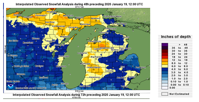
This was Southwest Michigan's heaviest snow fall event of the 2019 to 2020 winter season. Storm total snowfall amounts in 6 to 10 inch range were widespread across most of Southwest Michigan. There was 3 to 6 inches in the I-69 areas, which had the least amount of snow from this storm. Most of the pure storm system snow fell from the evening of the 17th into morning of the 18th. Southern and central sections of Lower Michigan saw the precipitation change to sleet and freezing rain during the mid to late morning hours of the 18th. Once the surface low moved east of the area, by early afternoon on the 18th, lake enhanced snow fell from the afternoon of the 18th into the morning of the mid morning of the 19th. The lake enhanced part of the storm featured wind gusts as high as 54 mph at Battle Creek but most areas had winds gusting to around 45 mph. Temperatures fell from the mid to upper 30s around noon on the 18th to the lower 20s by late evening and into the teens by the morning of the 19th. The combination of gusty west to southwest winds, snow showers that were heavy at times and temperatures well below freezing resulted in considerable blowing and drifting of the snow.
 |
| A typical scene across Lower Michigan during the cold and snow event with low visibility due to blowing snow and hazardous driving conditions. Photo taken on 1/19/2019 in the Grandville area |
Web Stories Created by Neighboring NWS Offices:
Accumulating Snow:
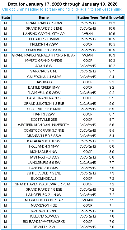
From January 17th to early January 19st, Lower Michigan experienced a nearly continuous period of heavy wet snowfall. This storm resulted in the largest amount of snowfall across the greatest area, of any snow storm in the 2019 to 2020 snow season. As seen from the table below snowfall totals of greater than 6 inches were widespread during this event.
|
|
|
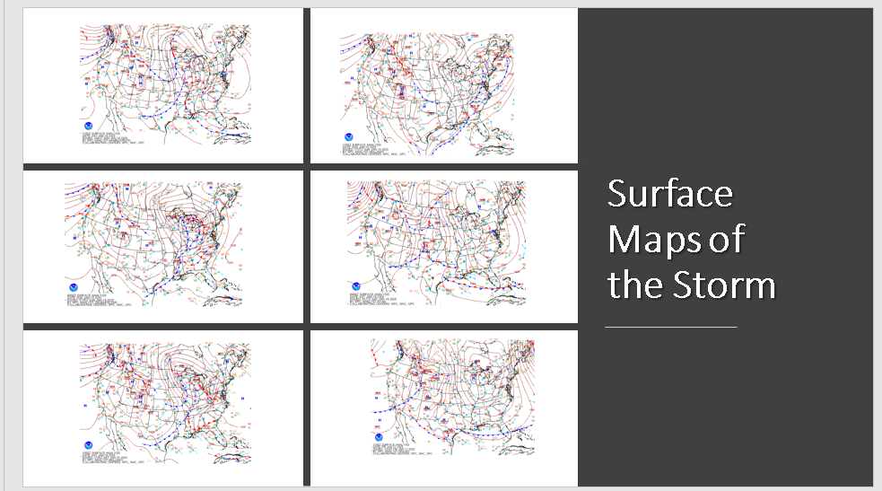
Surface Maps from January 17th, 2020 at 8 am through January 19th, 2020 at 8 am
Winds:
Maximum Wind Gusts During the Storm:
Grand Rapids 42 mph
Lansing 47 mph
Muskegon 45 mph
Kalamazoo 40 mph
Battle Creek 54 mph
Jackson 45 mph
Holland 46 mph