
Scattered strong to severe storms capable of sporadic large hail and severe winds are expected this afternoon and evening across portions of western Texas. Widespread showers and thunderstorms may produce isolated flash flooding across the Ozarks today and the Southeast into next week. Read More >
Grand Rapids, MI
Weather Forecast Office
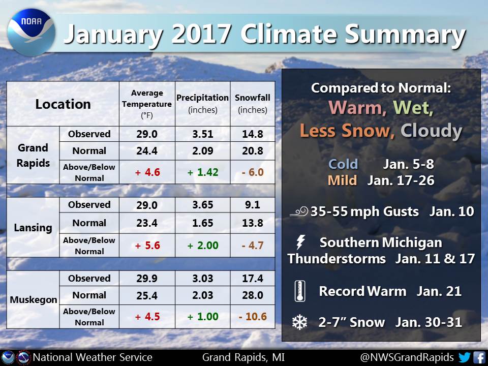
This January was locally our warmest since 2012 and warmer than 85-90% of Januaries on record. Gray sky was all too common: 22 days in Grand Rapids had no direct sunshine. There was less snow and more rain than usual. Places in southern Michigan even had a couple thunderstorms.
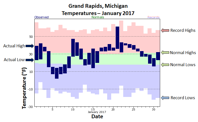
More temperature charts can be found here.
This spring's weather spotter training schedule has been posted: weather.gov/grr/spottertraining
 |
Media use of NWS Web News Stories is encouraged! |
|
US Dept of Commerce
National Oceanic and Atmospheric Administration
National Weather Service
Grand Rapids, MI
4899 Tim Dougherty Drive SE
Grand Rapids, MI 49512-4034
616-949-0643
Comments? Questions? Please Contact Us.

