
Dry and windy conditions will bring widespread fire weather concerns to the northern/central Plains and portions of the Southwest into the southern Plains. Severe thunderstorms with large hail and damaging wind gusts are possible over the central Plains today into this weekend. Rain and high elevation snow is expected over parts of the Cascades and Northern Intermountain Region through Saturday. Read More >
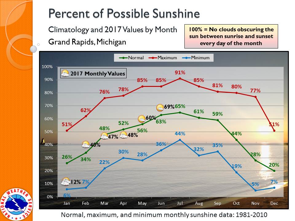
Minutes of direct sunshine recorded at the NWS Grand Rapids office were slightly above average for June, with 69% of maximum possible sunshine counted.
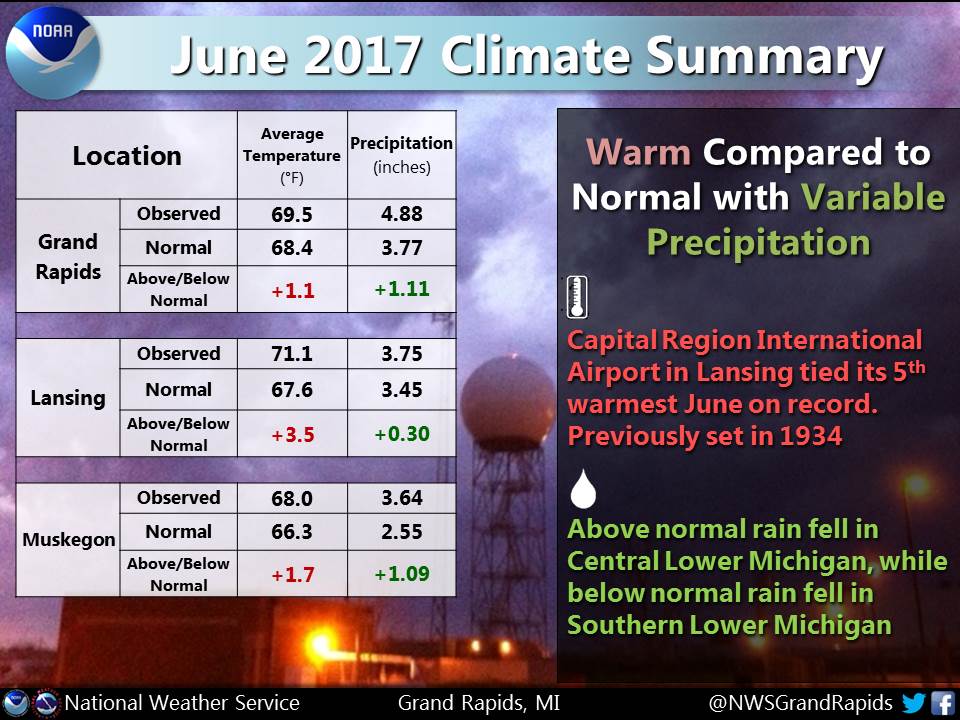
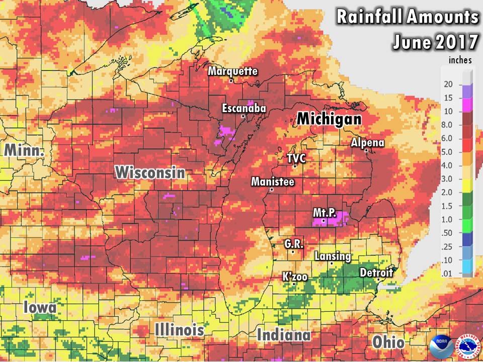
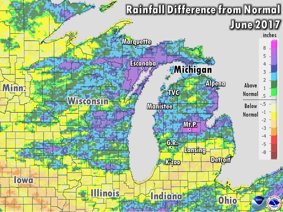
Precipitation ranged from below normal in Southern Michigan to much above normal in Central Michigan. Occasional thunderstorms focused mainly in Central Michigan over a 2-week period in the middle of the month culminated with a final blow of 3 to 6 inches of rain falling overnight June 22-23. The heaviest rain was focused in Isabella and Midland counties, in the Chippewa and Tittabawassee river basins. Flooding destroyed a number of roadways in the counties, and the rivers running through Mount Pleasant and Midland rose to major flood stage, just short of the record flooding of September 1986.
Severe weather was rather minimal in Central to Southwest Lower Michigan, with only a few isolated incidents of damaging thunderstorm winds. On June 17, an isolated severe thunderstorm in southeast Gratiot county and southwest Saginaw county laid a swath of wind gusts over 70 mph, knocking down trees and damaging a few structures. The month ended with a weak and short-lived "landspout" tornado near Grand Junction at the Allegan / Van Buren county border on June 30 (more info).
 |
Media use of NWS Web News Stories is encouraged! |
|

