Overview
|
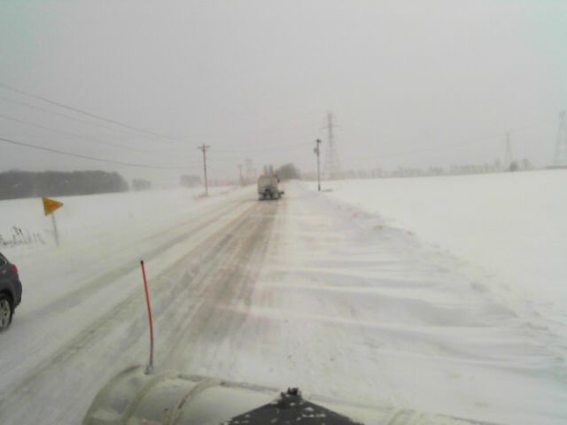
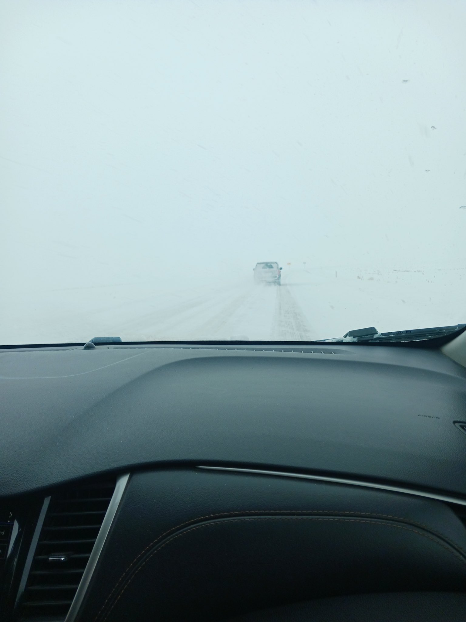
Late on the 18th of January, an intense lake effect snow band set up over Lake Michigan and into La Porte County, IN. The lake effect snow band had a plethora of mesovortices embedded within it, which helped contribute to snow rates of 2-3" per hour. By the evening of the 19th, La Porte and Michigan City both had over two feet of snow! The lake effect snow band gradually shifted west, dropping 8-12" in parts of Berrien County, MI and St Joseph County, IN as well. A 30 mile stretch of the Indiana Toll Road had to be closed by the Indiana State Police on January 19th due to a 5-10 car pileup. Portions of I-94 near Michigan City, IN had traffic backed up for several hours due to numerous crashes and slide offs.
The La Porte Cooperative Observer station measured 21.9" of snow for January 19th. This is a record 1-day snowfall total for this site. The previous record was 19.5" on January 26, 1978, during the Blizzard of 1978. Records for this station go back to 1948. |
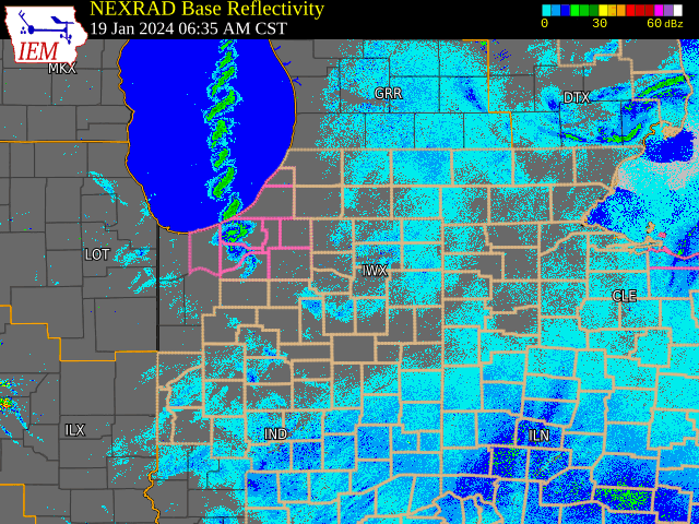
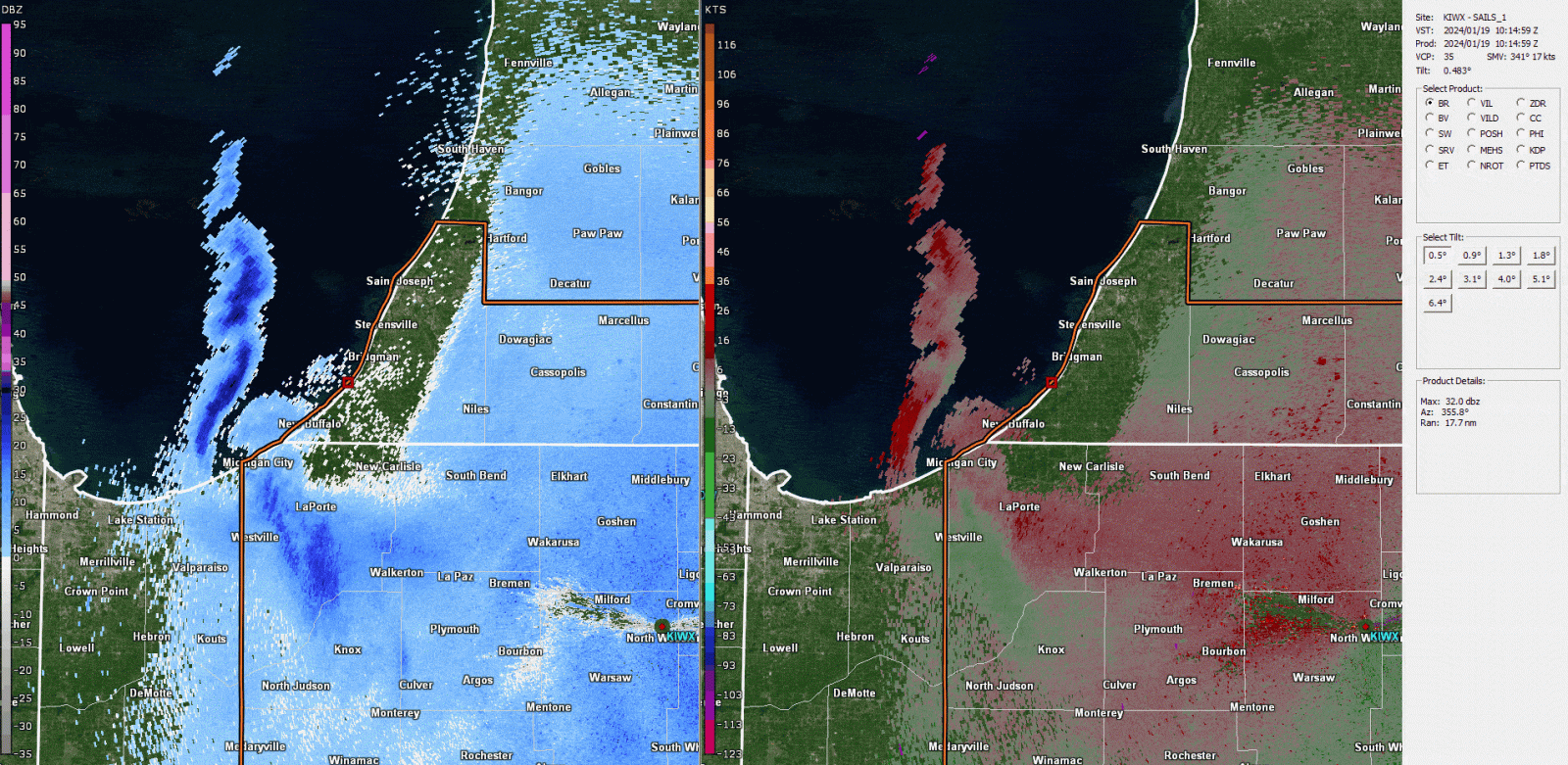
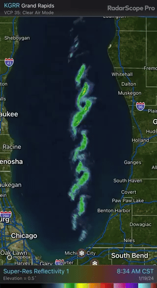 Radarscope video 7-10 AM CST January 19th showing numerous mesovortices embedded within the lake effect snow band over Lake Michigan (as seen by KGRR) |
Snow Totals
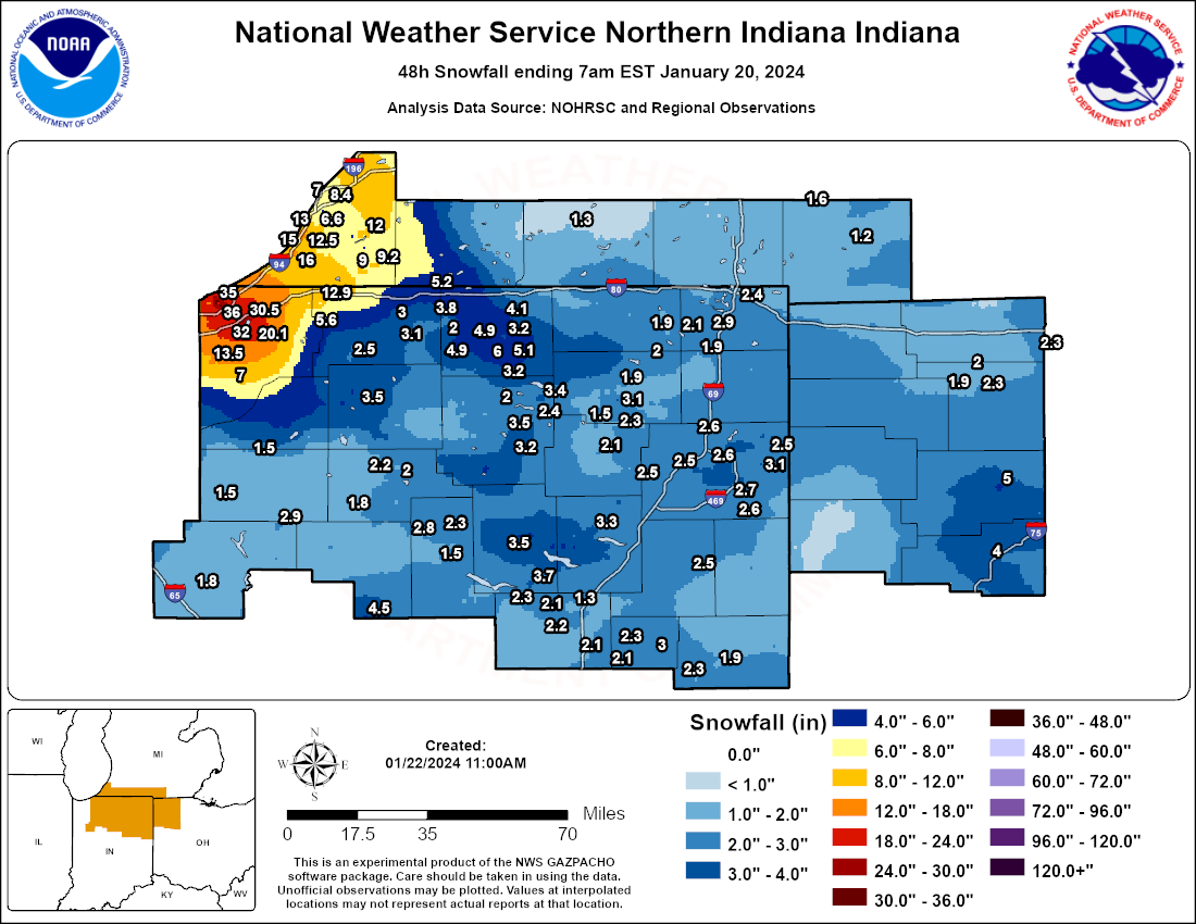
The snow map above highlights how LaPorte County was "ground zero" for this lake effect snow band.
The map above favors official observation sources, such that reports exceeding 24" were not adequately
captured. See the full list of reports below.


...2-DAY SNOWFALL REPORTS...

Location                     Amount    Time/Date       Lat/Lon

...Indiana...

...Allen County...
Woodburn 2.8 WSW             3.1 in    0700 AM 01/20   41.12N/84.91W
Fort Wayne 9.1 SE            2.7 in    0700 AM 01/20   40.99N/85.00W
Fort Wayne 4.1 NE            2.6 in    0700 AM 01/20   41.12N/85.09W
Hoagland 1.5 SSW             2.6 in    0700 AM 01/20   40.93N/85.00W
Fort Wayne 2.6 NW            2.5 in    0700 AM 01/20   41.10N/85.18W
Woodburn 2.6 NNW             2.5 in    0900 AM 01/19   41.16N/84.88W
Fort Wayne 10.4 N            2.4 in    0800 AM 01/19   41.22N/85.14W
Fort Wayne 9.3 W             2.4 in    0700 AM 01/20   41.05N/85.31W
2 N Wallen                   2.2 in    0901 AM 01/19   41.19N/85.17W
2 ENE Nine Mile              1.6 in    0700 PM 01/19   40.99N/85.19W

...Blackford County...
Hartford City 4 ESE          2.6 in    0900 AM 01/19   40.44N/85.29W
(KA9VIS) Hartford City 0.7 N 2.3 in    0700 AM 01/20   40.46N/85.37W

...Cass County...
Young America                3.0 in    0800 AM 01/19   40.57N/86.33W

...De Kalb County...
Ashley                       1.5 in    1015 AM 01/19   41.51N/85.13W
0.6 S Garrett                1.5 in    0700 AM 01/20   41.34N/85.13W

...Elkhart County...
Goshen 3.0 WSW               6.0 in    0700 AM 01/20   41.56N/85.88W
Goshen 1.8 SE                5.1 in    0700 AM 01/20   41.56N/85.81W
Goshen 1.2 SW                4.9 in    0700 AM 01/20   41.57N/85.85W
Wakarusa 2.4 NNE             4.9 in    0700 AM 01/20   41.57N/85.99W
Goshen 1.8 SE                3.6 in    0700 AM 01/20   41.56N/85.81W
Elkhart                      3.5 in    0830 PM 01/19   41.69N/85.97W

...Fulton County...
Rochester 2.4 NW             2.2 in    0700 AM 01/20   41.09N/86.23W
Rochester                    2.0 in    0700 AM 01/20   41.07N/86.21W
Kewanna 4.9 S                1.8 in    0700 AM 01/20   40.95N/86.41W

...Grant County...
Marion 1.8 NW                2.2 in    0720 AM 01/20   40.57N/85.69W
(KC9QCJ) Shamrock Lakes 3.0  2.1 in    0700 AM 01/20   40.45N/85.45W
2.2 N Marion                 2.1 in    0700 AM 01/20   40.58N/85.66W
Upland 2.4 SSE               2.1 in    0700 AM 01/20   40.43N/85.50W

...Huntington County...
Huntington 0.3 W             3.3 in    0700 AM 01/20   40.88N/85.51W

...Jay County...
(KB9PPK) Redkey 0.5 SE       2.3 in    0700 AM 01/20   40.34N/85.15W
(KC9LQY) Portland 5.4 SW     1.9 in    0700 AM 01/20   40.39N/85.06W

...Kosciusko County...
Warsaw 3.7 E                 3.5 in    0730 AM 01/20   41.23N/85.78W
2.3 N North Webster          3.4 in    0700 AM 01/20   41.36N/85.70W
Milford 0.9 N                3.2 in    0700 AM 01/20   41.42N/85.85W
Leesburg 6.7 ESE             2.4 in    0700 AM 01/20   41.31N/85.72W
Leesburg 0.1 WNW             2.0 in    0700 AM 01/20   41.33N/85.85W

...La Porte County...
Michigan City                35.0 in   0530 AM 01/20   41.71N/86.87W
2 NNE Pinola                 32.0 in   0930 PM 01/19   41.63N/86.78W
3 SSW Springville            30.5 in   0950 PM 01/19   41.64N/86.76W
2 NW La Porte                28.0 in   0715 PM 01/19   41.63N/86.75W
Pinola                       27.3 in   0500 PM 01/19   41.60N/86.80W
2 NE Trail Creek             27.0 in   0412 PM 01/19   41.71N/86.84W
1 N La Porte                 26.8 in   0538 PM 01/19   41.62N/86.72W
Kingsford Heights            25.0 in   0410 PM 01/19   41.48N/86.69W
3 NW La Porte                25.0 in   0646 PM 01/19   41.64N/86.76W
Michigan City                25.0 in   0400 PM 01/19   41.71N/86.88W
2 S Waterford                25.0 in   0207 PM 01/19   41.64N/86.84W
Waterford                    24.5 in   0220 PM 01/19   41.67N/86.84W
3 N Pinola                   24.0 in   0336 PM 01/19   41.64N/86.80W
3 SW Springville             24.0 in   0105 PM 01/19   41.66N/86.79W
3 SE Waterford               24.0 in   0357 PM 01/19   41.65N/86.81W
0.8 W La Porte               23.4 in   1258 AM 01/20   41.61N/86.73W
La Porte                     22.3 in   0300 PM 01/19   41.61N/86.72W
Union Mills                  22.2 in   0551 PM 01/19   41.50N/86.78W
0.8 W La Porte               21.9 in   1258 AM 01/20   41.61N/86.73W
3 WSW Waterford              21.1 in   0620 PM 01/19   41.66N/86.89W
2 WSW La Porte               20.0 in   0500 PM 01/19   41.59N/86.75W
Pottawattomie Park           15.0 in   0930 AM 01/19   41.72N/86.87W
Westville                    15.0 in   0330 PM 01/19   41.54N/86.91W
1 SE Hudson Lake             14.0 in   0928 PM 01/19   41.70N/86.53W

...Lagrange County...
Lagrange 9.6 ESE             1.9 in    0700 AM 01/20   41.59N/85.24W

...Miami County...
Peru                         4.0 in    0534 PM 01/19   40.75N/86.07W
Denver 0.5 SSE               2.8 in    0700 AM 01/20   40.86N/86.07W
Denver 1.3 NE                2.3 in    0700 AM 01/20   40.88N/86.06W

...Noble County...
Albion 2.9 S                 3.0 in    1000 AM 01/19   41.35N/85.42W
Kendallville 4.5 NW          2.0 in    0700 AM 01/20   41.50N/85.31W
3 E Lisbon                   1.8 in    0842 AM 01/19   41.40N/85.20W

...Pulaski County...
Francesville                 1.5 in    0700 AM 01/20   40.98N/86.89W

...St. Joseph County...
New Carlisle                 12.9 in   0730 AM 01/20   41.71N/86.50W
South Bend                   6.0 in    0800 PM 01/19   41.68N/86.27W
Granger 1.8 ENE              5.2 in    0700 AM 01/20   41.75N/86.11W
1 W Granger                  4.5 in    0800 PM 01/19   41.74N/86.16W
2 ENE South Bend             4.5 in    0700 PM 01/19   41.68N/86.23W
2 NW Georgetown              4.0 in    0930 PM 01/19   41.75N/86.25W
Granger                      4.0 in    0805 PM 01/19   41.74N/86.14W
South Bend 4.6 SE            3.1 in    0700 AM 01/20   41.62N/86.22W

...Steuben County...
Hudson 4.6 N                 2.9 in    0715 AM 01/20   41.60N/85.09W
Angola 4.1 N                 2.4 in    0545 AM 01/20   41.70N/84.99W
Hudson 4.1 NNW               2.1 in    0700 AM 01/20   41.59N/85.10W
Orland                       2.0 in    0754 PM 01/19   41.73N/85.17W

...Wabash County...
La Fontaine 1.1 NW           3.7 in    0700 AM 01/20   40.68N/85.74W
Wabash 0.3 NNW               3.5 in    0600 AM 01/20   40.80N/85.83W

...Wells County...
Markle 5.1 NE                3.3 in    0450 PM 01/19   40.89N/85.28W
Ossian 2.4 W                 3.0 in    0800 AM 01/19   40.87N/85.21W
Bluffton 0.9 SE              2.5 in    0700 AM 01/20   40.73N/85.16W
Craigville 2.7 NW            1.9 in    0800 AM 01/19   40.80N/85.13W

...White County...
5.6 N Badger Grove           1.8 in    0700 AM 01/20   40.67N/86.95W
Burnettsville 9.9 NNW        1.8 in    0100 PM 01/19   40.90N/86.65W

...Whitley County...
Columbia City 0.5 WSW        2.1 in    0600 AM 01/20   41.16N/85.49W
Tri-Lakes 3.0 N              1.5 in    0700 AM 01/20   41.26N/85.49W

...Michigan...

...Berrien County...
Saint Joseph                 10.2 in   0700 AM 01/20   42.10N/86.49W
Buchanan 1.4 ESE             9.0 in    0700 AM 01/20   41.82N/86.34W
St. Joseph 2.8 SSE           8.4 in    0700 AM 01/20   42.06N/86.47W
Buchanan                     8.0 in    0845 PM 01/19   41.83N/86.37W
Grand Beach                  8.0 in    0411 PM 01/19   41.78N/86.79W
St. Joseph 2.8 SSE           7.1 in    0700 AM 01/20   42.06N/86.47W
Stevensville 1.7 SSE         6.6 in    0700 AM 01/20   41.99N/86.51W
Fair Plain                   6.5 in    1120 PM 01/19   42.08N/86.45W
3 ESE Berrien Springs        6.0 in    0832 PM 01/19   41.93N/86.30W
Stevensville                 5.5 in    0749 AM 01/20   42.01N/86.53W
2 SE Shoreham                5.4 in    1027 PM 01/19   42.03N/86.49W
Sodus                        4.0 in    0600 PM 01/19   42.05N/86.37W

...Cass County...
1 SW Barron Lake             6.0 in    0800 PM 01/19   41.84N/86.19W
1 S Indian Lake              5.0 in    0710 AM 01/20   41.98N/86.21W
2 NNW Edwardsburg            4.7 in    0700 AM 01/20   41.84N/86.10W
Edwardsburg                  4.0 in    0935 PM 01/19   41.80N/86.09W

...Hillsdale County...
Litchfield 0.3 ENE           1.6 in    0705 AM 01/20   42.05N/84.75W
Osseo 2.7 NE                 1.3 in    0830 AM 01/19   41.90N/84.49W

...St. Joseph County...
Three Rivers 2.4 NE          1.3 in    0700 AM 01/20   41.97N/85.60W

...Ohio...

...Allen County...
Lima 2.7 NE                  4.0 in    0700 AM 01/20   40.77N/84.08W
Delphos                      2.0 in    0845 AM 01/19   40.84N/84.34W

...Fulton County...
Swanton 4.0 S                2.3 in    0734 AM 01/20   41.53N/83.91W

...Henry County...
Napoleon 1.2 SSE             2.3 in    0700 AM 01/20   41.38N/84.12W
Napoleon 4.5 NNW             2.0 in    0700 AM 01/20   41.46N/84.15W

...Putnam County...
Ottawa 1.0 N                 5.0 in    0700 AM 01/20   41.04N/84.04W

...Van Wert County...
1 SW Cavett                  2.5 in    0840 AM 01/19   40.93N/84.59W

...Williams County...
Edon 4 S                     1.6 in    0400 PM 01/19   41.50N/84.77W

Observations are collected from a variety of sources with varying
equipment and exposures. We thank all volunteer weather observers
for their dedication. Not all data listed are considered official.

$$
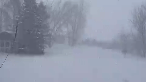
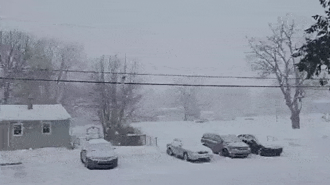
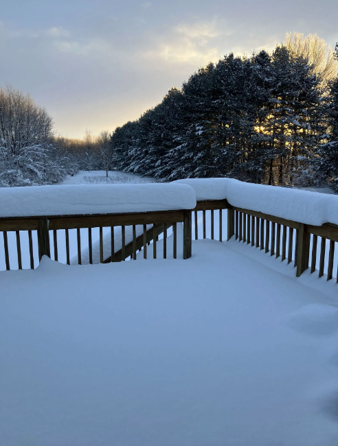
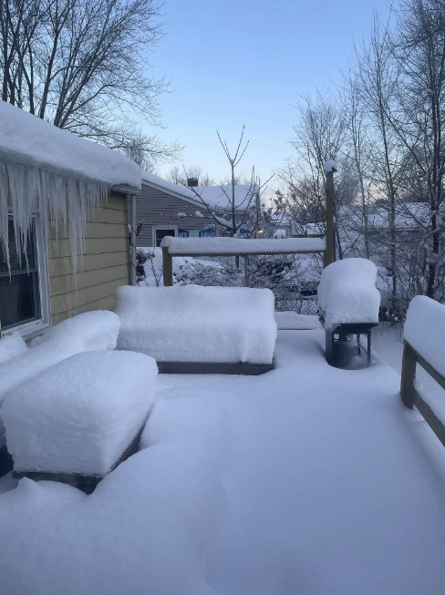
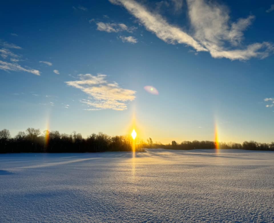
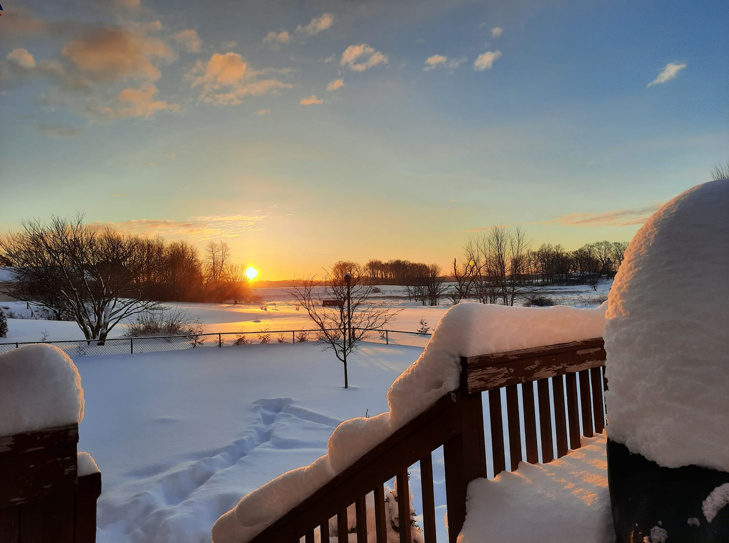
Photos & Videos
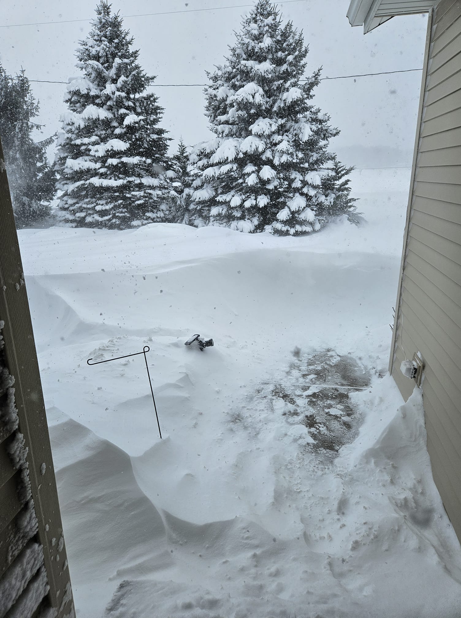
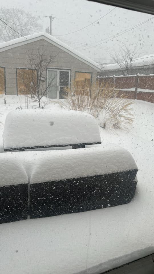
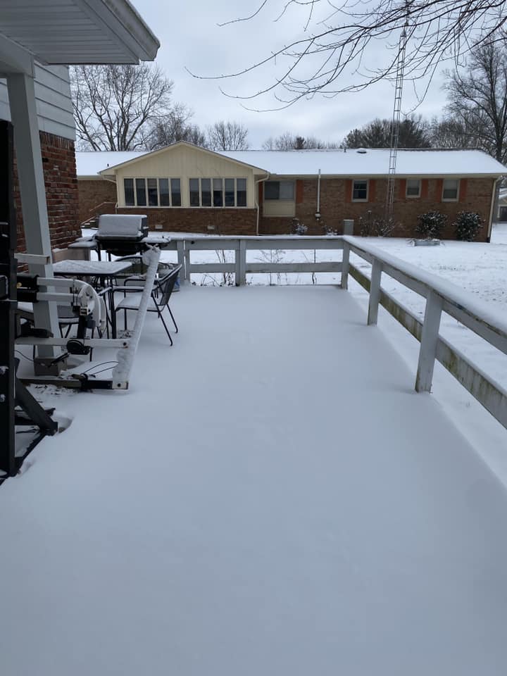
Widespread totals of 18-36" were observed in La Porte County, IN.
 |
 |
 |
 |
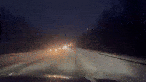
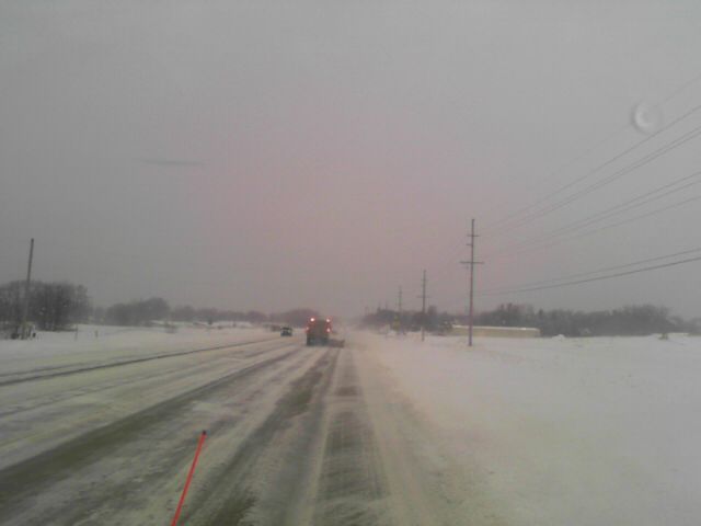
| A slick, snow covered drive on US 12 on the night of January 19th (Lynnette Grant WSBT) |
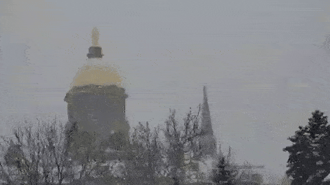
Snow falls at Notre Dame University in South Bend, IN (Dr Cullen Hardy) |
Heavy snow and reduced visibility at Warren Dunes beach in Michigan (Twitter @heyitsdjwx) |
Heavy snow with rates up to 2"/hr in South Bend, IN (Twitter @NISWWeather) |
 |
 |
 |
 |
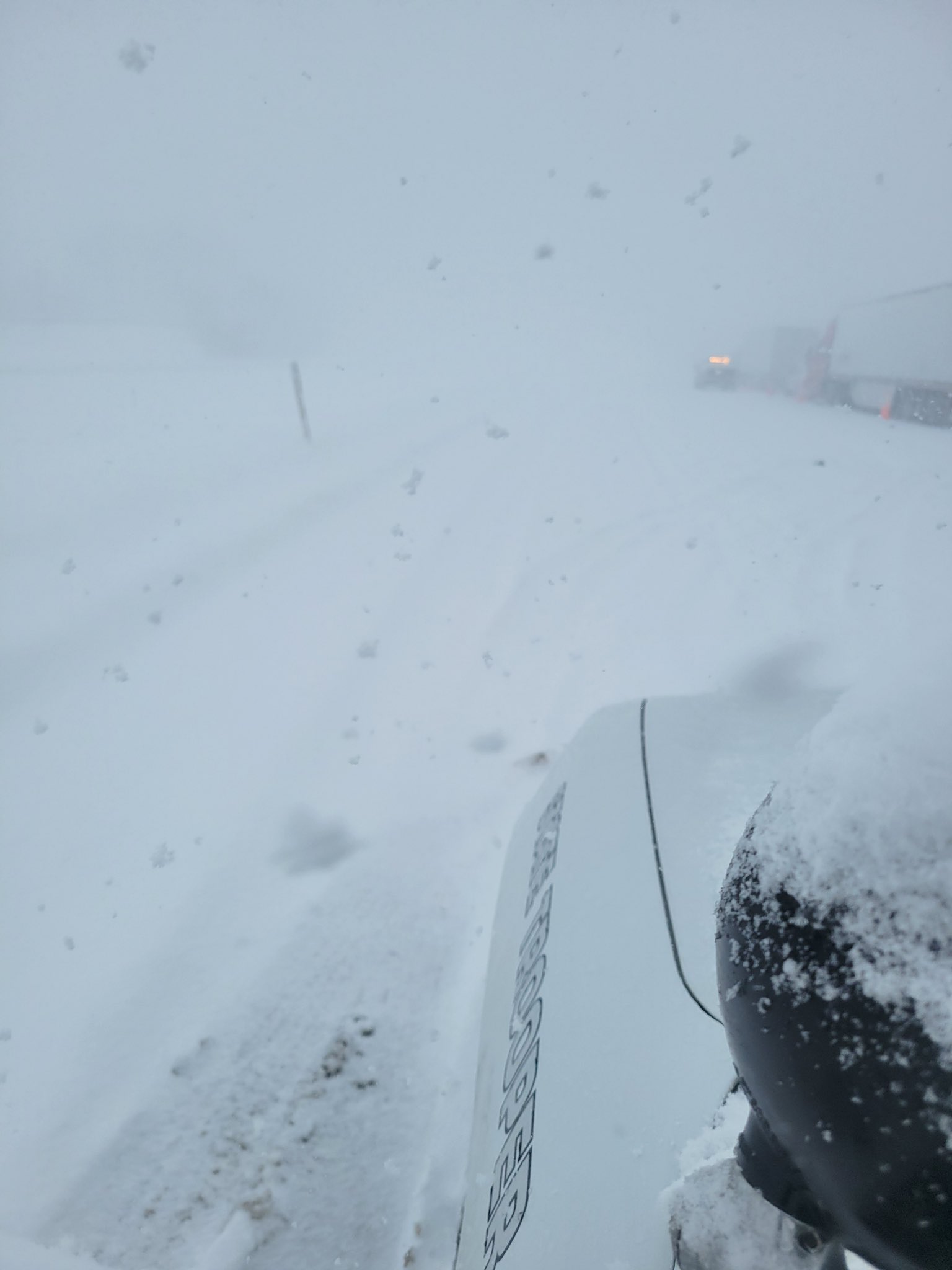
| Blowing and drifting snow on IN 114 near Kingsbury Heights, IN (INDOT) |
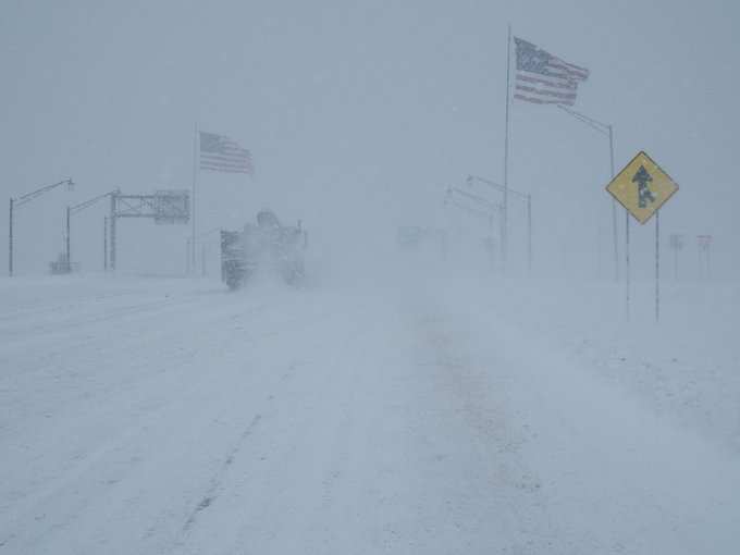
Whiteout conditions on US 421 near Michigan City, IN (ISP Lowell) |
Whiteout conditions on the Indiana Toll Road near mile marker 47 (ISP Trooper Matt Henson) |
Blowing and drifting snow on US 421 near Westville, IN (INDOT) |
 |
 |
 |
 |
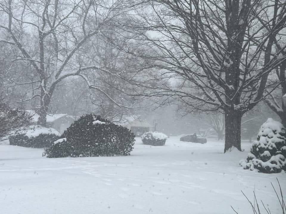
| Snow in South Bend, IN (April Schooley Evans) |
Accumulating snow in New Buffalo, MI (Malinda Brown) |
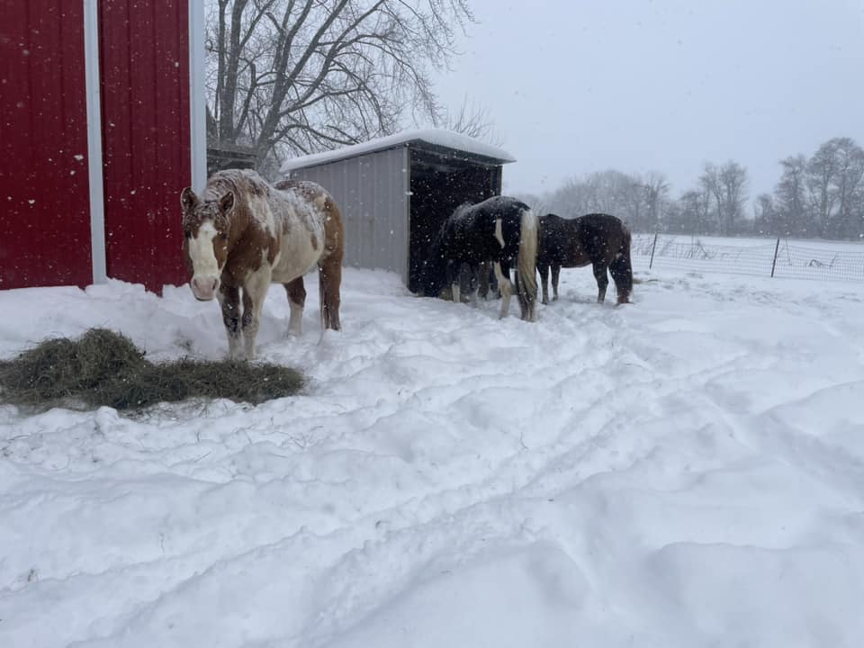
Horses enjoying the snow in La Porte, IN where up to 27" fell! (Tabitha Somers) |
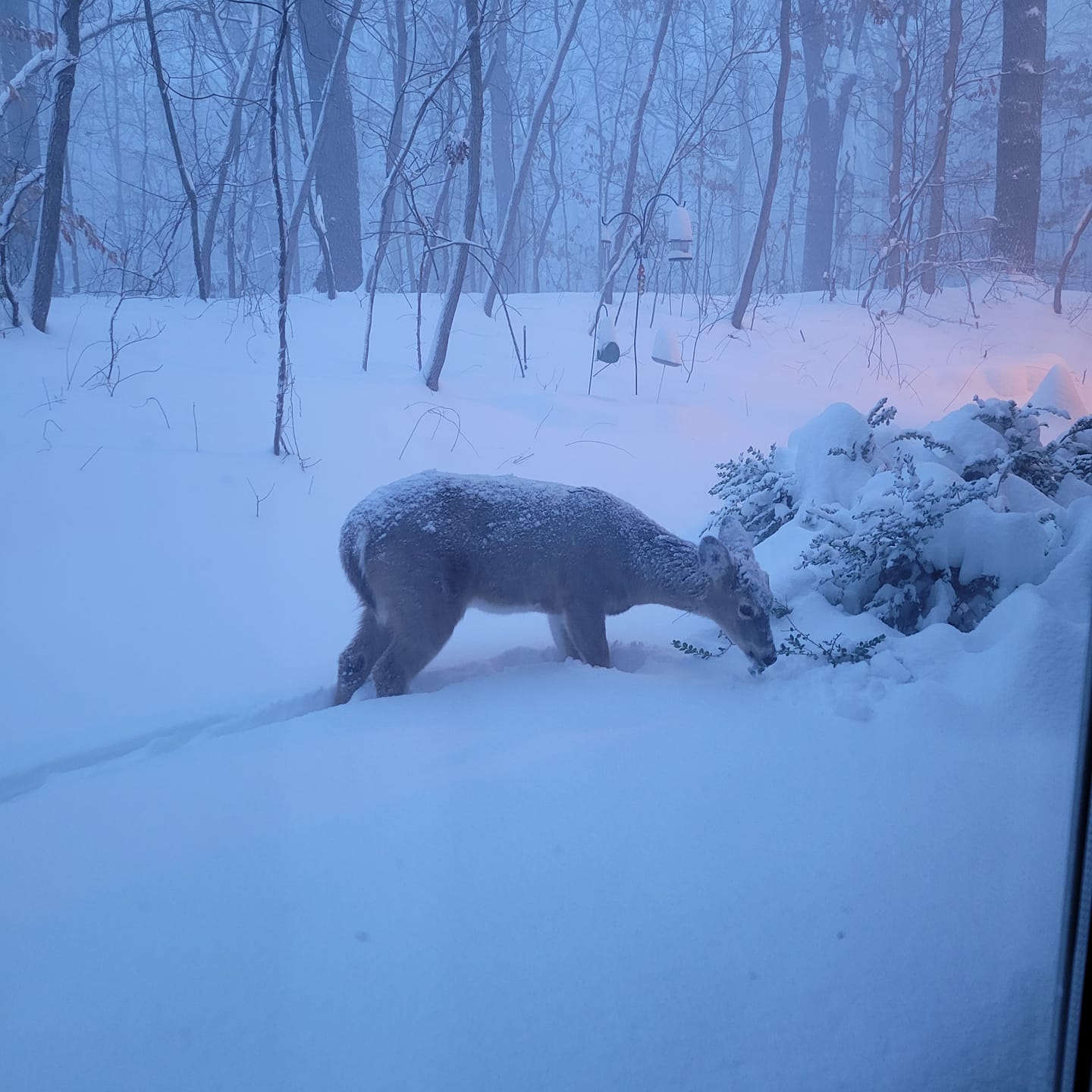
A deer in Long Beach, IN finding something to eat in the snow (Amarie Jana) |
 |
 |
 |
 |
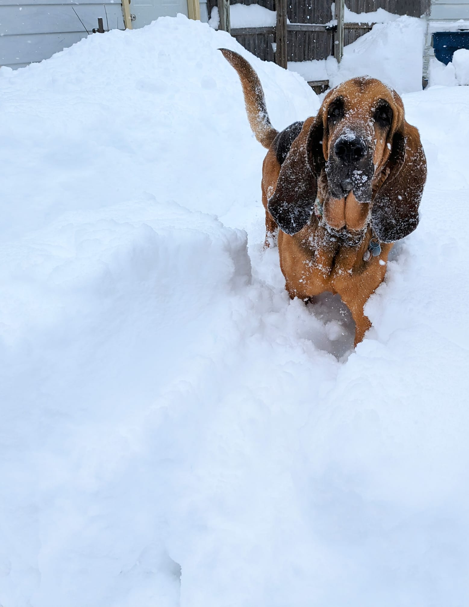
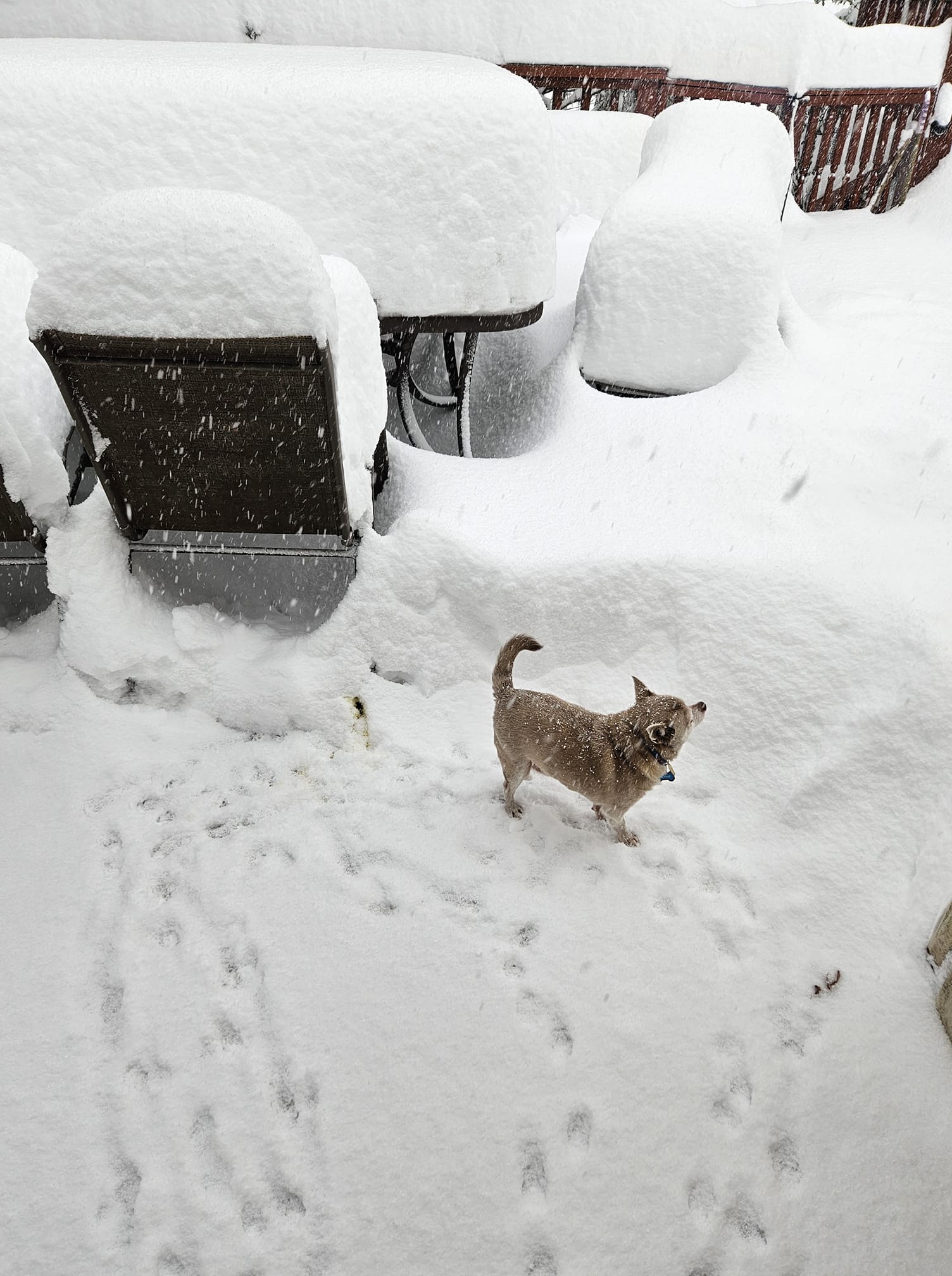
| A dog enjoys the snow in La Porte, IN (Rebecca Jaspers Frye) |
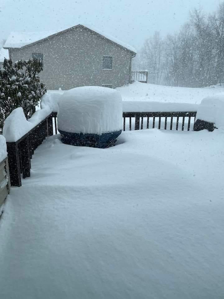
2 feet of snow in La Porte, IN (Chris Cage) |
Snow drifts in La Porte, IN (Danielle Coetzee) |
Snow in Niles, MI (Hailey Colpitts) |
 |
 |
 |
 |
| Whiteout conditions on January 20th on the Starke-La Porte County line (Amy Streets - relayed by Tom Coomes ABC57 News) |
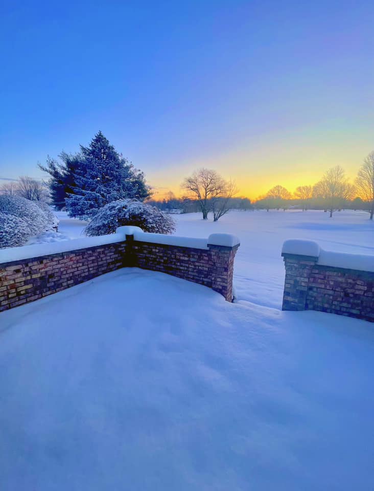
Sunrise on January 20th in Elkhart, IN (Elyse Toth) |
A snowy morning in Eau Claire, MI (John Gibbs - relayed by WSBT) |
Heavy snow fell in Niles, MI (Christian Edgerton - relayed by WSBT) |
 |
 |
 |
 |
| Sundogs in New Carlisle, IN (Katie Honselman Jesswein) |
La Porte, IN sunrise (Erin Bozetarnik) |
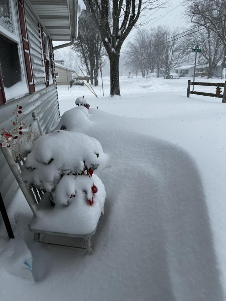
Snow drifts in La Porte, IN nearly covering up lightposts and a stop sign (Derek M - relayed by Jessica Burns WSBT) |
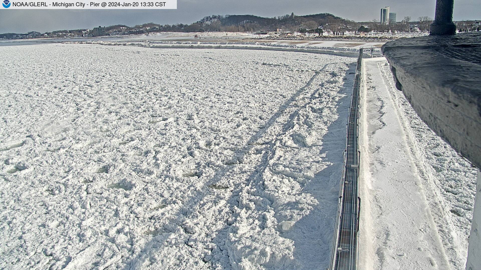
Ice pancakes and shelf ice near the Michigan City Pier (NOAA GLERL) |
 |
 |
 |
 |
| Long Beach, IN where over a foot of snow fell! (CL Leonard) |
Snow drifts in Michigan City, IN (Pamela Bailey) |
27" of snow in Michigan City, IN (Sarah Rinkel) |
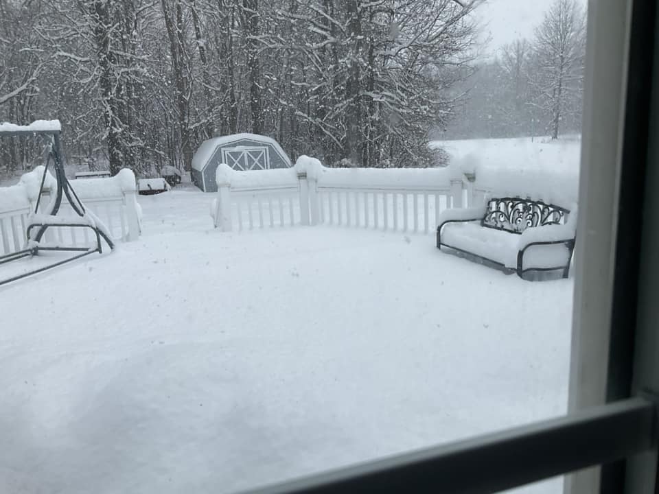
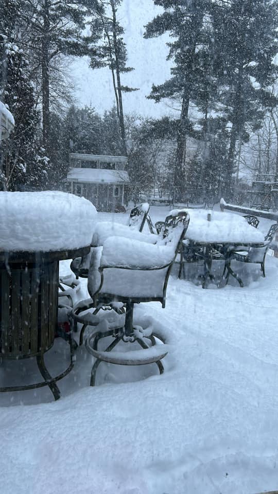
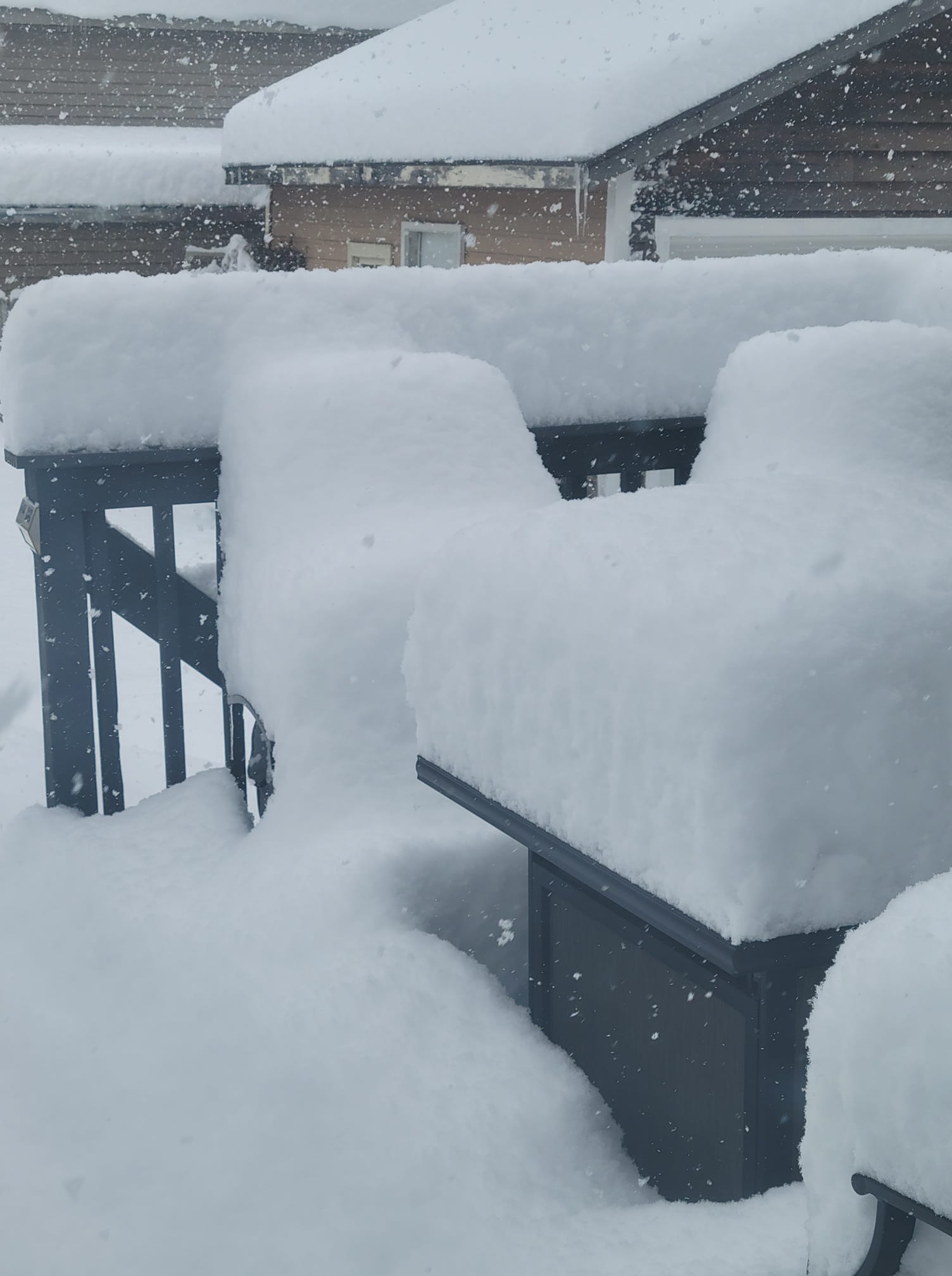
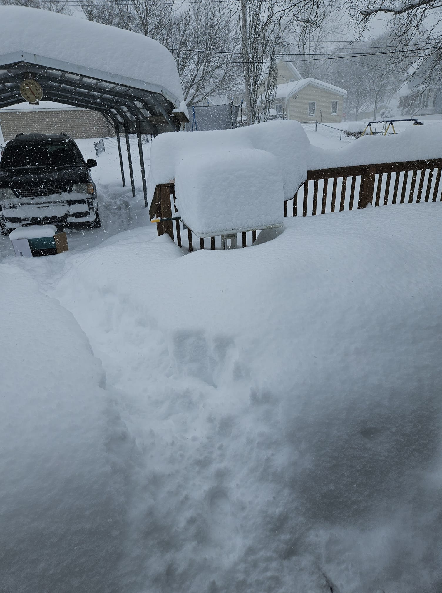
Patio furniture buried in snow in La Porte, IN (Kelley Hartfield Turley) |
 |
 |
 |
 |
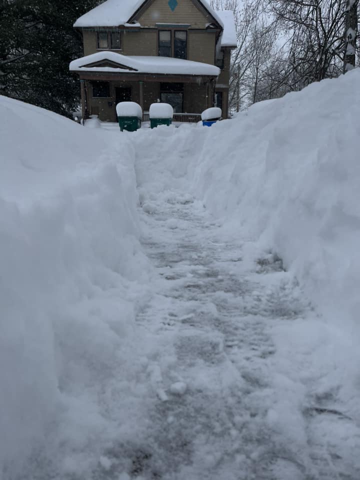
| A car buried in snow in La Porte (Emma, last name unknown - relayed by Maci Tetrick ABC57 News) |
Snow in Union Mills where up to 18" fell (Stephanie Rodman) |
A view of the snow in Michigan City, IN (Suzanne Watson) |
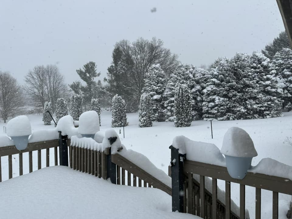
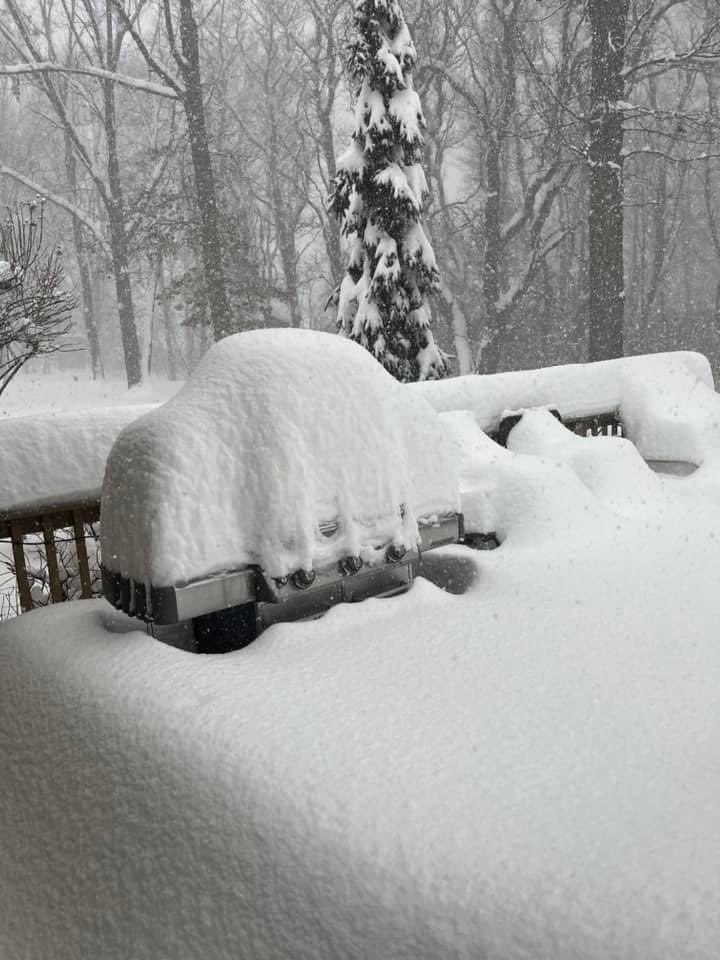
Outdoor furniture buried by heavy snow in Bridgman, MI (Macy Scott) |
.jpg) |
 |
 |
 |
| Snow drifts near Summit Farm in La Porte, IN (Tina Coburn) |
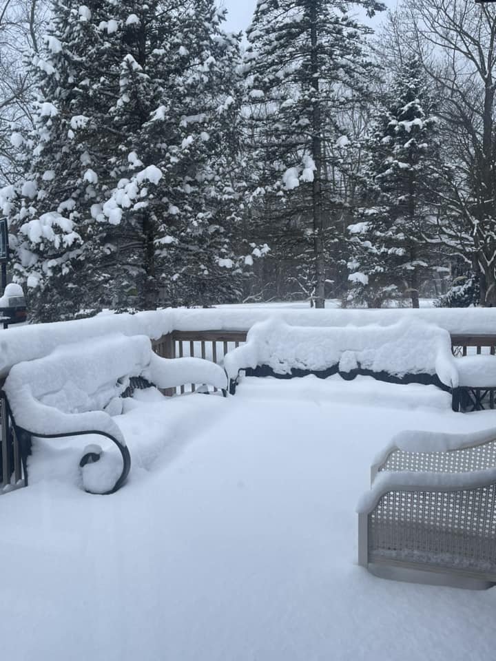
Over 2 ft of snow on the western side of La Porte, IN (Larry Murray) |
Snow in Rush, IN (Jean Cooper) |
Snow in La Porte, IN (Matt Rudkin) |
Radar Loops
 |
 |
| Radar loop of the lake effect event 6AM Jan 19 - 10AM Jan 20 | Radar loop of reflectivity and storm relative velocity. Note the convective structure to the lake effect cells and one of the cells even has a hint of subtle rotation in it. Loop 4:15am to 5:45am CT |
Environment
A deep upper level low pressure system settled over the Great Lakes with very cold temperatures at the surface and aloft.
 |
 |
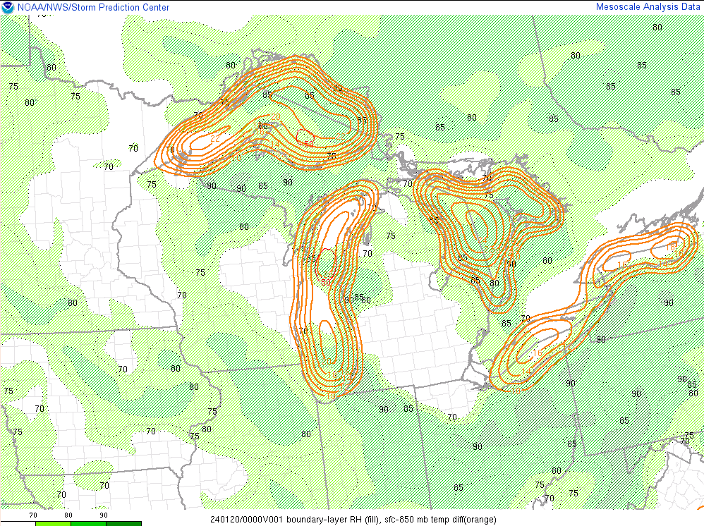 |
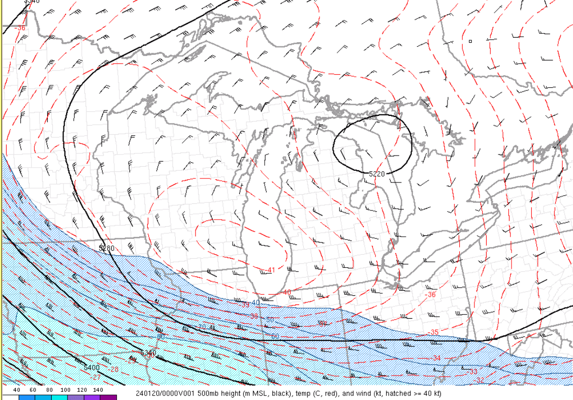
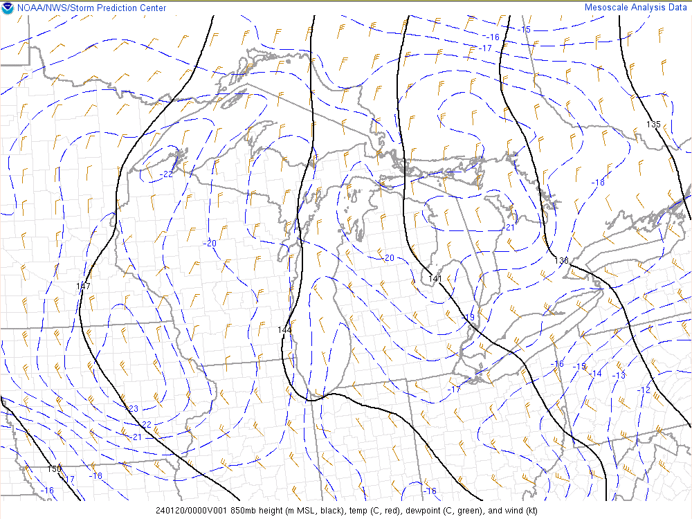
| Figure 1: 500mb heights, temperatures, and winds. 500mb temperatures were below -40C in this upper low. | Figure 2: 850mb heights, temperatures, and winds. 850mb temperatures were -15 to -20C. | Figure 3: Boundary layer RH and 850mb temp differences. Lake Michigan water temperatures were roughly 3C, creating temperature differences of 20C (highly favorable for lake effect) |
The winds and temperatures in this pattern were highly favorable for strong lake effect snow.
 |
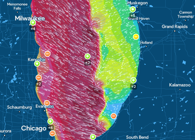 |
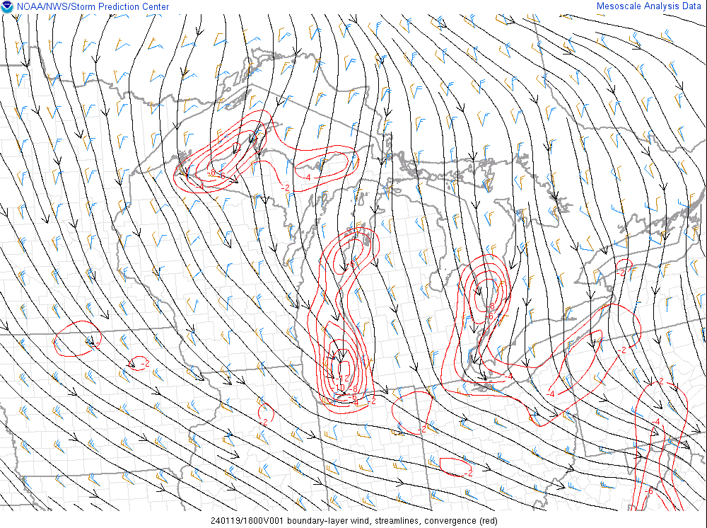
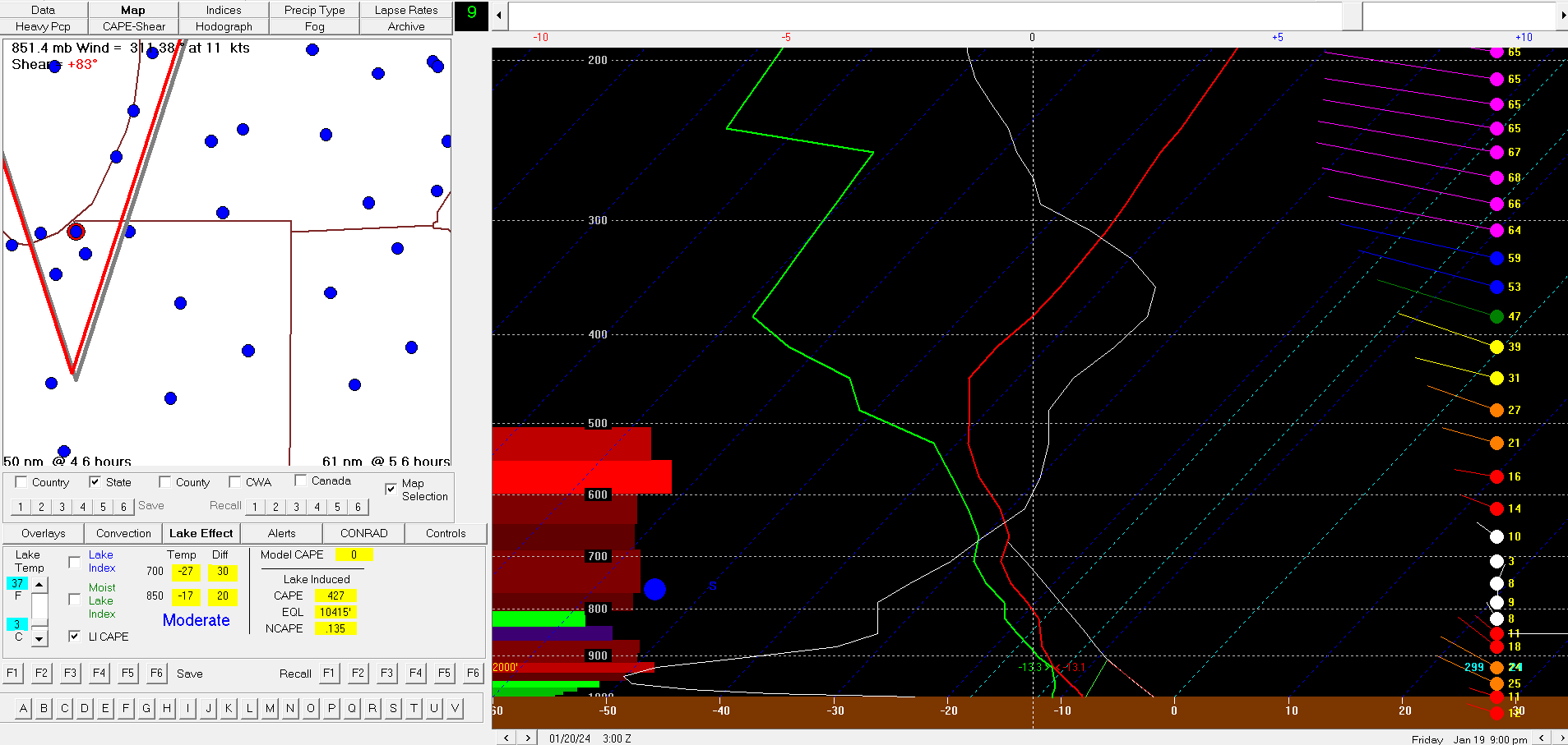 |
| Figure 4: Boundary-layer wind, streamlines, and convergence. Convergence helps create a single, dominant band. The fetch was also ideal, going down the long axes of Lakes Superior and Michigan. | Figure 5: Winds over Lake Michigan were highly convergent which helps to create a single, very strong band of snow. Small-scale vortices also formed and aided snowfall rates. Image courtesy GLOS. | Figure 6: HRRR BUFKIT sounding shows very deep convection/strong instability. The bulk of the ascent was also focused in the dendritic growth zone (-10 to -20C) which lead to very high snow:liquid ratios. (Up to 40:1 in some cases) |
 |
Media use of NWS Web News Stories is encouraged! Please acknowledge the NWS as the source of any news information accessed from this site. |
|

