Overview
|
On the evening of July 12th, a line of severe storms moved across Lake Michigan and into southwest Lower Michigan. As of 7:30 PM EDT on July 13th, we have confirmed one waterspout and one tornado from this event. - An EF-1 tornado with estimated peak wind speeds of 90 MPH occurred near Colon, MI in St Joseph County around 11:09 PM EDT. The path length was just under 3 miles with a max width of 50 yards. PNS can be found here: https://mesonet.agron.iastate.edu/wx/afos/p.php?pil=PNSIWX&e=202307132104 - A waterspout formed 2 miles northwest of Saint Joseph, MI over Lake Michigan around 9 PM ET. There are multiple reports on Twitter and Facebook of this waterspout. Through reviewing photo/video evidence, we can confirm that the waterspout remained offshore, thus, there were no reports of damage. |
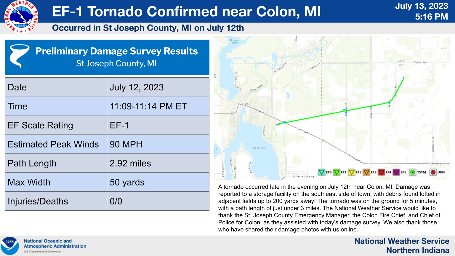 EF-1 Tornado Confirmed near Colon, MI |
Tornado:
|
Tornado - COLON, MI
Track Map 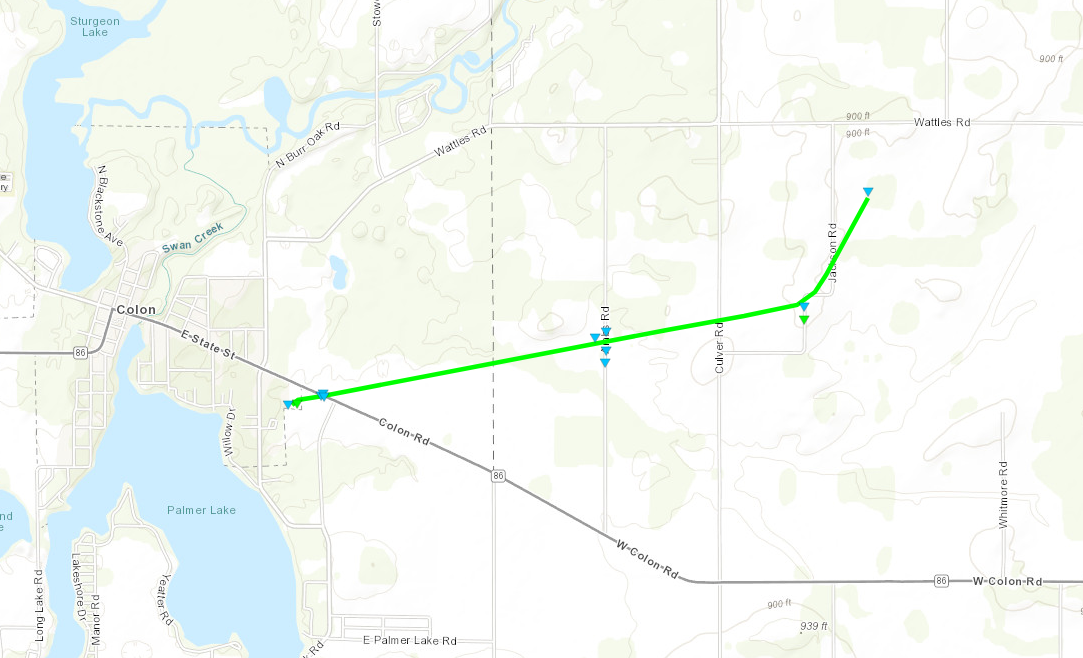 
Downloadable KMZ File |
||||||||||||||||
The Enhanced Fujita (EF) Scale classifies tornadoes into the following categories:
| EF0 Weak 65-85 mph |
EF1 Moderate 86-110 mph |
EF2 Significant 111-135 mph |
EF3 Severe 136-165 mph |
EF4 Extreme 166-200 mph |
EF5 Catastrophic 200+ mph |
 |
|||||
Photos
July 12th Damage in and near Colon, MI
 |
 |
 |
 |
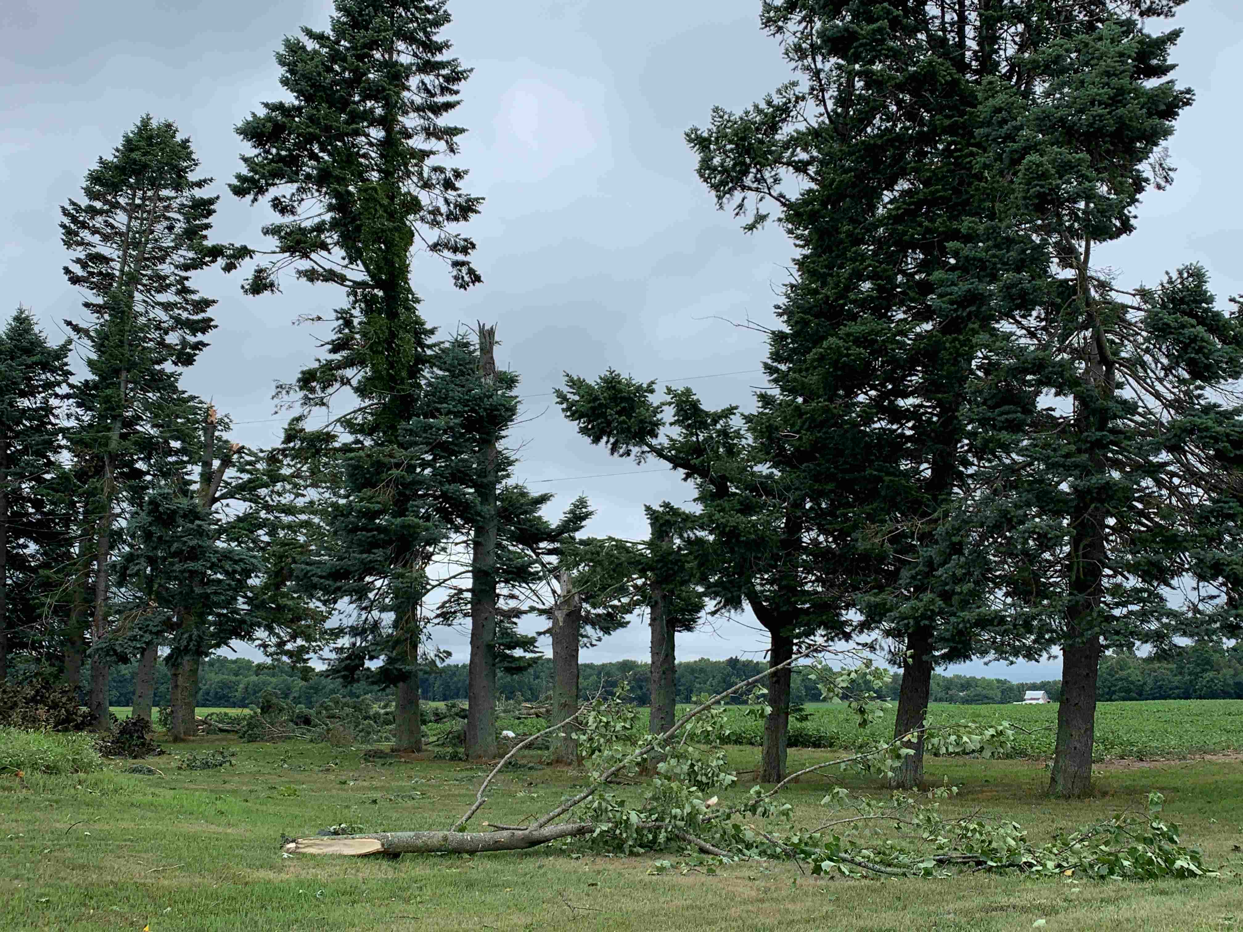
| 6 softwood trees snapped about 15 ft off the ground along Jackson Street. (NWS IWX Storm Survey - Kyle Brown) |
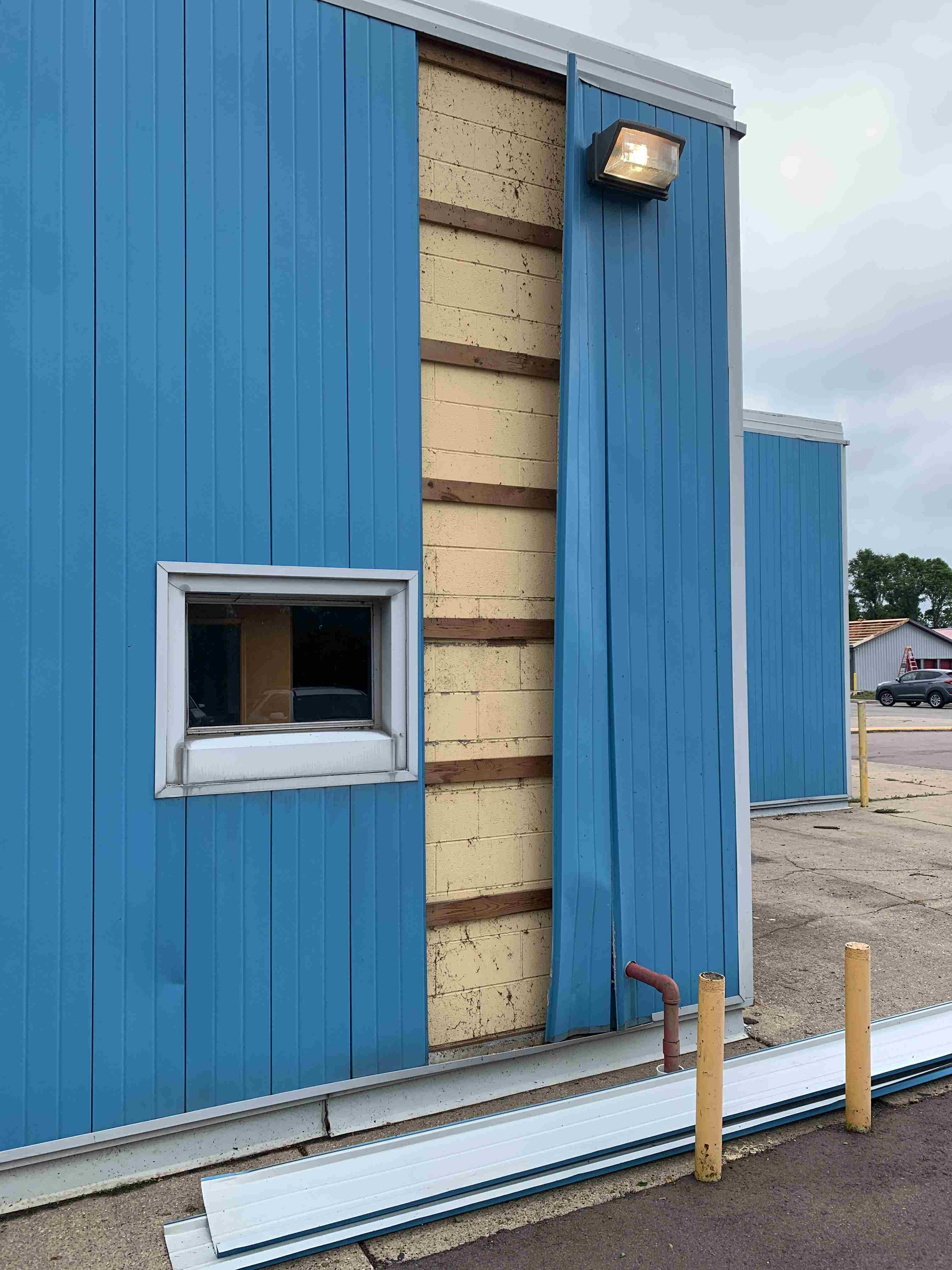
Siding peeled off the south side of Maxitrol Manufacturing. Facility had 5 windows damaged as well. (NWS IWX Storm Survey - Kyle Brown) |
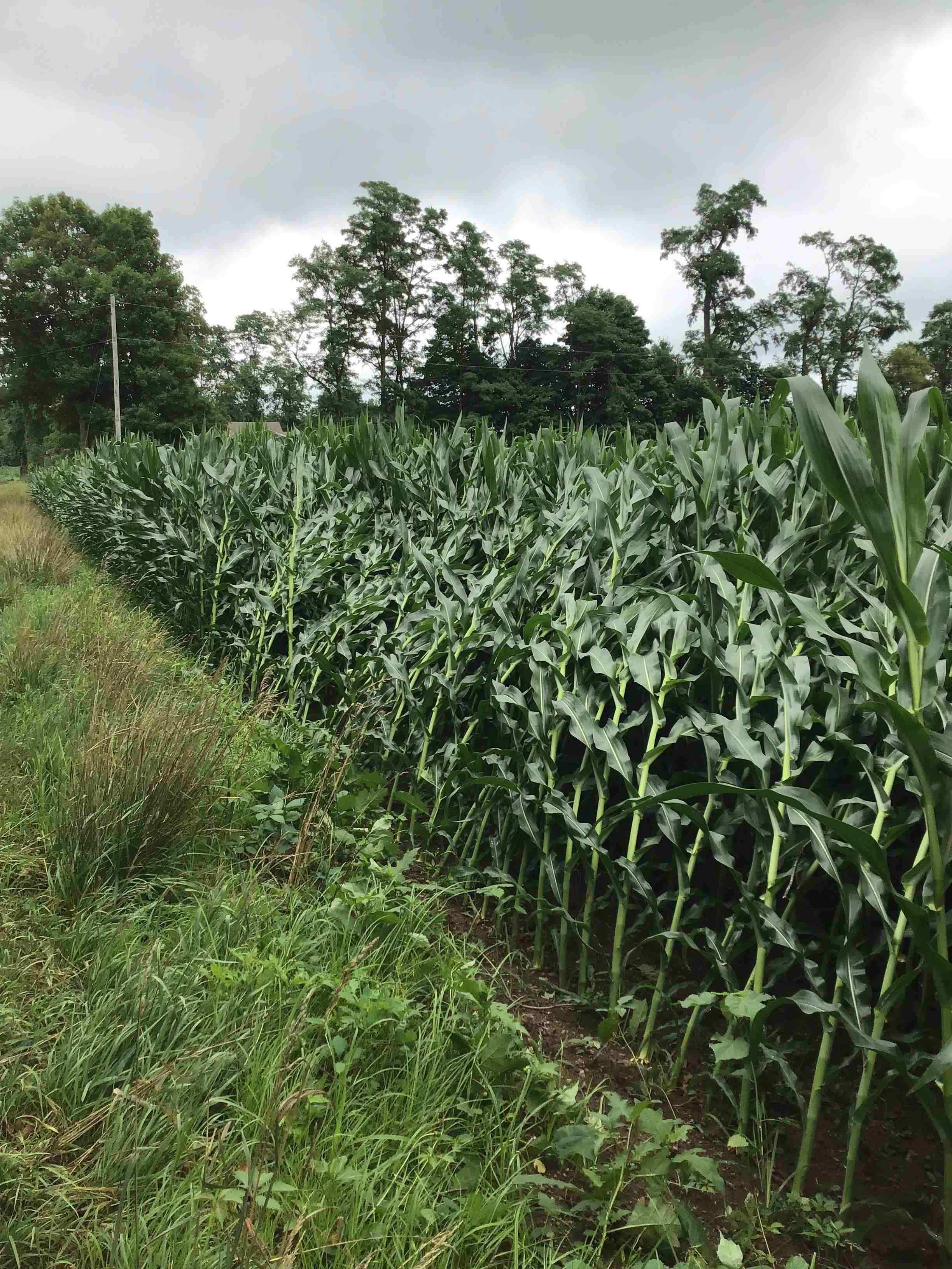
Multiple rows of corn leaning/flattened along Ambs Rd. (NWS IWX Storm Survey - Kyle Brown) |
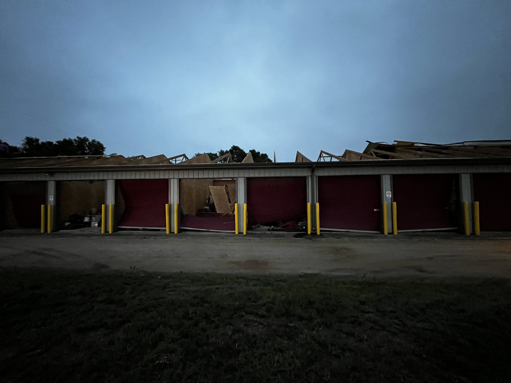
Garage doors blown in and roof lifted off of a multi-unit storage facility in Colon, MI (Emmett Twomey - ABC 57) |
 |
.jfif) |
 |
 |
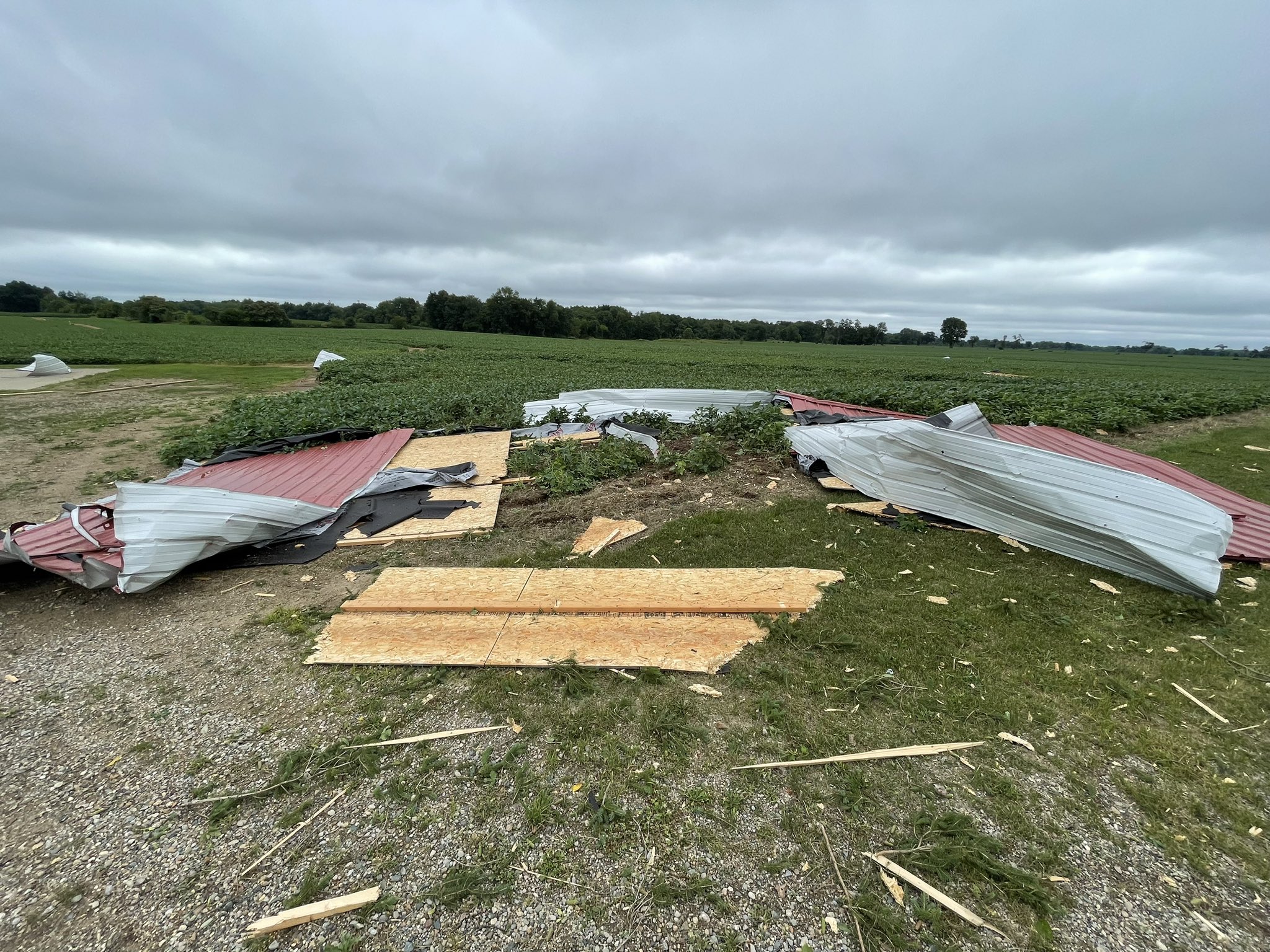
| Debris from storage units lofted into nearby field along M-86. (Emmett Twomey - ABC 57) |
Debris from storage units lofted into nearby field along M-86. (Nick Ponton via Twitter) |
Pieces of the storage facility roof in field. Screws visible where the roof was torn from the building (Nick Ponton via Twitter) |
Portions of the storage facility roof and garage doors found in a nearby field. (Tim Talbot via Twitter) |
 |
 |
 |
 |
| Trees snapped along Ambs Rd (MiStormChasers via Twitter) |
Small tree limbs down on Ambs Rd (MiStormChasers via Twitter) |
Another view of the damaged Colon, MI storage units (Gabrielle Phifer - WOOD TV) |
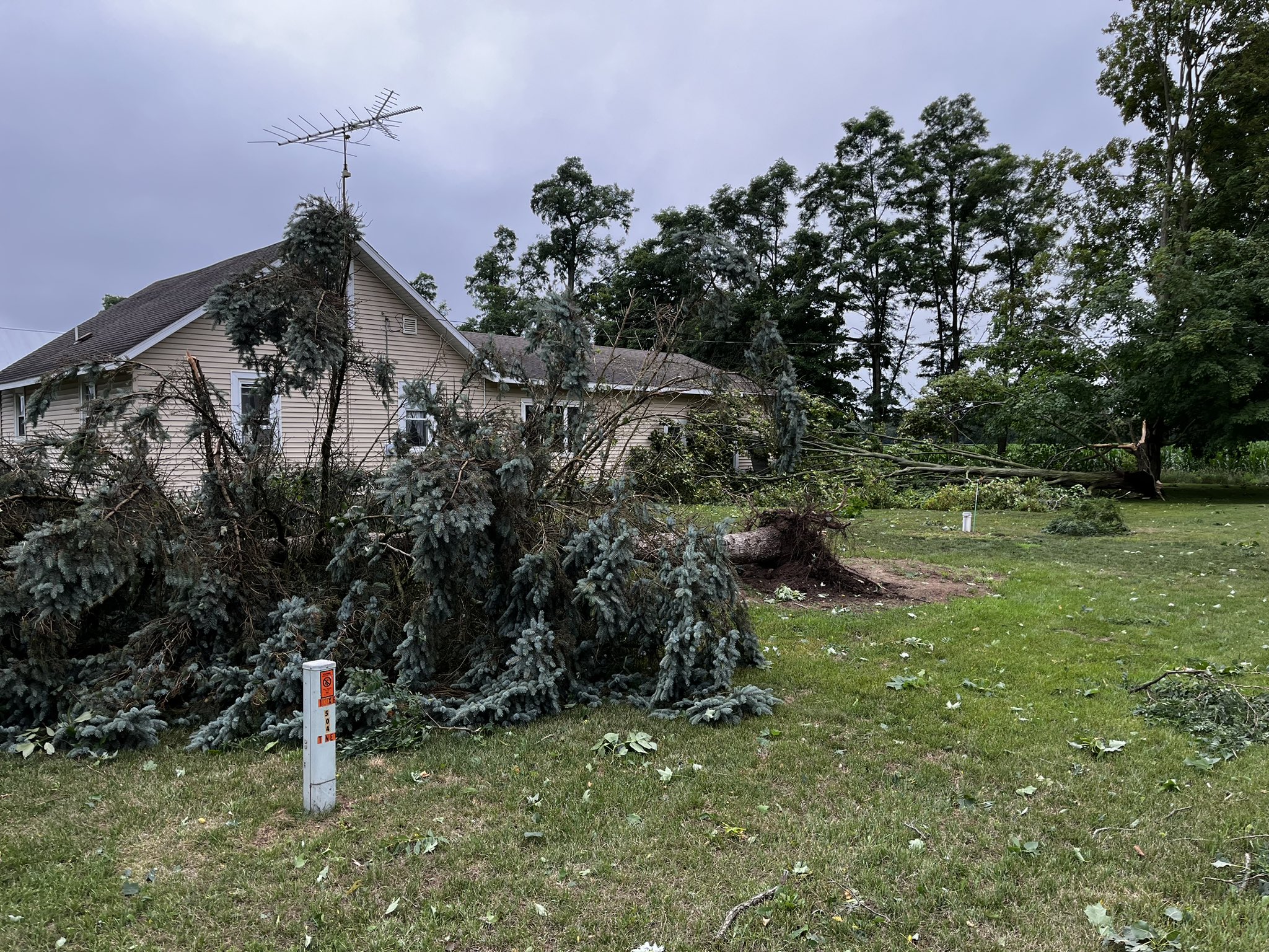
Several trees fell close to a home on Ambs Road. (Gabrielle Phifer - WOOD TV) |
Radar
Loop of Radar from 8:55 PM ET July 12th to 1 AM ET July 13th
 |
| Radar Loop courtesy of Iowa Environmental Mesonet (IEM) |
Environment
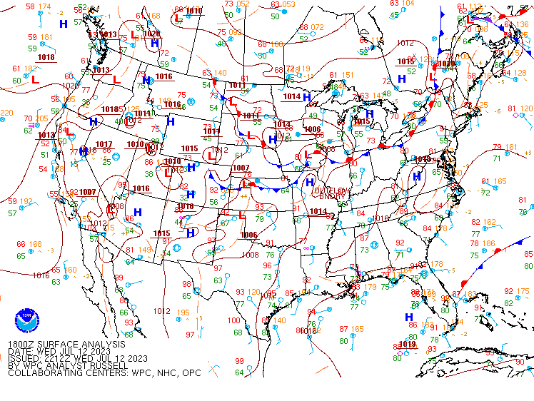
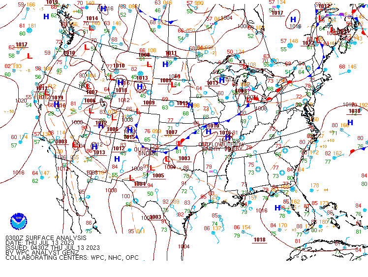
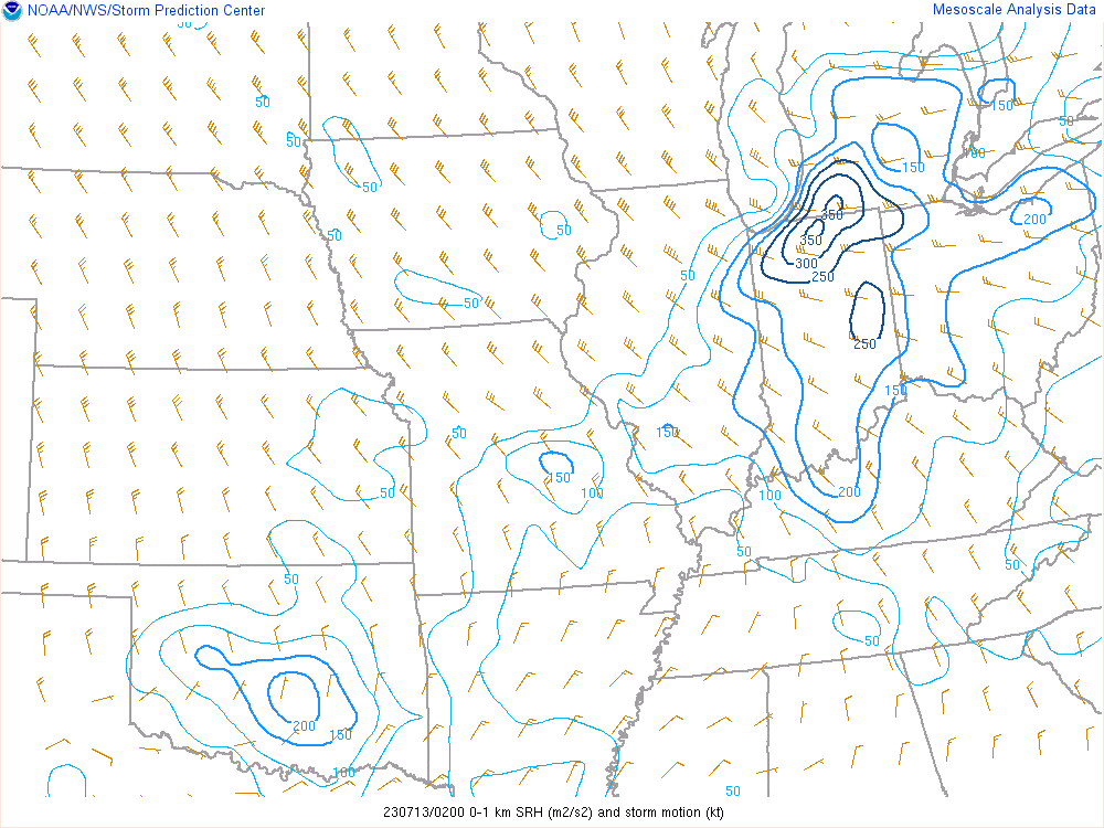
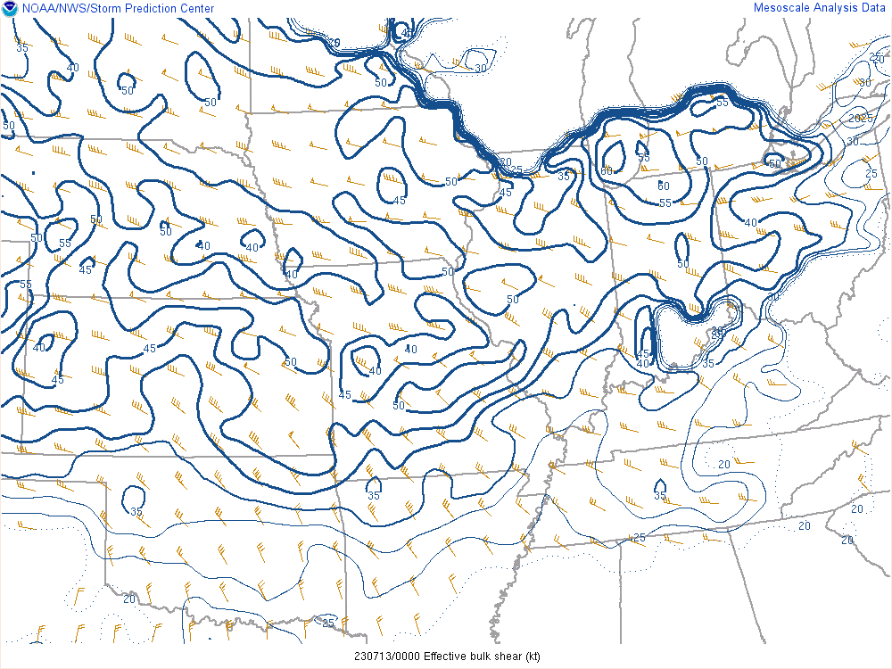
A quasi-stationary front was positioned over far northern Indiana around 18Z (2 PM ET) July 12th, with the parent low over eastern Iowa. By 3Z (11 PM) July 13th, the low pressure had lifted into far southern Lower Michigan, with Colon, MI in the warm sector. Broad troughing was noted aloft at 500mb and 300mb, coinciding with strong winds aloft with the jet stream overhead. High bulk shear (40-60 knots), high 0-1km SRH (up to 350 m2/s2), LCLs near 500m-750m, and a warm front in the vicinity suggested a favorable tornado setup. Instability was lacking with abundant cloud cover from morning and midday rain.
 |
 |
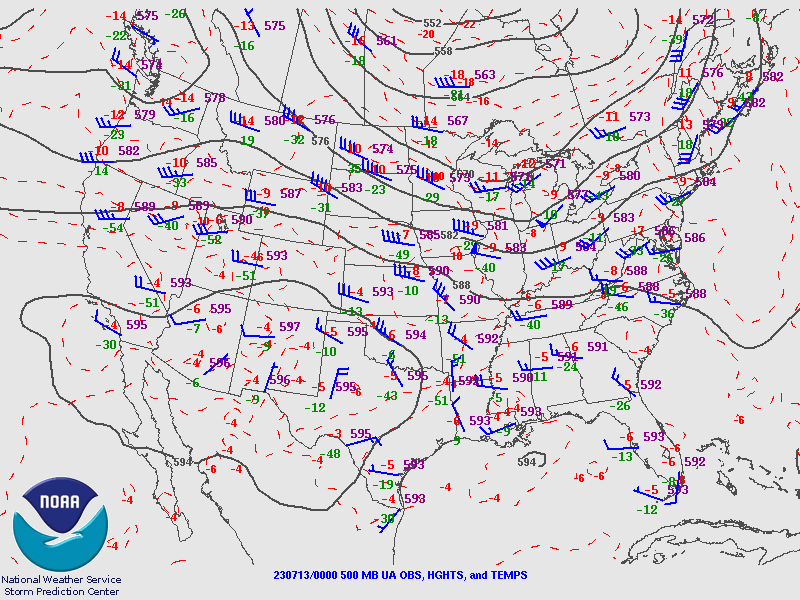 |
| Figure 1: 18Z July 12th surface map | Figure 2: 3Z July 13th surface map | Figure 3: 500mb chart 00Z July 13th |
 |
 |
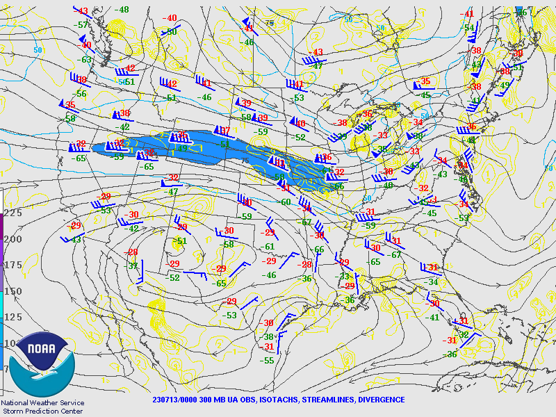 |
| Figure 4: 2Z July 13th SRH 0-1km | Figure 5: 00Z July 13th Bulk Shear | Figure 6: Jet stream map (300mb) at 00Z July 13th |
 |
Media use of NWS Web News Stories is encouraged! Please acknowledge the NWS as the source of any news information accessed from this site. |
|

