Northern Indiana
Weather Forecast Office
The fourth and fifth tornadoes of the outbreak developed simultaneously, virtually on the same north-south meridian in eastern St. Joseph County, Indiana.
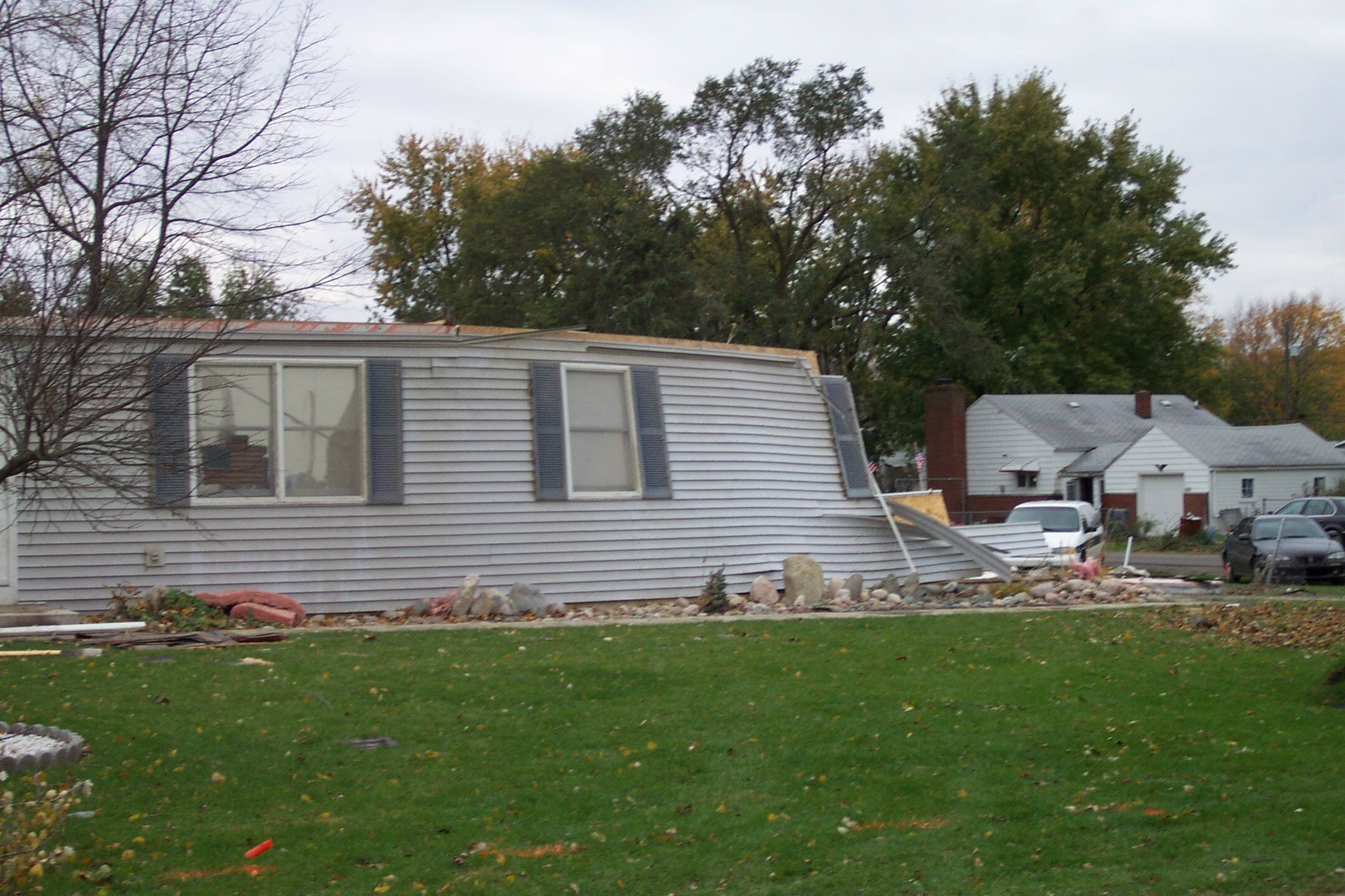
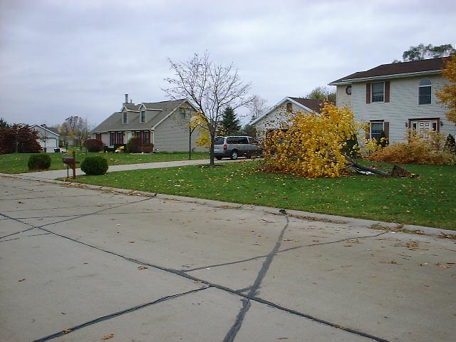
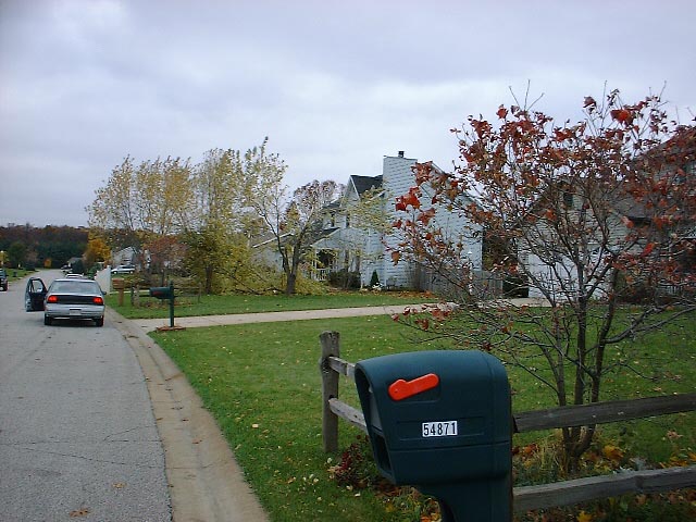
The southern of the two twisters touched ground in extreme southeast Mishawaka at 4:30 p.m., traveled northeast through osceola%20and the cobus%20green%20mobile home community, lifting back into the clouds several hundred feet after entering Elkhart County. It produced F2 damage between Mishawaka and Osceola, was up to 3/4 of a mile wide, and had an intermittent path length of 7 and a half miles. Two people were injured.
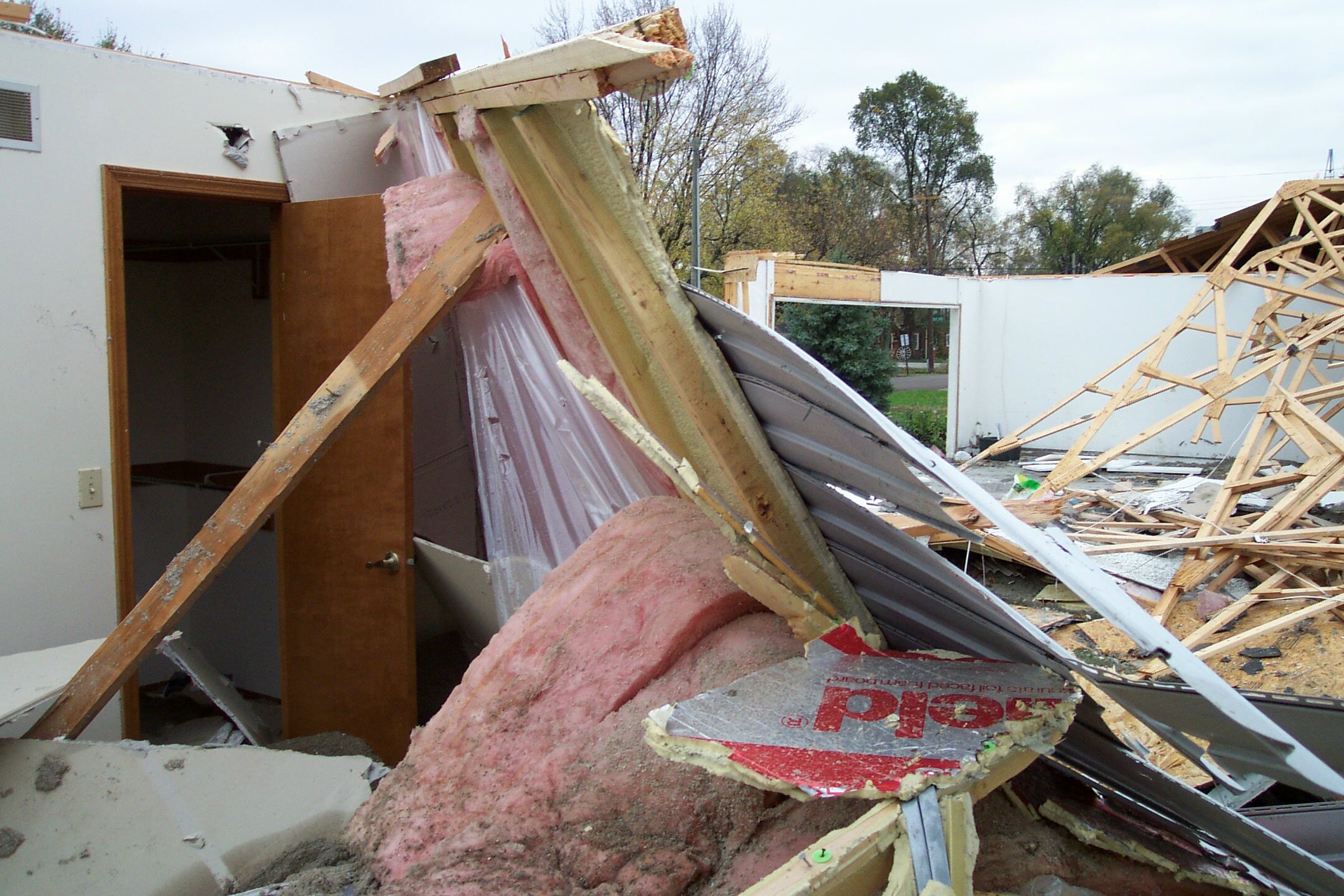
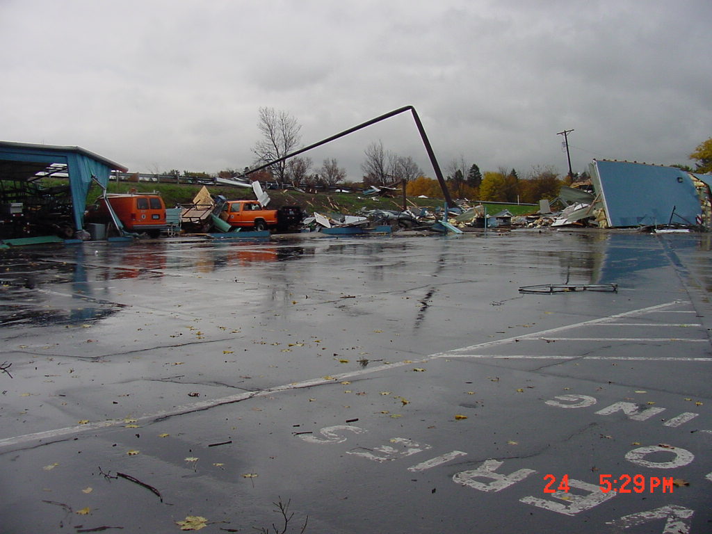
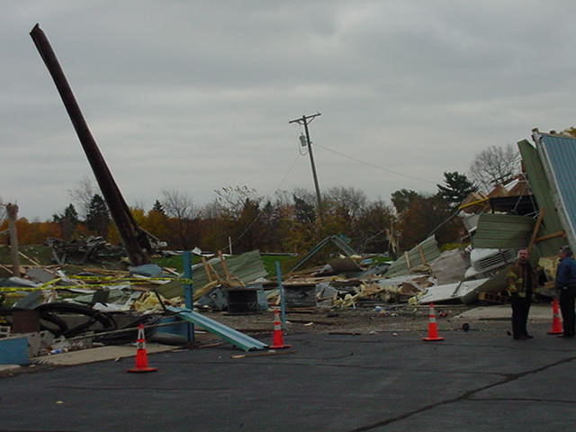
The northern of these two tornadoes touched down at the same moment, northeast of Mishawaka. This tornado moved northeast, hitting the Toll Road at the Elkhart County line, and dissipated north of the Elkhart Airport. This tornado produced F1 damage, had a skipping path length of 2 and a half miles, and was up to 50 yards wide.
A total of four tornadoes had occurred in St. Joseph County Indiana within an hour.
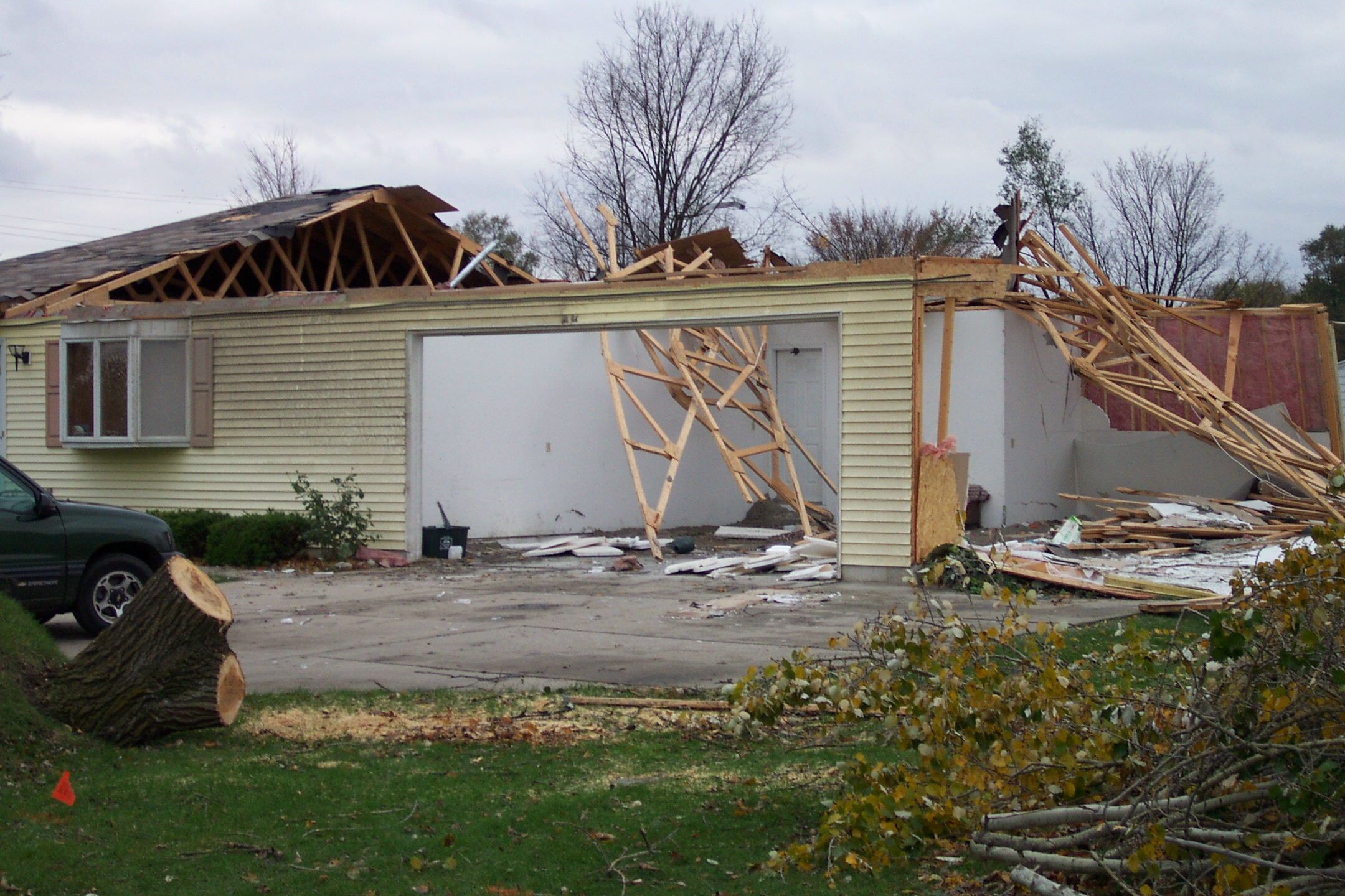
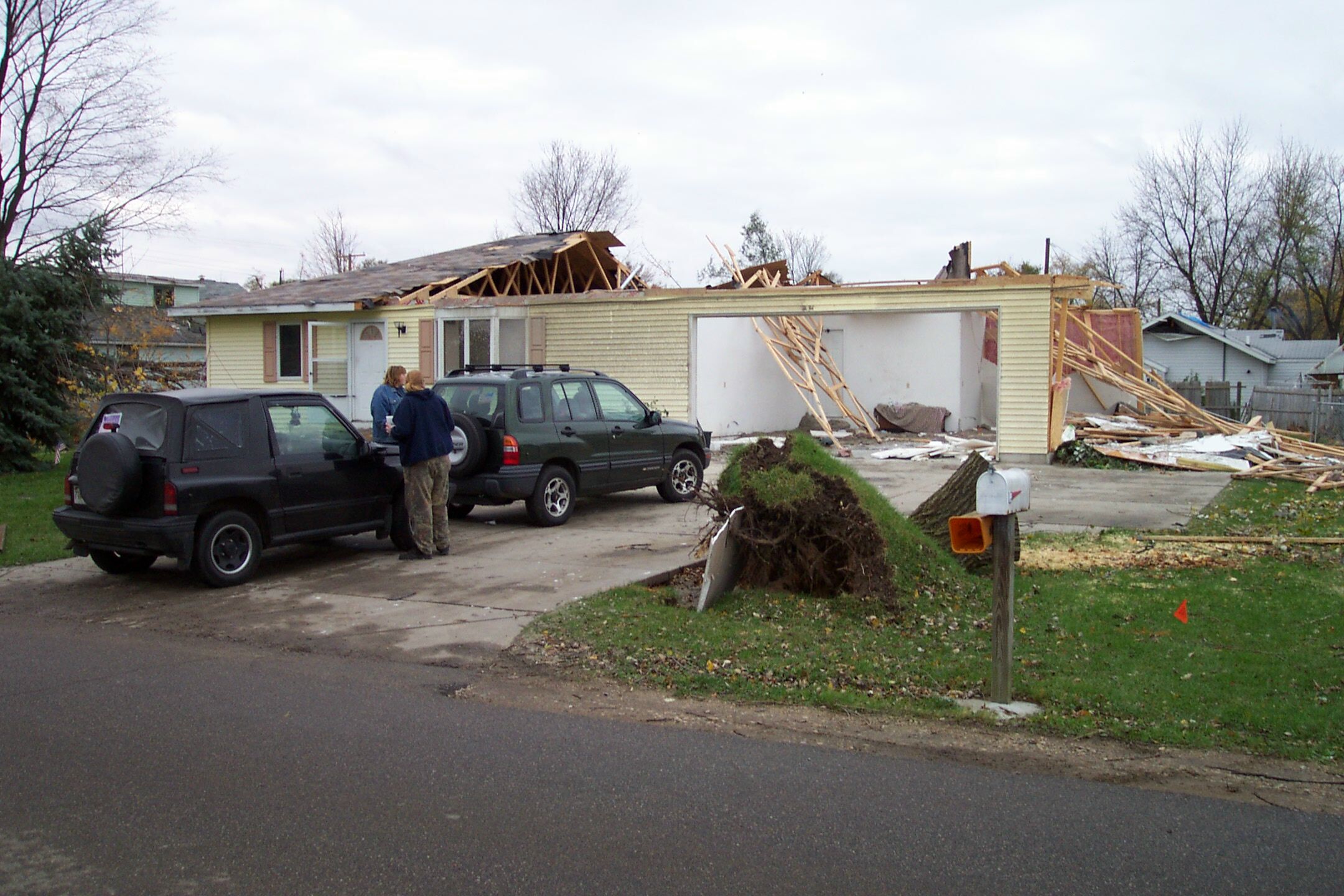
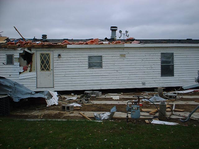
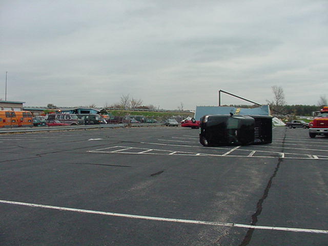
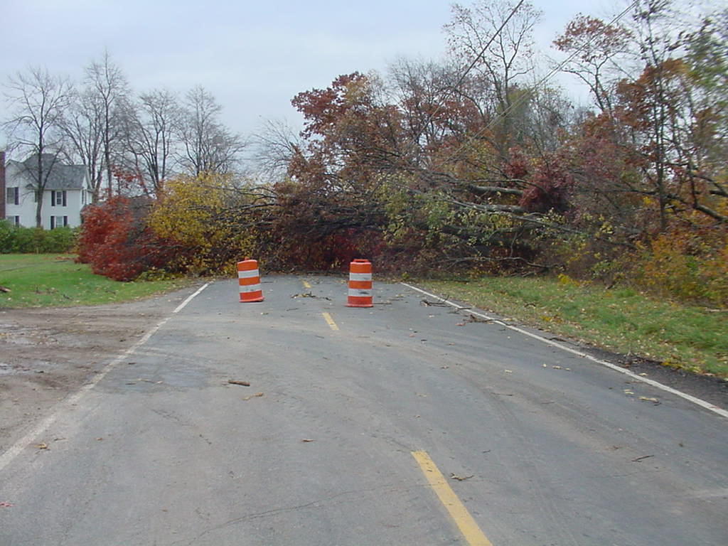
The southern tornado, between Mishawaka and Osceola:
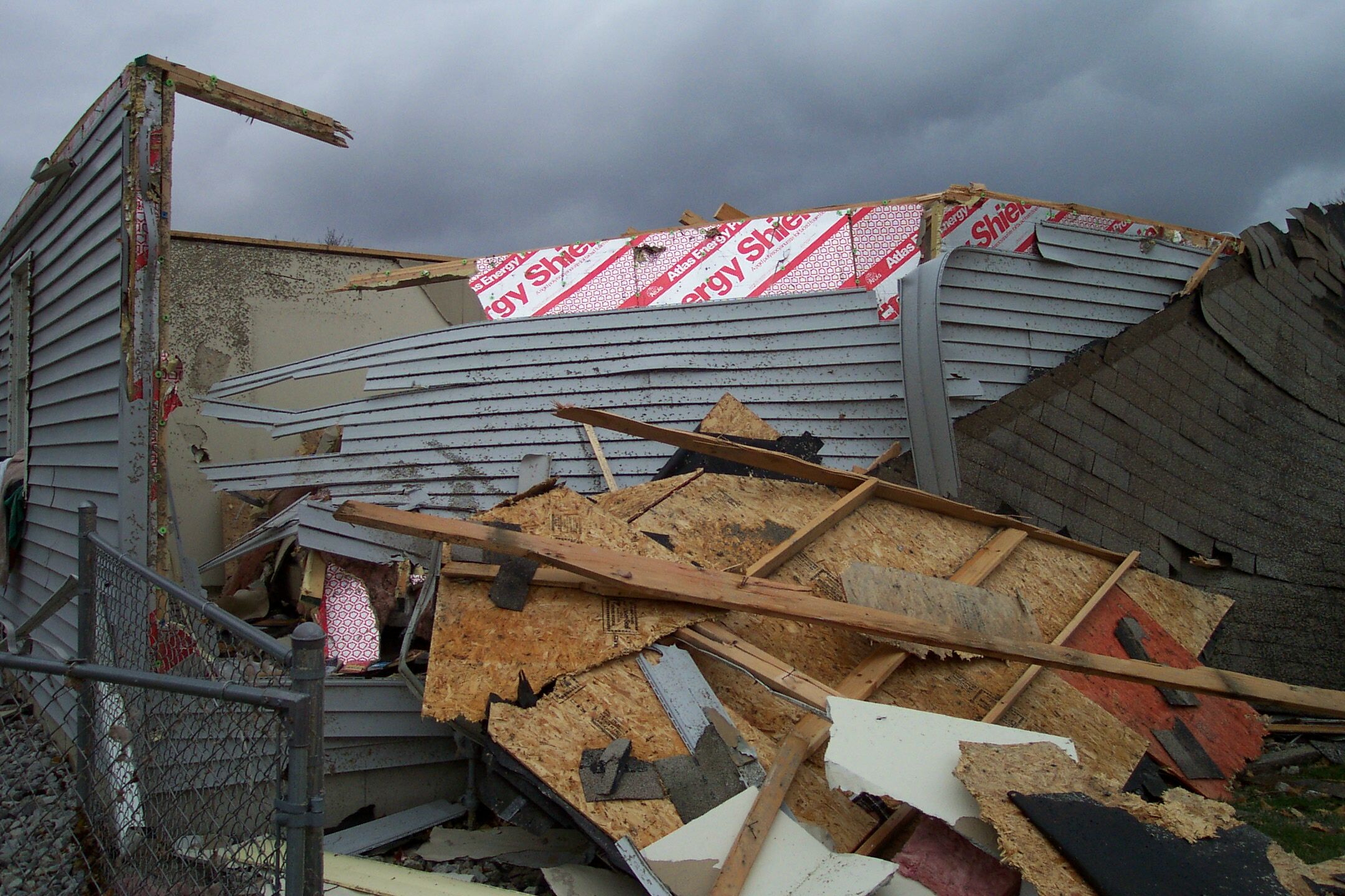


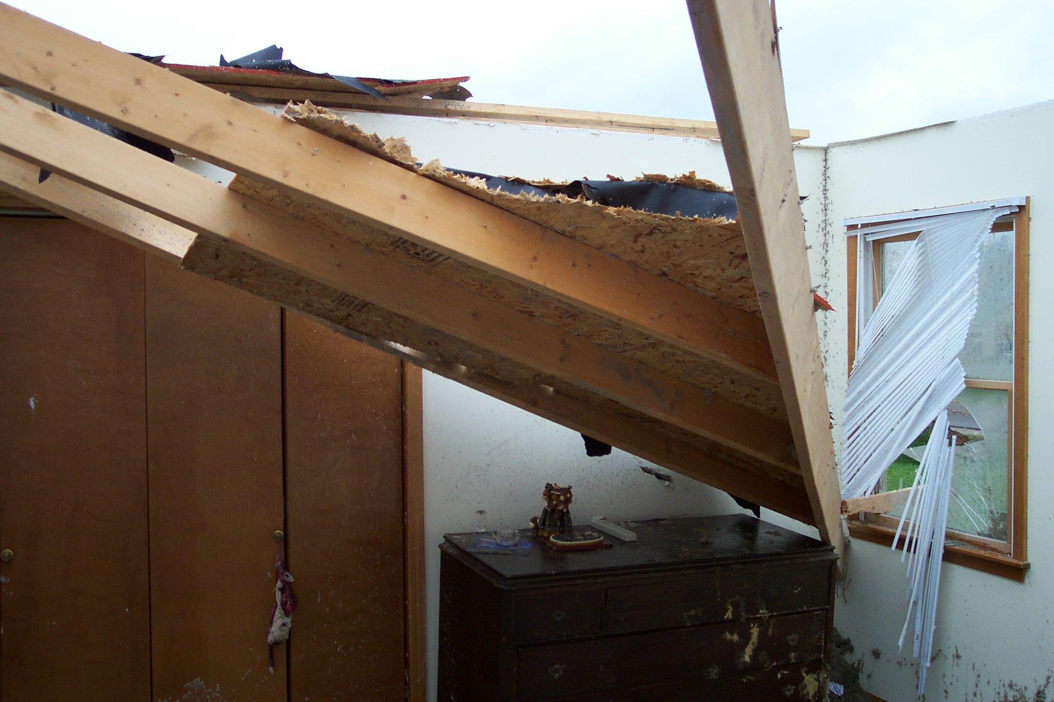

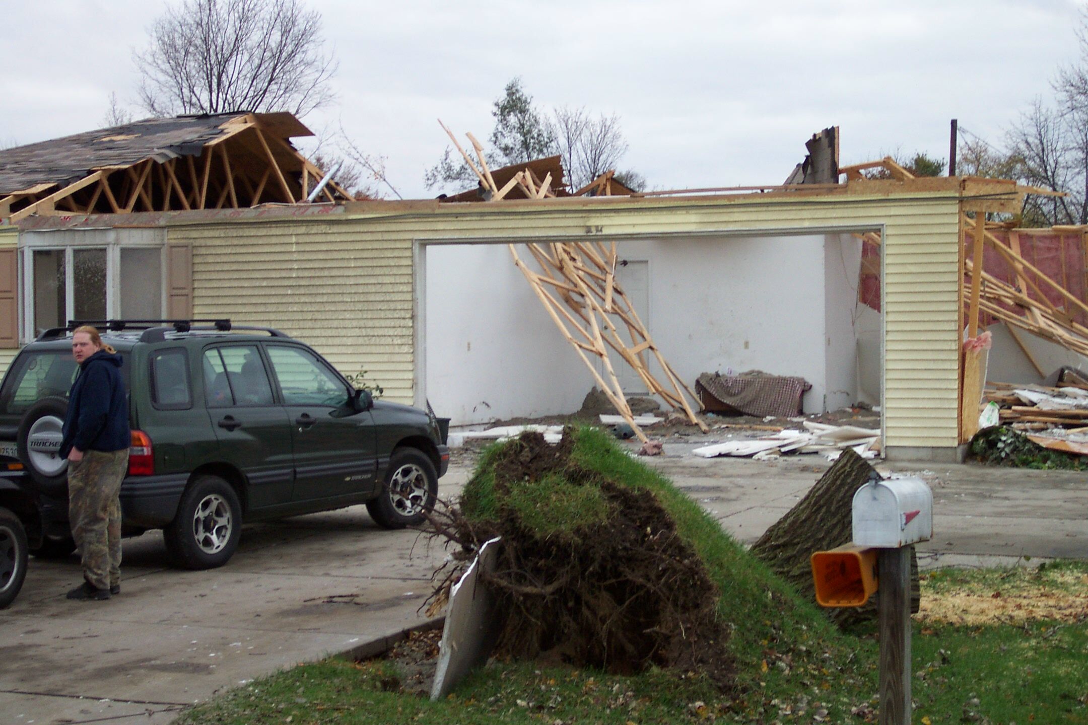
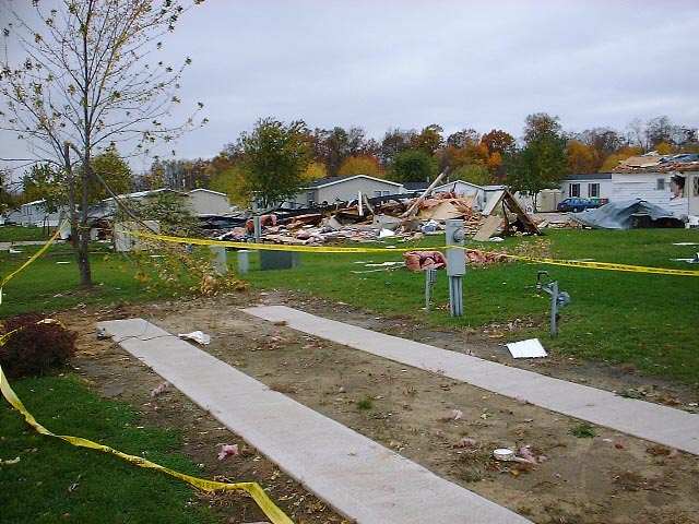
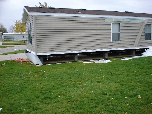
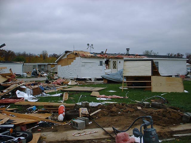
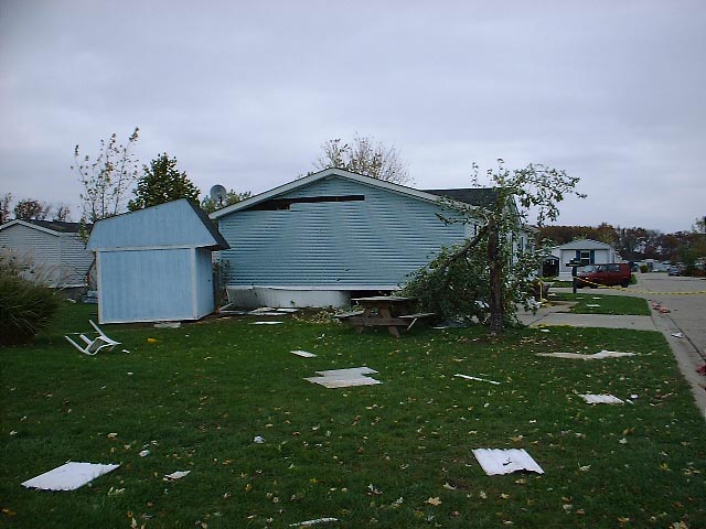
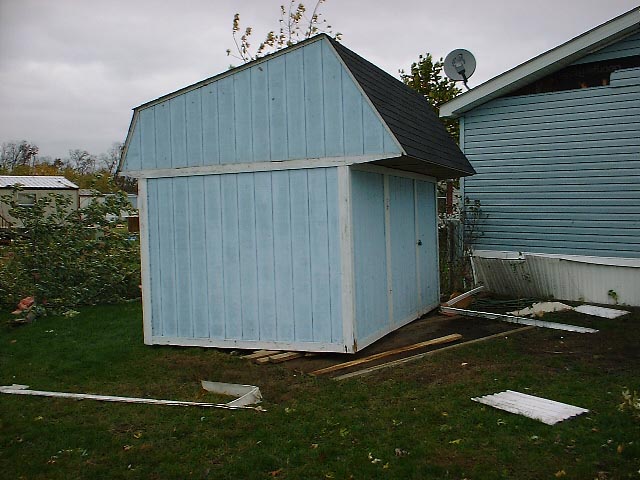
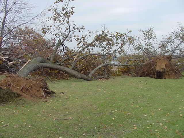
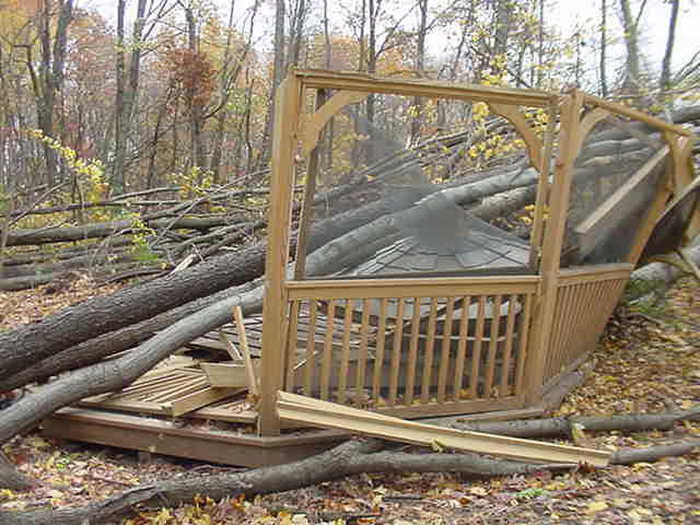
The southern tornado, north of Osceola:


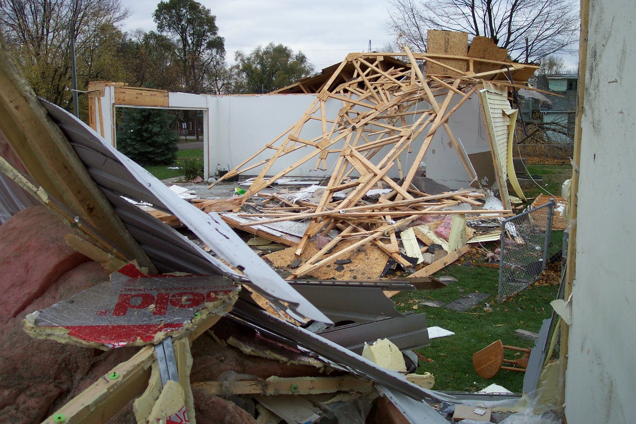
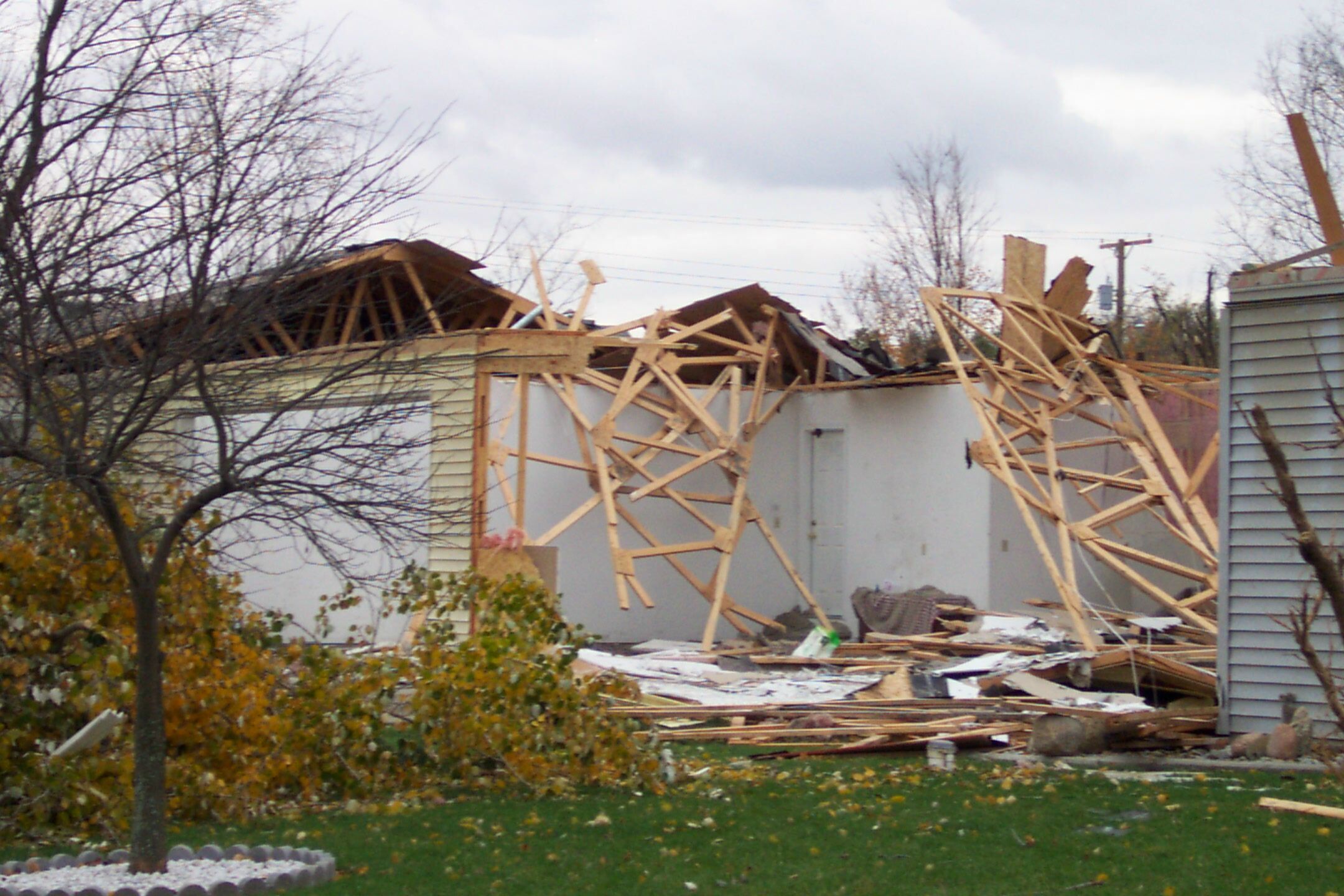
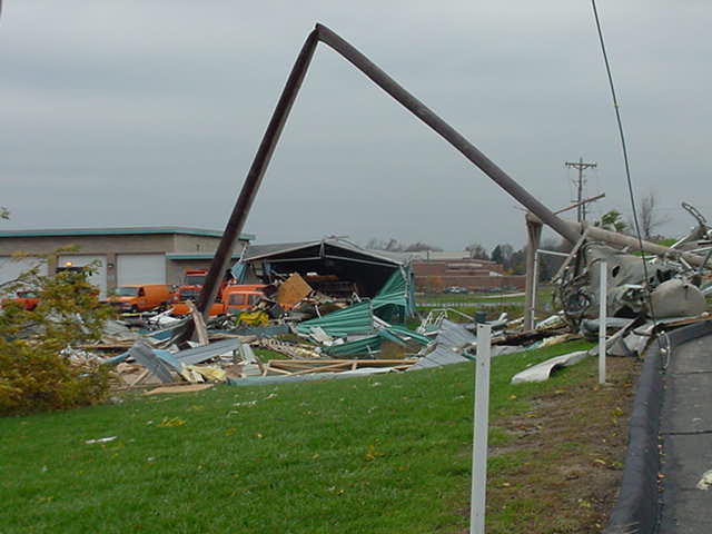
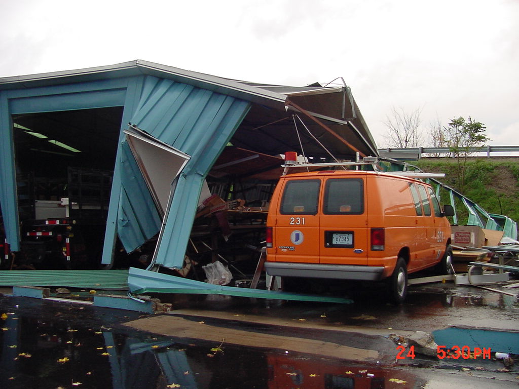
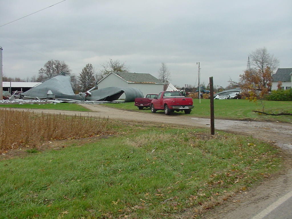
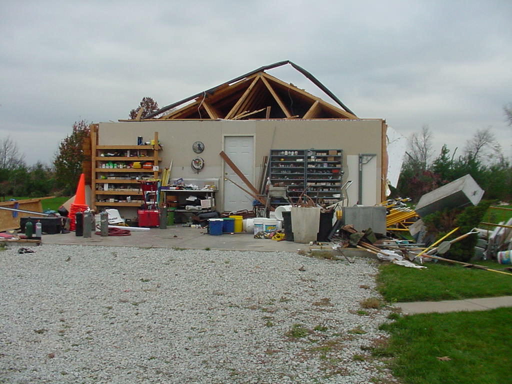
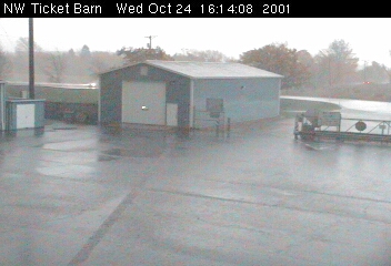
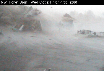
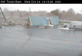
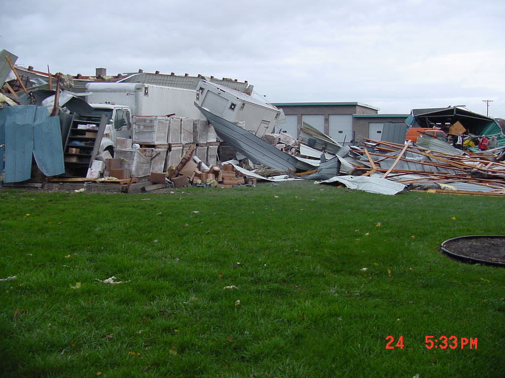
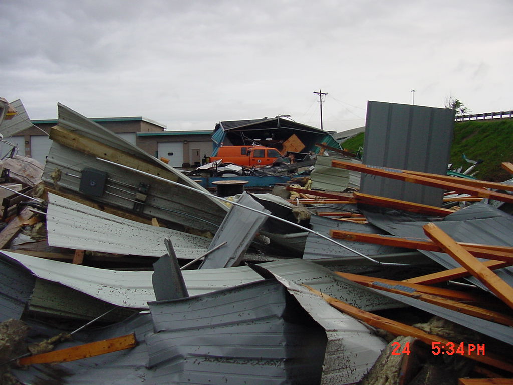
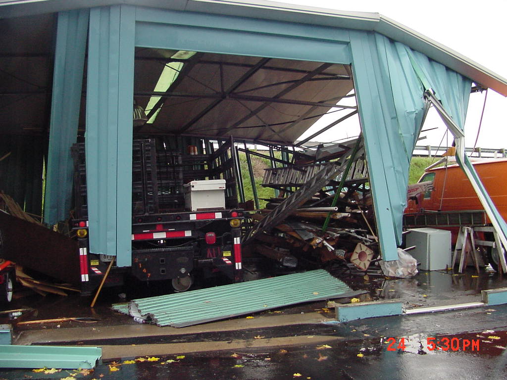
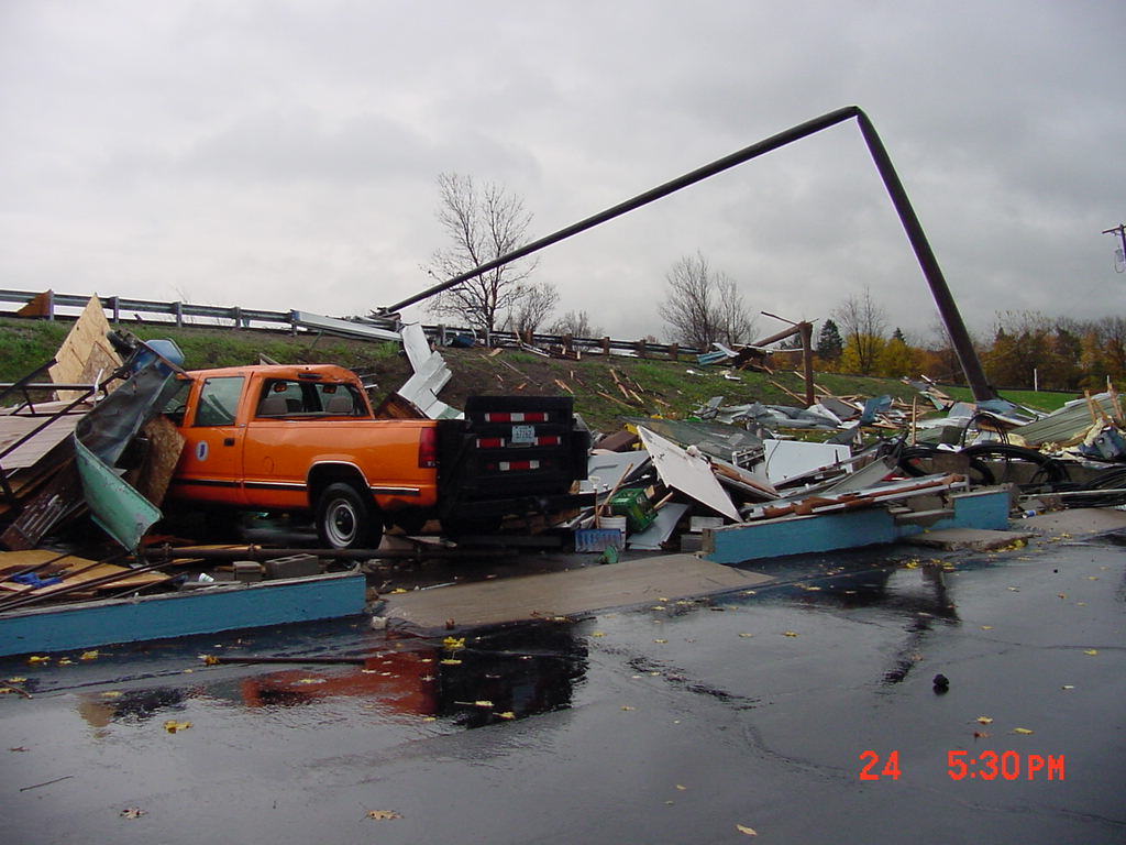
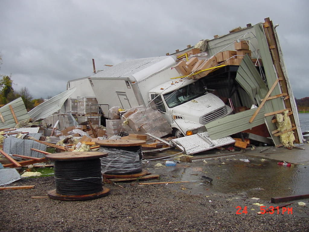
Where the northern tornado crossed the Toll Road, hitting a Toll Road Authority garage and nearby properties:


Hazards
Heat Related
Winter Related
Watch/Warning
Outlook
Storm Reports
Storm Prediction Center
Submit a Report
Event Ready
Climate
FWA Daily
SBN Daily
FWA Monthly
SBN Monthly
CoCoRaHS
Spring Frost Climatology
Fall Frost Climatology
Severe Climatology
Local Information
Skywarn
COOP
Our Office
WSR-88D
Headline Criteria
NOAA Weather Radio
Weather History
Probabilistic Snowfall
Public Information Statement
Social Media Feeds
Weather Events Page
US Dept of Commerce
National Oceanic and Atmospheric Administration
National Weather Service
Northern Indiana
7506 E 850 N
Syracuse, IN 46567
574-834-1104
Comments? Questions? Please Contact Us.

