Lake Effect Snowstorm on December 13-14th, 2004
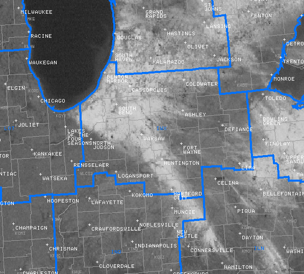
| The first major lake effect snow event developed late Sunday night in response to the first significant push of modified arctic air southward across the Great Lakes. The heaviest snowbands developed Monday afternoon and continued Monday night as low level wind shear behind the front lessened with a two persistent shore parallel mesocale snowbands owing to the bulk of the Lake Effect snow accumulation as denoted by the arrows in figure 1. This lake effect snow event was well forecast with snow forecast consistently from 7 days out. As the event grew nearer the potential for significant accumulations became evident. Winter Storm Warnings and Winter Weather Advisories were issued in advance of the storm for the affected areas. | 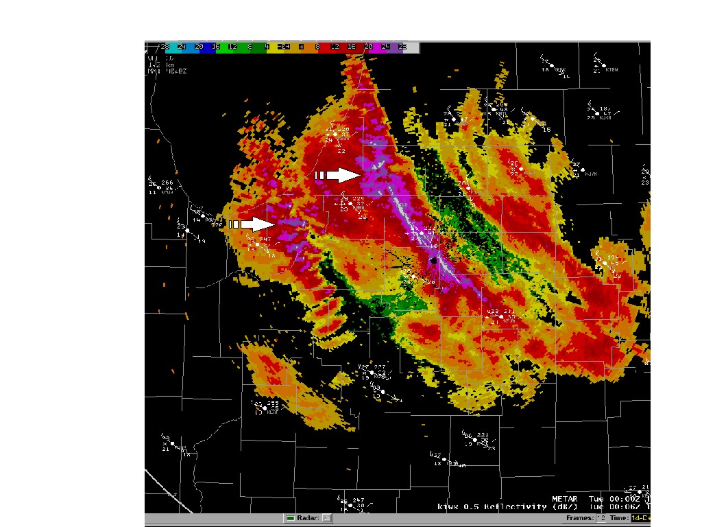 Figure 1 National Weather Service 0.5 Reflectivity image from 700 pm EST |
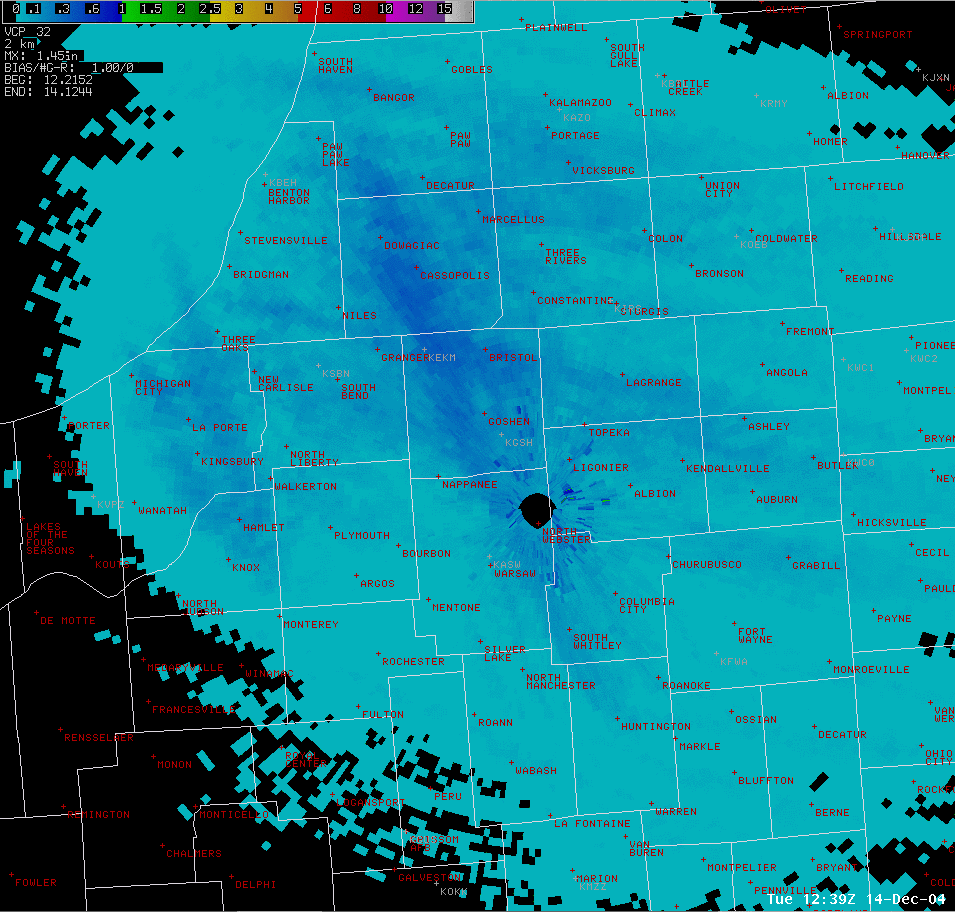 Figure 2 National Weather Service Digital Storm Total Precipitation |
These bands resulted in the higher observed accumulations...especially the eastern band which resulted in a general 4 to 8 inch snowfall with 8 to 12 inches from southern Van Buren and western Berrien county southward into extreme northern Elkhart. The second, less intense band, from Laporte county south into northern Starke, brought a swath of 4 to 6 inches. Estimated liquid equivalents within these two snowbands were impressive for lake effect snow with amounts up to 0.40 inch indicated as seen in Figure 2. |
|
|
|
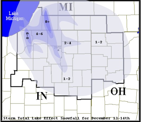 Figure 3 Contour analysis of storm total snowfall |
| Figure 4 is a visible satellite image on December 16 showing where the swath of snow fell across the area. Notice how far southeast the dominant snow band extended (into southwestern Ohio) |
|
Figure 4 Visible Satellite Image on December 15 |
The following are some specific snow reports from around the area
..SOUTHWEST LOWER MICHIGAN...

WATERVLIET           9.0
CASSOPOLIS           8.0
SISTER LAKES         8.0
BUCHANAN             7.0
3E NILES             5.5
NILES                4.5
UNION                3.0
WHITE PIGEON         1.5
STURGIS              1.0
THREE RIVERS         0.8

...NORTHERN INDIANA...

SIMONTON LAKE        9.0
LAPORTE WWTP         6.5
KINGSBURY            6.0
ROLLING PRAIRIE      6.0
ELKHART              5.5
SOUTH BEND AIRPORT   5.2
GOSHEN               5.0
GRANGER              5.0
LAPORTE              5.0
1S ELKHART           5.0
NEW PARIS            4.5
SOUTH BEND           4.0
MIDDLEBURY           3.0
NORTH WEBSTER NWS    2.9
MICHIGAN CITY        2.0
WARSAW               2.0
NAPPANEEE            2.0
NEW CARLISLE         2.0
KNOX                 2.0
ASLAY                1.5
KENDALLVILLE         1.0
MARION               1.0

...NORTHWESTERN OHIO

PANDORA              1.4
PAULDING             1.0
COLUMBUS GROVE       1.0
MONTPELIER           0.2
TH...12/14/04