Northern Indiana
Weather Forecast Office
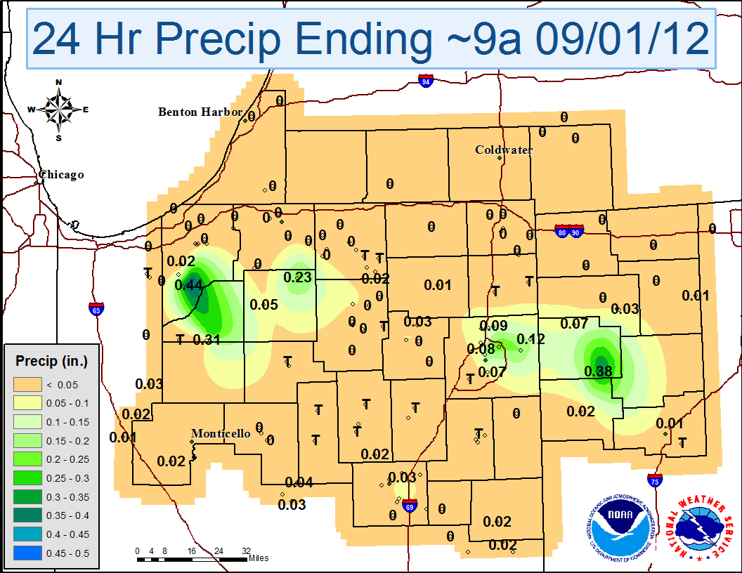
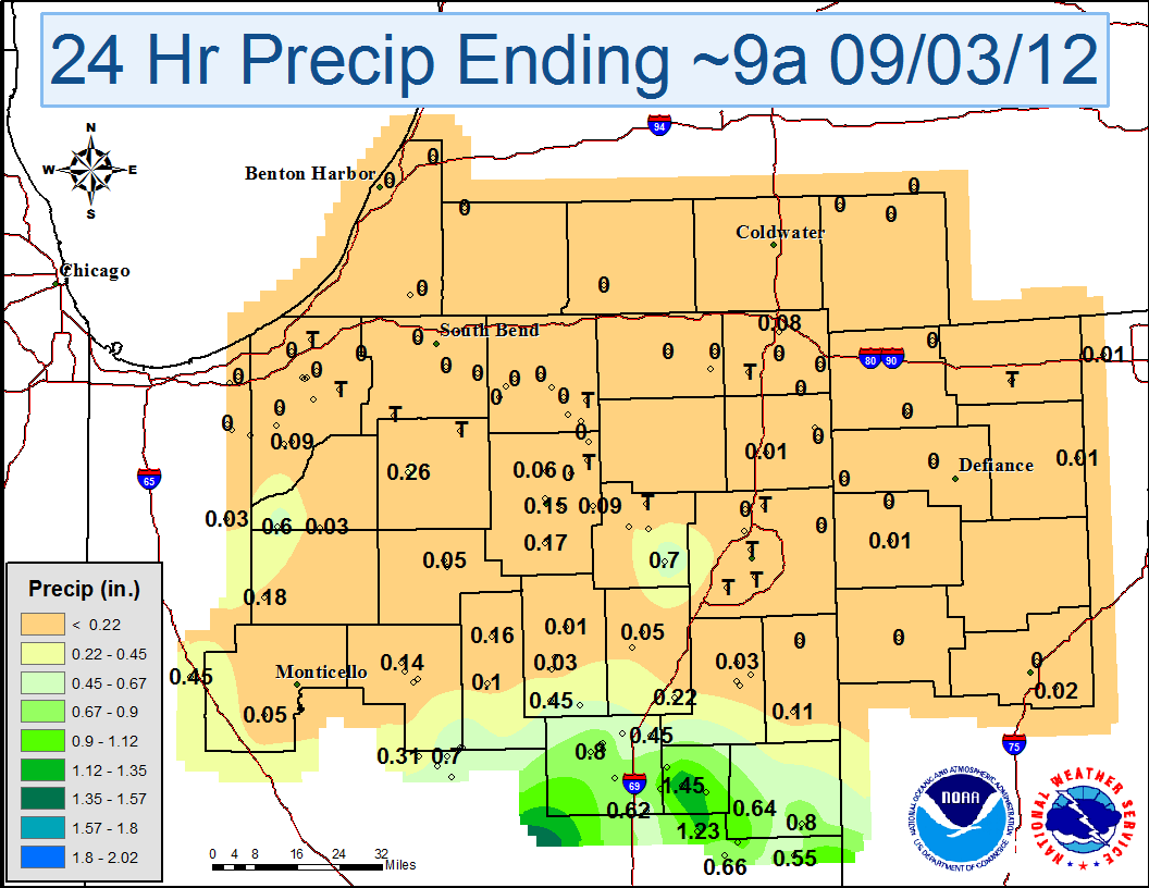
| The remnants of Hurricane Isaac moved across the Mississippi and Ohio Valleys over Labor Day weekend. Heavy rainfall fell across central and southern Illinois and Indiana. The gradient in heavy rainfall was sharp across the local area, with southern portions of the Northern Indiana CWA (county warning area) receiving the most rain. Areas across southern lower Michigan, northwest Ohio and far northern Indiana saw less than a half inch of rain. The maps below show rainfall totals across the area. Click on any image to enlarge. |
| 24 hour rainfall, ending 9/1/12 | 24 hour rainfall, ending 9/2/12 |
 |
 |
| 24 hour rainfall, ending 9/3/12 | Regional Rainfall totals from the MRCC |
 |
 |
Published 9/4/12
CEO
Hazards
Heat Related
Winter Related
Watch/Warning
Outlook
Storm Reports
Storm Prediction Center
Submit a Report
Event Ready
Climate
FWA Daily
SBN Daily
FWA Monthly
SBN Monthly
CoCoRaHS
Spring Frost Climatology
Fall Frost Climatology
Severe Climatology
Local Information
Skywarn
COOP
Our Office
WSR-88D
Headline Criteria
NOAA Weather Radio
Weather History
Probabilistic Snowfall
Public Information Statement
Social Media Feeds
Weather Events Page
US Dept of Commerce
National Oceanic and Atmospheric Administration
National Weather Service
Northern Indiana
7506 E 850 N
Syracuse, IN 46567
574-834-1104
Comments? Questions? Please Contact Us.

