Overview
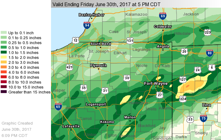
A couple of rounds of showers and thunderstorms affected northern Indiana, southern Lower Michigan, and northwest Ohio on June 29th and June 30th. 1 to 3 inches of rain fell across many locations south of a Winamac Indiana to Warsaw Indiana to Wauseon Ohio line over the two days, with localized amounts of 3 to 6 inches across Paulding, Defiance, Henry, and Putnam counties in northwest Ohio. This heavy rainfall resulted in flash flooding across these counties on Friday June 30th.Flooding
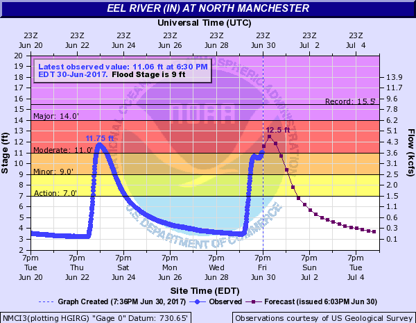
The greatest two day rainfall amounts occurred across portions of northwest Ohio where 3 to 6 inches of rain fell in Henry, Paulding, Putnam, and Defiance counties. Several road closures were reported across these counties. Heavy rain also caused significant river rises at on the Eel River at North Manchester where moderate flooding is forecast. The storms produced some sub-severe wind gusts of 35 to 50 mph, with the strongest winds reported across the Fort Wayne area.
 |
 |
 |
 |
| 2-day Rainfall June 29th-June 30th | Hydrograph for North Manchester |
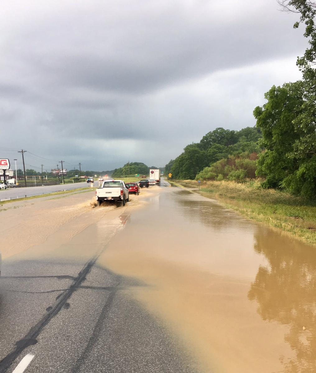
Flooding in Huntington Co near US 24 and Thurman Poe Way 6/30 -- Photo credit to Chief Deputy Chris Newton
|
Shelf cloud in Miami Co -- Photo credit to Rick Woodall |
Storm Reports
Public Information Statement
National Weather Service Northern Indiana
847 PM EDT Fri Jun 30 2017

...48 hr Rainfall Reports...

Location                     Amount    Time/Date       Lat/Lon

...Indiana...

...Adams County...
Linn Grove                   2.11 in   0745 PM 06/30   40.66N/85.03W

...Allen County...
2 SSW Huntertown             3.34 in   0535 PM 06/30   41.20N/85.19W
Fort Wayne International Ap  3.08 in   0754 PM 06/30   40.98N/85.19W
3 NE Nine Mile               2.89 in   0540 PM 06/30   41.02N/85.18W

...Fulton County...
Macy 3.4 W                   2.45 in   0700 AM 06/30   40.95N/86.19W

...Huntington County...
1 ENE Bowerstown             2.49 in   0800 PM 06/30   40.90N/85.41W
3 SSW Huntington             2.22 in   0833 PM 06/30   40.83N/85.53W

...La Porte County...
2 WNW Union Mills            2.10 in   0900 AM 06/30   41.51N/86.83W

...Miami County...
3 W Amboy                    2.15 in   0829 PM 06/30   40.59N/85.98W

...Wabash County...
1 SSE Roann                  2.94 in   0542 PM 06/30   40.89N/85.92W

...Wells County...
Bluffton                     2.43 in   0745 PM 06/30   40.74N/85.17W

...White County...
Norway                       2.67 in   0745 PM 06/30   40.78N/86.76W

...Ohio...

...Defiance County...
Defiance Memorial Airport    2.86 in   0753 PM 06/30   41.34N/84.43W
Defiance 9.4 NE              2.27 in   0600 AM 06/30   41.38N/84.24W
Defiance                     2.25 in   0800 AM 06/30   41.28N/84.35W
Hicksville                   2.19 in   0615 AM 06/30   41.32N/84.75W

...Henry County...
Napoleon                     2.42 in   0800 AM 06/30   41.39N/84.14W

...Paulding County...
3 SW Charloe                 5.17 in   0535 PM 06/30   41.10N/84.48W
1 NW Oakwood                 4.44 in   0539 PM 06/30   41.11N/84.40W

...Putnam County...
Kalida                       2.99 in   0824 PM 06/30   40.98N/84.20W

...Van Wert County...
Convoy                       3.37 in   0610 PM 06/30   40.92N/84.71W

Observations are collected from a variety of sources with varying
equipment and exposures. We thank all volunteer weather observers
for their dedication. Not all data listed are considered official.

$$
Environment
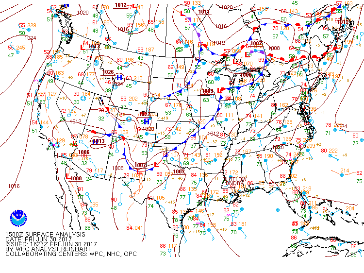
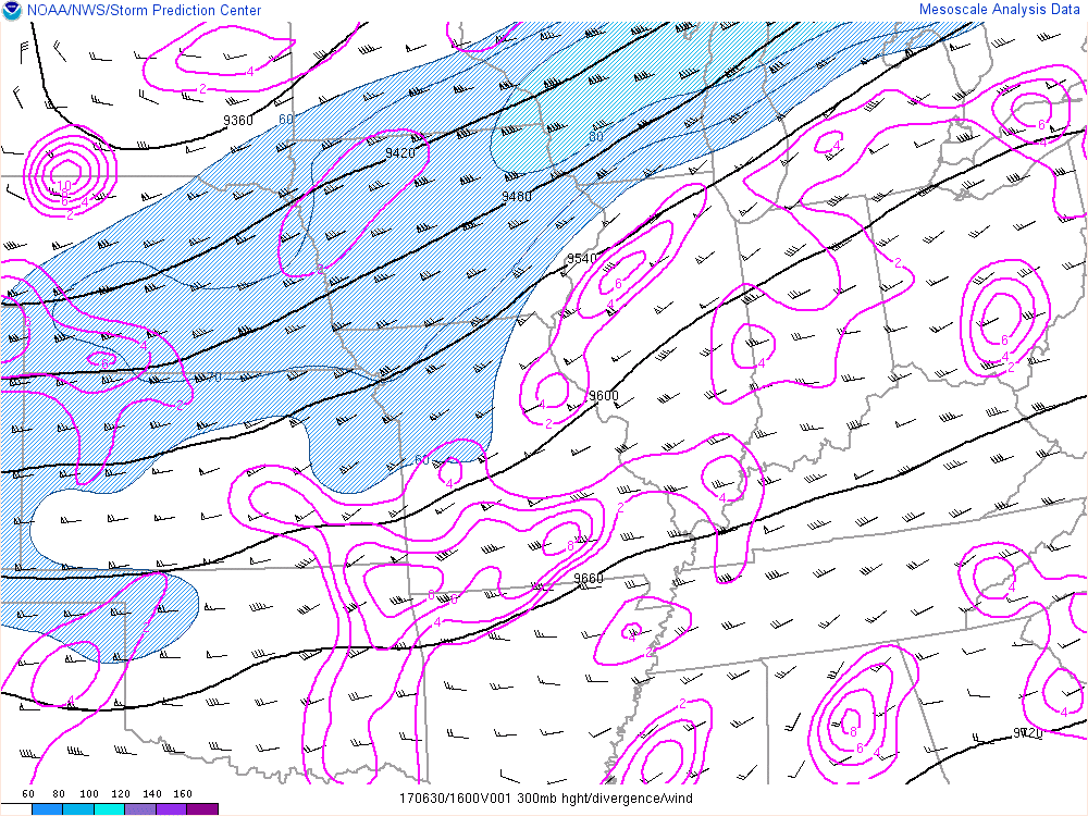
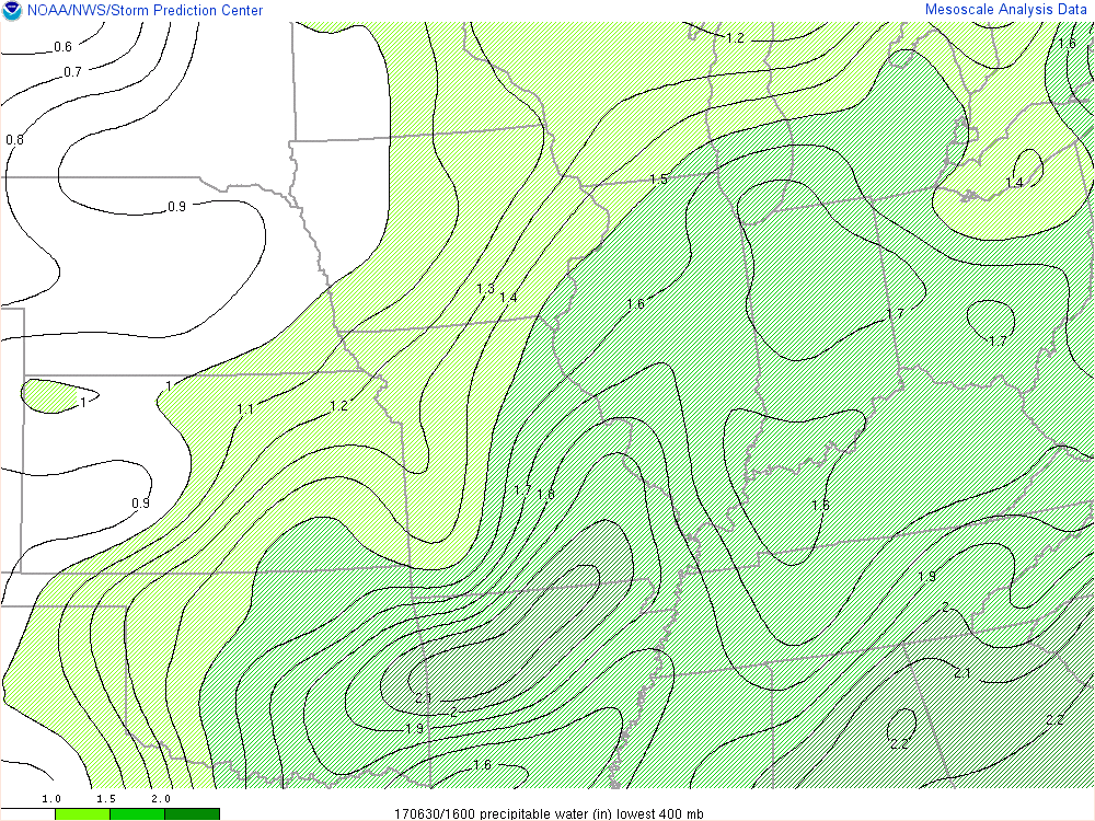
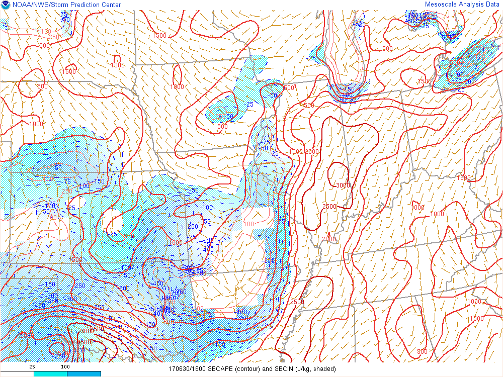
Several short waves tracked across the region June 29th and 30th in advance of a cold front. These short waves interacted with a very moist air mass to produce pockets of heavy rainfall. Little in the way of severe weather was noted these two days due to the marginal nature of the instability and wind shear profiles. The biggest impacts were from heavy rain which led to flash flooding across portions of northwest Ohio.
 |
 |
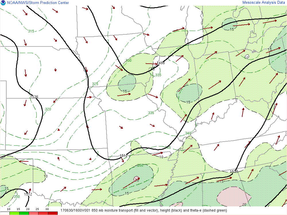 |
| Surface map 11am Friday | 12 pm Friday RAP 300 mb wind speeds and divergence | 12 pm Friday RAP 850 mb moisture transport |
Near-storm environment summary.
 |
 |
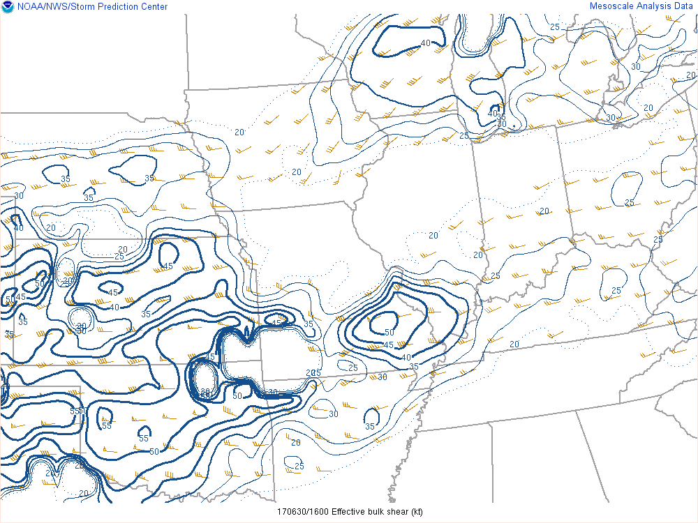 |
| 12 pm Friday RAP Precipitable Water Values | 12 pm Friday RAP Surface Based CAPE | 12 pm Friday RAP Effective Shear |
 |
Media use of NWS Web News Stories is encouraged! Please acknowledge the NWS as the source of any news information accessed from this site. |
|

