Overview
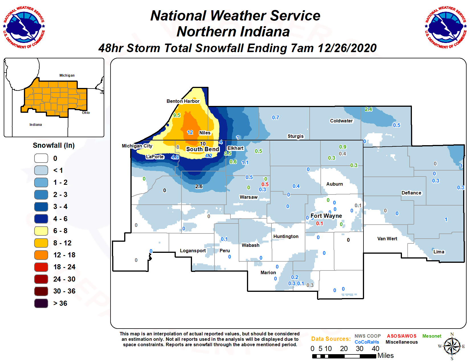
A cold air mass settling across the Great Lakes region set the stage for a significant lake effect snow event Christmas Eve and Christmas morning. The lake effect began in a rather disorganized fashion Thursday evening with several weak banded of lake effect snow with embedded cellular characteristics. After midnight, a more dominant single lake effect snow band developed which brought intense snowfall rates of 2 to 4 inches per hour for a brief time. Storm total snowfall amounts with the lake effect snow ranged from 6 to 12 inches with a few spots reporting totals in excess of a foot. The snow showers dissipated Christmas afternoon.Snow/Ice
Photos & Video
Header
 |
 |
 |
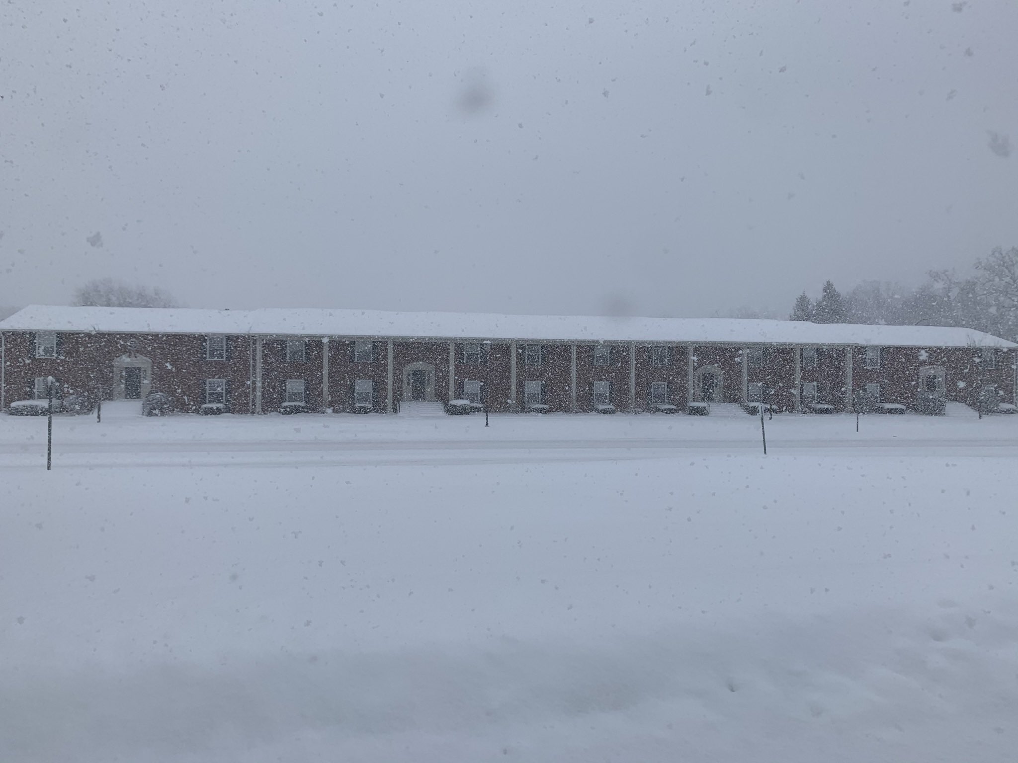 |
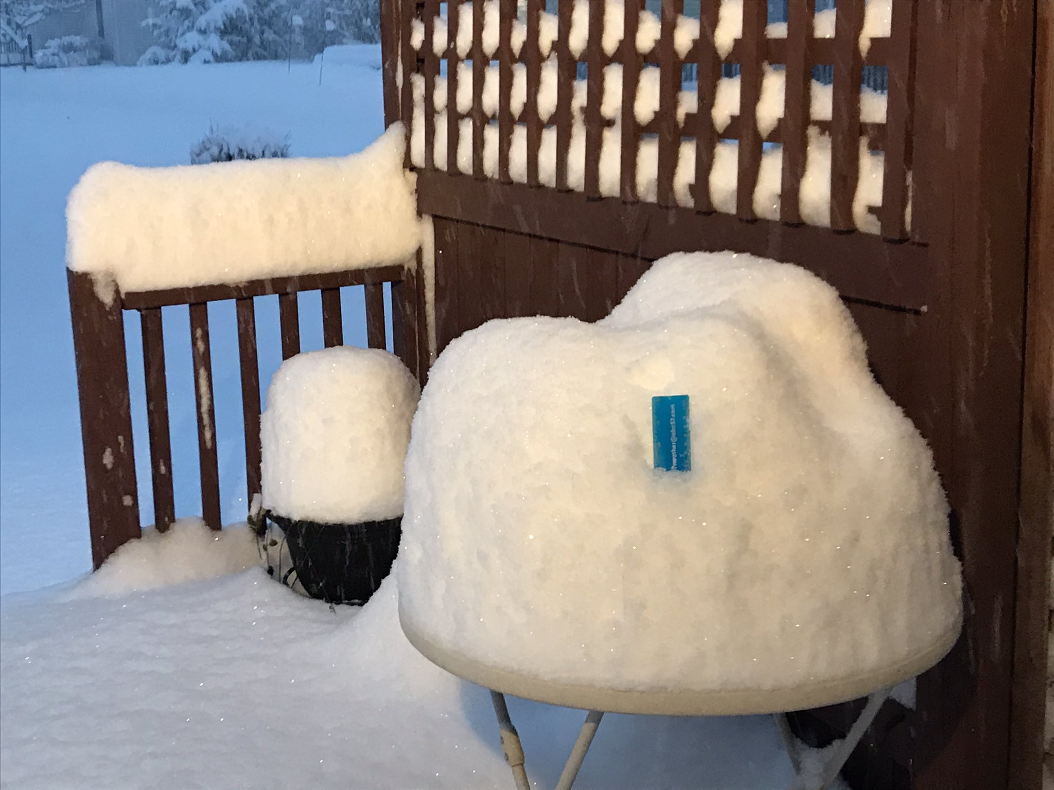
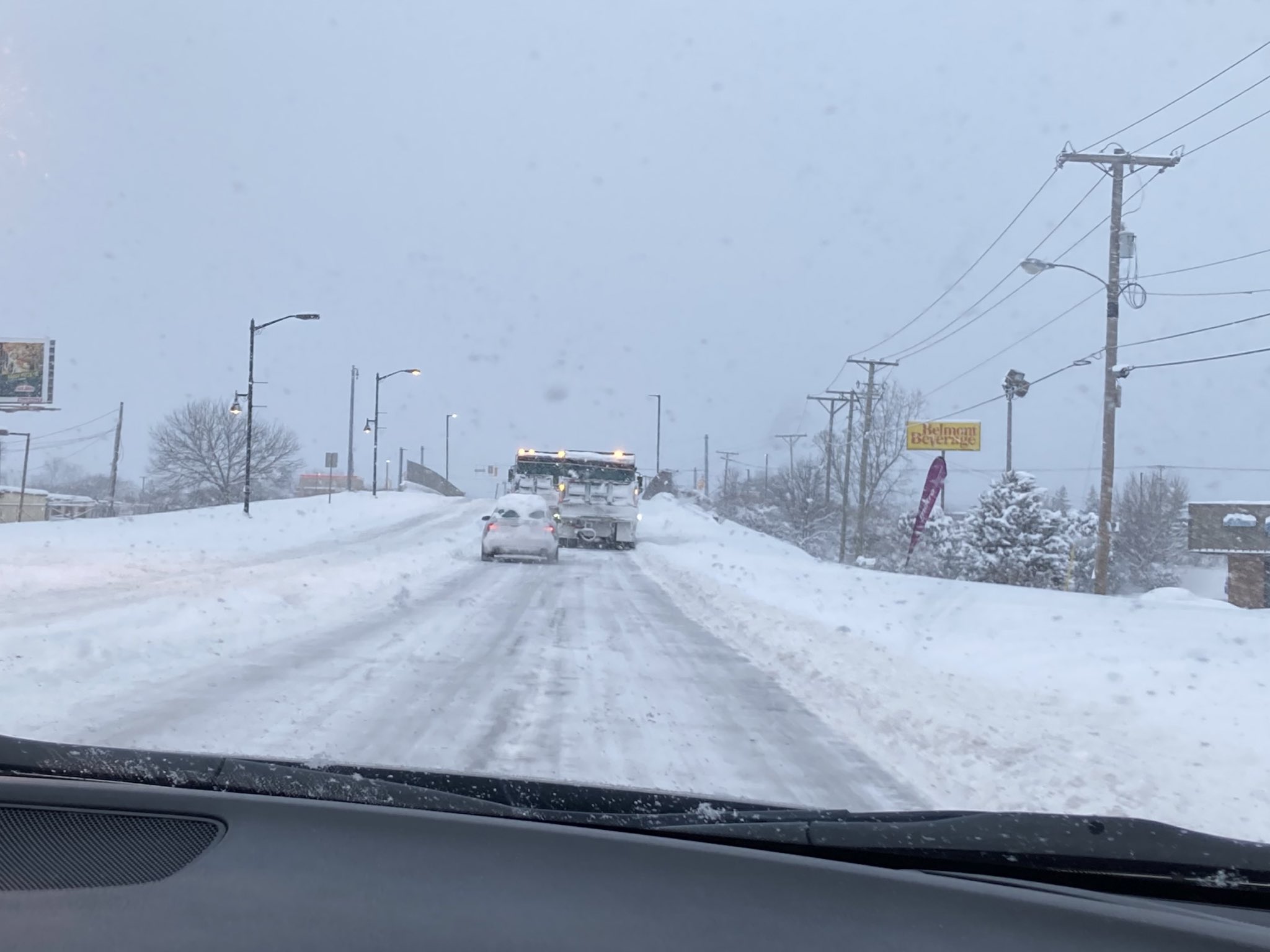
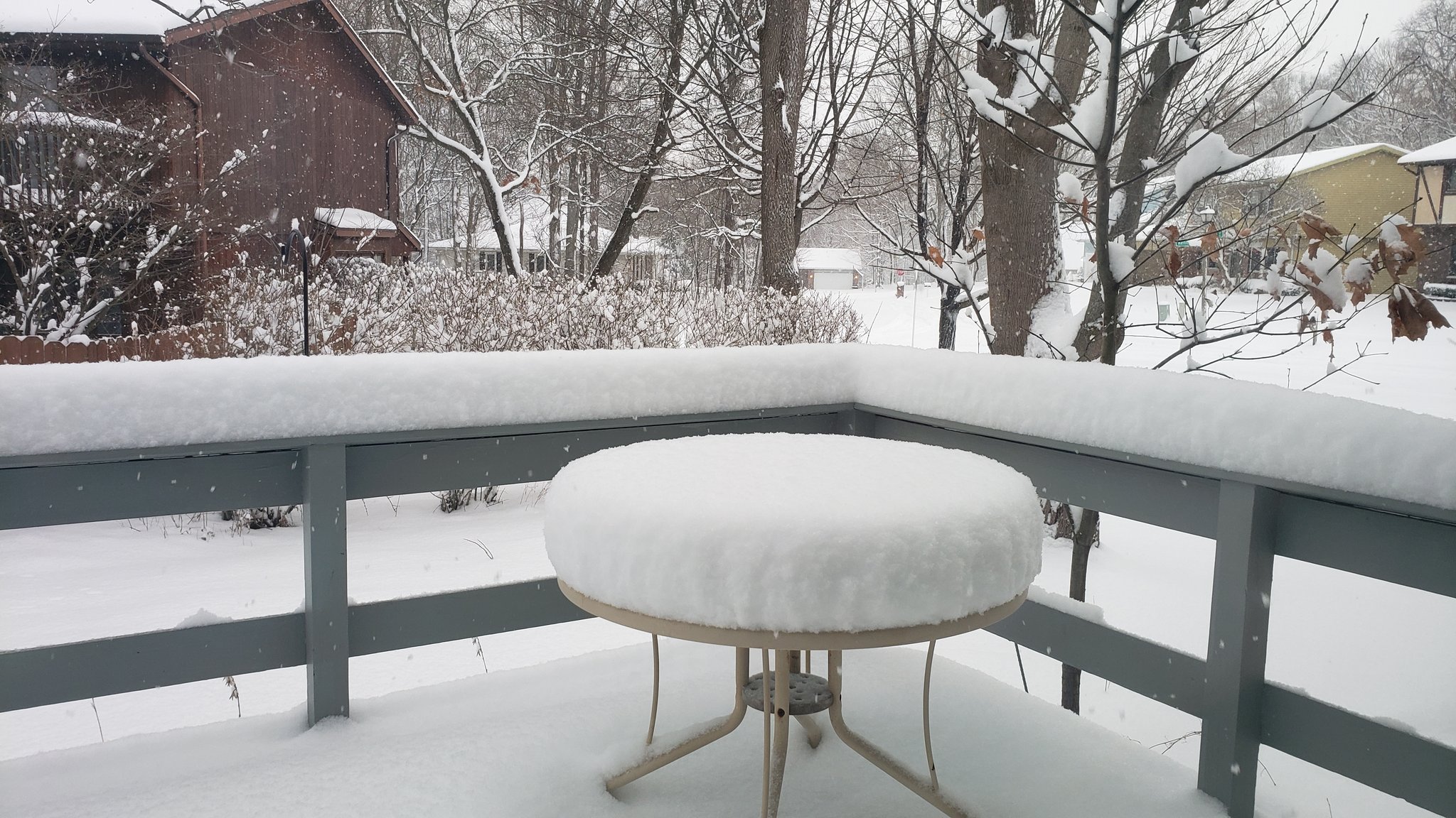
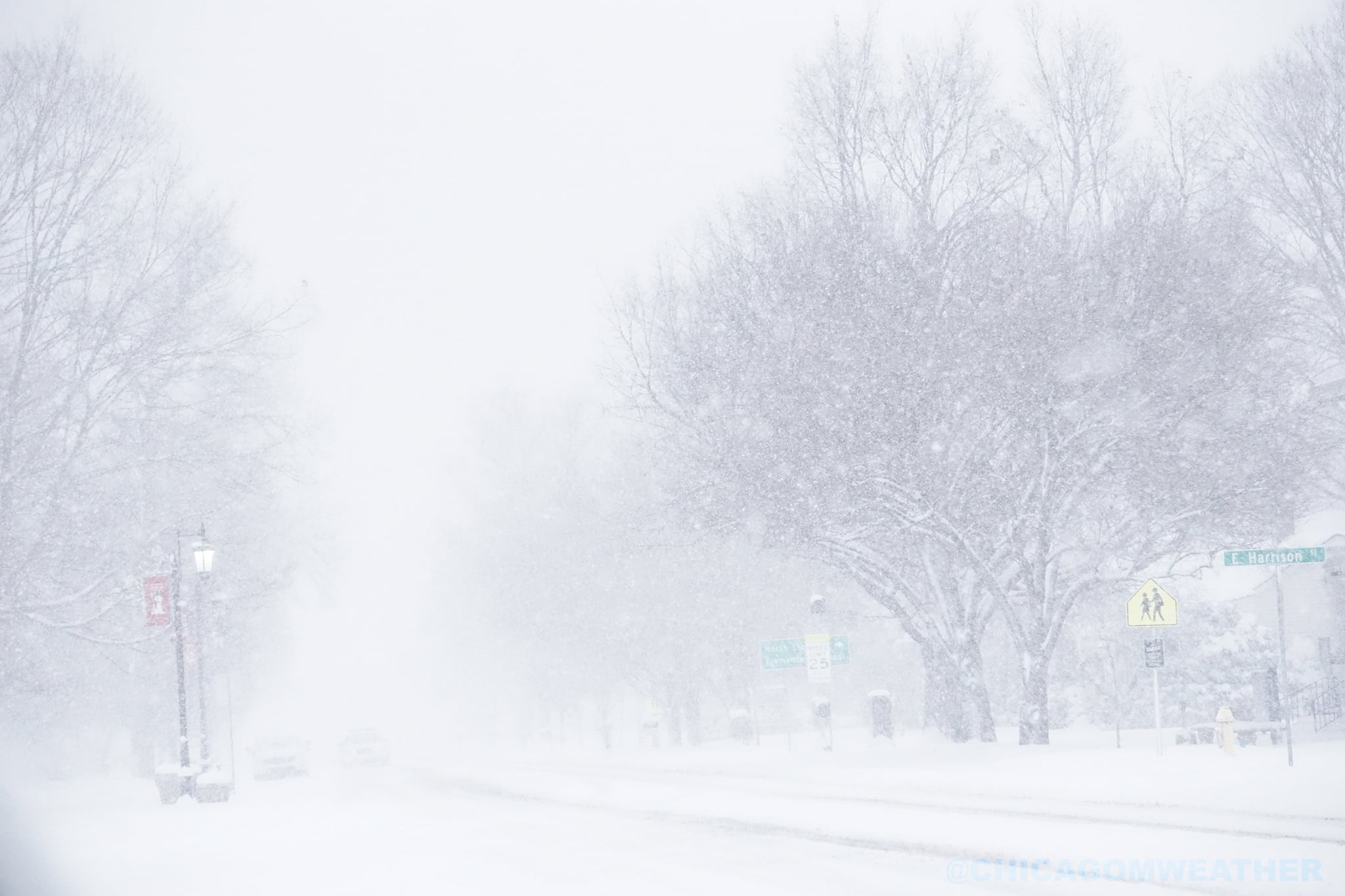
| Heavy snow in South Bend, Photo courtesy of Tom Coomes | Heavy snow in South Bend. Photo courtesy of Tom Coomes | Heavy snow southeast side of South Bend. Photo courtesy of Nick Deranek | Snow in Mishawaka, IN. Photo courtesy of Nick Kovatch |
 |
| Snowfall in North Liberty, IN. Photo courtesy of ChicagoMWeather (twitter) |
Radar
Header
 |
 |
 |
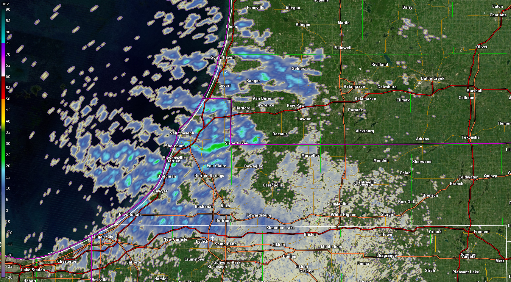
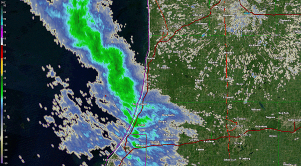
| 0.5 base reflectivity from KIWX from around 7pm Thu. Not the disorganized multi-banded cellular nature. Brief visibility drops to under 1/2 mile were noted underneath stronger cells | 0.5 base reflectivity from GRR radar from approximately 1am to 3 am EST Friday morning. Note development of smaller smaller scale circulations embedded in the band. These were associated with periods of very heavy snow. | 0.5 base reflectivity from KIWX radar shortly after 3 am EST with dominant single band and several mesovorts affecting southwest Lower Michigan into far north central Indiana. |
Storm Reports
PRELIMINARY LOCAL STORM REPORT...SUMMARY
NATIONAL WEATHER SERVICE NORTHERN INDIANA
1044 PM EST FRI DEC 25 2020

..TIME...   ...EVENT...      ...CITY LOCATION...     ...LAT.LON...
..DATE...   ....MAG....      ..COUNTY LOCATION..ST.. ...SOURCE....
            ..REMARKS..

0500 AM     SNOW             1 WNW BUCHANAN          41.84N 86.39W
12/25/2020  M6.0 INCH        BERRIEN            MI   COCORAHS

            COCORAHS STATION MI-BN-5 BUCHANAN 1.3 WNW.

0505 AM     HEAVY SNOW       NILES                   41.84N 86.25W
12/25/2020  M7.0 INCH        BERRIEN            MI   BROADCAST MEDIA

            TOTAL SNOWFALL THROUGH 430 AM EST.

0506 AM     HEAVY SNOW       MISHAWAKA               41.67N 86.17W
12/25/2020  M5.0 INCH        ST. JOSEPH         IN   BROADCAST MEDIA

            TOTAL SNOWFALL THROUGH 430 AM EST.

0520 AM     HEAVY SNOW       BUCHANAN                41.83N 86.37W
12/25/2020  M8.8 INCH        BERRIEN            MI   PUBLIC

            REPORT VIA TWITTER.

0630 AM     HEAVY SNOW       NILES                   41.84N 86.25W
12/25/2020  M8.2 INCH        BERRIEN            MI   PUBLIC

            REPORT VIA TWITTER.

0700 AM     SNOW             1 WSW FAIR PLAIN        42.08N 86.48W
12/25/2020  M7.6 INCH        BERRIEN            MI   COCORAHS

            COCORAHS STATION MI-BN-13 ST. JOSEPH 1.5
            SSE.

0700 AM     HEAVY SNOW       1 S ROSELAND            41.70N 86.25W
12/25/2020  M8.5 INCH        ST. JOSEPH         IN   CO-OP OBSERVER

            CO-OP OBSERVER STATION SBSI3 SOUTH BEND.

0700 AM     HEAVY SNOW       1 E INDIAN VILLAGE      41.72N 86.21W
12/25/2020  M6.0 INCH        ST. JOSEPH         IN   BROADCAST MEDIA

            REPORTED VIA TWITTER AT ABC57.

0700 AM     SNOW             2 ENE GULIVOIRE PARK    41.62N 86.22W
12/25/2020  M4.2 INCH        ST. JOSEPH         IN   COCORAHS

            COCORAHS STATION IN-SJ-58 SOUTH BEND 4.5 SE.

0700 AM     SNOW             3 WSW GOSHEN            41.56N 85.88W
12/25/2020  M0.9 INCH        ELKHART            IN   COCORAHS

            COCORAHS STATION IN-EL-39 GOSHEN 3.0 WSW.

0730 AM     SNOW             NEW CARLISLE            41.71N 86.50W
12/25/2020  M8.0 INCH        ST. JOSEPH         IN   CO-OP OBSERVER

            CO-OP OBSERVER STATION NCLI3 NEW CARLISLE.

0753 AM     HEAVY SNOW       2 SW ROSELAND           41.70N 86.27W
12/25/2020  M12.0 INCH       ST. JOSEPH         IN   PUBLIC

            RECEIVED VIA TWITTER.

0800 AM     HEAVY SNOW       SAINT JOSEPH            42.10N 86.49W
12/25/2020  M11.0 INCH       BERRIEN            MI   TRAINED SPOTTER

            SNOW CONTINUES TO FALL.

0800 AM     HEAVY SNOW       2 SSE STEVENSVILLE      41.99N 86.51W
12/25/2020  M9.0 INCH        BERRIEN            MI   COCORAHS

            COCORAHS STATION MI-BN-2 STEVENSVILLE 1.7
            SSE.

0800 AM     HEAVY SNOW       2 NE GEORGETOWN         41.75N 86.22W
12/25/2020  M8.1 INCH        ST. JOSEPH         IN   TRAINED SPOTTER

            .

0800 AM     SNOW             2 NW OSCEOLA            41.68N 86.10W
12/25/2020  M4.5 INCH        ST. JOSEPH         IN   COCORAHS

            COCORAHS STATION IN-SJ-26 MISHAWAKA 3.9 ENE.

0800 AM     HEAVY SNOW       1 ESE GEORGETOWN        41.72N 86.20W
12/25/2020  E8.0 INCH        ST. JOSEPH         IN   BROADCAST MEDIA

            VIA TWITTER.

0800 AM     HEAVY SNOW       2 SW LA PORTE           41.59N 86.73W
12/25/2020  M4.2 INCH        LA PORTE           IN   COCORAHS

            COCORAHS STATION IN-LP-7 LA PORTE 1.6 SW.

0800 AM     HEAVY SNOW       3 NNE FISH LAKE         41.61N 86.52W
12/25/2020  M4.5 INCH        LA PORTE           IN   COCORAHS

            COCORAHS STATION IN-LP-73 MILL CREEK 1.9
            NNE.

0800 AM     SNOW             1 WNW JIMTOWN           41.64N 86.04W
12/25/2020  M3.0 INCH        ELKHART            IN   COCORAHS

            COCORAHS STATION IN-EL-36 ELKHART 4.8 SW.

0815 AM     SNOW             2 SE JUNO LAKE          41.79N 85.95W
12/25/2020  M1.0 INCH        CASS               MI   COCORAHS

            COCORAHS STATION MI-CS-11 CASSOPOLIS 9.0
            SSE.

0830 AM     SNOW             3 NW GOSHEN             41.60N 85.88W
12/25/2020  M1.5 INCH        ELKHART            IN   COCORAHS

            COCORAHS STATION IN-EL-57 GOSHEN 2.8 NW.

0850 AM     HEAVY SNOW       2 NE GULIVOIRE PARK     41.64N 86.22W
12/25/2020  M7.0 INCH        ST. JOSEPH         IN   BROADCAST MEDIA

            REPORT VIA TWITTER.

0900 AM     SNOW             BARRON LAKE             41.84N 86.18W
12/25/2020  M6.8 INCH        CASS               MI   COCORAHS

            COCORAHS STATION MI-CS-5 NILES 3.5 E.

0900 AM     HEAVY SNOW       2 ENE GRANGER           41.75N 86.11W
12/25/2020  M4.0 INCH        ST. JOSEPH         IN   COCORAHS

            COCORAHS STATION IN-SJ-46 GRANGER 1.8 ENE.

0920 AM     SNOW             2 N MISHAWAKA           41.70N 86.17W
12/25/2020  M7.5 INCH        ST. JOSEPH         IN   PUBLIC

            M 7.5 INCHES.

0930 AM     HEAVY SNOW       2 ESE LA PORTE          41.59N 86.68W
12/25/2020  M2.5 INCH        LA PORTE           IN   COCORAHS

            COCORAHS STATION IN-LP-45 LA PORTE 2.3 ESE.

1200 PM     HEAVY SNOW       4 SW GRANGER            41.69N 86.19W
12/25/2020  M7.5 INCH        ST. JOSEPH         IN   BROADCAST MEDIA

            STORM TOTAL SNOWFALL.

1220 PM     SNOW             2 NW SOUTH BEND         41.69N 86.29W
12/25/2020  E10.5 INCH       ST. JOSEPH         IN   BROADCAST MEDIA

            VIA TWITTER.

1225 PM     HEAVY SNOW       3 SSE FAIR PLAIN        42.04N 86.44W
12/25/2020  E12.0 INCH       BERRIEN            MI   PUBLIC

            MEDIA RELAYED VIA TWITTER.

1230 PM     HEAVY SNOW       4 WNW ROSELAND          41.74N 86.31W
12/25/2020  E15.0 INCH       ST. JOSEPH         IN   PUBLIC

            STORM TOTAL. REPORTED VIA TWITTER.

1250 PM     SNOW             4 N SOUTH BEND          41.73N 86.27W
12/25/2020  M10.0 INCH       ST. JOSEPH         IN   PUBLIC

            .

0115 PM     HEAVY SNOW       1 SE SHOREHAM           42.04N 86.49W
12/25/2020  M10.0 INCH       BERRIEN            MI   TRAINED SPOTTER

            .

0115 PM     HEAVY SNOW       GEORGETOWN              41.73N 86.23W
12/25/2020  M10.0 INCH       ST. JOSEPH         IN   PUBLIC

            .

0230 PM     HEAVY SNOW       1 WSW NILES             41.83N 86.26W
12/25/2020  M11.0 INCH       BERRIEN            MI   MESONET

            MESONET STATION NILM4 0.7 SW NILES.

0300 PM     HEAVY SNOW       BERRIEN SPRINGS         41.95N 86.34W
12/25/2020  M12.0 INCH       BERRIEN            MI   TRAINED SPOTTER


0300 PM     HEAVY SNOW       4 NW BUCHANAN           41.87N 86.41W
12/25/2020  M12.0 INCH       BERRIEN            MI   TRAINED SPOTTER


0313 PM     SNOW             3 WNW LIMA              40.76N 84.16W
12/25/2020  M2.5 INCH        ALLEN              OH   COCORAHS


0336 PM     SNOW             OTTAWA                  41.03N 84.04W
12/25/2020  M1.0 INCH        PUTNAM             OH   TRAINED SPOTTER


0500 PM     HEAVY SNOW       1 S ROSELAND            41.71N 86.25W
12/25/2020  M12.8 INCH       ST. JOSEPH         IN   OFFICIAL NWS OBS

            STORM TOTAL SNOWFALL.

0800 PM     HEAVY SNOW       1 W ROSELAND            41.71N 86.27W
12/25/2020  M14.0 INCH       ST. JOSEPH         IN   PUBLIC

            STORM TOTAL SNOWFALL.

1002 PM     HEAVY SNOW       SAINT JOSEPH            42.10N 86.49W
12/25/2020  M12.0 INCH       BERRIEN            MI   TRAINED SPOTTER

            STORM TOTAL SNOWFALL.


&&

$$
Environment
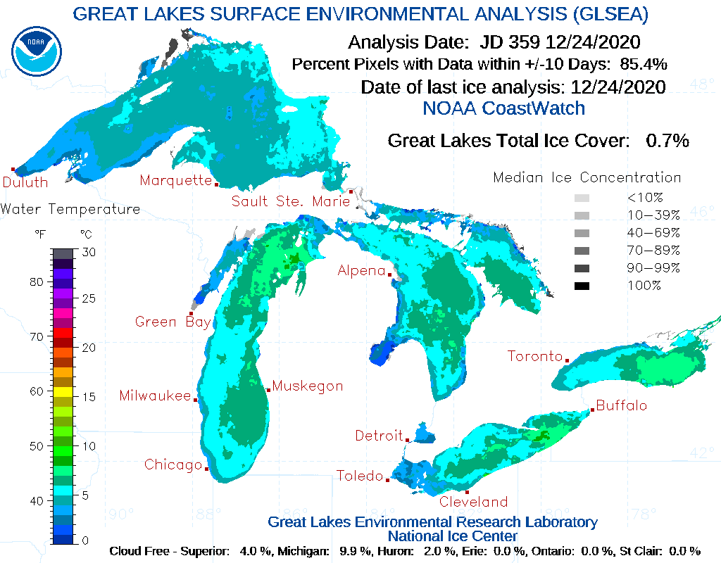
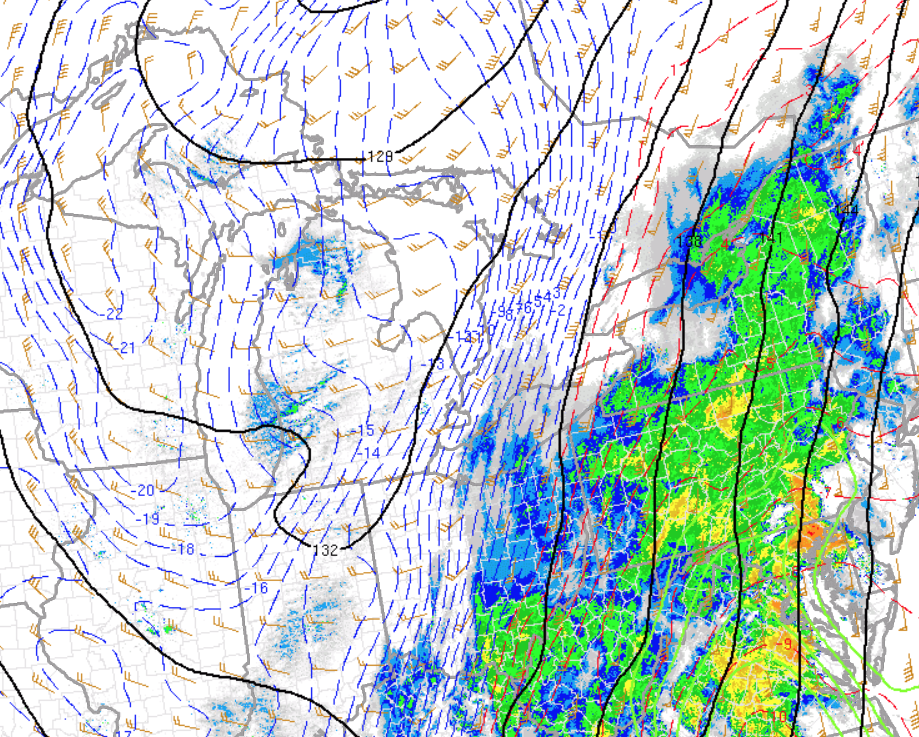
Lake Michigan water temperatures were relatively warm given this is an early season lake effect event. Lake temperatures evident from the GLSEA analysis were on the order of +4 to +6 deg C. A very cold air mass advected across the Great Lakes region with 850 mb temps on the order of -18 to -21. The modification of this cold air mass over the warmer lake led to a sharpening trough along the eastern shoreline late Thursday night. This strong convergence eventually led to the formation of a dominant single band across west central Lower Michigan that dove southward overnight into Christmas morning.
 |
 |
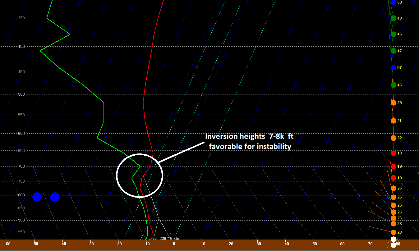 |
| Figure 1: GLSEA Great Lakes Water Temp Analysis for 12/24/20 | Figure 2: Very cold 850 mb temps advected across warmer Lake Michigan waters Thursday afternoon helping to induce lake response. (RAP) | Figure 3: RAP sounding from KSBN valid at 1am Friday morning indicating sufficient depth of lake induced instability. |
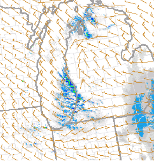 |
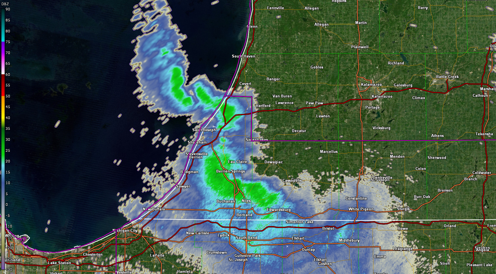
| Figure 4: Surface winds/radar composite from approximately 10pm Thursday evening. Note developing convergence along eastern shore of Lake Michigan where dominant band would form |
 |
Media use of NWS Web News Stories is encouraged! Please acknowledge the NWS as the source of any news information accessed from this site. |
|

