Overview
This webpage is a summary for the October 17th, 2022 lake enhanced snow event over Northern Indiana and Southwest Lower Michigan. An intense band of lake effect rain/snow developed during the afternoon and evening hours of 10/17/22, bringing 1-4" of accumulation in areas beneath the band. Heavy, wet snow brought down trees/limbs around the area, and caused power outages. Roads were quickly snow covered/slick where it was accumulating fast. Wind gusts to 40-50 mph occurred near the Lake Michigan shoreline, and 30 to 40 mph inland through the afternoon and evening.
Wind:
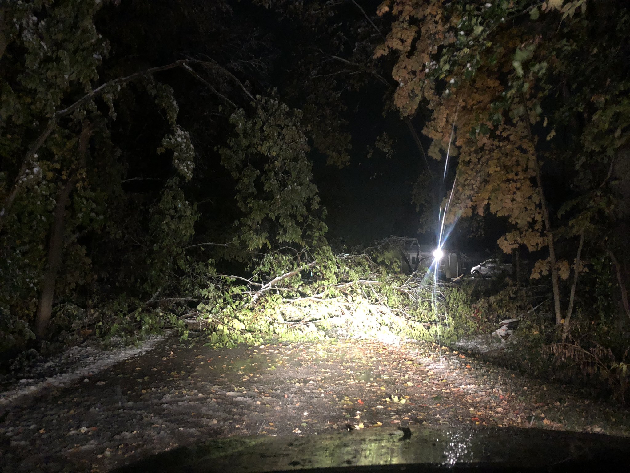
The winds were pretty strong with this system, with many locations seeing between 35-40 mph wind gusts. Several locations, especially near Lake Michigan, saw wind gusts up to 40-50 mph! Once it began snowing, the combination of gusty winds and heavy, wet snow (in some areas mixed with rain) caused tree damage in many locations.
 |
 |
 |
 |
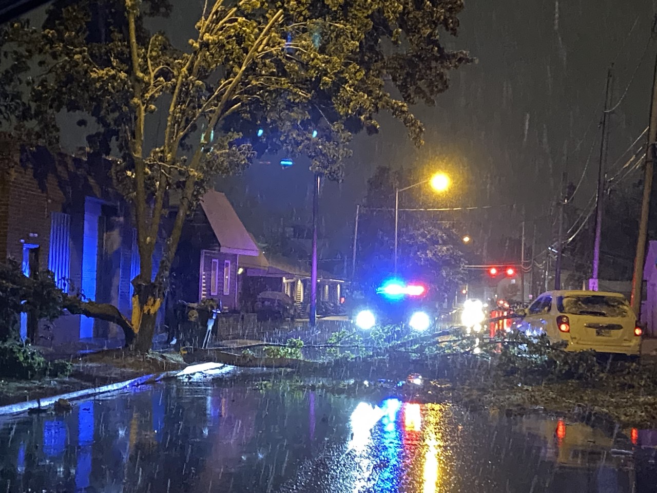
| From @Lindajnews at WPTA. Trees down in Fort Wayne, IN | Tree Damage near Lake Everette, IN courtesy of @CILWX_ | Tree Damage near Lake Everette, IN courtesy of @CILWX_ | Tree Damage at NWS IWX, which is 2N North Webster, IN. Photo taken by: Megan Dodson |
WIND DAMAGE REPORTS FROM OCTOBER 17
..TIME...   ...EVENT...      ...CITY LOCATION...     ...LAT.LON...
..DATE...   ....MAG....      ..COUNTY LOCATION..ST.. ...SOURCE....
            ..REMARKS..

0545 PM     NON-TSTM WND DMG 2 N NORTH WEBSTER       41.35N 85.70W
10/17/2022                   KOSCIUSKO          IN   OFFICIAL NWS OBS

            TREE LIMB 6-12 INCHES IN DIAMETER DOWNED
            FROM THE COMBINATION OF HEAVY WET SNOW AND
            WIND.

0725 PM     NON-TSTM WND DMG SYRACUSE                41.42N 85.75W
10/17/2022                   KOSCIUSKO          IN   BROADCAST MEDIA

            REPORT WITH PICTURE ON TWITTER SHOWING A
            COUPLE OF TREES DOWNED IN SYRACUSE. POWER
            OUTAGES ARE REPORTED IN THE AREA FROM THE
            WIND AND HEAVY, WET SNOW COMBINATION.

0855 PM     NON-TSTM WND DMG 1 NNW FORT WAYNE        41.09N 85.15W
10/17/2022                   ALLEN              IN   BROADCAST MEDIA

            A TREE SPLIT INTO THREE AND ONE OF THE LIMBS
            FELL ONTO SPRING STREET NEAR THE 500 BLOCK.
            THE LIMBS APPEAR TO BE 6 TO 12 INCHES IN
            DIAMETER AND RELATIVELY HEALTHY. LIKELY
            COLLAPSED FROM THE WIND AND HEAVY, WET SNOW.

1030 PM     NON-TSTM WND DMG LAKE EVERETT            41.16N 85.31W
10/17/2022                   ALLEN              IN   PUBLIC

            SEVERAL TREES DOWNED IN THE LAKE EVERETTE
            AREA FROM THE COMBINATION OF HEAVY, WET SNOW
            AND GUSTY WINDS TODAY. UNCERTAIN AS TO WHAT
            TIME THE TREES FELL BUT IT WAS REPORTED TO
            US AT 1030 PM EDT.
1100 PM     NON-TSTM WND DMG 2 WNW FORT WAYNE        41.08N 85.18W
10/17/2022                   ALLEN              IN   BROADCAST MEDIA

            SEVERAL TREES AND BRANCHES DOWNED DUE TO
            STRONG WINDS AND WET SNOW.
Maximum Wind Gust Reports from 10/17/22 to 10/18/22
Public Information Statement
National Weather Service Northern Indiana
655 PM EDT Tue Oct 18 2022

...HIGHEST WIND REPORTS FOR PERIOD OCTOBER 17 and 18...

Location                     Speed     Time/Date       Lat/Lon

...Indiana...

...Allen County...
2.9 S Wallen (INDOT)         40 MPH    0259 PM 10/17   41.17N/85.09W
Fort Wayne International Ap  40 MPH    0437 PM 10/17   40.98N/85.18W

...Cass County...
Walton                       33 MPH    1030 AM 10/18   40.66N/86.22W

...De Kalb County...W
Auburn Dekalb C              30 MPH    0215 PM 10/18   41.30N/85.07W

...Elkhart County...
Goshen                       38 MPH    0230 PM 10/17   41.53N/85.78W

...Fulton County...
Rochester                    31 MPH    0555 PM 10/17   41.07N/86.18W

...Grant County...
Gas City                     37 MPH    0459 PM 10/17   40.48N/85.55W
Grant County Municipal Apt   35 MPH    0715 PM 10/17   40.48N/85.68W

...Huntington County...
Huntington                   33 MPH    0335 PM 10/17   40.85N/85.45W
Markle                       30 MPH    0343 PM 10/17   40.82N/85.41W

...Kosciusko County...
Warsaw Muni                  35 MPH    0255 PM 10/17   41.27N/85.83W
NE Tulare                    33 MPH    0308 PM 10/17   41.20N/85.71W
Warsaw                       30 MPH    0205 PM 10/17   41.21N/85.85W

...La Porte County...
Michigan City KMGC           37 MPH    1235 AM 10/18   41.70N/86.82W

...Marshall County...
2.6 NW Argos (INDOT)         32 MPH    0339 PM 10/17   41.24N/86.26W
Plymouth                     32 MPH    0355 PM 10/17   41.37N/86.30W

...Miami County...
Grissom AFB Peru             31 MPH    0628 PM 10/17   40.63N/86.15W

...Noble County...
Kendallville                 36 MPH    1155 AM 10/17   41.47N/85.25W

...St. Joseph County...
South Bend International Ap  40 MPH    0219 PM 10/17   41.70N/86.32W

...Starke County...
Knox - Starke Co. Airport    30 MPH    0315 AM 10/18   41.33N/86.67W

...Steuben County...
Angola                       36 MPH    0155 PM 10/17   41.63N/85.08W

...Wabash County...
Somerset                     32 MPH    0425 PM 10/17   40.66N/85.81W
RoAnn                        31 MPH    0330 PM 10/17   40.89N/85.92W

...Wells County...
Markle                       34 MPH    0340 PM 10/17   40.86N/85.32W

...Whitley County...
4.5 S Columbia City          31 MPH    0330 PM 10/17   41.09N/85.47W

...Michigan...

...Berrien County...
Benton Harbor                45 MPH    0525 PM 10/17   42.13N/86.42W
Saint Joseph                 44 MPH    0400 AM 10/18   42.10N/86.49W
Eau Claire                   36 MPH    0559 PM 10/17   41.99N/86.27W
4.1 S Fair Plain (MAWN)      36 MPH    1100 PM 10/17   42.02N/86.43W
2.0 W Spinks Corners (MAWN)  35 MPH    0600 PM 10/17   42.08N/86.36W
4.2 S Watervliet (MAWN)      35 MPH    1000 PM 10/17   42.13N/86.27W
2.2 W Berrien Springs (MAWN) 32 MPH    0500 PM 10/17   41.94N/86.38W

...Branch County...
Coldwater                    33 MPH    1155 AM 10/18   41.92N/85.03W

...Hillsdale County...
Camden                       37 MPH    0229 PM 10/17   41.71N/84.65W
Hillsdale                    32 MPH    0255 PM 10/18   41.92N/84.58W

...St. Joseph County...
Three Rivers                 35 MPH    0515 PM 10/18   41.97N/85.60W
Sturgis Kirsch               30 MPH    1235 PM 10/17   41.80N/85.43W

...Ohio...

...Allen County...
Lima                         43 MPH    0414 PM 10/17   40.70N/84.02W
Lima 1 N                     34 MPH    0558 PM 10/17   40.78N/84.12W
Bluffton                     33 MPH    0520 PM 10/17   40.89N/83.89W

...Defiance County...
Defiance                     39 MPH    0353 PM 10/17   41.33N/84.43W

...Fulton County...
Wauseon                      36 MPH    0215 PM 10/17   41.62N/84.13W

...Putnam County...
Ottawa                       39 MPH    0535 PM 10/17   41.03N/83.98W
Kalida                       38 MPH    0430 PM 10/17   40.98N/84.20W

...Van Wert County...
Van Wert                     47 MPH    0410 PM 10/17   40.85N/84.48W
1 ENE Van Wert               37 MPH    0459 PM 10/17   40.87N/84.56W
Scott                        34 MPH    0459 PM 10/18   40.95N/84.51W
Van Wert County Airport      33 MPH    0155 PM 10/17   40.86N/84.61W
Scott                        32 MPH    0559 PM 10/17   40.95N/84.51W

...Williams County...
Bryan                        30 MPH    0100 PM 10/17   41.50N/84.56W

...Michigan...

...Maritime Stations...
4 NW Bridgman                49 MPH    0810 PM 10/17   41.98N/86.62W

Observations are collected from a variety of sources with varying
equipment and exposures. We thank all volunteer weather observers
for their dedication. Not all data listed are considered official.

$$
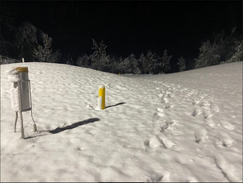
Snow
Locations beneath the heaviest lake effect band saw precipitation rates of 1 to 2 inches per hour at times, which caused an earlier transition to all snow than originally forecasted. As of 11 pm EDT 10/17/22, we had reports of 2 to 4 inches of snow in the worst hit areas, and about 1-3 inches in the surrounding locations. Here is a list of snow totals, which will be updated once we finalize the snow totals from our observers in the morning.
Snow Totals for the October 17-18 event
PUBLIC INFORMATION STATEMENT
NATIONAL WEATHER SERVICE NORTHERN INDIANA
647 PM EDT TUE OCT 18 2022

...SNOWFALL REPORTS FOR OCT 17/18 EVENT...

LOCATION                     AMOUNT    TIME/DATE       LAT/LON

...INDIANA...

...ALLEN COUNTY...
FORT WAYNE 2.6 NW            1.8 IN    0700 AM 10/18   41.10N/85.18W
FORT WAYNE 4.1 NE            0.9 IN    0700 AM 10/18   41.12N/85.09W
FORT WAYNE INTL APRT         0.7 IN    0800 AM 10/18   40.98N/85.18W
FORT WAYNE 2.6 NE            0.6 IN    0700 AM 10/18   41.10N/85.11W
FORT WAYNE 9.3 W             0.5 IN    0700 AM 10/18   41.05N/85.31W

...ELKHART COUNTY...
NAPPANEE 4.8 NE              2.0 IN    0700 AM 10/18   41.50N/85.92W
GOSHEN 3.0 WSW               1.1 IN    0700 AM 10/18   41.56N/85.88W
GOSHEN 0.3 NE                1.0 IN    0845 AM 10/18   41.58N/85.83W
WAKARUSA 2.4 NNE             0.8 IN    0700 AM 10/18   41.57N/85.99W

...KOSCIUSKO COUNTY...
LEESBURG 6.7 ESE             2.8 IN    0700 AM 10/18   41.31N/85.72W
NWS NORTHERN INDIANA         2.7 IN    0800 AM 10/18   41.36N/85.70W
MILFORD 0.9 N                1.7 IN    0700 AM 10/18   41.42N/85.85W

...NOBLE COUNTY...
ALBION 2.9 S                 1.2 IN    0900 AM 10/18   41.35N/85.42W

...WHITLEY COUNTY...
TRI-LAKES 3.0 N              3.3 IN    0700 AM 10/18   41.26N/85.49W
COLUMBIA CITY 5.4 N          3.0 IN    0700 AM 10/18   41.24N/85.49W
COLUMBIA CITY 6.9 N          3.0 IN    0700 AM 10/18   41.26N/85.51W
COLUMBIA CITY 0.5 WSW        1.8 IN    0745 AM 10/18   41.16N/85.49W

OBSERVATIONS ARE COLLECTED FROM A VARIETY OF SOURCES WITH VARYING
EQUIPMENT AND EXPOSURES. WE THANK ALL VOLUNTEER WEATHER OBSERVERS
FOR THEIR DEDICATION. NOT ALL DATA LISTED ARE CONSIDERED OFFICIAL.
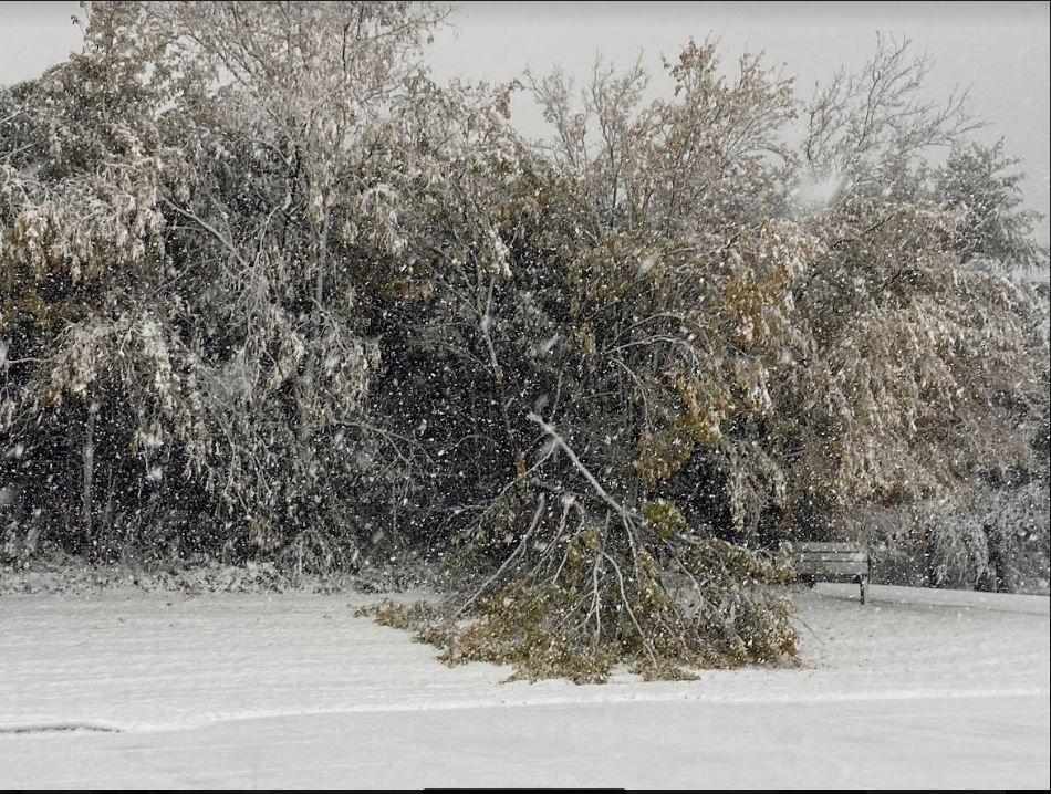
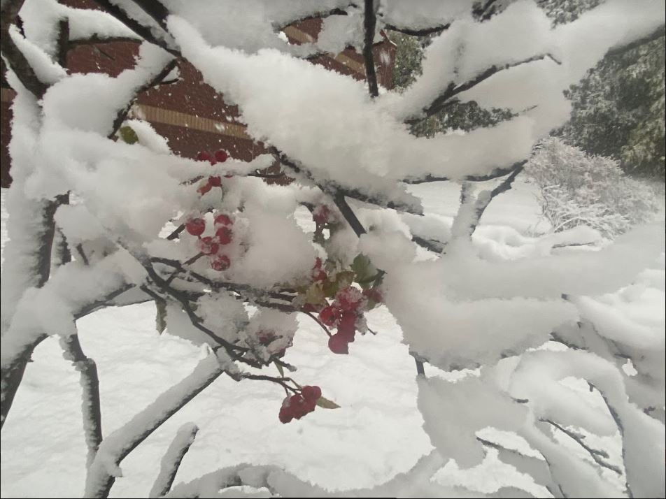
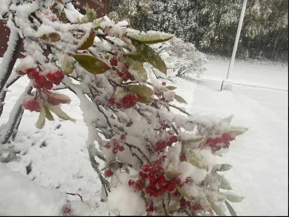
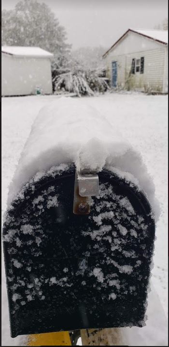
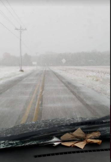
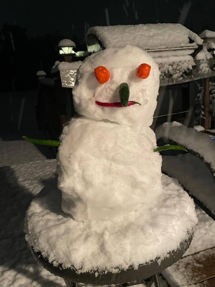
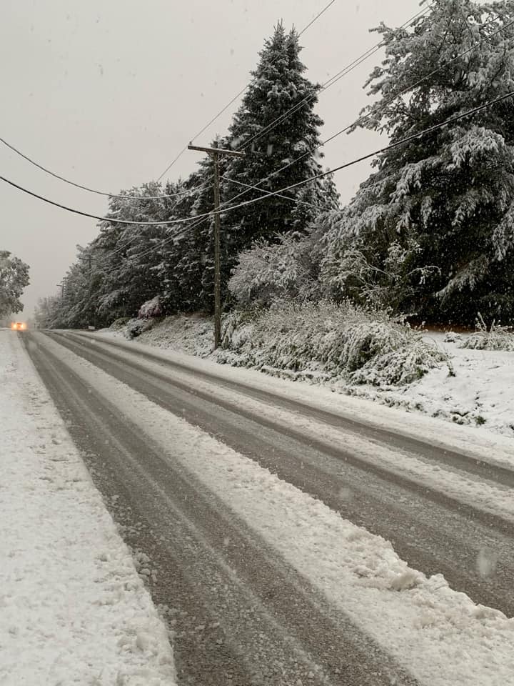
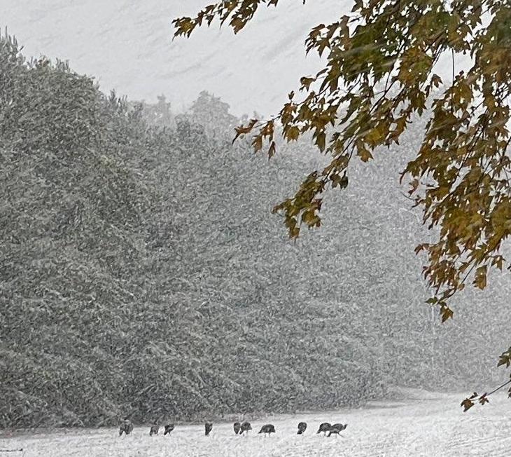
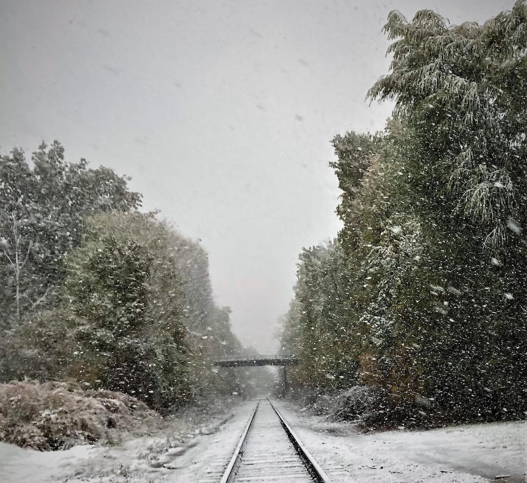
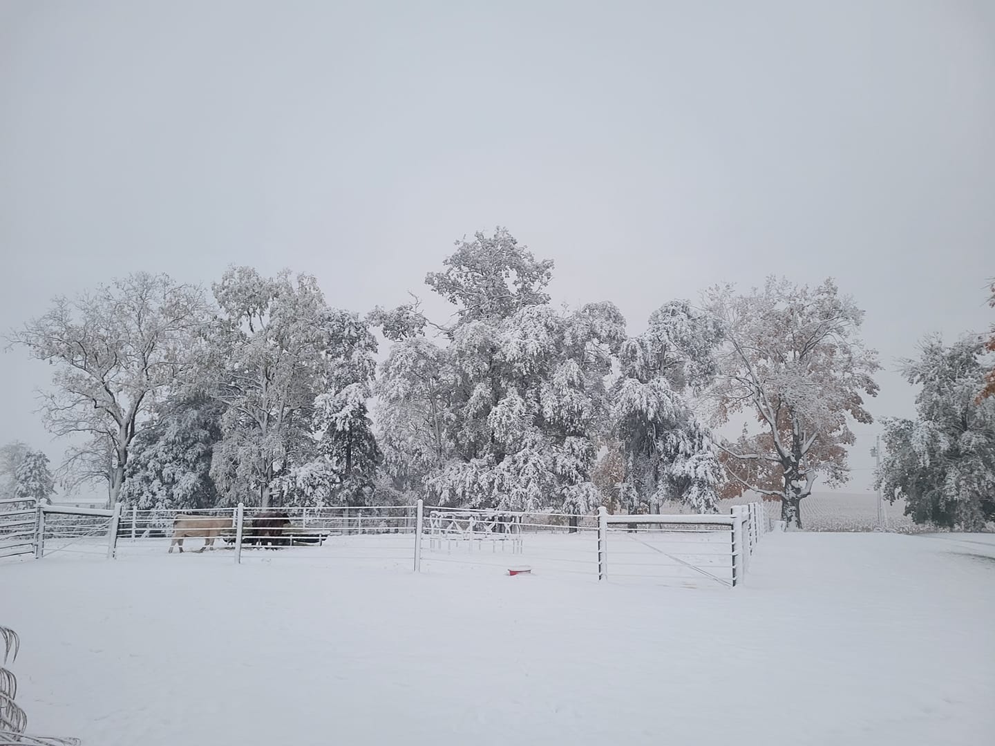
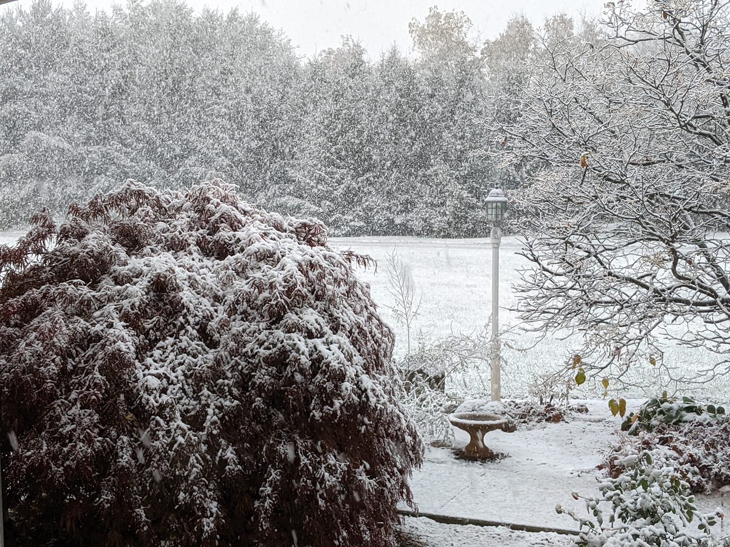
Photos
Thank you to those who submitted photos to us during and after the event. We really appreciate having them for ground truth while an event is going on, and also after the event to document what happened. If you'd like to send us a report or picture, send it to our webmaster email: nws.northernindiana@noaa.gov
 |
 |
 |
 |
| At NWS IWX: 2N North Webster, IN. Photo taken by: Megan Dodson | At NWS IWX: 2N North Webster, IN. Photo taken by: Megan Dodson | At NWS IWX: 2N North Webster, IN. Photo taken by: Megan Dodson | At NWS IWX: 2N North Webster, IN. Photo taken by: Megan Dodson |
 |
 |
 |
 |
| Leesburg, IN (Lonnie Fisher) | Leesburg, IN (Lonnie Fisher) | Snowman west of Fort Wayne, IN (Kyle Stoffel) | Syracuse, IN (Linda Minnick) |
 |
 |
 |
 |
| Leesburg, IN. Photo taken by Michelle Hall | Snow in Larwill, IN Photo taken by: Kathie Schram | Snow 2SE Wilmot, IN. Photo taken by: Kelley Sheiss | Churubusco, IN. Photo taken by: Judy Garrison |
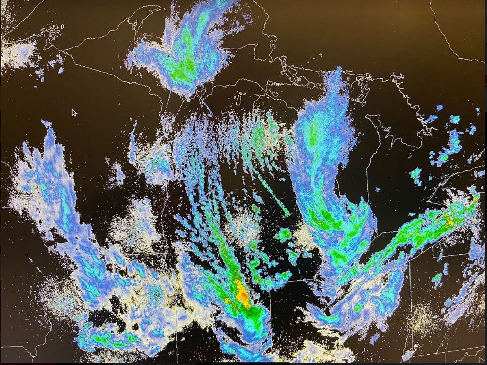
Radar
Radar images from the event are below.
 |
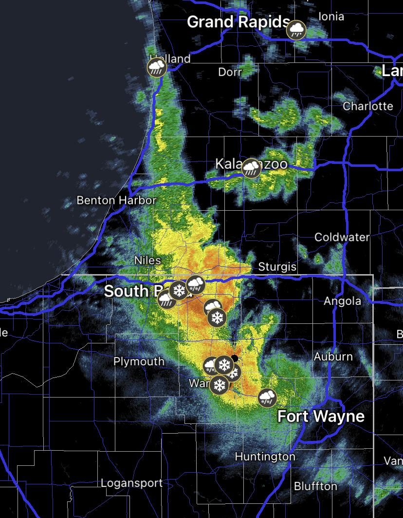 |
| Regional Radar Image showing Lake Effect Band towards the end of the event on 10/17/22. Moisture was brought down from Lake Superior to feed the snow bands (AWIPS Screenshot, NWS IWX) | KIWX Radar image from ~6 pm EDT showing the MPING reports of mixed precipitation and the large lake enhanced band responsible for higher totals (Radarscope) |
Radar Loop of the Event
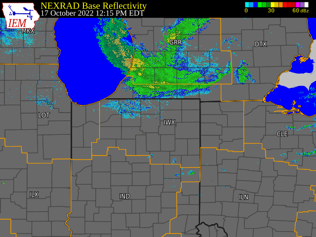 |
| KIWX Radar Loop from 12 pm to 11 pm EDT Oct 17 (IEMCow) |
Environment
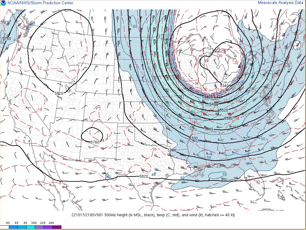
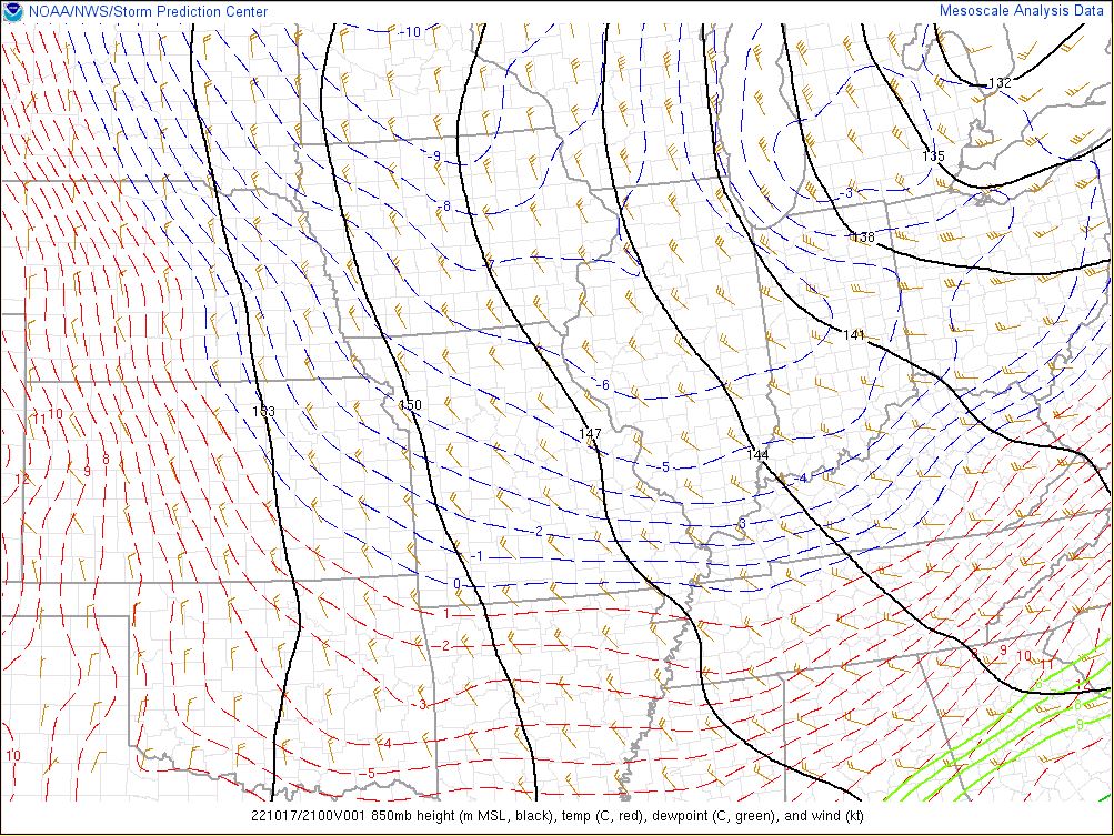
In the upper levels of the atmosphere, there was a large upper level low (Fig. 1) that provided good upper level support for the precipitation and strong upper level winds. At 850mb (Fig. 2), the temperatures were cold enough to create some instability over the warm Lake Michigan waters, which gave us our lake enhancement for the snow band. Frontogenesis was underway in the low to mid levels as well, which is maximized where our largest band was (Fig. 3).
 |
 |
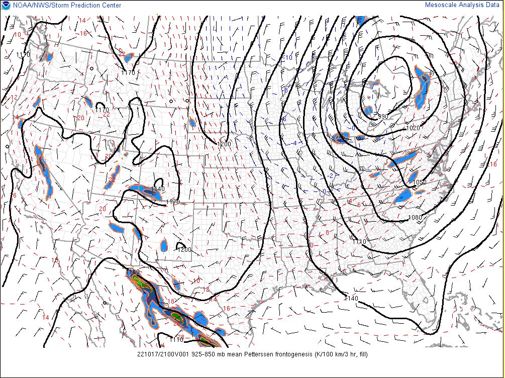 |
| Figure 1: 500mb chart: Upper level low over the Great Lakes at 21z when the band was cranking (SPC Mesoanalysis Page) | Figure 2: 850mb chart showing the 850mb temperatures, heights, and winds at 21z when the band was cranking (SPC Mesoanalysis Page) | Figure 3: 850-925 mb image of Pettersen Frontogenesis depicting enhancement at 21z when the band was cranking (SPC Mesoanalysis Page) |
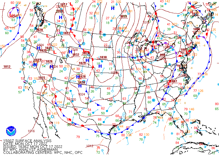
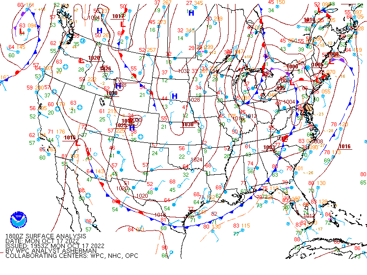
At the surface, a low pressure system was moving through the Great Lakes, dragging a cold front through the forecast area. This provided lift and colder air for the snow band to intensify and change to mostly snow.
 |
 |
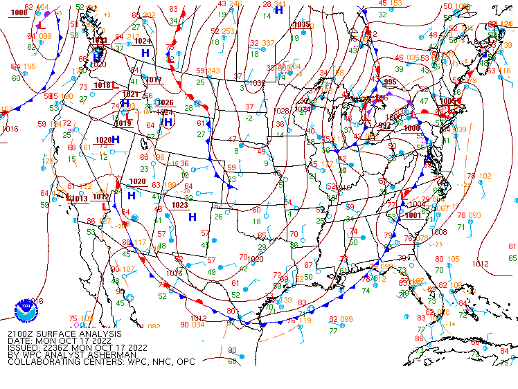 |
| Figure 4: Surface Analysis at 11 am EDT October 17th, 2022 (WPC Surface Analysis Archive) | Figure 5: Surface Analysis at 2 pm EDT October 17th, 2022 (WPC Surface Analysis Archive) | Figure 6: Surface Analysis at 5 pm EDT October 17th, 2022 (WPC Surface Analysis Archive) |
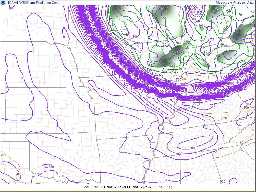
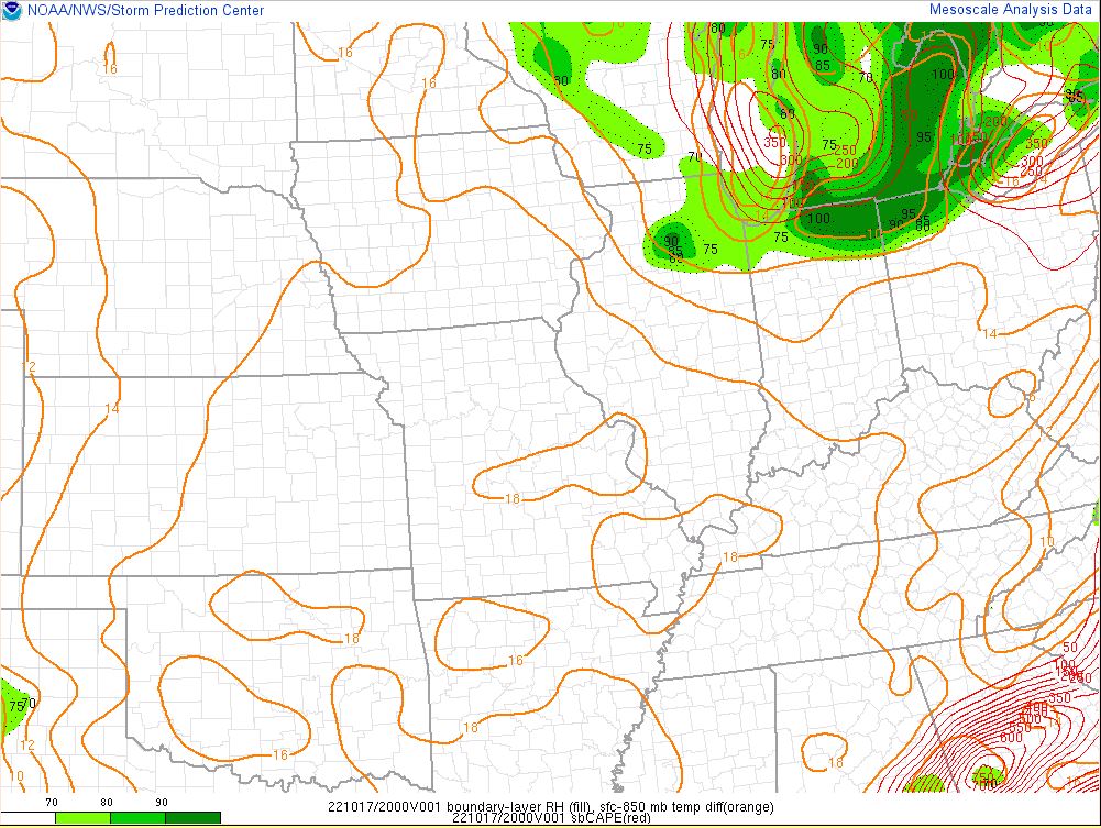
With the 850mb temperature differences in place (Figs. 8-9), a deeper saturated Dendritic Growth Zone (Fig. 7), and north-northwest winds we were able to develop the stronger single band.
 |
 |
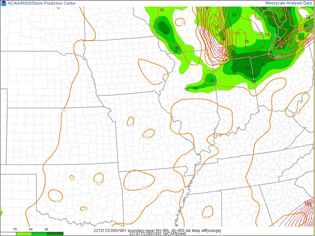 |
| Figure 7: Snow Growth Layer Depth and Relative Humidity (SPC Mesoanalysis Page) | Figure 8: Lake Effect Snow variables highlighting the boundary layer relative humidity and the sfc-850mb temp difference in orange. Time was 4 pm EDT. (SPC Mesoanalysis Page) | Figure 9: Lake Effect Snow variables highlighting the boundary layer relative humidity and the sfc-850mb temp difference in orange. Time was 7 pm EDT. (SPC Mesoanalysis Page) |
 |
Media use of NWS Web News Stories is encouraged! Please acknowledge the NWS as the source of any news information accessed from this site. |
|

