Overview
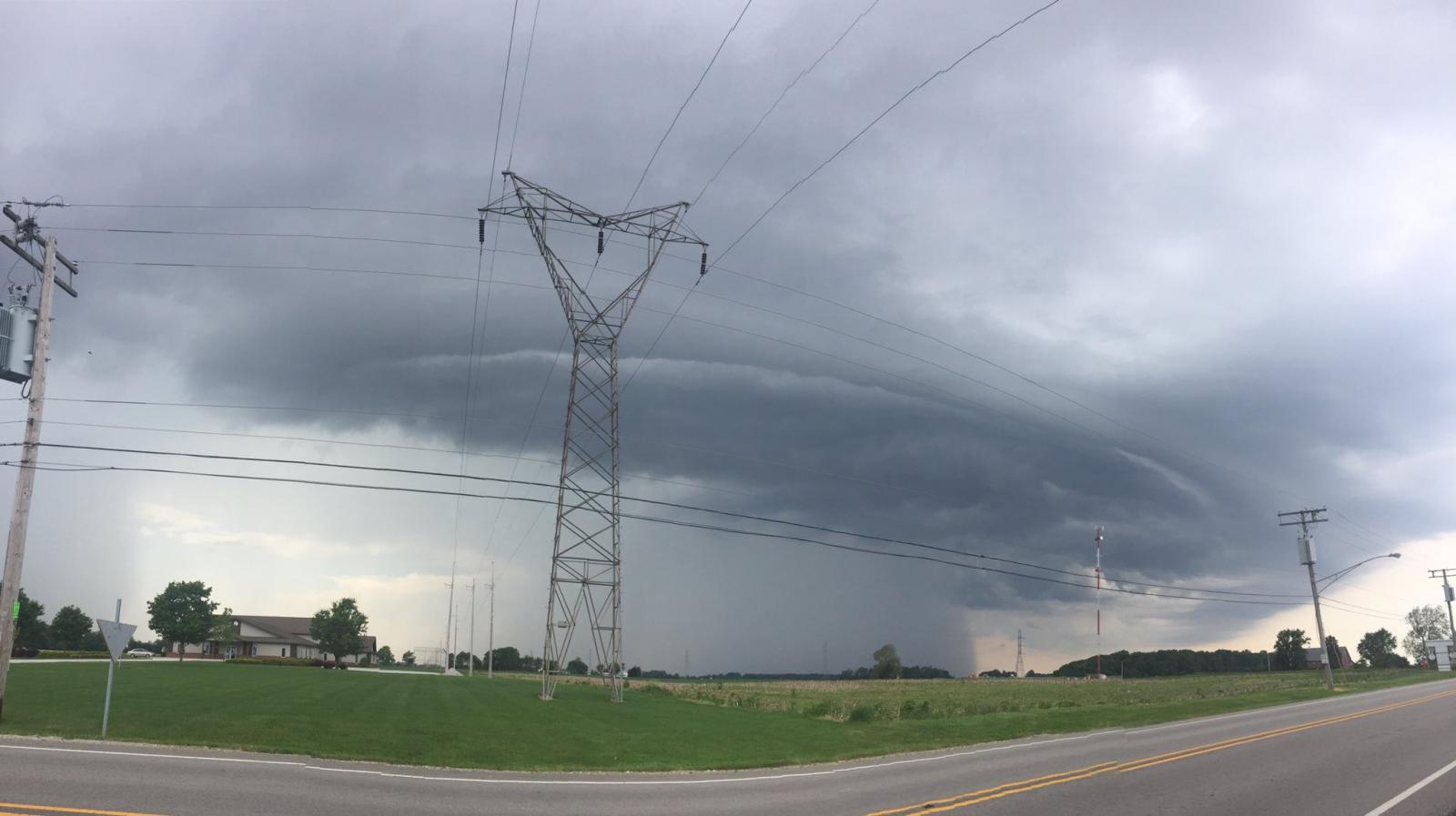
Strong to severe storms developed across the forecast area on June 13th, 2017 during the afternoon hours. At our office, we received reports of hail and wind gusts, with mainly minor damage reported from winds. We also have video footage of two gustnadoes that were observed near Milford, IN and Grover Hill, OH. If you saw any hail and/or wind damage, we would appreciate you sending us your report, using the form here.Wind, Gustnadoes, & Hail:
Here are the details on the wind, gustnadoes, and hail from the June 13th, 2017 Severe Weather event.
Gustnadoes
A few "Gustnadoes" were reported to the National Weather Service June 13, 2017. What's the difference between a tornado, landspout, and gustnado? Click here to find out! Read our public information statement here.
Near Milford Indiana
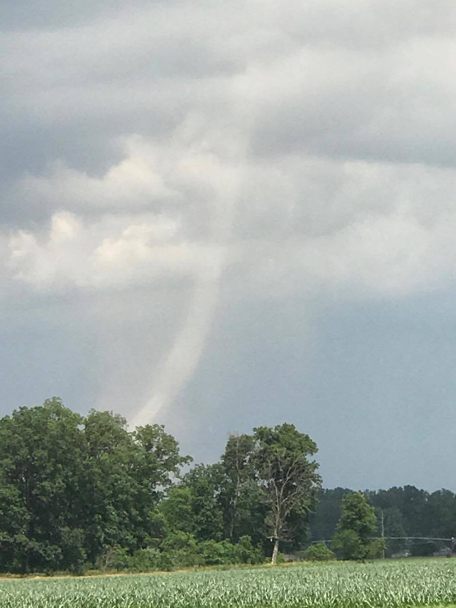
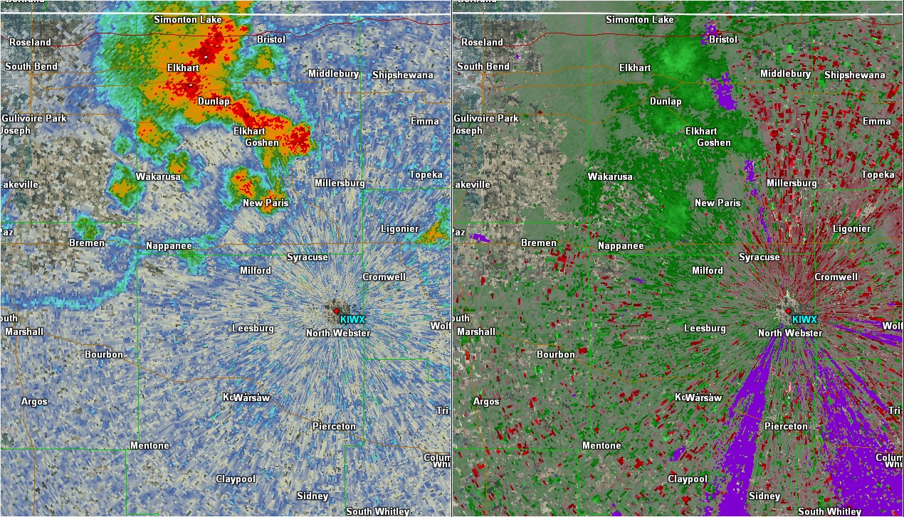
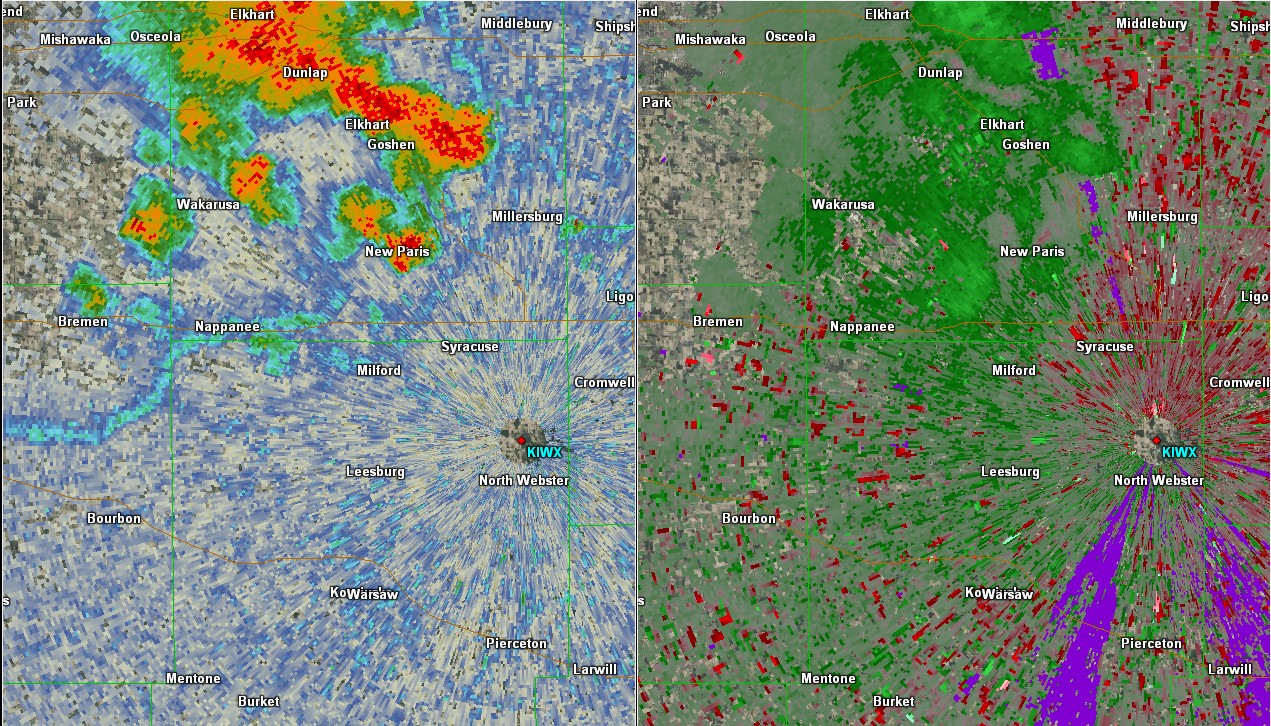
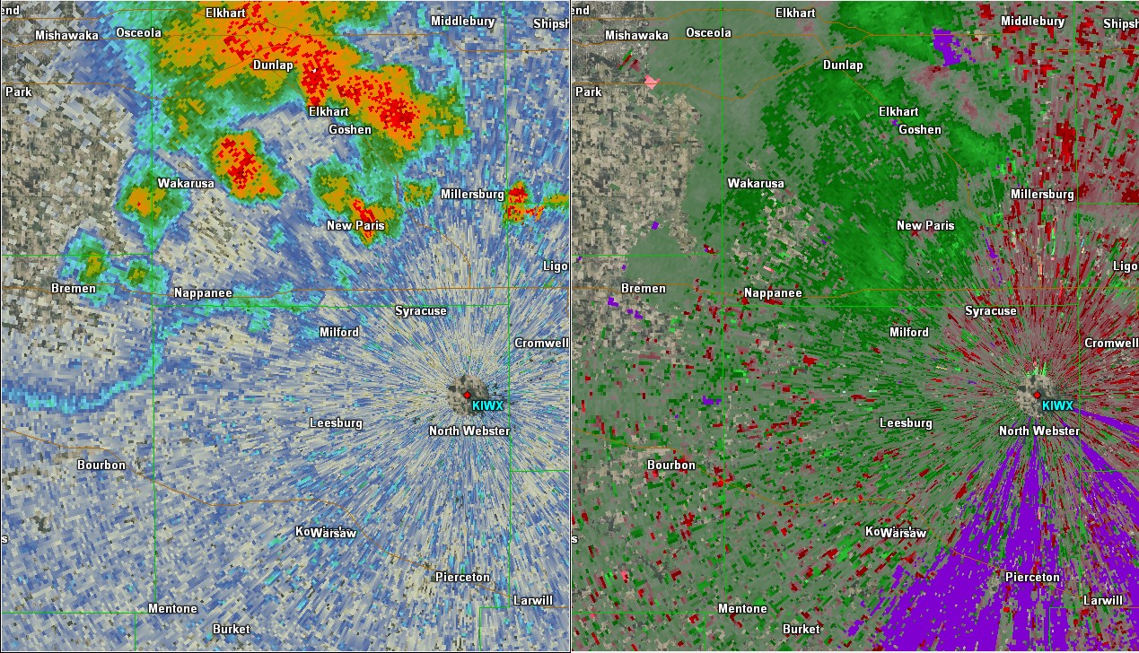
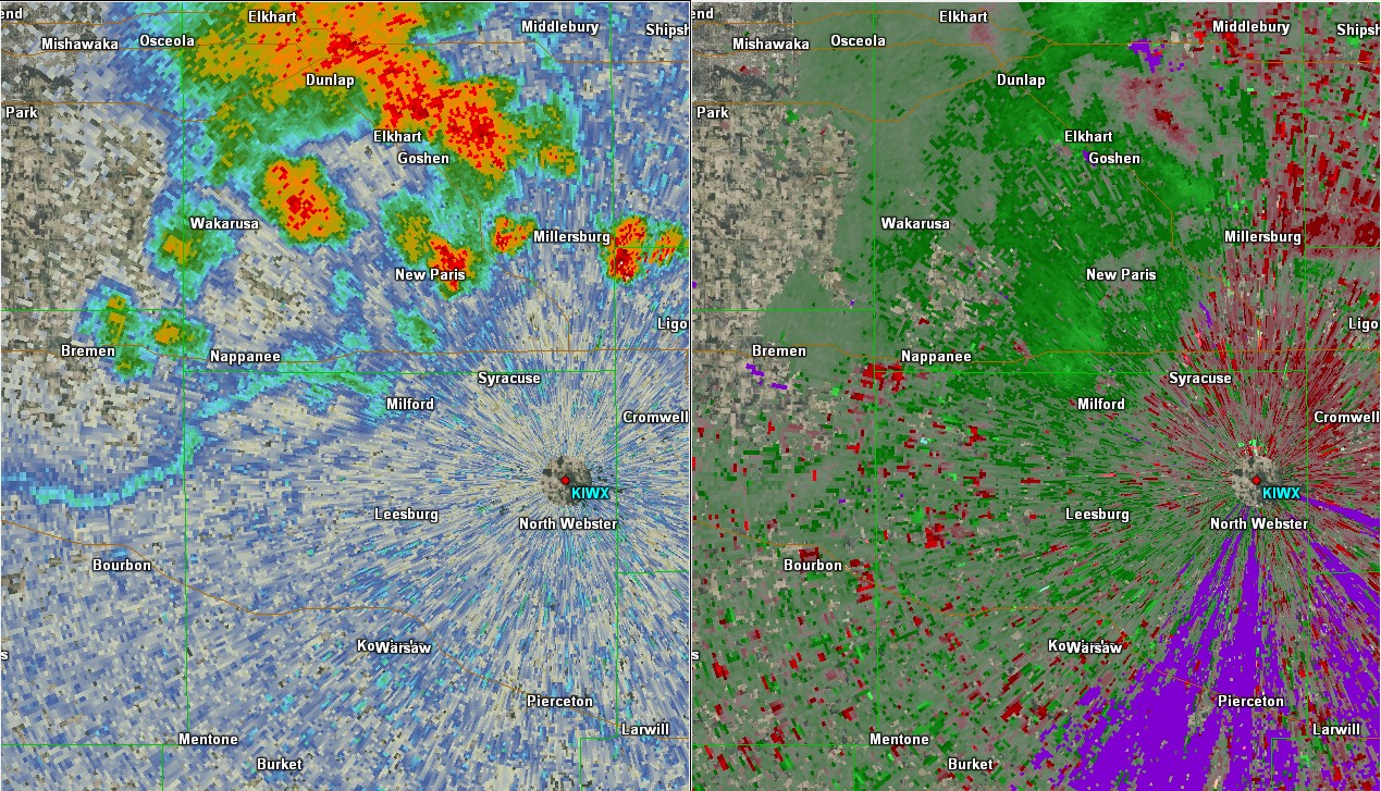
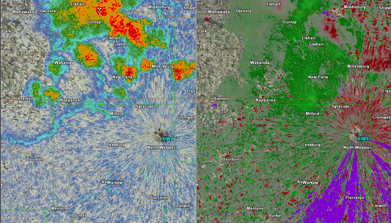
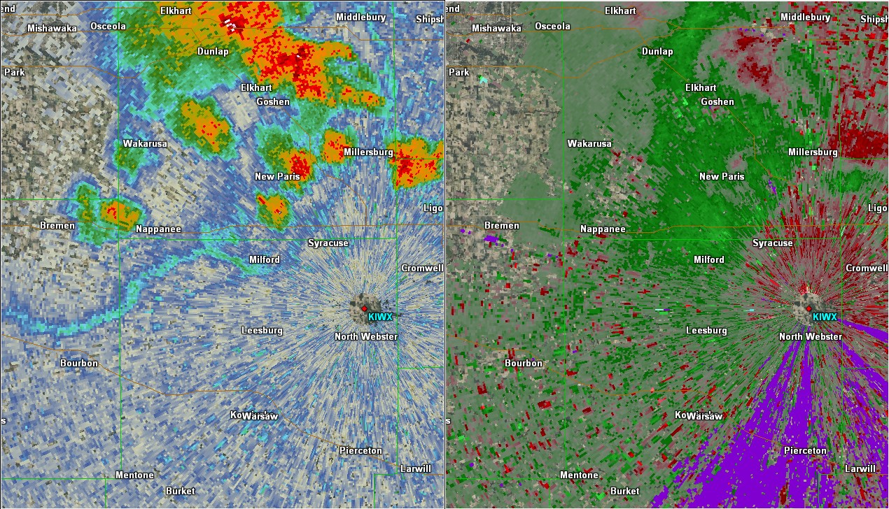
The first gustnado occurred near Milford, IN around 2:15-2:20 pm ET. Radar shows an outflow boundary just south of Milford. Shortly thereafter a shower begins to develop north of the area but not in the location of the reported circulation. The complex interactions caused a brief gustnado, as shown in the photo and video below. Radar data images created using GR2 Analyst.
 |
 |
 |
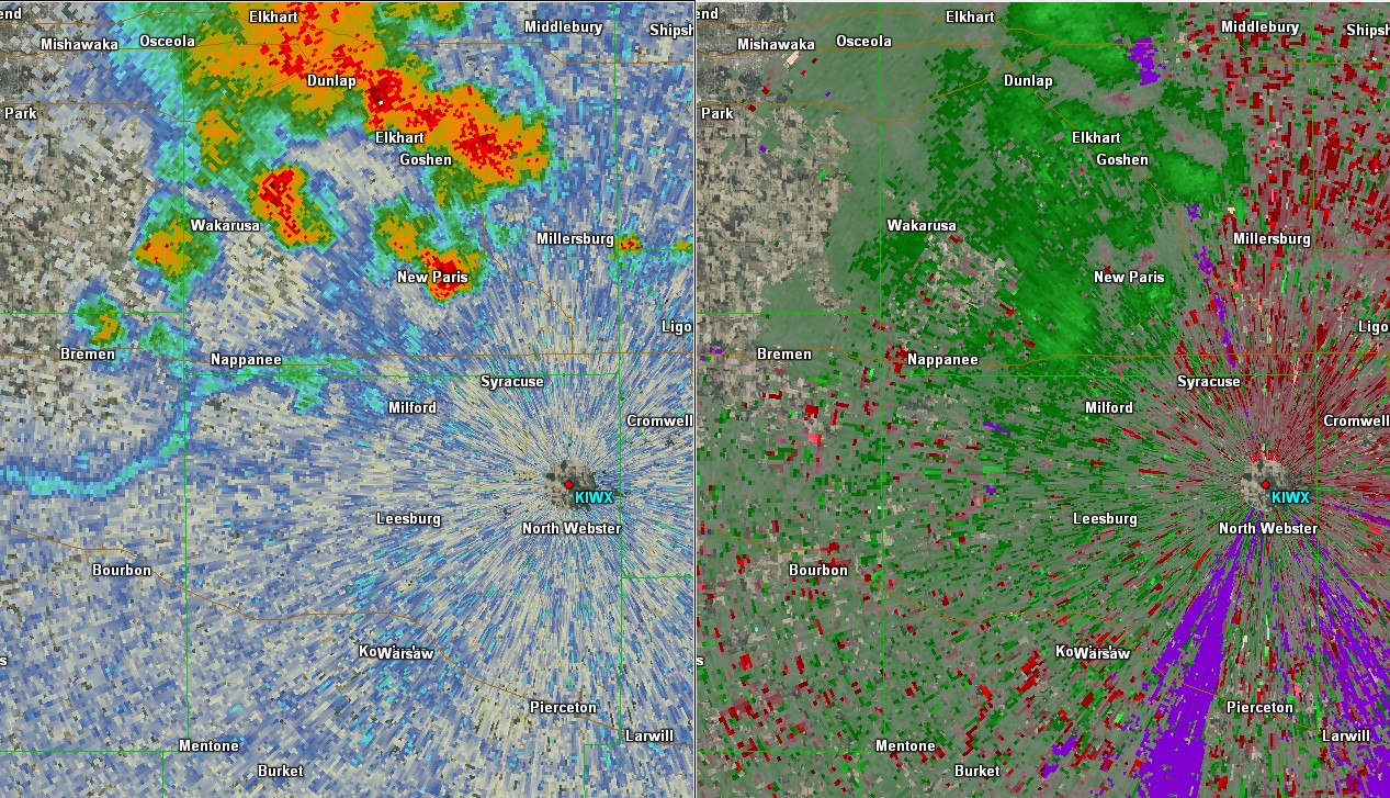 |
| Gustnado south of Milford, IN Associated with the outflow from the gust front. Photo by Molly Lewis. | Radar Data: Reflectivity/Velocity data at 2:11 pm 6/13/17 | Radar Data: Reflectivity/Velocity data at 2:12 pm 6/13/17 | Radar Data: Reflectivity/Velocity data at 2:14 pm 6/13/17 |
 |
 |
 |
 |
| Radar Data: Reflectivity/Velocity data at 2:16 pm 6/13/17 | Radar Data: Reflectivity/Velocity data at 2:18 pm 6/13/17 | Radar Data: Reflectivity/Velocity data at 2:19 pm 6/13/17 | Radar Data: Reflectivity/Velocity data at 2:22 pm 6/13/17 |
This video of the Gustnado was taken by Molly Lewis near Milford, IN.
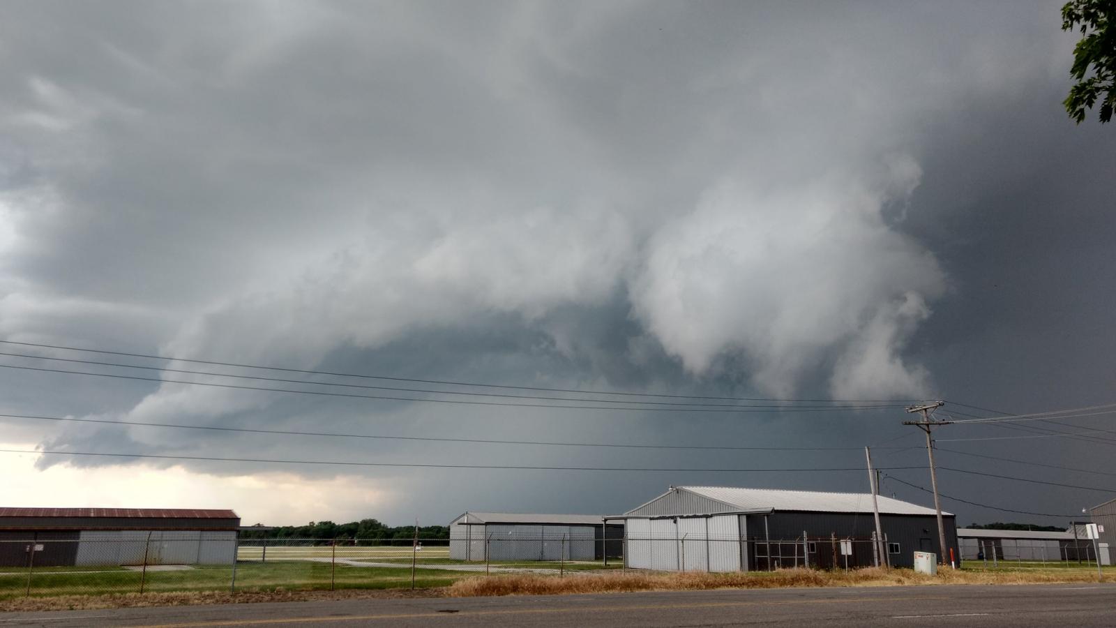
Near Grover Hill, OH
A video was submitted to WANE TV's Hannah Strong showing a gustnado near Grover Hill, OH. Chaise May took this video around 4:15 pm EDT on June 13, 2017. No damage was reported to the National Weather Service as of 9:32 PM EDT 6/13/17 as a result of this gustnado.
Another video was submitted to Matt Leach from ABC21 WPTA of the Gustnado near Grover Hill, OH. Video was by Brian Recker.
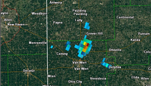
Below is the radar data for the Grover Hill Gustnado. You can see some slight rotation just south of the area. VIL shows the potential for hail and heavy rain, NROT shows some rotation.
 |
 |
 |
 |
| Gustnado South of Grover Hill. Reflectivity at 4:11 pm ET. Images created with GR2 Analyst. | Gustnado South of Grover Hill. Velocity at 4:11 pm ET. Images created with GR2 Analyst. | Gustnado South of Grover Hill. VIL at 4:11 pm ET. Images created with GR2 Analyst. | Gustnado South of Grover Hill. NROT at 4:11 pm ET. Images created with GR2 Analyst. |
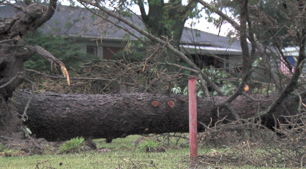
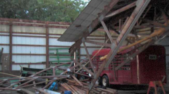
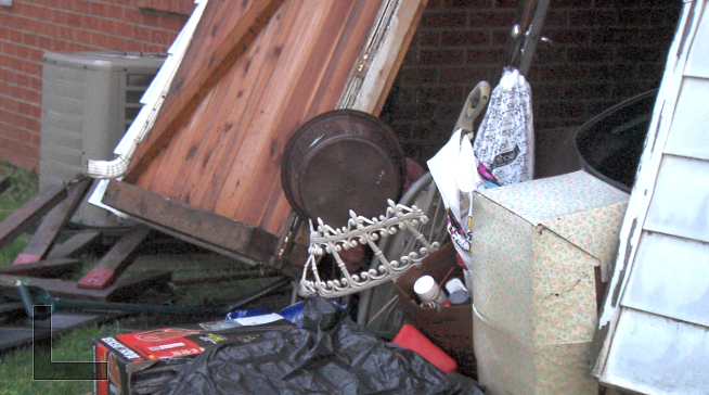
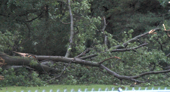
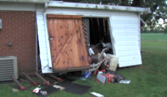
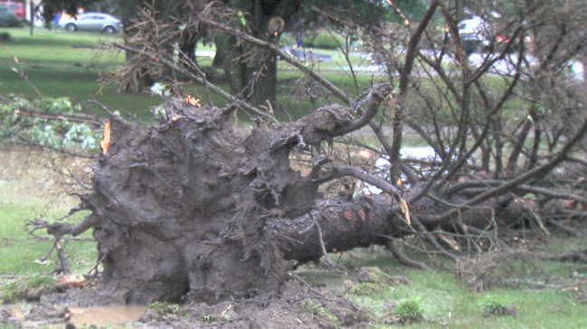
Straight Line Wind Damage
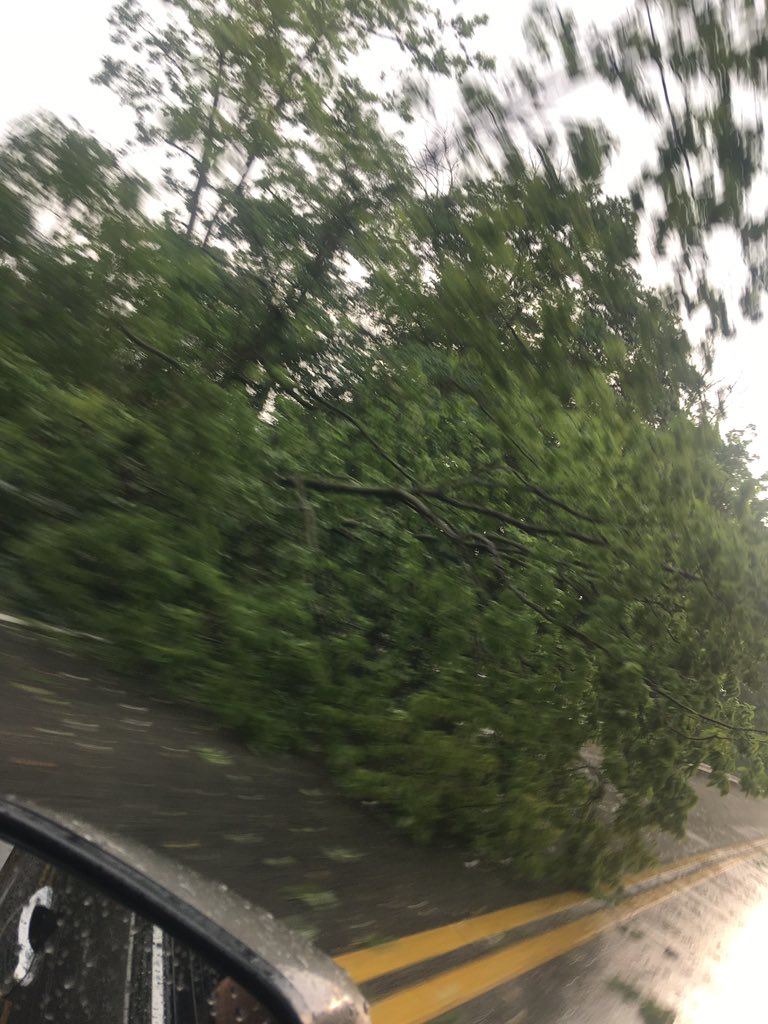
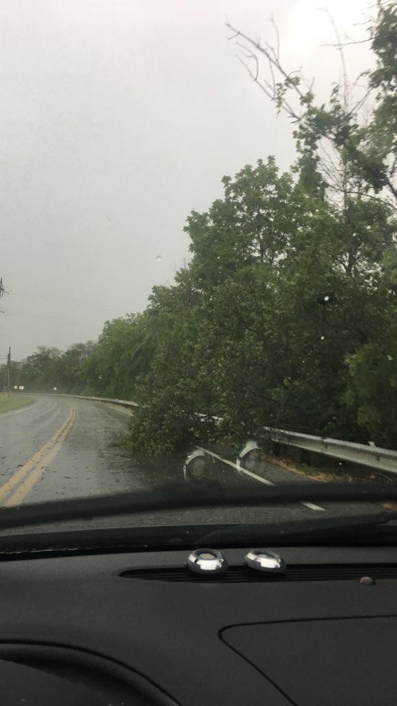
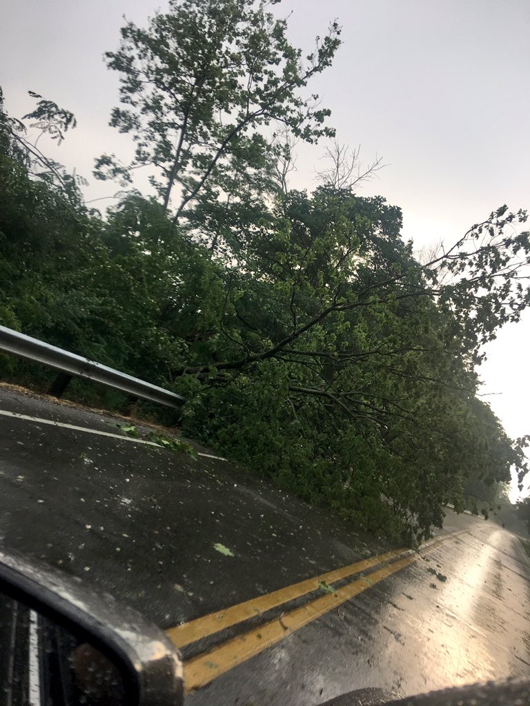
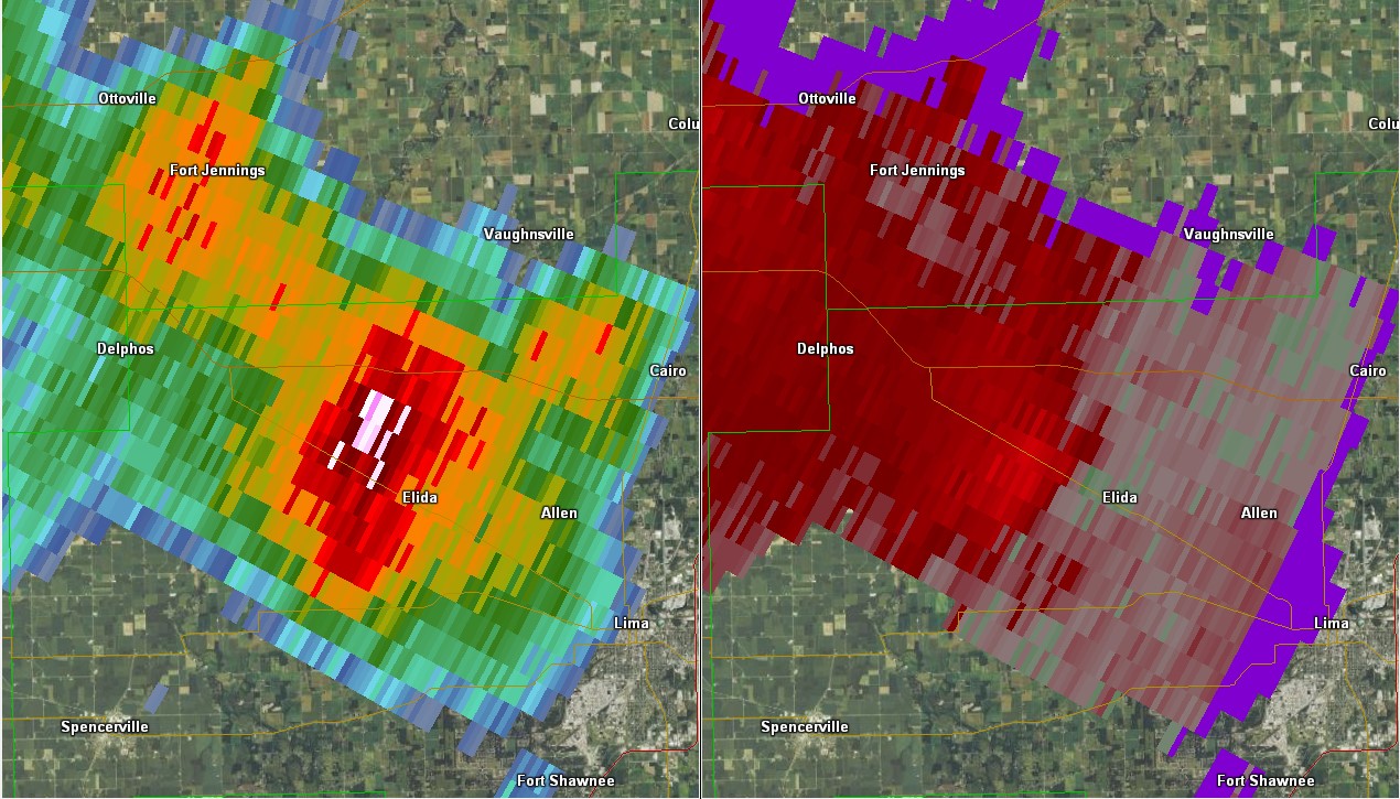
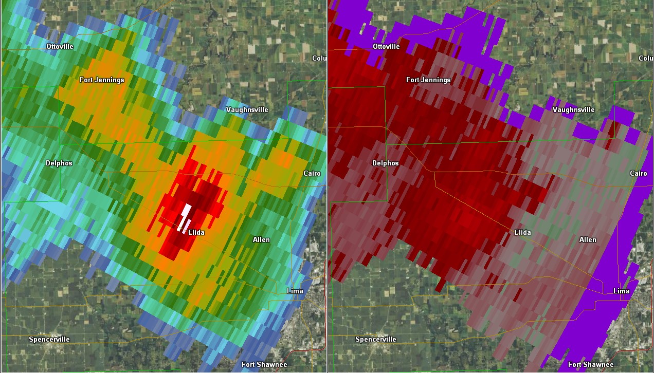
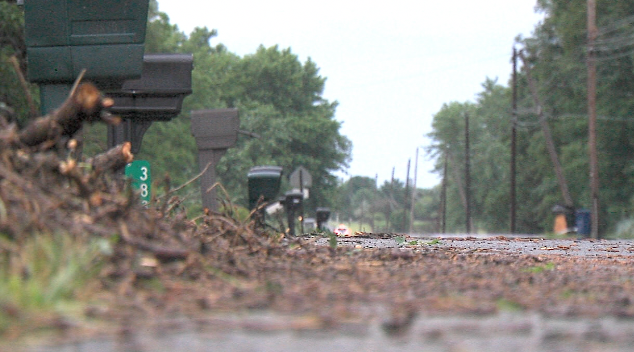
Straight line winds from thunderstorms led to wind damage across the forecast area. Defiance, OH, South Whitley, IN, and Elida, OH reported several trees and power lines downed. Elida saw a barn roof blown off, and the back wall of a house blown out with roof damage. We did not get any reports of wind gusts greater than 60 mph, but gusts near Elida could have been slightly more than that as the damage was more significant.
 |
 |
 |
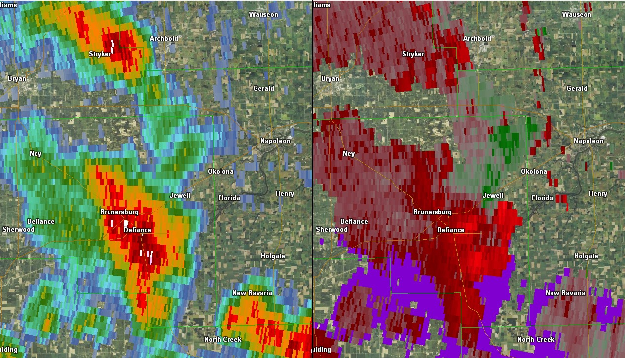 |
| Defiance, OH. Taken by John Duslak. | Defiance, OH. Taken by John Duslak. | Defiance, OH. Taken by John Duslak. | Radar Data (Reflectivity & Velocity) from Defiance at 5:22 PM ET. Created using GR2 Analyst |
 |
 |
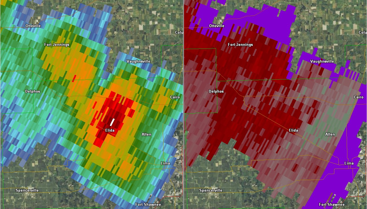 |
| Radar Data (Reflectivity & Velocity) from Elida, OH Area at 5 pm 6/13/17. Created using GR2 Analyst. | Radar Data (Reflectivity & Velocity) from Elida, OH Area at 5:06 pm 6/13/17. Created using GR2 Analyst. | Radar Data (Reflectivity & Velocity) from Elida, OH Area at 5:11 pm 6/13/17. Created using GR2 Analyst. |
 |
 |
 |
 |
| Damage in Elida, OH. Photos taken by Jason Mikell (WLIO) | Damage in Elida, OH. Photos taken by Jason Mikell (WLIO) | Damage in Elida, OH. Photos taken by Jason Mikell (WLIO) | Damage in Elida, OH. Photos taken by Jason Mikell (WLIO) |
 |
 |
 |
 |
| Damage in Elida, OH. Photos taken by Jason Mikell (WLIO) | Damage in Elida, OH. Photos taken by Jason Mikell (WLIO) | Damage in Elida, OH. Photos taken by Jason Mikell (WLIO) | Damage in Elida, OH. Photos taken by Jason Mikell (WLIO) |
 |
 |
| Damage in Elida, OH. Photos taken by Jason Mikell (WLIO) | Damage in Elida, OH. Photos taken by Jason Mikell (WLIO) |
Some of the Sub-Severe Wind Reports (one Estimated at 50-60 mph)
...Wind Reports from June 13 2017...

Location                     Speed     Time/Date       Lat/Lon

...Indiana...

...Allen County...
Fort Wayne International Ap  44 MPH    0508 PM 06/13   40.98N/85.19W

...Cass County...
1 SE Walton                  31 MPH    0330 PM 06/13   40.64N/86.23W

...Elkhart County...
Middlebury                50-60 MPH    0234 PM 06/13   41.67N/85.71W
2 SW Simonton Lake           39 MPH    0220 PM 06/13   41.72N/86.01W
1 WNW Jimtown                33 MPH    0143 PM 06/13   41.64N/86.04W
Goshen Municipal Airport     30 MPH    0225 PM 06/13   41.53N/85.79W

...Grant County...
Grant County Municipal Apt   35 MPH    0336 PM 06/13   40.48N/85.68W

...Huntington County...
3 SSW Huntington             33 MPH    0413 PM 06/13   40.83N/85.53W

...Lagrange County...
1 NW Howe                    31 MPH    0310 PM 06/13   41.75N/85.44W

...Miami County...
3 W Amboy                    33 MPH    0315 PM 06/13   40.59N/85.98W

...St. Joseph County...
2 SE Mishawaka               37 MPH    0134 PM 06/13   41.65N/86.13W
South Bend International Ap  37 MPH    0100 PM 06/13   41.71N/86.32W

...Starke County...
2 ESE Brems                  33 MPH    0315 PM 06/13   41.33N/86.66W

...Wabash County...
1 SSE Roann                  37 MPH    0400 PM 06/13   40.89N/85.92W

...White County...
White Cnty Ap                30 MPH    0455 PM 06/13   40.71N/86.77W

...Michigan...

...St. Joseph County...
Sturgis                      31 MPH    0335 PM 06/13   41.81N/85.44W

...Ohio...

...Allen County...
Lima                         35 MPH    0520 PM 06/13   40.73N/84.12W
Lima Allen County Airport    32 MPH    0521 PM 06/13   40.71N/84.02W

...Fulton County...
Fulton Cnty Ap               30 MPH    0715 PM 06/13   41.61N/84.13W

...Putnam County...
Leipsic                      34 MPH    0533 PM 06/13   41.10N/83.99W

Observations are collected from a variety of sources with varying
equipment and exposures. We thank all volunteer weather observers
for their dedication. Not all data listed are considered official
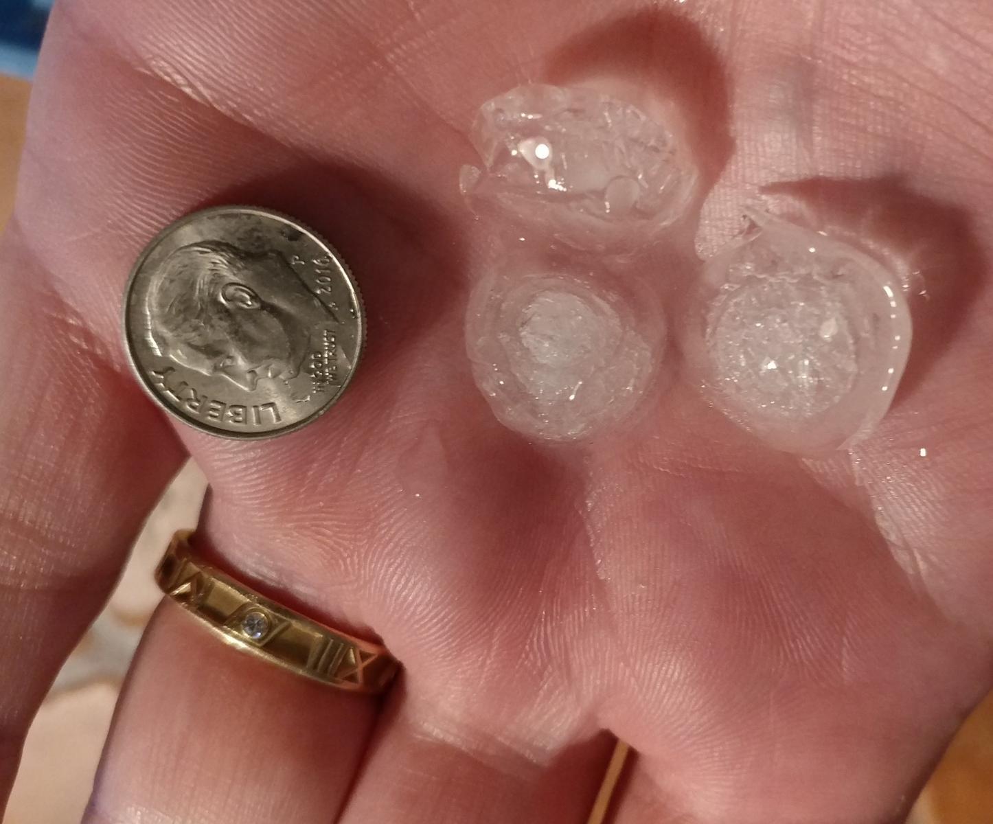
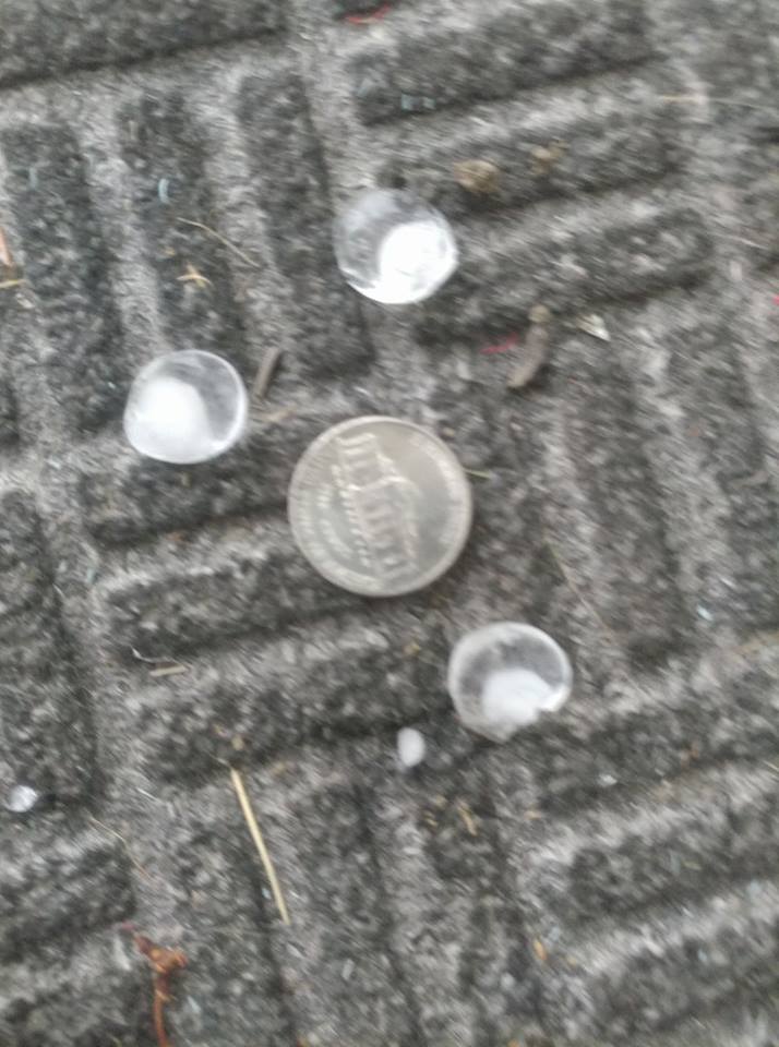
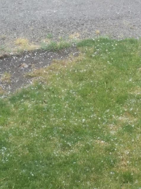
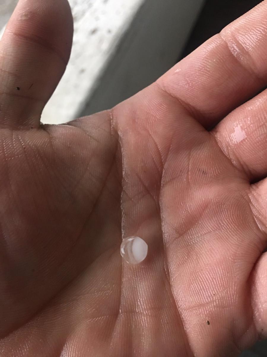
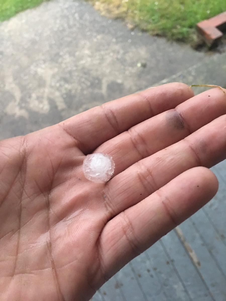
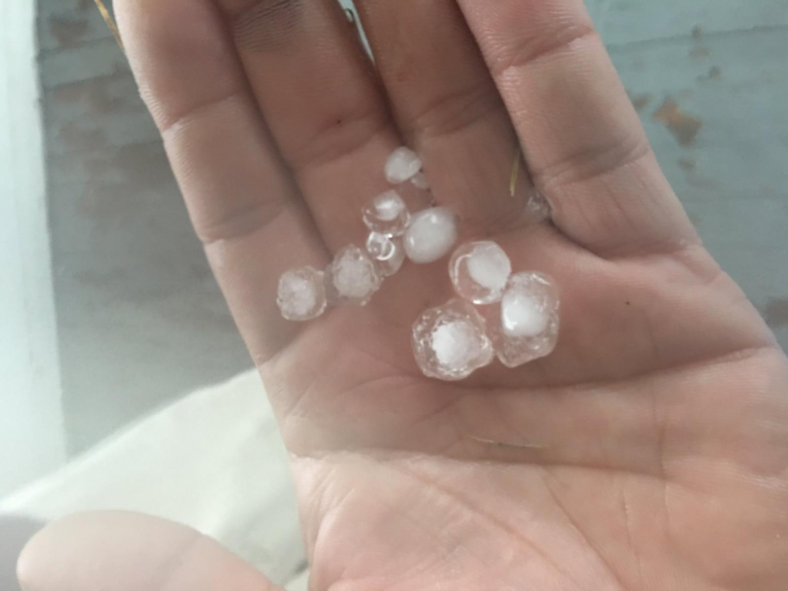
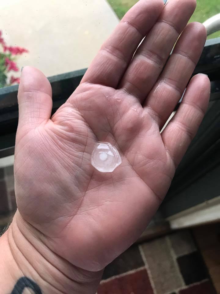
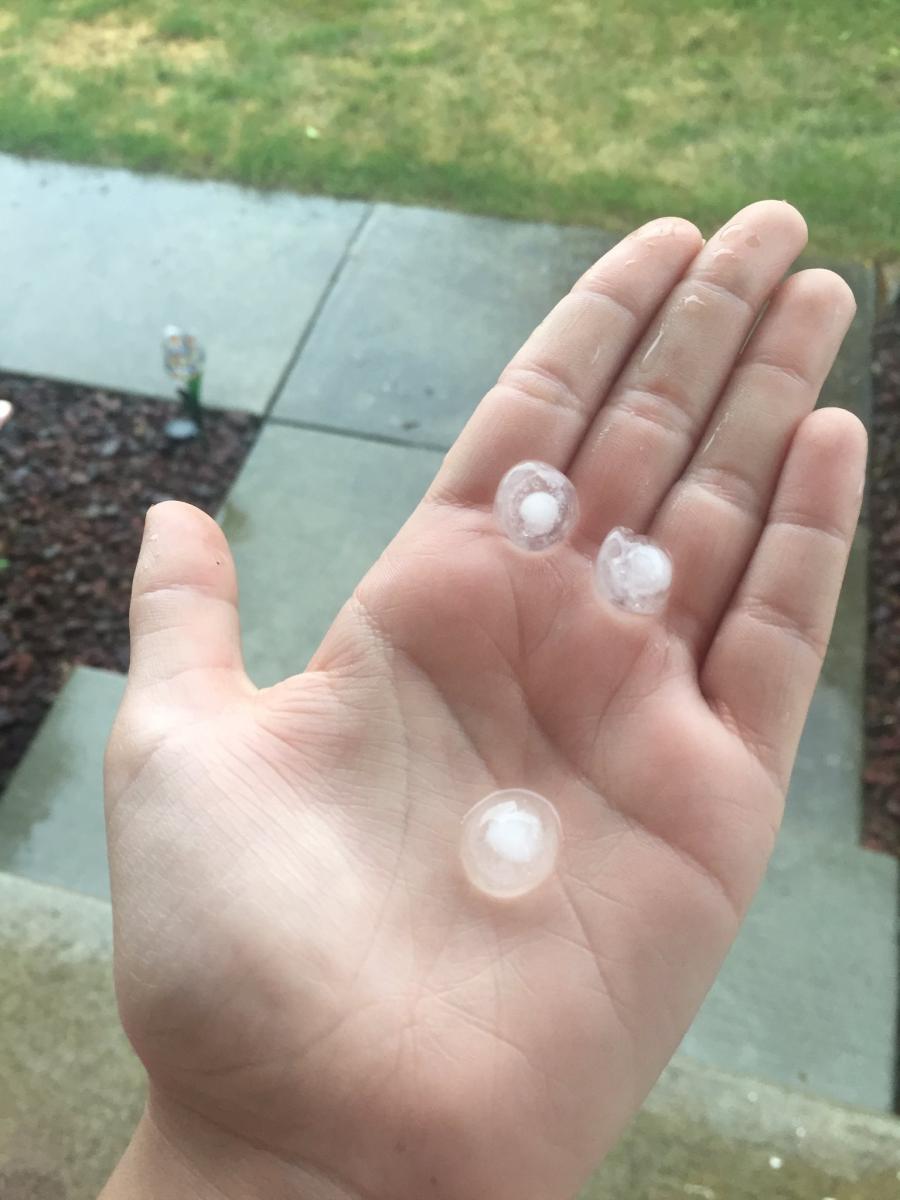
Hail
Hail up to 1" in diameter was observed across the forecast area from the storms. Storms were very pulsey, so they often popped up quickly then collapsed-dropping some hail and causing gusty winds (in some cases damaging). Here are the photos people sent to us (thank you!) and some radar images of the storms.
 |
 |
 |
 |
| Elkhart, IN. Photo by Renes Points. | Leipsic, OH. Photo by Bob Kroeger. | Leipsic, OH. Photo by Bob Kroeger. | Defiance, OH. Photo by Jon Duslak. |
 |
 |
 |
 |
| Defiance, OH. Photo by Jon Duslak. | Defiance, OH. Photo by Jon Duslak. | South Bend, IN. Photo by Matt McFarland. | Taken near US 20 and SR 23 in South Bend, IN. Photo by Christines Rare Pics. |
 |
| Osceola, IN. Photo by Morgan. |
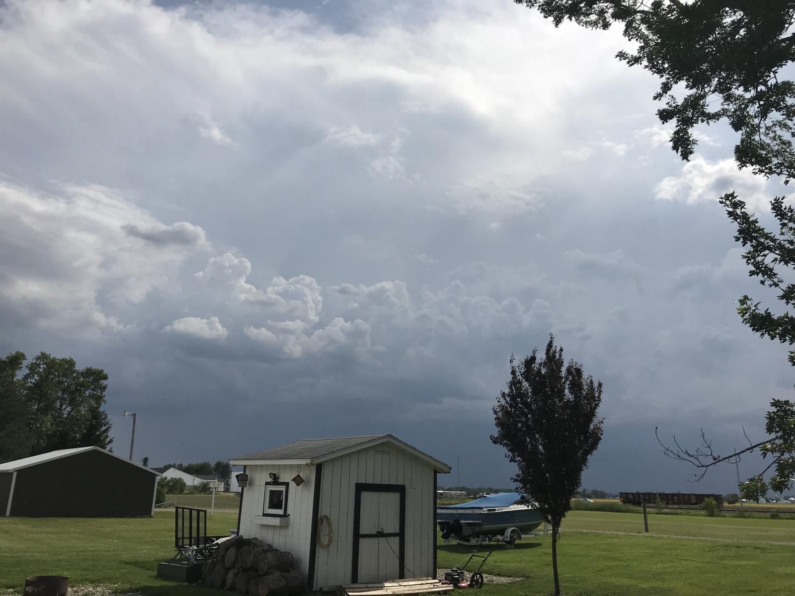
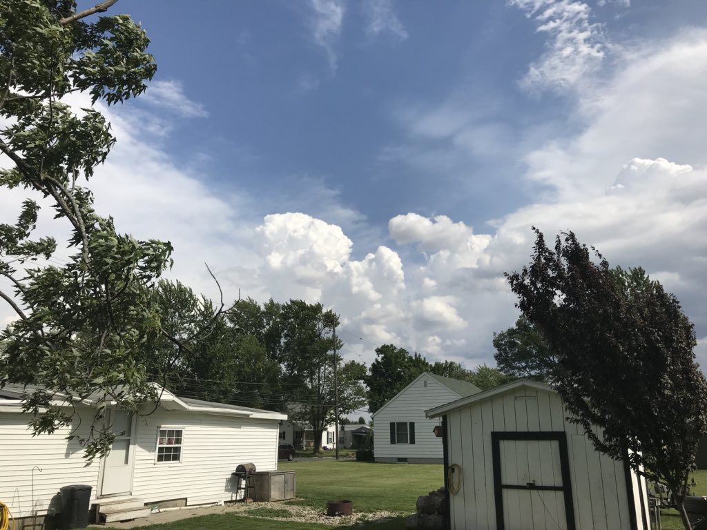
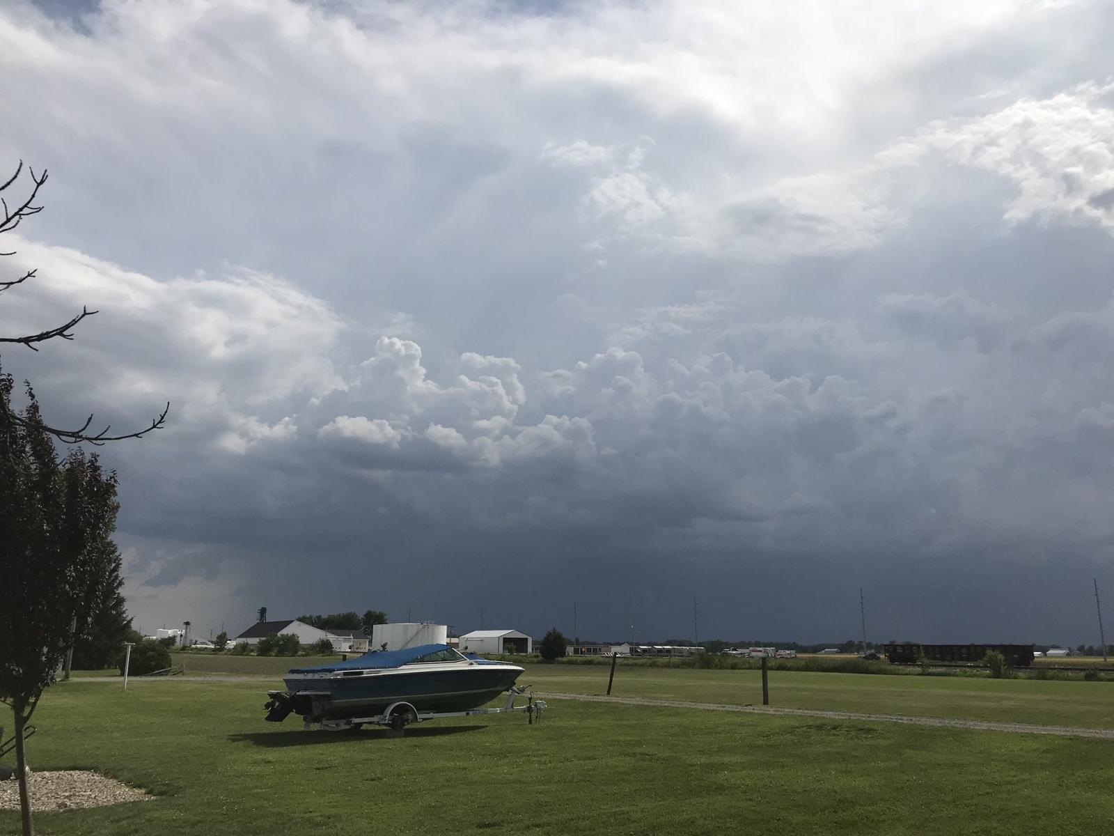
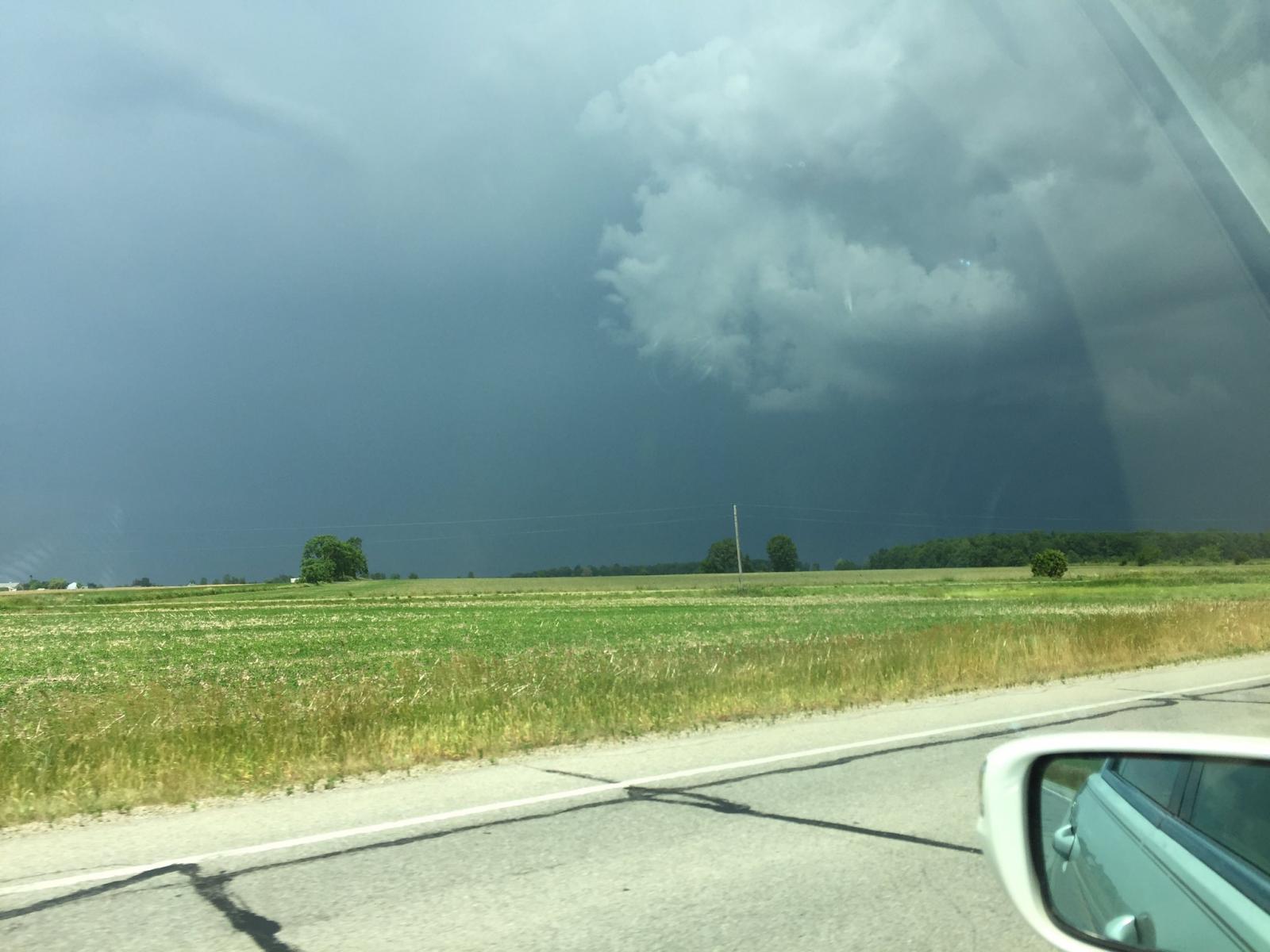
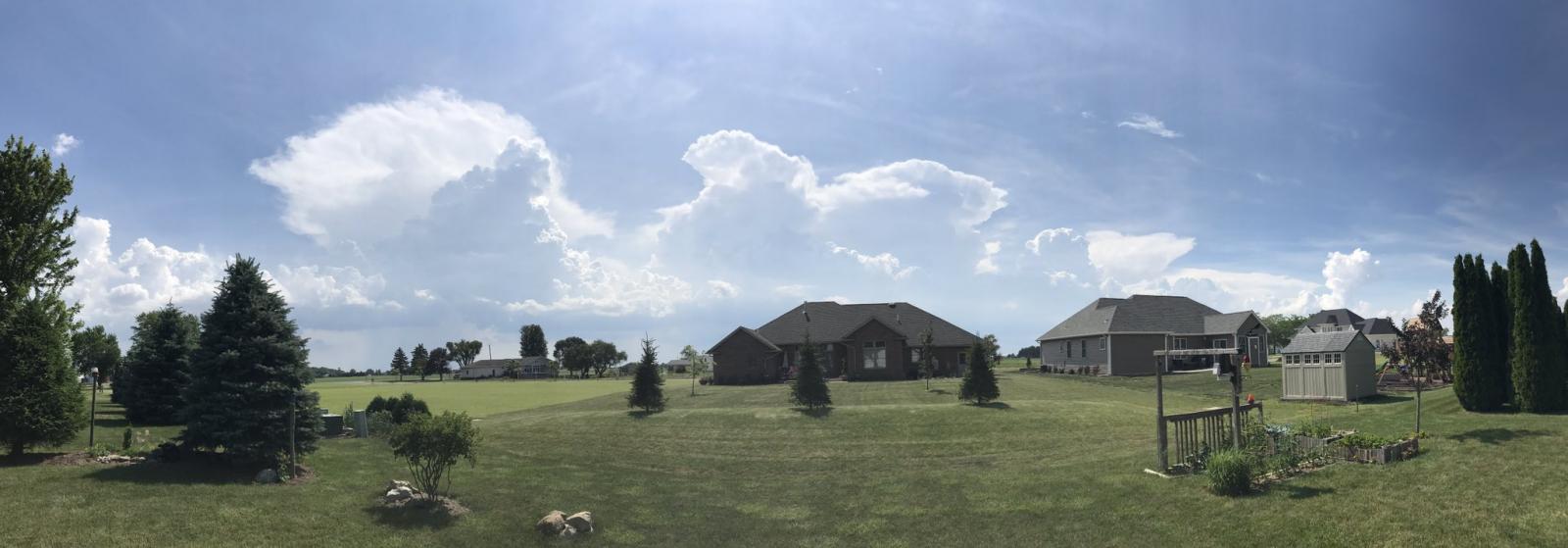
Photos:
Thanks to those who submitted photos, videos, and reports to us! For videos of hail and wind damage photos, along with videos of the gustnadoes observed, see the wind & hail section. Below are photos of the storms for you to enjoy.
 |
 |
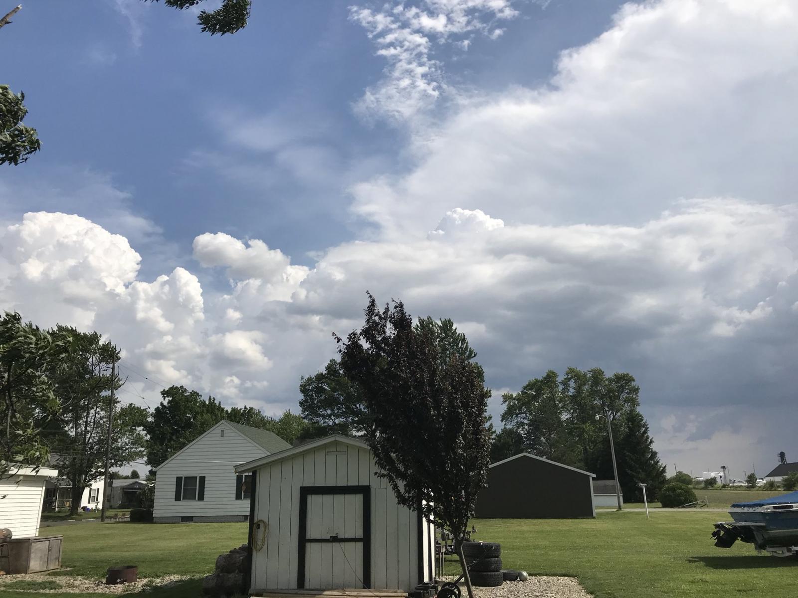 |
 |
| Ottawa, OH. Photo by Abbot Carder. | Ottawa, OH. Photo by Abbot Carder. | Ottawa, OH. Photo by Abbot Carder. | Ottawa, OH. Photo by Abbot Carder. |
 |
 |
 |
 |
| Taken on US 6. Photo by Clint B. | Tops of a cluster of T-storms just inside the Ohio State Line. Photo by Geddy Davis. | Storm near Bourbon, IN. Photo by Jack Garner. | Storm near Elkhart, IN. Photo by Tom Nielson. |
 |
 |
 |
 |
| North Webster, IN (IWX). Photo by Megan Dodson. | North Webster, IN (IWX). Photo by Megan Dodson. | North Webster, IN (IWX). Photo by Megan Dodson. | North Webster, IN (IWX). Photo by Megan Dodson. |
Storm Reports
PRELIMINARY LOCAL STORM REPORT...SUMMARY
NATIONAL WEATHER SERVICE NORTHERN INDIANA
844 PM EDT TUE JUN 13 2017
..TIME... ...EVENT... ...CITY LOCATION... ...LAT.LON...
..DATE... ....MAG.... ..COUNTY LOCATION..ST.. ...SOURCE....
..REMARKS..
0643 PM FLOOD LIBERTY CENTER 41.44N 84.01W
06/13/2017 HENRY OH EMERGENCY MNGR
REPORTS OF HIGH WATER ON SOME ROADS ACROSS
HENRY COUNTY, OH. DETAILS ON SPECIFIC ROADS
UNAVAILABLE.
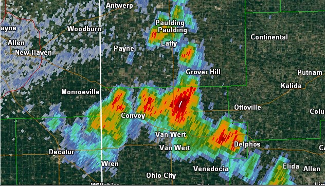
0640 PM HEAVY RAIN 3 ESE CONVOY 40.90N 84.65W
06/13/2017 M1.00 INCH VAN WERT OH TRAINED SPOTTER
TOTAL WITH ONE STORM. PEA SIZED HAIL WAS
ALSO OBSERVED. MINOR PONDING ON ROADS, SOME
MINOR FLOODING OF AGRICULTURAL FIELDS.
0608 PM HEAVY RAIN 1 SSW DEFIANCE 41.27N 84.37W
06/13/2017 M2.00 INCH DEFIANCE OH EMERGENCY MNGR
ON JEFFERSON STREET. TOTAL FROM STORMS
TODAY.
0549 PM TSTM WND DMG SOUTH WHITLEY 41.09N 85.63W
06/13/2017 WHITLEY IN EMERGENCY MNGR
TREE DAMAGE ON 500 S JUST WEST OF SR 5.
TREES WERE LARGE AND HEALTHY.
0543 PM TSTM WND DMG 1 SSE COLLAMER 41.06N 85.66W
06/13/2017 WHITLEY IN EMERGENCY MNGR
POWER LINES DOWNED ON W 700 S BETWEEN 850W
AND 900W.
0543 PM TSTM WND DMG 1 S COLLAMER 41.06N 85.66W
06/13/2017 WHITLEY IN EMERGENCY MNGR
POWER LINES DOWNED ON W 700 S BETWEEN 850W
AND 900W.
0542 PM TSTM WND DMG COLLAMER 41.07N 85.66W
06/13/2017 WHITLEY IN EMERGENCY MNGR
TREE DAMAGE ON W RIVER ROAD. TREES WERE
LARGE AND HEALTHY.
0542 PM TSTM WND DMG 1 SSW COLLAMER 41.06N 85.67W
06/13/2017 WHITLEY IN EMERGENCY MNGR
TREE DAMAGE REPORTED AT RIVER RD & CR S 950
W.
0535 PM TSTM WND DMG 2 ESE DEFIANCE 41.27N 84.33W
06/13/2017 DEFIANCE OH EMERGENCY MNGR
POWER POLES DOWNED ON HIRE ROAD. PEA SIZED
HAIL ALSO OBSERVED.
0535 PM TSTM WND DMG 2 W COLLAMER 41.08N 85.70W
06/13/2017 KOSCIUSKO IN EMERGENCY MNGR
REPORTS OF MULTIPLE TREES DOWN IN SOUTH
WHITLEY AREA. LARGE, HEALTHY TREES. WINDS
ESTIMATED AT 50-60 MPH AND NICKLE SIZED HAIL
ALSO OBSERVED AT SR 14 AND CR 700.
0530 PM TSTM WND DMG 1 E DEFIANCE 41.28N 84.35W
06/13/2017 DEFIANCE OH EMERGENCY MNGR
LIGHT POLE SNAPPED IN HALF ON EAST SECOND
STREET.
0520 PM HAIL LEIPSIC 41.10N 83.98W
06/13/2017 M0.50 INCH PUTNAM OH TRAINED SPOTTER
0516 PM HAIL DEFIANCE 41.28N 84.36W
06/13/2017 E1.00 INCH DEFIANCE OH PUBLIC
PEA UP THROUGH QUARTER-SIZED HAIL.
0512 PM HAIL ELIDA 40.79N 84.20W
06/13/2017 M0.75 INCH ALLEN OH BROADCAST MEDIA
WIND GUST TO 40 MPH ESTIMATED AS WELL.
0510 PM TSTM WND DMG 2 E ELIDA 40.79N 84.17W
06/13/2017 ALLEN OH PUBLIC
UPDATED: NEAR INTERSECTION OF GOMER RD AND
EASTOWN RD. 4-5 TREES SNAPPED, A FEW
UPROOTED. TREES WERE MOSTLY HEALTHY, ABOUT
2-3 FEET IN DIAMETER. FELL ONTO SUN ROOM OF
THE HOUSE, MINOR DAMAGE TO SUN ROOM.
NEIGHBORS BARN ROOF (WELL KEPT) WAS TORN OFF
AND THE DEBRIS FROM IT WAS SCATTERED ALMOST
TO CABLE RD.
0415 PM TSTM WND DMG 1 ENE ASHLEY 41.53N 85.05W
06/13/2017 STEUBEN IN EMERGENCY MNGR
CORRECTION FOR LOCATION: SMALL TO MEDIUM
SIZED TREES DOWN WITH FENCING AT OLD 27.
CATTLE GOT LOOSE AS A RESULT OF DAMAGE BUT
ARE NOW CONTAINED.
0328 PM HEAVY RAIN 1 WNW JIMTOWN 41.64N 86.04W
06/13/2017 M1.07 INCH ELKHART IN MESONET
1 HOUR TOTAL. STATION C1697, 1 WNW JIMTOWN.
0253 PM FLOOD 1 NE MIDDLEBURY 41.68N 85.70W
06/13/2017 ELKHART IN TRAINED SPOTTER
WATER OVER THE ROAD.
0234 PM TSTM WND DMG MIDDLEBURY 41.67N 85.71W
06/13/2017 ELKHART IN AMATEUR RADIO
A FEW SMALL LIMBS DOWNED AND A FEW SIGNS
BLOWN DOWN (SMALLER).
0216 PM HAIL 1 NE ELKHART 41.70N 85.95W
06/13/2017 E0.75 INCH ELKHART IN TRAINED SPOTTER
OBSERVED ON NORTH BAY DRIVE.
0210 PM HAIL 3 SE SIMONTON LAKE 41.72N 85.93W
06/13/2017 E0.50 INCH ELKHART IN TRAINED SPOTTER
0.25 TO 0.50 INCH DIAMETER HAIL.
0200 PM HAIL 1 ENE JIMTOWN 41.64N 86.01W
06/13/2017 E1.00 INCH ELKHART IN TRAINED SPOTTER
PEA TO QUARTER SIZED HAIL OBSERVED.
0149 PM HAIL OSCEOLA 41.67N 86.08W
06/13/2017 E0.88 INCH ST. JOSEPH IN PUBLIC
FELL FOR ABOUT FIVE MINUTES OR SO.
0126 PM HAIL 2 ESE SOUTH BEND 41.66N 86.23W
06/13/2017 M0.75 INCH ST. JOSEPH IN PUBLIC
0105 PM HAIL 3 SW SOUTH BEND 41.64N 86.30W
06/13/2017 E0.88 INCH ST. JOSEPH IN PUBLIC
DIME TO NICKEL SIZED HAIL REPORTED.
Rain Reports
Public Information Statement
National Weather Service Northern Indiana
822 PM EDT Tue Jun 13 2017

...24 hour Rainfall Reports From June 13 2017...

Location                     Amount    Time/Date       Lat/Lon

...Indiana...

...Allen County...
Fort Wayne Airport           0.74 in   0800 PM 06/13   40.98N/85.20W
Rolling Hills                0.35 in   0733 PM 06/13   41.03N/85.29W

...De Kalb County...
Auburn                       0.22 in   0732 PM 06/13   41.36N/85.06W

...Elkhart County...
1 WNW Jimtown                1.08 in   0643 PM 06/13   41.64N/86.04W
3 NE Osceola                 0.53 in   0730 PM 06/13   41.71N/86.04W
1 ENE Elkhart                0.24 in   0735 PM 06/13   41.69N/85.94W

...Huntington County...
3 NW Huntington              0.36 in   0732 PM 06/13   40.93N/85.55W
3 NE Majenica                0.10 in   0733 PM 06/13   40.82N/85.41W

...Marshall County...
Plymouth                     0.21 in   0730 PM 06/13   41.34N/86.31W
2 W Mentone                  0.19 in   0738 PM 06/13   41.18N/86.08W
Plymouth                     0.17 in   0738 PM 06/13   41.34N/86.31W

...St. Joseph County...
2 ESE Mishawaka              0.47 in   0732 PM 06/13   41.65N/86.13W
South Bend Airport           0.25 in   0800 PM 06/13   41.71N/86.31W

...Starke County...
3 N Brems                    0.58 in   0700 PM 06/13   41.39N/86.71W

...Wabash County...
2 ESE Somerset               1.07 in   0735 PM 06/13   40.66N/85.79W
Somerset                     0.67 in   0740 PM 06/13   40.66N/85.81W

...White County...
1 WNW Indiana Beach          0.28 in   0735 PM 06/13   40.80N/86.79W
Norway                       0.24 in   0645 PM 06/13   40.78N/86.76W

...Ohio...

...Allen County...
1 SSW Elida                  0.32 in   0739 PM 06/13   40.76N/84.21W

...Defiance County...
1 SSW Defiance               2.00 in   0608 PM 06/13   41.27N/84.37W

...Putnam County...
Leipsic                      0.61 in   0733 PM 06/13   41.10N/83.99W
Kalida                       0.18 in   0731 PM 06/13   40.98N/84.20W

...Van Wert County...
3 ESE Convoy                 1.00 in   0640 PM 06/13   40.90N/84.65W
Middle Point                 0.18 in   0738 PM 06/13   40.86N/84.45W

Observations are collected from a variety of sources with varying
equipment and exposures. We thank all volunteer weather observers
for their dedication. Not all data listed are considered official.
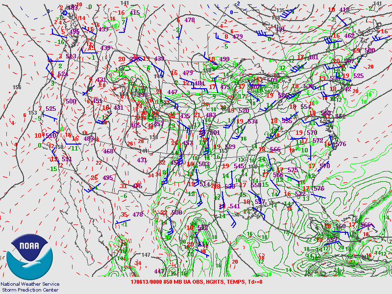
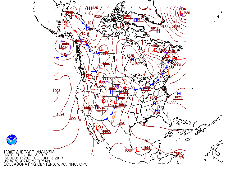
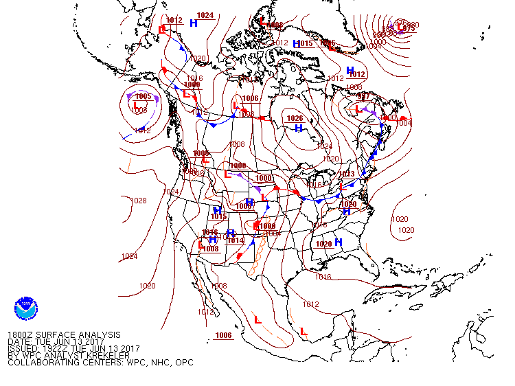
Environment
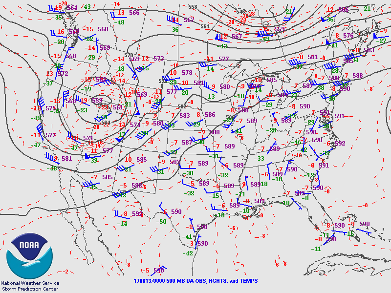
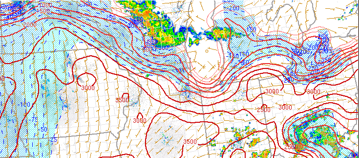
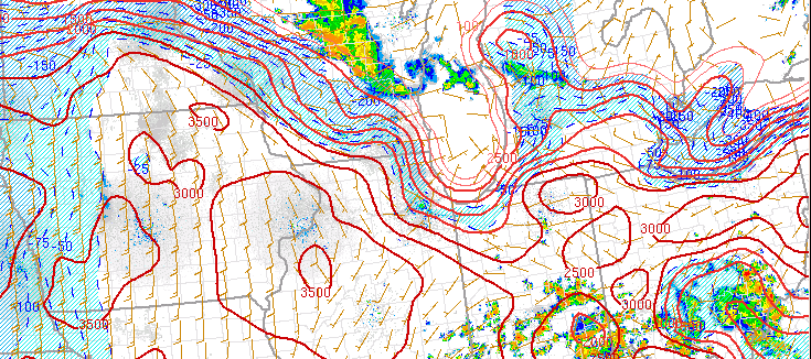
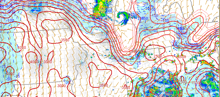
​Synoptic
A strong upper level ridge and area of surface high pressure kept our area hot and dry for a few days. High temperatures were in the upper 80's and low 90's across the region. A weak upper level disturbance was able to erode the periphery of this ridge just enough to allow for storms to pop on Tuesday afternoon, though overall forcing was weak. Given the lack of upper level support and wind shear, the storms were very pulsey in nature. This means they would develop strong "cores" then quickly collapse.
 |
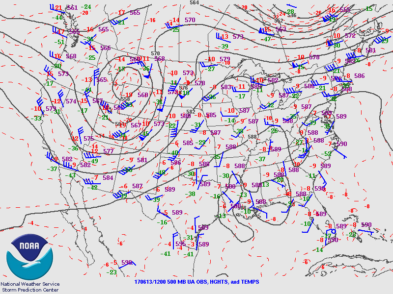 |
| Figure 1: 500 MB Map from 8 pm 6/12/17 (night prior to event) | Figure 2:500 MB Map from 8 am ET 6/13/17 (Morning of event) |
 |
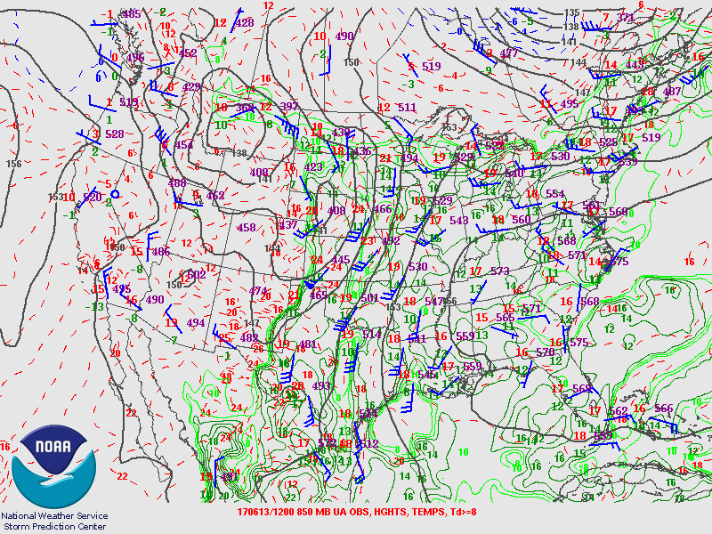 |
| Figure 3: 850MB Map from 8 pm ET 6/12/17 (night prior to event) | Figure 4: 850MB Map from 8 am ET 6/13/17 (Morning of event) |
 |
 |
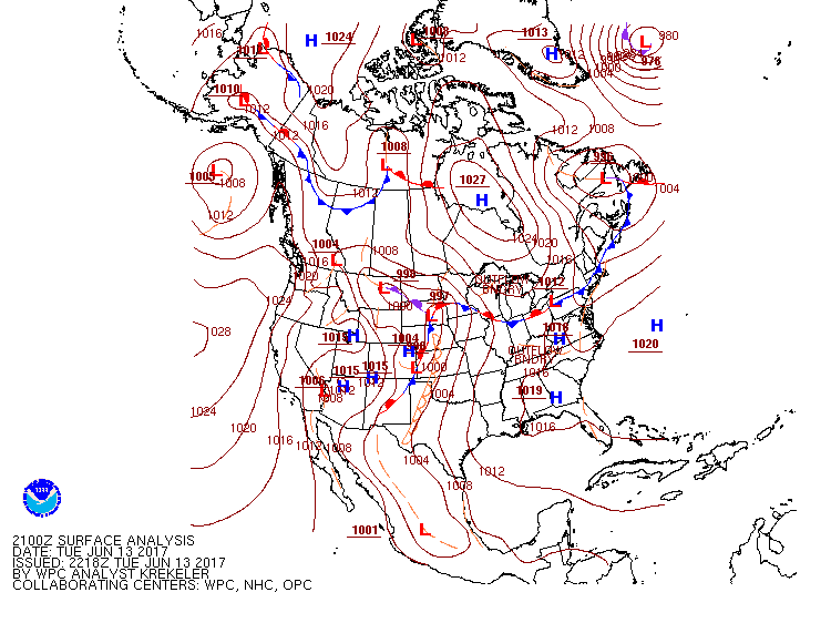 |
| Figure 5: Surface Map from 8 am ET 6/13/17 | Figure 6: Surface Map from 2 pm ET 6/13/17 | Figure 7: Surface Map from 5 pm ET 6/13/17 |
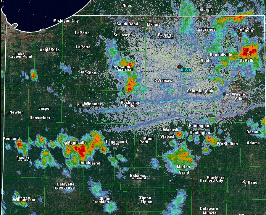
Mesoscale
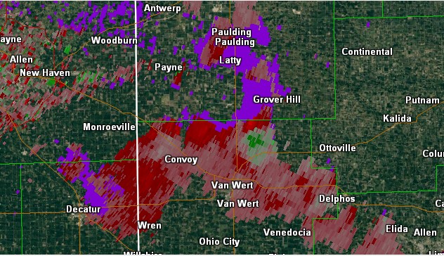
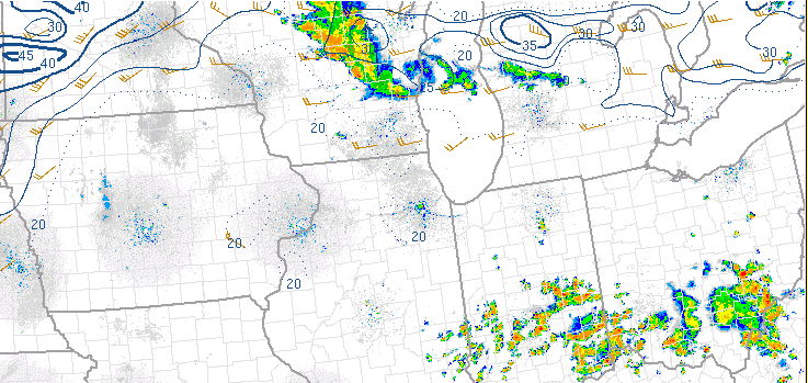
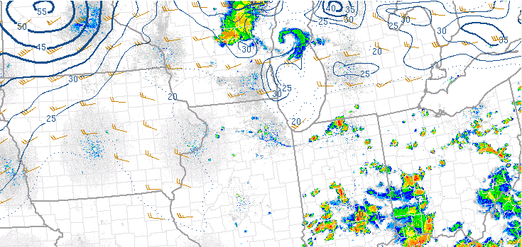
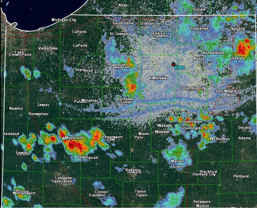
Strong to severe thunderstorms crossed parts of Lake Michigan Monday night (12th) into Tuesday morning (13th), which led to an outflow boundary that merged with the normal lake breeze. This boundary moved inland throughout the afternoon. The atmosphere was moist and very unstable, thus storms triggered along the incoming boundary as it moved inland in the early afternoon. Gradually, this boundary interacted with additional outflow from the storms that developed, and produced even more storms. Because the atmosphere was very unstable, stronger updrafts were able to reach above the freezing level and the -20C level aloft, producing hail of up to around 1" in diameter. With limited wind shear, however-the storms quickly collapsed. At times, this produced wind gusts of 30-60 mph.
 |
 |
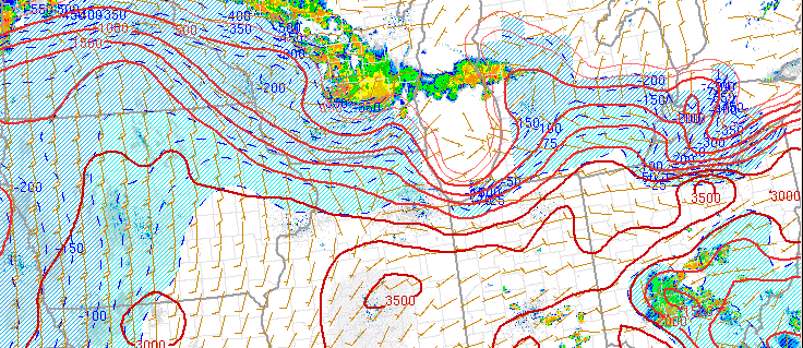 |
| Figure 8: Bulk Effective Shear (kts) at 12 pm ET 6/13/17 | Figure 9: Bulk Effective Shear (kts) at 2 pm ET 6/13/17 | Figure 10: Surface Based CAPE (J/Kg) at |
 |
 |
 |
| Figure 11: Caption | Figure 12: Caption | Figure 13: Caption |
 |
 |
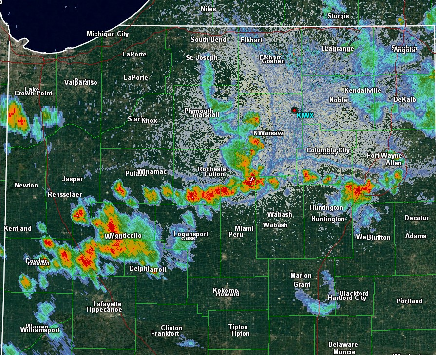 |
| Figure 14: Radar Image at 4:09 pm EDT showing complex outflow/lake breeze boundary interactions. | Figure 15: Radar Image at 4:20 pm EDT showing complex outflow/lake breeze boundary interactions. | Figure 16: Radar Image at 4:55 pm EDT showing complex outflow/lake breeze boundary interactions. |
Moisture
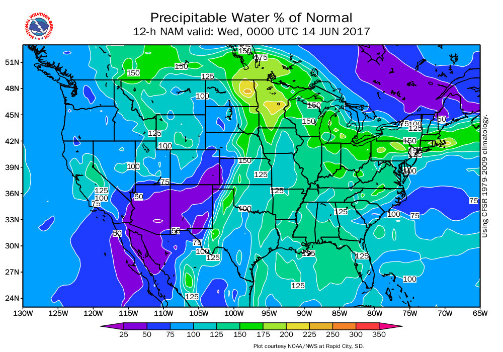
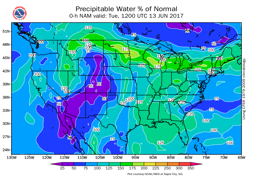
It was pretty humid around the area. Just for some perspective, the precipitable water values of 1.4-1.7 inches were about 125-175% of normal! Storms were somewhat slow moving and produced heavy rain, leading to a few reports of flooding.
 |
 |
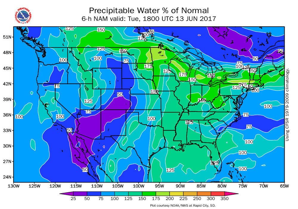 |
| Figure 17: Precipitable Water (% of Normal) at 8 pm ET 6/12/17 (Night Before Event) | Figure 18: Precipitable Water (% of Normal) at 8 am 6/13/17 | Figure 19: Precipitable Water (% of Normal) at 2 pm 6/13/17 |
 |
Media use of NWS Web News Stories is encouraged! Please acknowledge the NWS as the source of any news information accessed from this site. |
|

