Overview
An energetic disturbance, originally from the Pacific Ocean, came towards and enveloped the region with snow after cold air came in Saturday. The event started around 7 am EST from west to east as low pressure system moved through the area. As the system exited to the east an impressive single lake effect band developed pushing southward from Lake Michigan. Widespread snow across the area ranged between 3-6" with heavier amounts near the lake due to the lake effect band.Snow
A listing of all the specific snow totals can be found under the "Snow Reports" tab. Thanks to those that submitted reports to us throughout the event.
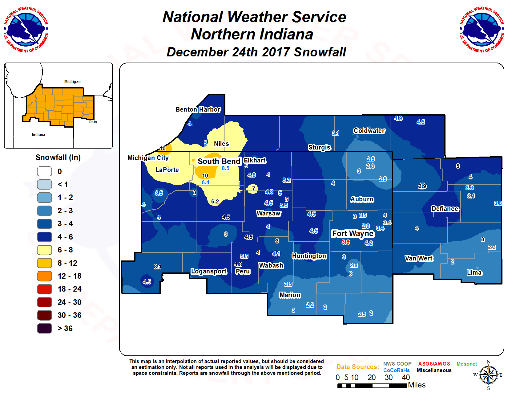 |
| Smoothed snowfall contours with reports overlaid |
Photos & Video:
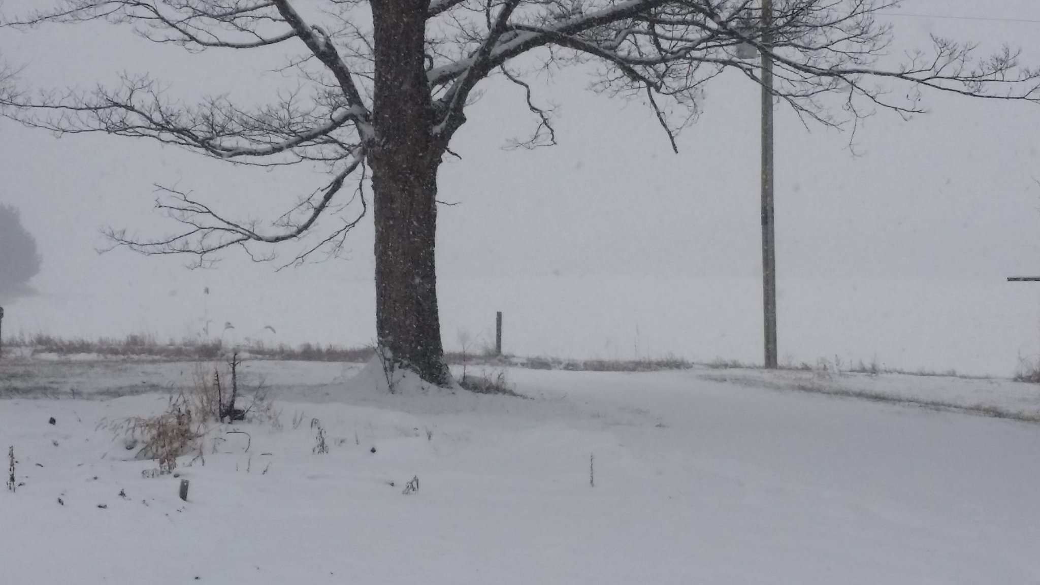
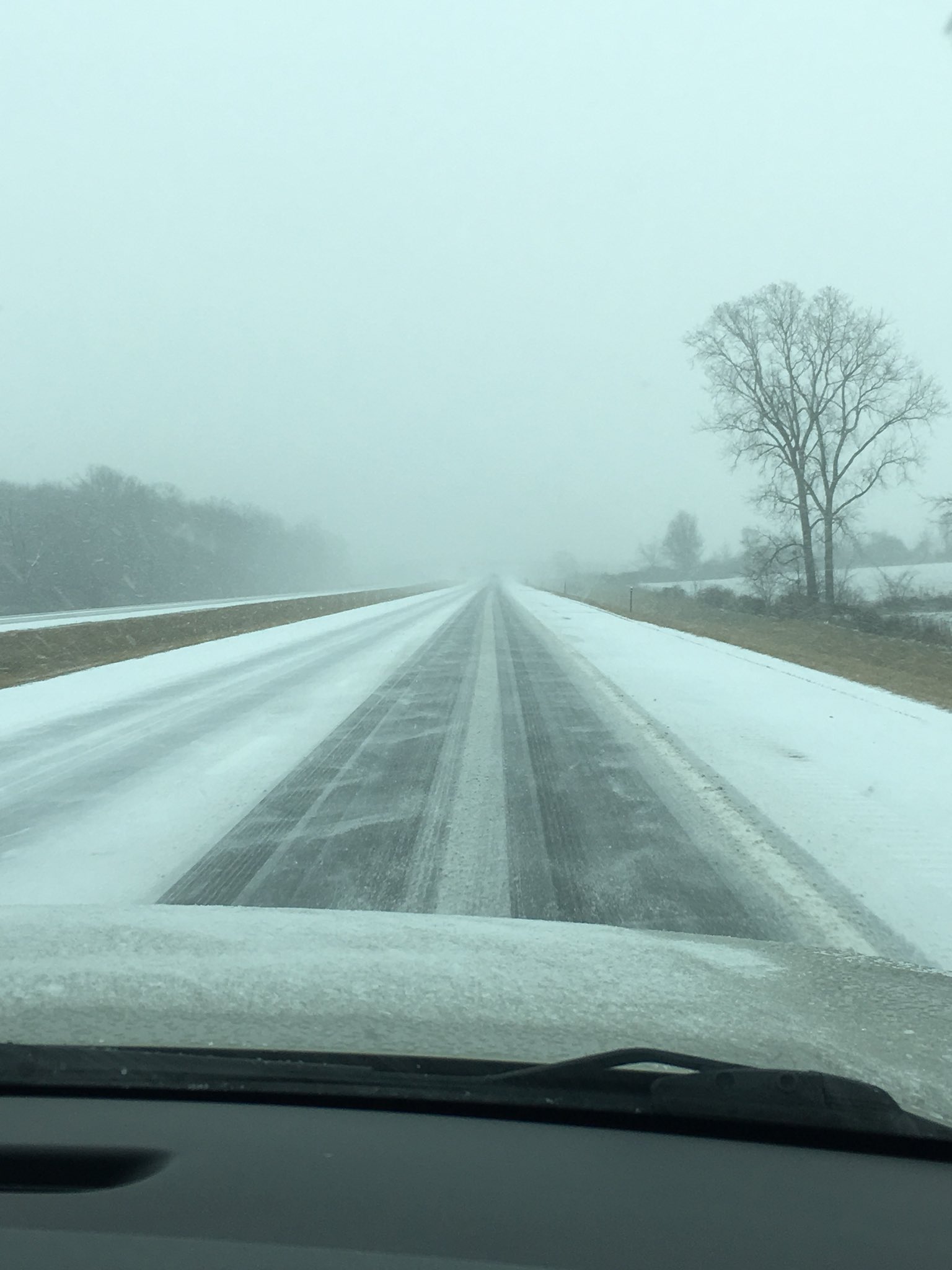
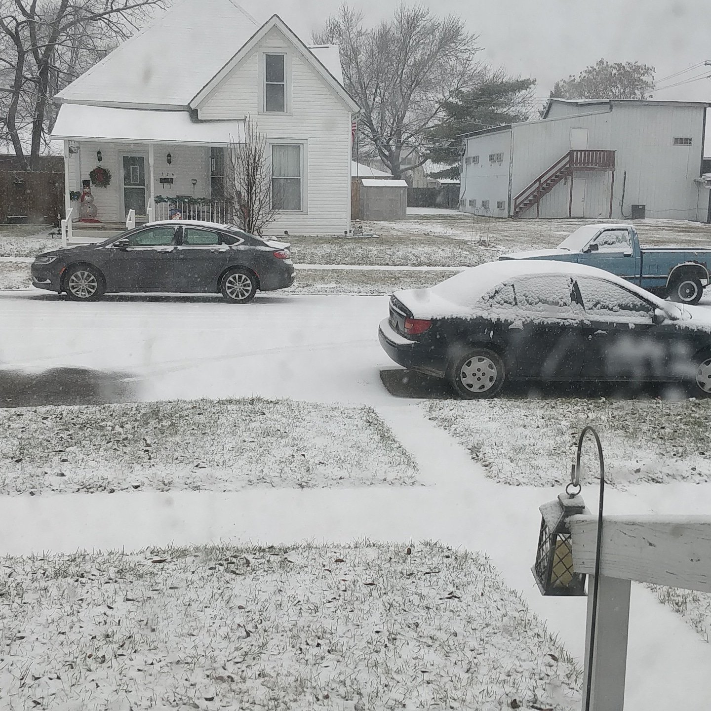
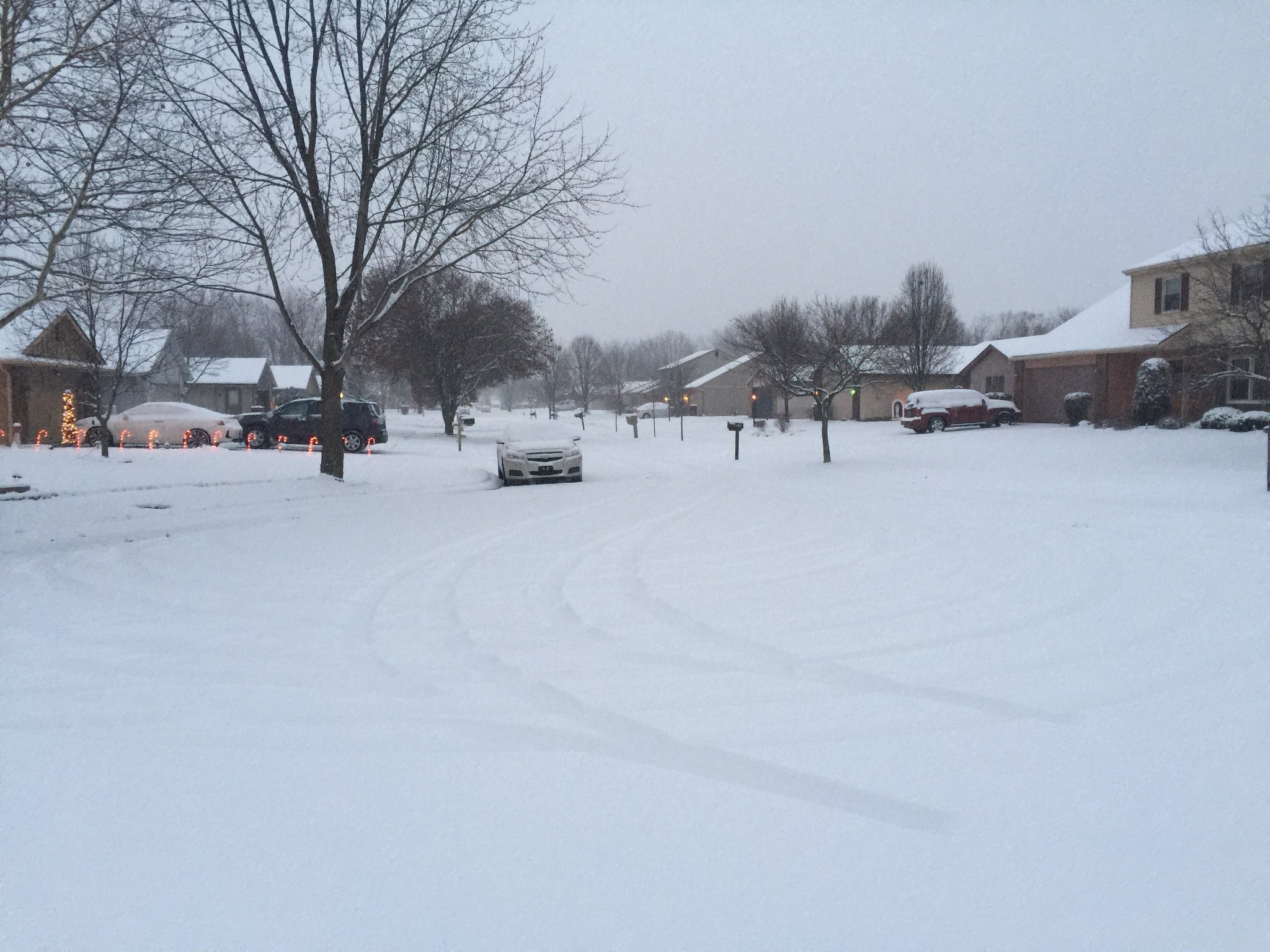
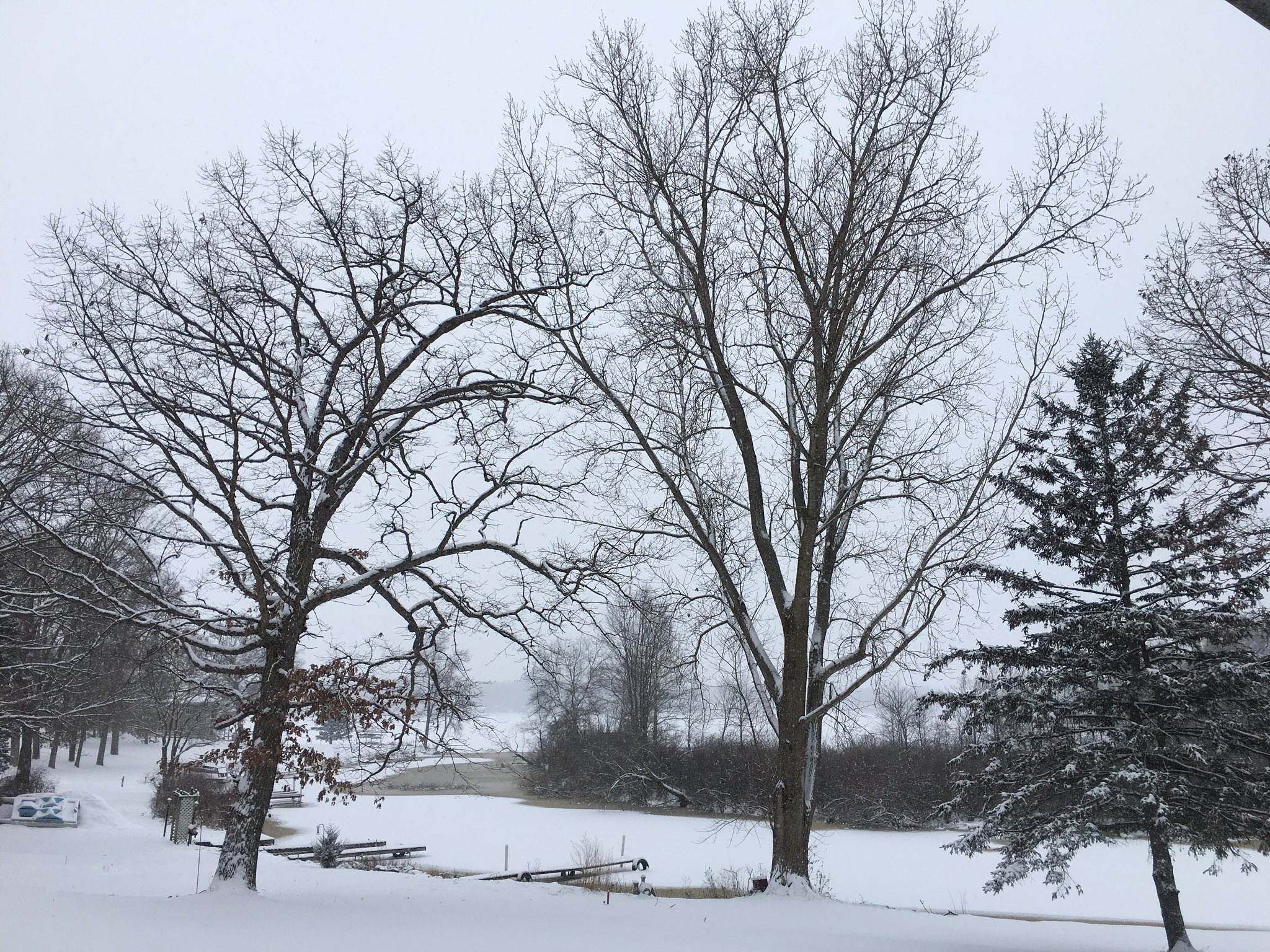
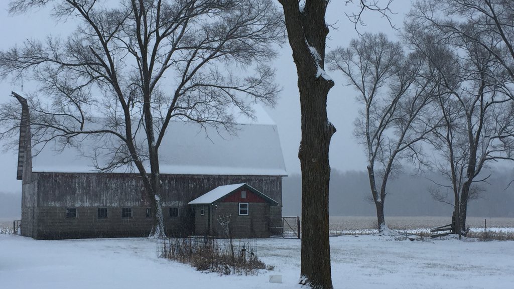
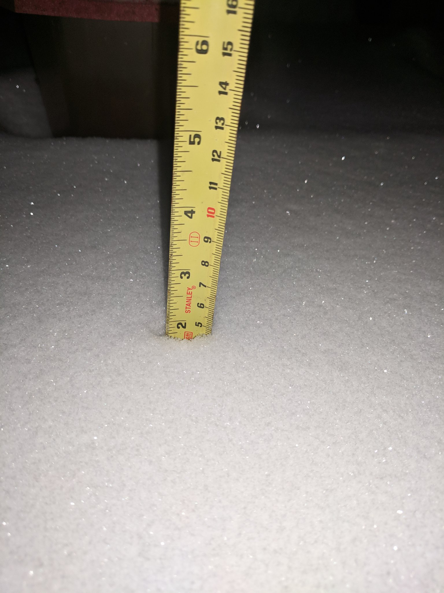
Various pictures from around the area. Special thanks to all the people who were kind enough to share their photos with us.
 |
 |
 |
 |
| The scene at Noble County, OH with low visibility and around 1 to 2" on the ground. (Via Scott Truelove) |
I-80 in Fulton County, OH at 1:45 PM with low visibility. (Via Bailey Elchinger) |
Peru, Indiana a few hours into the event at 10AM. (Via Dustin Blythe) |
Fort Wayne, Indiana where 2" was recorded at the time of the photo (5:35 PM). (Via Jay Farlow) |
 |
 |
 |
 |
| Koontz Lake IN as of 4 PM. (Via Agarikon on twitter) |
5" of snow at the time of the photo from North Liberty, IN. (Via Tom Coomes) | Around 1.75" in St Joe county MI around 6:30 PM. (Via Tommy Talbot) |
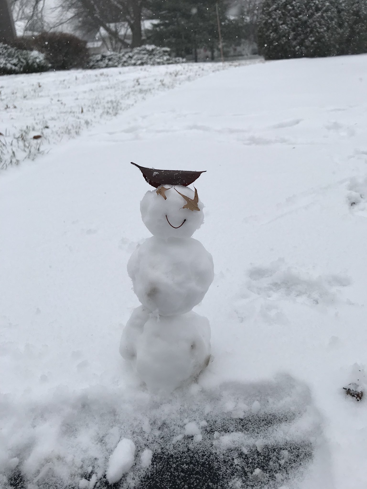
Enough snow to make a tiny snowman in Fort Wayne, IN (Via Adam Solarczyk) |
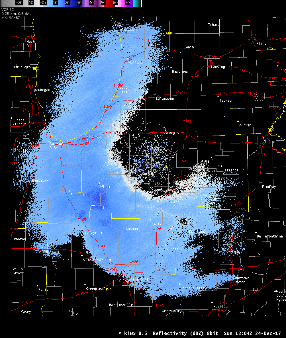
Radar:
Starting the morning of December 24, 2017 a large scale synoptic system pushed through the area. Snowfall from this system ended around 7 PM EST and then was followed by an impressive lake effect snow band.
 |
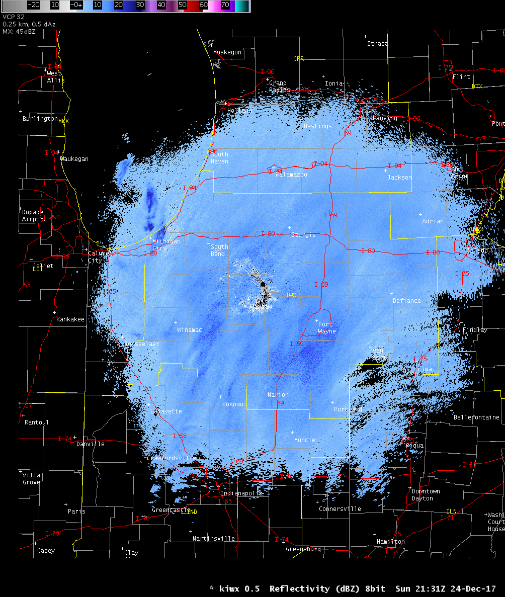 |
| Radar from the synoptic system snow storm | Radar Loop from the Lake Effect Snow Event |
Storm Reports
Public Information Statement
National Weather Service Northern Indiana
1216 PM EST Mon Dec 25 2017

...Storm Total Snowfall Through December 25th 2017 at 12 pm EST...

Location                     Amount    Time/Date       Lat/Lon

...Indiana...

...Adams County...
Decatur 1n                   3.0 in    0730 AM 12/25   40.85N/84.93W

...Allen County...
2 WSW Maples                 4.2 in    0700 AM 12/25   40.99N/85.00W
Georgetown                   4.0 in    0900 AM 12/25   41.23N/84.87W
Fort Wayne International AP  3.6 in    0654 AM 12/25   40.98N/85.19W
2 WNW Leo-cedarville         3.5 in    0800 AM 12/25   41.22N/85.06W
2 W Woodburn                 3.4 in    0700 AM 12/25   41.12N/84.91W
Woodburn 3N                  3.4 in    0700 AM 12/25   41.16N/84.85W
1 N Rolling Hills            3.1 in    0800 AM 12/25   41.05N/85.27W
2 ESE Huntertown             3.0 in    0800 AM 12/25   41.21N/85.12W
2 NE Fort Wayne              3.0 in    0700 AM 12/25   41.10N/85.11W
4 N New Haven                2.9 in    0800 AM 12/25   41.13N/85.03W

...Blackford County...
Hartford City obs. 1         3.0 in    0700 AM 12/25   40.45N/85.37W
Hartford City obs. 2         2.0 in    0700 AM 12/25   40.46N/85.37W
Hartford City 4ESE           1.9 in    0800 AM 12/25   40.44N/85.29W

...De Kalb County...
Auburn obs. 1                4.0 in    0548 PM 12/24   41.36N/85.06W
Auburn obs. 2                3.5 in    0600 AM 12/25   41.37N/85.05W
Garrett                      3.0 in    0700 AM 12/25   41.34N/85.13W

...Elkhart County...
Nappanee                     7.0 in    0815 AM 12/25   41.45N/85.98W
Millersburg                  5.2 in    0600 AM 12/25   41.53N/85.70W
1 WNW Jimtown                5.0 in    0700 AM 12/25   41.64N/86.04W
2 NNE Wakarusa               4.8 in    0700 AM 12/25   41.57N/85.99W
2 WSW Goshen                 4.4 in    0700 AM 12/25   41.56N/85.88W
1 WSW Goshen                 4.0 in    0700 AM 12/25   41.57N/85.85W
Elkhart Public Works         3.5 in    1200 AM 12/25   41.68N/86.00W

...Fulton County...
Akron                        4.5 in    0845 PM 12/24   41.53N/85.70W
Rochester                    3.0 in    0700 AM 12/25   41.07N/86.21W

...Grant County...
Marion 2N                    3.0 in    0700 AM 12/25   40.58N/85.66W
Fairmount                    3.0 in    0700 AM 12/25   40.42N/85.64W
1 NW Marion                  2.7 in    0515 AM 12/25   40.57N/85.69W
2 SE La Fontaine             2.5 in    0654 AM 12/25   40.64N/85.69W
Upland                       2.2 in    0700 AM 12/25   40.47N/85.50W
3 NW Shamrock Lakes          2.2 in    0700 AM 12/25   40.45N/85.45W

...Huntington County...
Huntington                   4.3 in    0700 AM 12/25   40.88N/85.51W

...Jay County...
1 SSW Blaine                 2.5 in    0700 AM 12/25   40.39N/85.06W
College Corner               2.0 in    0700 AM 12/25   40.40N/84.98W

...Kosciusko County...
James Lake                   5.5 in    0700 AM 12/25   41.31N/85.72W
2 N North Webster            5.0 in    0800 AM 12/25   41.36N/85.70W
Northern Indiana WFO         5.0 in    0700 AM 12/25   41.36N/85.70W
Milford                      4.8 in    0700 AM 12/25   41.42N/85.85W
Leesburg                     4.5 in    0600 AM 12/25   41.33N/85.85W
1 NNE Winona Lake            4.0 in    0913 PM 12/25   41.24N/85.80W
1 E Claypool                 4.0 in    0630 AM 12/25   41.13N/85.86W
1 SSE Monoquet               3.9 in    0630 AM 12/25   41.28N/85.86W
1 N Warsaw                   3.8 in    0600 AM 12/25   41.26N/85.85W
1 NNW Warsaw                 3.8 in    0700 AM 12/25   41.25N/85.86W

...La Porte County...
Laporte                      9.1 in    0100 AM 12/25   41.61N/86.73W
1 SW La Porte                6.8 in    0800 AM 12/25   41.59N/86.73W
2 WSW Springville            6.5 in    0730 AM 12/25   41.67N/86.78W
Michigan City                6.0 in    0900 PM 12/24   41.71N/86.88W
la Porte 1.7 SW              5.5 in    0710 AM 12/25   41.59N/86.74W
1 E Hanna                    3.0 in    0800 AM 12/25   41.41N/86.76W

...Marshall County...
Plymouth                     6.2 in    0700 AM 12/25   41.34N/86.34W
2 SE Argos                   4.5 in    0600 PM 12/24   41.21N/86.21W
Culver                       3.0 in    0350 PM 12/24   41.22N/86.42W

...Miami County....
1 NE Denver                  5.5 in    0700 AM 12/25   40.88N/86.06W
Mexico                       4.8 in    0905 PM 12/24   40.81N/86.11W
Peru                         4.6 in    0645 PM 12/24   40.75N/86.07W

...Noble County...
2 E Rome City                4.0 in    0700 AM 12/25   41.50N/85.31W
Kendallville                 3.2 in    0700 AM 12/25   41.44N/85.26W

...Pulaski County...
Francesville                 2.6 in    0900 AM 12/25   40.98N/86.89W

...St. Joseph County ..
3 NE North Liberty          10.0 in    0921 PM 12/24   41.75N/86.38W
South Bend Int.  AP          9.7 in    0654 AM 12/25   41.71N/86.32W
South Bend                   8.7 in    1200 AM 12/25   41.70N/86.25W
1 ENE Gulivoire Park         8.5 in    0800 AM 12/25   41.62N/86.22W
Georgetown                   7.1 in    1020 AM 12/25   41.73N/86.23W
2 S Mishawaka                7.0 in    1000 PM 12/24   41.63N/86.16W
1 E Indian Village           6.7 in    0700 AM 12/25   41.71N/86.21W
2 N Teegarden                6.4 in    0700 AM 12/25   41.50N/86.39W
1 NW Osceola                 4.4 in    0740 AM 12/25   41.68N/86.10W

...Starke County...
North Judson                 4.0 in    0728 AM 12/25   41.21N/86.78W
Knox Wwtp                    3.5 in    0830 AM 12/25   41.31N/86.63W
Koontz Lake                  3.0 in    0409 PM 12/24   41.42N/86.48W

...Steuben County...
1 W Golden Lake              3.0 in    0800 AM 12/25   41.60N/85.09W
Angola                       2.8 in    0700 AM 12/25   41.64N/84.99W
2 ENE Crooked Lake           2.5 in    0545 AM 12/25   41.70N/84.99W
1 E Hamilton                 2.5 in    0700 AM 12/25   41.53N/84.89W
2 WSW Golden Lake            2.4 in    0700 AM 12/25   41.59N/85.10W


...Wabash County...
Wabash                       4.0 in    0600 AM 12/25   40.80N/85.83W
Stockdale                    4.0 in    0553 PM 12/24   40.91N/85.94W
North Manchester             3.0 in    0440 PM 12/24   41.01N 85.78W

...Wells County...
Bluffton                     3.0 in    0700 AM 12/25   40.73N/85.16W

...White County...
Chalmers 5w                  4.5 in    0600 AM 12/25   40.67N/86.95W
Burnettsville 9.9 NNW        3.0 in    0250 PM 12/24   40.90N/86.65W

...Whitley County...
1 NNW Tri-lakes              4.5 in    0700 AM 12/25   41.24N/85.49W

...Michigan...

...Berrien County...
New Buffalo                 10.0 in    0947 PM 12/24   41.79N/86.75W
2 SW Granger                 8.1 in    0700 AM 12/25   41.73N/86.15W
1 ESE Buchanan               7.2 in    0700 AM 12/25   41.82N/86.34W
2 W Niles                    7.0 in    0800 AM 12/25   41.84N/86.30W
Stevensville                 6.0 in    0915 AM 12/25   42.01N/86.53W
1 WNW Buchanan               5.0 in    0600 AM 12/25   41.84N/86.39W
St. Joseph                   4.5 in    0815 AM 12/25   42.10N/86.49W
1 W Fair Plain               2.9 in    0700 AM 12/25   42.08N/86.48W

...Branch County...
3 SE Colon                   3.1 in    0700 AM 12/25   41.92N/85.28W
Coldwater St School          3.0 in    1200 AM 12/25   41.96N/84.99W

...Cass County...
Barron Lake                  7.1 in    0900 AM 12/25   41.84N/86.18W

...Hillsdale County...
1 NE Moscow                  5.0 in    0800 AM 12/25   42.05N/84.51W
Litchfield                   4.9 in    0650 AM 12/25   42.05N/84.75W
3 NW North Adams             4.5 in    0800 AM 12/25   42.01N/84.56W
1 SSE Montgomery             1.7 in    0800 AM 12/25   41.76N/84.79W

...Ohio...

...Allen County...
1 WSW Slabtown               2.0 in    0700 AM 12/25   40.77N/84.08W

...Fulton County...
Wauseon, OH                  5.0 in    1000 PM 12/24   41.55N/84.14W

...Henry County...
Napoleon Obs. 1              4.0 in    0820 PM 12/24   41.70N/84.13W
3 SE Mcclure                 3.8 in    0700 AM 12/25   41.33N/83.91W
Gallup                       3.3 in    0700 AM 12/25   41.46N/84.15W
Napoleon Obs. 2              3.1 in    0800 AM 12/25   41.39N/84.14W

...Putnam County...
Ottawa                       3.0 in    0830 PM 12/24   41.02N/84.04W

...Van Wert County...
Convoy                       4.0 in    1120 AM 12/25   40.92N/84.71W

Observations are collected from a variety of sources with varying
equipment and exposures. We thank all volunteer weather observers
for their dedication. Not all data listed are considered official.
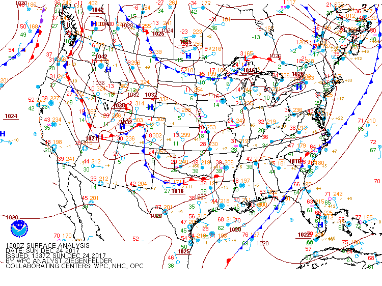
Environment
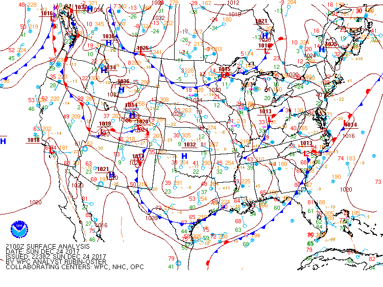
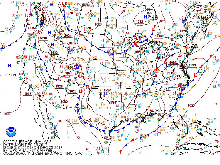
Cold temperatures came in on Saturday and an energetic disturbance from the Pacific developed into a low pressure system overhead.
 |
.gif) |
.gif) |
| Figure 1: WPC Surface Analysis: 7 am EST December 24th, 2017 | Figure 2: WPC Surface Analysis: 10 am EST December 24th, 2017 | Figure 3: WPC Surface Analysis: 1 pm EST December 24th, 2017 |
 |
 |
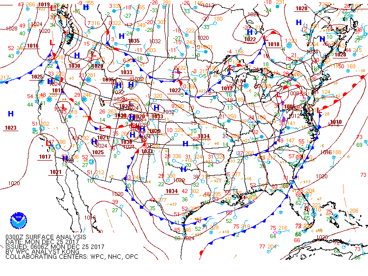 |
| Figure 1: WPC Surface Analysis: 4 pm EST December 24th, 2017 | Figure 2: WPC Surface Analysis: 7 pm EST December 24th, 2017 | Figure 3: WPC Surface Analysis: 10 pm EST December 24th, 2017 |
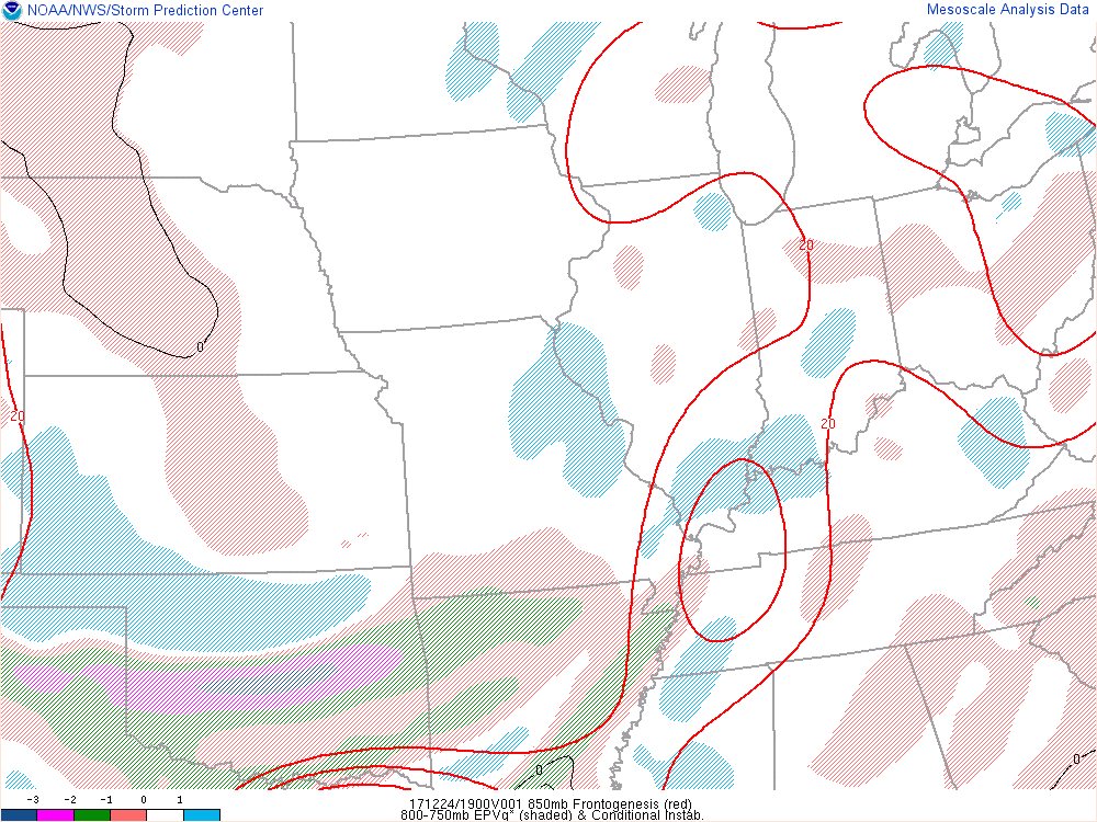
Near-storm environment summary.
 |
 |
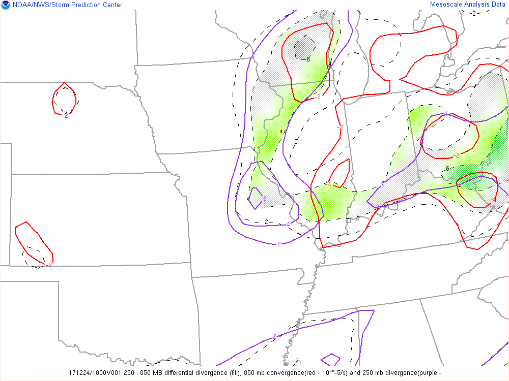 |
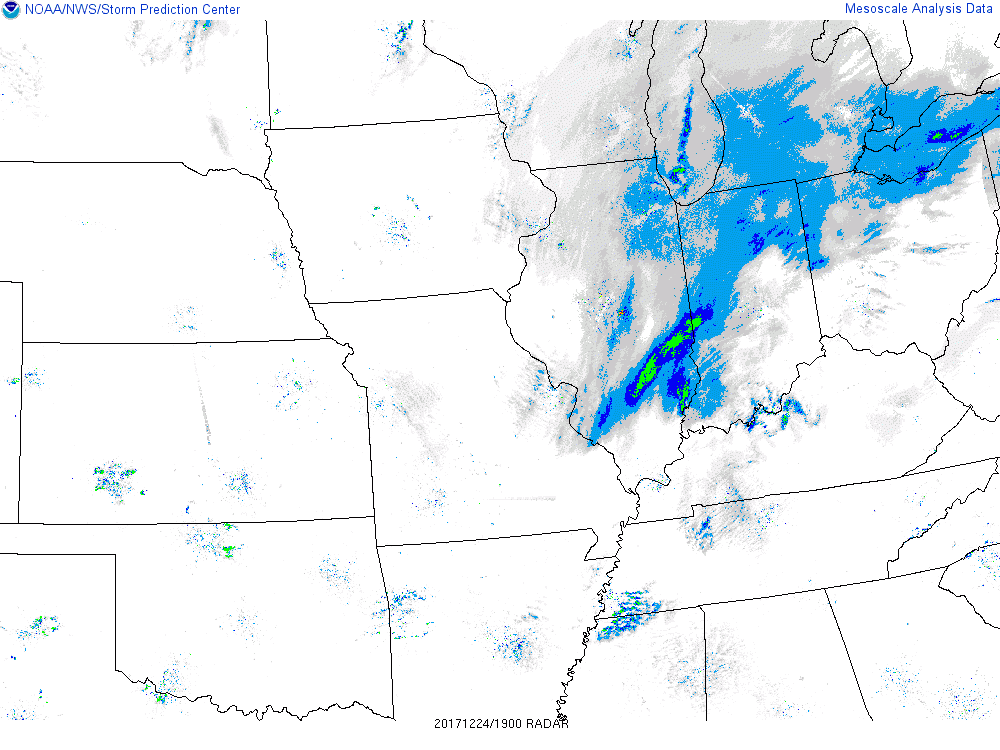
| Figure 4: SPC frontogensis and EPV - measures of atmospheric instability. (inside the red lines and red shading is instability) at 2PM EST. | Figure 5: SPC radar image that corresponded to the instability at 2PM est. Notice some of the higher returns showed up in line with the higher instability measures. | Figure 6: SPC Low level wind convergence, which is another way to indicate upward motion which contributes to higher snow totals. (1PM est) |
 |
 |
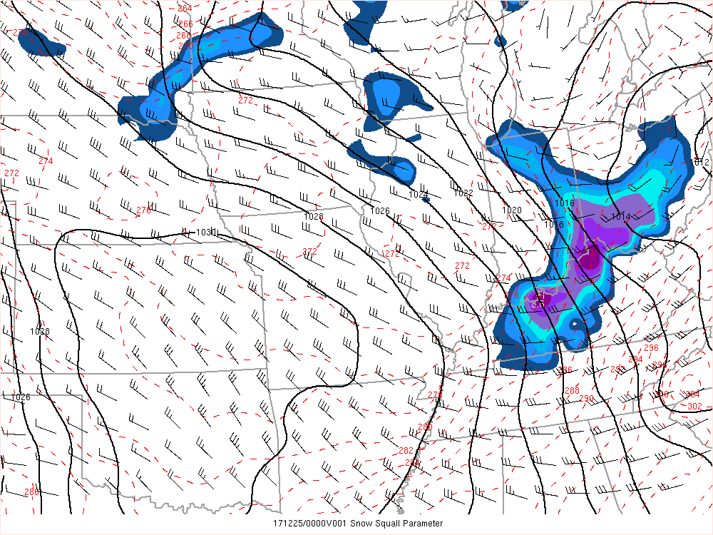 |
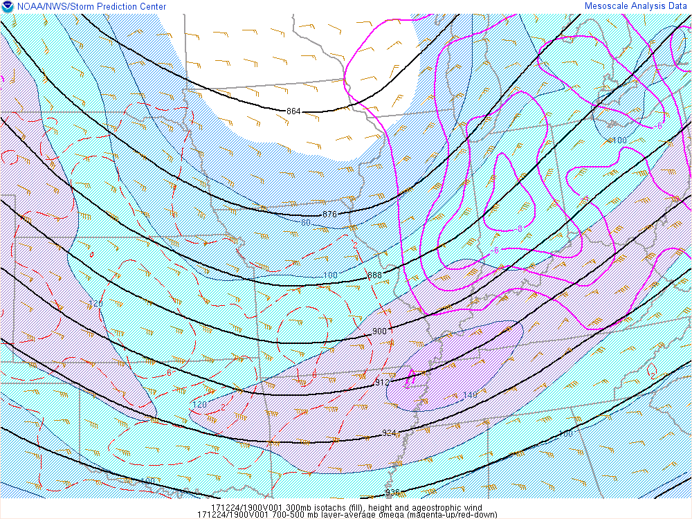
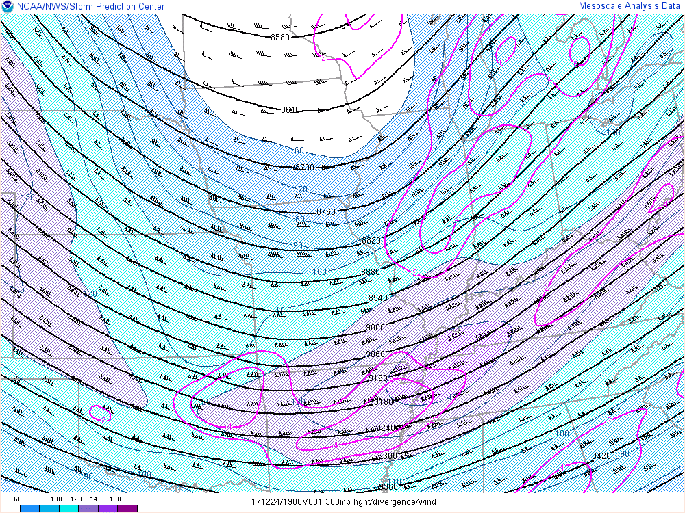
| Figure 7: SPC mid layer omega (yet another instability measure) contoured with the jet stream at 2PM. | Figure 8: SPC Upper level jet and upper level divergence adding to the instability across the region at 2PM est. | Figure 9: SPC snow squall parameter at 7pm est when the lake effect snow was intense with multiple vortices and very heavy snow. |
 |
Media use of NWS Web News Stories is encouraged! Please acknowledge the NWS as the source of any news information accessed from this site. |
|

