New Orleans/Baton Rouge
Weather Forecast Office
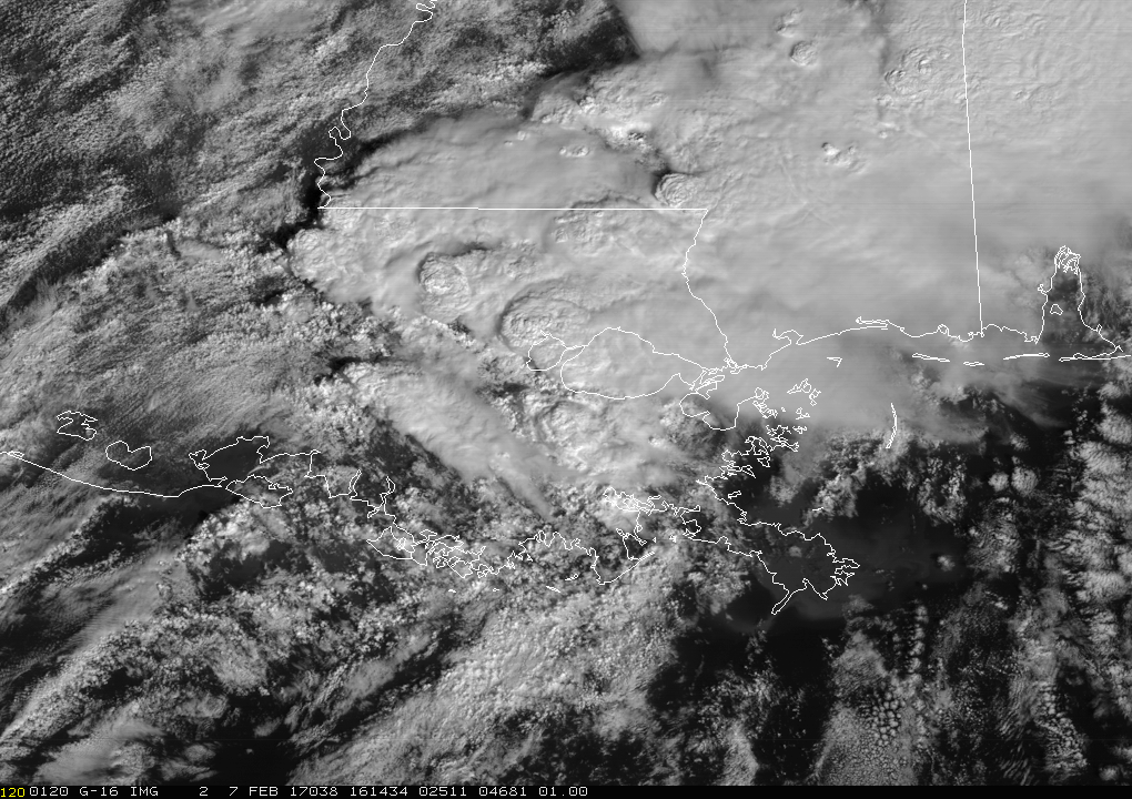
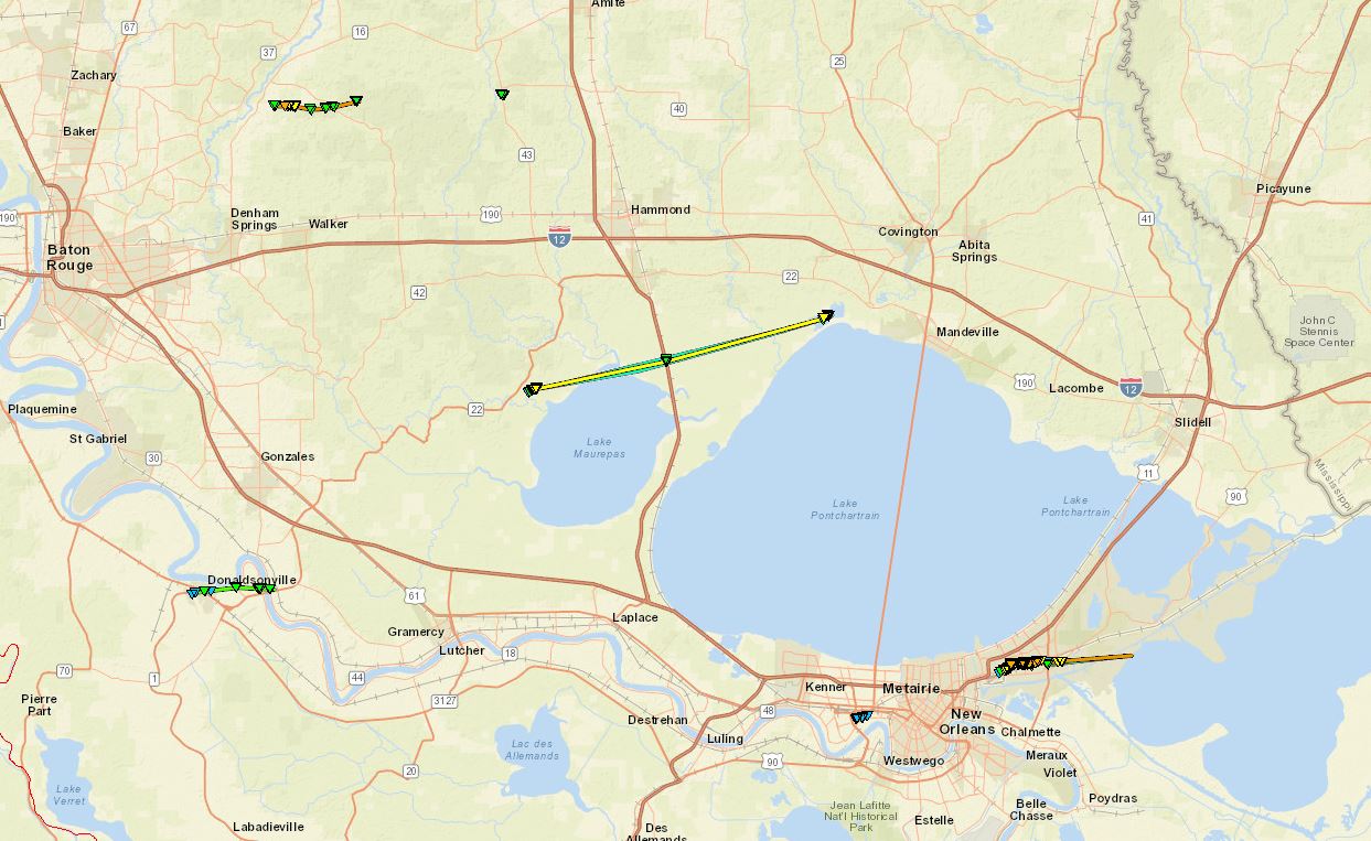
A strong upper level disturbance and related surface low produced several severe thunderstorms across the area from mid-morning through the early afternoon hours of Tuesday February 7, 2017. There were several tornadoes reported with these severe thunderstorms as they moved across the area. The most significant tornadoes impacted the New Orleans East community, the Watson area of Livingston Parish, and near Killian also in Livingston Parish.
6 tornadoes have been confirmed from this event. These tornadoes have been determined to range in strength from EF0 to EF3 after NWS storm surveys were conducted.
Current Hazards
Outlooks
Fire Manager Quick Brief
Briefing Page
Storm Prediction Center
Extended Outlooks
Forecasts
Tropical Forecast
Forecast Discussion
Aviation Weather Forecast
Graphical Forecast
Weather Models and Maps
Fire Weather Forecast
Hourly Weather Graph
Air Quality Forecasts
Marine Forecast
Activity Planner
River Forecasts
US Dept of Commerce
National Oceanic and Atmospheric Administration
National Weather Service
New Orleans/Baton Rouge
62300 Airport Rd.
Slidell, LA 70460-5243
504.522.7330 985.649.0429
Comments? Questions? Please Contact Us.

