Watson, LA Tornado - February 7, 2017
|
Rating:
|
EF-3
|
|
Estimated Maximum Wind:
|
140 mph
|
|
Injuries/Fatalities:
|
3 injuries
|
|
Damage Path Length:
|
6.43 miles
|
|
Maximum Path Width:
|
350 yards
|
|
Approximate Start Point/Time:
|
3 miles NE of Watson, LA at 1150 AM CST
|
|
Approximate End Point/Time:
|
6 miles ENE of Watson, LA at 1203 AM CST
|
|
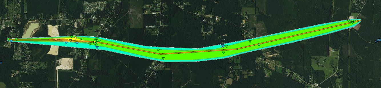
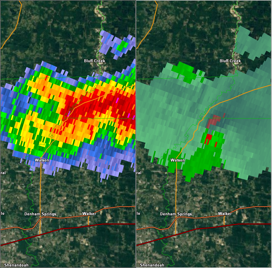
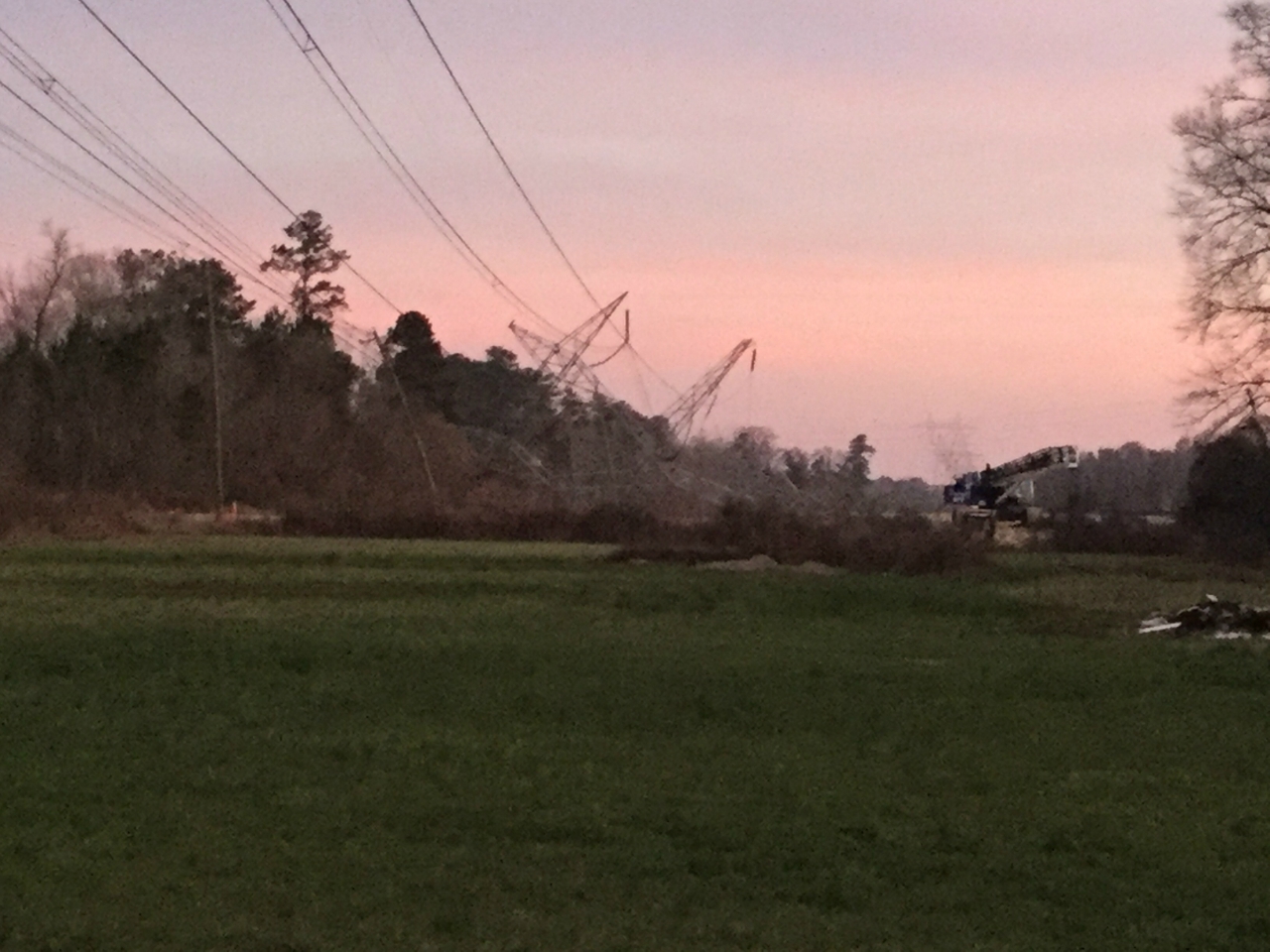
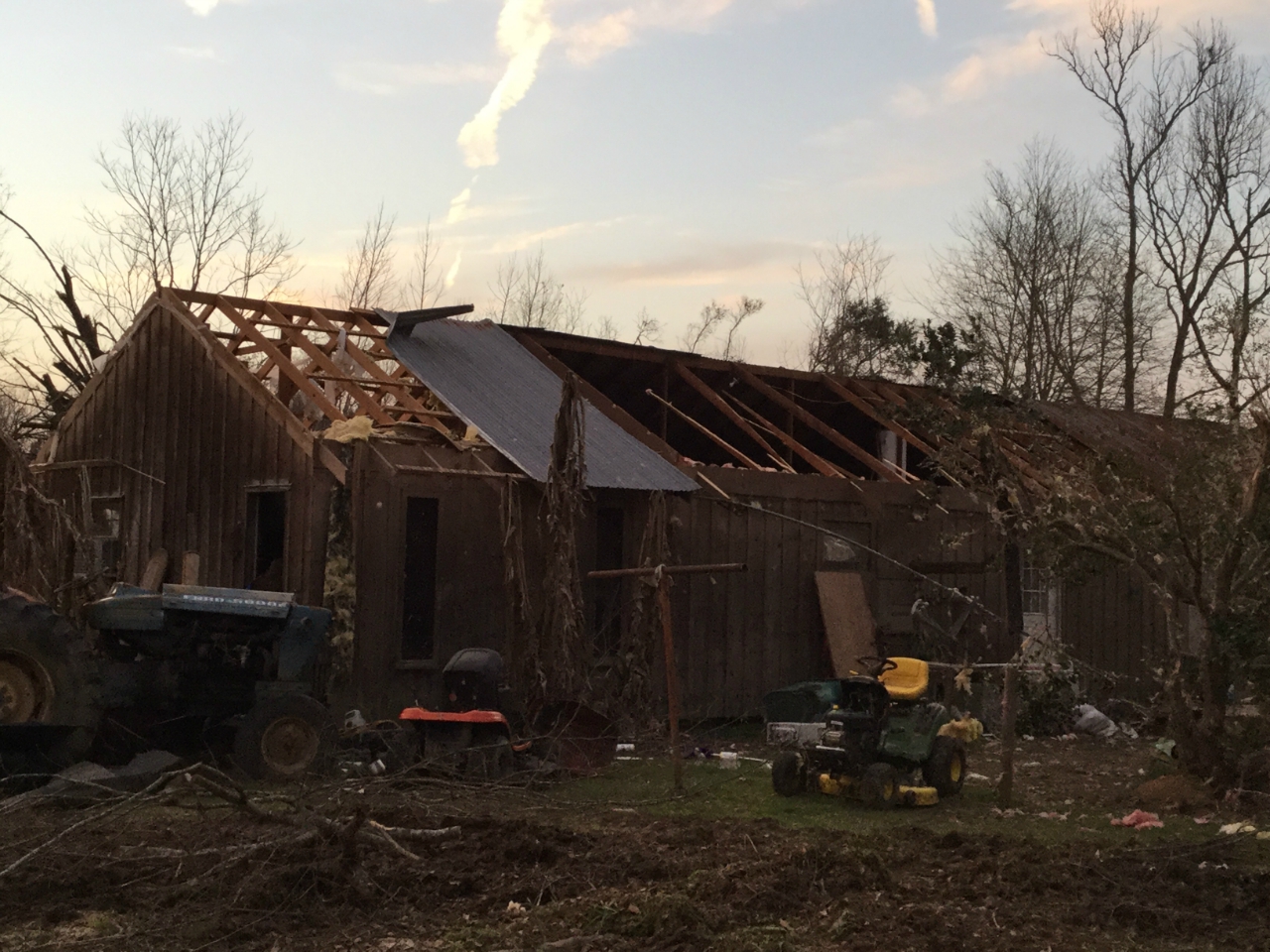
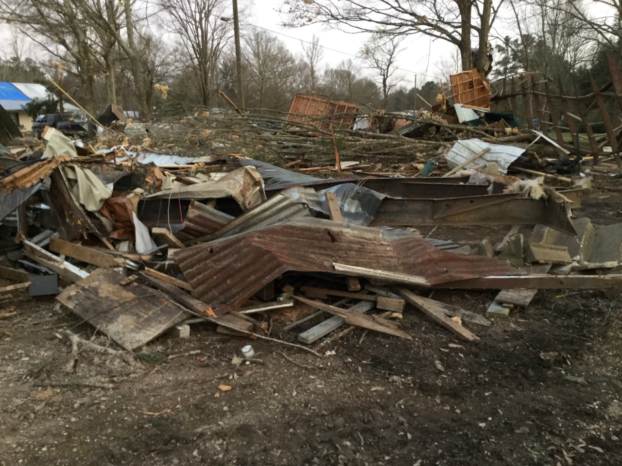
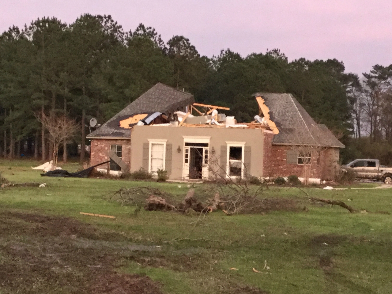
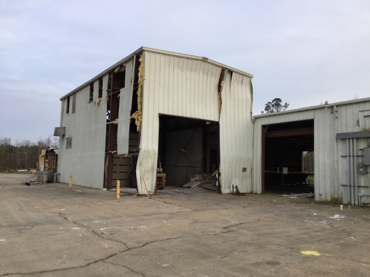
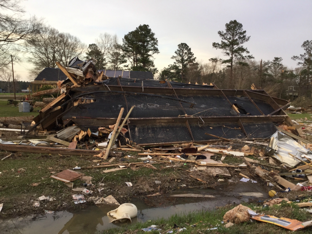
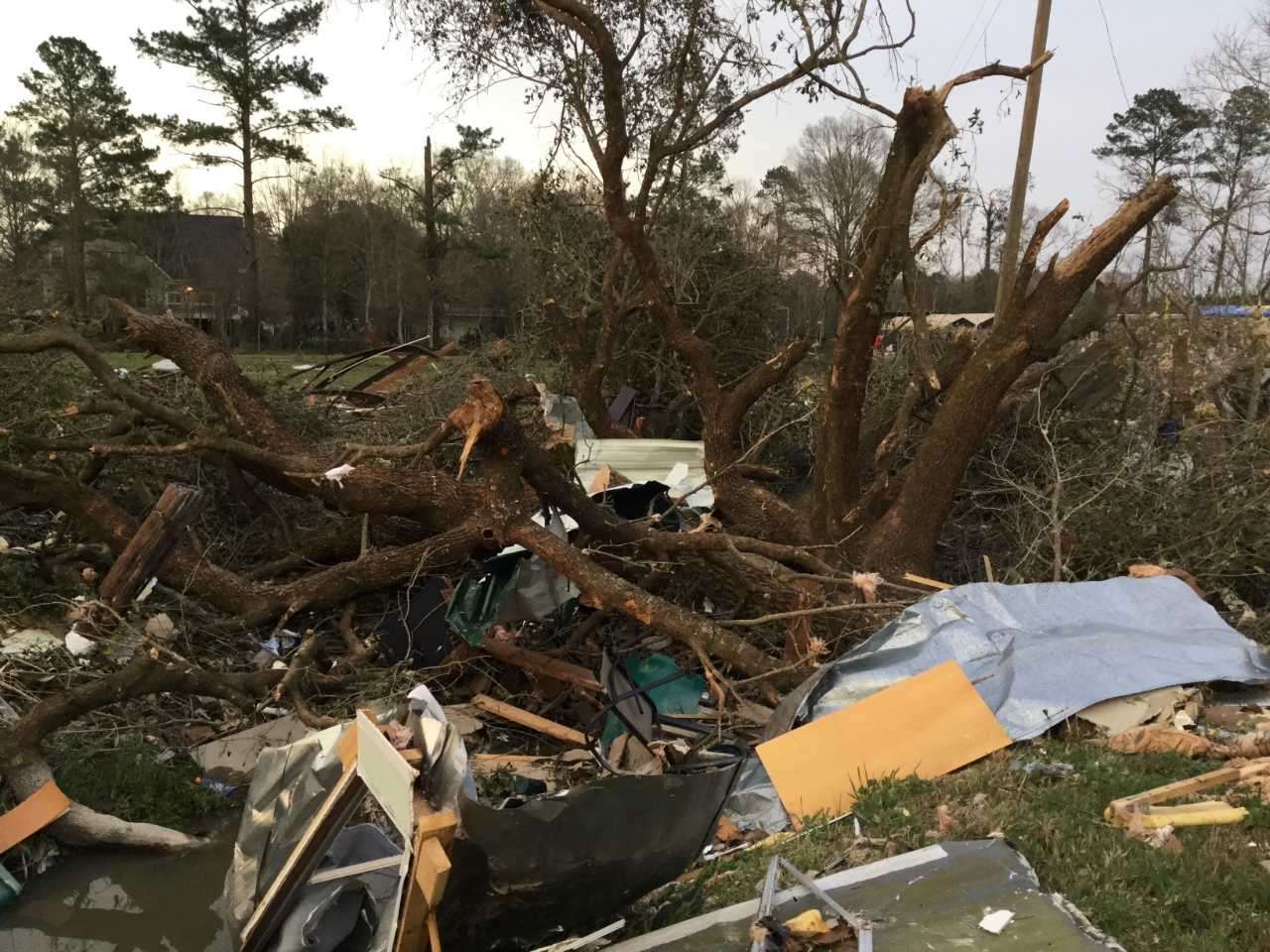
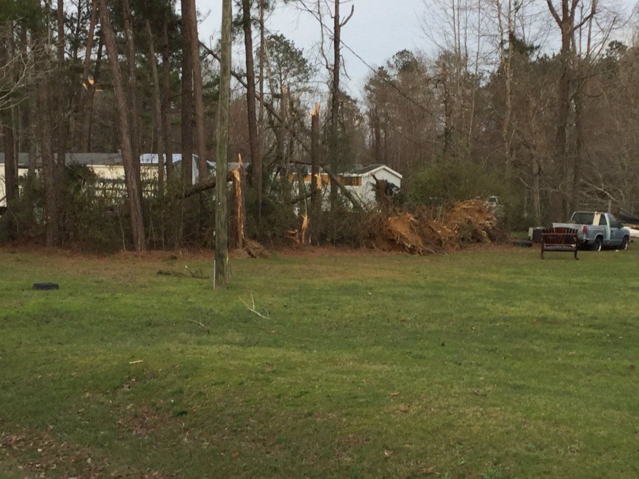
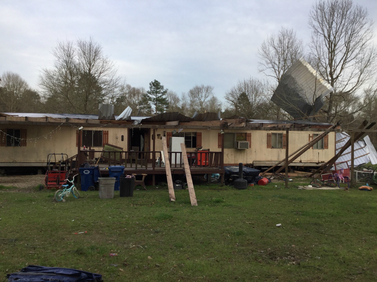
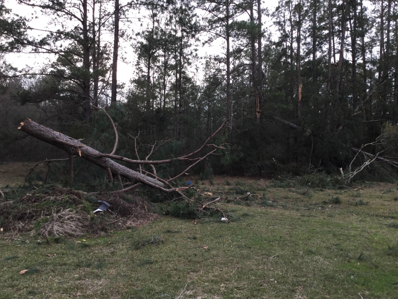
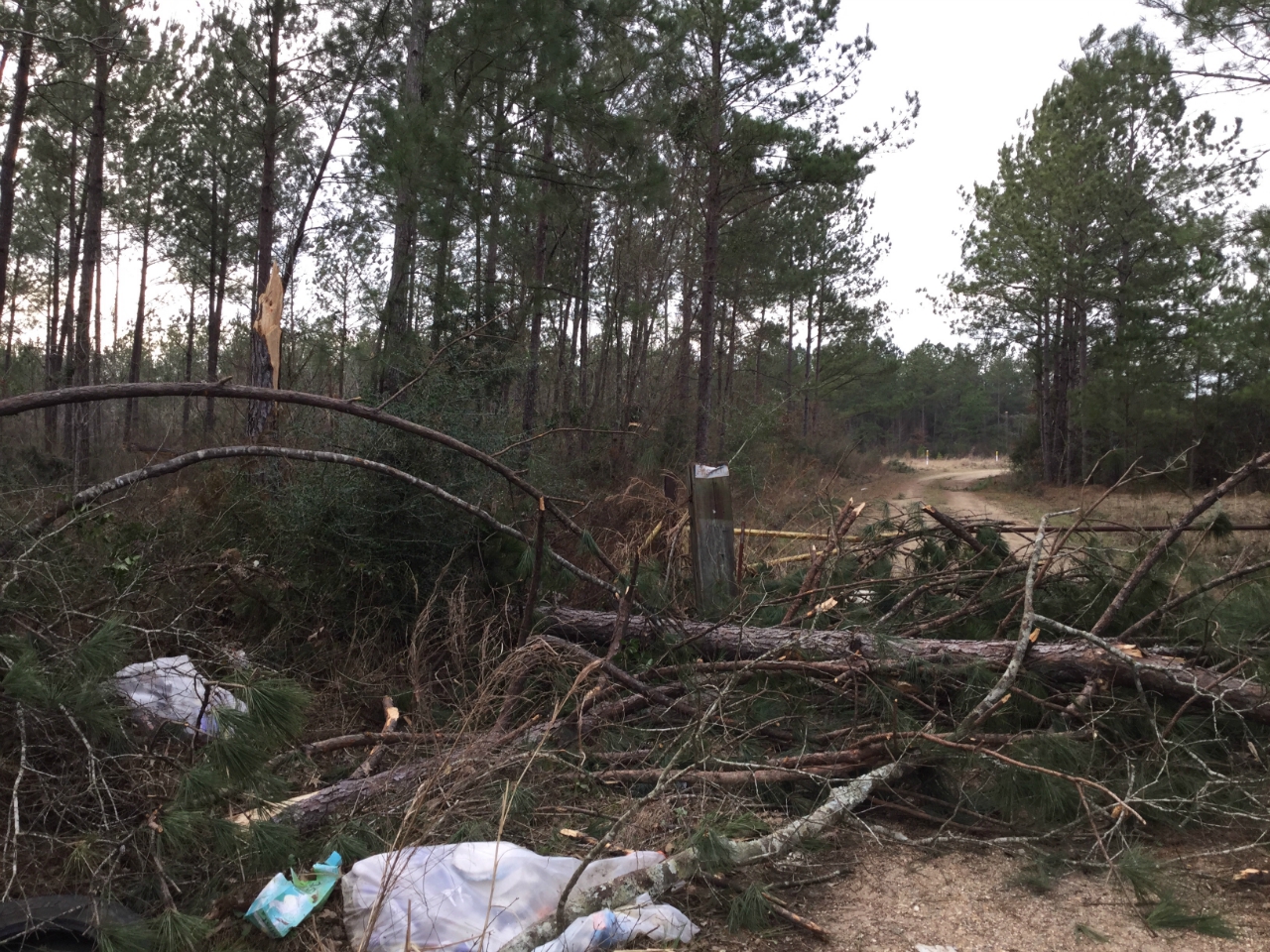
A National Weather Service Damage Assessment Team has surveyed the storm damage near Watson, LA. It has been determined the damage was the result of a tornado. The tornado has been rated an EF-3 on the Enhanced Fujita Scale. Damage estimates were consistent with winds of 140 mph. The tornado first touched down on Little Woods Dr. and proceeded due east just north of Percy Easterly Road. The tornado was initially a narrow 25 yards wide, but quickly widened to over 100 yards wide as it moved east through a stand of trees. Intensity in this area was EF-1 level with estimated winds of around 100 mph. The tornado then continued to the east and rapidly intensified as it approached some high tension electrical lines running in a north-south direction between Little Woods Dr. and Nan Westerly Rd. The tornado was estimated to be approximately 200 yards wide at this point, and winds were estimated at 140 mph or EF-3 strength due to the metal truss system supporting the electrical lines being twisted and collapsed. As the tornado approached Nan Westerly Rd. it widened considerably to around 350 yards, and also decreased slightly in intensity to a high end EF-2 tornado. Three manufactured homes were completely destroyed with only the metal undergirding remaining. All walls and floors were removed. Two single family homes in this area had significant roof damage with support beams removed. Numerous hardwood trees were also snapped in this area. Winds were estimated to be around 125 mph at this point. The tornado continued eastward across a fairly open field until it impacted several homes and an industrial building on Highway 1023 or Renninger Road. The tornado maintained the same width as it crossed the road at around 350 yards, and produced more EF-2 damage with winds remaining around 125 mph. A manufactured home was completely destroyed, and the industrial building had most of the exterior wall on one side of the building removed. Numerous hardwood trees including a large live oak also had trunks snapped in this area. The tornado continued to the east, and decreased in intensity to EF-1 with winds of approximately 100 mph as it crossed Highway 447, Joe Lee Road, Highway 63, and Highway 449. Several manufactured homes experienced minor damage on Highway 447 and Joe Lee Road with the worst damage noted on Joe Lee Road where a home had partial uplift of tin roofing material. Numerous softwood trees were also snapped along the path of the tornado. Damage was noted after it crossed into the woods east of Highway 449, but the lack of access prohibited further assessment. Tornadic activity was not observed further to the east on Highway 1036 or Highway 441. |
|
|
|
|
||||||||||||||||||||