New Orleans/Baton Rouge
Weather Forecast Office
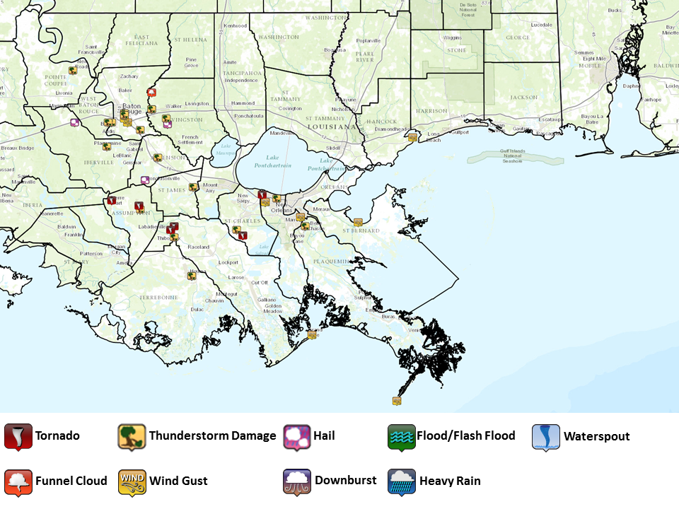
Several Tornadoes and Strong Straight Line Winds Impact Southeast Louisiana April 27th, 2015A strong squall line with several embedded bow echoes and tornadoes impacted much of Southeast Louisiana on Monday April 27th, 2015. At this time, 5 tornadoes have been confirmed from this event. Of the 5 tornadoes, 3 were rated EF1 and 2 were rated EF0. A widespread area extending across the Baton Rouge and New Orleans metro areas experienced damaging straight line winds in excess of 70-80mph.
Damage Surveys:
|
Current Hazards
Outlooks
Fire Manager Quick Brief
Briefing Page
Storm Prediction Center
Extended Outlooks
Forecasts
Forecast Discussion
Aviation Weather Forecast
Graphical Forecast
Weather Models and Maps
Fire Weather Forecast
Hourly Weather Graph
Air Quality Forecasts
Marine Forecast
Activity Planner
River Forecasts
Tropical Forecast
US Dept of Commerce
National Oceanic and Atmospheric Administration
National Weather Service
New Orleans/Baton Rouge
62300 Airport Rd.
Slidell, LA 70460-5243
504.522.7330 985.649.0429
Comments? Questions? Please Contact Us.