Baton Rouge, LA Tornado - June 24, 2020
|
Rating:
|
EF-1
|
|
Estimated Maximum Wind:
|
110 mph
|
|
Injuries/Fatalities:
|
None
|
|
Damage Path Length:
|
3.8 miles
|
|
Maximum Path Width:
|
100 yards
|
|
Approximate Start Point/Time:
|
Baton Rouge, LA at 447 AM CDT
|
|
Approximate End Point/Time:
|
Baton Rouge, LA at 500 AM CDT
|
|
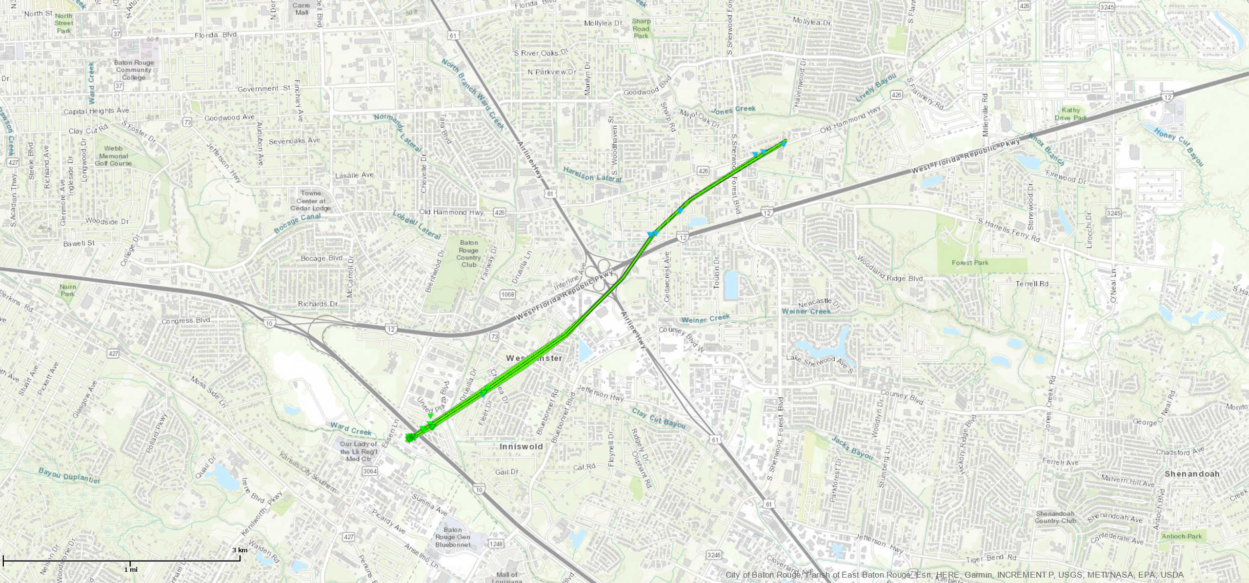
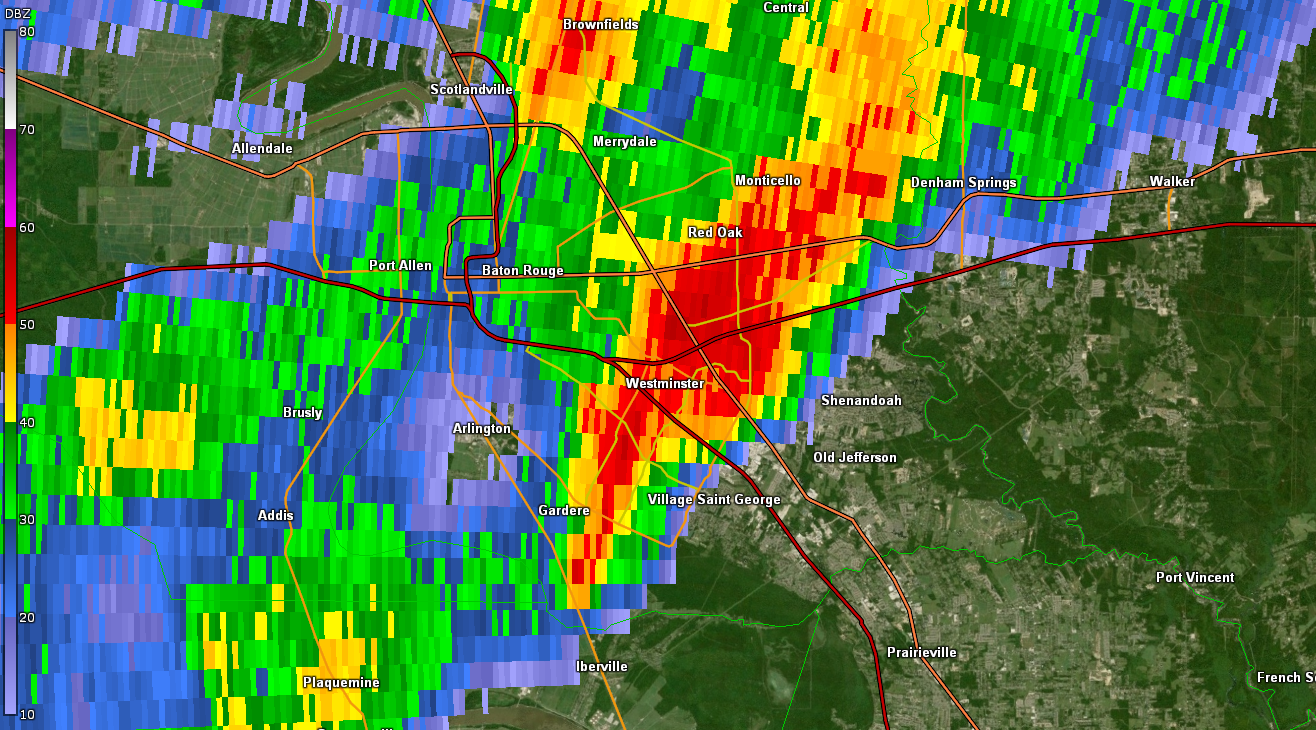
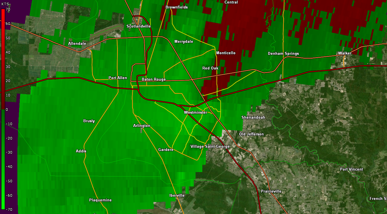
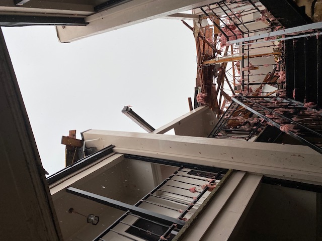
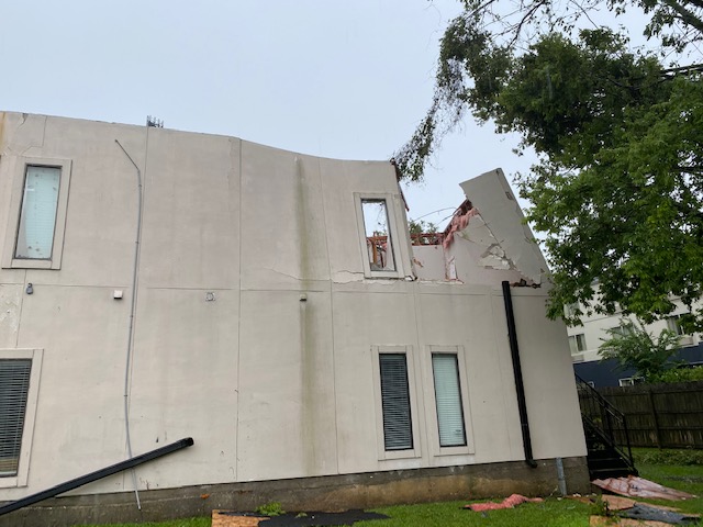
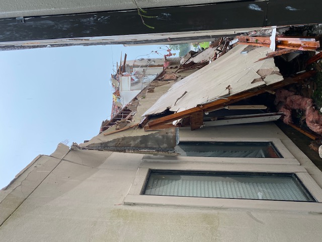
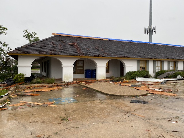
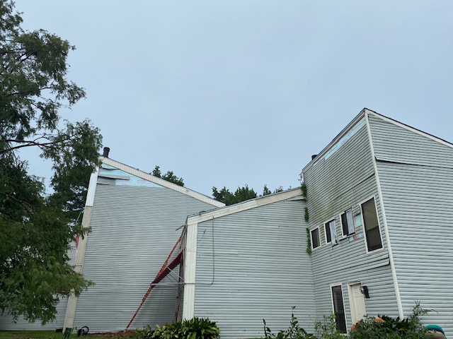
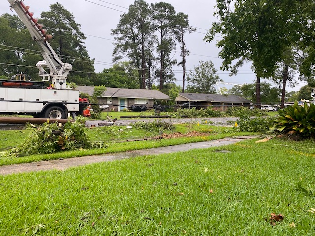
A National Weather Service Damage Assessment Team has surveyed the storm damage in Baton Rouge, LA. It has been determined the damage was the result of a tornado. The tornado has been rated an EF-1 on the Enhanced Fujita Scale. Damage estimates were consistent with winds of 110 mph. The tornado first touched down near Essen Park Avenue, just south of the Interstate 10 near Essen Lane. It produced minor roof damage to the Fairfield Inn, snapped a few smaller trees and knocked down a light pole. The tornado rapidly intensified, producing significantly more damage just moments later. As the tornado reached two Ammon Staffing buildings, it downed fencing, peeled the northern side metal roof of, and blew out a window on the east side of the building. Of the two buildings, the western one was damaged the most. More than half its flat roof was ripped off or collapsed. There was a partial collapse of the southwest exterior wall on the second story. It is suspected that a large limb or some other object hit that corner of the building, which could have aided in the lifting of the roof. No roof straps were seen during the survey. The tornado also damaged the roof of a building just to the east of the Ammon Staffing Buildings. Only the center section of the roof was removed and the rafters actually remained intact. Based on the overall damage of these 3 buildings, a peak wind speed of 110 mph was given at this point which was the strongest point of the tornado's track. These winds carried over into those building's parking lot to carry debris and, based on tire slide marks, may have pushed a vehicle through a chain link fence to the interstate on-ramp. The tornado the crossed Interstate 10. On the north side of the interstate, it downed smaller trees, ripped off some vinyl siding and damaged the roof slightly. The tornado continued northeastward, downing several large trees and powerlines along Essen Heights Ct. The tornado then moved through Westminster, downing multiple trees across several streets. As the tornado passed over Westminster Elementary School, it damaged the school sign and ripped skirting of modular classrooms. The strength of the tornado would generally only weaken from this point onward. Tree damage persisted along a path through the I-12 and Airline Highway intersection. Minor commercial building window damage was noted near the Costco. The last few points of damage were just east-northeast of this location through Cedarcrest Avenue and finally Old Hammond Highway just east of Sherwood Blvd.
|
|
|
|
|
||||||||||||||