New Orleans/Baton Rouge
Weather Forecast Office
Ford's Creek, MS Tornado - February 23, 2016
|
Rating:
|
EF-1
|
|
Estimated Maximum Wind:
|
90 mph
|
|
Injuries/Fatalities:
|
None
|
|
Damage Path Length:
|
2.5 miles
|
|
Maximum Path Width:
|
75 yards
|
|
Approximate Start Point/Time:
|
5.6 miles E of Angie, LA at 350 PM
|
|
Approximate End Point/Time:
|
6.6 miles NE of Angie, LA at 354 PM
|
|
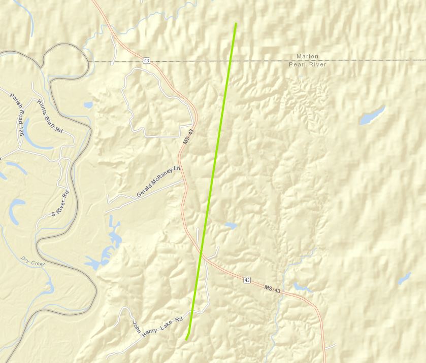
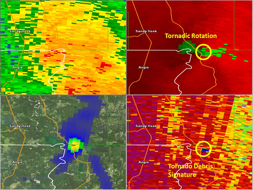
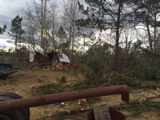
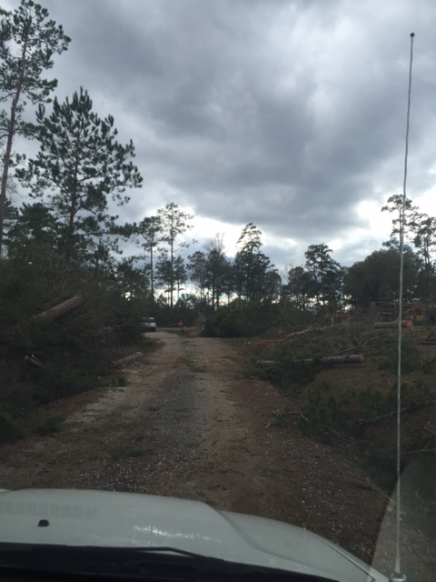
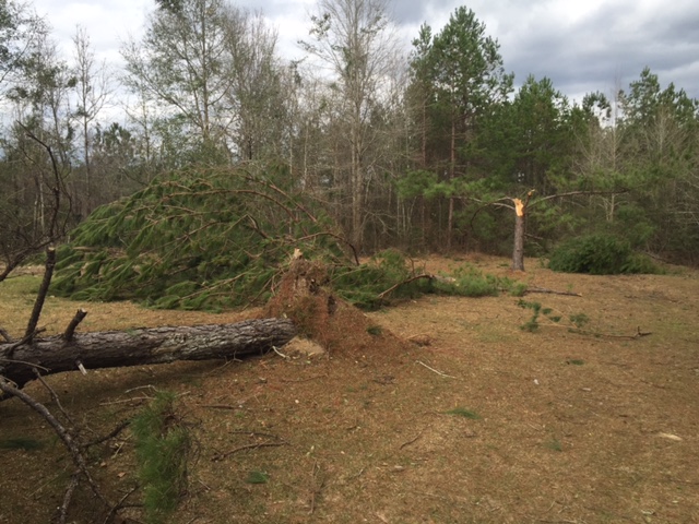
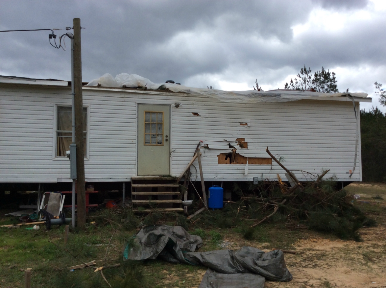
A National Weather Service Damage Assessment Team has surveyed the storm damage in northwest Pearl River County, MS near Ford's Creek. It has been determined the damage was the result of a tornado. The tornado has been rated an EF-1 on the Enhanced Fujita Scale. Damage estimates were consistent with winds of 90 mph. This tornado was surveyed by NWS WFO Jackson. Damage consisted of a mobile home shifted of its foundation, and numerous snapped trees. The tornado continued into Lamar County, MS. The tornado damage path in our parish/county warning area was 2.5 miles long and was 75 yards wide at its widest point. |
|
|
|
|
||||||||||||
Current Hazards
Storm Prediction Center
Extended Outlooks
Outlooks
Fire Manager Quick Brief
Briefing Page
Forecasts
Hourly Weather Graph
Air Quality Forecasts
Marine Forecast
Activity Planner
River Forecasts
Tropical Forecast
Forecast Discussion
Aviation Weather Forecast
Graphical Forecast
Weather Models and Maps
Fire Weather Forecast
US Dept of Commerce
National Oceanic and Atmospheric Administration
National Weather Service
New Orleans/Baton Rouge
62300 Airport Rd.
Slidell, LA 70460-5243
504.522.7330 985.649.0429
Comments? Questions? Please Contact Us.