New Orleans/Baton Rouge
Weather Forecast Office
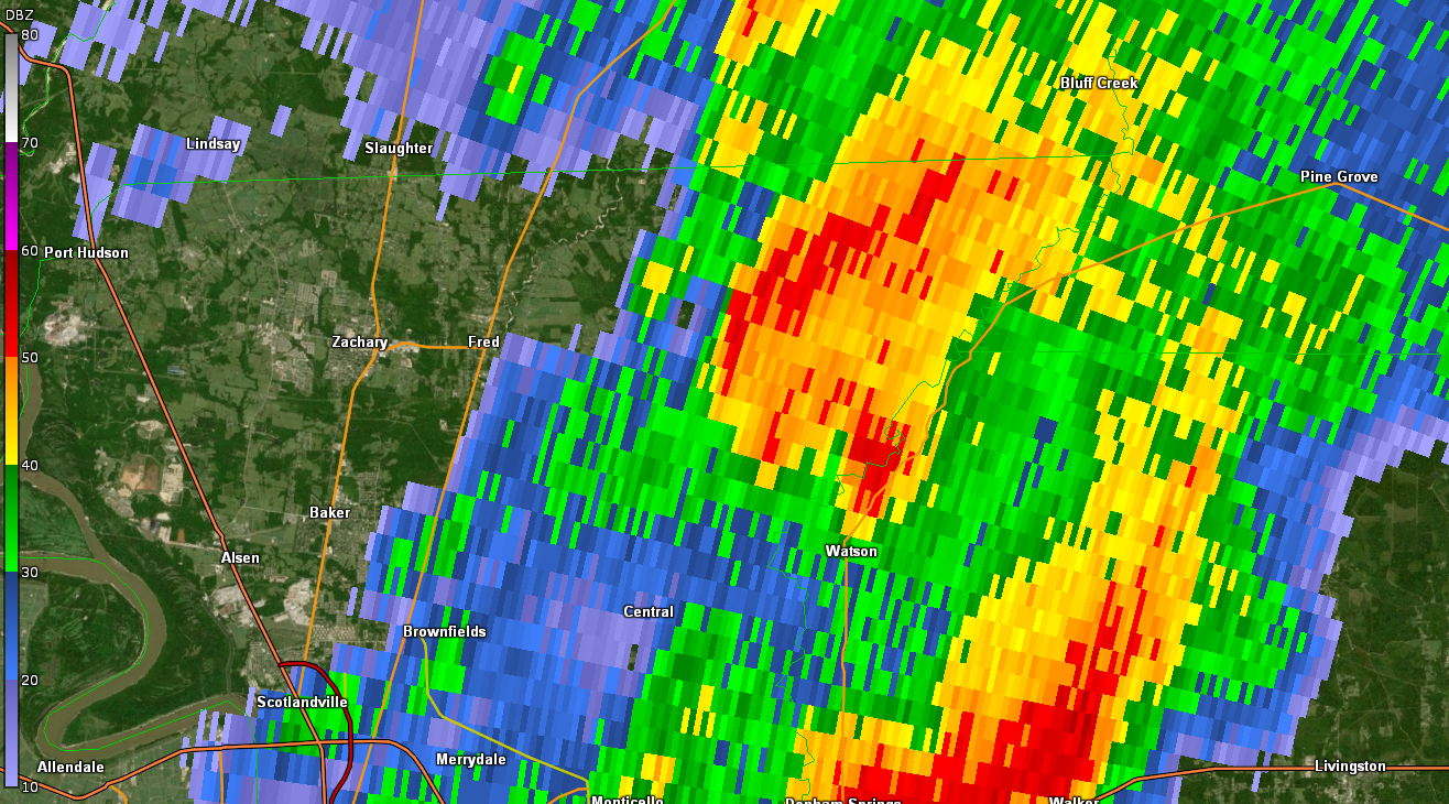
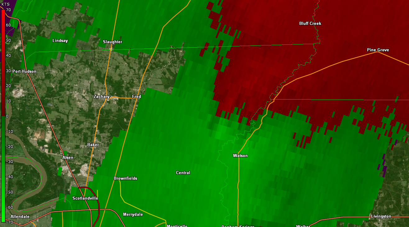
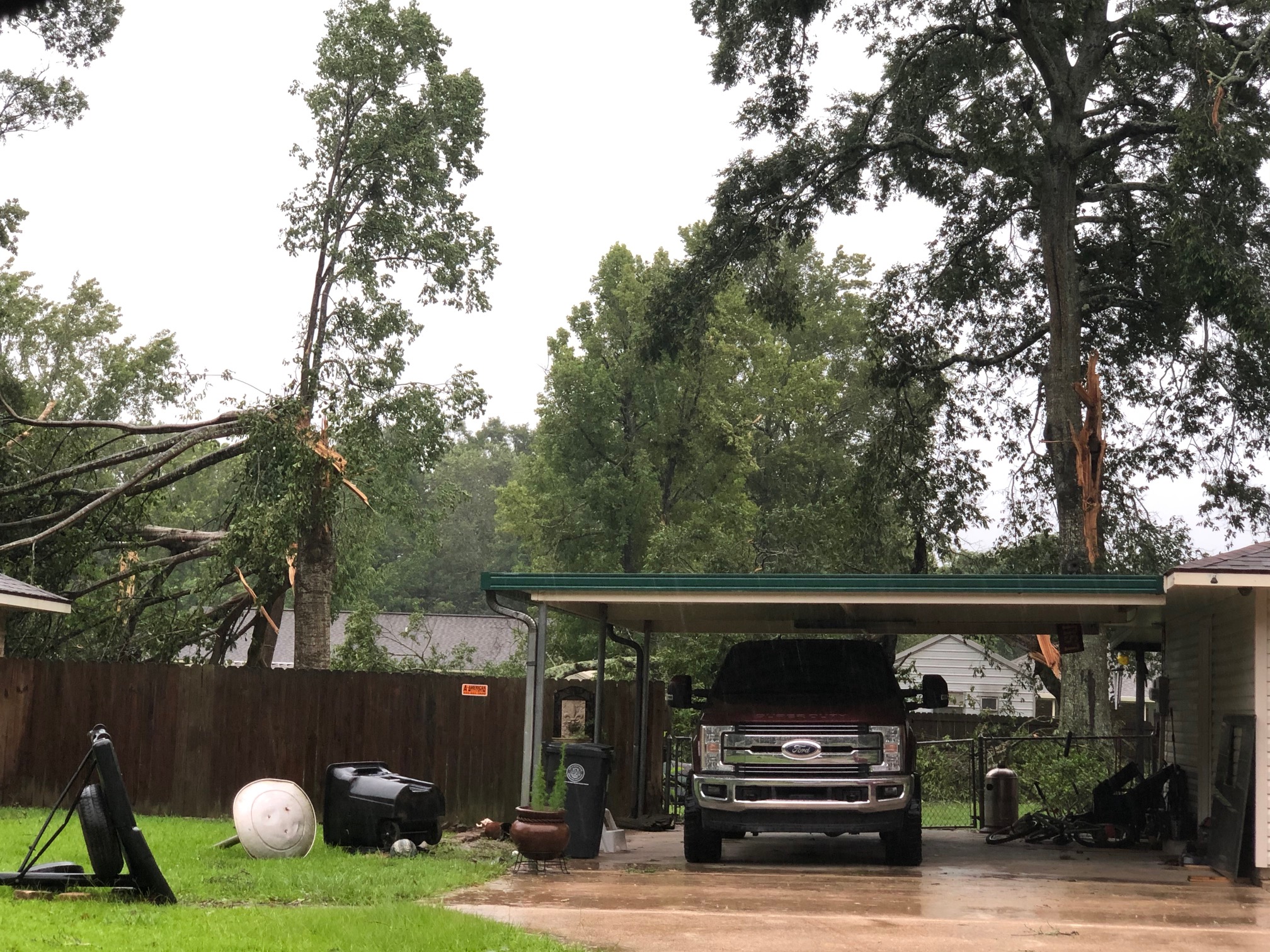
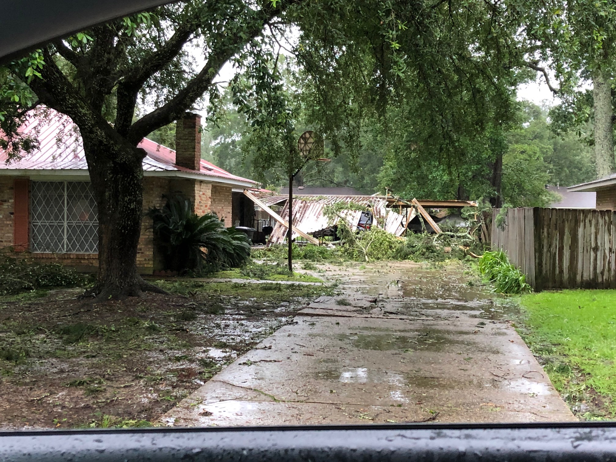
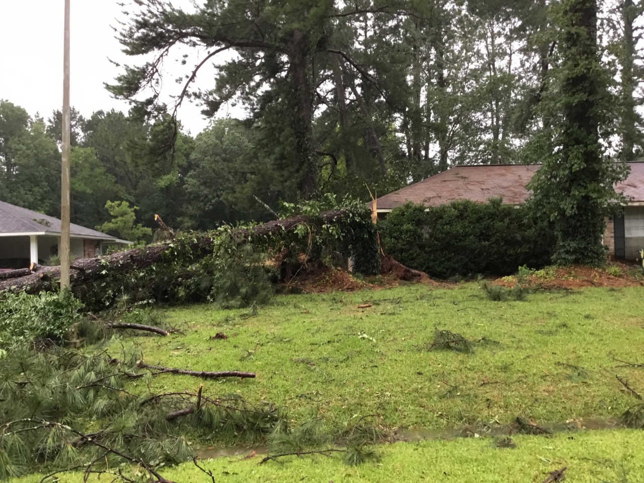
Greenwell Spring, LA Tornado - June 24, 2020
|
Rating:
|
EF-1
|
|
Estimated Maximum Wind:
|
90 mph
|
|
Injuries/Fatalities:
|
None
|
|
Damage Path Length:
|
0.3 miles
|
|
Maximum Path Width:
|
125 yards
|
|
Approximate Start Point/Time:
|
3 miles northeast of Central, LA at 525 AM CDT
|
|
Approximate End Point/Time:
|
3 miles northeast of Central, LA at 530 AM CDT
|
|
A National Weather Service Damage Assessment Team has surveyed the storm damage in Greenwell Spring, LA. It has been determined the damage was the result of a tornado. The tornado has been rated an EF-1 on the Enhanced Fujita Scale. Damage estimates were consistent with winds of 90 mph. This tornado touched near Yatasi Ave., snapping and uprooting trees. Trees landed and damaged 2 cars. It then progressed in a northeast direction where it damaged the carport and fascia of some nearby houses. It then lifted just before Greenwell Springs-Port Hudson Rd.
|
|
|
|
|
||||||||||||
Current Hazards
Extended Outlooks
Outlooks
Fire Manager Quick Brief
Briefing Page
Storm Prediction Center
Forecasts
Marine Forecast
Activity Planner
River Forecasts
Tropical Forecast
Forecast Discussion
Aviation Weather Forecast
Graphical Forecast
Weather Models and Maps
Fire Weather Forecast
Hourly Weather Graph
Air Quality Forecasts
US Dept of Commerce
National Oceanic and Atmospheric Administration
National Weather Service
New Orleans/Baton Rouge
62300 Airport Rd.
Slidell, LA 70460-5243
504.522.7330 985.649.0429
Comments? Questions? Please Contact Us.