Severe thunderstorms and the threat for excessive rainfall will move into the mid-Mississippi and lower Ohio Valleys today. There is potential for a few strong tornadoes, damaging wind gusts, large hail, and scattered flash flooding. Low humidity and windy conditions will continue to produce elevated to critical fire weather conditions across the southern High Plains into midweek. Read More >
New Orleans/Baton Rouge
Weather Forecast Office
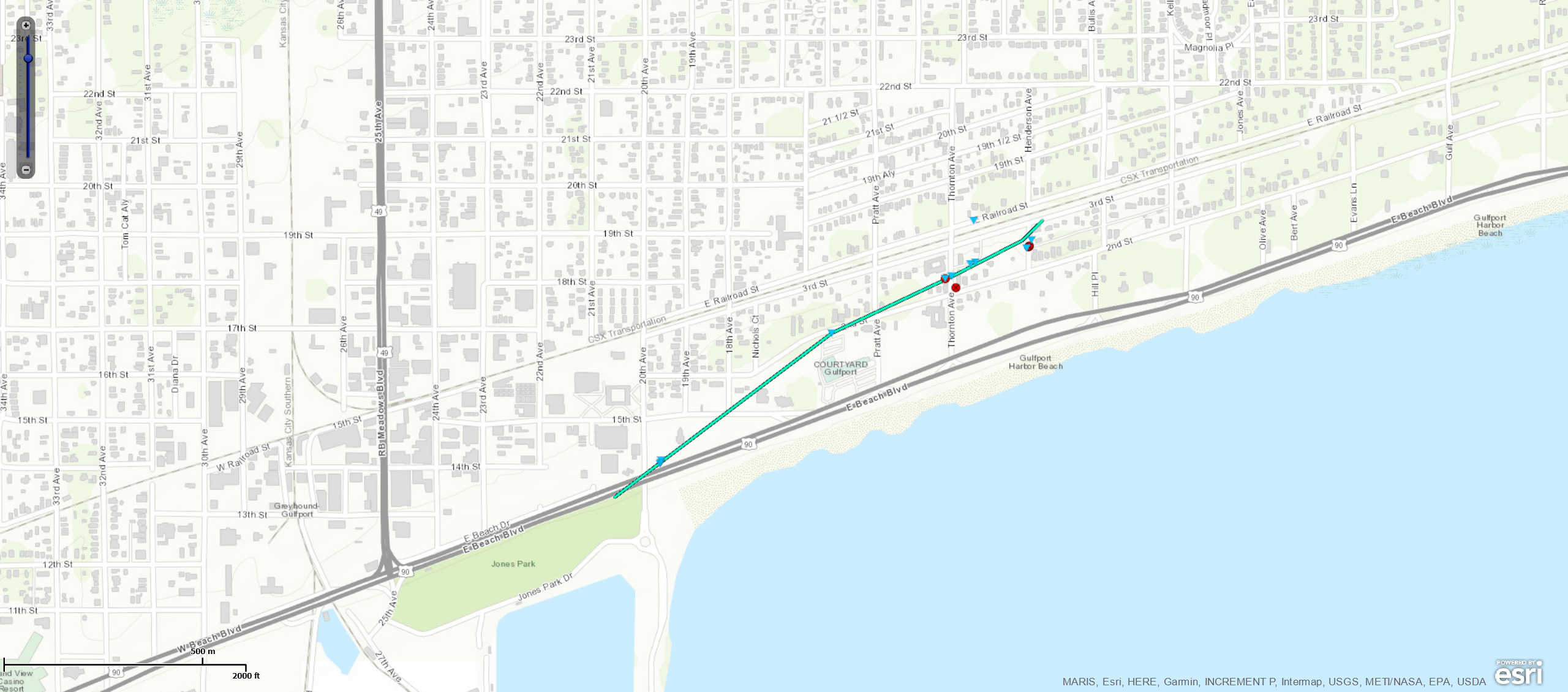
Gulfport, MS Tornado - June 24, 2020
|
Rating:
|
EF-0
|
|
Estimated Maximum Wind:
|
65 mph
|
|
Injuries/Fatalities:
|
None
|
|
Damage Path Length:
|
0.8 miles
|
|
Maximum Path Width:
|
40 yards
|
|
Approximate Start Point/Time:
|
Gulfport, MS at 1227 PM CDT
|
|
Approximate End Point/Time:
|
Gulfport, MS at 1230 PM CDT
|
|
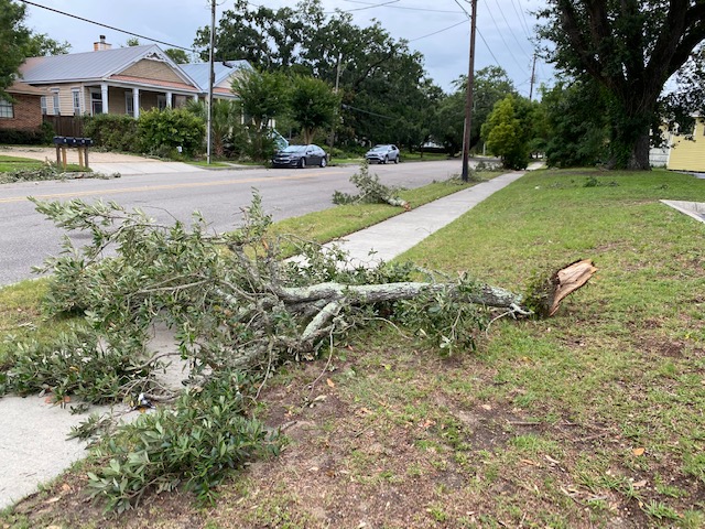
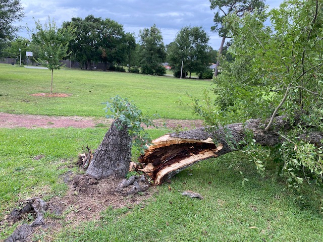
A National Weather Service Damage Assessment Team has surveyed the storm damage in Gulfport, MS. It has been determined the damage was the result of a tornado. The tornado has been rated an EF-0 on the Enhanced Fujita Scale. Damage estimates were consistent with winds of 65 mph. Several large hardwood tree limbs snapped and minor roof damage to several homes from US Highway 90 near the aquarium to the CSX railway near Henderson Avenue.
|
Current Hazards
Fire Manager Quick Brief
Briefing Page
Storm Prediction Center
Extended Outlooks
Outlooks
Forecasts
Graphical Forecast
Weather Models and Maps
Fire Weather Forecast
Hourly Weather Graph
Air Quality Forecasts
Marine Forecast
Activity Planner
River Forecasts
Tropical Forecast
Forecast Discussion
Aviation Weather Forecast
US Dept of Commerce
National Oceanic and Atmospheric Administration
National Weather Service
New Orleans/Baton Rouge
62300 Airport Rd.
Slidell, LA 70460-5243
504.522.7330 985.649.0429
Comments? Questions? Please Contact Us.


