New Orleans/Baton Rouge
Weather Forecast Office
Henleyfield, MS Tornado - February 23, 2016
|
Rating:
|
EF-1
|
|
Estimated Maximum Wind:
|
105 mph
|
|
Injuries/Fatalities:
|
None
|
|
Damage Path Length:
|
9.7 miles
|
|
Maximum Path Width:
|
150 yards
|
|
Approximate Start Point/Time:
|
8 miles W of McNeil, MS at 349 PM
|
|
Approximate End Point/Time:
|
6 miles N of McNeil, MS at 401 PM
|
|
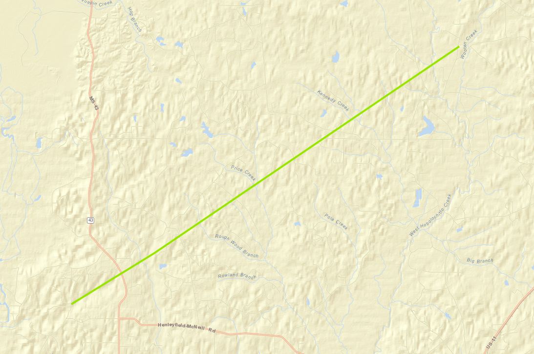
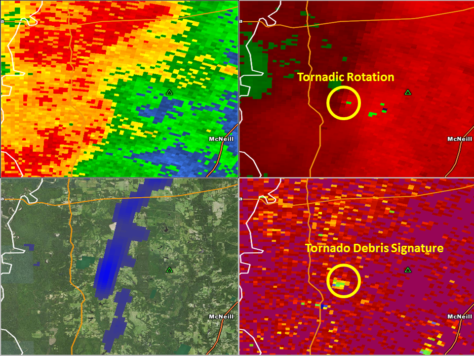
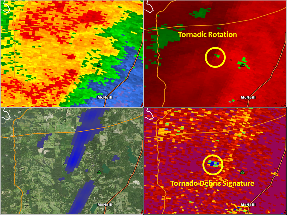
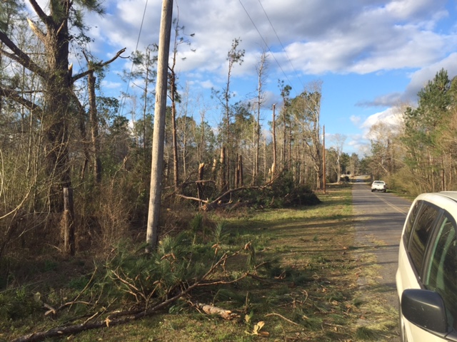
A National Weather Service Damage Assessment Team has surveyed the storm damage in Pearl River County, MS near Henleyfield. It has been determined the damage was the result of a tornado. The tornado has been rated an EF-1 on the Enhanced Fujita Scale. Damage estimates were consistent with winds of 105 mph. The tornado touched down near Donley Burks Road west of Highway 43 and tracked northeast ending around Osborn Moody Road southwest of Poplarville, MS. Minor to moderate damage occurred to 5 homes, and numerous trees were uprooted in rural Pearl River County. The metal roof was completely ripped off of one house. The tornado had a path length of 9.7 miles and a maximum width of 150 yards. |
|
|
|
|
||||||||||||
Current Hazards
Outlooks
Fire Manager Quick Brief
Briefing Page
Storm Prediction Center
Extended Outlooks
Forecasts
Activity Planner
River Forecasts
Tropical Forecast
Forecast Discussion
Aviation Weather Forecast
Graphical Forecast
Weather Models and Maps
Fire Weather Forecast
Hourly Weather Graph
Air Quality Forecasts
Marine Forecast
US Dept of Commerce
National Oceanic and Atmospheric Administration
National Weather Service
New Orleans/Baton Rouge
62300 Airport Rd.
Slidell, LA 70460-5243
504.522.7330 985.649.0429
Comments? Questions? Please Contact Us.