New Orleans/Baton Rouge
Weather Forecast Office
Madisonville, LA Tornado - February 23, 2016
|
Rating:
|
EF-0
|
|
Estimated Maximum Wind:
|
65 mph
|
|
Injuries/Fatalities:
|
None
|
|
Damage Path Length:
|
0.5 miles
|
|
Maximum Path Width:
|
25 yards
|
|
Approximate Start Point/Time:
|
Madisonville, LA at 441 PM
|
|
Approximate End Point/Time:
|
Madisonville, LA at 442 PM
|
|
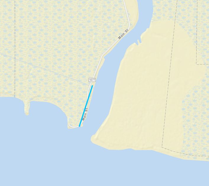
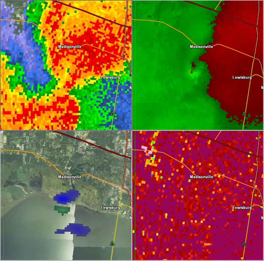
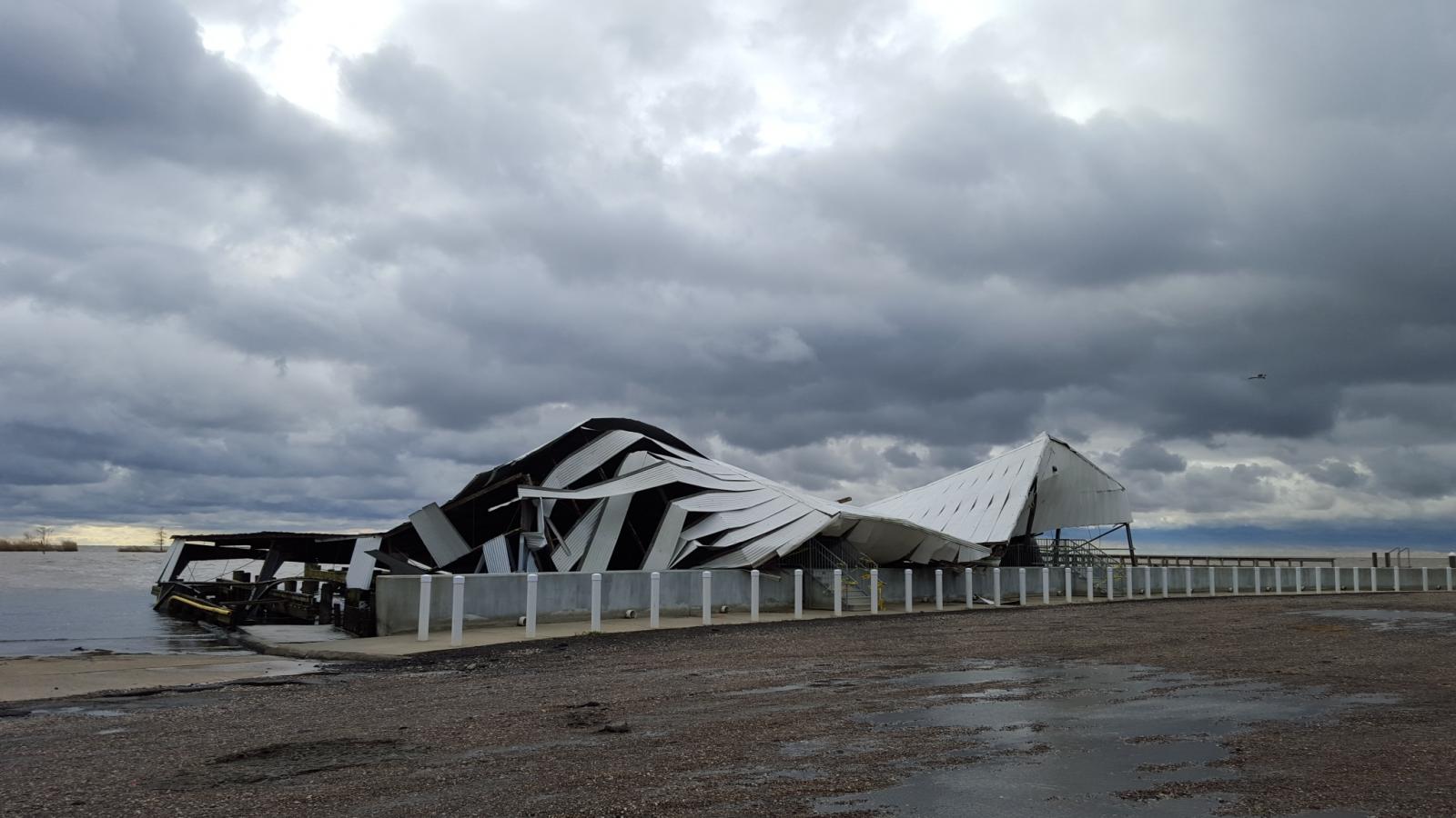
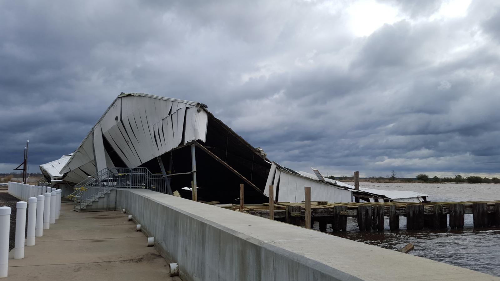
A National Weather Service Damage Assessment Team has surveyed the storm damage in Madisonville, LA. It has been determined the damage was the result of a tornado. The tornado has been rated an EF-0 on the Enhanced Fujita Scale. Damage estimates were consistent with winds of 65 mph. A tornadic waterspout moved onshore from Lake Pontchartrain at the end of Louisiana Highway 1077 producing a short path of damage. An open air boat launch covering experienced column and roof failure, and a nearby bar had some minor fascia damage. No damage to power poles or trees was seen in the area. Also, no damage was seen across the Tchefuncte River. The damage was consistent with a 65 mph EF-0 tornado. The tornado damage path was 1/2 a mile long and was 25 yards wide at its widest point. |
|
|
|
|
||||||||||
Current Hazards
Outlooks
Fire Manager Quick Brief
Briefing Page
Storm Prediction Center
Extended Outlooks
Forecasts
Tropical Forecast
Forecast Discussion
Aviation Weather Forecast
Graphical Forecast
Weather Models and Maps
Fire Weather Forecast
Hourly Weather Graph
Air Quality Forecasts
Marine Forecast
Activity Planner
River Forecasts
US Dept of Commerce
National Oceanic and Atmospheric Administration
National Weather Service
New Orleans/Baton Rouge
62300 Airport Rd.
Slidell, LA 70460-5243
504.522.7330 985.649.0429
Comments? Questions? Please Contact Us.