New Orleans/Baton Rouge
Weather Forecast Office
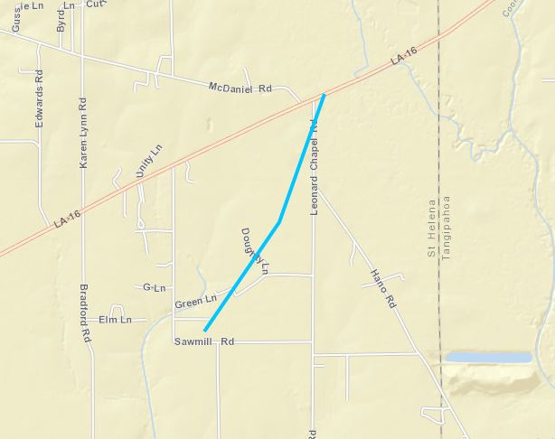
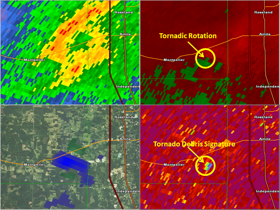
Montpelier, LA Tornado - February 23, 2016
|
Rating:
|
EF-0
|
|
Estimated Maximum Wind:
|
85 mph
|
|
Injuries/Fatalities:
|
None
|
|
Damage Path Length:
|
0.3 miles
|
|
Maximum Path Width:
|
50 yards
|
|
Approximate Start Point/Time:
|
3.5 miles ENE of Montpelier, LA at 114 PM CST
|
|
Approximate End Point/Time:
|
3.8 miles ENE of Montpelier, LA at 115 PM CST
|
|
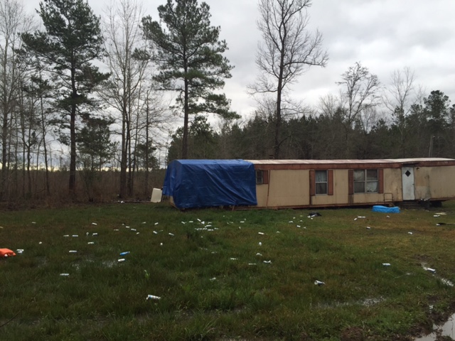
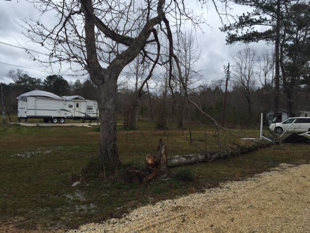
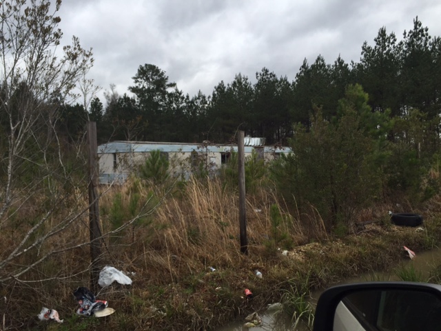
A National Weather Service Damage Assessment Team has surveyed the storm damage in Montpelier, LA. It has been determined the damage was the result of a tornado. The tornado has been rated an EF-0 with 85 mph winds on the Enhanced Fujita Scale. The tornado touched down near Green Lane in St. Helena Parish and tracked northeast ending near Jackson Lane. A single wide mobile home shifted off its block piers and lost part of the metal roof. A metal shed was destroyed and a few softwood trees were snapped above the base. The tornado had a path length of 0.3 miles and was 50 yards wide at its widest point. |
|
|
|
|
||||||||||||
Current Hazards
Outlooks
Fire Manager Quick Brief
Briefing Page
Storm Prediction Center
Extended Outlooks
Forecasts
Forecast Discussion
Aviation Weather Forecast
Graphical Forecast
Weather Models and Maps
Fire Weather Forecast
Hourly Weather Graph
Air Quality Forecasts
Marine Forecast
Activity Planner
River Forecasts
Tropical Forecast
US Dept of Commerce
National Oceanic and Atmospheric Administration
National Weather Service
New Orleans/Baton Rouge
62300 Airport Rd.
Slidell, LA 70460-5243
504.522.7330 985.649.0429
Comments? Questions? Please Contact Us.