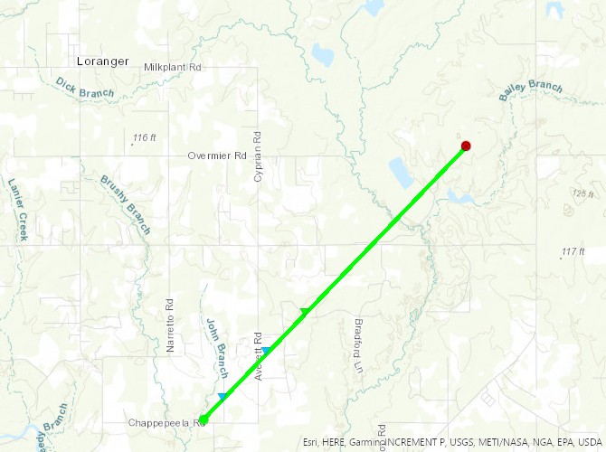
Robert, LA Tornado - December 14, 2022
|
Rating:
|
EF-1
|
|
Estimated Maximum Wind:
|
100 mph
|
|
Injuries/Fatalities:
|
None
|
|
Damage Path Length:
|
4.25 miles
|
|
Maximum Path Width:
|
50 yards
|
|
Approximate Start Point/Time:
|
5 miles NNW of Robert, LA at 1210 PM CST
|
|
Approximate End Point/Time:
|
7 miles W of Folsom, LA at 1218 PM CST
|
|
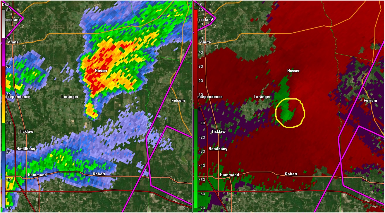
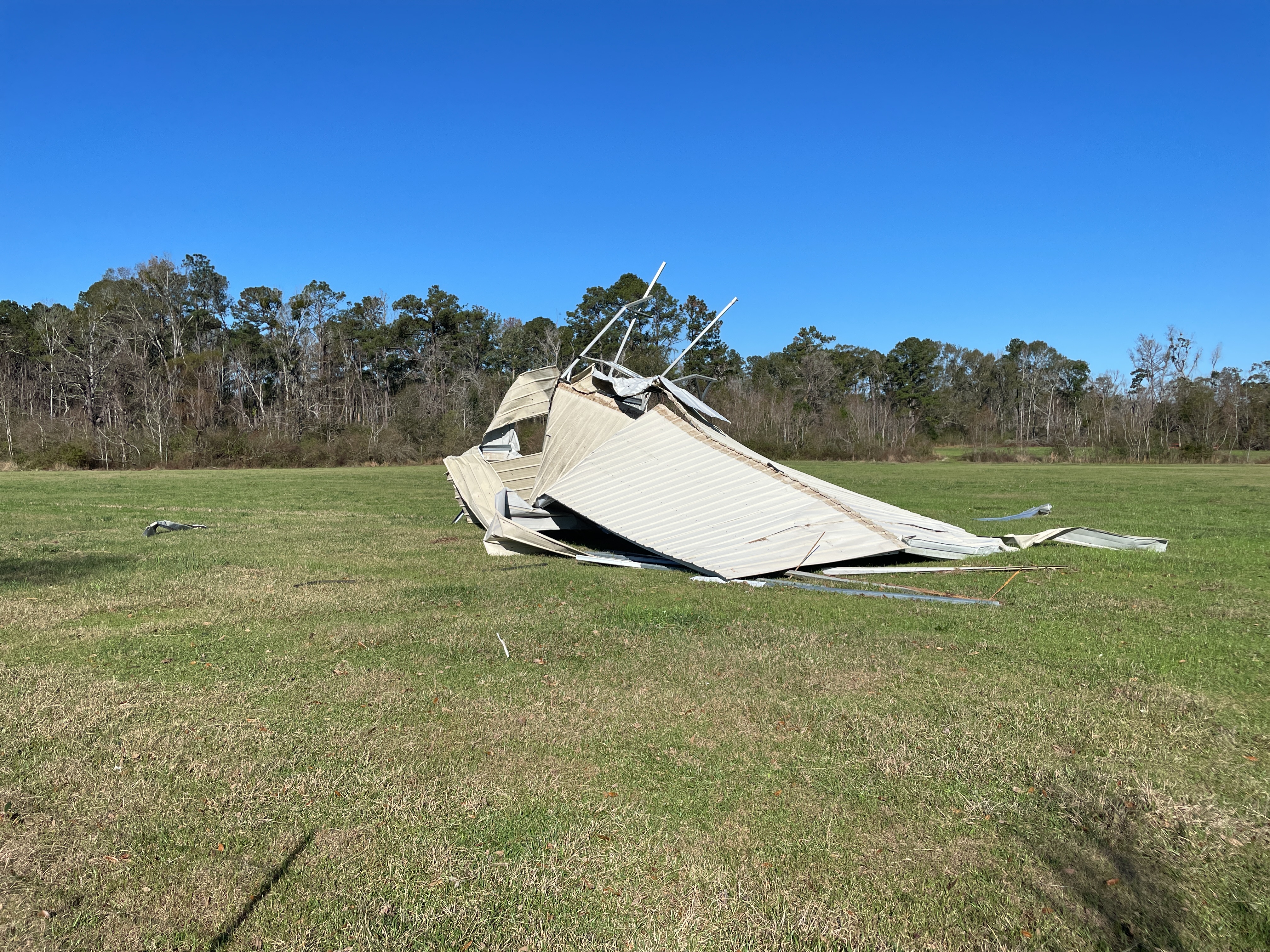
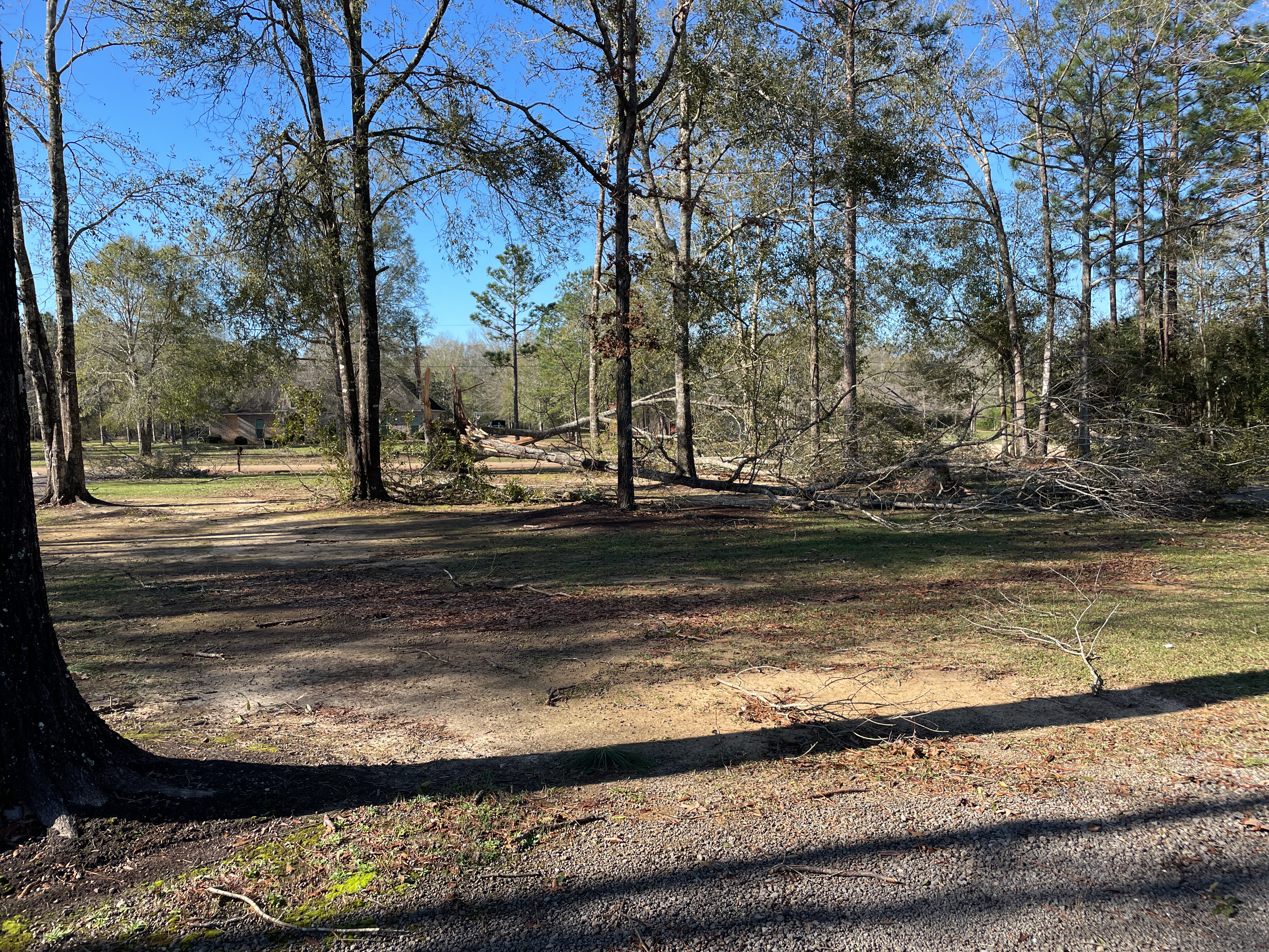
A National Weather Service Damage Assessment Team has surveyed the storm damage near Robert, LA. It has been determined the damage was the result of a tornado. The tornado has been rated an EF-1 on the Enhanced Fujita Scale. Damage estimates were consistent with winds of 100 mph. A tornado dropped down near Chappepeela Road, damaging a shed at 12:10 PM CST. It continued northeast, tearing a shed in half and throwing it downstream about 100 yards. The tornado tracked northeast, flipping and turning over a shed as it reached Averett Road. A few small trees, less than 10 feet tall, were downed at this location. The tornado continued northeast. It torn down and threw sections of residential wood fencing as it crossed Beau Place Lane and Allen Drive. One home on Allen drive had around half a dozen hardwoods snapped or uprooted, consistent with wind speeds of 100 mph. The path width at this point was the greatest at 50 yards. The rest of the tornado track was in inaccessible woods area. Video evidence showed the tornado tracking through this wooded and field area north of Highway 40 and west of Highway 445. The tornado lifted before reaching Highway 445 at approximately 12:18 PM CST. |
|
|
|
|
||||||||||