Salem, MS Tornado - June 24, 2020
|
Rating:
|
EF-1
|
|
Estimated Maximum Wind:
|
95 mph
|
|
Injuries/Fatalities:
|
None
|
|
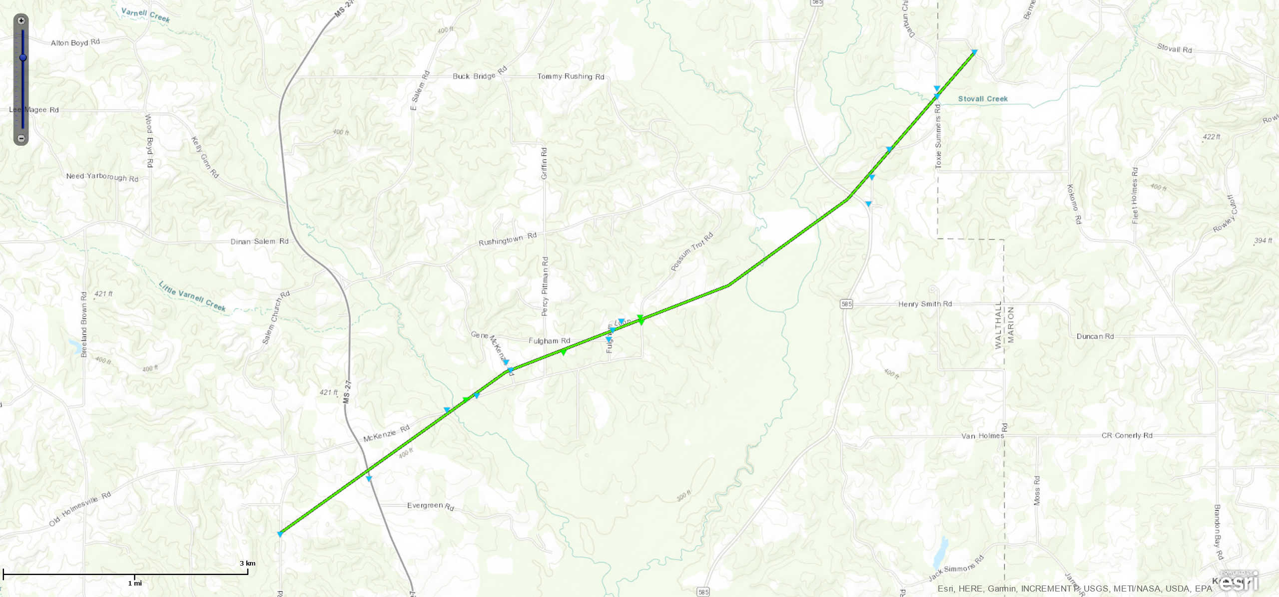
Damage Path Length:
|
6.5 miles
|
|
Maximum Path Width:
|
150 yards
|
|
Approximate Start Point/Time:
|
5 miles S of Darbun, MS at 720 AM CDT
|
|
Approximate End Point/Time:
|
4 miles ESE of Darbun, MS at 737 AM CDT
|
|
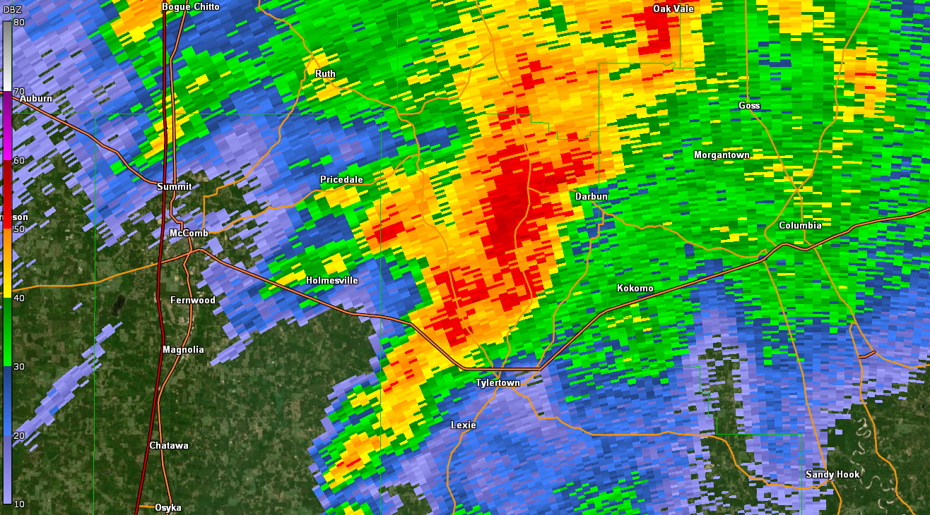
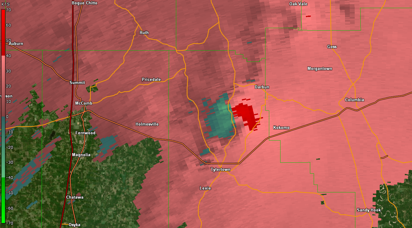
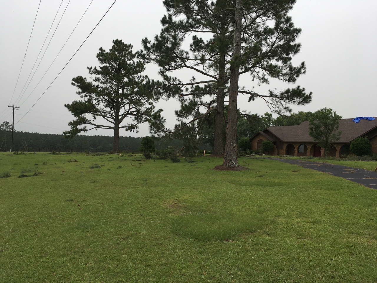
A National Weather Service Damage Assessment Team from NWS Jackson, MS has surveyed the storm damage in Walthall County, MS. It has been determined the damage was the result of a tornado. The tornado has been rated an EF-1 on the Enhanced Fujita Scale. Damage estimates were consistent with winds of 95 mph. This tornado started just west of MS Highway 27 along St. John Road and tracked northeast and dissipated just inside Marion County, MS at the dairy farm along Brumfield Rd. Along the path, many trees were damaged. This included snapped and uprooted trees as well as many large limbs broken. Along Highway 27, minor roof damage occurred to one home. Along McKenzie Road, more substantial tree damage was noted and a power pole was taken down. Another area where more substantial tree damage occurred was south of Fulgham Road and at the intersection o Possum Trot Road. The tornado continued northeast and weakend as it crossed Highway 585 and into western Marion County. Large limbs were blown down mostly, with some scattered uprooted trees as well. About 0.4 miles of the track occurred in Marion County, MS.
|
|
|