New Orleans/Baton Rouge
Weather Forecast Office
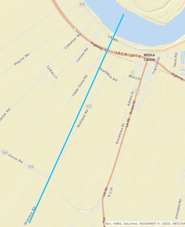
Morning White Castle, LA Tornado - February 23, 2016
|
Rating:
|
EF-0
|
|
Estimated Maximum Wind:
|
65 mph
|
|
Injuries/Fatalities:
|
None
|
|
Damage Path Length:
|
3.3 miles
|
|
Maximum Path Width:
|
50 yards
|
|
Approximate Start Point/Time:
|
3.4 miles SW of White Castle, LA at 1120 AM
|
|
Approximate End Point/Time:
|
0.6 miles W of White Castle, LA at 1125 AM
|
|
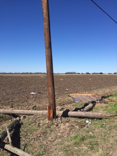
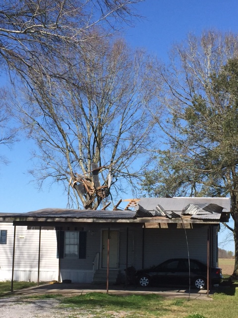
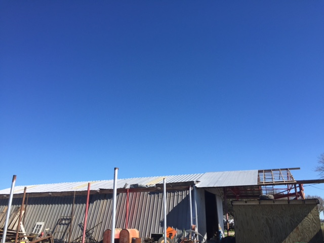
A National Weather Service Damage Assessment Team has surveyed the storm damage near White Castle, LA. It has been determined the damage was the result of a tornado. The tornado has been rated an EF-0 on the Enhanced Fujita Scale. Damage estimates were consistent with winds of 65 mph. Intermittent damage was found. Damage consisted of peeled back tin roofs, damage to power lines, and downing of large tree branches. The tornado damage path was 3.3 miles long and was 50 yards wide at its widest point. |
|
|
|
|
|||||||||||
Current Hazards
Briefing Page
Storm Prediction Center
Extended Outlooks
Outlooks
Fire Manager Quick Brief
Forecasts
Graphical Forecast
Weather Models and Maps
Fire Weather Forecast
Hourly Weather Graph
Air Quality Forecasts
Marine Forecast
Activity Planner
River Forecasts
Tropical Forecast
Forecast Discussion
Aviation Weather Forecast
US Dept of Commerce
National Oceanic and Atmospheric Administration
National Weather Service
New Orleans/Baton Rouge
62300 Airport Rd.
Slidell, LA 70460-5243
504.522.7330 985.649.0429
Comments? Questions? Please Contact Us.