New Orleans/Baton Rouge
Weather Forecast Office
Wilmer, LA Tornado - December 16, 2019
|
Rating:
|
EF-1
|
|
Estimated Maximum Wind:
|
105 mph
|
|
Injuries/Fatalities:
|
None
|
|
Damage Path Length:
|
1.35 miles
|
|
Maximum Path Width:
|
50 yards
|
|
Approximate Start Point/Time:
|
14 miles NE of Amite City, LA at 346 PM CST
|
|
Approximate End Point/Time:
|
5.5 miles SSW of Mount Hermon, LA at 349 PM CST
|
|
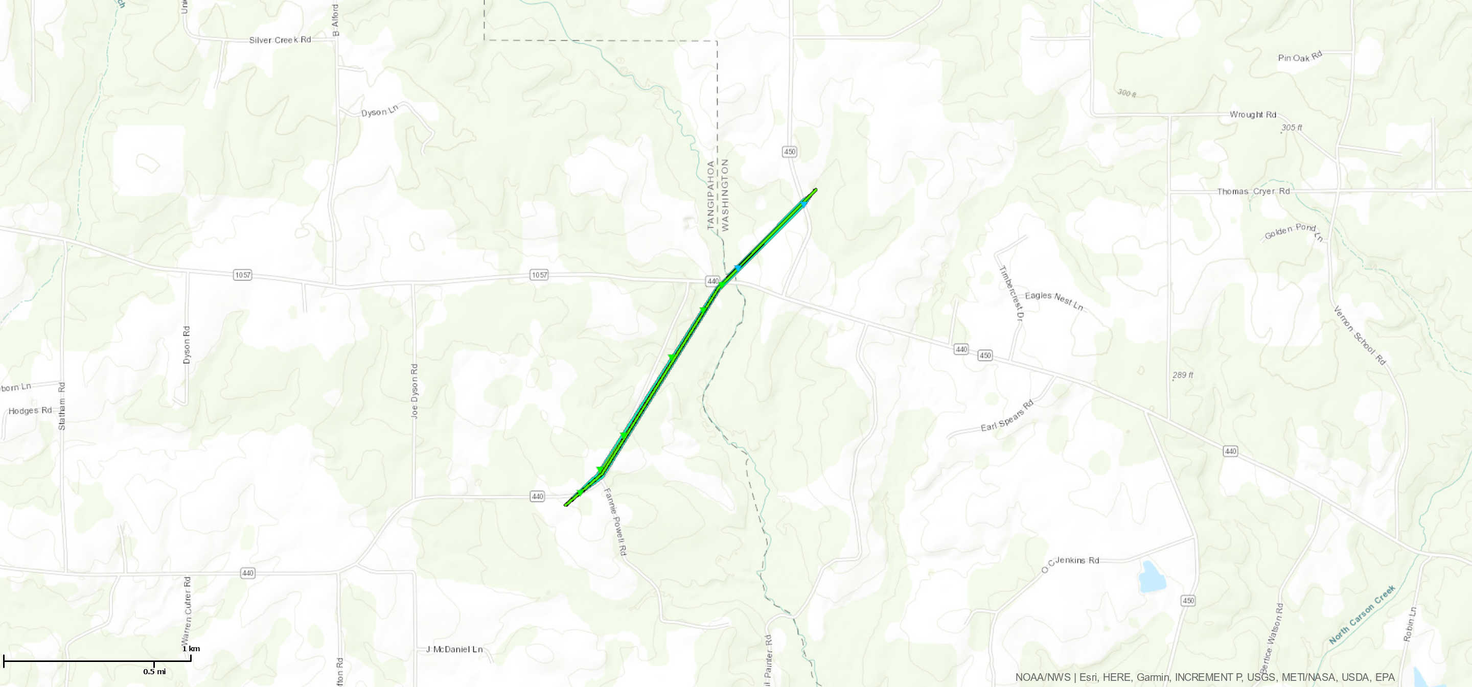
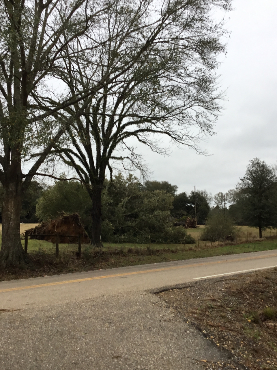
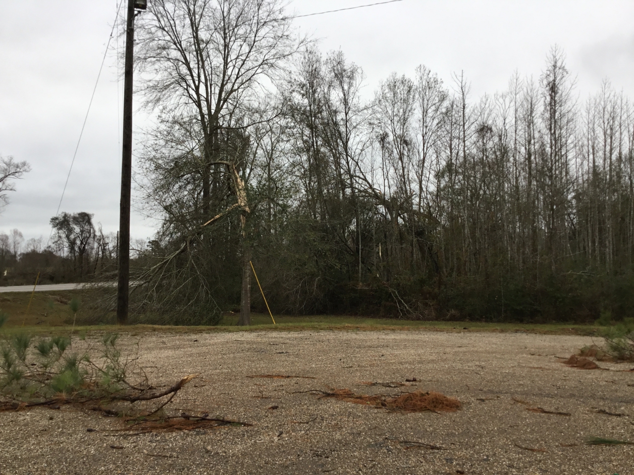
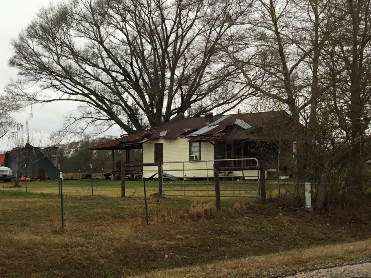
A National Weather Service Damage Assessment Team has surveyed the storm damage near Wilmer, LA. It has been determined the damage was the result of a tornado. The tornado has been rated an EF-1 on the Enhanced Fujita Scale. Damage estimates were consistent with winds of 105 mph. The tornado touched down near the intersection of Hwy 440 and Fannie Powell Rd in far northeast Tangipahoa Parish. It produced damage consistent with 105 mph winds in this area with numerous trees snapped along the road. The tornado continued to cause damage to trees and tree limbs as it moved northeastward roughly parallel to the east side of Hwy 440. It crossed into northwestern Washington Parish roughly where Hwy 440 crosses the Tangipahoa River. It continued to cause minor tree damage and peeled a small section of tin roof from a home as it approached and crossed Hwy 450. The tornado lifted shortly after crossing hwy 450. |
|
|
|
|
|||||||||||
Current Hazards
Fire Manager Quick Brief
Briefing Page
Storm Prediction Center
Extended Outlooks
Outlooks
Forecasts
Aviation Weather Forecast
Graphical Forecast
Weather Models and Maps
Fire Weather Forecast
Hourly Weather Graph
Air Quality Forecasts
Marine Forecast
Activity Planner
River Forecasts
Tropical Forecast
Forecast Discussion
US Dept of Commerce
National Oceanic and Atmospheric Administration
National Weather Service
New Orleans/Baton Rouge
62300 Airport Rd.
Slidell, LA 70460-5243
504.522.7330 985.649.0429
Comments? Questions? Please Contact Us.