New Orleans/Baton Rouge
Weather Forecast Office
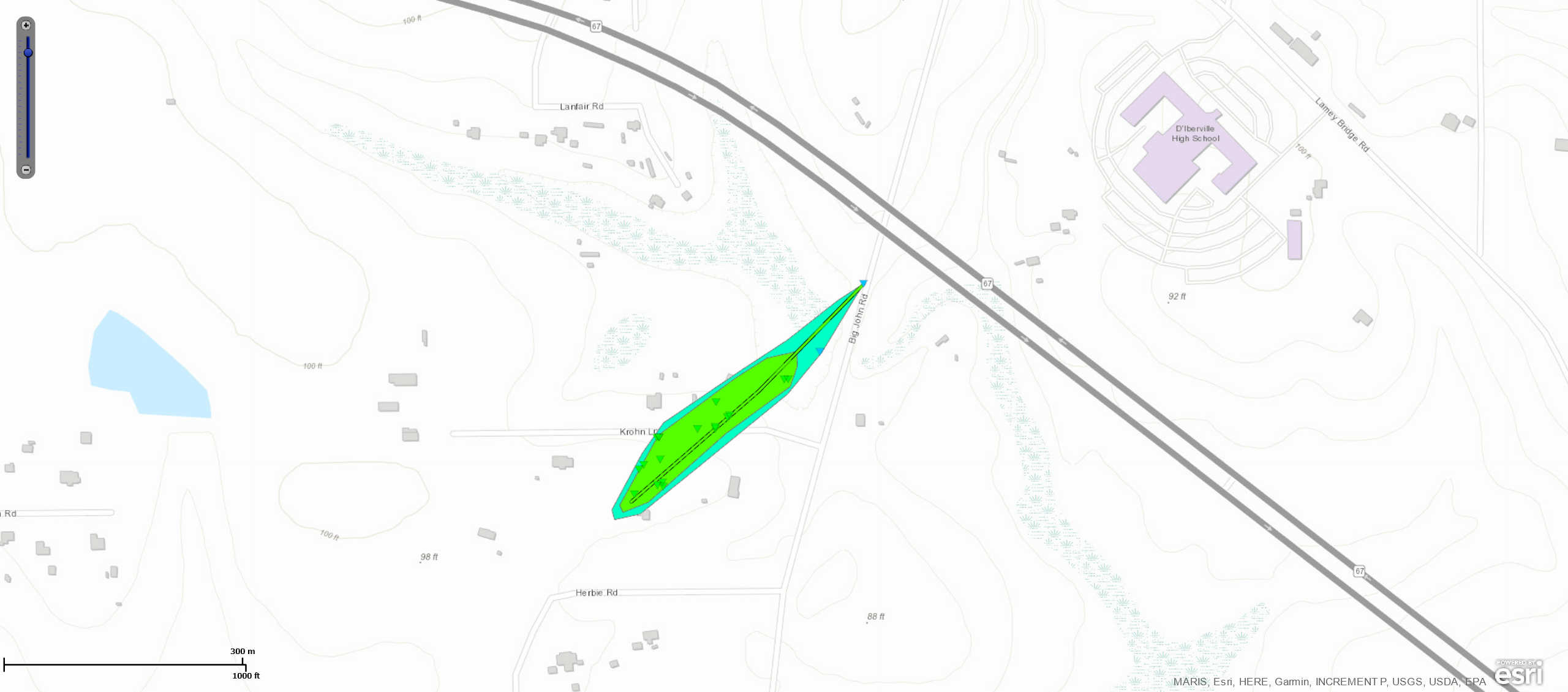
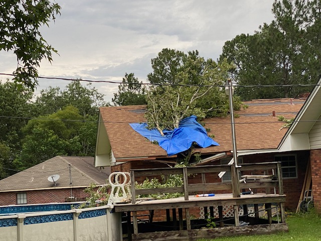
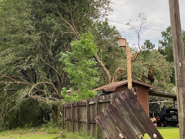
Woolmarket, MS Tornado - June 24, 2020
|
Rating:
|
EF-1
|
|
Estimated Maximum Wind:
|
100 mph
|
|
Injuries/Fatalities:
|
None
|
|
Damage Path Length:
|
0.2 miles
|
|
Maximum Path Width:
|
50 yards
|
|
Approximate Start Point/Time:
|
3.1 NE of Woolmarket, MS at 1234 PM CDT
|
|
Approximate End Point/Time:
|
3.2 NE of Woolmarket, MS at 1236 PM CDT
|
|
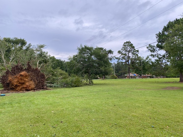
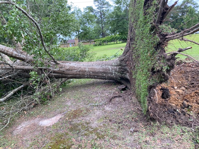
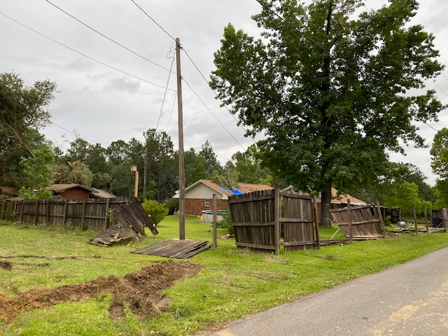
A National Weather Service Damage Assessment Team has surveyed the storm damage near Wookmarket, MS. It has been determined the damage was the result of a tornado. The tornado has been rated an EF-1 on the Enhanced Fujita Scale. Damage estimates were consistent with winds of 100 mph. A short track of damage was noted in the area of Big John Road and Krohn Lane. Most notable was a large hardwood tree uprooted along with several pine trees twisted and snapped.
|
|
|
|
|
||||||||||||||
Current Hazards
Outlooks
Fire Manager Quick Brief
Briefing Page
Storm Prediction Center
Extended Outlooks
Forecasts
Tropical Forecast
Forecast Discussion
Aviation Weather Forecast
Graphical Forecast
Weather Models and Maps
Fire Weather Forecast
Hourly Weather Graph
Air Quality Forecasts
Marine Forecast
Activity Planner
River Forecasts
US Dept of Commerce
National Oceanic and Atmospheric Administration
National Weather Service
New Orleans/Baton Rouge
62300 Airport Rd.
Slidell, LA 70460-5243
504.522.7330 985.649.0429
Comments? Questions? Please Contact Us.