| Overview | |
|
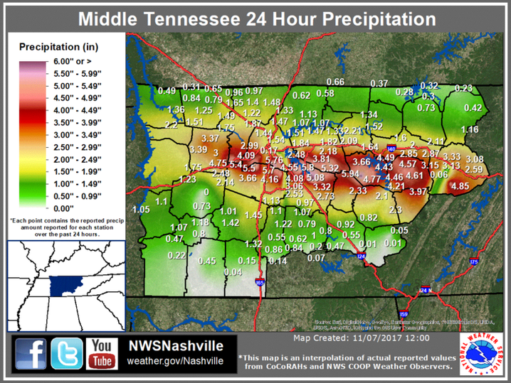
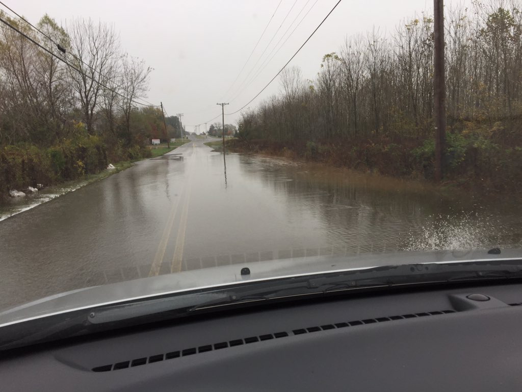
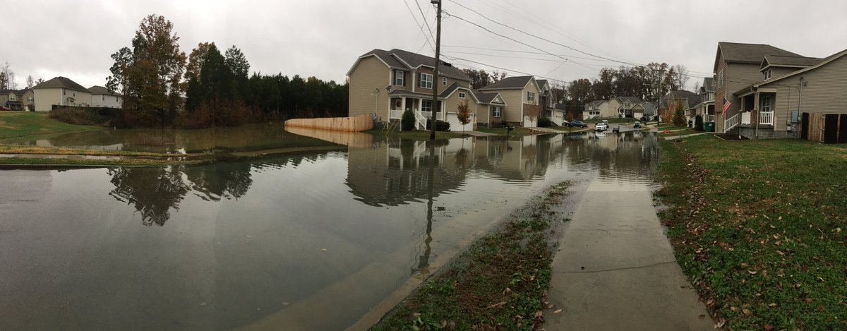
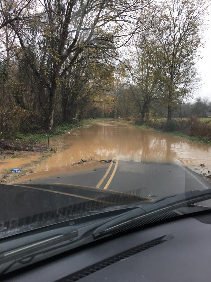
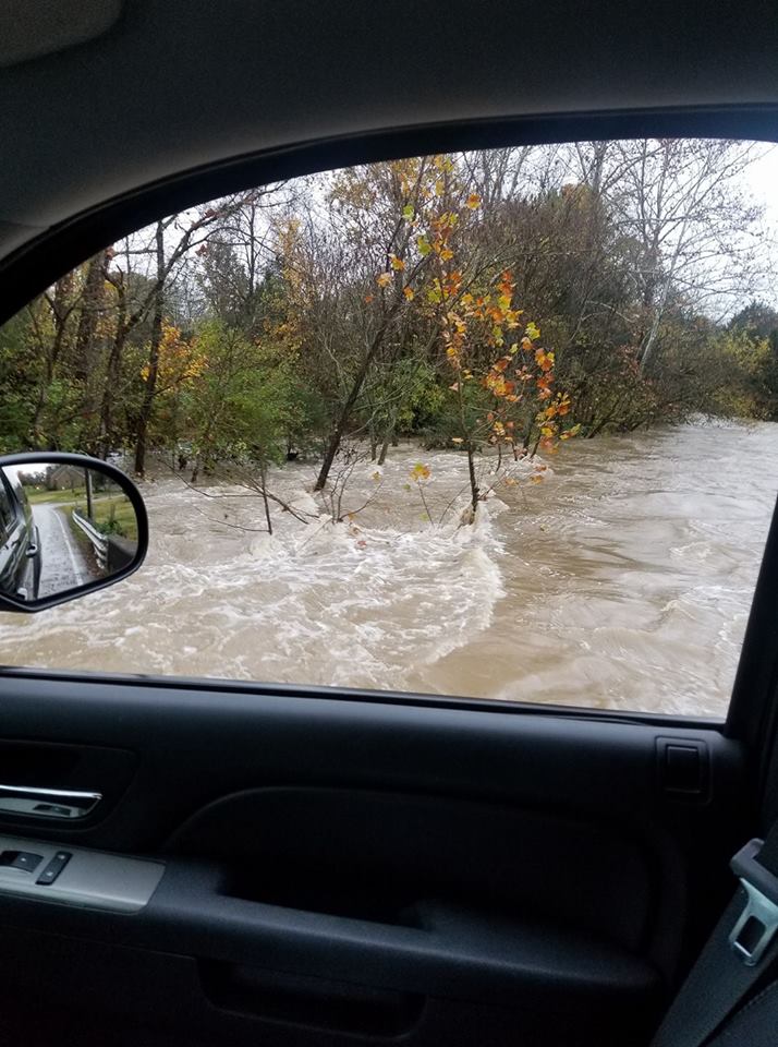
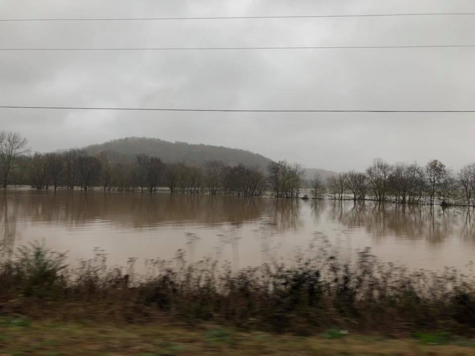
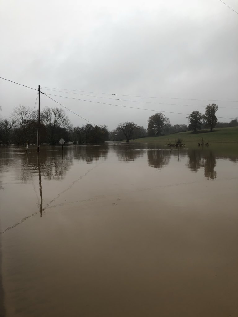
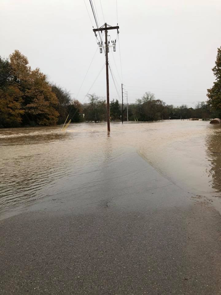
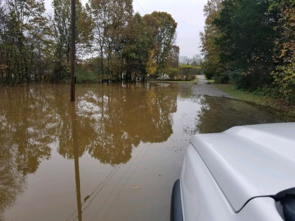
A cold front moved across Middle Tennessee during the day on Monday, November 6, stalling across far northern Alabama in the evening before lifting slowly back northward overnight into Tuesday, November 7. Scattered showers and thunderstorms developed north of the front during the afternoon and evening hours and then moved eastward along the I-40 corridor. Additional showers and storms formed across West Tennessee and spread eastward across the same areas along the I-40 corridor during the night and into the morning hours on November 7. As a result, over 6 inches of rain fell in some areas, which resulted in widespread flash flooding and river flooding from Humphreys County eastward across the southern Nashville metro area to Cumberland County. Some of the worst flooding affected parts of De Kalb County, including the Alexandria, Liberty, Temperance Hall, and Dowelltown areas. |
| Reports & Outlooks | ||||
| SPC Storm Reports | SPC Event Archive | Local Storm Reports | ||
| 72 Hour Rainfall Totals | |
|
|
| 24 Hour Rainfall Totals | |
|
|
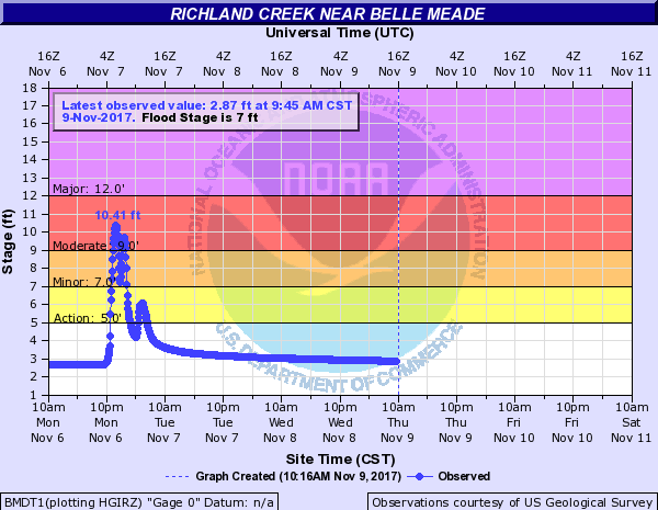
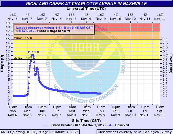
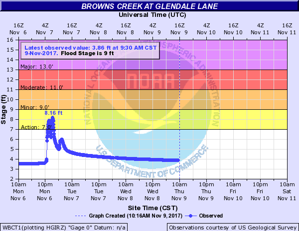
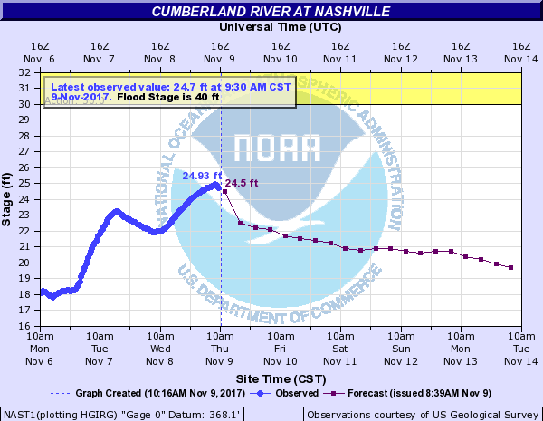
| Hydrographs | |||||||
 |
 |
||||||
|
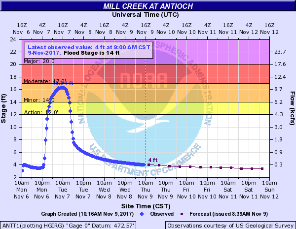
Mill Creek at Antioch |
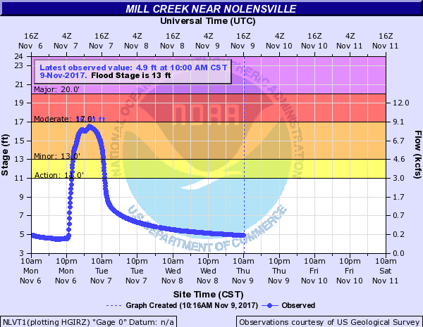
Mill Creek near Nolensville |
||||||
 |
 |
||||||
|
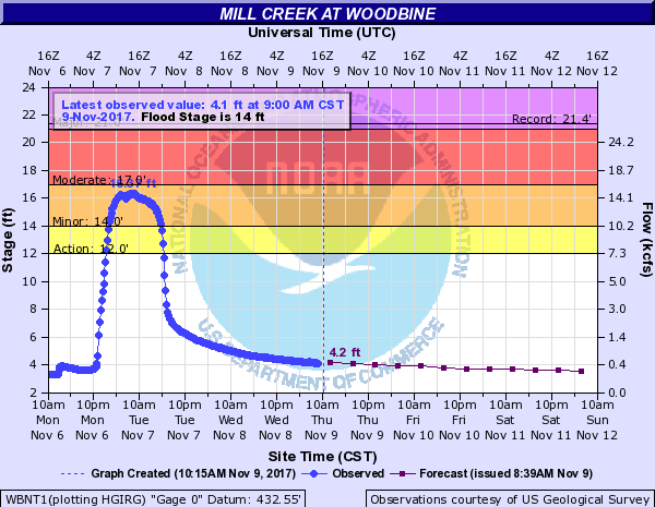
Mill Creek at Woodbine |
Harpeth River at Franklin |
||||||
 |
 |
||||||
|
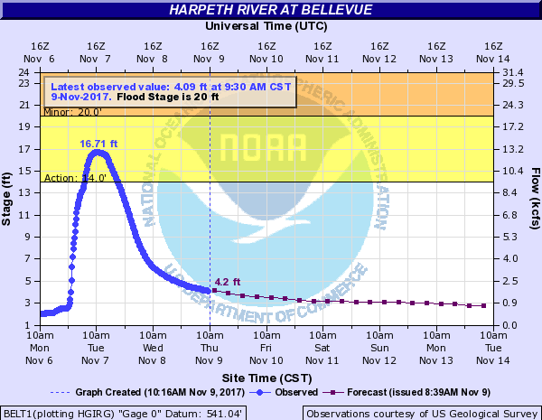
Harpeth River below Franklin |
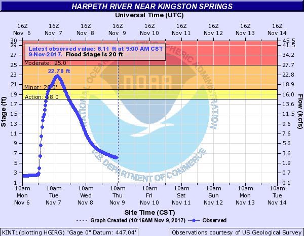
Harpeth River near Kingston Springs |
||||||
 |
 |
||||||
|
|
||||||
 |
 |
||||||
|
|
||||||
 |
 |
||||||
|
|
||||||
 |
 |
||||||
|
|
||||||
 |
 |
||||||
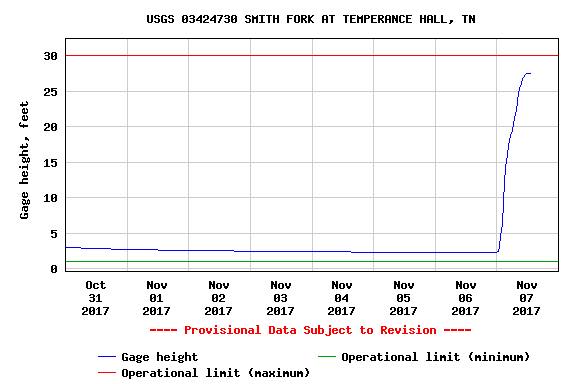
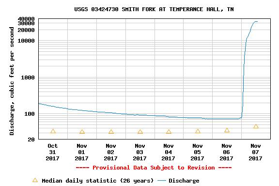
| USGS Smith Fork at Temperance Hall | USGS Smith Fork at Temperance Hall Discharge Rate | ||||||
| Photos | |
 |
 |
|
Auburntown, TN (De Kalb County) |
Winding Hills Lane in Gordonsville, TN (Smith County) |
 |
 |
|
Cherry Lane in Murfreesboro, TN (Rutherford County) |
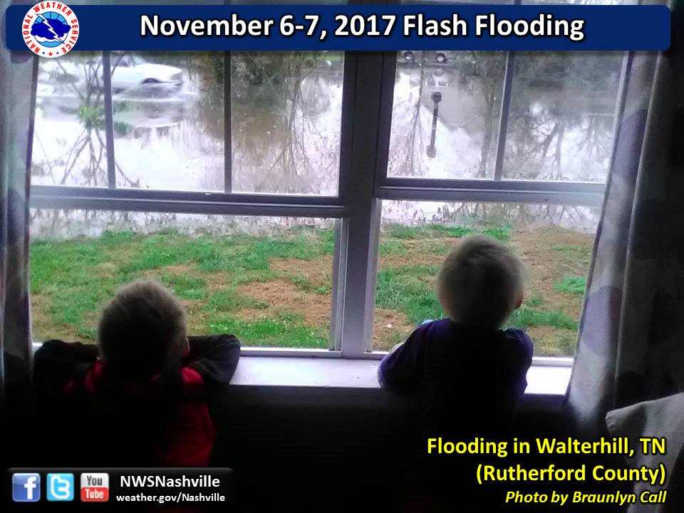
Antioch, TN (Davidson County) |
 |
 |
|
Waverly Road north of Waverly, TN (Humphreys County) |
La Vergne, TN (Rutherford County) |
 |
 |
|
Nevada Drive in Smyrna, TN (Rutherford County) |
Brittain Lane in Nolensville, TN (Williamson County) |
 |
 |
|
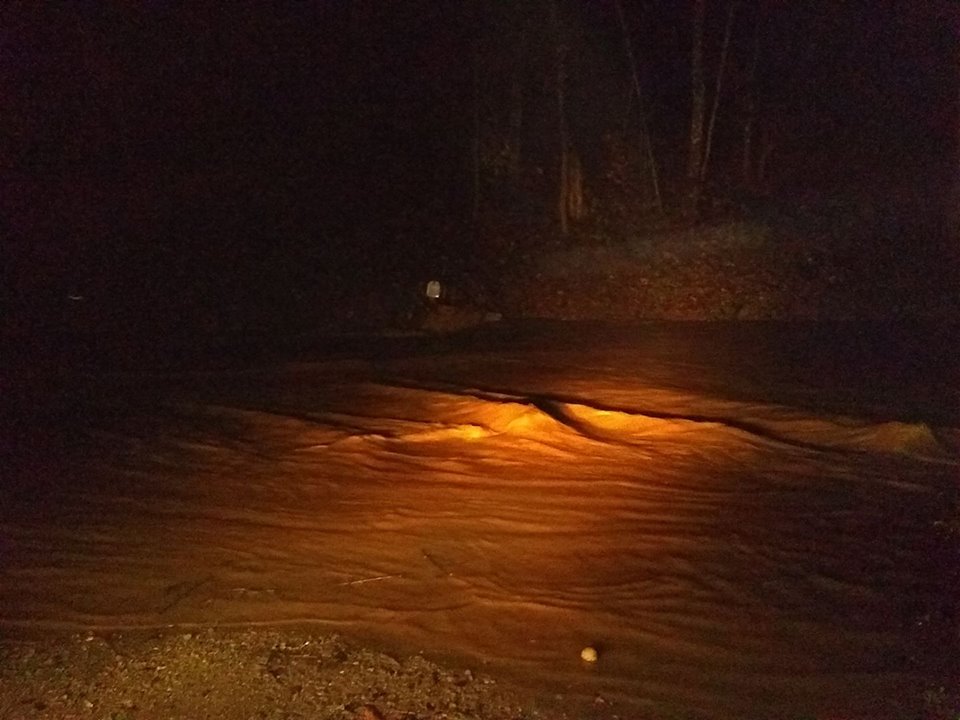
Smith Fork Creek in Temperance Hall, TN (De Kalb County) |
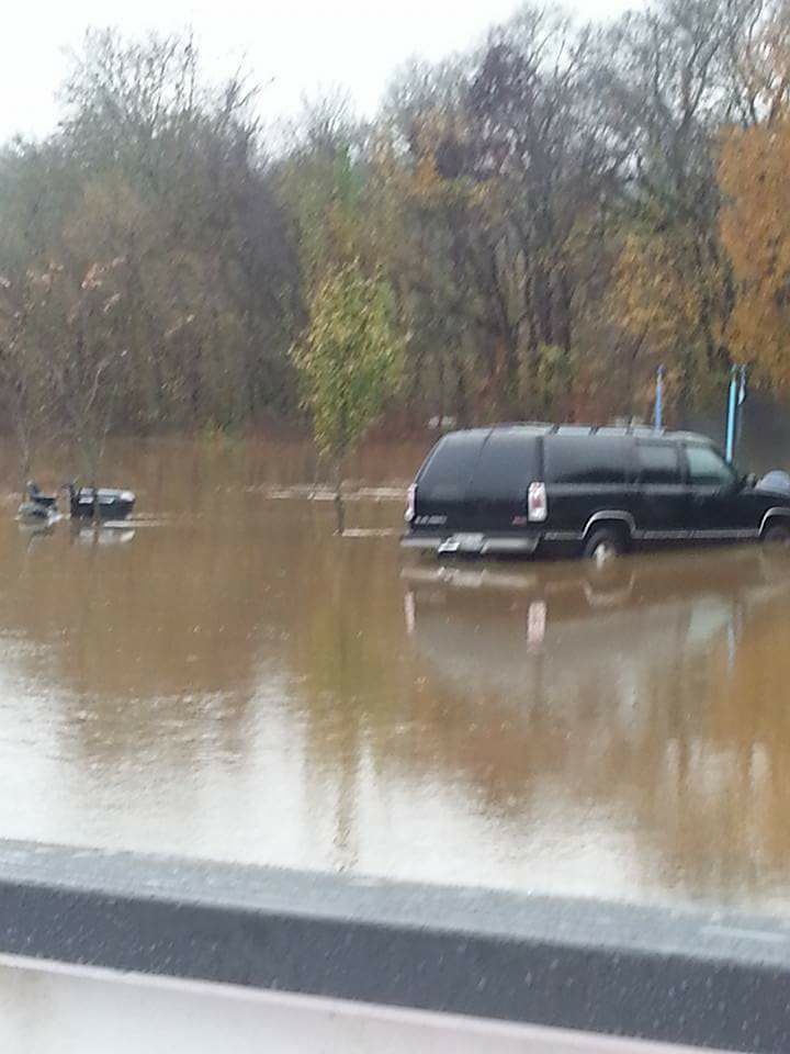
Highway 264 in Temperance Hall, TN (De Kalb County) |
 |
 |
|
Walterhill, TN (Rutherford County) |
Powells Chapel Road in Walterhill, TN (Rutherford County) |
 |
 |
|
near Sparta, TN (White County) |
Stones River in Woodbury, TN (Cannon County) |
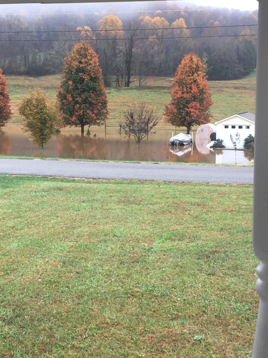
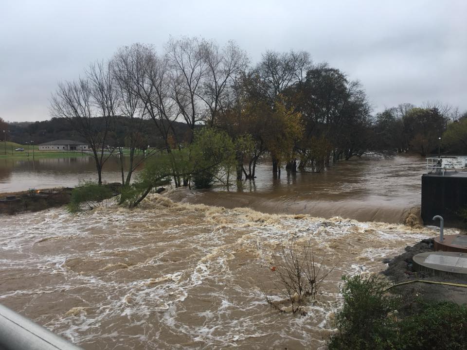
| De Kalb County Flooding by Hunter Robinson, UAH student | |
|
The flooding event during the overnight and early morning of November 7, 2017 was perhaps the most significant flooding event in western DeKalb County in over 75 years. The setup that caused such heavy rainfall is a process known as “training,” which occurs when thunderstorm bands orient themselves east to west and move directly over the same area for several hours. Something similar to this happened on May 1, 2010 in the Nashville area, kicking off that historic flooding event. This rain event came through overnight, dumping up to 6 or 7 inches of rain along a swath of land from Dickson to White County, with flooding issues being noted along the Harpeth River, in Williamson, Davidson, and Rutherford counties, and throughout DeKalb and parts of Cannon and Wilson counties. In western DeKalb County, the major waterway is the Smith Fork Creek, a tributary of the Caney Fork River. Rising around Statesville, the Smith Fork drains parts of southeastern Wilson and northern Cannon in addition to DeKalb. Notable tributaries of the Smith Fork include Marshall, Kennedy, Leach, Carter, Saunders Fork, Hurricane, Clever, Rocky Branch, Knight, Sunset, Purtle, Johnson, Wilmouth, Sycamore, Connell, Three Forks Branch, Adamson Branch, and Clear Fork Creek. Water from all of these waterways drains the communities of Statesville, Auburntown, Liberty Hill, Cottage Home, Gassaway, and parts of northern Short Mountain. The Clear Fork joins the Smith Fork in Liberty, one spot where significant flooding occurred. Floodwaters surrounded DeKalb West School and Salem Baptist Church, in addition to numerous homes. It also reached the top of the Main Street bridge on the east side of town. Continuing into Dowelltown, the Smith Fork picks up Dry Creek and its tributaries Bluhmtown Creek, Egypt Hollow Branch, Frazier Hollow Branch, and Wilder Hollow Branch, among other smaller ones. More unbelievable flooding occurred here, with the Smith Fork backing up through a small branch on the west side of town, flooding West Main Street early in the morning and prompting water rescues conducted by local EMA and rescue squad members. The east side of town was inundated by Dry Creek, making East Main Street and Smith Fork Road impassable. Downstream, water topped the bridge along Dismal Road where Dismal Branch enters the creek, leaving debris scattered along the bridge. Water backed up into a low spot along Hannah Branch, completely covering a spot in that area to a point I didn’t think was possible. After picking up water from Helton Creek and its tributaries of Coon Branch and Tramel Branch, the creek entered Temperance Hall, where there is a United States Geological Service river gauge in operation at the Highway 264 bridge where Reynolds Branch joins. An eyewitness account (my grandpa, who owns the land and lives there) stated that he had only seen water that high two other times, 1999 and 2010. Data from the gauge shows that during this event, the Smith Fork crested at 27.5 feet at 12:30 pm, having started at 2.32 feet at midnight the night before. Water discharge hit a high of 33,600 cubic feet per second, from 75 cubic feet/sec the night before. This eclipsed the mark set on May 3, 2010 of 26.89 feet and 31,600 cubic feet/sec. Further downstream, Highway 264 was completely covered in the area “between the bridges” in Temperance Hall, with water topping the Walker Creek bridge at its confluence with the Smith Fork. Roads from Auburntown to Lancaster were made impassable by the creek. All this flooding, combined with flooding in numerous other creek and river systems, led to the closure of schools in DeKalb, Rutherford, and Cheatham counties, as well as a delay in Dickson County for the day. These flooding events are not unusual or unprecedented, they happen several times a year around the country and world, but this is definitely an event to remember in DeKalb County. |