Overview
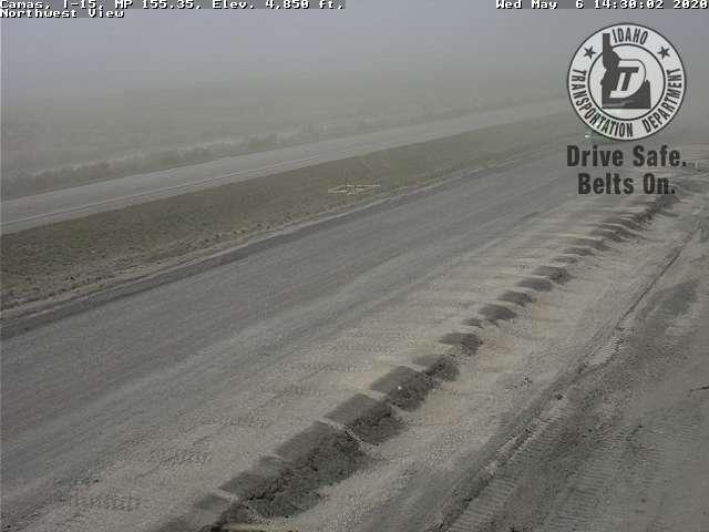
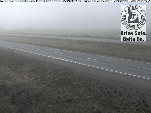
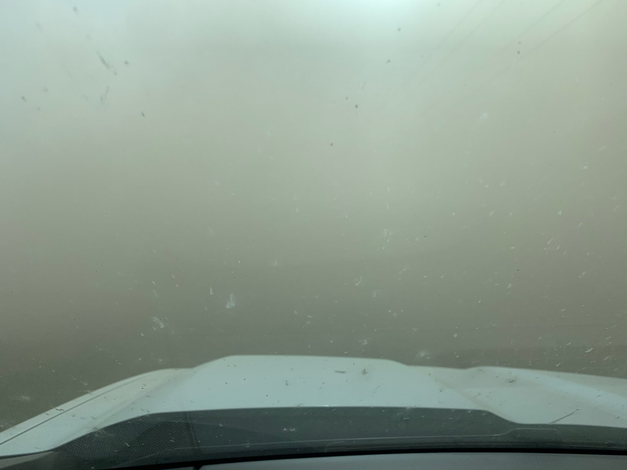
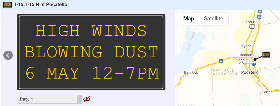
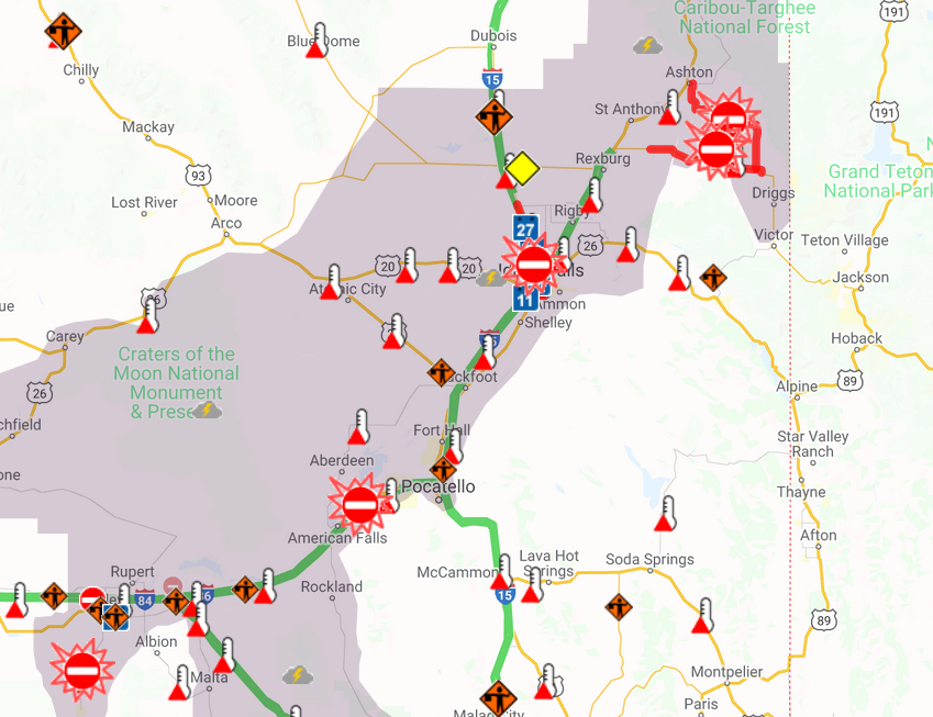
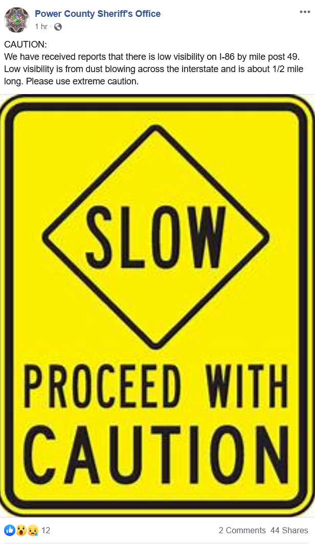
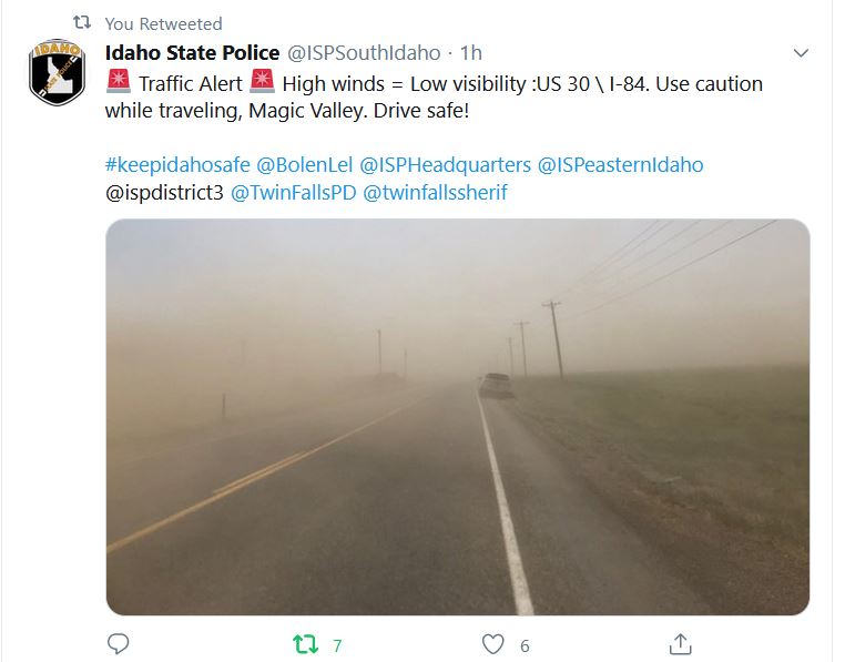
EVENT: A strong cold front blasted across southern and eastern Idaho during the late morning and early afternoon hours of Wednesday, May 6 2020. A strong pressure gradient and jet streak aloft was maximized across the area. Mostly clear skies allowed for the strong jet streak winds aloft to be mixed to the surface. A surge of wind and blowing dust accompanied the surface cold front, and this wall of blowing dust could be observed from Satellite imagery, and its existence was confirmed by area webcams. As the front raced north and east through the area, strong winds rapidly blasted across the region, reaching Hurricane force (74 mph) across Craters of the Moon and the INL. As a result of the strong winds, 5 area routes were closed due to near zero visibility in blowing dust, including Highway 27 between Burley and Oakley, I-86 between American Falls and Pocatello, I-15 between Idaho Falls and Roberts, Highway 33 between Newdale and Tetonia and finally Highway 32 between Ashton and Tetonia. Several instances of wind damage was noted, including downed trees and powerlines, arcing powerlines, and a few wildfires that quickly grew. The fires were either the result of controlled burns that crossed containment barriers or from sparks from nearby power lines. Fortunately, no injuries were reported.
LOCATION: The greatest impacts were observed across Cassia, Power, Bannock, Butte, Bonneville, Fremont, Jefferson and Teton Counties. The following routes were closed due to blowing dust: -Interstate 86 between American Falls and the Pocatello Airport -Interstate 15 between Idaho Falls and Roberts -Highway 27 between Burley and Oakley -Highway 33 between Newdale and Tetonia -Highway 32 between Ashton and Tetonia
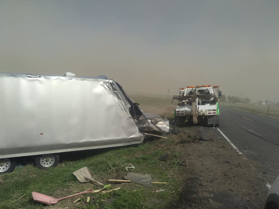
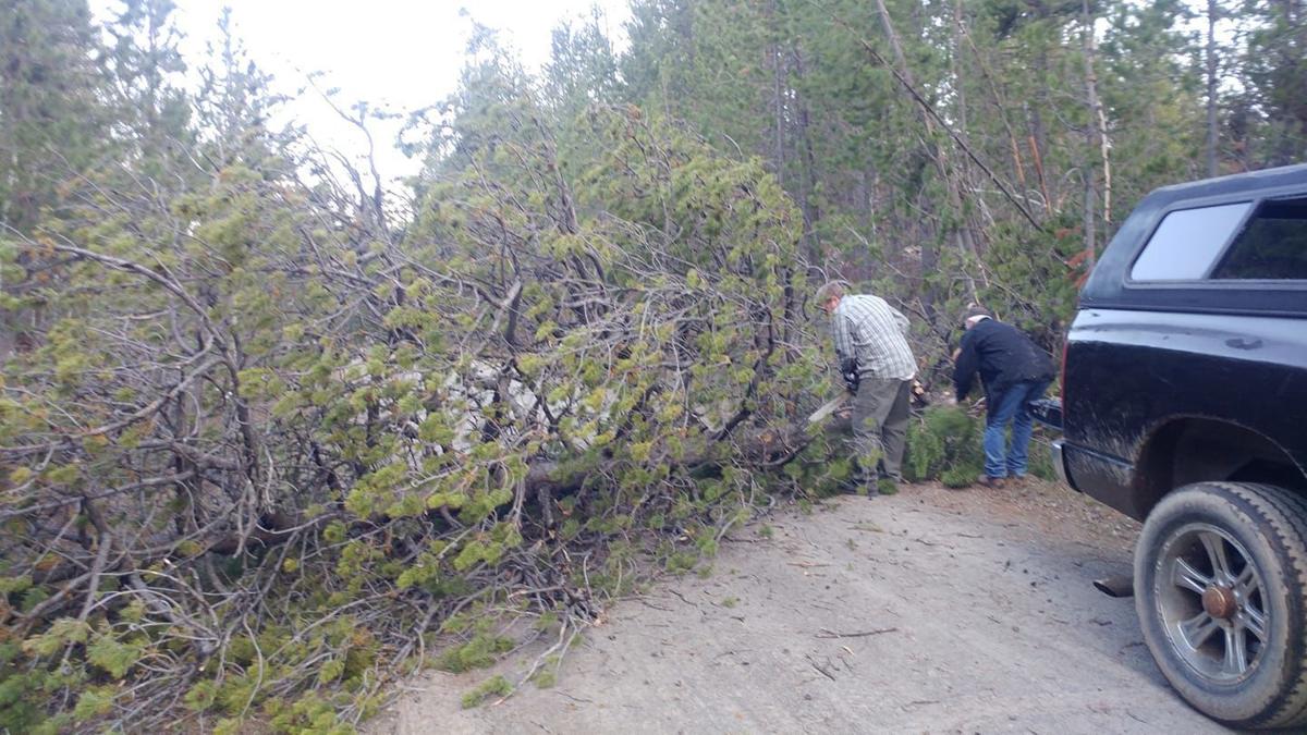
IMPACTS: -Two accidents occurred due to blowing dust on Interstate 86 within the closure area. - A semi truck was blown over on Highway 33 near Teton, ID. -Multiple powerlines were blown down, especially across Fremont and Jefferson counties. Across the northern Snake Plain, over 1200 customers were without power. Numerous reports of arcing or sparking power lines were received in these areas as well. -A tree fell on a home in Fremont County. No injuries were reported.
Video from Idaho State Police Trooper detailing dust/visibility conditions along Highway 33: https://twitter.com/i/status/1258173709682044929
|
|

Rexburg Standard Journal - Tree Uprooted
Photo by Lori Price Fuller
|
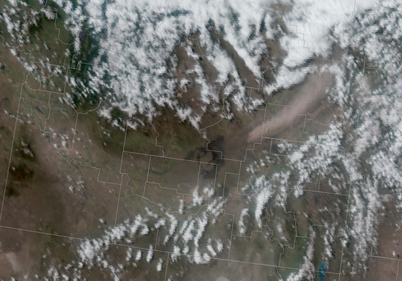
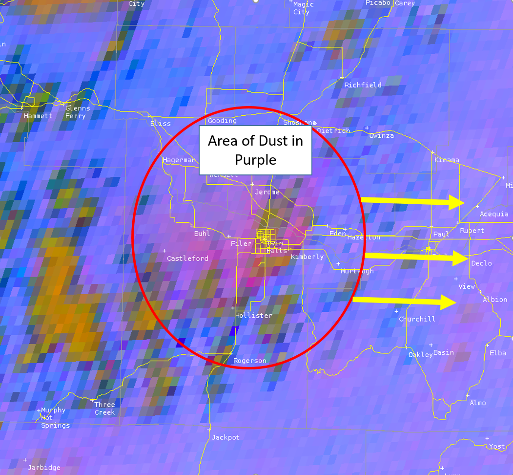
Satellite-Blowing Dust
 |
 |
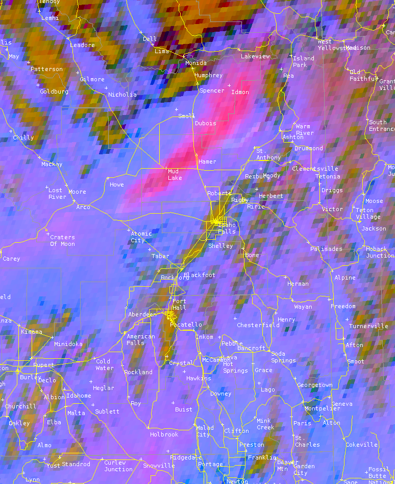 |
| Dust on Visible Satellite |
Dust Imagery - GOES 17 |
Dust Imagery - GOES 17 |
Storm Reports
NOUS45 KPIH 071700
PNSPIH
IDZ051>075-080500-
Public Information Statement
National Weather Service Pocatello ID
1100 AM MDT Thu May 7 2020
...HIGHEST WIND REPORTS FROM MAY 6TH 2020...
Location Speed Time/Date Elevation (ft.)
...Idaho...
...Bannock County...
Fort Hall 49 MPH 0535 PM 05/06 4452
Chubbuck 48 MPH 0516 PM 05/06 4484
...Bingham County...
13 ENE Atomic City 74 MPH 0330 PM 05/06
13 NE Atomic City 67 MPH 0300 PM 05/06
...Bonneville County...
D6 - Kettle Butte 66 MPH 0400 PM 05/06 5108
D6 - Ucon IC 63 MPH 0530 PM 05/06 4809
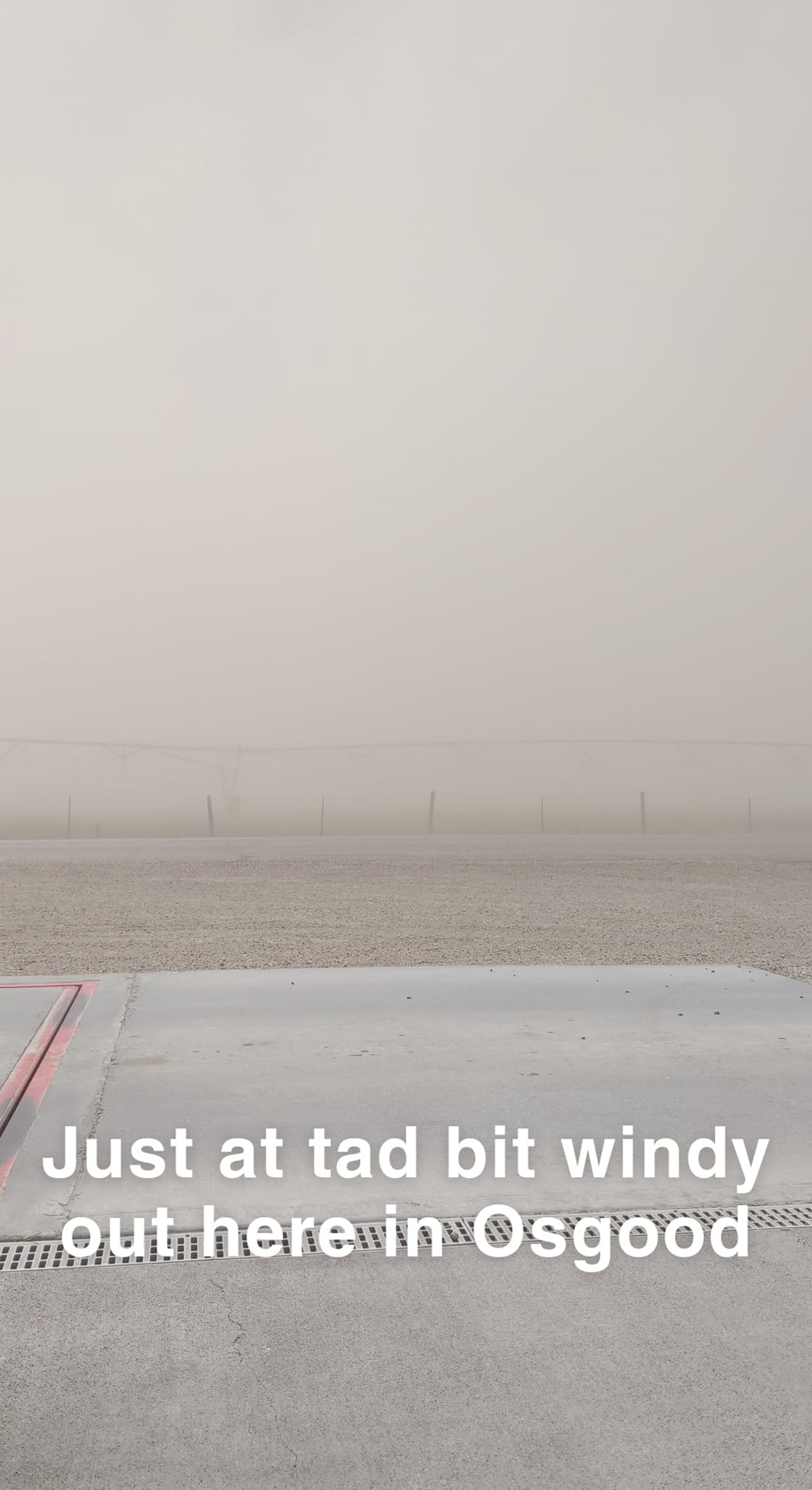
12 W Osgood 63 MPH 0415 PM 05/06
D6 - Ririe 58 MPH 0615 PM 05/06 5105
Idaho Falls 54 MPH 0450 PM 05/06 4708
Ammon 48 MPH 0325 PM 05/06 4750
D6 - Palisades Dam 48 MPH 0145 PM 05/06 5698
...Butte County...
5 W Craters of Moon 74 MPH 0245 PM 05/06
1 NW Craters of Moon 72 MPH 0255 PM 05/06
6 NW Atomic City 70 MPH 0300 PM 05/06
12 SE Butte City 66 MPH 0230 PM 05/06
Coxs Well 65 MPH 0250 PM 05/06 5200
20 ESE Craters of Moon 65 MPH 0225 PM 05/06
1 E Howe 64 MPH 0435 PM 05/06
Critical Infrastructure Comp 62 MPH 0220 PM 05/06 4910
...Cassia County...
Moburg Canyon 54 MPH 0839 PM 05/06 6570
Cotton Ridge 48 MPH 1109 AM 05/06 7584
...Clark County...
D6 - Camas 67 MPH 0415 PM 05/06 5104
1 S Dubois 66 MPH 0345 PM 05/06
D6 - Monida 56 MPH 0630 PM 05/06 6732
Dubois 54 MPH 0310 PM 05/06 5464
...Fremont County...
2 ENE Chester 66 MPH 0500 PM 05/06
D6 - Osborne Bridge 58 MPH 0444 PM 05/06 6122
Gas Caves 48 MPH 0423 PM 05/06 5774
...Jefferson County...
1 N Roberts 68 MPH 0425 PM 05/06
9 SSW Mud Lake 65 MPH 0405 PM 05/06
9 SSW Mud Lake 63 MPH 0330 PM 05/06
1 NE Terreton 63 MPH 0315 PM 05/06
Rigby 48 MPH 0431 PM 05/06 4819
Roberts 48 MPH 0220 PM 05/06 4759
Monteview 48 MPH 0200 PM 05/06 4796
...Madison County...
Sugar City 64 MPH 0430 PM 05/06 4895
D6 - Thornton 64 MPH 0415 PM 05/06 4849
Rexburg Airport 63 MPH 0427 PM 05/06 4862
...Power County...
17 W Aberdeen 54 MPH 0647 PM 05/06 5055
Pocatello Airport 49 MPH 0501 PM 05/06 4449
...Teton County...
1 NE Clementsville 70 MPH 0415 PM 05/06
Observations are collected from a variety of sources with varying
equipment and exposures. We thank all volunteer weather observers
for their dedication. Not all data listed are considered official.
Environment
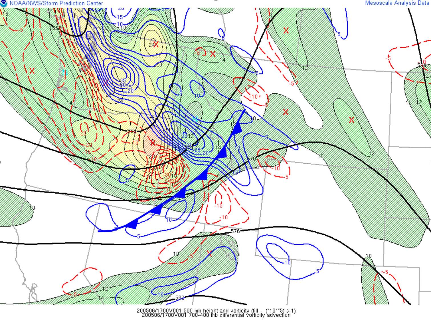
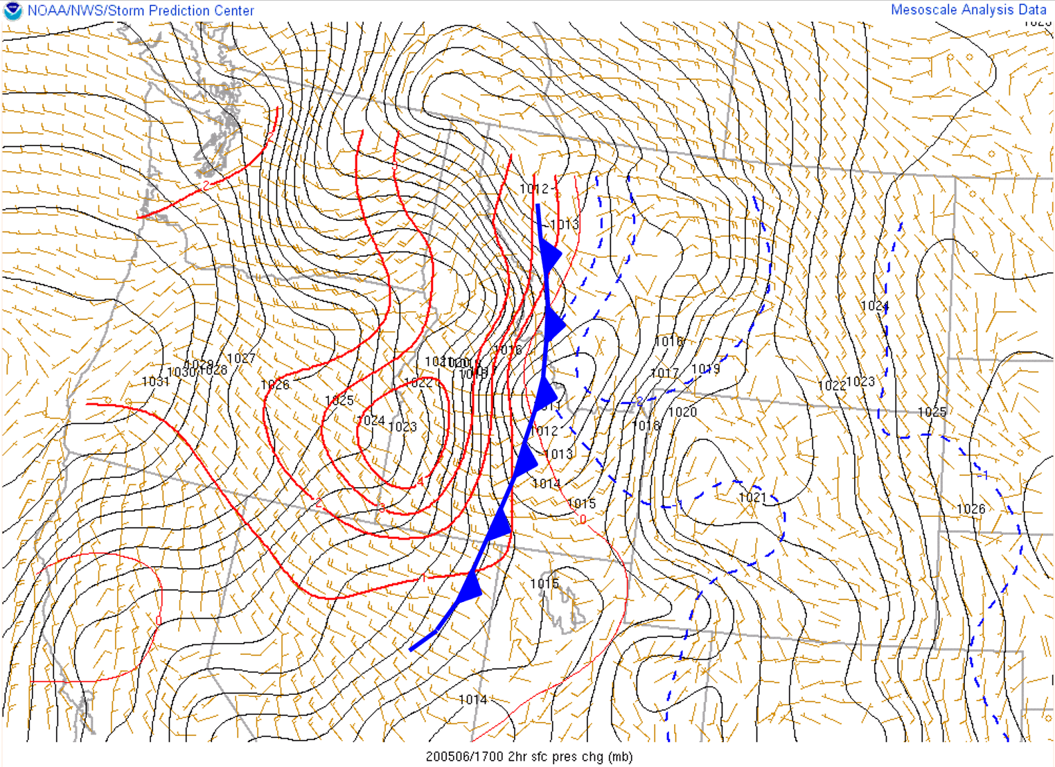
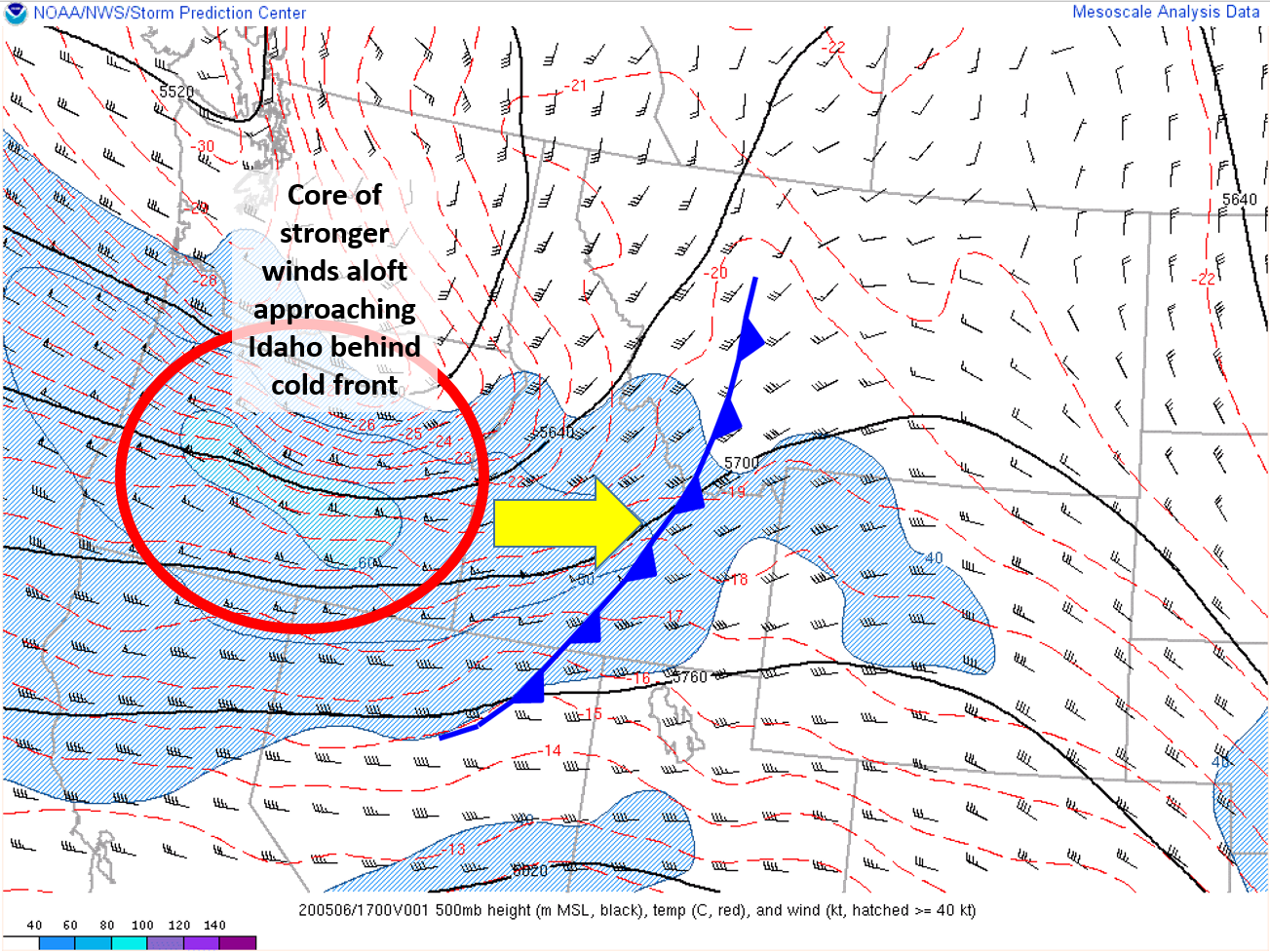
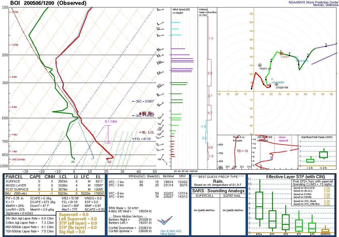
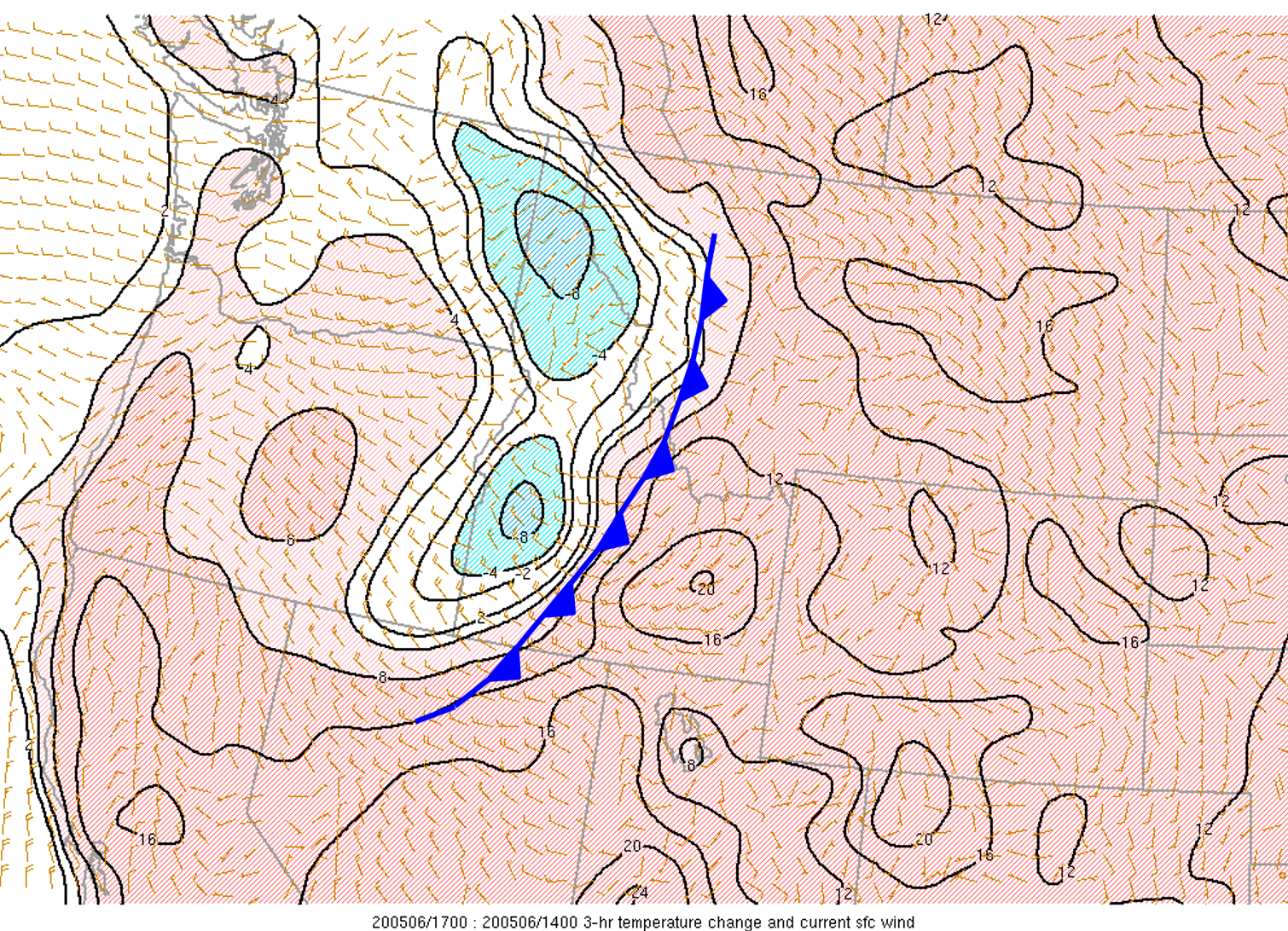
A potent shortwave through quickly zipped eastward across the Northern Rockies on Wednesday, May 6th before dropping southeastward through Wyoming. At the surface, a cold front raced across southern and eastern Idaho in lock-step with the upper-level shortwave. Although the amount of cold air behind the cold front wasn't particularly noteworthy, this system will be remembered for its sharp pressure gradient and resultant strong wind field. Surface pressure differences from west to east across southern Idaho would approach an impressive 10mb. An analysis of observed sounding data from the 12Z (6AM MDT) Boise sounding revealed the presence of a deep mixed layer to nearly 500mb. Winds at that level were observed at just over 50 knots. Plan views of 500mb winds indicated that this core of 50-60kt winds would move over northern portions of the Snake Plain behind the front. With nearly full sunshine, similar deep mixing would be observed over eastern Idaho in the post-frontal airmass, and this would allow stronger winds aloft to effectively mix to the surface, thanks to relatively steep low-level lapse rates. The juxtaposition of strong winds aloft, strongest pressure rise/fall couplets and fairly steep lapse rates (around 8°C/km) owing to surface insolation from a strong early May sun angle allowed for the perfect recipe to allow for the strong 500mb winds to reach the surface by way of downward momentum transport. Had the same system moved through the region at night or during the Winter, winds at the surface would have certainly been lighter. The relatively tree-less, flat surface across the Arco Desert is fairly frictionless, with no large trees or barriers to decrease the wind, and this makes for an ideal location for strong winds. In addition, wind through the boundary layer were unidirectional (from the same direction) and aligned with the topography of the valley, and this further increased the efficiency of the vertical mixing of the boundary layer. A dryer than normal second half of April and start to May led to dry topsoils, and when combined with agricultural activity throughout the valley, soil particles were able to be effectively lofted into the vertical, and this created widespread blowing dust across most of southern and eastern Idaho.
 |
 |
 |
|
Figure 1: Vorticity (red/blue showing shortwave location) & 500mb Heights in black & surface cold front
SPC Mesoanalysis
|
Figure 2: Pressure change with cold front. Red lines behind cold front show rapidly rising pressure.
SPC Mesoanalysis
|
Figure 3: 500 mb winds
SPC Mesoanalysis
|
 |
 |
 |
| Figure 4: Sounding from Boise at 6 am that morning showing 40 knot winds available to mix down. |
Figure 5: Temperature change (3hr temp change) with cold front.
SPC Mesoanalysis
|
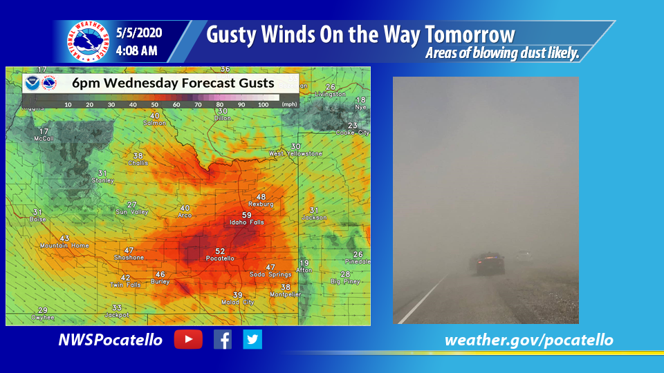
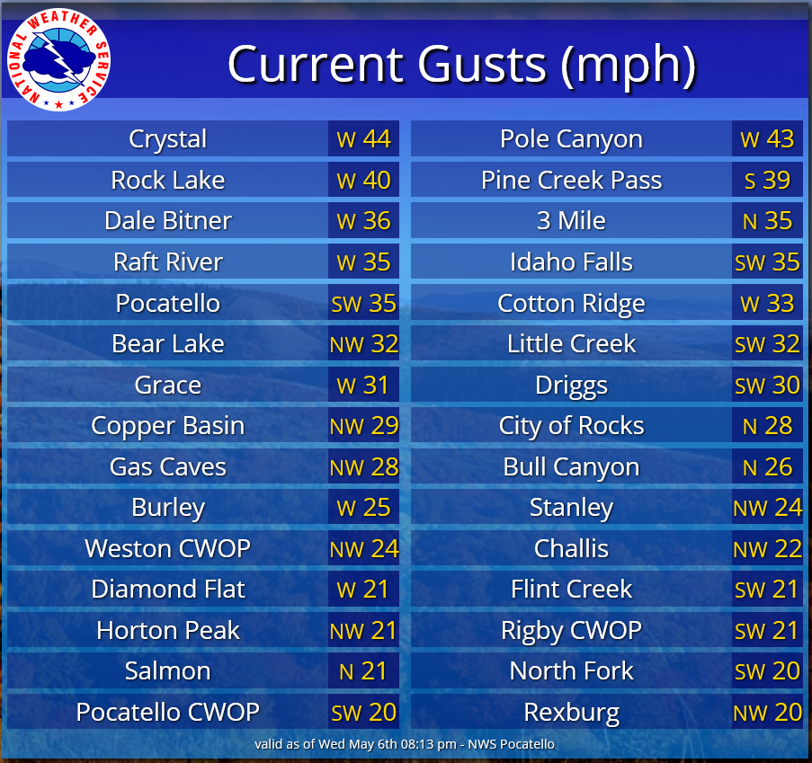
Figure 6: Max wind gusts for the event |


.W.19.1651.jpg)