On this page you learn what types of flooding are typical in South Dakota and how to you protect yourself, your family and your home. You will also find out more about significant South Dakota floods. Finally, you'll find links to NWS offices that provide forecast and safety information for South Dakota as well as links to our partners who play a significant role in keeping you safe.
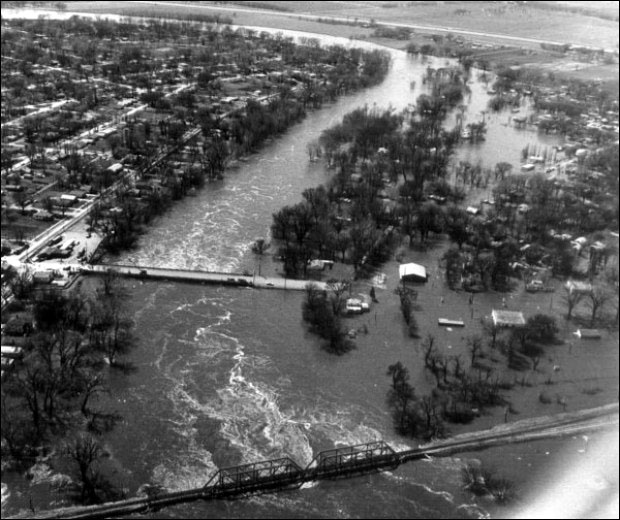
Following a wet autumn in 1968 when much of the eastern part of the state received from 150 percent to over 300 percent of normal rainfall, the winter of 1968-1969 saw the James, Vermillion, and Big Sioux river basins receive record snowfall of 60 to over 90 inches from December 1968 through March 1969 (300 to 400 percent of normal). The snow came along with temperatures that were 4 to 6 degrees below normal through the heart of the winter. The water equivalent of the snow pack by early March 1969 was between 4 to 8 inches across nearly all of eastern South Dakota. Little of the snow melted in March because temperatures remained below normal, but in early April, a rapid warm-up occurred with high temperatures reaching into the 50s and 60s and low temperatures remaining near to above freezing at night.
On the James River, backwater from ice and high tributary flows north of Huron kept the stage from reaching the record levels of the 1881 flood, but peak discharge from the snowmelt was as much as 1.5 times the previous maximum discharge. Major flooding affected the entire river basin, and flood damages exceeded $16 million across the basin.
The Vermillion River also saw major flooding, but not near any record levels. Flood damages in the Vermillion Basin exceeded $1 million.
The Big Sioux River from Watertown through Sioux Falls to Sioux City also saw major to record flooding in early to mid-April as the deep and wet snowpack quickly melted. More than 100 families were evacuated along the river from Watertown to north of Sioux Falls, including all 50 residents of the town of Renner. The U.S. Army Corps of Engineers flood prevention works in and around Sioux Falls, which include a bypass channel and extensive dikes and levees, protected the state's largest city from any major damages even though peak discharges were about 1.5 times the previous peak flood.
Downstream of Sioux Falls to Sioux City, roughly 50 homes were evacuated and suffered damage. The entire population of North Sioux City (800 people at the time) was evacuated. Total estimates of the number of people evacuated were around 4,000 in South Dakota. Over 150 National Guard troops were called out to help with the flood emergency in southeastern South Dakota. Total flood damages in the Big Sioux River Basin were greater than $15 million.
|
|
During 2011, the annual runoff into the Missouri River Reservoir System, upstream of Sioux City, IA, was estimated at 60.8 million acre-feet (MAF). In comparison, the previous greatest annual runoff volumes were 49 million acre-feet in 1997 and about 50 MAF in 1881. During 2011, the March-July runoff was 48.7 MAF, greatly exceeding the previous record of 36.6 MAF in 1997.
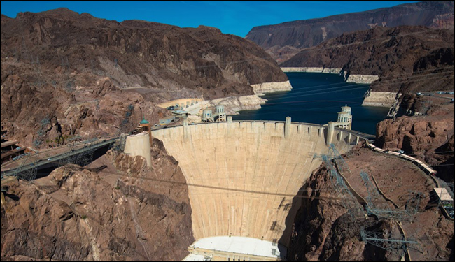
The Missouri River mainstem reservoir system, authorized by the 1944 Flood Control Act (Missouri River Authorized Purposes Study, 2010), consists of six dams and reservoirs constructed on the Missouri River: Fort Peck Dam (Fort Peck Lake), Garrison Dam (Lake Sakakawea), Oahe Dam (Lake Oahe), Big Bend Dam (Lake Sharpe), Fort Randall Dam (Lake Francis Case), and Gavins Point Dam (Lewis and Clark Lake). The combined storage of all six system reservoirs is reported to be 73.1 MAF.
Downstream from Oahe Dam, at Pierre, SD, the river stage reached an average daily level of 1,433.98 feet at a streamflow rate of about 160,000 feet 3/s on June 21, 2011. This was the highest stage since the dam was completed in 1958. Although the 2011 flood is the largest flood of record in overall volume, earlier floods have had higher peak flow rates and stage levels. Prior to construction of Garrison and Oahe Dams, the Missouri River at Pierre reached a peak stage of 1439.6 feet on April 6, 1952 at a streamflow rate of 440,000 ft. 3/s.
Downstream of Gavins Point Dam, the peak flood stage at Sioux City, IA, was the highest since construction of the dams. The stage on July 21, 2011, was 35.25 feet, or over 4 feet higher than the next highest, which occurred in 1984 (Figure 5). Prior to regulation, the stage at Sioux City reached 44.26 feet at a streamflow of 441,000 ft. 3/s.
On June 1, nearly 3,000 people in Pierre and Fort Pierre were evacuated. On June 3, South Dakota governor Dennis Daugaard urged residents in the Country Club section of Dakota Dunes (which is below Gavins Point Dam) to evacuate. He noted that it might be 2 months before they could return.
On June 21, South Dakota reported its first flood fatalities when two women drowned in Lyman County after they drove their car down a washed out road. On the same day Pierre officials estimated costs from the flood would be $13.2 million for that community. High water damaged 42 of the 130 state parks and recreation areas in 2011, ultimately causing about $9 million in damage. The flooding on the Missouri River persisted into  September 2011, leaving many areas under water for 3 to 4 months.
The floods of the Missouri River Basin caused approximately $85 million in direct damages, claimed 5 lives and led FEMA to issue disaster declarations in each state along the Missouri River. Two of these flood deaths were vehicle related and occurred directly on or near the main-stem Missouri River.
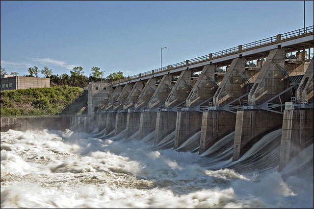
Gavins Point Dam
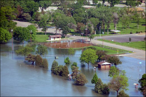
Flood waters from the Missouri River flood Griffin Park in Pierre, S.D., AP Photo
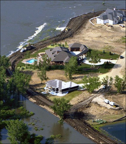
Levee construction continues along the Missouri River in this aerial photograph taken over the Spanish Bay addition in Dakota Dunes, S.D., Tuesday, June 7, 2011, AP Photo/The Sioux City Journal
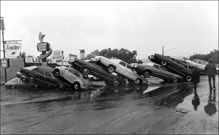
October 1983 through March 1984 saw greater than normal precipitation across most of southeastern South Dakota. Most sites reported over 200 percent of normal precipitation for this period. That precipitation was followed by a wet April with southeastern South Dakota averaging between 250-300 percent of normal. May 1984 had near normal rainfall, but the ground remained saturated with higher than normal river levels heading into June. June 1984 then set a record (at the time) for wetness, and the James, Vermillion, and Big Sioux Rivers all saw widespread and damaging flooding from June 11-26.
The first heavy rains of June occurred on the 4th-5th, causing lowland flooding on the Vermillion and Big Sioux rivers. Then, from the 7th-11th, the area measured additional rains of up to 5 inches, causing flash flooding on the smaller tributaries and eventually more significant flooding on the three rivers, with many roads and bridges damaged. Another 1-4 inches of rain fell over the same areas on the 14th-17th, followed by up to 7 inches of rain on the 19th-22nd.
Roads, bridges and culverts were washed out, basements collapsed, and stock dams were washed out. Some streets were under 5 feet of water, and many homes had 3 to 4 feet of water in them. In total, it was estimated that on June 21-22 alone, 1,000 miles of roads and over 1 million acres of crop land were inundated, and over 40 homes were evacuated. Damage estimates in 16 counties in southeastern South Dakota were placed at $300 million, most of which was to agriculture.
Learn More:
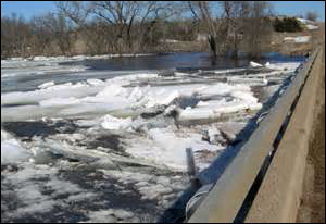
Ice Jams on the Vermillion River, courtesty SD Public Broadcasting
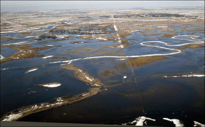
This is the flood pool sitting just north of Lake Kampeska. Much of this water is headed into Lake Kampeska until the lake elevation rises enough to force it downstream through Watertown. The outline of winding ice is the normal river channel, Watertown Public Opinion
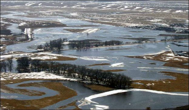
The Big Sioux River swallows up farm land near Castlewood, Watertown Public Opinion
|
||||||

