Dangerous heat will expand from the Gulf Coast into the Southern Plains and Desert Southwest through week's end. Additional extreme heat impacting the Pacific Northwest will shift to the northern Plains by the weekend. Tropical Storm Bertha is expected to continue to impact portions of the northern Gulf Coast from the western Florida Panhandle to southeastern Louisiana through tonight. Read More >
Overview
On the evening of June 9, 1972, heavy thunderstorms caused devastating flash flooding throughout Rapid City and the eastern foothills of the Black Hills—destroying homes, vehicles, businesses, and bridges, and claiming 238 lives. Here is information about flood safety.
 |
| Flood damage on East Blvd. at Omaha St. in Rapid City, June 10, 1972 (photo courtesy of the Rapid City Journal) |
Flash Flood Timeline
June 9, 1972 (all times are Mountain Daylight Time)
9:00 am – The National Severe Local Storm Forecast Center (now known as the Storm Prediction Center) advised that isolated thunderstorms approaching severe limits (hail larger than ¾” and wind gusts stronger than 60 mph) were expected in western South Dakota during the late afternoon and evening.
Noon – The Rapid City National Weather Service (NWS) office predicted isolated thunderstorms approaching severe limits (hail larger than ¾” and wind gusts stronger than 60 mph) in the afternoon and evening in their release to the media.
1:30 pm – Thunderstorms over the Black Hills were detected on Ellsworth Air Force Base (AFB) weather radar.
3:00 pm – A line of thunderstorms developed southeast of Rapid City and moved west-northwest.
3:40 pm – The Ellsworth AFB weather radar observer notified the NWS of precipitation over the Black Hills.
5:00 pm – Rain began at Pactola Reservoir.
6:00 pm – State Radio Dispatch requested commercial radio and television stations to announce that motorists should avoid Boulder Canyon because of high water between Deadwood and Sturgis.
6:15 pm – State Radio advised the NWS of 12 inches of water over the highway west of Sturgis and heavy rain southwest of Rapid City.
6:30 pm – The South Dakota School of Mines and Technology (SDSMT) radar operator told the NWS about strong thunderstorms in the Hermosa area.
6:30 pm – The Pennington County Civil Defense Director called the Rapid City police to report 3 inches of rain at Pactola Dam, and that Rapid Creek was rising rapidly.
6:45 pm – The National Guard Commander was informed of water over the road in Boulder Canyon by the Lawrence County Sheriff.
6:50 pm – The SDSMT radar operator advised the NWS of heavy rain from Piedmont to the northern Hills, with radar indications of rain falling at the rate of 2 inches per hour.
7:00 pm – The NWS received a report of 4 inches of rain since 5:00 pm at Galena (southeast of Deadwood).
7:15 pm – The NWS issued a flash flood warning for the northern Black Hills.
7:30 pm – Rapid City Mayor Don Barnett was notified of the flash flood warning; the National Guard and local law enforcement were called to duty.
7:30 pm – KOTA received a call from the dam tender at Pactola of rapid rises along several creeks.
7:45 pm – A person in Nemo informed the NWS that Box Elder Creek was flooding, two dams upstream had broken, and low-lying areas of Nemo had been evacuated.
8:00 pm – The NWS expanded the flash flood warning to include Rapid Creek and Box Elder Creek.
8:00 pm – The Rapid City–Pennington County emergency operations center opened.
8:40 pm – The Ellsworth AFB radar observer reported heavy precipitation over the central Black Hills.
9:00 pm – Commercial phone service at the NWS office at the Rapid City Airport became intermittent and unreliable.
9:30 pm – NWS informed radio and television stations that the heavy rain will continue until about midnight.
10:10 pm – The Brookdale residential area (near the Central States Fairgrounds) was evacuated.
10:30 pm – In a television and radio broadcast, Mayor Don Barnett urged immediate evacuation of low-lying areas.
10:45 pm – Canyon Lake Dam failed, adding to the flood waters rushing through Rapid City.
June 10, 1972
12:15 am – A flood crest estimated at 50,000 cubic feet per second reached downtown Rapid City.
5:00 am – Rapid Creek was once again within its banks.
 |
| Debris and damaged bridge, Rapid Creek (photo courtesy of the Journey Museum) |
Technology Changes & Mitigation Projects
Many improvements in communications, technology, zoning, and infrastructure have been implemented since the 1972 flood to create a safer community.
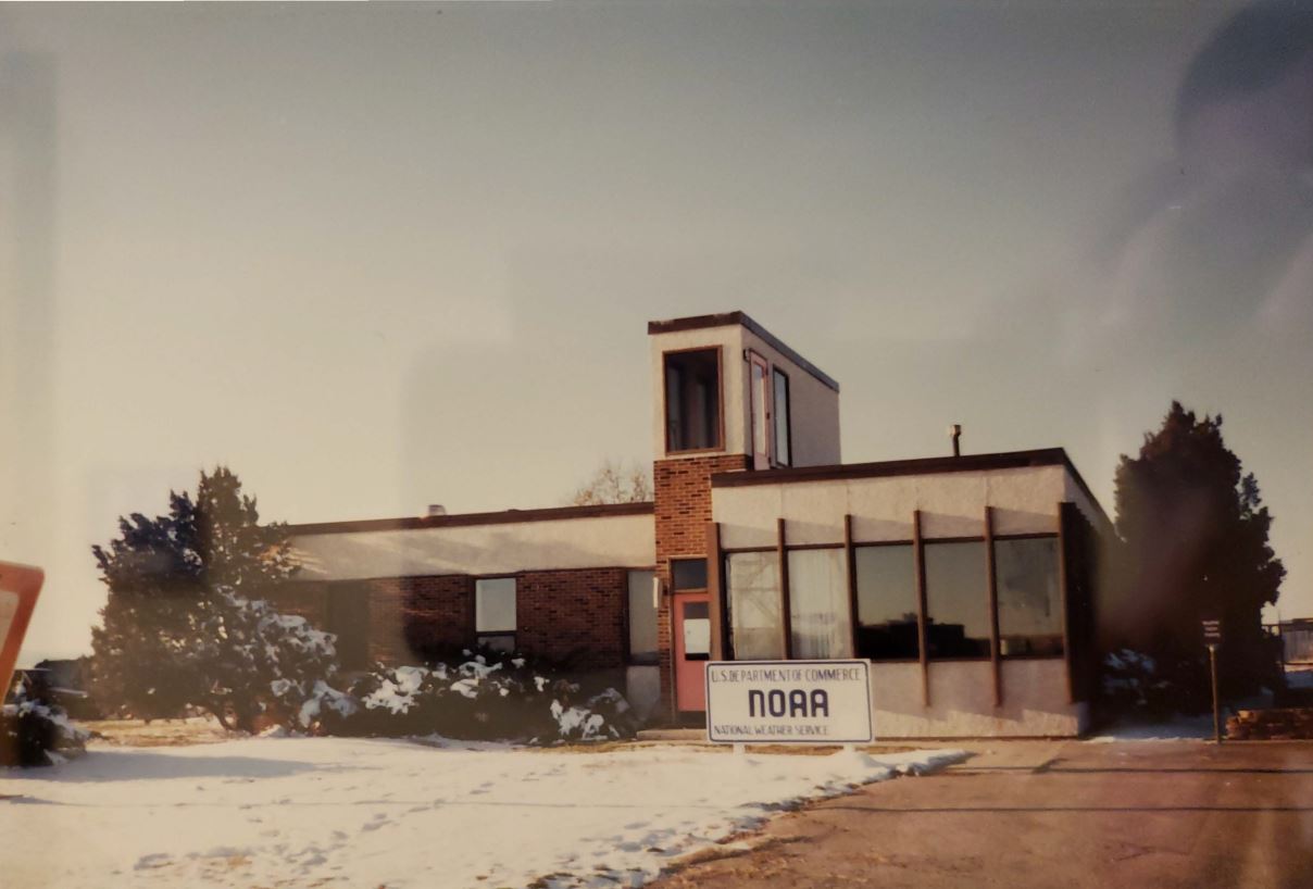 |
| Rapid City NWS office as it looked in 1972 |
National Weather Service Office Duties
In 1972, the primary duties of the National Weather Service (NWS) office in Rapid City were taking hourly surface observations and twice-daily upper air observations, issuing local storm warnings, and providing local forecasts to the media. Forecasts were made by the NWS offices in Sioux Falls, South Dakota, and Minneapolis, Minnesota. Flood warnings were issued by the NWS office in Sioux City, Iowa. The personnel in Rapid City were not trained to make forecasts and use new technologies and procedures to issue warnings; instead, they relied on reports of severe weather from people across the area. The staff at Rapid City also lacked access to vital weather data needed to issue warnings.
The Rapid City NWS office is now a forecast office with a full-time staff of meteorologists who issue all the forecasts and warnings for northeastern Wyoming and the western third into south-central South Dakota. In order to fully utilize the equipment available in the offices, forecasters and technicians frequently attend seminars and training sessions to improve their skills and learn new forecasting techniques. Staff members also research storm events in the local area to better understand the effects of the Black Hills on the weather.
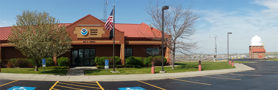 |
| Rapid City NWS forecast Office, 2015 |
All NWS offices are connected by a nationwide computer network called the Advanced Weather Information Processing System (AWIPS). Data from AWIPS are transmitted among the sites by telephone lines and satellite. Forecasters can examine weather observations, satellite images, radar data, lightning strike information, river observations, and computer generated forecasts at their workstations. From these workstations, forecasters can select potential severe storms and have the computer compose the warning bulletin (including arrival time at locations along its path), and then transmit it to other NWS offices, external users, and National Oceanic and Atmospheric Administration (NOAA) Weather Radio.
National Weather Service Warnings
In 1972, the NWS office in Rapid City did not have a teletype system to transmit warning bulletins to the media, emergency officials, and other NWS offices. Instead, the NWS used a one-way telephone hotline to the media to verbally notify them of warnings. Today, all NWS offices, including Rapid City, are connected by dedicated phone lines and satellite links that transmit data within the agency and to external users within seconds of issuance.
NWS warnings are transmitted to a regional site where they are sent to the NOAA Weather Wire System satellite. Users receive the warnings through a satellite downlink. The warnings also enter the NWS's communications hub near Washington, DC, and are relayed through news services to local media.
NWS forecasters use the South Dakota state radio system to notify 911 dispatchers and emergency managers of warnings and receive reports of severe weather and flooding from law enforcement officials and weather spotters across the area.
NOAA Weather Radio
In the mid-1970's, NOAA, the NWS's parent organization, developed NOAA Weather Radio (NWR), a network of radio stations operated by local NWS offices. The continuous broadcasts provide current weather warnings, forecasts, and conditions. Warnings for tornadoes, severe thunderstorms, and flash floods activate weather radio receivers to alert people to the hazard even if they're sleeping, watching cable or satellite TV, don't live near a warning siren, are outdoors, or the electricity is off. The station serving Rapid City was installed in 1981, but broadcast at only 200 watts, so the range was quite limited. The power was eventually raised to 1,000 watts and coverage expanded to include the eastern slopes of the Black Hills. Additional NWR stations on Terry Peak near Lead, Battle Mountain near Hot Springs, Philip, Porcupine, Faith, White River, Newcastle, Gillette, and surrounding states provide NWR coverage to nearly all of western South Dakota and northeastern Wyoming. More information on NOAA Weather Radio in the Black Hills region is available on our NOAA Weather Radio page.
Emergency Alert System
The Emergency Broadcast System (EBS) was designed to announce nuclear attack warnings over commercial radio and television through a "daisy chain" relay system. Stations would monitor one designated station in the area for emergency messages and manually activate the system. When someone at the primary station announced weather warnings, people at other stations listened for the warning signal, copied the information they heard, and read it on their station. Other stations that were monitoring the secondary stations would repeat the process. If one station was off the air, the remainder of the stations never received the warnings.
The EBS was replaced by the Emergency Alert System (EAS) in 1997. All local radio and television stations and cable television systems monitor several other stations to ensure they receive emergency messages. Warnings automatically interrupt routine broadcasts, even if no one is at the station. The EAS uses digital codes, so television stations can also scroll warning information as the message is announced. Stations can also monitor NWR signals for severe weather warnings. The Rapid City–Pennington County Emergency Management office can also activate the EAS from the Emergency Operations Center.
Sirens
In 1972, Rapid City had only four outdoor sirens, which were not used during the 1972 flood. The county has installed nine additional sirens in the city since then and has four more serving outlying areas of the county.
Other Systems
Weather information is available from many more sources today than in 1972. Wireless service providers broadcast Wireless Emergency Alerts (WEA) that they receive from the Federal Emergency Management Agency's (FEMA) Integrated Public Alert and Warning System (IPAWS). Warning information is available through text messages, e-mail messages, and pager systems. The Internet has many sites with weather forecasts and warnings (including official NWS products), and small satellite systems are available for homes and businesses to provide warnings, forecasts, and radar data.
Weather and Water Observations
Obtaining measurements of various elements is necessary to forecast conditions in the environment. Instruments that record and transmit temperature, precipitation, wind, humidity, and river-level data are scattered throughout the region.
Satellite
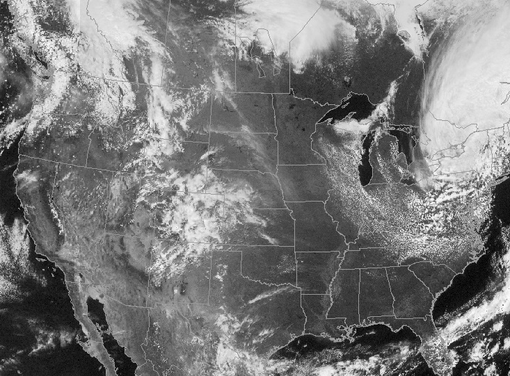
Satellite images are photographs of the earth taken from space and provide information for climate research, atmospheric temperature and humidity, volcanic eruptions, and global vegetation analysis. The use of satellite data to monitor storm development was not very advanced in 1972. Visible satellite images were available only during daylight hours, when the sun provided enough light to illuminate cloud features. The images were only available at a few NWS offices, but they did not have personnel available to analyze and interpret the data.
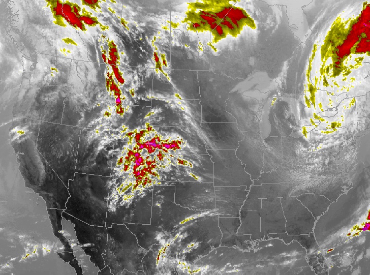
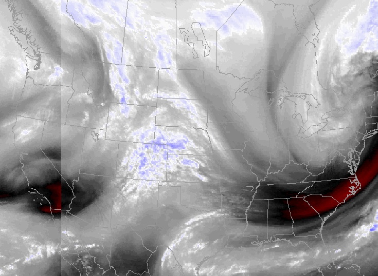
Three types of satellite images are commonly used in forecast operations.
 |
 |
 |
| Visible satellite image | Infrared satellite image | Water vapor satellite image |
Visible images (image on the left) use reflected light, like a regular camera. Although this type of satellite provides very detailed images, the information is not available at night.
Infrared images (center image) show infrared energy radiated from the top of objects in the satellite's view. Since atmospheric temperature generally decreases with height above the ground, clouds are cooler than ground temperatures and tall thunderstorms have even colder temperatures than regular clouds, so they appear different. Infrared images are often enhanced, or color-coded, to make features easier to distinguish. These images are available 24 hours a day, giving continuity to forecasters tracking storms.
In addition to taking a photograph or measuring infrared energy, the satellite sensors also detect the amount of water vapor in the air (image on the right). It is an excellent tool to track larger scale storm systems and the path of jet streams, which affect the development of thunderstorms (as well as winter storms). Water vapor images are also enhanced to make analysis easier. These images are available 24 hours a day.
Surface Observations
NWS meteorologists use surface observations to make forecast and warning decisions. The data are also input into forecast models to produce extended-range forecast guidance. In 1972, hourly observations of temperature, dewpoint, wind speed and wind direction, sky condition, visibility, current weather, and barometric pressure were taken by a human observer. The information was recorded on a paper form and disseminated to other users on a teletype machine.
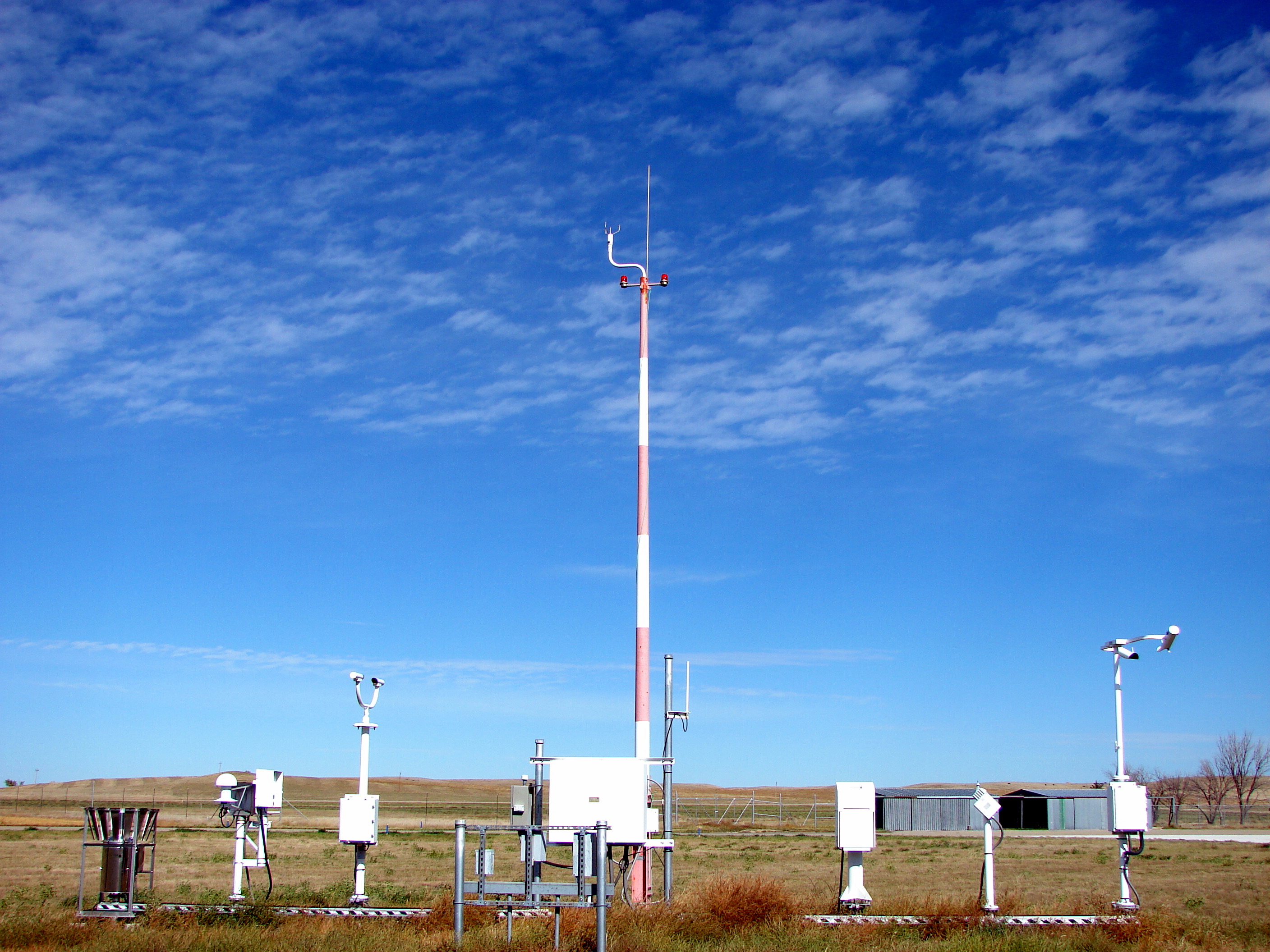 |
| The Automated Surface Observing System (ASOS) |
Now, observations are obtained using Automated Surface Observing Systems (ASOS), which are continuously recording data. When significant changes occur, ASOS sends out a special observation. Additional observing networks are operated by federal and state land management agencies, state climatologists, state departments of transportation, and television stations (among others).
Radar
Radar, an acronym for "radio detection and ranging", was originally used by the military to track aircraft, but is now also a very important observational tool for meteorologists. A weather radar unit sends out energy that bounces off objects in the atmosphere, such as rain drops and hailstones; some of this energy is returned to a receiver, amplified, and processed for interpretation by meteorologists.
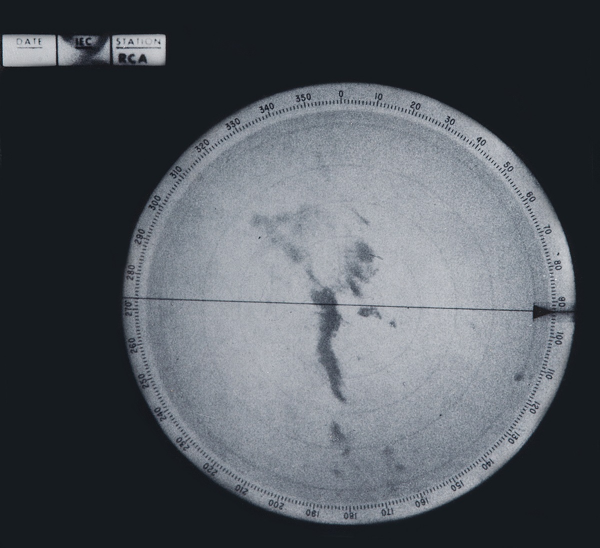 |
| Ellsworth Air Force Base Conventional (old) radar display June 9, 1972 at 730 PM MDT |
The Rapid City NWS office did not have its own weather radar in 1972, but monitored a remote display from the radar at Ellsworth Air Force Base. However, the display was inoperable and the radar itself was operating intermittently during the flood. The NWS radar station in Huron indicated the location of the thunderstorms over the Black Hills region in their hourly observations, but storm intensity information was not included because they were so far from the radar. The Rapid City NWS office also did not have the radar circuit, so the staff didn't receive the reports. The South Dakota School of Mines and Technology (SDSMT) Institute of Atmospheric Sciences also operated a radar and contacted the NWS Office periodically with information until the SDSMT radar was shut off at 7:00 p.m.
 |
| Current (2018) radar display with storm-total precipitation estimates |
Upper-Air Observations
The NWS office in Rapid City is part of a network that takes observations of the upper atmosphere that provide forecasters with a three-dimensional view of the atmosphere. Weather balloons carrying instruments called radiosondes are launched simultaneously twice a day at stations around the world. A radiosonde is an instrument that measures the temperature, pressure, and humidity of the air above the ground. Analyzing the radiosonde's positional data yields wind speed and direction information. Supercomputers collect, process, and analyze observational data as a key component to numerical prediction models. Below are the 5:00 am and 5:00 pm June 9, 1972 upper-air observations taken by the Rapid City NWS office.
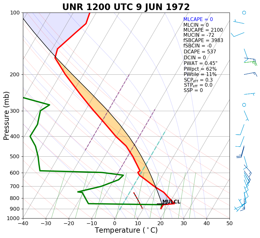 |
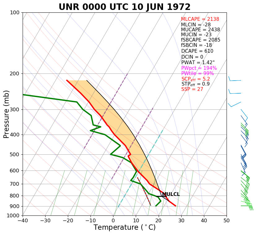 |
| 5:00 am, June 9th, 1972 upper-air observation from Rapid City | 5:00 pm, June 9th, 1972 upper-air observation from Rapid City |
River Gauge Network
To determine the stage, or how deep the water is at a given location, river gauges are used. Although there are many types of river gauges, they are classified as either recording or non-recording. Two common types of non-recording gauges are staff gauges and wire-weight gauges. A staff gauge is similar to a ruler, and the river level is read directly from the gauge.
 |
 |
| Wire-weight gauge (left) and data collection platform (DCP, right) | |
A wire-weight gauge consists of a drum wound with cable, a weight attached to the end of the cable, a graduated disc, and a counter. When the bottom of the weight is resting on the water surface, a river stage reading can be obtained from the graduated disc and counter.
A limitation of non-recording gauges is the need for an observer. However, data collection platforms (DCPs) are electronic devices connected to river or rain gauges to automatically record stage and precipitation data. In 1974, geosynchronous meteorological satellites were developed and launched by the National Aeronautics and Space Administration (NASA). DCPs transmit data to these meteorological satellites, which in turn relay information to a remote computer for analysis.
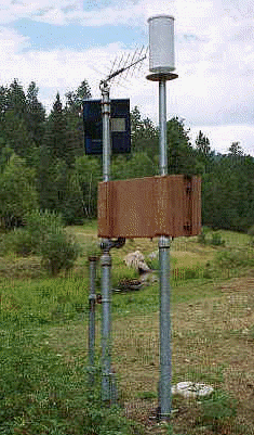
Precipitation Network
According to NWS documents, the observational network in western South Dakota was about 50% complete at the time of the flood. Twenty sites in the area provided precipitation readings on a daily basis. Since 1972, the number of sites routinely reporting precipitation information has increased to 94.
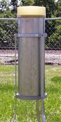 |
 |
| Standard 8-inch rain gauge (left) and weighing rain gauge (right) | |
Like river gauges, there are two types of precipitation gauges, recording and non-recording. The 8-inch standard non-recording rain gauge has been used since 1891 as the official precipitation measuring device. Rain, funneled into a narrower tube that "magnifies" the catch, can be read to the nearest hundredth of an inch using a specially calibrated measuring stick. The narrower tube holds up to 2 inches of rain, so the larger tube acts as an overflow.
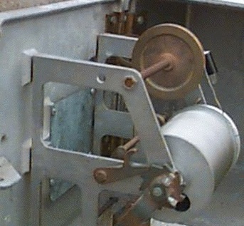
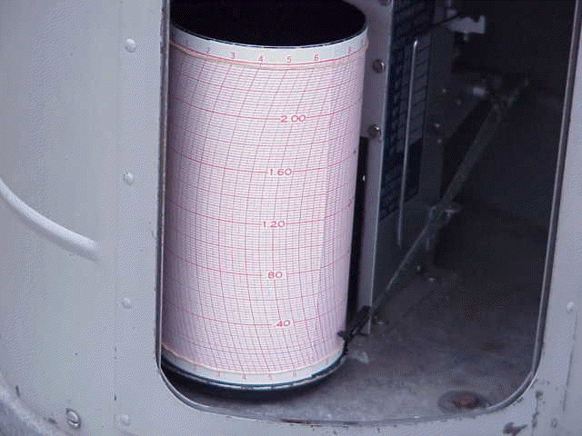
Recording rain gauges not only measure the amount of rain, but the rate at which it falls. The Universal Weighing and Recording gauge collects rainfall in a weighing bucket. The weight of the precipitation in the bucket causes a pen to move and make a trace on a graph.
Other types of recording gauges include the Fischer–Porter punched tape recorder and the tipping bucket. Fischer–Porter gauges punch a paper to record the amount of accumulated precipitation in a given period, generally 15 minutes. Tipping bucket gauges collect rainfall in a two-chambered bucket until the weight of the precipitation causes the bucket to tip, dump the collected water, and move to the other chamber under the funnel. Precipitation observations in 1972 were recorded in a similar manner to the Universal Weighing and Recording gauge.
Greenways and Infrastructure
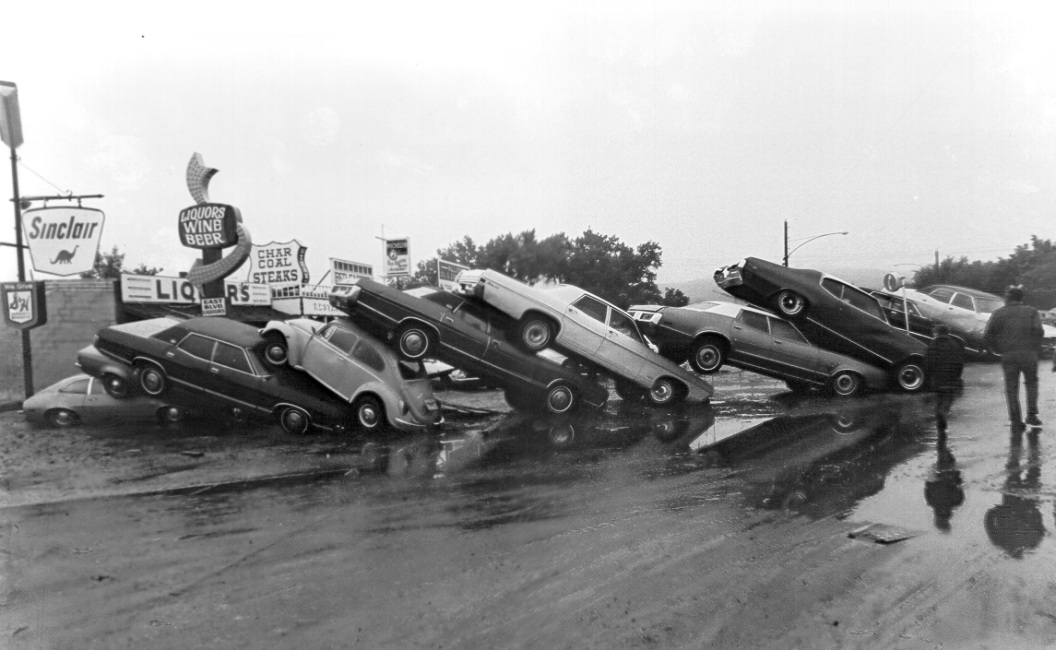
Prior to the 1972 flood, numerous homes and businesses were built along the banks of Rapid Creek. The photo on the left below shows Omaha Street in downtown Rapid City before the flood. The businesses located along the street were damaged or destroyed in the flood. According to statistics compiled by the United States Geological Survey (USGS) and NOAA, the flood caused a total of $160 million ($664 million in 2002 dollars) damage, including $37 million in residential property damage and $33 million to businesses and industries. Over 1,800 houses were flooded—1,335 of which were destroyed. Nearly 50 businesses and 5,000 cars were destroyed.
In order to prevent another flooding disaster in Rapid City, several options for hazard mitigation were discussed shortly after the flood; these included the construction of a dam and/or levee, or straightening Rapid Creek. Straightening the channel was not well received according to the Flood Disaster Feasibility Study. The United States Army Corps of Engineers (USACE) indicated dams and levees were not considered due to sink holes. Not only would water be lost, but unstable rock formations could cause structural damage at the dam.
The other option was to develop an open floodway along Rapid Creek. A floodway is the area of the floodplain where water is likely to be the deepest and moving the most quickly. The USACE determined which areas adjacent to Rapid Creek were in the floodway and performed channel modifications in areas where businesses could not be relocated. Within two months of the flood, officials in Rapid City began the process of acquiring property along Rapid Creek—the first step in prohibiting the construction of homes or businesses in the floodway. Approximately 750 acres of land near Rapid Creek were developed as a floodway. Over $12 million in funds from Housing and Urban Development (HUD) was allotted for relocation of homes and businesses displaced by the flood. Several sites located in the floodway were given the option of relocating, but didn't. Further expansion or development at those businesses, known as non-conforming sites, is restricted. Ordinances have been passed that prohibit development in the greenway along Rapid Creek.
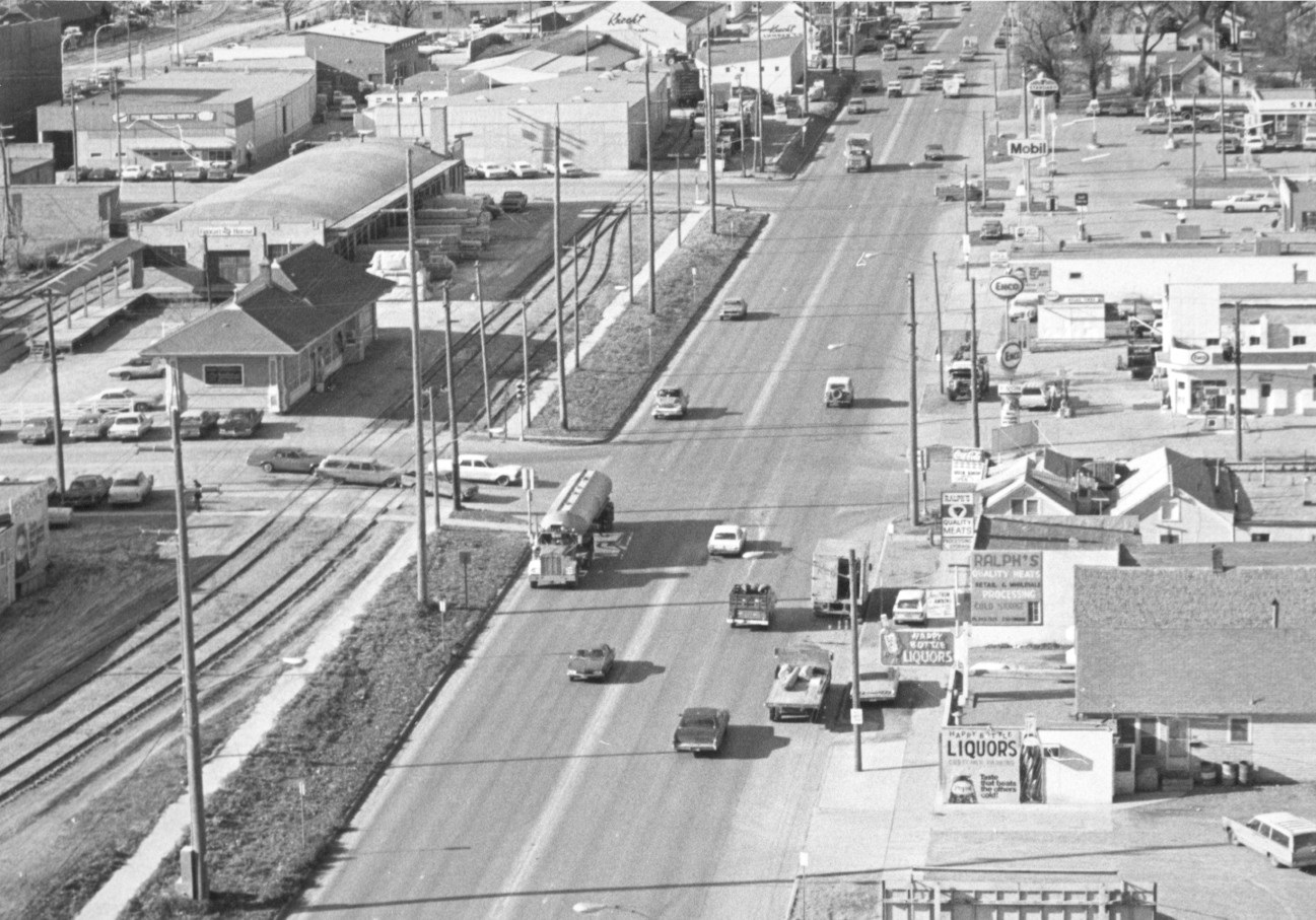 |
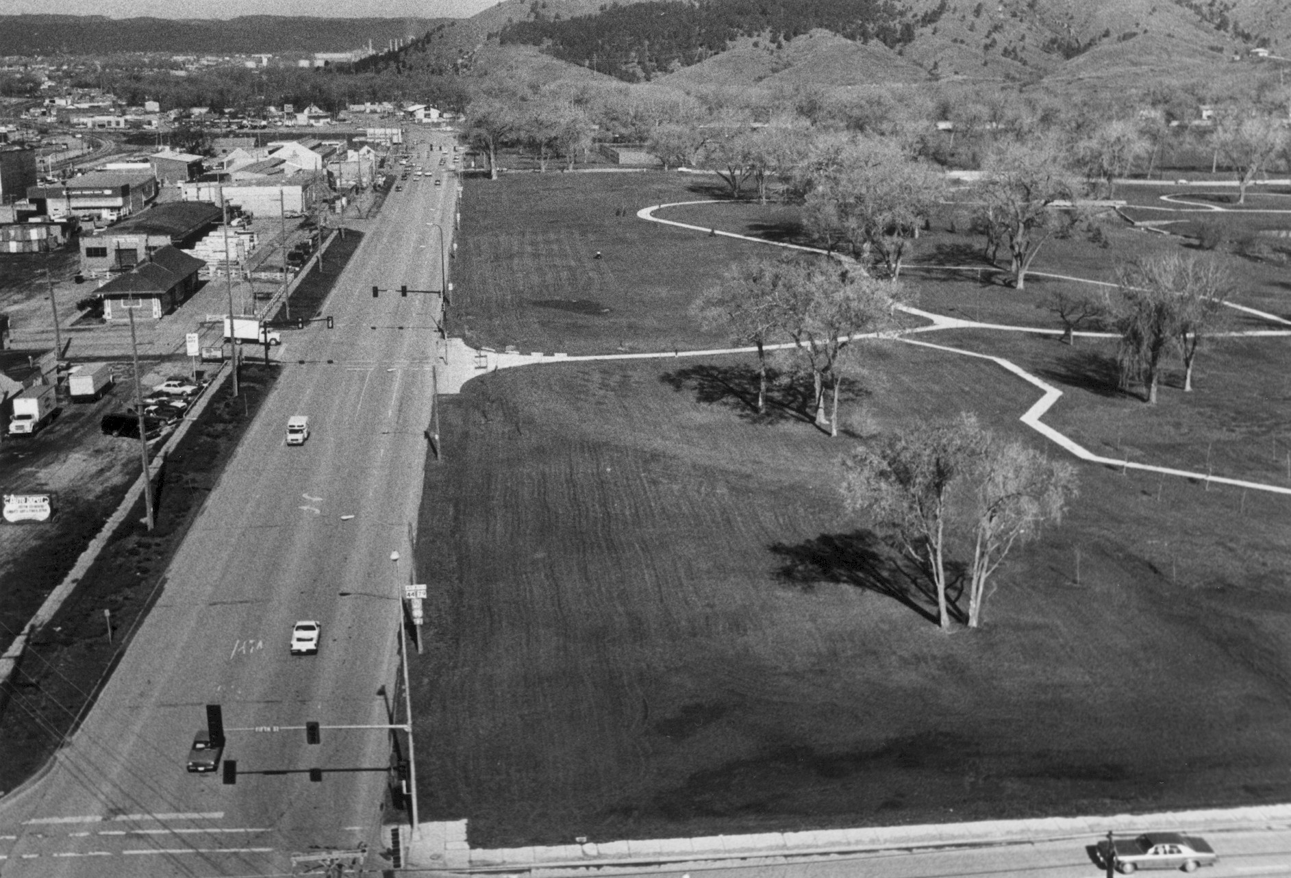 |
| Looking west on Omaha Street, before 1972 (left) and after the development of the greenway (right) (photos courtesy of the Rapid City Journal) |
|
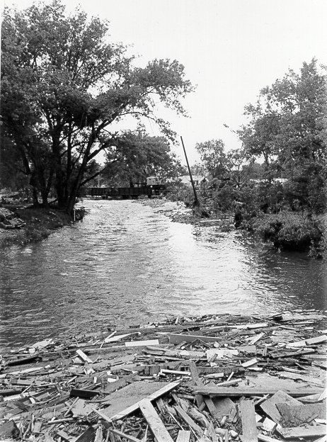
Flood damage to roads, bridges and vehicles was estimated at $35 million (1972 dollars). When the stage, or water level, on Rapid Creek (photo below) rose as much as 3.5 feet in 15 minutes, 15 of the 23 bridges over Rapid Creek were destroyed. Peak flow was 50,600 cubic feet per second, more than 10 times greater than the previous flood of record.
|
|
| One of the bridges over Rapid Creek destroyed in the flood (photo courtesy of the Journey Museum) | |
In the months following the flood, an engineering company conducted a study and determined which bridge types best withstood the flood. Debris can dam up water, worsening the effects of the flood waters. With funding from the Federal Highway Administration, the South Dakota Division of Highways, and the Office of Emergency Preparedness, bridges were redesigned to prevent debris from collecting underneath. Two highway bridges were rebuilt with design consultation from the USACE.
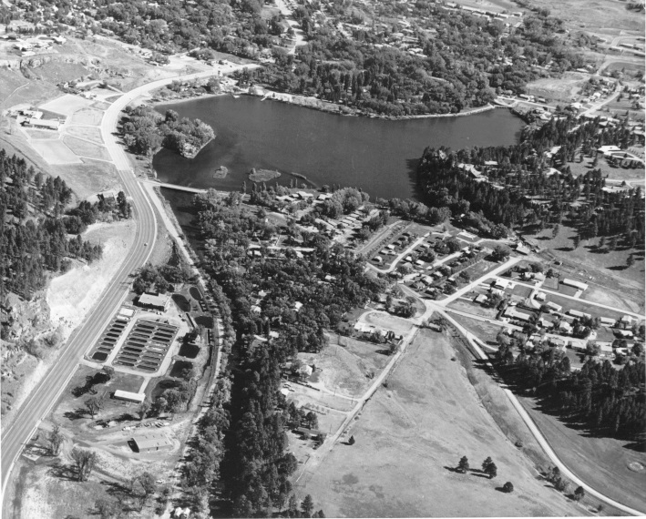
The first Canyon Lake Dam was constructed in 1890 and washed out by a flood in 1907. The lake remained dry until 1932 when the land was donated to Rapid City and the Works Projects Administration (WPA) rebuilt the lake.
The left bottom photo is the Canyon Lake Dam before the June 9, 1972 flood. During the 1972 flood, debris clogged the spillway, temporarily raising the pool 12 feet deeper than usual. The debris clog also weakened the dam, which eventually breached at 10:40 p.m. on June 9.
The photo at the lower right is Canyon Lake shortly after the flood. Reconstruction of the lake was completed in 1976 and the spillway was redesigned to minimize debris clogs. The lake typically holds 140 acre-feet, or enough water to cover 140 acres of land to a depth of one foot.
 |
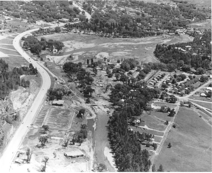 |
| Canyon Lake Dam before (left) and after (right) the 1972 flood (photos courtesy of the Rapid City Journal) | |
Statistics
Flood Comparisons
Flooding causes more damage in the United States than any other weather related event and flash floods are the most deadly natural disaster. Average annual flood damage is around $7.8 billion with an average of 94 deaths. The June 1972 flash flood in Rapid City caused 238 deaths and $165 million in damage. How do other notable United States flash floods compare to the Rapid City Flash Flood? See the table below.
Summary of historic floods and flash floods for the Black Hills area (click for summary)
| Date | Location | Cause | Damage (at time of flood) |
Damage (2017 Value) |
Deaths |
| 06/10/1972 | Rapid City, SD | Flash Flood | $165 million | $965 million | 238 |
| 05/31/1889 | Johnstown, PA | Dam Break | $17 million | $431 million | 2,200 |
| 03/12/1928 | Santa Clarita, CA | Dam Break | $7 million | $100 million | 431 |
| 02/26/1972 | Buffalo Creek, WV | Dam Break | $100 million | $584 million | 125 |
| 07/31/1976 | Big Thompson Canyon, CO | Flash Flood | $40 million | $172 million | 145 |
| 08/01/1985 | Cheyenne, WY | Flash Flood | $61 million | $139 million | 12 |
| 06/14/1990 | Shadyside, OH | Flash Flood | $8 million | $15 million | 26 |
| 07/28/1997 | Fort Collins, CO | Flash Flood | $190 million | $290 million | 5 |
| 08/27/2002 | Kaycee, WY | Flash Flood | $459 million | $624 million | 0 |
| 08/17/2007 | Hermosa, SD | Flash Flood | $3 million | $3.5 million | 0 |
| 09/09/2013 | Colorado Front Range, CO | Flash Flood | $2 billion | $2.1 billion | 8 |
Weather Summary
Dense fog covered the eastern slopes of the Black Hills during the early morning of June 9. A large, cold high pressure moved southward from Canada into the upper Midwest, pushing a cold front westward across the Dakotas to the eastern slopes of the Black Hills (see map below left). The air northeast of the front was very humid, with drier air southwest of the front. Above the ground, a high pressure extended from the Gulf of America into Canada and a weak low pressure was over the Great Basin that was moving northeastward toward the northern Plains; light winds were over the Black Hills area.
 |
.jpg) |
| Surface map on the morning of June 9, 1972 | 500 millibar map for the morning of June 9, 1972 (approximately 18,000 feet above sea level) |
As the front moved slowly southwest during the morning, strong easterly winds brought additional moisture to the area. Dewpoint temperatures, a measure of the moisture in the air, were in the middle to upper 60s°F, about ten degrees higher than usual for early June. Upslope clouds formed over western South Dakota by the process of orographic lifting; when terrain forces air to rise, the air becomes saturated as it cools, and clouds develop.
 |
| Idealized depiction of orographic lifting |
Two areas of thunderstorms developed over the Black Hills during the afternoon as the approaching low pressure made the atmosphere more unstable. Rain over the northeastern corner of the Black Hills spread southward toward the Nemo area. Showers over the southern Black Hills and southeast of Rapid City moved northwest and intensified over the central Black Hills. By 6 p.m., a nearly continuous line of thunderstorms covered the eastern Black Hills. The strong easterly winds along the ground and light winds above the hills kept the storms anchored in place.
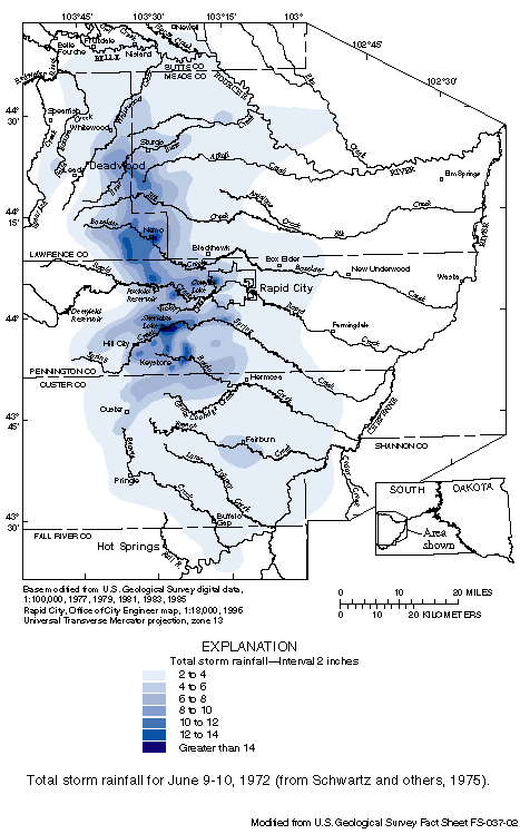
The steep canyons channeled the high volumes of water that rushed toward the plains. Flood water from Deer Creek, Victoria Creek, Prairie Creek, and smaller drainages emptied into Rapid Creek above Rapid City, swelling the stream over 300 times its normal volume. Data from the stream gauge on Rapid Creek above Canyon Lake indicated that from 9:15 p.m. until 11:15 p.m., the water level rose approximately 12 feet in two hours. Flooding also occurred along Bear Butte, Elk, Box Elder, Spring, and Battle Creeks from Sturgis to Hermosa.
Around 12:30 a.m. June 10, the storms began to dissipate and move slowly to the east over the plains with no precipitation indicated by the Ellsworth Air Force Base weather radar by 6:30 a.m.
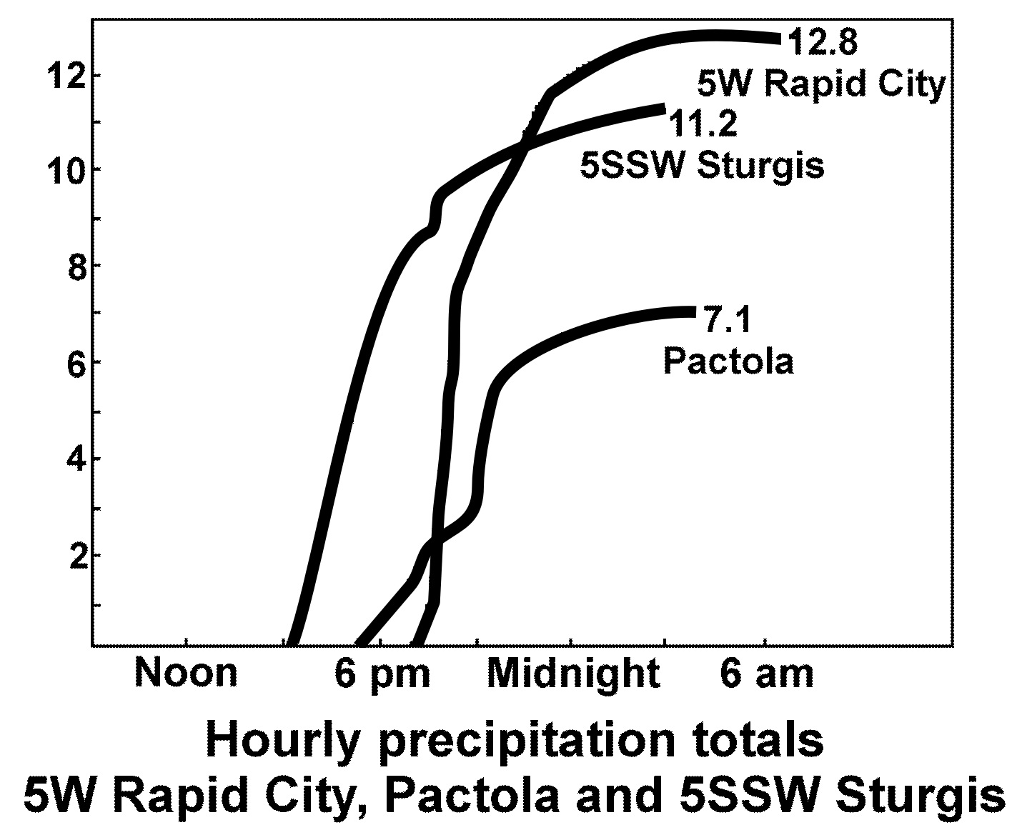
|
Precipitation totals (inches) at three sites: 5 miles south-southwest of Sturgis, Pactola Dam, and near Johnson Siding (5 miles west of Rapid City) |
 |
References
C. F. Boone Publishing, 1972: The Rapid City Flood…June 9, 1972, 66 pp.
Dennis, A. S., R. A. Schleusener, J. H. Hirsch and Alexander Koscielski, 1973: Meteorology of the Black Hills Flood of 1972.
Halligan, Don K., 1976: Hourly Cumulative Totals of Rainfall Black Hills Flash Flood June 9-10, 1972, NOAA Technical Memorandum NWS CR-59, pp. 17.
Larimer, Owen J., 1973: Flood of June 9-10, 1972, at Rapid City, South Dakota, U. S. Geological Survey Atlas HA-511.
Rapid City Urban Renewal Agency, 1973: Rapid Creek flood disaster feasibility study : Project S.D. R-3 (FS) / Rapid City Urban Renewal Agency.
Rothrock, Edgar Paul, 1943: A Geology of South Dakota, State of South Dakota, pp 88.
Saint Amand, P., R. J. Davis, and R. D. Elliot, 1972: Report on Rapid City Flood of 9 June 1972, South Dakota Weather Commission, Pierre, SD, 37 pp.
Schwarz, Francis K., Lawrence A. Hughes, and E. Marshall Hansen (NWS) and M. S. Petersen and Donovan B. Kelly (USGS), 1975: The Black Hills-Rapid City Flood of June 9-10, 1972: A Description of the Storm and Flood. Report prepared jointly by the USGS and NOAA. Geological Survey Professional Paper 877, US Government Printing Office, Washington, pp 47.
South Dakota Department of Highways, Communications Division, 1973: Rapid City Flood Documentation.
Thompson, Herbert J., 1972: The Black Hills Flood. Weatherwise, 162-167.
U. S. Army Corps of Engineers, Omaha District, 1973: Flood Plain Information: Rapid City, South Dakota, pp. 48.
U. S. Army Corps of Engineers, Omaha District, 1972: Cheyenne River Basin, South Dakota Black Hills Area Flood of 9-10 June 1972, pp. 108.
U. S. Department of Commerce, 1972: Natural Disaster Survey Report 72-1. Black Hills Flood of June 9, 1972, pp. 20.
U. S. Department of Housing and Urban Development, 1974: Rapid City flood disaster program: urban renewal project, project no. SD-R3, Rapid City, South Dakota. Final environmental impact statement, pp. 266.
U. S. Geological Survey, 1972: Water Resources Review, pp. 18.
U.S. Geological Survey, 2002: The 1972 Black Hills - Rapid City Flood Revisited; FS; 037-02; Carter, Janet M.; Williamson, Joyce E.; Teller, Ralph W.
Other websites of interest:
Rapid City Public Library: Rapid City Flood of 1972
Friends of Rapid City Parks Facebook Page
 |
Media use of NWS Web News Stories is encouraged! Please acknowledge the NWS as the source of any news information accessed from this site. |
|