
Wildfires and poor air quality continue for the Pacific Northwest, Rockies and extended into the Plains. Severe thunderstorms possible for the northern Plains and upper Midwest on Monday along a frontal boundary. Another boundary will focus showers and thunderstorms for the eastern seaboard with localized heavy rainfall possible. For Alaska, a strong Bering Sea storm will bring winds and rainfall. Read More >
Banner image courtesy Pat Gerdes
SKYWARN SPOTTER SEASON 2025 REGISTRATION IS OPEN!
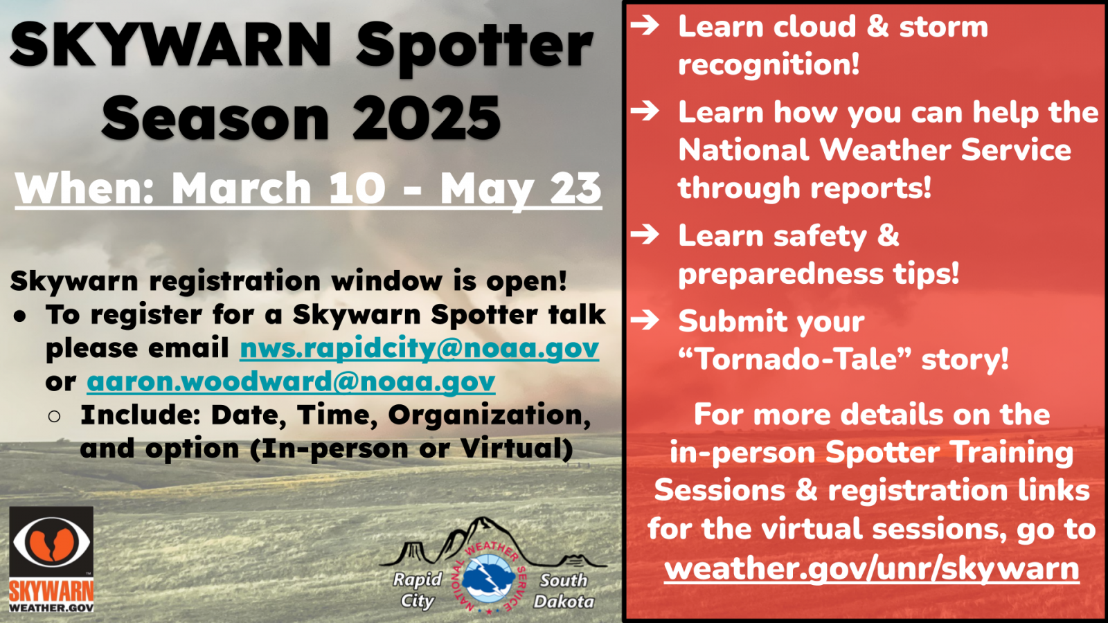
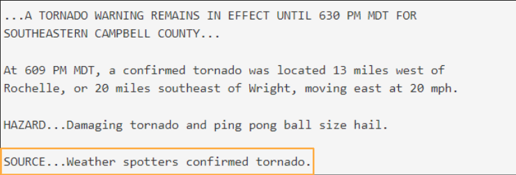
 Becoming a Skywarn Storm Spotter helps the National Weather Service during severe weather operations. Skywarn Spotters go out and provide crucial ground truth by reporting real-time storm reports that are then shared to the radar meteorologists which helps improve the warning process and storm verification. Research has shown that people are more likely to seek shelter if a warning is confirmed!
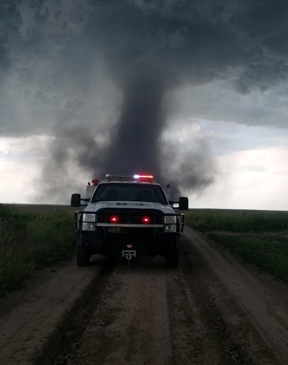
WARNING + CONFIRMATION = SHELTER RESPONSE
How to Report
There are a variety of ways to report weather to the NWS office in Rapid City, SD
You can use any/all of these to reach us. Below the contact info are the types of information we'd like you to report. Please be sure to include the location of the weather event, e.g. 5 miles northwest of Columbus. You may also indicate if you are a trained spotter, a ham radio operator, a member of law enforcement, or other affiliation if applicable.
 Submit Report
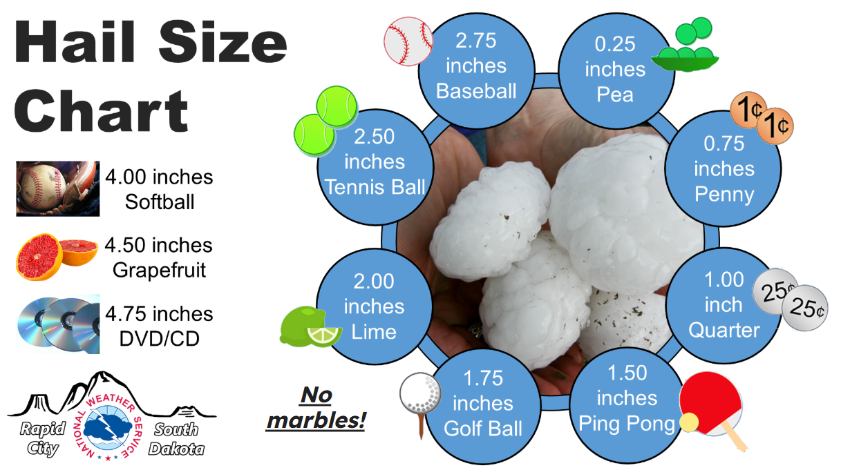
Use this Web Based Form: Submit Report
![]()
Post information on our Facebook page:
https://www.facebook.com/NWSRapidCity
![]()
Send us a tweet:

Send us an email:
![]()
Mobile App
Send reports from your location via a smartphone app: MPing
To view Skywarn Spotter Talk information, hover over the blue dot in the area you are interested in to view talk information!

