Overview
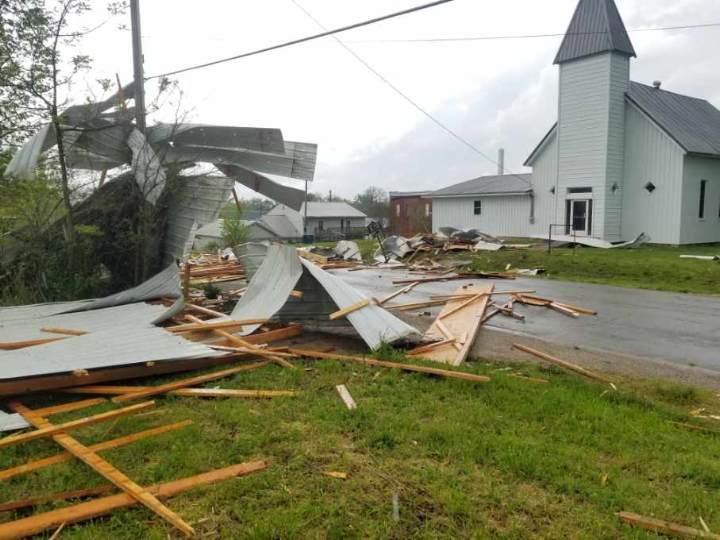
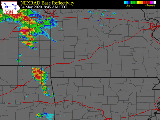
A frontal system over the region resulted in the development of numerous severe thunderstorms that caused extensive hail and wind damage over portions of the area. Storms moved into southeast Kansas and far southwest Missouri Monday morning, with the first storm report coming in at 9:10am CDT. This initial round of storms moved west to east across the area, changing from primarily hail producers to wind producers generally after they passed the Highway 65 corridor.
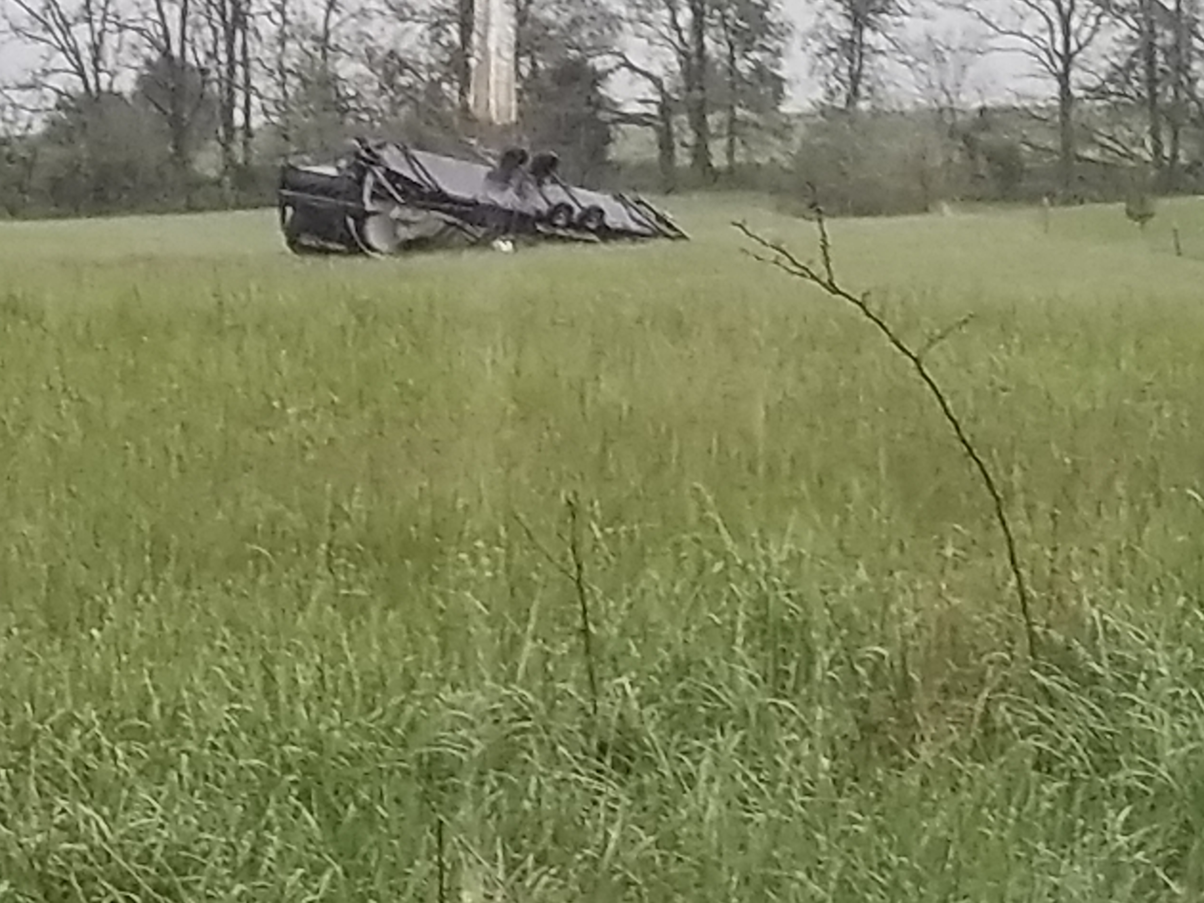
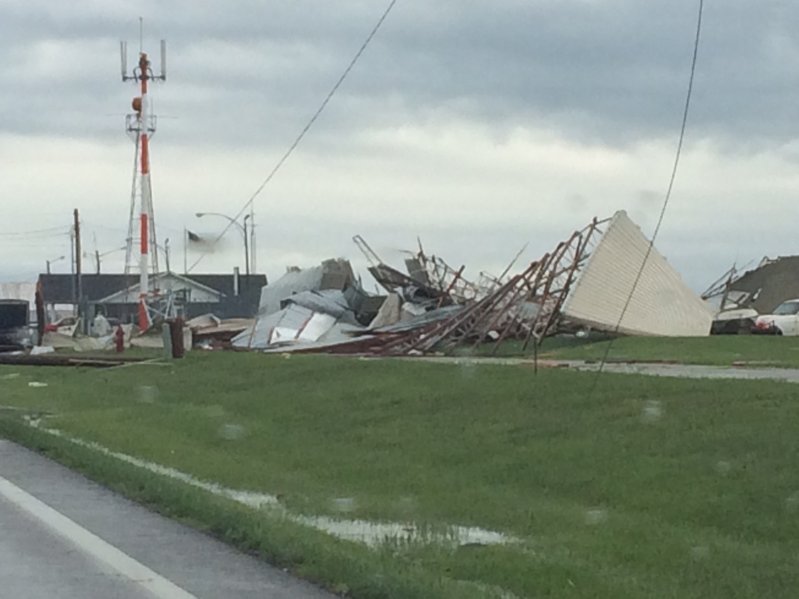
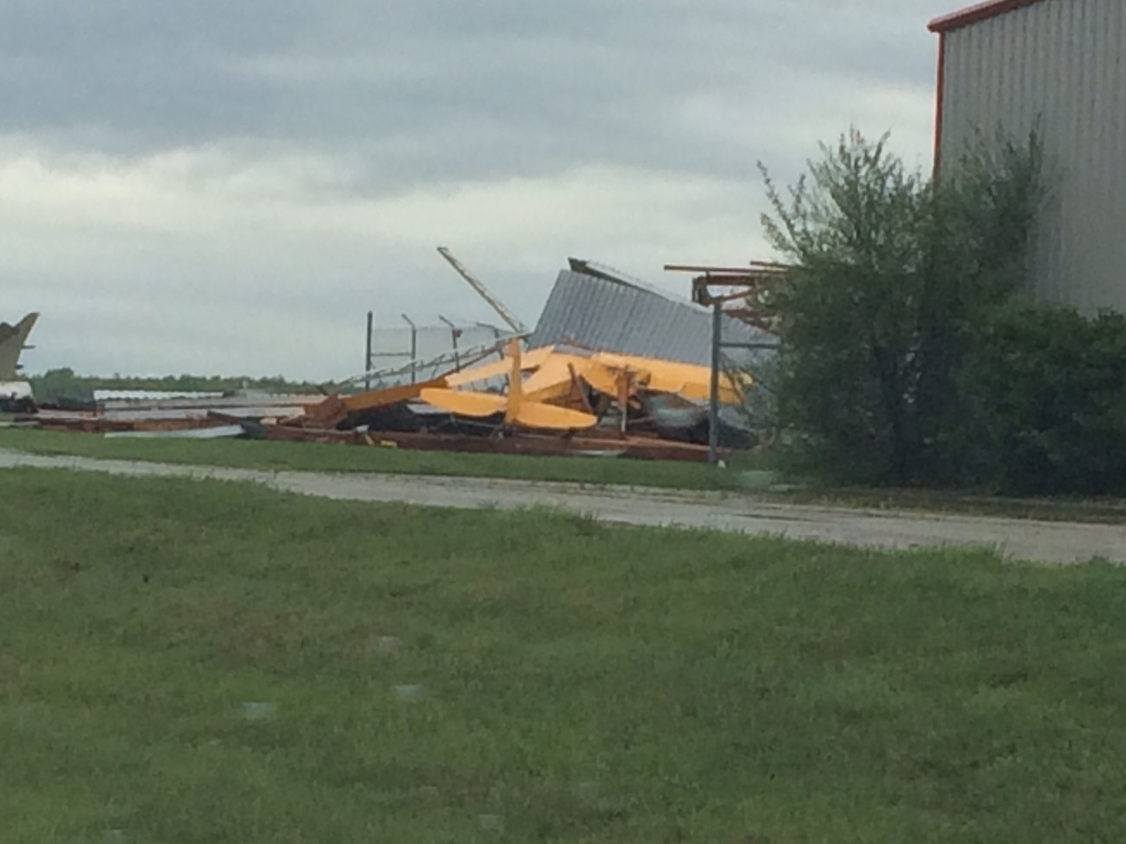
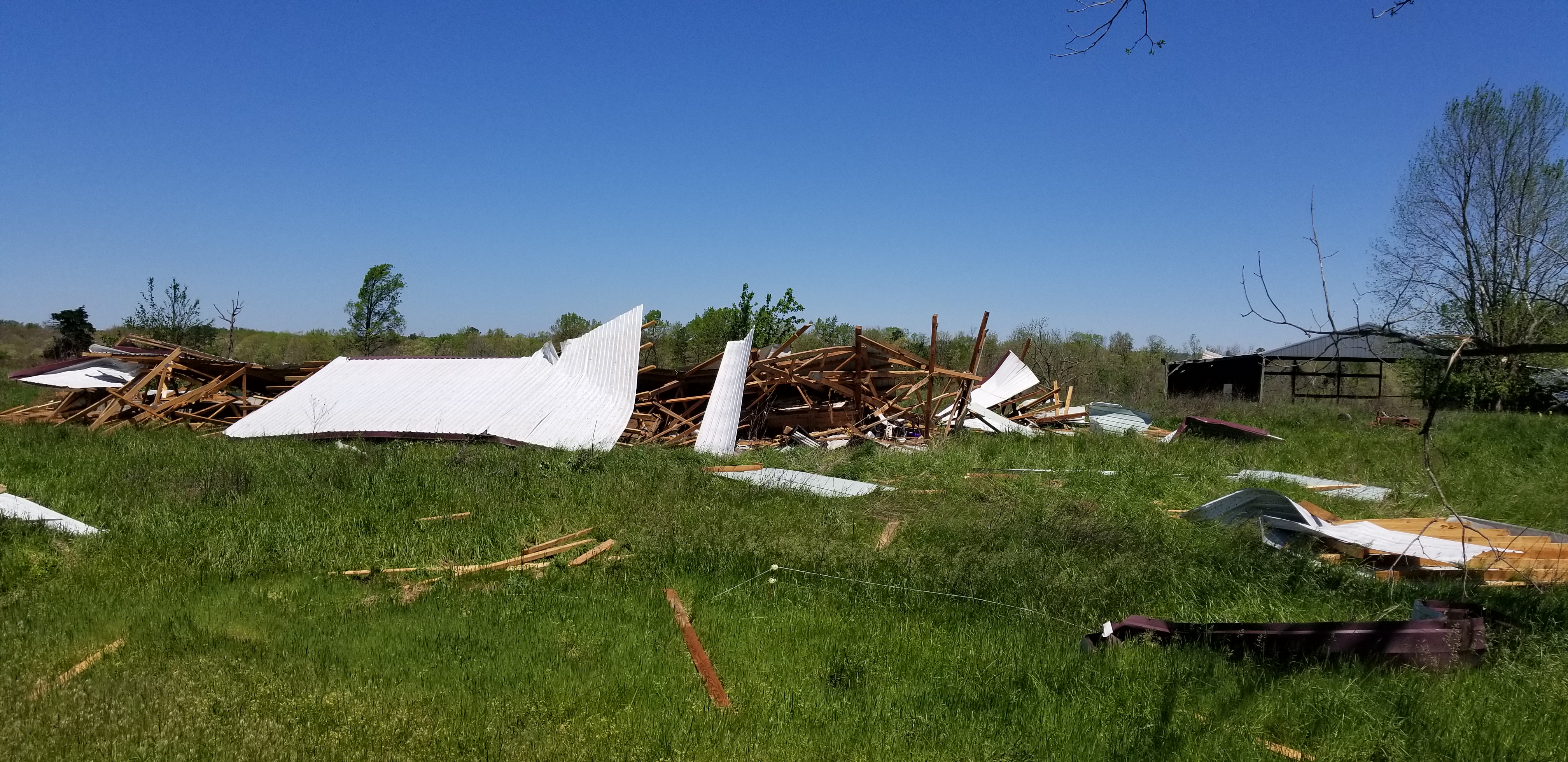
Quickly following the first round of storms was a line of storms that started near Topeka, KS and roared into east-central Missouri in the early afternoon. These storms then impacted the eastern Ozarks during the later afternoon hours. This line produced substantial straight-line wind damage along portions of it's track, with maximum winds of 80-90 mph (possibly higher) in portions of the Ozarks. The Lebanon Airport anemometer recorded a wind speed of 89 mph before going offline.
A third round of severe storms then developed in the late afternoon and evening along a warm front over southeast Kansas and far southwest Missouri, producing primarily large hail. This third round of storms would have threatened a greater portion of the forecast area, but cold air spreading from earlier thunderstorms kept much of the area too cool to support additional severe storm development.
Severe thunderstorms were ongoing almost the entire day across the National Weather Service Springfield's coverage area, with the final storm report coming in at 9:12pm CDT.
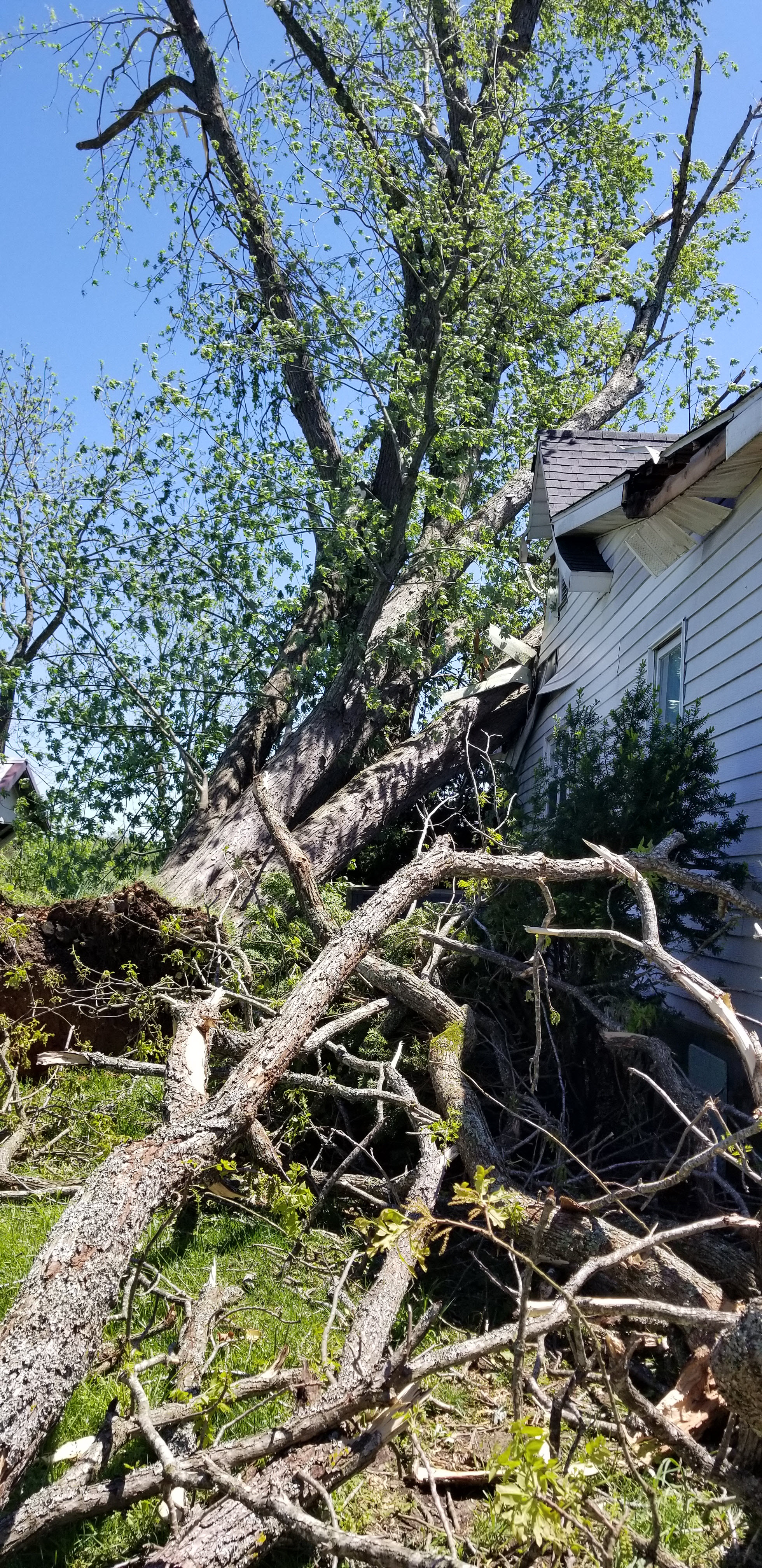
There has been some speculation that some of the wind damage from Monday was caused by tornadoes, but all the evidence at this time suggests it was caused by straight-line winds. This preliminary determination has been made through the use of radar data, pictures, and through the support of Emergency Management, Fire, and Law Enforcement professionals in the impacted areas. The National Weather Service will continue to gather information and evaluate the situation.
Hail:
We received numerous reports of large to destructive hail ranging from the size of quarters (1") to the size of baseballs (2.75"). The majority of hail reports were from far southwest Missouri and far southeast Kansas.
Pictures
 |
 |
 |
.jpg) |
| South Springfield | South Springfield | South Springfield |
Kimberling City |
 |
 |
 |
.jpg) |
| Branson West | Branson | Holister | Kimberling City |
 |
.jpg) |
 |
 |
| Kirbyville | Mount Vernon | Neosho | Seneca |
 |
.jpg) |
.jpg) |
.jpg) |
| South Springfield | South Springfield | South Springfield | South Springfield |
.jpg) |
 |
.jpg) |
.jpg) |
| South Springfield | Lampe | South Springfield | South Springfield |
Seymour to Norwood:
Straight-line winds along the southern edge of a line of thunderstorms with the second round of severe thunderstorms produced significant wind damage from areas around Seymour to around Norwood. In this area, straight-line winds of 80-90 mph occurred, but may have been higher in some spots.
Pictures
 |
 |
 |
 |
| Seymour | Norwood | Norwood | Mountain Grove |
 |
 |
||
| Mountain Grove | Mountain Grove | Blank | Blank |
Lebanon:
Two severe thunderstorms caused wind damage to the Lebanon area on Monday. The first storm moved through early in the afternoon and caused some scattered wind damage. Following the first storm by just over an hour, the second storm produced widespread significant damage, with the Lebanon Airport wind observation hitting 89 mph before the system went offline.
Pictures
 |
 |
 |
 |
| Lebanon | Lebanon | Lebanon | Lebanon |
 |
.jpg) |
 |
 |
| Lebanon | Lebanon | Lebanon | Lebanon |
Douglas & Howell Counties:
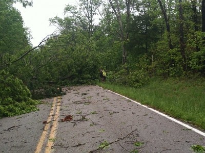
A continuation of the storm that moved through the Seymour-Norwood areas. Storm damage continued out of eastern Douglas County roughly along Highway 60 across northern Howell County. Taller trees were specifically noted to be affected, suggesting that winds were even stronger aloft. The trees and structures affected in the area from Highway AW (roughly two miles in from the Douglas County border) into Willow Springs were largely blown west to east, with this type of damage then continuing along Highway 60. Closer to Mountain View, the damage then shifted largely from north to south.
We will add additional pictures as they come available.
Pictures
 |
 |
 |
 |
| Hutton Valley | NW of Willow Springs | NW of Willow Springs | Eastern Howell County |
| Caption | Caption | Caption | Caption |
Radar
Polk County:
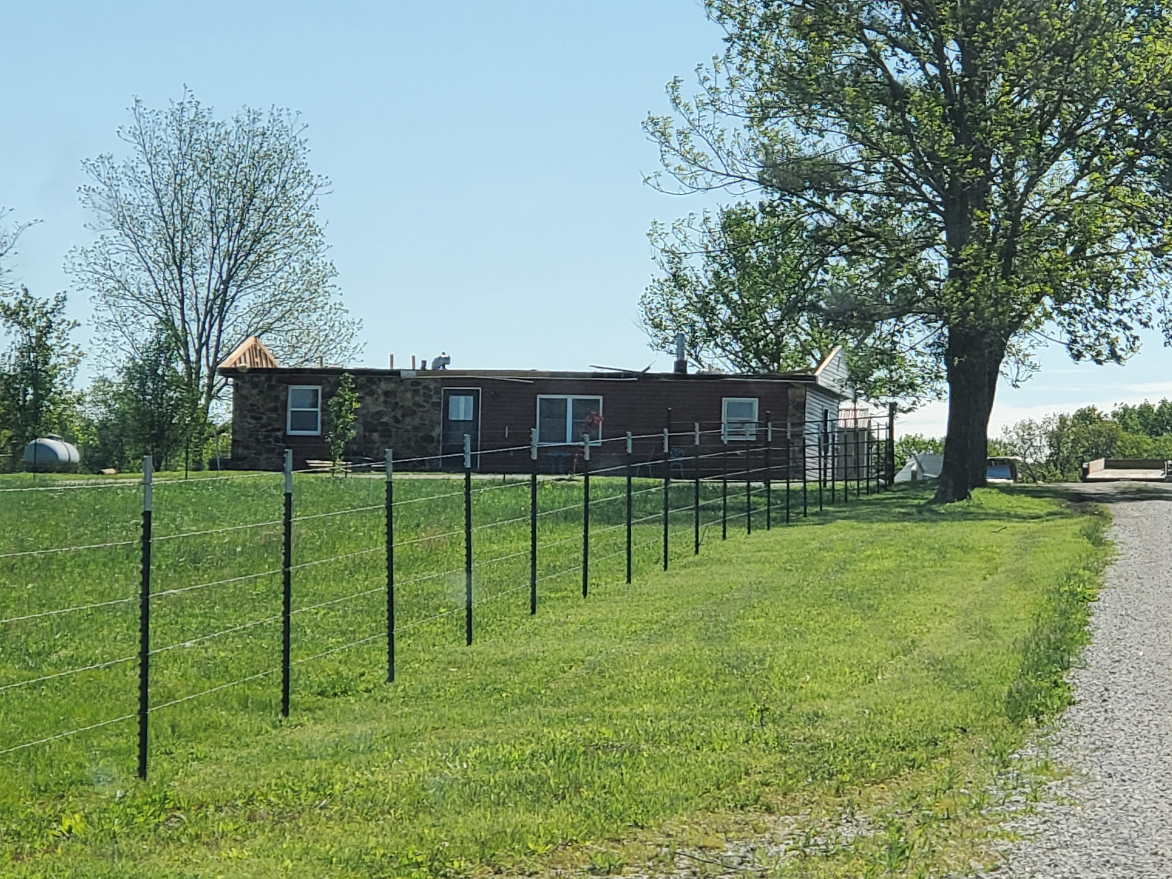
Two rounds of storms moved through Polk County, producing damaging winds across northern portions of the county. Particularly hard hit were areas near Humansville where numerous trees, powerlines, and barns/outbuildings were damaged or destroyed. Photos will be added as we receive them.
Pictures
 |
|||
| Caption | Caption | Caption |
| Caption | Caption | Caption | Caption |
 |
Media use of NWS Web News Stories is encouraged! Please acknowledge the NWS as the source of any news information accessed from this site. |
|


 Weather Story
 Weather Map
 Local Radar