|
|
|
Click on risk level to display risk map and proper legend
|
Severe Weather Arrival Tool

|
|
Risk
|
Level
|
Risk
|
Level
|
|
|
Tornado
|
|
Fog
|
|
|
Hail
|
|
Non - Thunderstorm Winds
|
|
|
Thunderstorm Wind Gusts
|
|
Excessive Heat
|
|
|
Flooding
|
|
Snow and Sleet
|
|
|
Lightning
|
|
Ice Accumulation
|
|
|
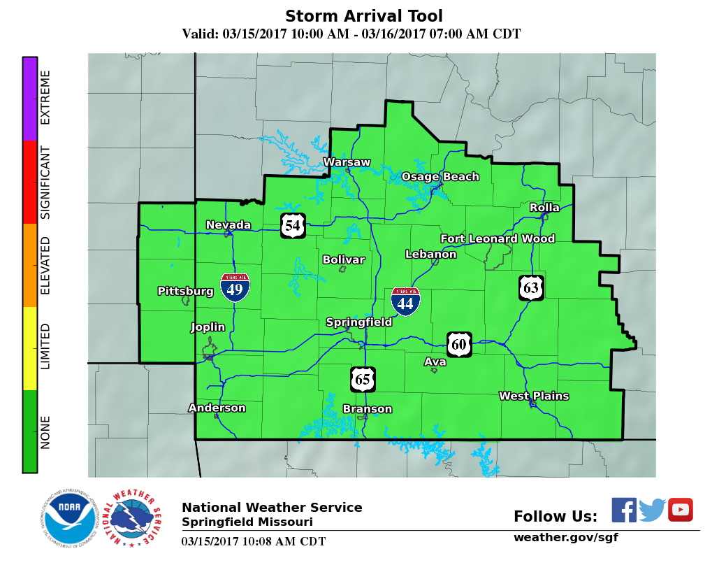
Severe Thunderstorm
Arrival Tool
|
|
Frost and Freeze
|
|
|
Fire Weather
|
|
Excessive Cold
|
|
|
|
|
Risk Level
|
Definition
|
|
|
None
|
No tornado risk.
|
|
|
Limited
|
Probability of a tornado within 25 miles of a point:
less than 10 percent.
|
|
|
Elevated
|
Probability of a tornado within 25 miles of a point:
Equal to or greater than 10 percent.
|
|
|
Significant
|
Probability of a tornado within 25 miles of a point:
Equal to or greater than 30 percent.
|
|
|
Extreme
|
Probability of a tornado within 25 miles of a point:
Equal to or greater than 45 percent.
|
|
Risk Level
|
Definition
|
|
|
None
|
No risk of fog.
|
|
|
Limited
|
Fog with visibilities less than or equal to 1 mile.
|
|
|
Elevated
|
Fog with visibilities less than or equal to 1/2 mile.
|
|
|
Significant
|
Fog with visibilities less than or equal to 1/4 mile.
|
|
|
Extreme
|
Fog with near zero visibilities.
|
|
Risk Level
|
Definition
|
|
|
None
|
No risk of hail.
|
|
|
Limited
|
Risk of sub-severe hail (less than 1")
or
Probability of severe hail (1" or greater) within 25 miles of a point:
less than 15%
|
|
|
Elevated
|
Probability of severe hail (1" or greater) within 25 miles of a point:
Equal to or greater than 15%
|
|
|
Significant
|
Probability of severe hail (1" or greater) within 25 miles of a point:
Equal to or greater than 45%
|
|
|
Extreme
|
Probability of severe hail (1" or greater) within 25 miles of a point:
Equal to or greater than 60%
|
|
Risk Level
|
Definition
|
|
|
None
|
Sustained winds < 20 mph
and
Wind gusts < 30 mph.
|
|
|
Limited
|
Sustained winds 20-29 mph
or
Wind gusts 30-44 mph.
|
|
|
Elevated
|
Sustained winds 30-39 mph
or
Wind gusts 45-57 mph.
|
|
|
Significant
|
Sustained winds 40-49 mph
or
Wind gusts 58-64 mph.
|
|
|
Extreme
|
Sustained winds > 50 mph
or
Wind gusts > 65 mph.
|
|
Risk Level
|
Definition
|
|
|
None
|
No thunderstorm wind risk.
|
|
|
Limited
|
Risk for sub-severe wind gusts (less than 58 mph)
or
Probability of severe wind gusts (58 mph or greater) within 25 miles of a point:
Less than 15%
|
|
|
Elevated
|
Probability of severe wind gusts (58 mph or greater) within 25 miles of a point:
Equal to or greater than 15%
|
|
|
Significant
|
Probability of severe wind gusts (58 mph or greater) within 25 miles of a point:
Equal to or greater than 45%
|
|
|
Extreme
|
Probability of severe wind gusts (58 mph or greater) within 25 miles of a point:
Equal to or greater than 60%
|
|
Risk Level
|
Definition
|
|
|
None
|
Maximum Apparent Temperature < 95
|
|
|
Limited
|
Maximum Apparent Temperature 95 to 104
|
|
|
Elevated
|
Maximum Apparent Temperature 105 to 109
OR
Maximum Apparent Temperature greater than or equal to 100 for 4 consecutive days.
|
|
|
Significant
|
Maximum Apparent Temperature 110 to 114
OR
Maximum Apparent Temperature greater than or equal to 105 for 4 consecutive days.
|
|
|
Extreme
|
Maximum Apparent Temperature greater than or equal to 115
OR
Maximum Apparent Temperataure greater than or equal to 105 for 5 consecutive days.
|
|
Note:
|
Apparent Temperature is defined as: |
| |
Wind Chill Temperature during the cold season. |
| |
Heat Index Temperature during the warm season. |
|
|
Risk Level
|
Definition
|
|
|
None
|
No Flooding risk.
|
|
|
Limited
|
Risk of localized flash flooding of small streams and low water crossings, and minor flooding of poor drainage or urban areas.
|
|
|
Elevated
|
Risk of flash flooding of several low water crossings, roads, and small streams,
or
Minor River Flooding.
|
|
|
Significant
|
Risk of flash flooding of numerous roads, low water crossings, and small streams,
or
Moderate river flooding.
|
|
|
Extreme
|
Risk of widespread flash flooding of low water crossings, roads, and small streams.
or
Major river flooding.
|
|
Risk Level
|
Definition
|
|
|
None
|
No snow or sleet.
|
|
|
Limited
|
Snow and/or sleet with less than 1 inch of accumulation expected.
|
|
|
Elevated
|
Snow and/or sleet with 1 to 5.9 inches of accumulation expected.
|
|
|
Significant
|
Snow and/or sleet with 6 to 11.9 inches of accumulation expected.
|
|
|
Extreme
|
Snow and/or sleet with greater than or equal to 12 inches of accumulation expected.
|
|
Risk Level
|
Definition
|
|
|
None
|
No lightning risk
|
|
|
Limited
|
Thunderstorms expected to be isolated to scattered in coverage.
Atmospheric conditions support cloud to ground lightning strikes in and near thunderstorms.
|
|
|
Elevated
|
Thunderstorms expected to be numerous in coverage.
Atmospheric conditions support cloud to ground lightning strikes in and near thunderstorms.
|
|
|
Significant
|
Widespread thunderstorms are expected.
Atmospheric conditions support cloud to ground lightning strikes in and near thunderstorms.
|
|
|
Extreme
|
Thunderstorms are expected with nearly continuous cloud to ground lightning strikes in and near thunderstorms.
|
|
Risk Level
|
Definition
|
|
|
None
|
No freezing rain or drizzle.
|
|
|
Limited
|
Very light freezing rain or drizzle with up to a thin glaze, OR Freezing Fog.
|
|
|
Elevated
|
Freezing rain or drizzle with accumulation less than 1/4 inch.
|
|
|
Significant
|
Freezing rain with accumulation of 1/4 inch to less than 1 inch.
|
|
|
Extreme
|
Freezing rain with accumulation of greater than or equal to 1 inch.
|
|
Risk Level
|
Definition
|
|
|
None
|
No danger of frost or freeze causing damage to vegetation.
|
|
|
Limited
|
Patchy frost during the growing season with minor damage to unprotected vegetation.
|
|
|
Elevated
|
Frost expected during the growing season with damage to unprotected vegetation.
This may include temperatures less than or equal to 32 degrees F for less than 3 hours.
|
|
|
Significant
|
Freeze expected (less than or equal to 32 degrees F for 3 or more hours) during the growing season with significant damage to unprotected vegetation.
|
|
|
Extreme
|
Hard freeze (less than or equal to 28 degrees F) during the growing season with catastrophic damage to unprotected vegetation.
|
|
Risk Level
|
Definition
|
|
|
None
|
Severe thunderstorms are not expected today or tonight.
|
|
|
Limited
|
Severe thunderstorms will be possible later today or tonight .
|
|
|
Elevated
|
Severe thunderstorms will be possible in the next 6 hours.
|
|
|
Significant
|
Severe thunderstorms will be possible in the next 3 hours.
|
| The Severe Thunderstorm Arrival Tool is a resource for municipalities, counties, and SKYWARN storm spotters to plan for possible storm spotter activation on the current calendar day. Other interests can also use the Severe Thunderstorm Arrival Tool to determine the expected time frame for severe thunderstorm potential. |
|
Risk Level
|
Definition
|
|
|
None
|
Open burning is usually safe with proper containers and precautions under low fire danger conditions.
Residents should always check on local ordinances that prohibit open burning under any conditions.
|
|
|
Limited
|
Open burning is usually safe with the proper precautions.
Burning should be done in the early morning and late evening to avoid windier and drier conditions from midday through mid-afternoon.
Residents should always check on local ordinances that prohibit open burning under any conditions.
|
|
|
Elevated
|
Any open burning is discouraged due to increased wind and lower humidity - except by experienced fire personnel.
Increasing winds and lower humidity contribute to drying fuels. Fires escape control more easily and containment is difficult for inexperienced fire personnel.
Approaching Red Flag conditions.
|
|
|
Significant
|
Open burning should not be attempted.
High winds and extended dry periods lead to extreme burning conditions. Open fires can quickly escape and are very difficult to control, even for experienced fire fighters.
Conditions exceed minimum criteria for a Red Flag Warning in most cases.
|
|
|
Extreme
|
Very strong winds, well in excess of Red Flag Criteria combined with moderate to low humidity.
Fires will spread very quickly with spot fires common. Fire control is extremely difficult due to very strong winds.
|
|
***These definitions are geared towards the general public and general emergency management and should not be confused with the standard National Fire Danger Rating System (NFDRS) adjectives used by wildland fire personnel.
|
| The fire weather category for the Enhanced Hazardous Weather Outlook is based primarily on predicted wind, humidity and temperature, and does not account for fuel moisture from recent precipitation, snow cover and recently melted snow. Appropriate adjustments to the fire environment must be made. |
| Fire weather hazard categories will normally be more restricted, generally in the "none" or "limited" categories from May 1st to September 30th due to normally predominant green and moist live vegetation. This will be subject to change during unusual severe Spring and/or Summer drought. |
|
|
Risk Level
|
Definition
|
|
|
None
|
Minimum apparent temperature greater than or equal to 10 degrees F.
|
|
|
Limited
|
Minimum apparent temperature -9 to 9 deg F.
|
|
|
Elevated
|
Minimum apparent temperature -10 to -24 deg. F
|
|
|
Significant
|
Minimum apparent temperature -25 to -34 deg. F.
|
|
|
Extreme
|
Minimum apparent temperature less than or equal to -35 degrees F
|
|
Note:
|
Apparent Temperature is defined as: |
| |
Wind Chill Temperature during the cold season. |
| |
Heat Index Temperature during the warm season. |
|
|
Risk Level
|
Definition Severe Thunderstorm Risk Day 2 to 7
|
|
|
None
|
No risk of severe thunderstorms.
|
|
|
Limited
|
Risk for severe thunderstorms with the
Probability of severe thunderstorms* within 25 miles of a point:
Less than 15%
|
|
|
Elevated
|
Probability of severe thunderstorms* within 25 miles of a point:
Equal to or greater than 15%
|
|
|
Significant
|
Probability of severe thunderstorms* within 25 miles of a point:
Equal to or greater than 45%
|
|
|
Extreme
|
Probability of severe thunderstorms* within 25 miles of a point:
Equal to or greater than 60%
|
|
|
Risk
|
|
|
|
|
|
|
|
Level
|
|
Severe Thunderstorms
|
|
|
|
|
|
|
|
Lightning
|
|
|
|
|
|
|
|
Flooding
|
|
|
|
|
|
|
|
Fire Weather
|
|
|
|
|
|
|
|
Fog
|
|
|
|
|
|
|
|
Non - Thunderstorm Winds
|
|
|
|
|
|
|
|
Excessive Heat
|
|
|
|
|
|
|
|
Snow and Sleet
|
|
|
|
|
|
|
|
Ice Accumulation
|
|
|
|
|
|
|
|
Frost and Freeze
|
|
|
|
|
|
|
|
Excessive Cold
|
|
|
|
|
|
|
| |
The Experimental Enhanced Hazardous Weather Outlook is an experimental product that will be posted to this page for evaluation. We encourage your comments or suggestions for improvements using the electronic survey provided. Your feedback will help us determine product utility, if modifications are needed, and whether the product should become part of our operational suite.
The Experimental Enhanced Hazardous Weather Outlook is a decision support service that supports preparedness and response efforts prior to and during hazardous weather. This service provides decision makers with convenient access to potential weather hazard information by graphically depicting the risk of weather hazards out through seven days. |
542
FLUS43 KSGF 101916
HWOSGF
Hazardous Weather Outlook
National Weather Service Springfield MO
216 PM CDT Wed Jun 10 2026
KSZ073-097-101-MOZ055>058-066>071-077>083-088>098-101>106-111930-
Bourbon-Crawford-Cherokee-Benton-Morgan-Miller-Maries-Vernon-
St. Clair-Hickory-Camden-Pulaski-Phelps-Barton-Cedar-Polk-Dallas-
Laclede-Texas-Dent-Jasper-Dade-Greene-Webster-Wright-Newton-
Lawrence-Christian-Douglas-Howell-Shannon-McDonald-Barry-Stone-
Taney-Ozark-Oregon-
216 PM CDT Wed Jun 10 2026
This Hazardous Weather Outlook is for portions of the Missouri
Ozarks and extreme southeast Kansas.
.DAY ONE...Today and Tonight.
Weather hazards expected...
Slight hail risk.
Slight thunderstorm wind damage risk.
Limited lightning risk.
Limited excessive heat risk.
Limited excessive rainfall risk
Limited non thunderstorm wind risk.
DISCUSSION...
Heat index values between 95 and 100 degrees this afternoon may
pose a heat risk to vulnerable populations and those sensitive to
heat illnesses.
Gusty south-southwest winds at 25 to 40 mph through the afternoon.
There is low confidence in strong to severe storms capable of
producing hail to the size of quarters and 60 mph wind gusts
across eastern Kansas and western Missouri tonight.
.DAYS TWO THROUGH SEVEN...Thursday through Tuesday.
Humid conditions persist through Thursday. Maximum afternoon heat
index values between 95 and 105 degrees.
Slight Risk (2 of 5) for strong to severe thunderstorms late
Thursday afternoon and evening. Hail up to the size of golf balls
and wind gusts to 60 mph will be the primary hazards, with a
secondary risk of tornadoes.
Additional rain chances on Saturday and Sunday may pose a risk
for flash flooding due to recent heavy rainfall, elevated
streamflows, and saturated soils.
.SPOTTER INFORMATION STATEMENT...
Spotter activation may be needed tonight north of Interstate 44.
&&
More detailed information can be accessed at:
http://www.weather.gov/sgf/dsspacket
This product in graphical format...along with other weather...
hydrological and climate information...at
http://www.weather.gov/sgf
$$
Perez


 Weather Story
 Weather Map
 Local Radar