Overview
|
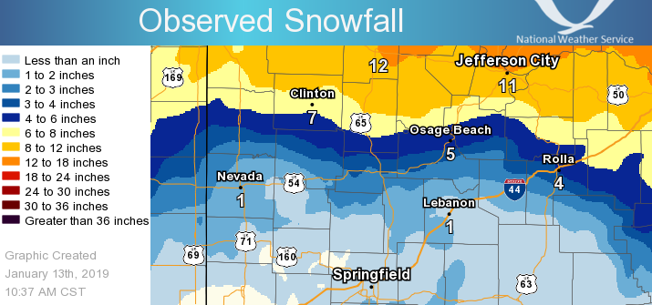
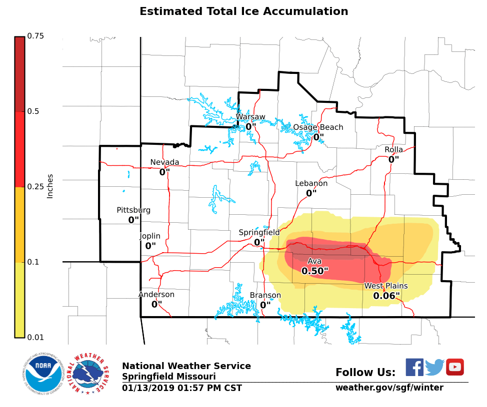
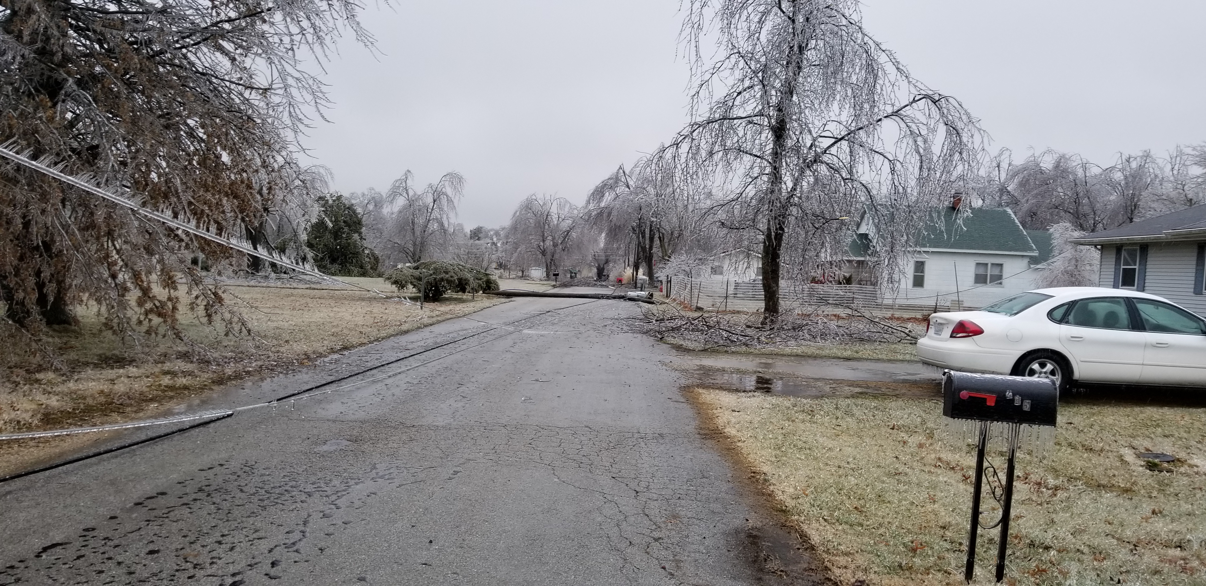
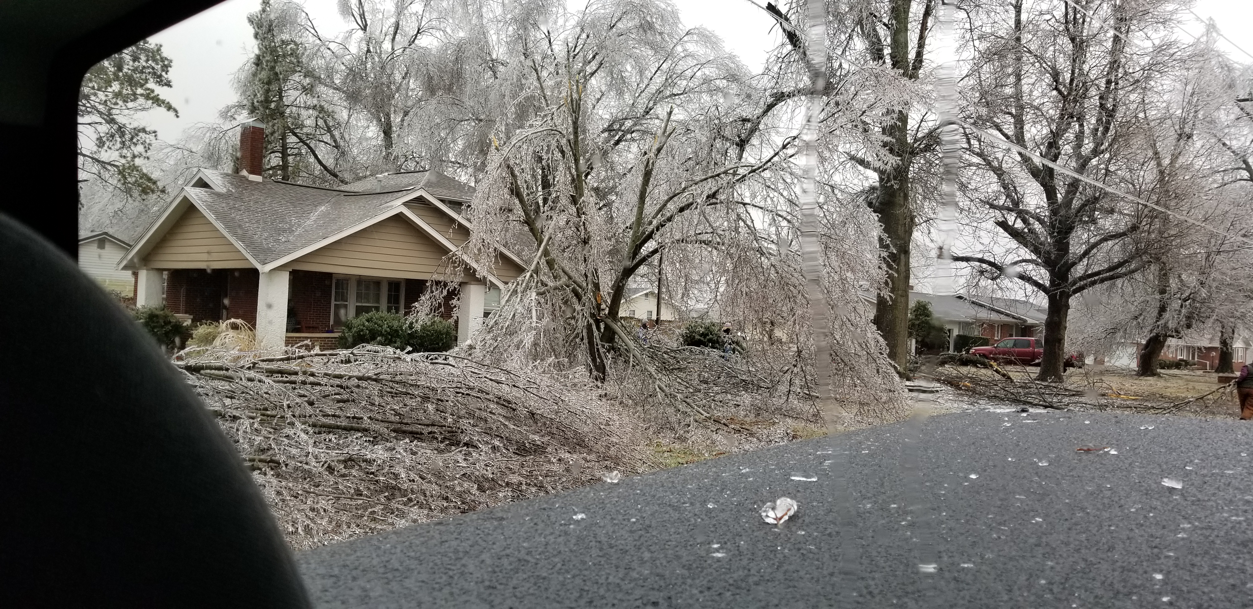
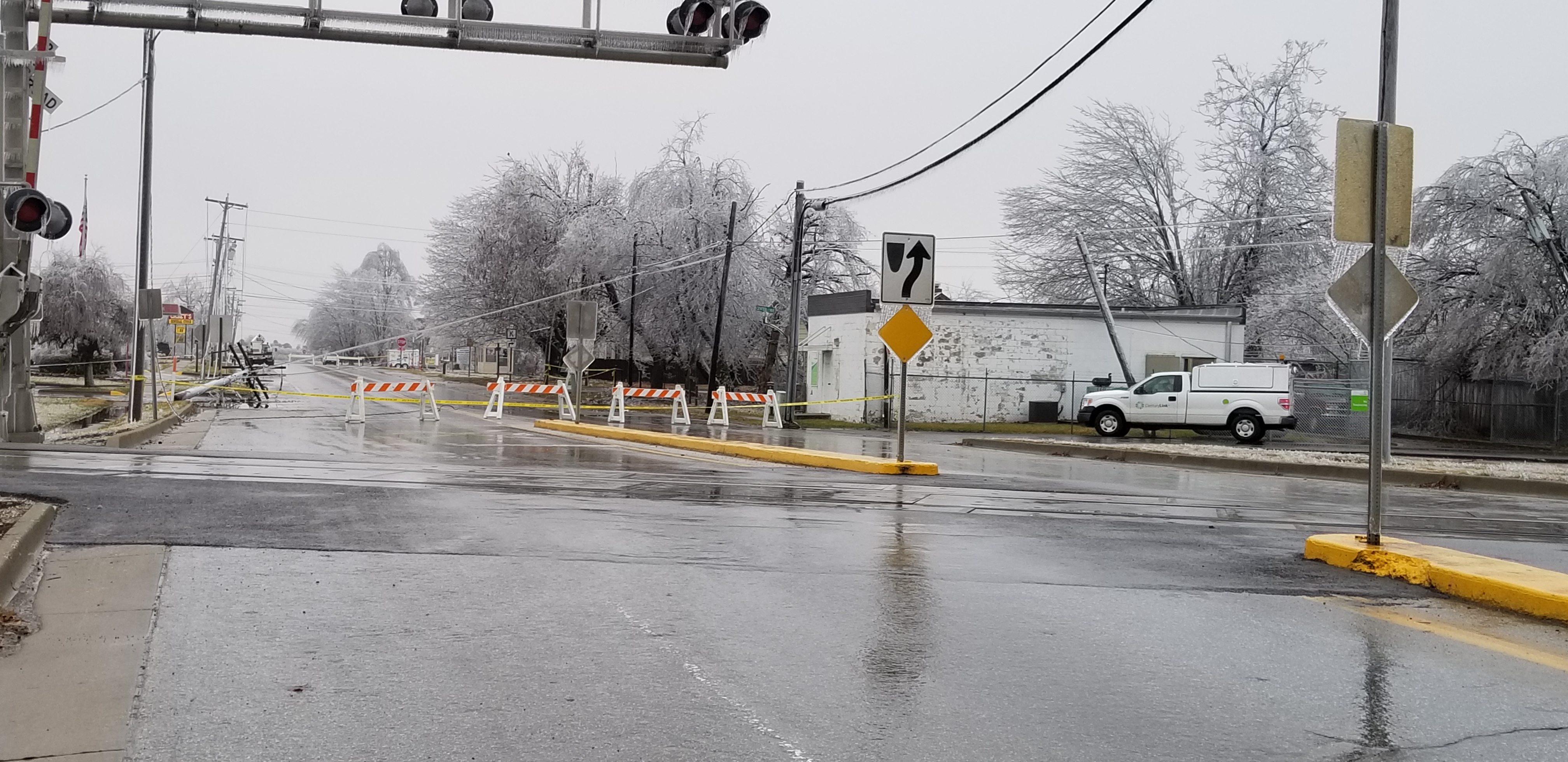
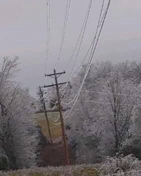
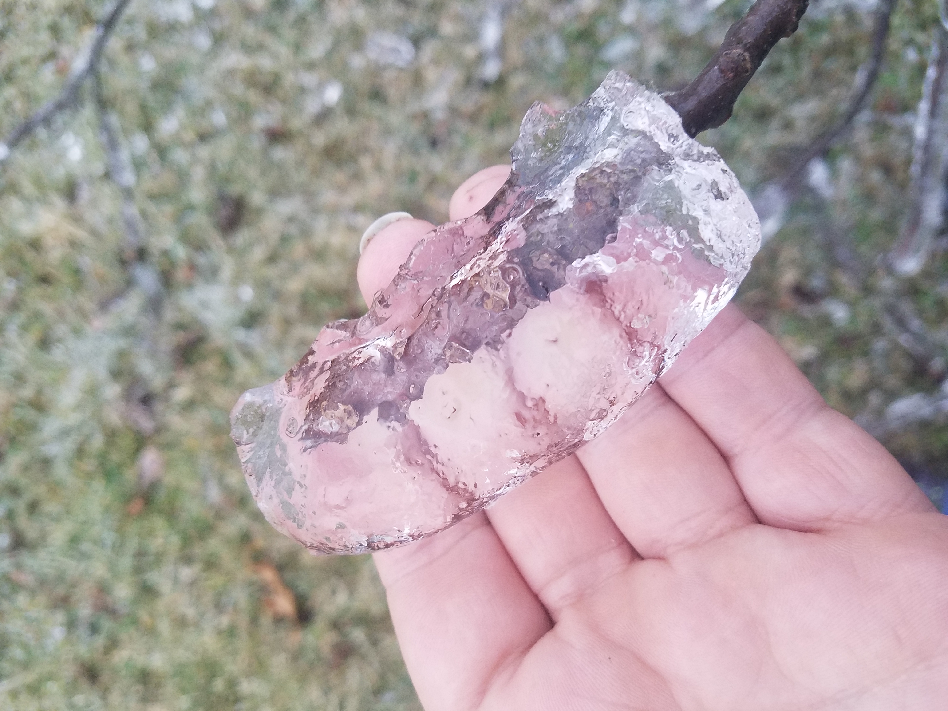
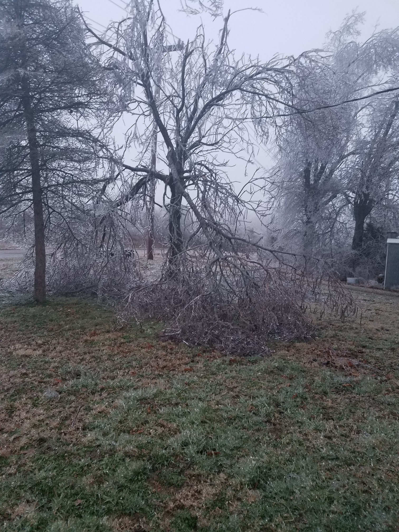
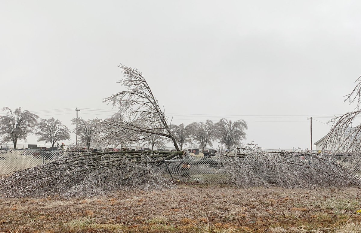
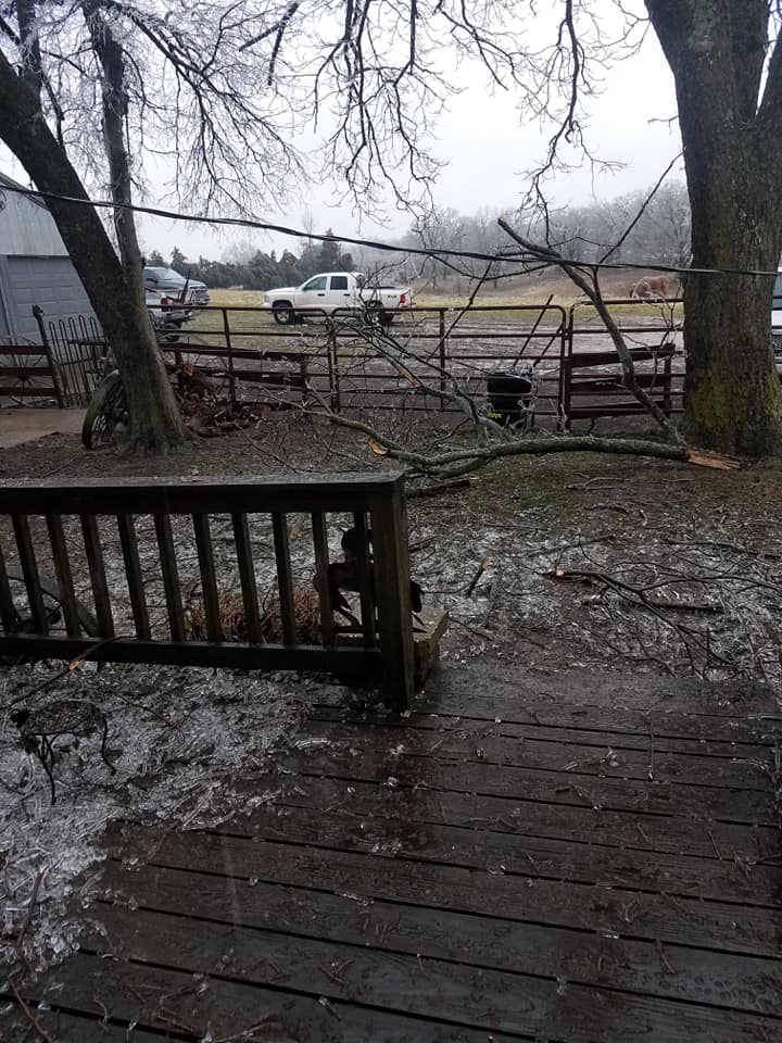
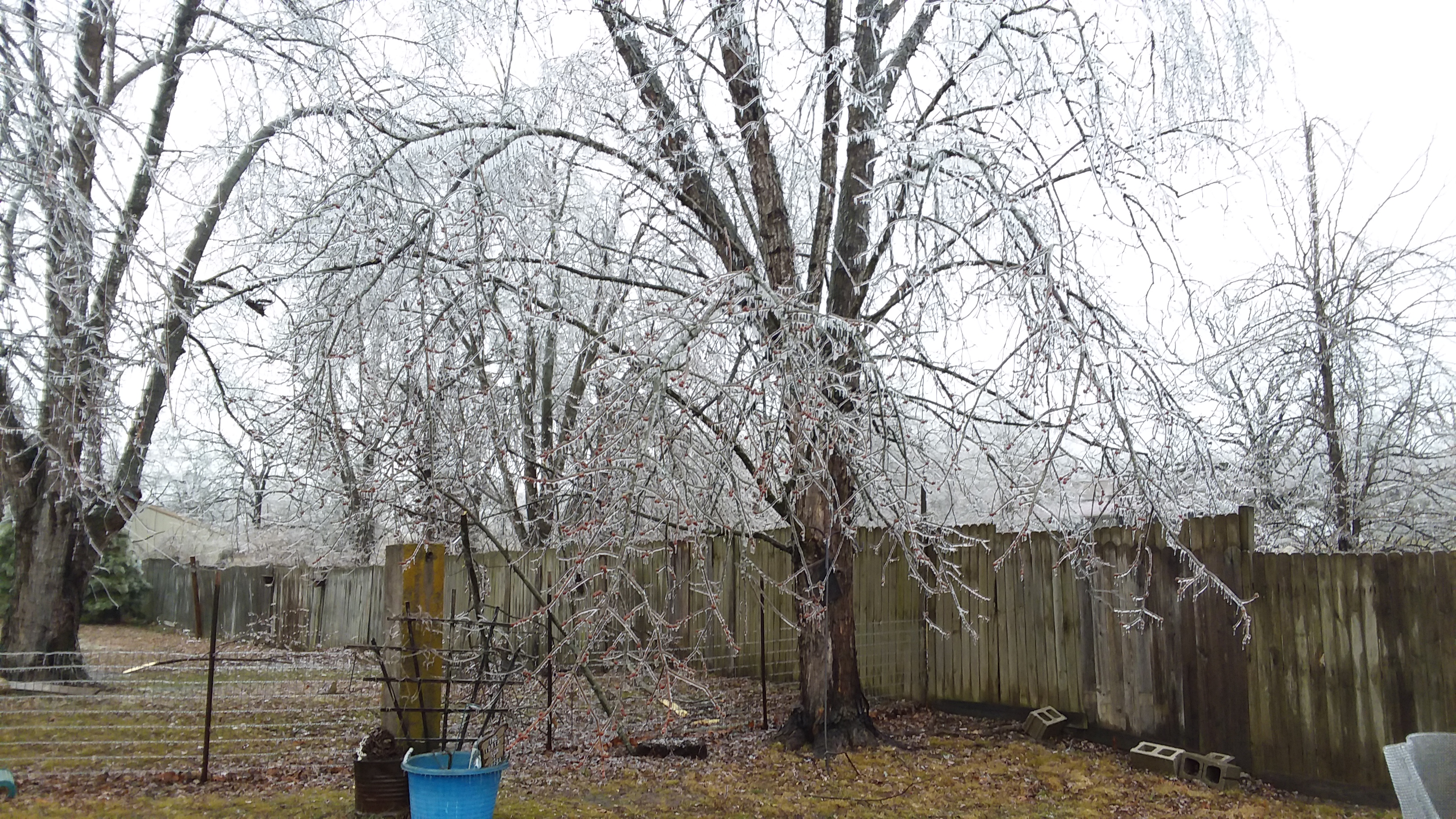
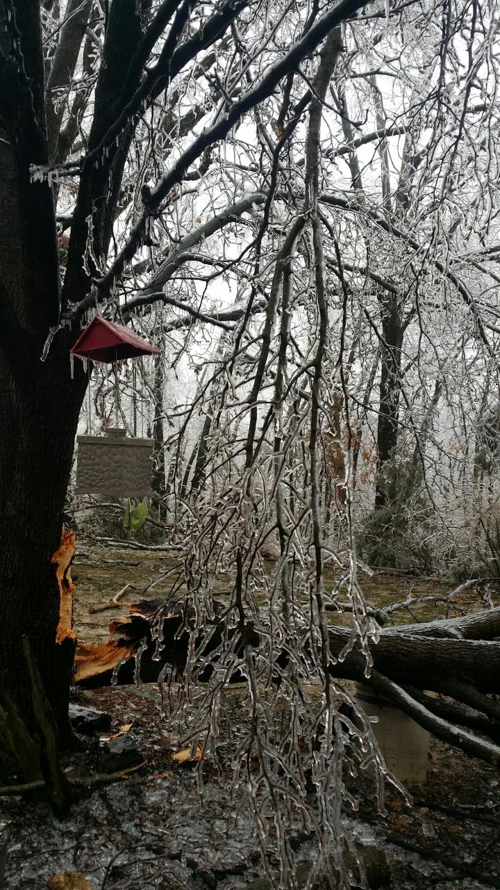
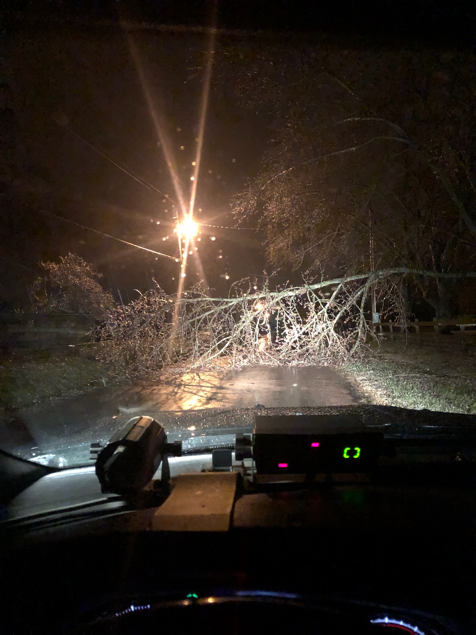
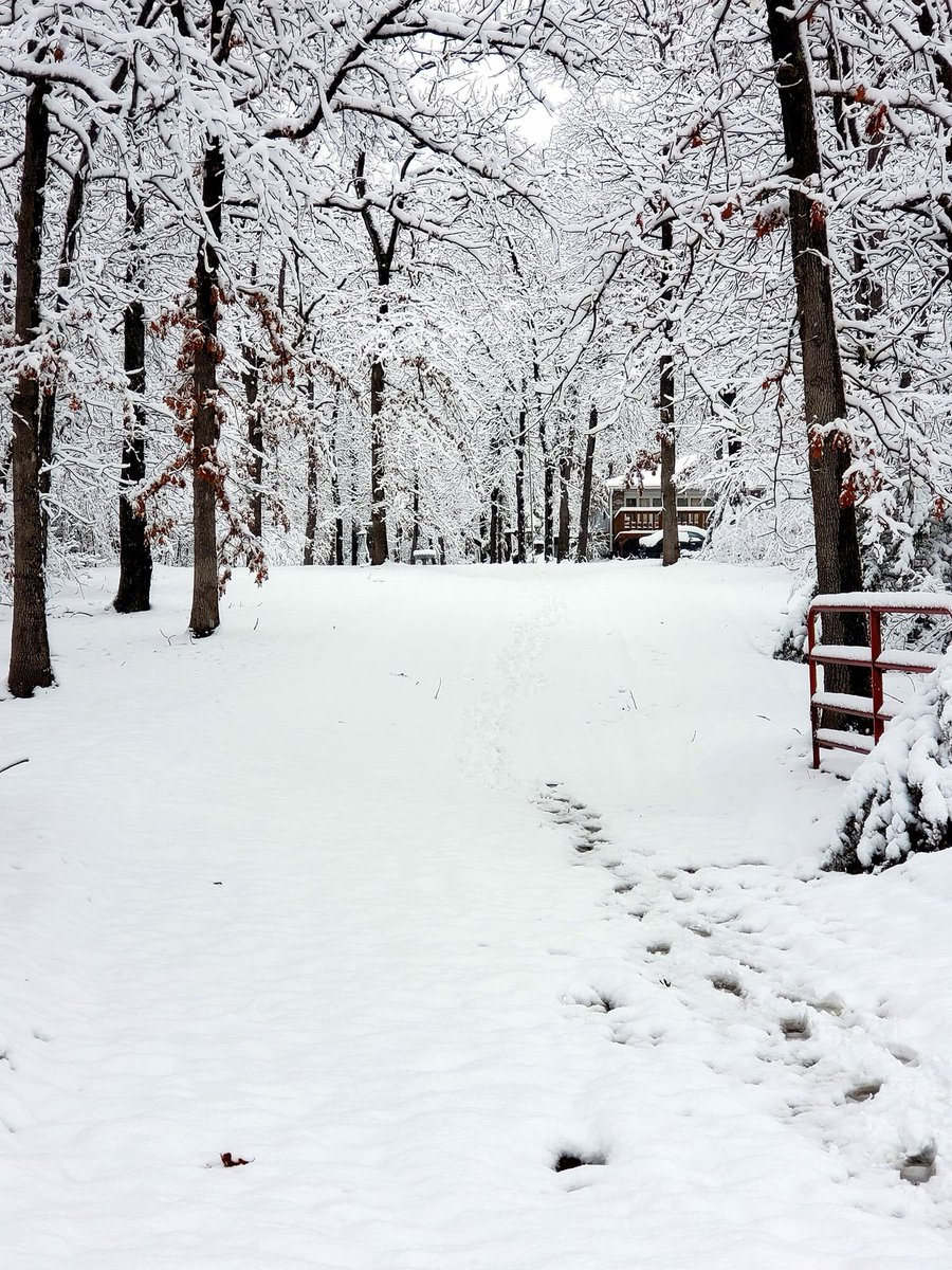
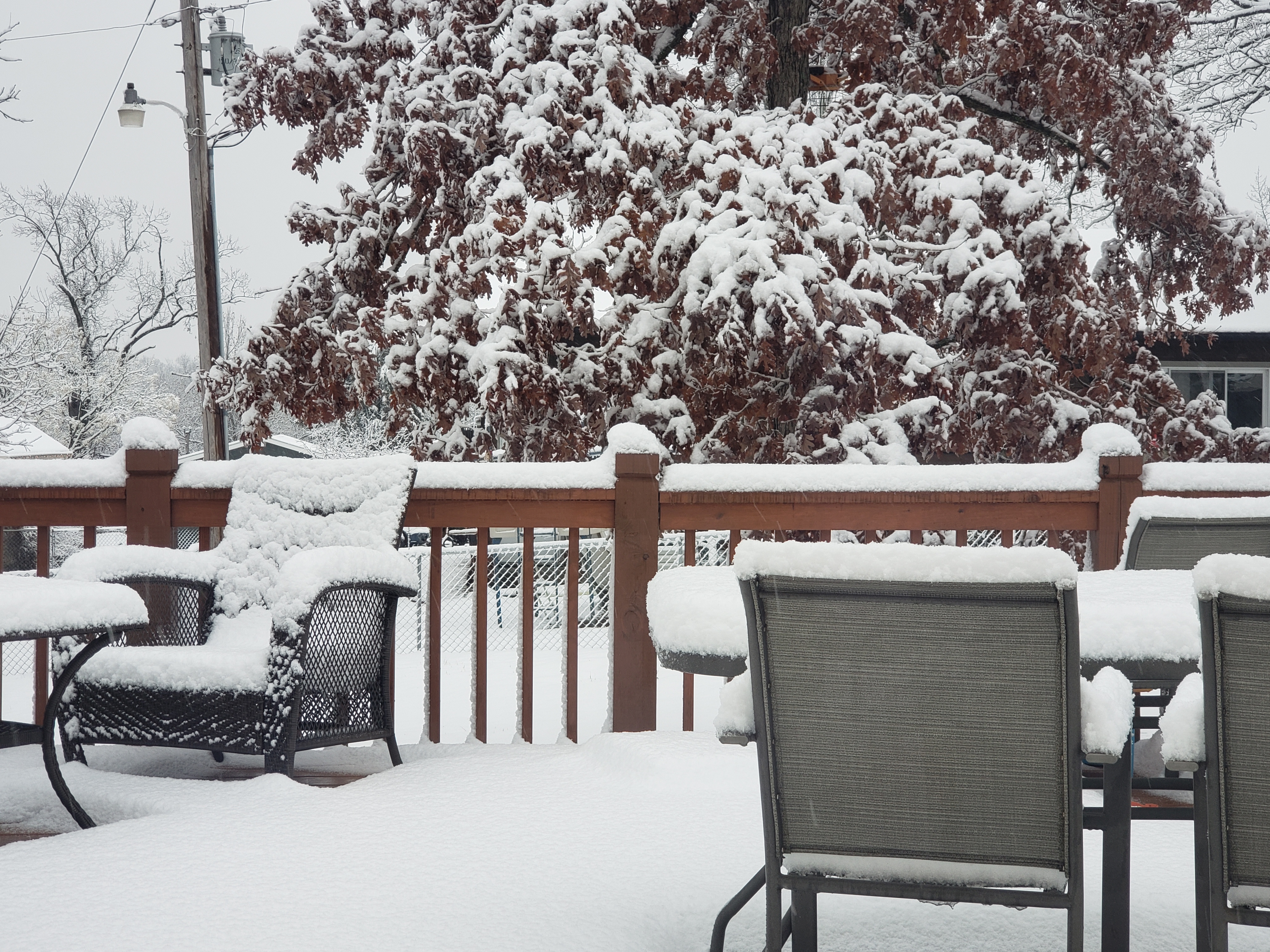
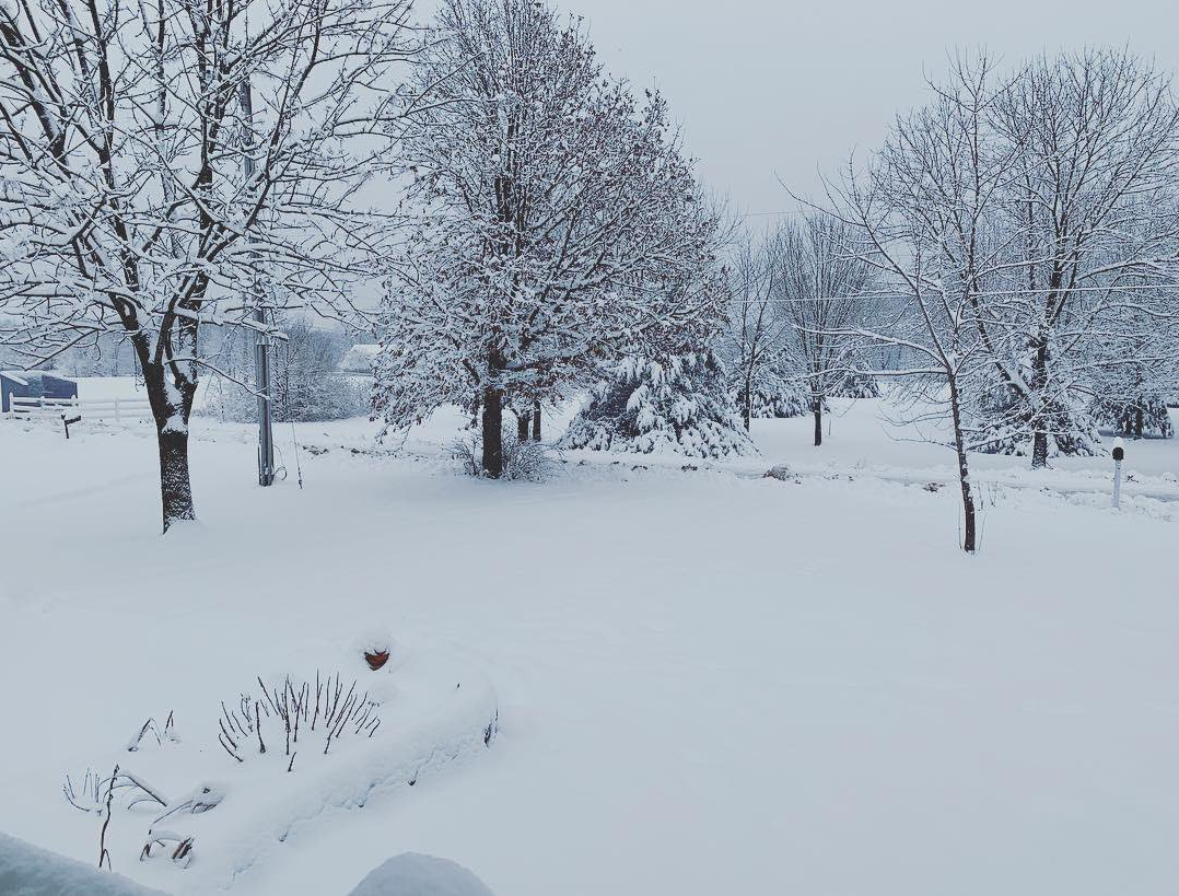
A winter storm affected portions of the Missouri Ozarks on January 11 and 12. Two main impacts occurred with this storm system with heavy snow in central Missouri and significant ice east of Springfield. Heavy snow occurred across portions of central Missouri with some locations seeing 6-9 inches of snowfall. The heaviest snowfall amounts occurred across Benton, Camden, Morgan, Miller and Maries counties. Lesser amounts of snow occurred to the southwest with very little, if any snowfall across the southwest 1/3 of the area. Numerous roadways were snow covered across central Missouri. Damaging ice accumulations occurred in the higher terrain of the Missouri Ozarks across Webster, Christian, Wright, Douglas, Ozark, Texas and Howell counties. The most widespread ice accumulations, in some cases exceeding 0.50 inch in diameter, occurred in southern Webster, southern Wright and Douglas counties. Several thousand power outages and widespread tree damage occurred with this system. |
 |
 |
|
| Snowfall Totals January 11-12 | Total Ice Accumulation January 11-12 |
Photos & Video
 |
 |
 |
 |
| Seymour, Mo | Seymour, Mo | Seymour, Mo | Fordland, Mo |
 |
 |
 |
 |
| Dogwood, Mo | Dogwood, Mo | Dogwood, Mo | Dogwood, Mo |
 |
 |
 |
 |
| Ava, Mo | Ava, Mo | Ava, Mo | Mountain Grove, Mo |
 |
 |
 |
|
| Lincoln, Mo | Camdenton, Mo | Eldon, Mo |
Storm Reports
PRELIMINARY LOCAL STORM REPORT...SUMMARY
NATIONAL WEATHER SERVICE SPRINGFIELD MO
1102 AM CST SUN JAN 13 2019
.TIME... ...EVENT... ...CITY LOCATION... ...LAT.LON
.DATE... ....MAG.... ..COUNTY LOCATION..ST.. ...SOURCE.
..REMARKS..
1130 AM FREEZING RAIN 3 NNE NORTHVIEW 37.32N 92.98W
01/11/2019 E0.01 INCH WEBSTER MO NWS EMPLOYEE
FREEZING RAIN OCCURRING WITH LIGHT GLAZE ON
ELEVATED OBJECTS. TEMPERATURE 32.
1153 AM FREEZING RAIN 1 NNE POMONA 36.88N 91.91W
01/11/2019 M0.03 INCH HOWELL MO ASOS
WEST PLAINS AIRPORT ASOS REPORTED A 6 HOUR
TOTAL OF 0.03 INCH OF FLAT ICE ACCUMULATION.
I6003.
1153 AM FREEZING RAIN 2 SE VICHY 38.09N 91.73W
01/11/2019 M0.02 INCH MARIES MO ASOS
VICHY ROLLA AIRPORT ASOS REPORTED A 6 HOUR
TOTAL OF 0.02 INCH OF FLAT ICE ACCUMULATION.
I6002.
1212 PM FREEZING RAIN AVA 36.96N 92.66W
01/11/2019 E0.10 INCH DOUGLAS MO AMATEUR RADIO
FLAT ICE ACCUMULATION ON ELEVATED SURFACES.
LESS THAN 0.1 INCH ON RADIAL OBJECTS. VIA
PICTURES SENT TO CONTACT.
1220 PM FREEZING RAIN ROGERSVILLE 37.12N 93.06W
01/11/2019 U0.00 INCH WEBSTER MO FIRE DEPT/RESCUE
FREEZING RAIN ON POWER LINES. NO ROAD
IMPACTS AT TIME OF REPORT.
1232 PM SLEET MACKS CREEK 37.97N 92.97W
01/11/2019 U0.0 INCH CAMDEN MO EMERGENCY MNGR
RAIN AND SLEET MIX IN MACKS CREEK.
1233 PM SLEET CAMDENTON 38.01N 92.74W
01/11/2019 U0.0 INCH CAMDEN MO PUBLIC
RAIN AND SLEET MIX IN CAMDENTON.
1246 PM FREEZING RAIN HIGHLANDVILLE 36.93N 93.28W
01/11/2019 U0.00 INCH CHRISTIAN MO NWS EMPLOYEE
DROVE FROM OZARK TO NE STONE COUNTY. 34F IN
SOUTH OZARK, 32F IN HIGHLANDVILLE, 33F IN
HOOTENTOWN, 34F IN NE STONE COUNTY NEAR
JAMESVILLE. THERE IS STILL A BIT OF A GLAZE
ON ELEVATED SURFACES NEAR HIGHLANDVILLE. NO
SLICK ROADS....AND THE HOOTENTOWN BRIDGE IS
JUST WET.
0125 PM SLEET PITTSBURG 37.84N 93.30W
01/11/2019 U0.0 INCH HICKORY MO BROADCAST MEDIA
REPORT OF SNOWING/SLEETING IN PITTSBURG, MO.
0132 PM FREEZING RAIN NORWOOD 37.11N 92.41W
01/11/2019 E0.10 INCH WRIGHT MO LAW ENFORCEMENT
ESTIMATED 0.10 INCH OF ICE ON TREE LIMBS.
VIA PICTURES SENT TO CONTACT. WEST OF
NORWOOD AND NORTH OF MANSHFIELD.
0145 PM SNOW 3 WNW COLE CAMP 38.48N 93.26W
01/11/2019 E0.0 INCH BENTON MO CO-OP OBSERVER
SNOW STARTED EARLY THIS AFTERNOON.
0230 PM SNOW MACKS CREEK 37.97N 92.97W
01/11/2019 E0.1 INCH CAMDEN MO PUBLIC
SNOW OCCURRING WITH LIGHT ACCUMULATION ON
GRASSY SURFACES.
0245 PM SNOW LEBANON 37.68N 92.66W
01/11/2019 E0.1 INCH LACLEDE MO PUBLIC
SNOW HAS BEGUN WITH LIGHT ACCUMULATION ON
GRASSY AREAS.
0248 PM SNOW URBANA 37.84N 93.17W
01/11/2019 E0.0 INCH DALLAS MO PUBLIC
SNOW HAS STARTED IN URBANA.
0310 PM SNOW ROLLA 37.95N 91.77W
01/11/2019 E0.1 INCH PHELPS MO PUBLIC
SNOW OCCURRING IN ROLLA WITH LIGHT
ACCUMULATION.
0323 PM FREEZING RAIN RUETER 36.61N 92.87W
01/11/2019 E0.01 INCH TANEY MO EMERGENCY MNGR
GLAZE OF ICE ON TREES IN THE RUETER AND
PROTEM AREA.
0341 PM SNOW CAMDENTON 38.01N 92.75W
01/11/2019 E0.5 INCH CAMDEN MO AMATEUR RADIO
DECENT SNOW IN CAMDENTON AND ALL ROADS
BECOMING SNOW COVERED.
0413 PM FREEZING RAIN 3 E NIANGUA 37.38N 92.79W
01/11/2019 E0.01 INCH WEBSTER MO AMATEUR RADIO
GLAZE OF ICE ON TREES.
0424 PM SNOW WAYNESVILLE 37.82N 92.20W
01/11/2019 E2.0 INCH PULASKI MO EMERGENCY MNGR
ESTIMATED 2 INCHES OF SNOWFALL ON ELEVATED
SURFACES AND GRAVEL ROADS. SOME MAIN ROADS
ARE NOW COVERED WITH SNOW WITH ACCIDENTS
ALSO OCCURRING.
0548 PM FREEZING RAIN DIGGINS 37.17N 92.85W
01/11/2019 E0.01 INCH WEBSTER MO BROADCAST MEDIA
GLAZE OF ICE ON TREES AND ELEVATED SURFACES
IN DIGGINS.
0556 PM SNOW 5 SSE CROCKERVILLE 38.38N 93.07W
01/11/2019 E2.0 INCH MORGAN MO PUBLIC
7 MILES SW OF STOVER HAS 2 INCHES SNOW. JUST
INSIDE MORGAN COUNTY.
0557 PM SNOW VIENNA 38.19N 91.95W
01/11/2019 E2.3 INCH MARIES MO LAW ENFORCEMENT
2.25IN SNOWFALL ON DECK IN VIENNA.
0559 PM SNOW IBERIA 38.09N 92.29W
01/11/2019 E3.0 INCH MILLER MO BROADCAST MEDIA
0600 PM FREEZING RAIN ALTON 36.69N 91.40W
01/11/2019 E0.01 INCH OREGON MO PUBLIC
ALTON MO- GLAZE OF ICE ON THE TREES AND
ELEVATED SURFACES AND STILL RAINING AS OF
6PM. ROADS ARE STILL JUST WET FOR NOW.
0600 PM SNOW SALEM 37.65N 91.54W
01/11/2019 E1.0 INCH DENT MO PUBLIC
0600 PM SNOW 2 WSW LAURIE 38.19N 92.85W
01/11/2019 E2.5 INCH CAMDEN MO COCORAHS
0613 PM FREEZING RAIN HARTVILLE 37.25N 92.51W
01/11/2019 E0.01 INCH WRIGHT MO PUBLIC
GLAZE OF ICE IN TREES IN HARTVILLE.
0616 PM SNOW 7 S SAINT JAMES 37.90N 91.61W
01/11/2019 E3.3 INCH PHELPS MO PUBLIC
3 1/4 IN OF SNOW 7 MILES SOUTH OF ST JAMES
ON 68 TOWARD SALEM. SLEET MIX FALLING NOW.
0625 PM SNOW 3 SE NORTHWYE 37.95N 91.72W
01/11/2019 E3.2 INCH PHELPS MO PUBLIC
0630 PM FREEZING RAIN 4 NNE RUETER 36.67N 92.84W
01/11/2019 E0.05 INCH TANEY MO PUBLIC
GLADE TOP IN TANEY COUNTY TREES AND LINES
ARE ICE COVERED. 1/8IN SO FAR.
0630 PM FREEZING RAIN FORDLAND 37.16N 92.94W
01/11/2019 U0.00 INCH WEBSTER MO PUBLIC
TREES HAVE GLAZE OF ICE. SOME FLICKERING
LIGHTS. FORDLAND.
0635 PM FREEZING RAIN 2 N AVA 36.98N 92.66W
01/11/2019 U0.00 INCH DOUGLAS MO BROADCAST MEDIA
REPORT OF A FEW BRANCHES BREAKING BECAUSE OF
ICE ABOUT 2 MILES NORTH OF AVA.
0654 PM SNOW KAISER 38.13N 92.59W
01/11/2019 E3.0 INCH MILLER MO PUBLIC
1111 PM ICE STORM MOUNTAIN GROVE 37.13N 92.26W
01/11/2019 WRIGHT MO PUBLIC
TREES DOWN AND POWER OUTAGES IN MOUNTAIN
GROVE DUE TO ICE ACCUMULATION.
0430 AM FLOOD 1 W BROOKLYN HEIGHTS 37.17N 94.40W
01/12/2019 JASPER MO LAW ENFORCEMENT
LOW WATER CROSSING FLOODED OVER CO RD 187,
JUST SOUTH OF OLD 66 BLVD.
0500 AM SNOW APPLETON CITY 38.19N 94.03W
01/12/2019 M2.5 INCH ST. CLAIR MO CO-OP OBSERVER
CO-OP OBSERVER STATION APCM7, APPLETON CITY.
0615 AM ICE STORM 1 S OZARK 37.01N 93.20W
01/12/2019 CHRISTIAN MO BROADCAST MEDIA
TREE LIMBS DOWN ON POWER LINES. DELAYED
REPORT.
0630 AM ICE STORM 1 ENE SEYMOUR 37.15N 92.75W
01/12/2019 WEBSTER MO BROADCAST MEDIA
PUBLIC PHOTOS COMING IN ON SOCIAL MEDIA OF
TREE LIMBS DOWNED ACROSS SEYMOUR. POWER
OUTAGES OVERNIGHT HAVE SINCE BEEN RESTORED.
DELAYED REPORT.
0630 AM SNOW 1 W NEVADA 37.84N 94.37W
01/12/2019 M1.0 INCH VERNON MO CO-OP OBSERVER
CO-OP OBSERVER STATION NEVM7, NEVADA.
0630 AM ICE STORM 1 N AVA 36.96N 92.66W
01/12/2019 DOUGLAS MO PUBLIC
MULTIPLE REPORTS OF TREE LIMBS DOWNED AND
SCATTERED ACROSS AVA. POWER OUTAGES
REPORTED. DELAYED REPORT.
0645 AM SNOW 4 NNW LECOMA 37.83N 91.76W
01/12/2019 M2.7 INCH PHELPS MO COCORAHS
COCORAHS STATION MO-PH-13, 4 NNW LECOMA.
0700 AM SNOW 3 WNW ROLLA 37.98N 91.82W
01/12/2019 M3.2 INCH PHELPS MO COCORAHS
COCORAHS STATION MO-PH-53, 3 WNW ROLLA.
0700 AM SNOW 4 N LECOMA 37.84N 91.72W
01/12/2019 M3.0 INCH PHELPS MO COCORAHS
COCORAHS STATION MO-PH-37, 4 N LECOMA.
0700 AM SNOW 3 S WHEATLAND 37.90N 93.39W
01/12/2019 M2.0 INCH HICKORY MO COCORAHS
COCORAHS STATION MO-HC-7, 2 S WHEATLAND.
0700 AM SNOW 2 WSW LAURIE 38.19N 92.85W
01/12/2019 M6.0 INCH CAMDEN MO COCORAHS
COCORAHS STATION MO-CM-20, 1 WSW LAURIE.
0700 AM SNOW 2 ESE FREEDOM 38.02N 92.55W
01/12/2019 M1.5 INCH CAMDEN MO COCORAHS
COCORAHS STATION MO-CM-2, 2 ESE FREEDOM.
0700 AM SNOW DEVON 37.92N 94.82W
01/12/2019 M1.9 INCH BOURBON KS COCORAHS
COCORAHS STATION KS-BB-17, DEVON.
0700 AM SNOW 4 NE FORT LEONARD WOOD 37.75N 92.11W
01/12/2019 M2.0 INCH PULASKI MO CO-OP OBSERVER
CO-OP OBSERVER STATION FLWM7, FORT LEONARD
WOOD.
0700 AM SNOW 1 SE SAINT JAMES 37.99N 91.60W
01/12/2019 M3.8 INCH PHELPS MO COCORAHS
COCORAHS STATION MO-PH-20, SAINT JAMES.
0700 AM SNOW 7 NNW BANGERT 37.86N 91.55W
01/12/2019 M3.4 INCH PHELPS MO COCORAHS
COCORAHS STATION MO-PH-27, 6 NNW BANGERT.
0700 AM SNOW 3 S ROLLA 37.90N 91.78W
01/12/2019 M3.2 INCH PHELPS MO COCORAHS
COCORAHS STATION MO-PH-33, 3 SSW ROLLA.
0700 AM SNOW 2 ESE DOOLITTLE 37.92N 91.84W
01/12/2019 M3.2 INCH PHELPS MO COCORAHS
COCORAHS STATION MO-PH-44, 2 ESE DOOLITTLE.
0730 AM SNOW ROLLA 37.96N 91.78W
01/12/2019 M4.5 INCH PHELPS MO CO-OP OBSERVER
CO-OP OBSERVER STATION RRGM7, ROLLA.
0730 AM HEAVY SNOW VERSAILLES 38.44N 92.84W
01/12/2019 M7.5 INCH MORGAN MO BROADCAST MEDIA
SNOWFALL MEASURED ON DECK RAILING, JUST
NORTH OF DOWNTOWN VERSAILLES. LIGHT SNOW
STILL ONGOING AT TIME OF OBSERVATION. PUBLIC
REPORT RELAYED BY BROADCAST MEDIA.
0740 AM SNOW 1 N CAMDENTON 38.02N 92.74W
01/12/2019 M4.5 INCH CAMDEN MO AMATEUR RADIO
MEASUREMENT AVERAGED FROM DECK RAILING AND
PATIO TABLE. LIGHT SNOW ONGOING AT TIME OF
OBSERVATION.
0745 AM HEAVY SNOW BARNETT 38.38N 92.67W
01/12/2019 M9.0 INCH MORGAN MO BROADCAST MEDIA
MEASURED IN GRASS AND IS AN AVERAGE OF 4
MEASUREMENTS. LIGHT SNOW ONGOING AT TIME OF
OBSERVATION.
0745 AM ICE STORM ROUND SPRING 37.29N 91.41W
01/12/2019 SHANNON MO PUBLIC
GLAZE OF ICE ON TREES AND COLD SURFACES.
FLAT ICE MEASUREMENT OF 0.25 INCH.
0800 AM SNOW 3 SSE STOVER 38.40N 92.97W
01/12/2019 M8.0 INCH MORGAN MO COCORAHS
COCORAHS STATION MO-MG-6, 3 SSE STOVER.
0800 AM ICE STORM 3 NNE WILLOW SPRINGS 37.03N 91.96W
01/12/2019 HOWELL MO PUBLIC
LARGE TREE LIMBS (6-8 INCHES IN DIAMETER)
DOWNED JUST NORTH OF WILLOW SPRINGS.
0800 AM SNOW 2 NW STOVER 38.46N 93.02W
01/12/2019 M9.3 INCH MORGAN MO COCORAHS
COCORAHS STATION MO-MG-5, 2 WNW STOVER.
0800 AM SNOW 4 ESE LOWRY CITY 38.13N 93.66W
01/12/2019 M3.6 INCH ST. CLAIR MO COCORAHS
COCORAHS STATION MO-SR-1, 3 E LOWRY CITY.
0840 AM ICE STORM 5 NNE AVA 37.02N 92.63W
01/12/2019 DOUGLAS MO PUBLIC
MULTIPLE TREES DOWNED DUE TO ICE. LARGEST
LIMBS MEASURE 6-8 INCHES IN DIAMETER. REPORT
VIA SOCIAL MEDIA, SHARED IMAGE.
0937 AM SNOW WARSAW 38.25N 93.38W
01/12/2019 M4.0 INCH BENTON MO BROADCAST MEDIA
PUBLIC REPORT RELAYED FROM BROADCAST MEDIA.
1000 AM HEAVY SNOW 1 NE LINCOLN 38.40N 93.32W
01/12/2019 M7.0 INCH BENTON MO BROADCAST MEDIA
MEASUREMENT TAKEN ON GRASS. PUBLIC REPORT
RELAYED BY BROADCAST MEDIA.
0100 PM FREEZING RAIN 1 NE POMONA 36.88N 91.90W
01/12/2019 M0.44 INCH HOWELL MO ASOS
STORM TOTAL ICE ACCUMULATION AT ASOS STATION
UNO, WEST PLAINS MUNICIPAL AIRPORT. RADIAL
ICE ACCUMULATION 0.17IN. FLAT ICE
ACCUMULATION 0.44IN.
0150 PM FLOOD MCDOWELL 36.82N 93.79W
01/12/2019 BARRY MO DEPT OF HIGHWAYS
STATE HIGHWAY C IS CLOSED DUE TO FLOODING AT
FLAT CREEK.
0150 PM SNOW WARSAW 38.24N 93.38W
01/12/2019 M6.0 INCH BENTON MO PUBLIC
STILL SNOWING.
0327 PM FLOOD 2 N STOTTS CITY 37.14N 93.95W
01/12/2019 LAWRENCE MO DEPT OF HIGHWAYS
MO-97 IS CLOSED IN BOTH DIRECTIONS DUE TO
WATER OVER THE ROADWAY AT THE SPRING RIVER.
0330 PM FLOOD 2 E AVA 36.96N 92.62W
01/12/2019 DOUGLAS MO DEPT OF HIGHWAYS
ROUTE FF IS CLOSED IN BOTH DIRECTIONS DUE TO
WATER FROM HUNTER CREEK OVER THE ROADWAY.
0331 PM FLOOD 4 WNW AVA 36.97N 92.73W
01/12/2019 DOUGLAS MO DEPT OF HIGHWAYS
MO-Y IS CLOSED IN BOTH DIRECTIONS AT COWSKIN
CREEK DUE TO WATER OVER THE ROADWAY.
0333 PM FLOOD 5 NE MANSFIELD 37.17N 92.53W
01/12/2019 WRIGHT MO DEPT OF HIGHWAYS
ROUTE AB IS CLOSED IN BOTH DIRECTIONS AT
WOLF CREEK DUE TO WATER OVER THE ROADWAY.
0356 PM FLOOD 4 SSW HARDENVILLE 36.54N 92.40W
01/12/2019 OZARK MO DEPT OF HIGHWAYS
ROUTE T CLOSED JUST SOUTH OF LICK CREEK DUE
TO WATER OVER THE ROADWAY.
0541 PM FLOOD 8 SSE MOUNTAIN GROVE 37.04N 92.19W
01/12/2019 DOUGLAS MO DEPT OF HIGHWAYS
ROUTE EE CLOSED AT THE NORTH FORK RIVER DUE
TO WATER OVER THE ROADWAY.
0500 AM SNOW APPLETON CITY 38.19N 94.03W
01/13/2019 M4.5 INCH ST. CLAIR MO CO-OP OBSERVER
THIS IS A 48 HOUR STORM TOTAL. CO-OP
OBSERVER STATION APCM7, APPLETON CITY.
0700 AM SNOW 3 WNW COLE CAMP 38.48N 93.26W
01/13/2019 M10.7 INCH BENTON MO CO-OP OBSERVER
THIS IS A 48 HOUR STORM TOTAL. CO-OP
OBSERVER STATION CCMM7, COLE CAMP 3NW.
0730 AM SNOW ROLLA 37.96N 91.78W
01/13/2019 M5.5 INCH PHELPS MO CO-OP OBSERVER
THIS IS A 48 HOUR STORM TOTAL. CO-OP
OBSERVER STATION RRGM7, ROLLA.
0800 AM SNOW 2 NW STOVER 38.46N 93.02W
01/13/2019 M11.1 INCH MORGAN MO COCORAHS
THIS IS A 48 HOUR STORM TOTAL. COCORAHS
STATION MO-MG-5, 2 WNW STOVER.
 |
Media use of NWS Web News Stories is encouraged! Please acknowledge the NWS as the source of any news information accessed from this site. |
|


 Weather Story
 Weather Map
 Local Radar