|
List of December 2015 Records |
|
Date |
Station |
Record |
|
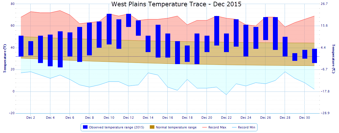
Dec 10th |
West Plains |
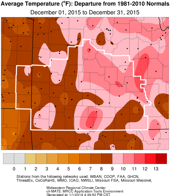
A record high temperature of 71 degrees breaks the old record of 69 set in 1996. |
|
Dec 12th
|
West Plains
|
A record high of 71 degrees breaks the old record of 70 set in 1980. |
|
A record warmest low temperature of 59 degrees shatters the old record of 50 set in 1975. |
|
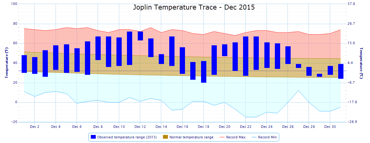
Joplin
|
A record high of 72 degrees breaks the old record of 69 set in 1907. |
|
A record warmest low temperature of 63 degrees shatters the old record of 45 set in 2014. |
|
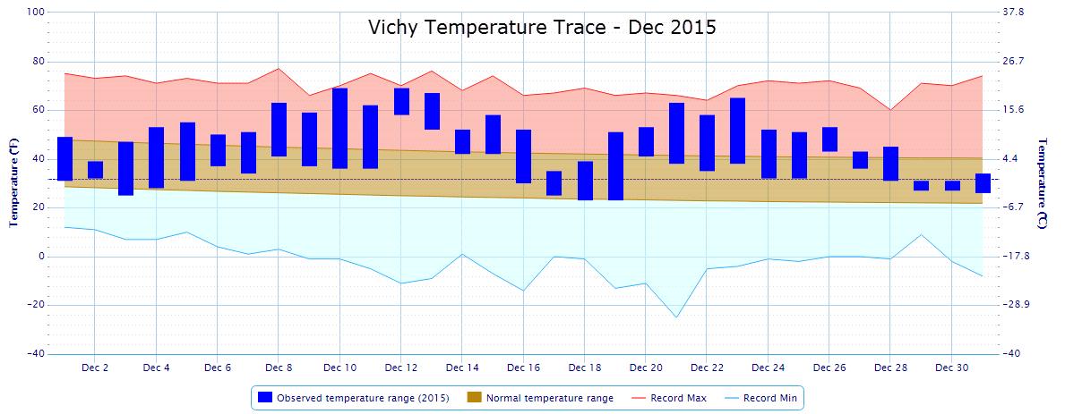
Vichy |
A record warmest low temperature of 58 degrees shatters the old record of 47 set in 1990. |
|
Dec 13th
|
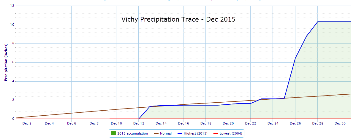
Vichy |
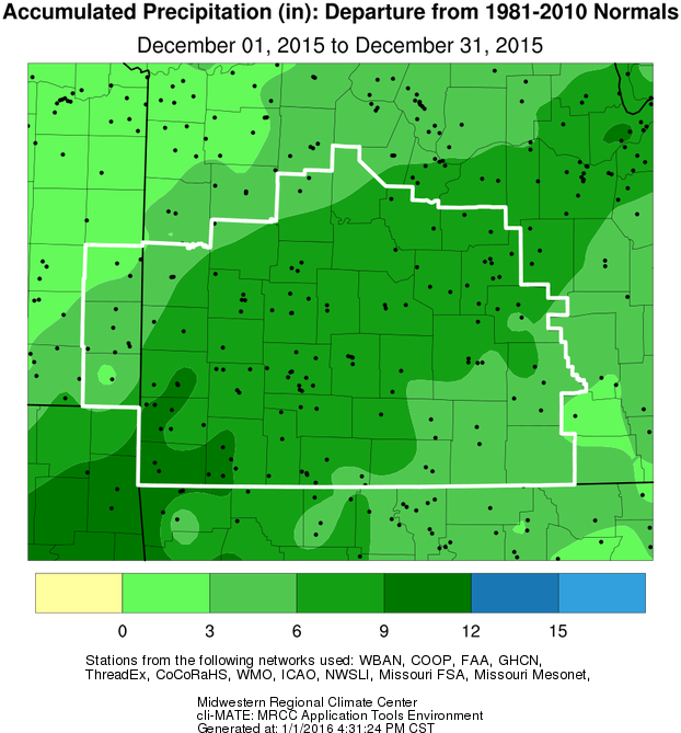
A record daily rainfall of 1.33 inches breaks the old record of 0.75 inches in 1897. |
|
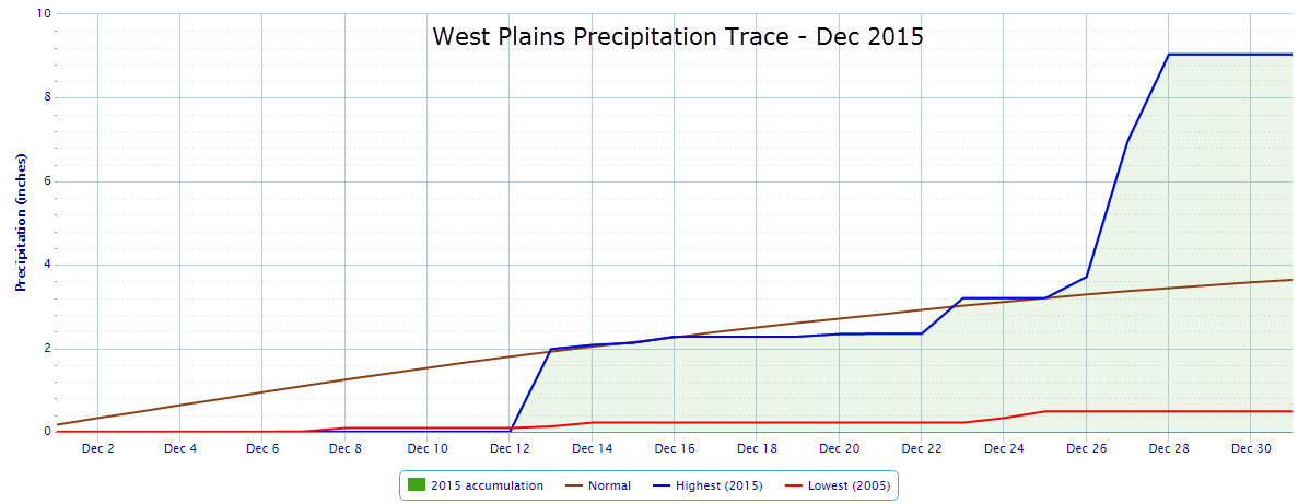
West Plains |
A record daily rainfall of 1.98 inches breaks the old record of 0.96 inches set in 2000. |
|
Dec 21st |
West Plains |
A record high temperature of 69 degrees breaks the old record of 68 set in 1967. |
|
Dec 26th
|
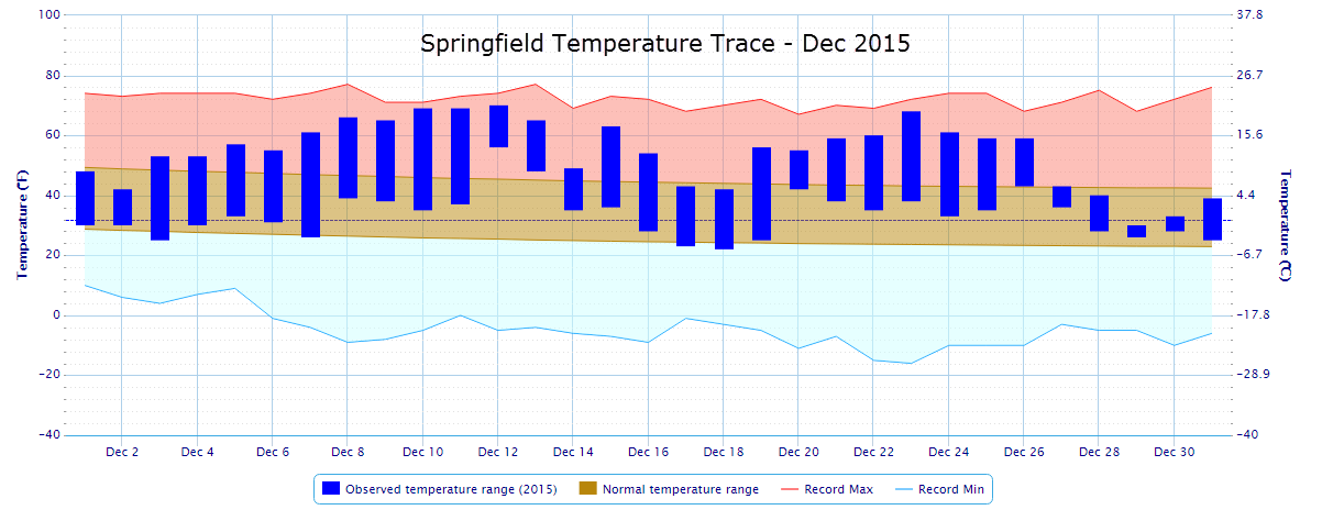
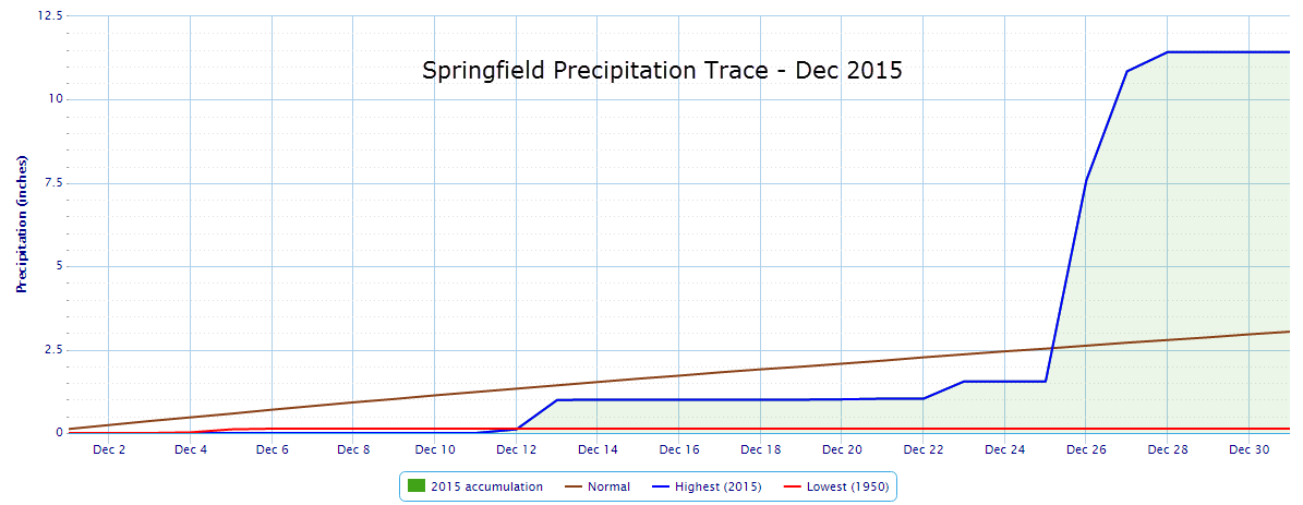
Springfield |
A record daily rainfall of 6.03 inches shatters the old record of 3.06 set in 1942. |
|
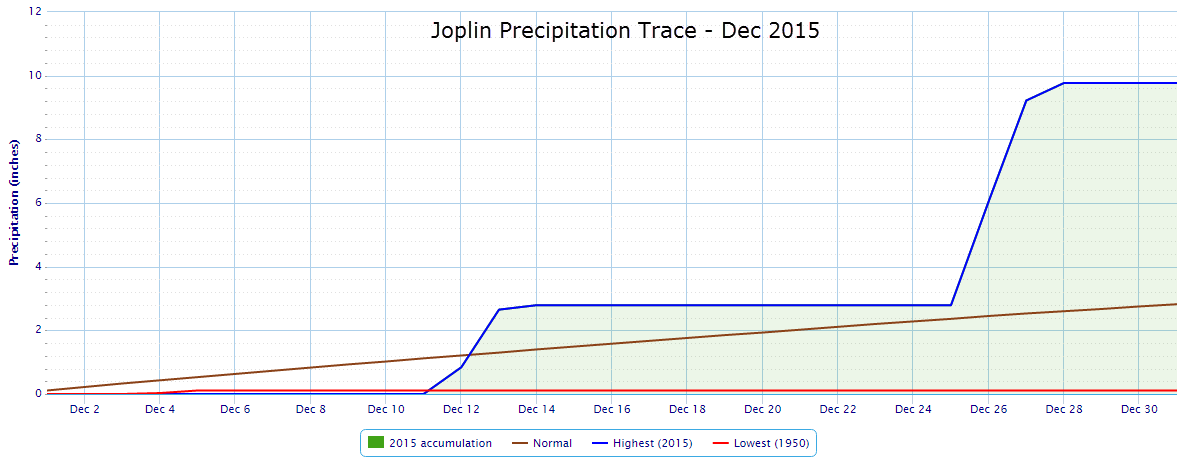
Joplin |
A record daily rainfall of 3.26 inches shatters the old record of 0.61 inches set in 1959. |
|
Vichy |
A record daily rainfall of 4.31 inches shatters the old record of 0.45 inches set in 2011. |
|
Dec 27th
|
Springfield |
A record daily rainfall of 3.27 breaks the old record of 2.60 inches set in 1968. |
|
Joplin |
A record daily rainfall of 3.17 inches breaks the old record of 2.35 inches set in 1954. |
|
West Plains |
A record daily rainfall of 3.25 inches breaks the old record of 2.44 inches set in 1968. |
|
Dec 28th
|
Vichy |
A record daily rainfall of 1.53 inches breaks the old record of 0.66 inches set in 1946. |
|
Joplin |
A record daily rainfall of 0.55 inches breaks the old record of 0.38 inches set in 1948. |
|
West Plains |
A record daily rainfall of 2.08 inches breaks the old record of 1.50 inches set in 1997. |
|
Monthly
|
Springfield |
Record rainfall for December of 11.43 inches breaks the old record of 11.02 inches set in 1895. |
|
Joplin |
Record rainfall for December of 9.77 inches breaks the old record of 7.67 inches set in 1999. |
|
Vichy |
Record rainfall for December of 10.32 inches breaks the old record of 9.21 inches set in 1982. |
|
West Plains |
Record warmest average tempreature for December of 45.0 degrees breaks the old record of 43.2 set in 1971. |
|
Vichy |
Record warmest average temperature for December of 43.0 degrees breaks the old record of 42.5 set in 1965. |


 Weather Story
 Weather Map
 Local Radar