Overview
Several waves of upper level energy interacted with instability and a little bit of shear to provide the region with several rounds of showers and thunderstorms over the 19th and 20th of May 2018. The strongest storms produced 2 EF-1 tornadoes, wind damage and many large hail reports. In addition, the storms moved across many of the same locations, producing between 4 and 6 inches of rain from extreme southeast Kansas into central and south central Missouri, which led to some flooding.
Tornadoes:
|
Tornado - 2 NW Pleasant Hope MO
Track Map 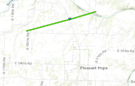 
|
||||||||||||||||
|
Tornado - 3 NNW Pleasant Hope MO
Track Map 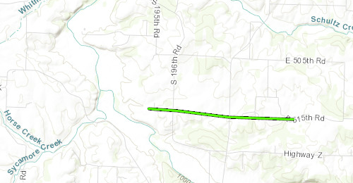
|
||||||||||||||||
The Enhanced Fujita (EF) Scale classifies tornadoes into the following categories:
| EF0 Weak 65-85 mph |
EF1 Moderate 86-110 mph |
EF2 Significant 111-135 mph |
EF3 Severe 136-165 mph |
EF4 Extreme 166-200 mph |
EF5 Catastrophic 200+ mph |
 |
|||||
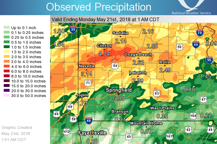
Flooding
Showers and thunderstorms occurred in several waves on the 19th - 20th of May, 2018. The heaviest rainfall occurred over southeast Kansas into central Missouri, extending back down into south central Missouri. Within this heavier band, 3 to 6 inches of rainfall occurred, causing flooded roadways and rivers to exceed flood stage.
Rainfall Totals Map
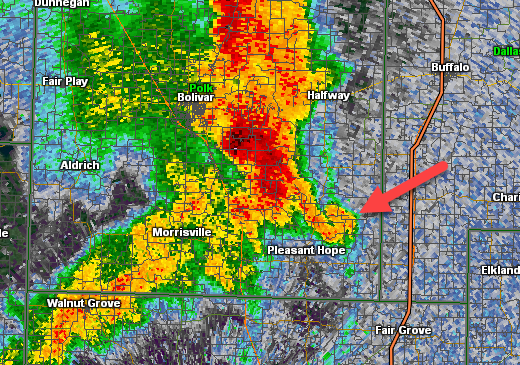
Radar:
Tornadoes near Pleasant Hope
 |
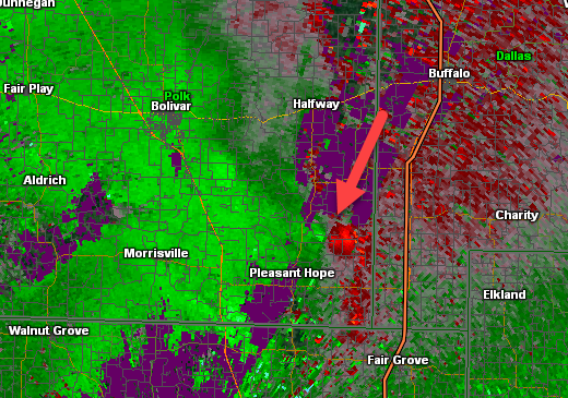 |
Reflectivity Image @ 6:32 pm |
Storm Relative Velecity Image @ 6:32 pm |
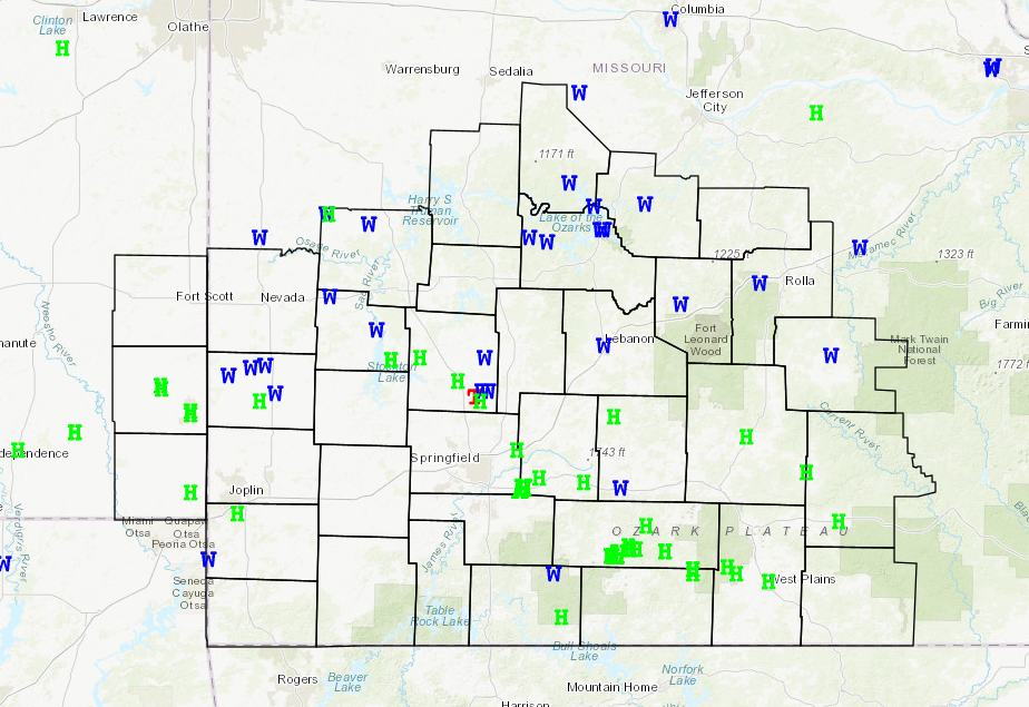
Storm Reports
 |
Media use of NWS Web News Stories is encouraged! Please acknowledge the NWS as the source of any news information accessed from this site. |
|


 Weather Story
 Weather Map
 Local Radar