Springfield, MO
Weather Forecast Office
Severe thunderstorms brought damaging winds, large hail and at least one confirmed tornado to portions of extreme southeast Kansas and the Missouri Ozarks Wednesday, June 10, 2009. Several funnel clouds were also reported. In addition, heavy rainfall resulted in localized flash flooding.
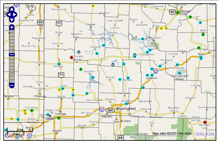
| ...EF-0 TORNADO CONFIRMED IN NORTHEAST VERNON COUNTY... A NWS STORM SURVEY TEAM DETERMINED THAT AN EF-0 TORNADO WITH ESTIMATED WINDS OF 80 MPH TOUCHED DOWN APPROXIMATELY 3 MILES SOUTHEAST OF HARWOOD IN NORTHEAST VERNON COUNTY. THE TORNADO DOWNED TREES AND OVERTURNED GRAVE MARKERS. THE TORNADO PATH WAS 50 YARDS WIDE AND TRACKED NORTHEAST APPROXIMATELY ONE MILE FROM NEAR THE INTERSECTION OF HIGHWAY AA AND EE. |
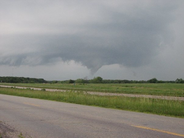
Funnel Cloud near St. James in northeast Phelps County - courtesy Cody Fritz

Funnel Cloud near St. James in northeast Phelps County - courtesy Cody Fritz
Current Hazards
Experimental Graphical Hazardous Weather Outlook
Submit a storm report
Local Storm Reports
Current Conditions
Observations
Lake Levels
Snowfall Analysis
Road Conditions
Satellite
CoCoRaHS
Graphical Conditions
Precip. Analysis
Forecasts
Forecast Discussion
Fire Weather
Aviation
GIS Forecast Maps
Activity Planner
Severe Weather
Winter Weather
Hurricanes
FAA Center Weather
Space Weather
Climatology
Records and Normals
Monthly Climate Summary
Local
National
Drought
Climate Science
Astronomical Data
US Dept of Commerce
National Oceanic and Atmospheric Administration
National Weather Service
Springfield, MO
Springfield-Branson National Airport
5805 West Highway EE
Springfield, MO 65802-8430
Business: 417-863-8028 Recording: 417-869-4491
Comments? Questions? Please Contact Us.


 Weather Story
 Weather Map
 Local Radar