Springfield, MO
Weather Forecast Office
 |
Flooding - April 22nd-27th, 2011National Weather Service, Springfield, MO |
 |
Several rounds of heavy rainfall produced significant flooding across southern Missouri from Friday, April 22 through Tuesday, April 26. Storm total rainfall amounts through Tuesday, April 26 generally ranged from 4 to 8 inches along the Interstate 44 corridor to the 10 to 14 inches across far southern Missouri south of highway 60. 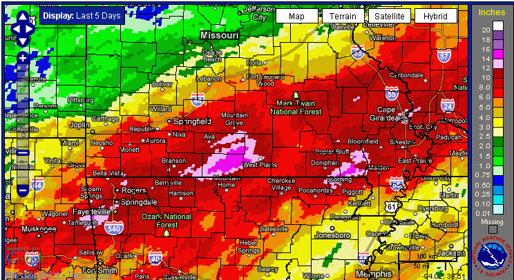
This torrential rainfall resulted in widespread flash flooding and river flooding. Numerous roads and low water crossings were closed and flooded. As many as 400 state roads were closed during the flood event.
The heavy rainfall developed as a front stalled from the southern Plains into Ohio River valley over several days. A train of upper level storm systems interacted with this front and copious of amounts of gulf and Pacific moisture to generate several rounds of thunderstorms and torrential rainfall. 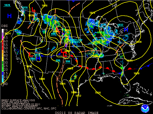
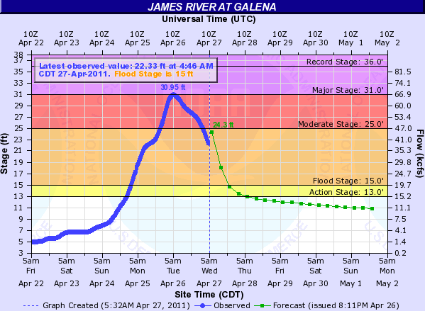
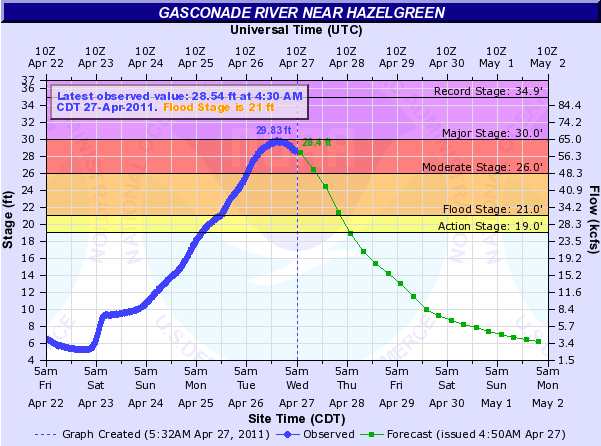
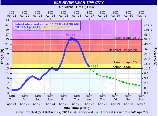
Below are hydrographs for rivers across the area during the flood event.
As many as 400 Missouri state highways were closed during the flood event.
The map below displays road closures Tuesday night April, 26th.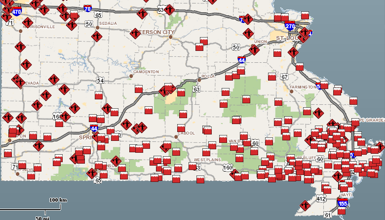
Current Hazards
Experimental Graphical Hazardous Weather Outlook
Submit a storm report
Local Storm Reports
Current Conditions
Observations
Lake Levels
Snowfall Analysis
Road Conditions
Satellite
CoCoRaHS
Graphical Conditions
Precip. Analysis
Forecasts
Forecast Discussion
Fire Weather
Aviation
GIS Forecast Maps
Activity Planner
Severe Weather
Winter Weather
Hurricanes
FAA Center Weather
Space Weather
Climatology
Records and Normals
Monthly Climate Summary
Local
National
Drought
Climate Science
Astronomical Data
US Dept of Commerce
National Oceanic and Atmospheric Administration
National Weather Service
Springfield, MO
Springfield-Branson National Airport
5805 West Highway EE
Springfield, MO 65802-8430
Business: 417-863-8028 Recording: 417-869-4491
Comments? Questions? Please Contact Us.


 Weather Story
 Weather Map
 Local Radar