 |
Severe Storms and Flooding - May 30th-June 1st, 2013National Weather Service, Springfield, MO |
 |
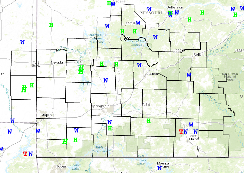
Strong to severe thunderstorms brought torrential rainfall and severe weather to extreme southeastern Kansas and the Missouri Ozarks from Friday afternoon May 31 into the early morning hours of June 1. The storms produced hail up to two inches in diameter and damaging winds that downed trees. Torrential rainfall rates accompanied the storms resulting in flash flooding of streams and low water crossings.
Rainfall amounts since Thursday have generally ranged from 2 to 4 inches with some areas receiving 6 to 8 inches.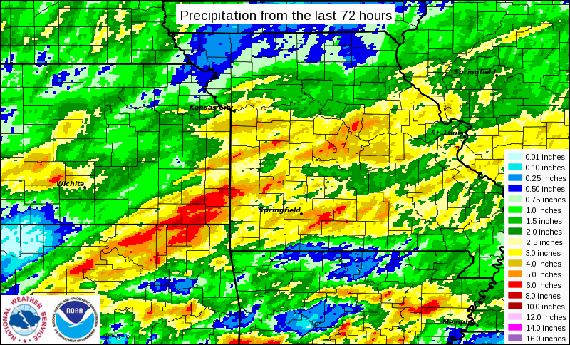
*Unofficial* Listing of Storm Total Precipitation Measurements
Precipitation ending: 2013-06-01 7 AM Total for previous 96 hours
Location Storm Total Rainfall
==== ====
Walnut 8.44
Cherokee 7.29
Liberal 0.7 SSE 6.76
Oswego 3E 6.72
Liberal - Drywood Ck 6.27
Hartville 5.94
Golden City 6S 5.65
Mccune 5.61
Norwood Water Station 5.41
Girard 5.38
Carl Junction 3.4 5.38
Republic 0.8 ESE 5.37
Mountain View 6.6 NE 5.18
Stockton 2.5 NNE 5.18
Bingham Elementary 5.15
Pittsburg 5.12
Springfield Central 5.11
Round Spring 5.07
Joplin 24N CRN Site 5.07
Springfield 4.9 5.06
Strafford 2.4 SSW 5.06
Springfield Arpt 5.00
Springfield 1SW 4.95
Sunshine School 4.95
Willard Elementary 4.94
Sherwood Elementary 4.93
Marshfield 4.86
Marshfield 0.9 SE 4.85
Waco 4.84
Marshfield 3.6 S 4.84
Hattiesburg Hills 4.77
Pittman Elementary 4.70
Mark Twain Elementary 4.70
Springfield Fire Sta 4.69
Carr Creek 4.67
Springfield East 4.65
West Plains Arpt 4.63
Strafford High School 4.62
Ava 5N 4.59
Columbus 4.58
Ash Grove 4.57
Eminence 1N 4.55
Carthage 0.8 S 4.55
Sinkin RAWS 4.51
Sequiota School 4.49
Field School 4.49
Republic High School 4.47
Shady Dell Elementary 4.44
Weller Elementary 4.42
Lamar Water Station 4.36
Battlefield West Elm 4.34
Asbury Water Station 4.34
Chestnut South Lift 4.33
Nevada 4.32
Southwest Treatment 4.31
Jeffries Elementary 4.30
Northwest Water Trtmt 4.29
DNR Well at Ava 4.27
Turner Station 4.24
Westport Elementary 4.20
Tiff City 4.20
Pleasant View Middle 4.14
Blackman Intake at J 4.14
Morrisville 4.11
Montauk State Park 4.10
Lockwood 4.07
Fremont 4.07
SALEM 4.3 S 4.05
Flemington 3E 4.04
Waste Water OPS - Sp 4.01
ATT Comms 3.95
Moundville 2.3 S 3.93
Truman Elementary 3.91
Disney Elementary 3.91
Wlanut Grove 4.6 SE 3.89
James River Lift Sta 3.87
Roby RAWS 3.86
Salem 10W - CRN Site 3.85
Springfield-South Dr 3.84
Neosho Water Station 3.82
Joplin Arpt 3.82
CASSVILLE 0.5 SW 3.82
Willard Community Ce 3.80
Cherokee Middle Scho 3.74
Neosho 3.2 SSW 3.71
Valley Water Mill 3.62
Fair Play 1.3 E 3.60
Mount Vernon 3.57
Shoal Creek Estates 3.53
Eminence 3.52
Anderson 10W - Buffa 3.52
Lynchburg 3.51
Carthage 3.46
Mt Vernon 1.3 NNW 3.46
Houston 4.5 WSW 3.45
Salem 14.9 E 3.39
Verona 4.0 WNW 3.38
Clever 4.0 ENE 3.38
Joplin 3.37
Springfield 5.5 3.37
Flemington 7.4 3.35
Sarcoxie 1W 3.34
Mountain Grove 3.33
El Dorado Springs 3.30
Wheatland 2.7 S 3.28
Anderson 3W 3.26
Williams Elementary 3.21
Hazelgreen 3.17
Cannon Range Hollow 3.16
Rolla/Vichy Arpt 3.15
Greenfield 3.13
Uniontown 3.12
Lake Springfield Boa 3.11
Purdy 4.8 SSW 3.09
Galena 3.08
Mansfield 3.7 SSE 3.08
Houston 1NE 3.06
Dora 2.6 NNW 3.01
Butterfield Water St 2.99
Edgar Springs 2.98
Miller 1E 2.98
Houston 0.3 SE 2.95
Kimberling City 2.85
Dadeville-Sac River 2.85
Nixa Junior High 2.83
Le Compte Lift Stati 2.83
Labanon Water Statio 2.82
Jerico Springs 2.80
Edwards 6W 2.80
Powell - Big Sugar Ck 2.80
Fulton 2.73
Noel 3.7 NNW 2.72
Ava 6W 2.70
Appleton City 2.65
Uniontown 2.64
Neosho 2.60
Carthage 1.5 S 2.56
Brookline 2.3 NNW 2.56
Dora 2.54
Ava 6.0 NW 2.53
Osage Beach Arpt 2.52
Eminence 20NW 2.50
Butler 0.8 SSW 2.49
Cole Camp 2.44
Waynesville-Roubidou 2.41
Ft Leonard Wood 2.38
Niangua 2.38
Ava 10.5 SSW 2.32
Crane 4N 2.30
Springfield 9.5 2.30
Millwood 2.28
Pittsburg 2.24
Ozark 6SW 2.23
Rolla Water Station 2.22
Seymour 0.9 SSW 2.22
Osceola 0.3 SW 2.22
Horton 2.21
Mansfield 2.16
Hurley 3.5 NNE 2.15
West Plains 2.2 NNW 2.15
Warsaw 2.14
Stockton 0.2 NW 2.13
Carthage 2.07
Noel 3.8 NNE 2.06
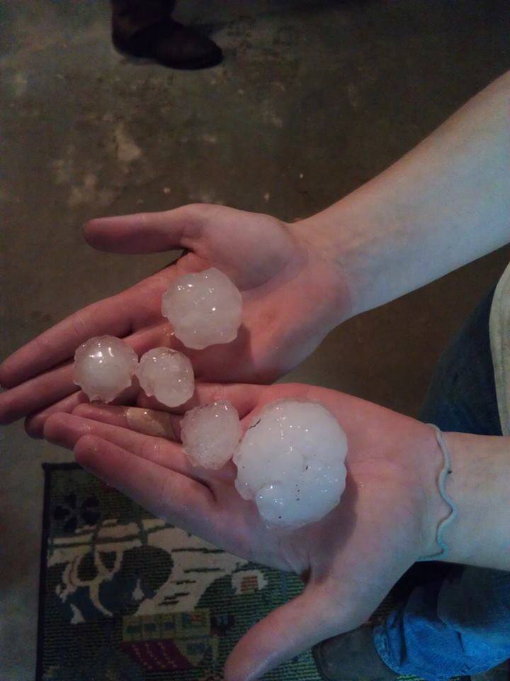
Golf Ball to Tennis Ball Size Hail near Stockton, MO. 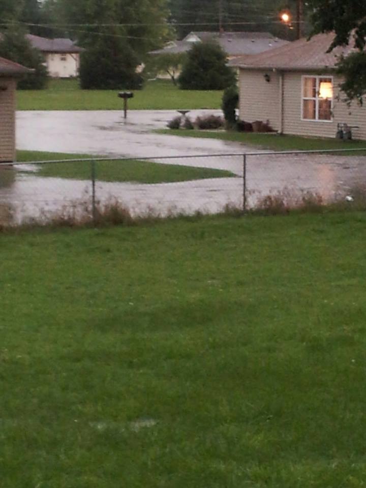
Flooding near Monett, MO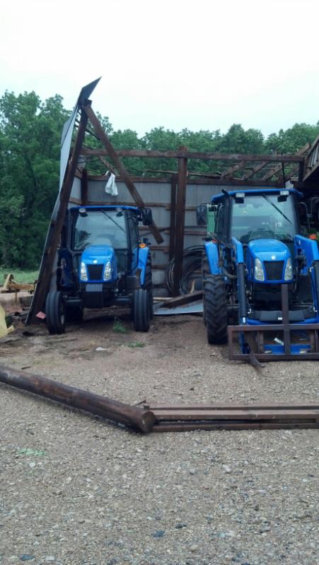
Damage in Howell County, MO late Thursday Night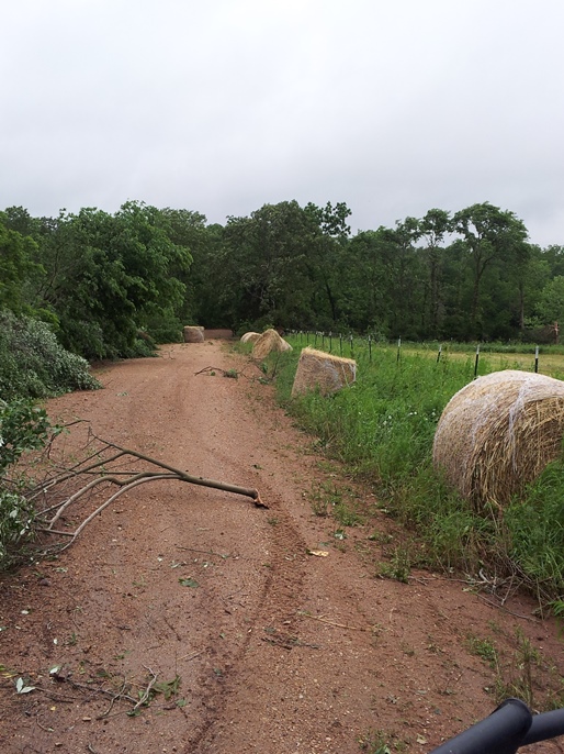
Damage in Howell County, MO Late Thursday Night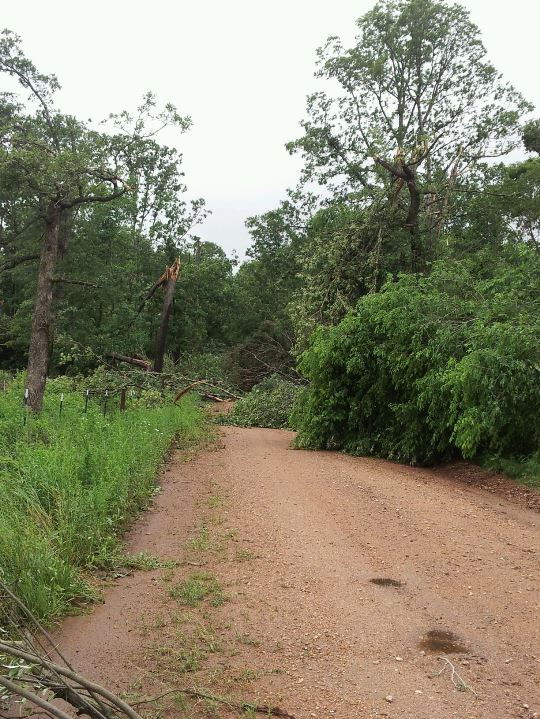
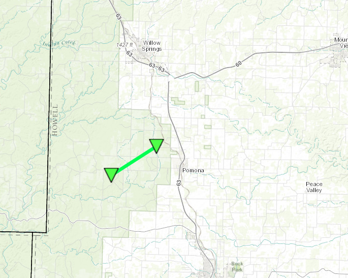
Damage in Howell County, MO late Thursday Night


 Weather Story
 Weather Map
 Local Radar