Springfield, MO
Weather Forecast Office
 |
Tornadoes and Severe Storms - September 1st-2nd, 2014National Weather Service, Springfield, MO |
 |
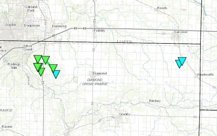
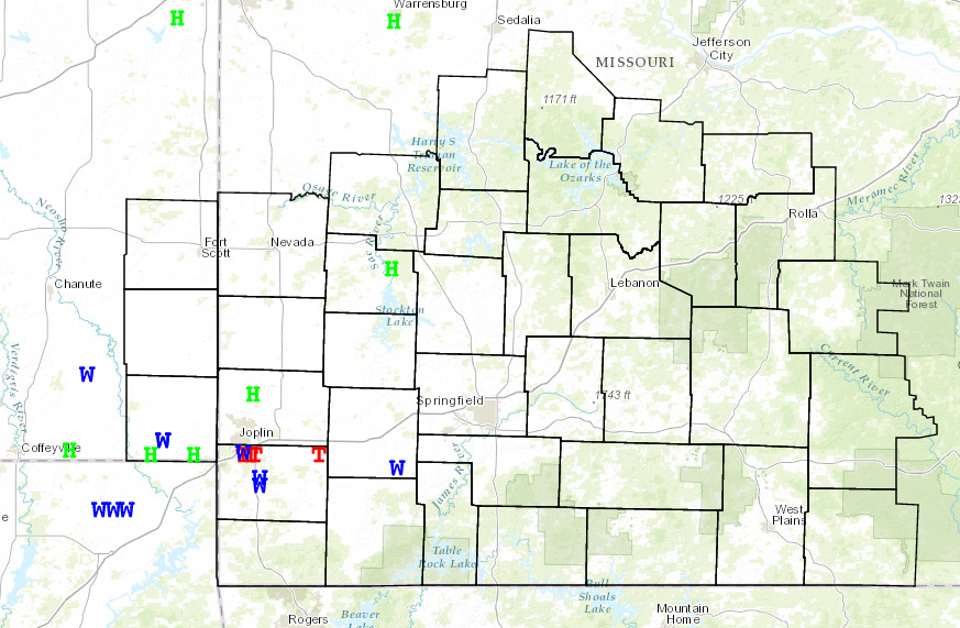
A frontal boundary, an increasing low level jet and an upper level disturbance interacted with a very moist and unstable atmosphere to produce several rounds of strong to severe storms across the Missouri Ozarks and extreme southeast Kansas during the evening into the overnight hours of September 1st-2nd, 2014.
The most intense storm was with a line segment that tracked across far southeast Cherokee county Kansas into central and northern Newton county and southern Lawrence county. This line segment produced straight line winds of 75 to 80 mph along with a small spin-up tornado in northern Newton county.
.gif)
Current Hazards
Experimental Graphical Hazardous Weather Outlook
Submit a storm report
Local Storm Reports
Current Conditions
Observations
Lake Levels
Snowfall Analysis
Road Conditions
Satellite
CoCoRaHS
Graphical Conditions
Precip. Analysis
Forecasts
Forecast Discussion
Fire Weather
Aviation
GIS Forecast Maps
Activity Planner
Severe Weather
Winter Weather
Hurricanes
FAA Center Weather
Space Weather
Climatology
Records and Normals
Monthly Climate Summary
Local
National
Drought
Climate Science
Astronomical Data
US Dept of Commerce
National Oceanic and Atmospheric Administration
National Weather Service
Springfield, MO
Springfield-Branson National Airport
5805 West Highway EE
Springfield, MO 65802-8430
Business: 417-863-8028 Recording: 417-869-4491
Comments? Questions? Please Contact Us.


 Weather Story
 Weather Map
 Local Radar