Overview
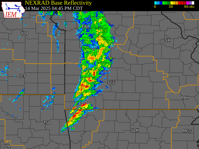
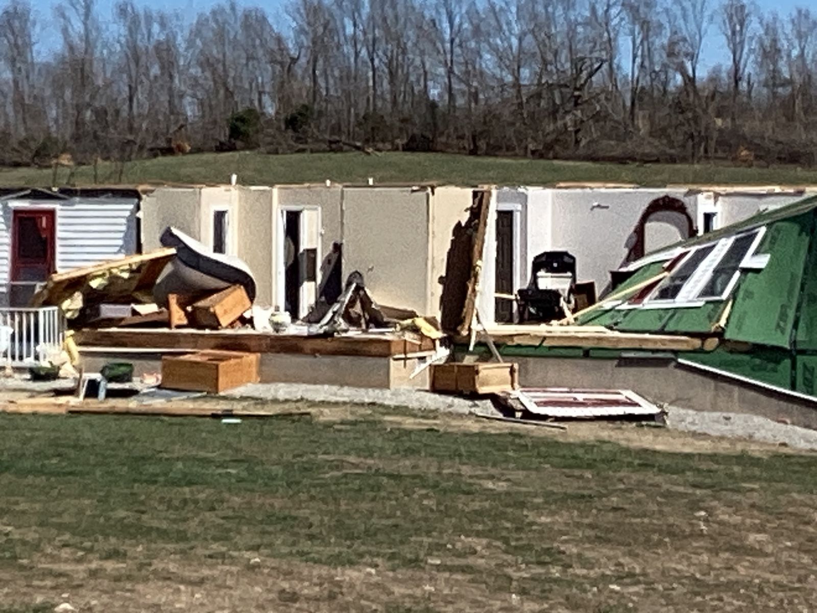
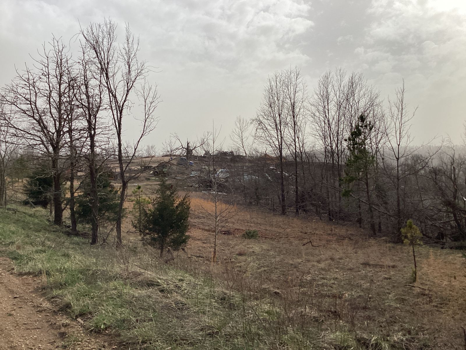
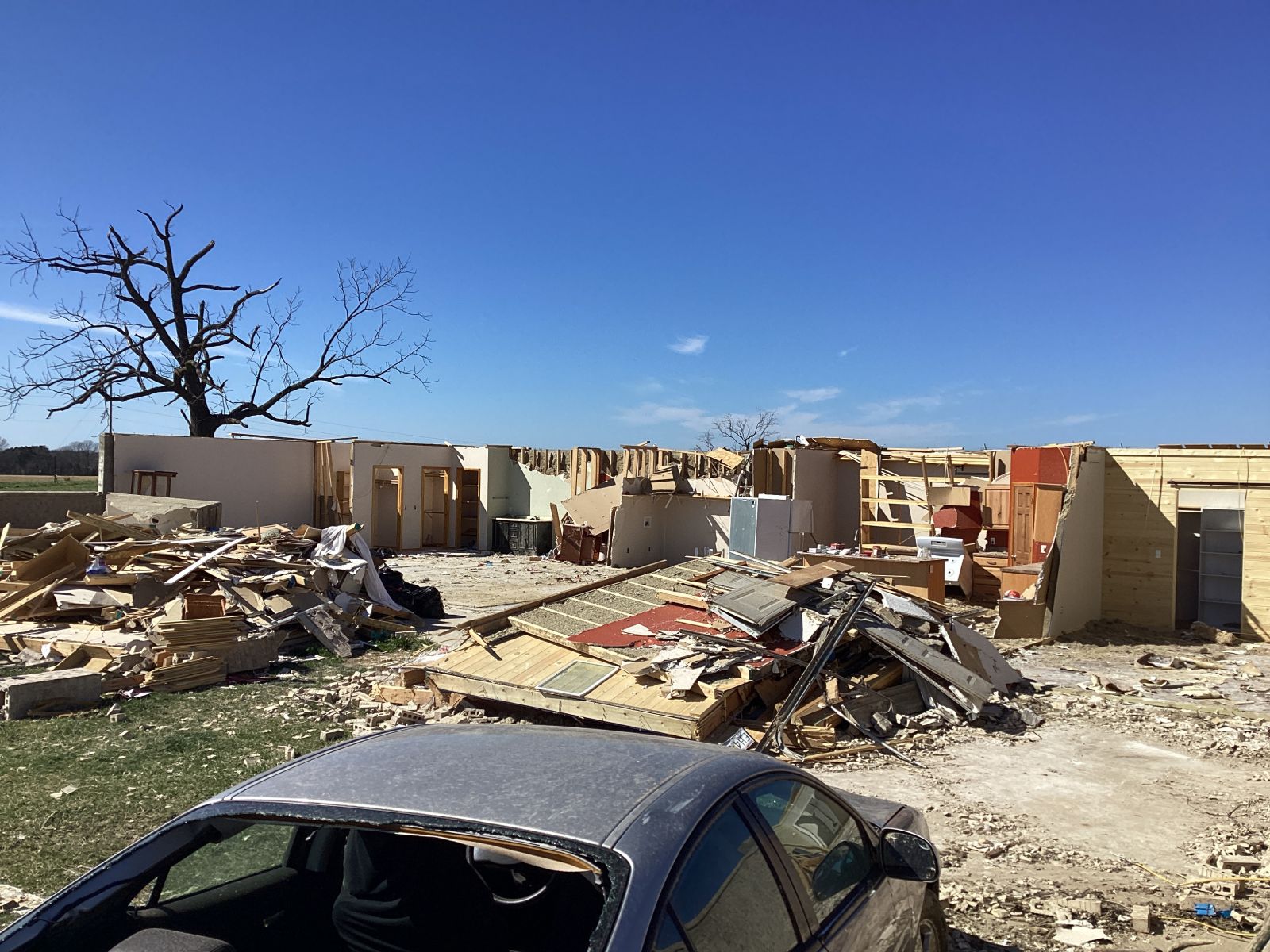
On Friday, March 14, 2025 an unseasonably deep low pressure system developed and traversed across the Central Plains. The impressively dynamic system produced non-thunderstorm wind gusts upwards of 60 mph in some locations within the Springfield forecast area. Dry air in place, paired with these strong synoptic winds, produced extremely critical fire weather conditions across the area. Multiple fires were reported with some damaging property. During the peak of the event, numerous robust supercells developed across southwest Missouri and rapidly moved northeast through the afternoon and evening. These storms produced large hail and multiple tornadoes, some being strong such as the EF-3 that damaged homes in Bakersfield, Missouri. Following the storms, the strong winds brought in dust from Texas and Oklahoma.Tornadoes
|
Tornado - Bakersfield
|
||||||||||||||||
|
||||||||||||||||
|
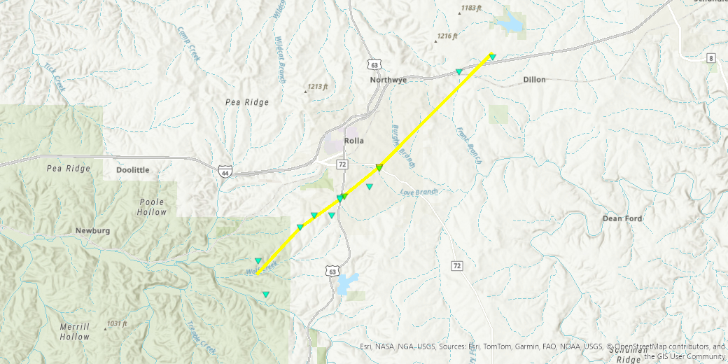
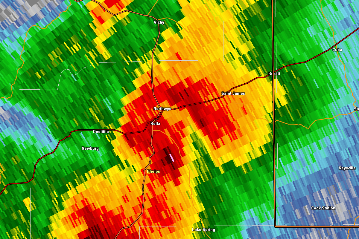
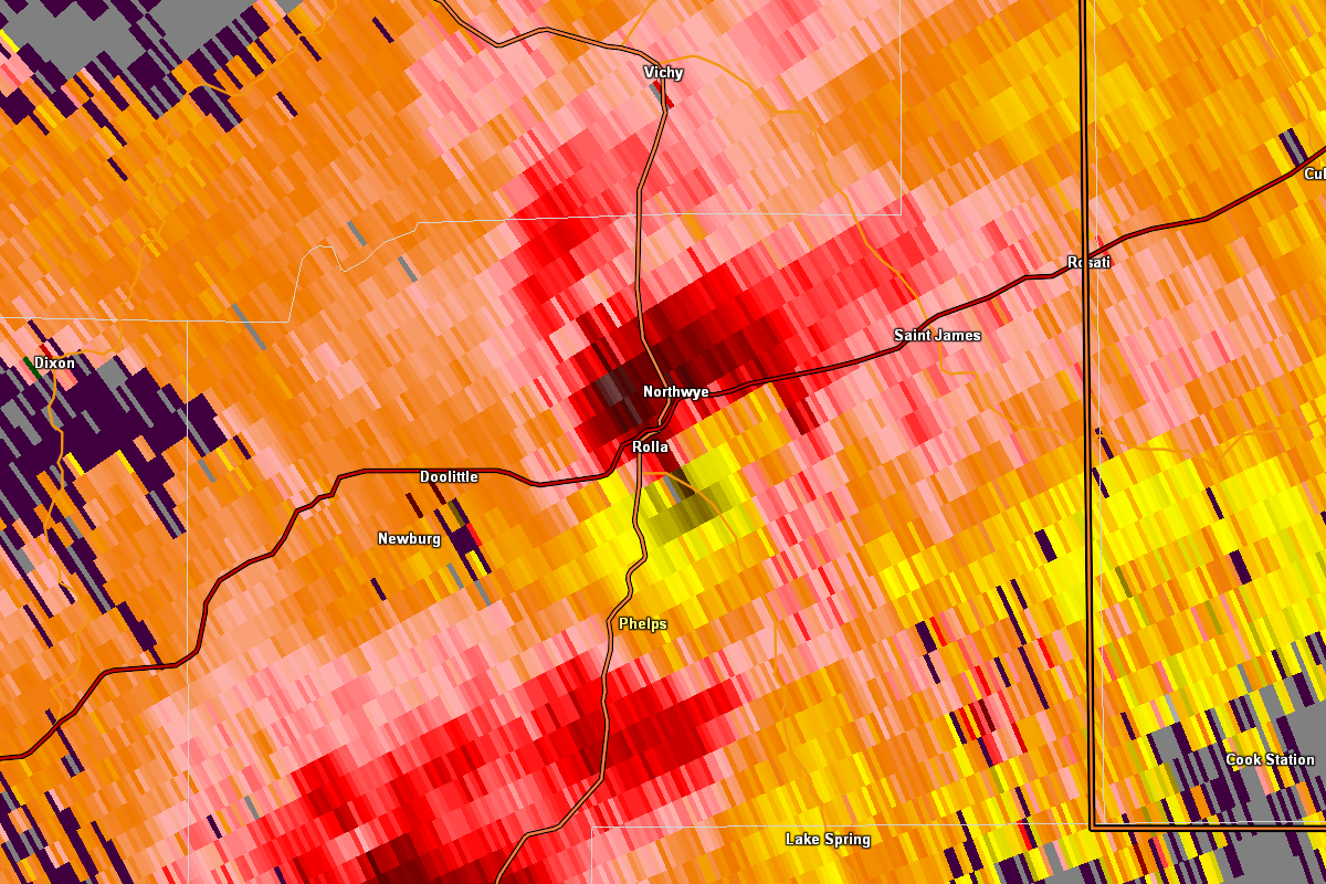
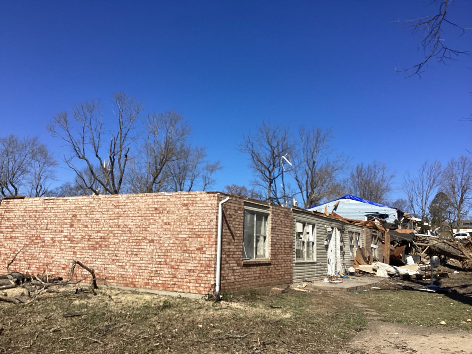
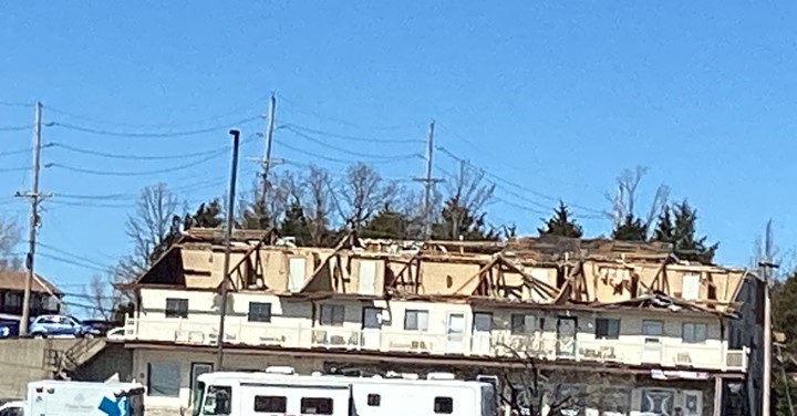
Tornado - Rolla
|
||||||||||||||||
|
||||||||||||||||
|
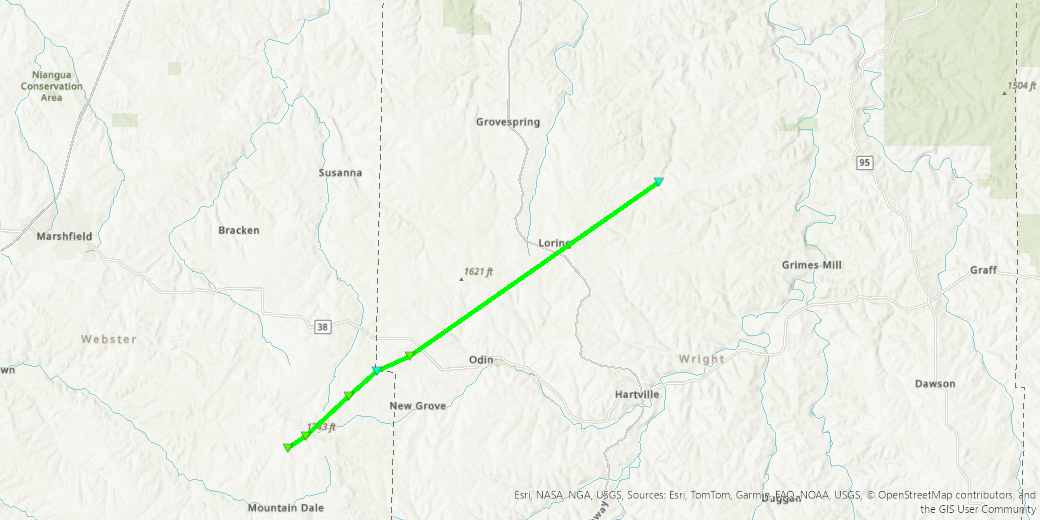
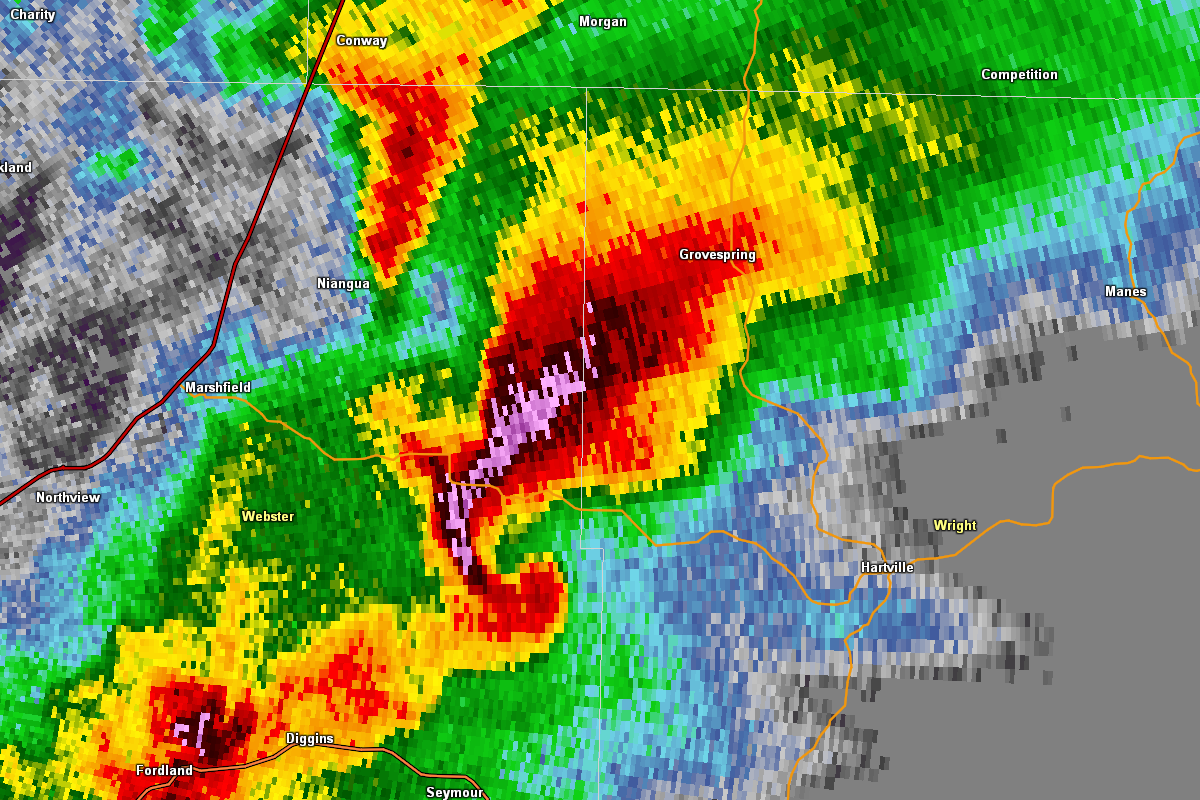
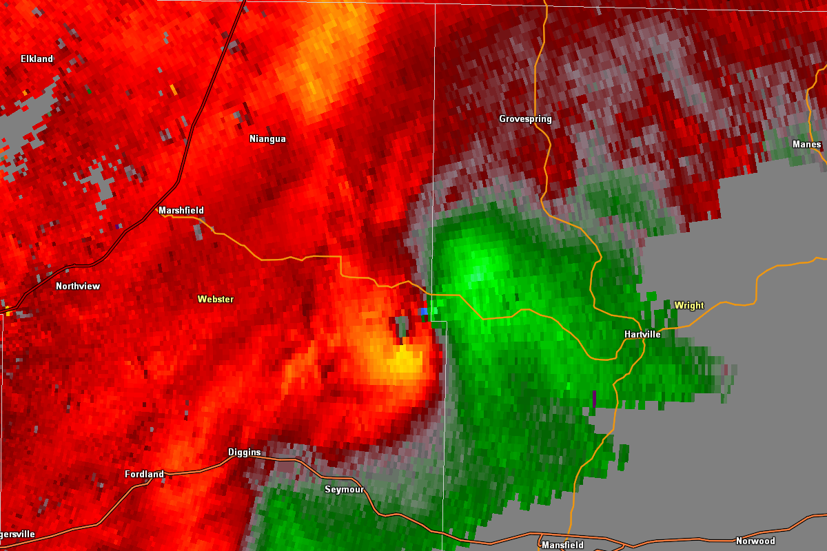
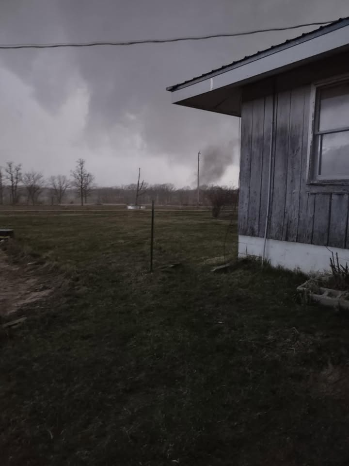
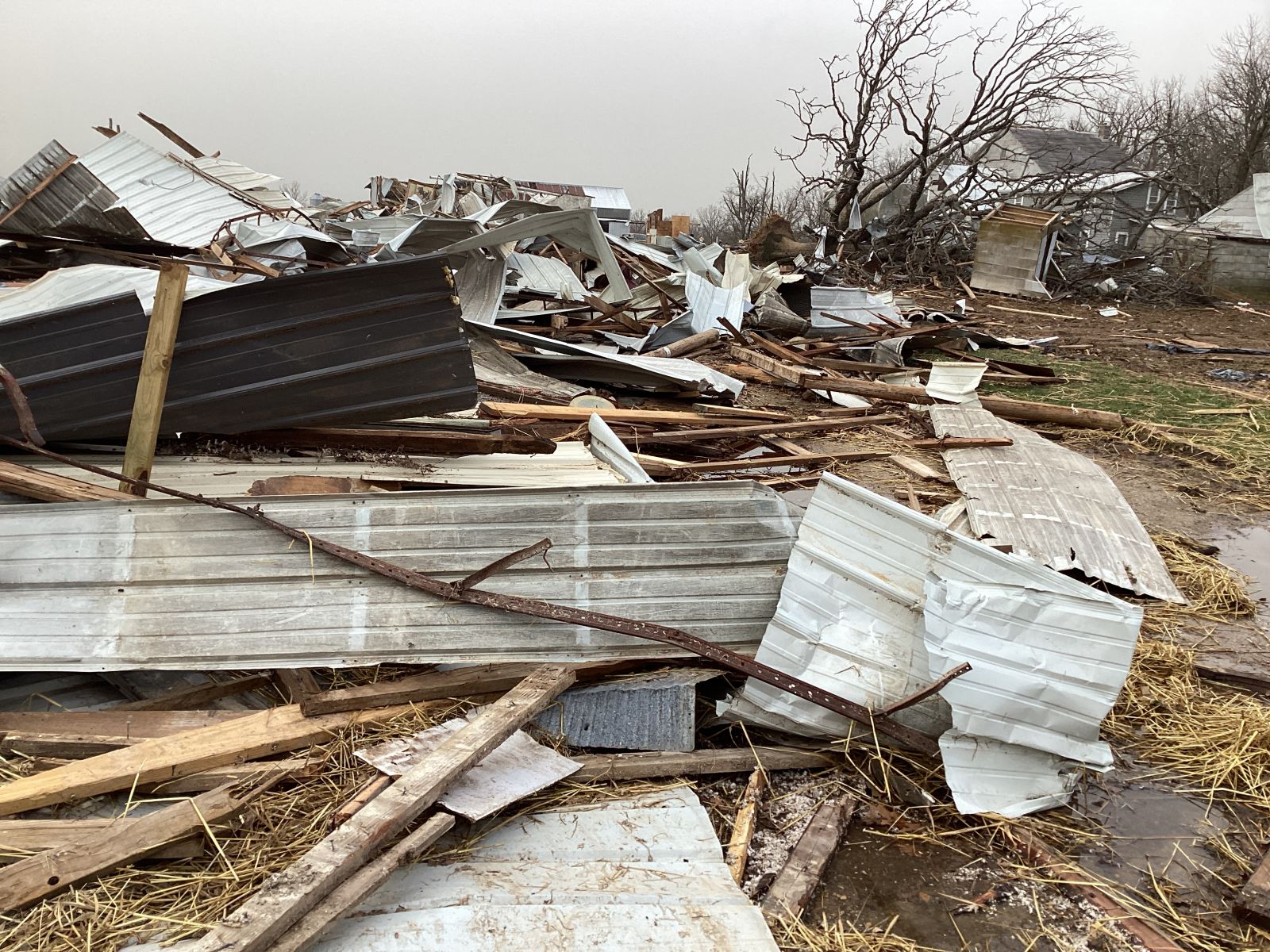
Tornado - Rural Webster/Wright County
|
||||||||||||||||
|
||||||||||||||||
|
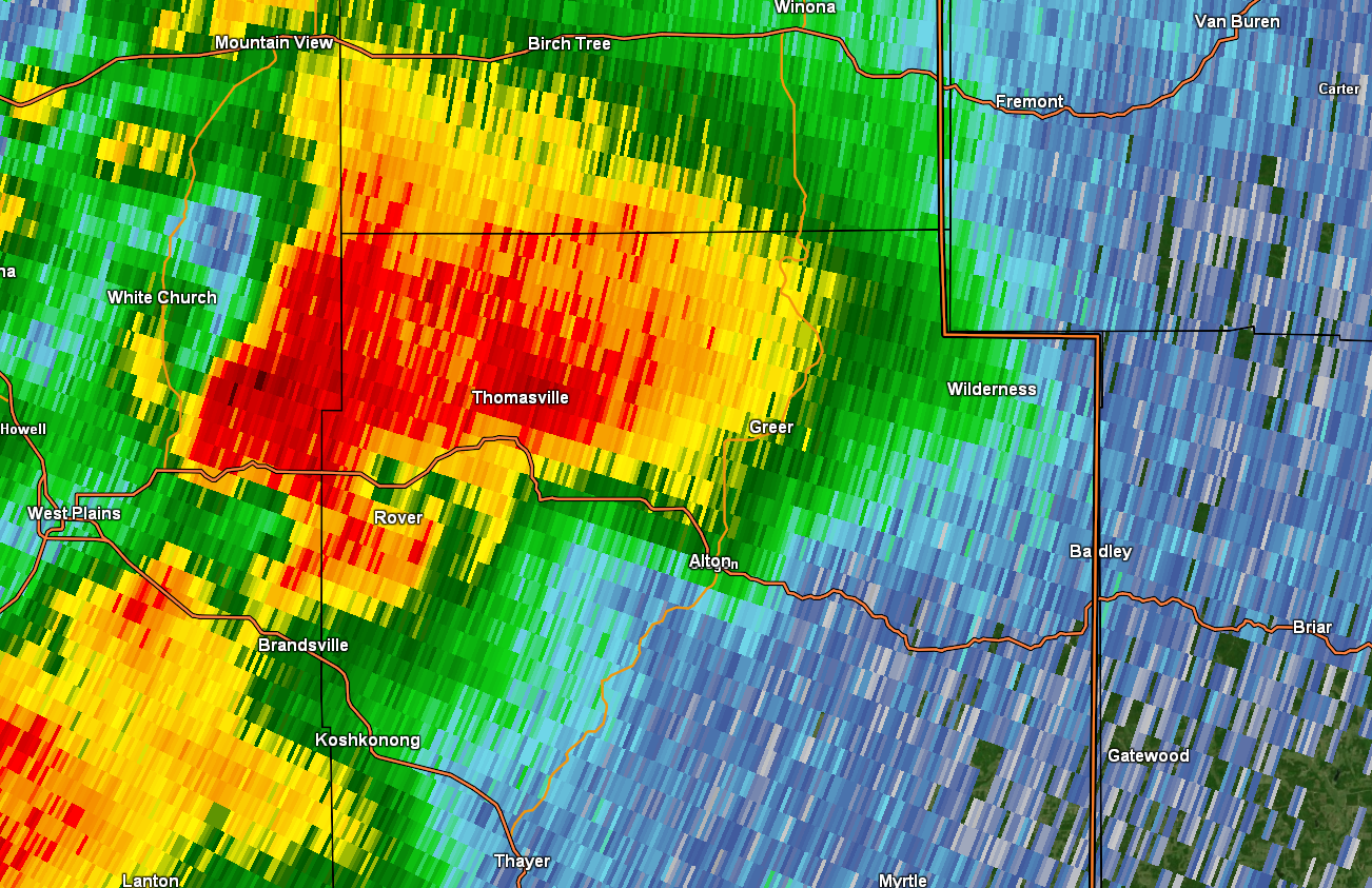
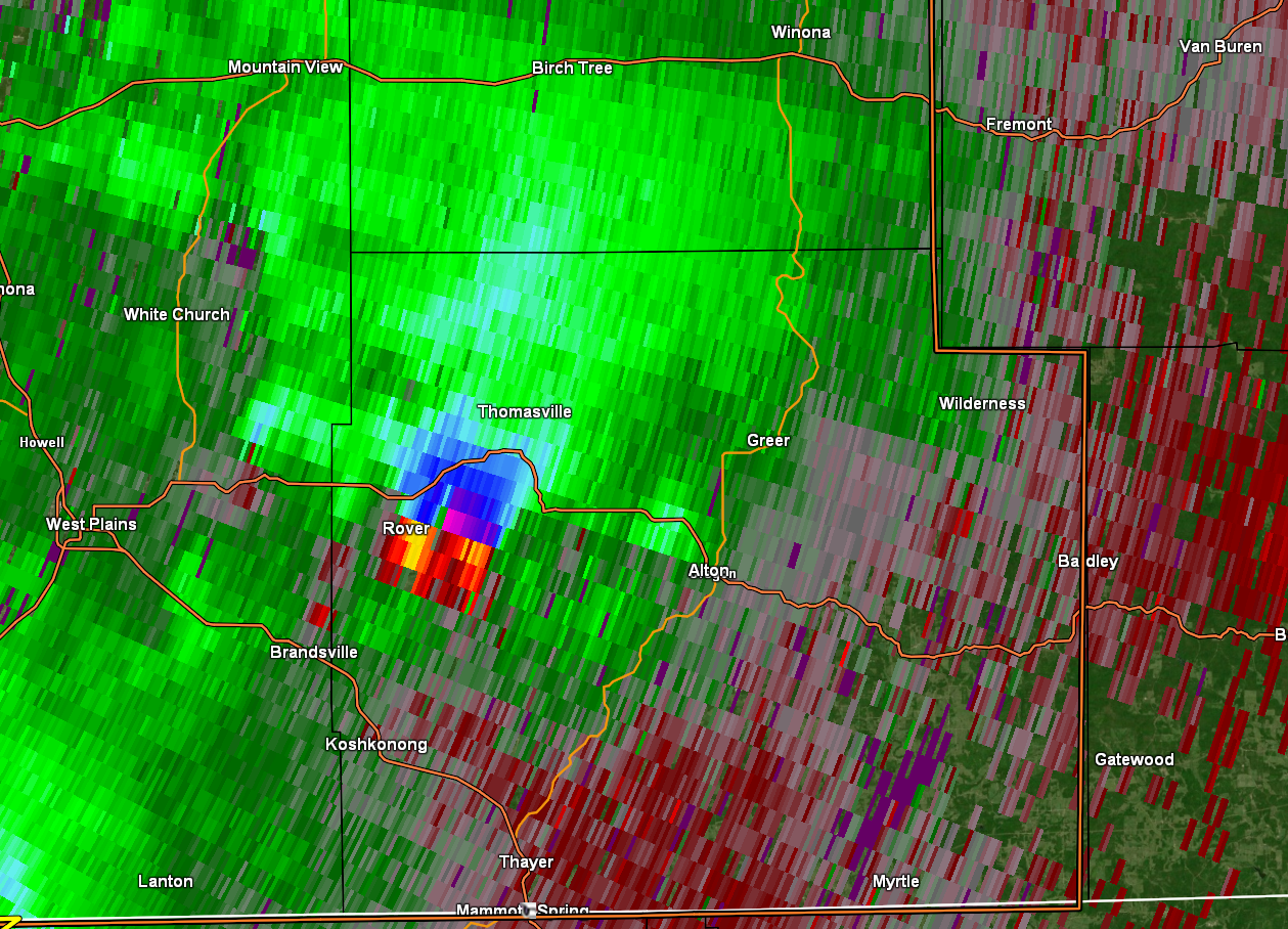
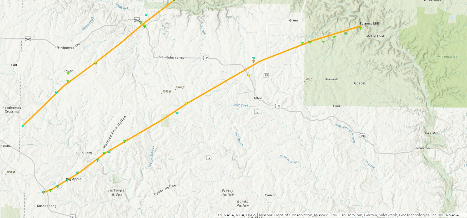
Tornado - Rover to Reynolds County
|
||||||||||||||||
|
||||||||||||||||
|
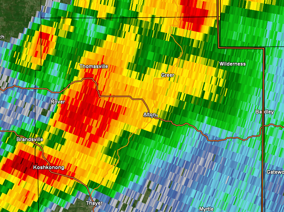
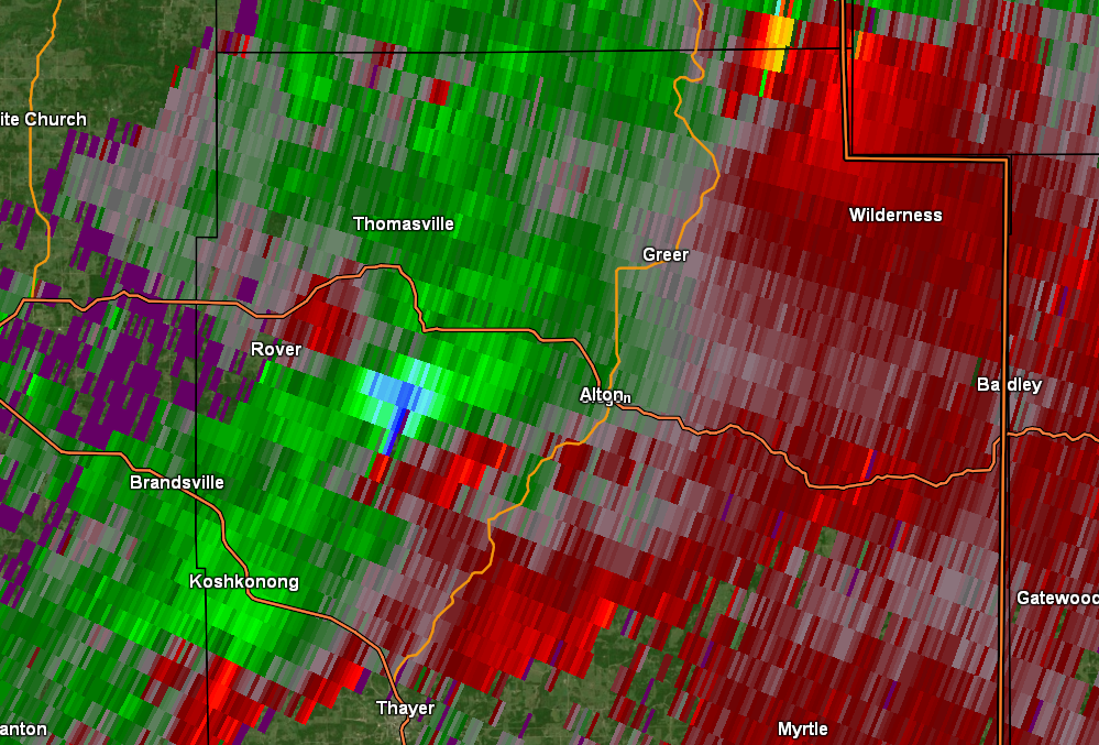
Tornado - Alton
|
||||||||||||||||
|
||||||||||||||||
|
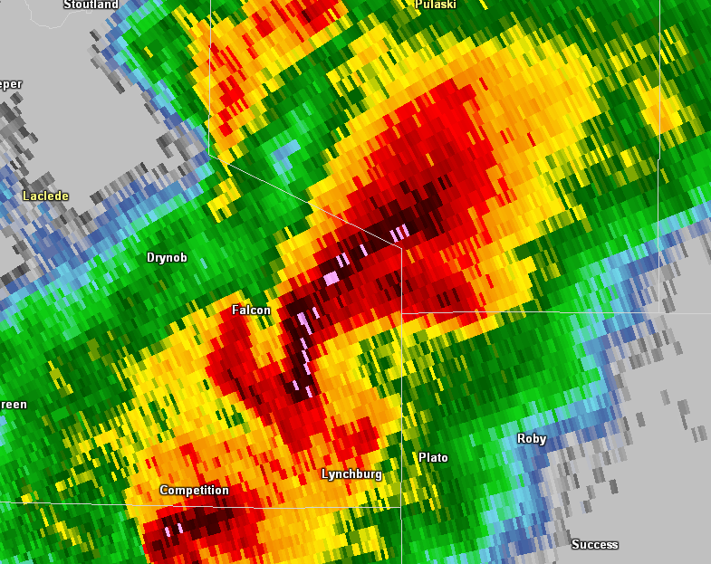
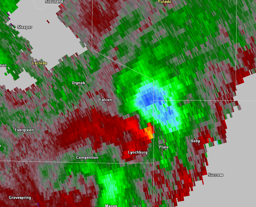
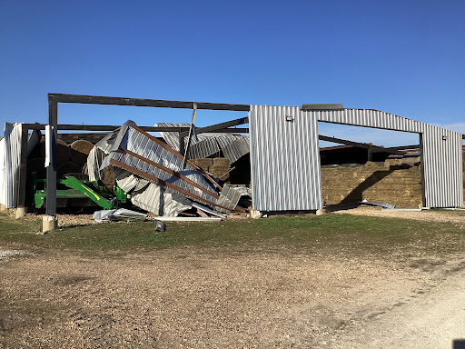
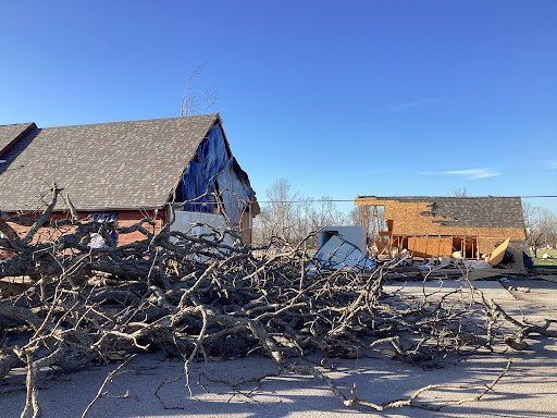
Tornado - Lynchburg
|
||||||||||||||||
|
||||||||||||||||
|
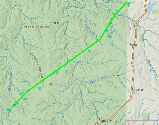
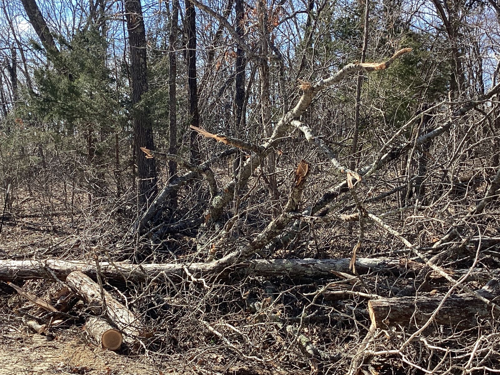
Tornado - Yancy Mills
|
||||||||||||||||
|
||||||||||||||||
The Enhanced Fujita (EF) Scale classifies tornadoes into the following categories:
| EF0 Weak 65-85 mph |
EF1 Moderate 86-110 mph |
EF2 Significant 111-135 mph |
EF3 Severe 136-165 mph |
EF4 Extreme 166-200 mph |
EF5 Catastrophic 200+ mph |
 |
|||||
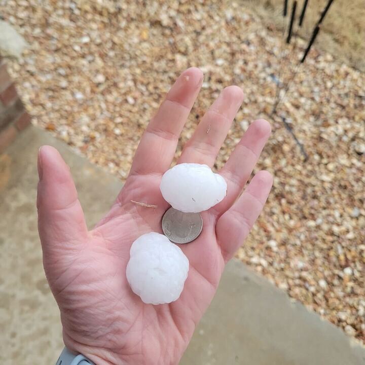
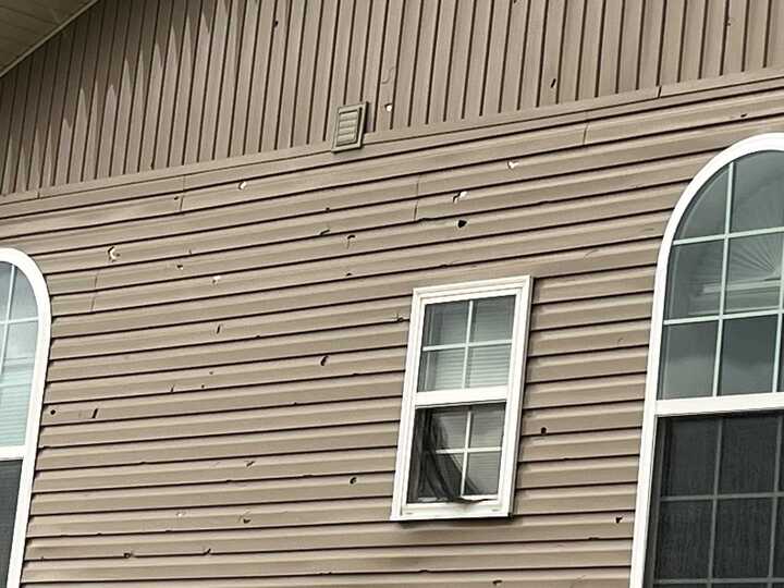
Hail
Supercell thunderstorms produced large hail up to the size of golf balls across southern Missouri.
 |
 |
 |
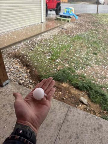 |
| Golf Ball Size Hail near Branson West | Large Hail Damage Near Highlandville | Ping Pong Ball Size Hail at Seymour | Large Hail in Reeds Spring |
Fire Weather
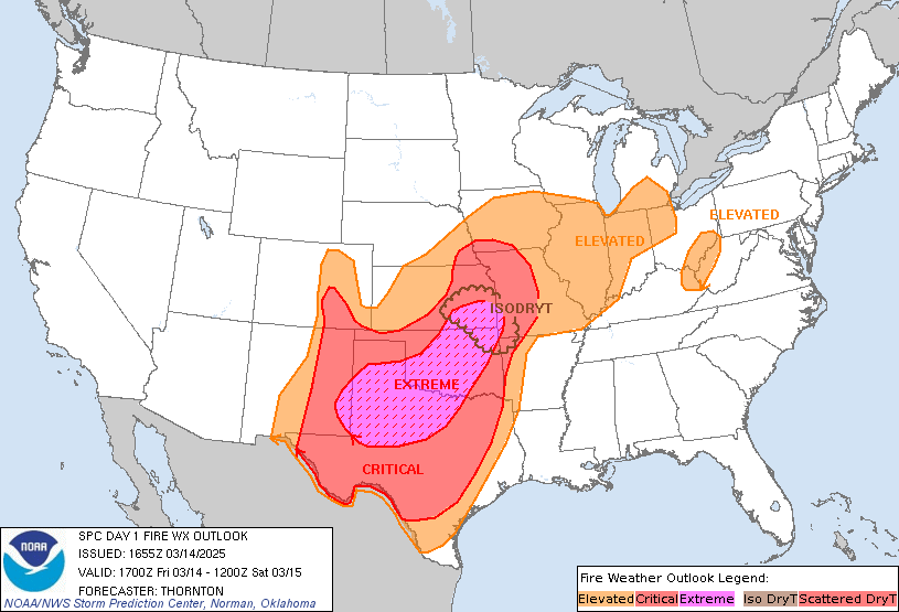 |
| The Storm Prediction Center's Day 1 Fire Weather Outlook forecast included southeast Kansas and portions of far southwestern Missouri in a rare area of Extremely Critical risk (level 3 of 3) to indicate meteorological conditions favoring rapid growth and spread of a fire should ignition occur. This was the first time that this region was ever included in an Extremely Critical risk area. Extremely Critical delineations are extremely rare and are only included in ~2% of fire weather outlooks nationwide. |
A very dry airmass was in place across the Ozarks region to start the day as an exceptionally strong storm system was moving across the Plains. The strength of the system produced winds that gusted as much as 60mph a times with sustained winds from 35 to 45mph. This combination of dry conditions and gusty winds allowed sparks from transformers and downed power lines to enhance the fire development and movement through the late morning into the afternoon in advance of a line of severe thunderstorms that evening.
As the day progressed, fuel moistures, such as dormant grasses, leaf litter and brush fell below 10%. The dry air allowed relative humidity values to fall below 20% with some locations dropping below 10%. This exceptionally dry air, warm afternoon temperatures in the 70s and the high winds all contributed to numerous fires across the Ozarks. Fires burned multiple acres with fires as large as 1200 acres or more. Multiple structures, vehicles and farm implements were reported to have burned as a result of the fires.
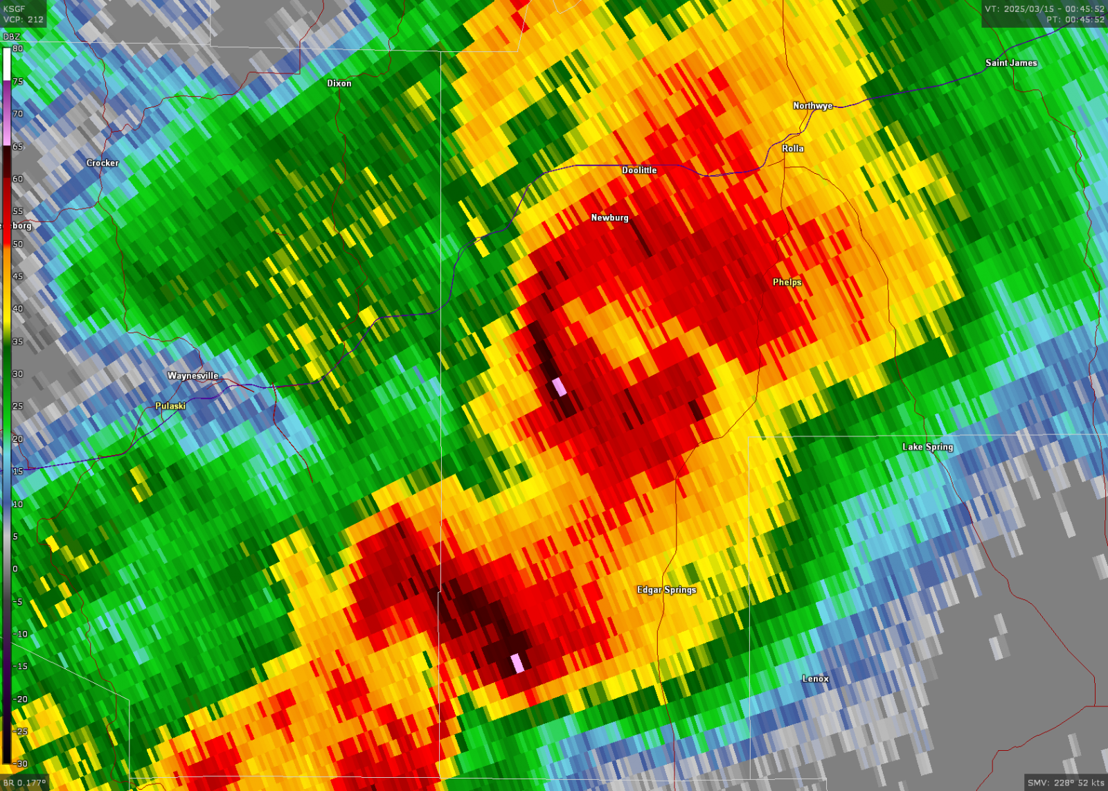
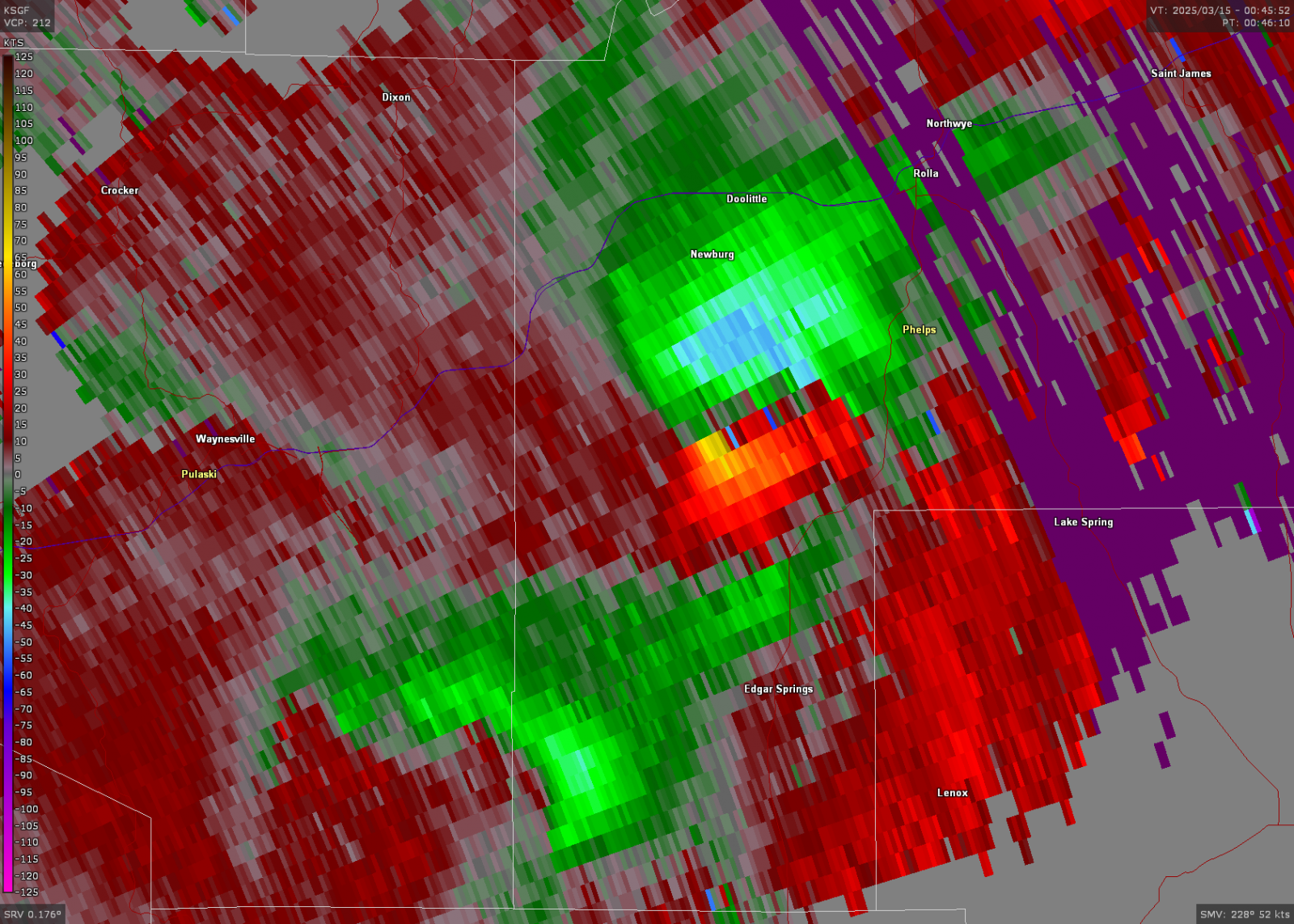
Radar
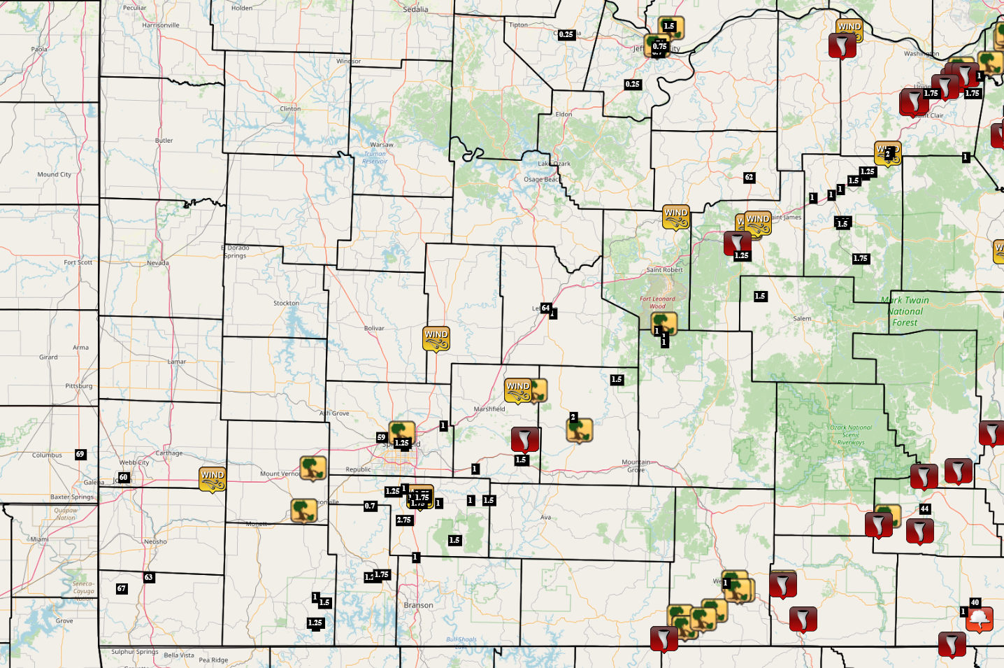
Storm Reports
 |
Media use of NWS Web News Stories is encouraged! Please acknowledge the NWS as the source of any news information accessed from this site. |
|


.png)
.png)

.png)
.jpg)

.png)
 Weather Story
 Weather Map
 Local Radar