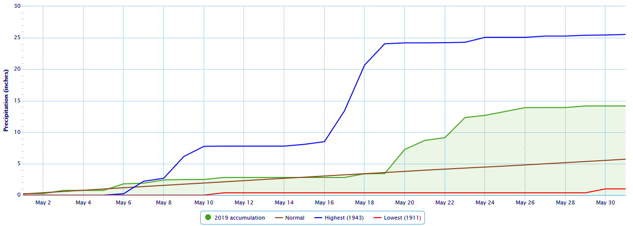
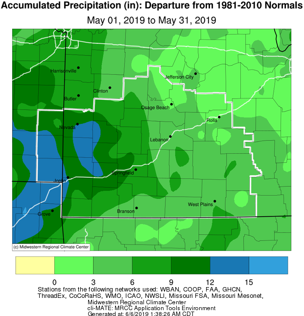
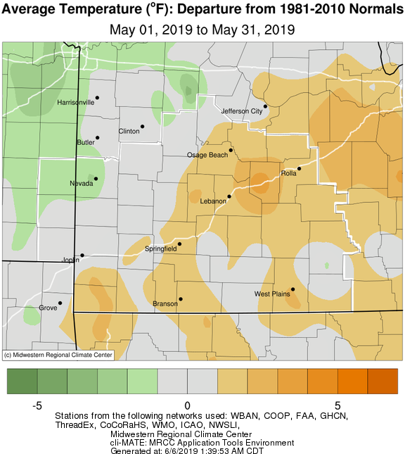
May 2019 was a month with well above normal precipitation for much of the area including some records and in the top 3 wettest. Temperatures were mostly above normal with the exception being far western Missouri and extreme southeast Kansas which had some of the highest precipitation totals.
May 20th-22nd Tornadoes and Flooding
|
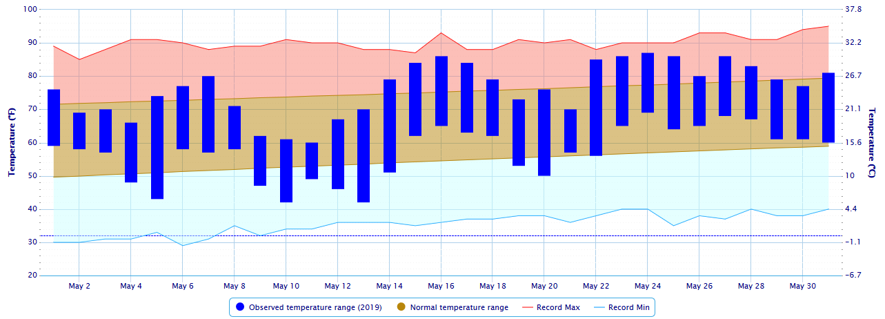
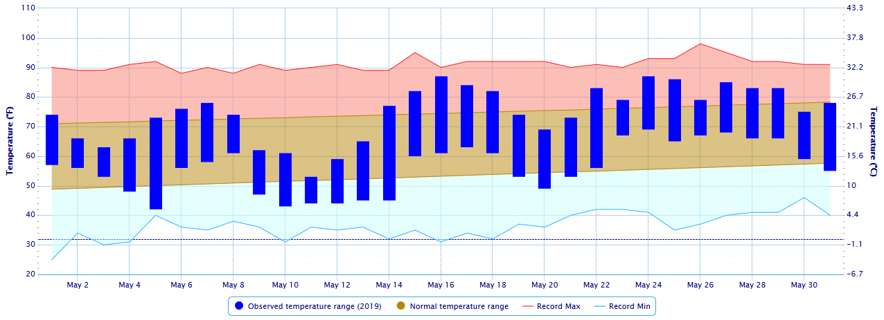
Springfield Temperature Plot for May 2019 |
 |
|
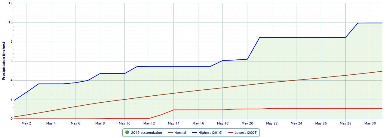
Springfield Precipitation Plot for May 2019 |
 |
|
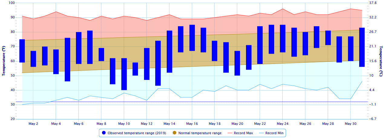
Joplin Temperature Plot for May 2019 |
 |
|
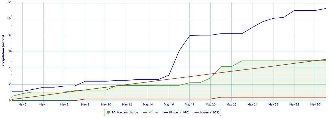
Joplin Precipitation Plot for May 2019 |
 |
|
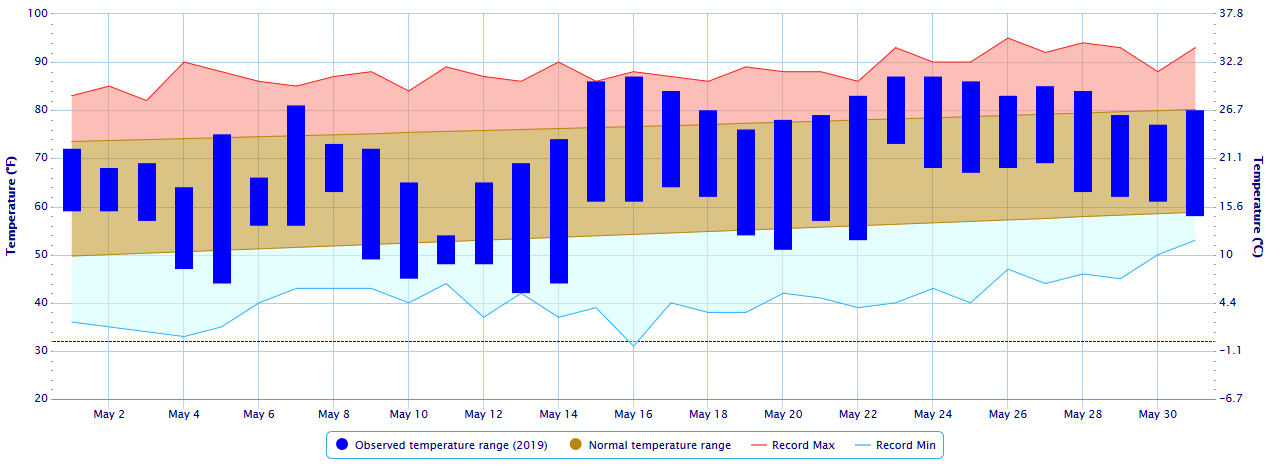
West Plains Temperature Plot for May 2019 |
 |
|
West Plains Precipitation Plot for May 2019 |
 |
|
Vichy Temperature Plot for May 2019 |
 |
|
Vichy Precipitation Plot for May 2019 |
 |
Monthly Climate MapsMay 2019 Precipitation Departure from Normal
|
Monthly Climate Normals
| |||||||||||||||||||||||||||||||||||||||||||||||||||||||||||||||||||||||||||||||||||||||||||||||||||||||||


 Weather Story
 Weather Map
 Local Radar