Overview
|
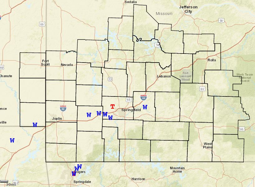
A broken line of thunderstorms produced wind damage and flooding across portions of southwestern Missouri and extreme southeastern Kansas Saturday evening. A National Weather Service storm survey concluded that an EF-0 tornado occurred on the extreme southwestern side of Willard. Reports of straight-line wind damage across the region were generally scattered in nature. Torrential rainfall did result in flash flooding across portions of Springfield and southern Greene County. Wilsons Creek and even the James River briefly flooded as locations saw over 3 inches of rainfall in just a couple of hours. |
 Caption |
Tornadoes:
|
Tornado - Willard
Track Map 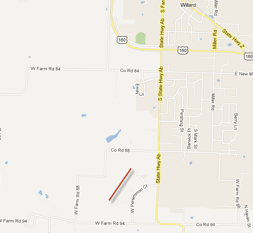 
|
||||||||||||||||
The Enhanced Fujita (EF) Scale classifies tornadoes into the following categories:
| EF0 Weak 65-85 mph |
EF1 Moderate 86-110 mph |
EF2 Significant 111-135 mph |
EF3 Severe 136-165 mph |
EF4 Extreme 166-200 mph |
EF5 Catastrophic 200+ mph |
 |
|||||
Radar:

 |
Media use of NWS Web News Stories is encouraged! Please acknowledge the NWS as the source of any news information accessed from this site. |
|


 Weather Story
 Weather Map
 Local Radar