Springfield, MO
Weather Forecast Office
Overview
|
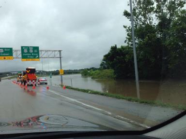
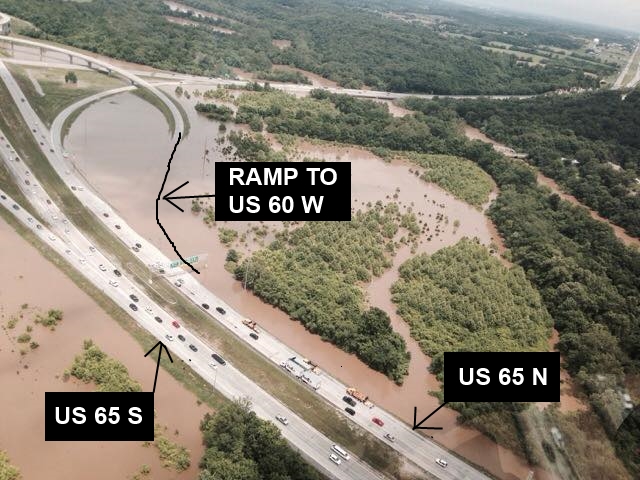
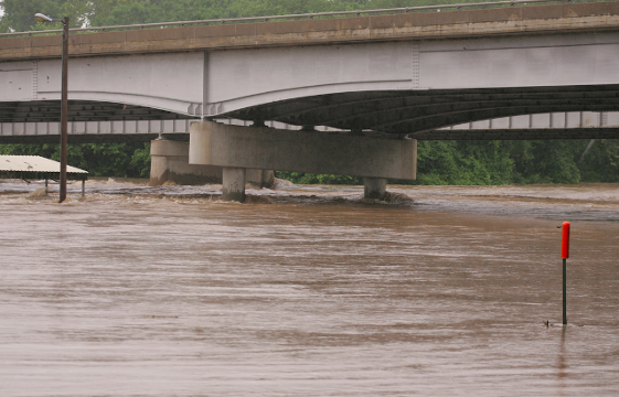
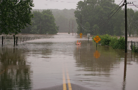
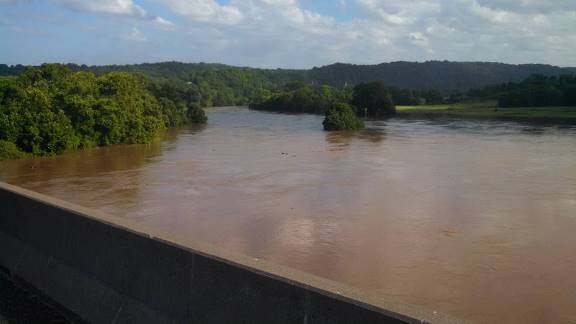
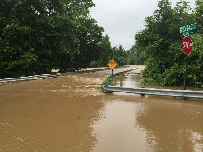
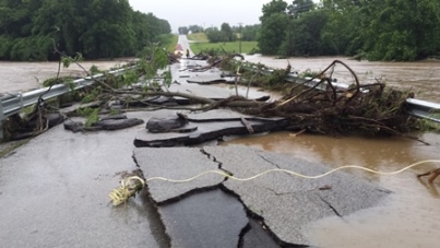
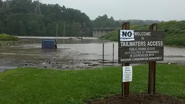
The remains of Tropical Storm Bill moved across southeastern Kansas and southern Missouri on June 18th and 19th. This very slow moving system brought significant amounts of rain to the region, with the heaviest band of rain falling along and just south of Interstate 44. Amounts between 5 and 8 inches fell across southeastern Greene, Christian, Webster, Wright and Laclede Counties, resulting in major to record flooding along the James River. Flood waters reached an unoffical record of 22.2' upstream of Lake Springfield, resulting in the temporary closure of portions of the U.S. 60/65 interchange southeast of Springfield. Significant flooding was noted all along the river between Springfield and Table Rock Lake. |
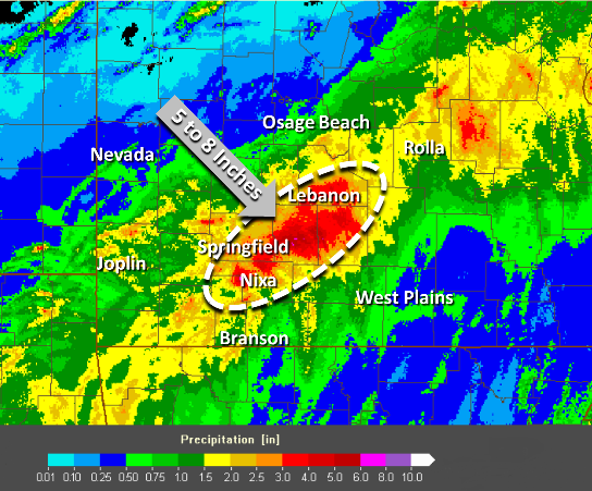 Rainfall |
Photos & Video:
Header
 |
 |
 |
 |
 |
 |
 |
 |
 |
Media use of NWS Web News Stories is encouraged! Please acknowledge the NWS as the source of any news information accessed from this site. |
|
Current Hazards
Experimental Graphical Hazardous Weather Outlook
Submit a storm report
Local Storm Reports
Current Conditions
Observations
Lake Levels
Snowfall Analysis
Road Conditions
Satellite
CoCoRaHS
Graphical Conditions
Precip. Analysis
Forecasts
Forecast Discussion
Fire Weather
Aviation
GIS Forecast Maps
Activity Planner
Severe Weather
Winter Weather
Hurricanes
FAA Center Weather
Space Weather
Climatology
Records and Normals
Monthly Climate Summary
Local
National
Drought
Climate Science
Astronomical Data
US Dept of Commerce
National Oceanic and Atmospheric Administration
National Weather Service
Springfield, MO
Springfield-Branson National Airport
5805 West Highway EE
Springfield, MO 65802-8430
Business: 417-863-8028 Recording: 417-869-4491
Comments? Questions? Please Contact Us.


 Weather Story
 Weather Map
 Local Radar