Springfield, MO
Weather Forecast Office
Overview
|
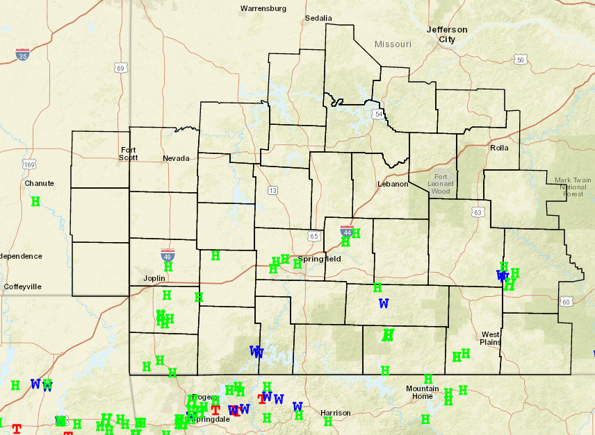
Two rounds of thunderstorms impacted extreme southeastern Kansas and the Missouri Ozarks from Wednesday afternoon into Wednesday night. The first rounds of storms produced several reports of large hail during the early and middle portions of Wednesday afternoon. Hail up to the size of golf balls occurred with these storms. |
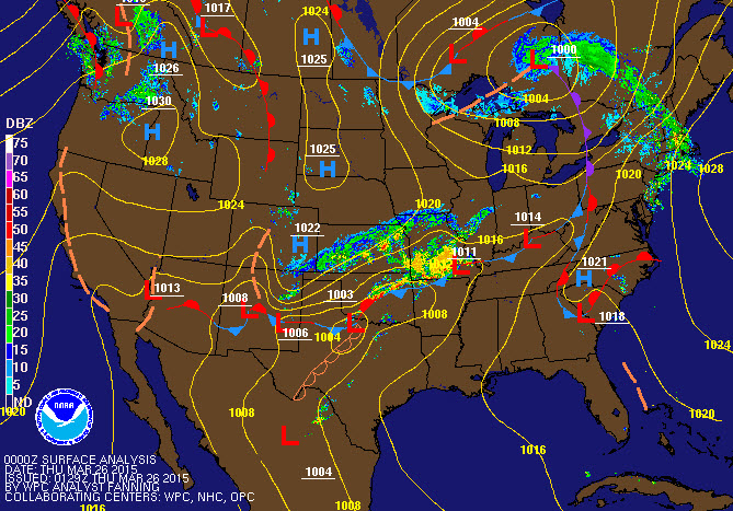 |
Radar:

Storm Reports
 |
Media use of NWS Web News Stories is encouraged! Please acknowledge the NWS as the source of any news information accessed from this site. |
|
Current Hazards
Experimental Graphical Hazardous Weather Outlook
Submit a storm report
Local Storm Reports
Current Conditions
Observations
Lake Levels
Snowfall Analysis
Road Conditions
Satellite
CoCoRaHS
Graphical Conditions
Precip. Analysis
Forecasts
Forecast Discussion
Fire Weather
Aviation
GIS Forecast Maps
Activity Planner
Severe Weather
Winter Weather
Hurricanes
FAA Center Weather
Space Weather
Climatology
Records and Normals
Monthly Climate Summary
Local
National
Drought
Climate Science
Astronomical Data
US Dept of Commerce
National Oceanic and Atmospheric Administration
National Weather Service
Springfield, MO
Springfield-Branson National Airport
5805 West Highway EE
Springfield, MO 65802-8430
Business: 417-863-8028 Recording: 417-869-4491
Comments? Questions? Please Contact Us.


 Weather Story
 Weather Map
 Local Radar