
Tropical system in the Gulf expected to gradually strengthen the next couple of days off the Florida Panhandle and Alabama coasts. Instances of flash flooding will be possible through Thursday along the eastern and central Gulf Coast. Severe thunderstorms will develop and move along a cold front crossing the Upper Midwest, and through the Ohio Valley/Mid-Atlantic on Tuesday. Read More >
A severe weather event occurred across various parts of west-central Texas on May 19. An upper level storm system gradually approached from the southern Rockies, and a cold front approached from the north late in the evening. With very unstable air and adequate vertical shear, strong to severe storms occurred at various times during the day and into the nighttime hours. Much of the severe weather was concentrated across the Concho Valley and Heartland areas during the afternoon through late evening hours.
Widely scattered severe storms across the Big Country area produced large hail, during the morning. The largest reported hail was golfball size at Sweetwater (Nolan County). During the afternoon, thunderstorms initially developed across the Concho Valley and moved mostly to the east. Most of the large hail reports ranged from quarter to golfball in size. Baseball size hail occurred 1 mile northwest of Paint Rock (Concho County), and hail up to softball size was reported 3 miles south-southwest of Santa Anna (Coleman County). Brief tornado touchdowns were reported 4 miles west of Trickham (Coleman County) and 4 miles southwest of Bangs (Brown County). A total of 34 severe weather reports were received on May 19.
Figure 1 shows an animated loop of radar imagery, with the severe thunderstorms which affected the aforementioned areas.
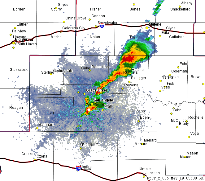
Figure 1: Animated Loop of Radar Imagery on May 19 (between 330 PM and 730 PM).

