 |
||||
Technology: Then vs Now
Tornado Forecasting Technology
 Then: Tornado watches and tornado warnings are things that many people take for granted in this day and age. However, in 1953 the concept of providing advanced notice of approaching severe weather was still in its infancy. For many years, the United States Weather Bureau (the National Weather Service's predecessor) had placed a ban on tornado warnings, because it was feared the warnings would create panic, causing more harm than good. This ban was not lifted until 1938, but even then there were few successful warnings, because the technology to provide successful warnings was still not in place. In addition, public tornado forecasts were still banned. The first successful tornado forecast was made at Tinker Air Force Base on March 25, 1948 when Air Force Captain Robert C. Miller and Major Ernest J. Fawbush predicted that conditions were favorable for tornadoes just two hours before a tornado struck the base. This, among other successes, led the Weather Bureau to also lift the ban on tornado forecasts in July of 1950.
Computer-based weather models were still being developed at the time of the Vicksburg tornado and were not yet a part of daily weather forecasting. The first routine computer model predictions didn't begin until 1955. In December 1953, forecasters had to rely on hand drawn charts to analyze the state of the atmosphere and lean heavily on experience while attempting to make forecast predictions.
In 1952, the U.S. Weather Bureau Severe Local Storms Unit (SELS) first began issuing tornado forecasts for large areas of the country for long periods of time. These forecasts would later become what we now know as tornado watches. They weren't called tornado watches until 1965. This was also the year that the "Tornado Warning" product was established. Previous Tornado Warning type products were referred to as tornado advisories and other variations in different parts of the country.
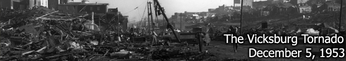
The day of the Vicksburg tornado, the U.S. Weather Bureau's SELS issued a severe weather bulletin at 1:30 PM indicating that "tornado-producing conditions" would exist in an area between Tyler, Texas, Little Rock, Arkansas, Clarksdale, Mississippi, and Monroe, Louisiana. Though Vicksburg was close to this area, the forecast did not technically include the city. No subsequent severe weather bulletins or tornado warnings were issued for Vicksburg before the tornado. When asked about the situation later, George V. Fish, the Meteorologist-in-Charge of the Weather Bureau office in Jackson told the Vicksburg Post, "We couldn't have predicted it." You can read the article in its entirety by clicking on the image at the top of this section.
 Now: In modern times, tornado watches and warnings are almost always issued in advance of the occurrence of a tornado. Warnings have a much greater deal of specificity than they did in the early days, providing information about the exact track of the storm and the type of impacts that might be experienced from it. In addition to watches, severe weather outlooks are issued up to a week in advance, affording people sufficient time to prepare for the potential of severe weather.
In addition, the tools that forecasters use to create severe weather outlooks, watches, and warnings have come a long, long way. Computer model forecasts have improved significantly. In the earliest days of numerical weather guidance, computer forecasts offered no improvement over forecasts created manually by meteorologists. Since then, accuracy has improved tremendously. Modern supercomputers can perform 14 trillion calculations per second. More than 14.8 million model fields are generated every day. Today's models not only forecast large-scale atmospheric conditions like the jet stream and fronts, but newer higher-resolution models can now frequently forecast individual thunderstorms.
Much of the historical information in this section comes from the May 2011 Bulletin of the American Meteorological Society article "The History (and Future) of Tornado Warning Dissemination in the United States" (Coleman, Timothy A., Kevin R. Knupp, James Spann, J. B. Elliott, Brian E. Peters)
Remote Sensing/Storm Tracking Capabilities
 Then: Another modern day convenience often taken for granted now is the accessibility of radar and satellite data. Imagery from weather satellites can be used to help assess large scale weather patterns, determine the amount of moisture in the atmosphere, and detect the height and location of smaller-scale features like thunderstorms among many other things. The first successful weather satellite, TIROS-I, did not launch until April 1960. Images from this satellite were never even available to local U.S. Weather Bureau offices. It wasn't until 1962 that satellite images from TIROS-IV and TIROS-V became available via facsimile to local offices.
 Unlike satellite, weather radar is a tool better geared to tracking individual storms. However, the first radar did not arrive in central Mississippi until April 1959, almost 5 1/2 years after the Vicksburg tornado. The first radar system in Jackson was a WSR-3 unit installed at Hawkins Field. This particular radar model was made from equipment not even originally intended for tracking tornadoes. In fact, most radar systems at the time were surplus military equipment. Unlike now, when the data can be viewed on zoomable and customizable map backgrounds, radar echoes only showed up as fuzzy shapes on a dark round scope. (see image at left, courtesy NWS Peachtree City, GA) Doppler radar, which is more capable of detecting tornadic conditions in a particular storm, was not installed in Jackson until the 1990s, several decades after the Vicksburg tornado.
Another important observational tool in severe weather forecasting is the radiosonde. Radiosondes are packages of weather equipment that are launched using a weather balloon to help diagnose the conditions of the atmosphere above ground level. Weather balloons and radiosondes were in existence in 1953, but data was much more sparse at that time as launches took place at a smaller number of stations. No launches were being done in central Mississippi in December 1953. In fact, the first radiosonde launches from Jackson took place earlier in 1953 between March and May, but they were no longer taking place at the end of the year. Permanent upper air launches did not begin at Hawkins Field in Jackson until February of 1956.
Now: Up-to-date satellite and radar data is more accessible than ever before. The advent of mobile Internet technology means the latest radar and satellite data can be accessed from almost anywhere. There are multiple weather satellites monitoring conditions in the atmosphere. Radar technology continues to advance. After the upgrade to Doppler technology in the late 20th century significantly improved tornado detection, the upgrade to dual polarization technology in the early 21st century has provided an additional means for confirming damaging tornadoes using radar. Radiosonde launches continue to occur at Jackson twice a day to help monitor the state of the atmosphere. Additional releases are frequently made during active weather situations, including severe weather, to provide more updated information.
Warning Dissemination Systems
Then: Aside from the fact that watches and warnings were scarce in the time of the 1953 Vicksburg tornado, the ways to receive critical weather information were also more scarce than in modern times. Radio stations had been around for quite some time, but the first television stations in the central Mississippi area did not sign on the air until January and February of 1953. Because television was a relatively new technology, most people didn't even own a television set at that time. Weather information on TV was typically limited to a 5 to 10 minute segment during a single daily newscast.
NOAA Weather Radio was not yet available in the Vicksburg area in 1953. A few weather radio stations were established in the 1950s at larger cities, providing mostly aviation weather information. The first major expansion of weather radio didn't occur until after the Super Outbreak of tornadoes in 1974. Warning sirens were not prevalent in 1953, and the practice of using sirens to alert of approaching tornadoes didn't take root until around 1970.
 Now: There are many, many ways to receive warning information. NOAA Weather Radio All Hazards broadcasts provide continuous weather information directly from the National Weather Service, and specialized weather radios alarm when severe weather warnings are issued. Wireless emergency alerts (WEAs) take advantage of existing cellular networks to transmit warning information directly to phones. In addition, several smartphone applications provide nearly instant warning information for the location of the device. Though weather information was harder to come by through the broadcast media in 1953, the television industry has flourished in the last 60 years, and now television and radio stations are a great place to receive current weather information.


 Follow us on YouTube