Overview
|
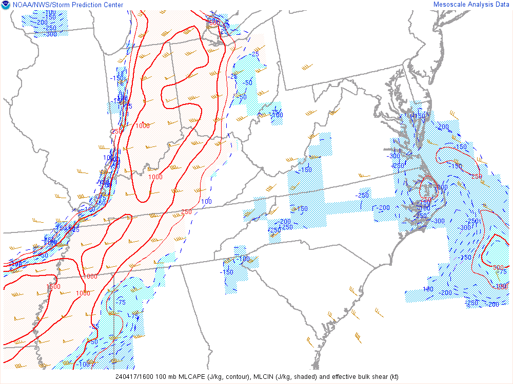
An occluded low pressure system across the Upper Midwest lifted a warm front north through the area on Wednesday, April 17, with convection firing along and just ahead of an approaching cold front towards the west. Rapid air mass recovery occurred in the wake of morning convection, sustained by a 40 to 50-knot southwesterly 700 mb jet punching into the region. The dry air associated with the 700 mb jet was likely associated with large-scale subsidence on the back side of the occluded low across the Upper Midwest. MLCAPE values reached around 1000 J/kg under 40 to 45 knots of bulk layer shear, most of which was contained within the 0-3 km layer. Hodographs were fairly impressive, especially below 700 mb with clockwise-curved profiles, owing to the multiple rotating storms and tornadoes in addition to strong bowing segments. Several tornadoes occurred across the region, including a high-end EF-1 in Bucyrus (Crawford County, OH), a high-end EF-1 in Windham (Portage County), and an EF-0 in Southington and Champion Townships (Trumbull County). |
 "Sandwich" (Visible + Infrared) satellite loop overlaid with GLM from roughly 1130 AM to 930 PM on April 17, 2024. |
Tornadoes:
|
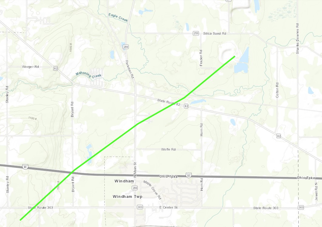
Tornado - Windham, OH
|
||||||||||||||||
|
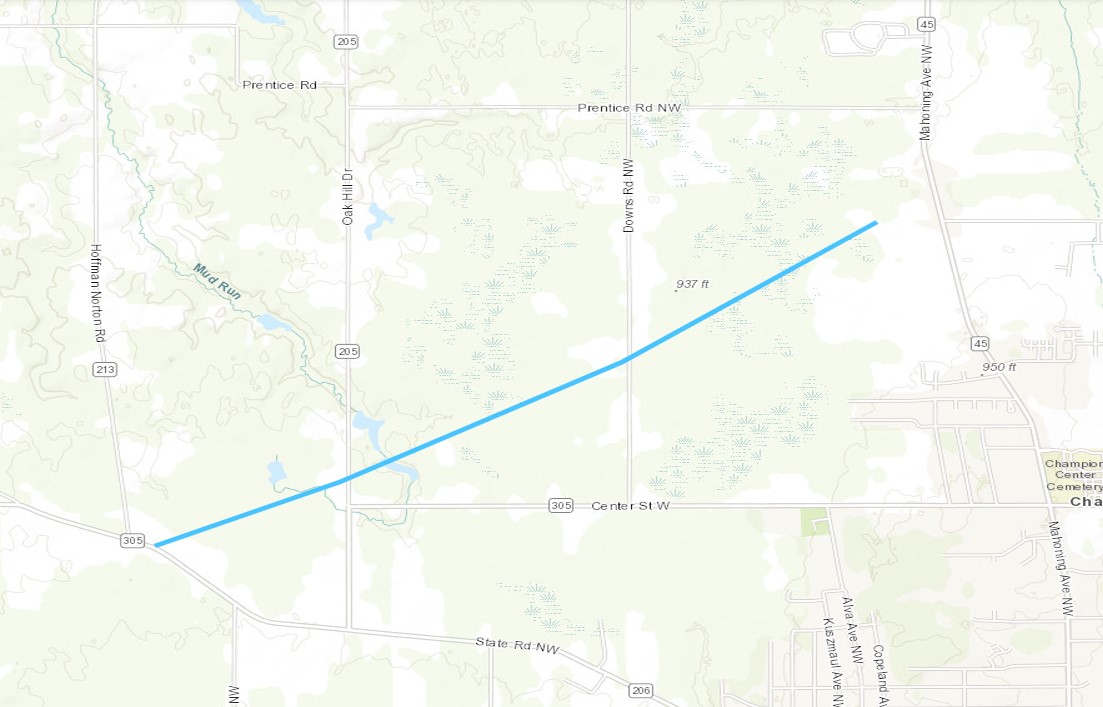
Tornado - Champion Township, OH
|
||||||||||||||||
|
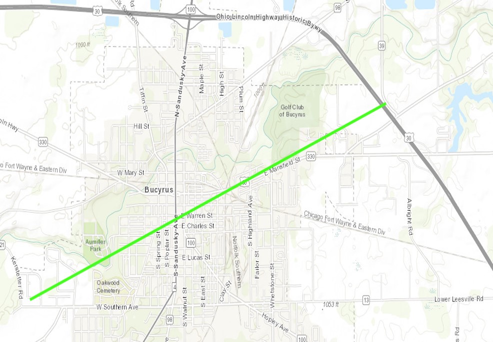
Tornado - Bucyrus, OH
|
||||||||||||||||
The Enhanced Fujita (EF) Scale classifies tornadoes into the following categories:
| EF0 Weak 65-85 mph |
EF1 Moderate 86-110 mph |
EF2 Significant 111-135 mph |
EF3 Severe 136-165 mph |
EF4 Extreme 166-200 mph |
EF5 Catastrophic 200+ mph |
 |
|||||
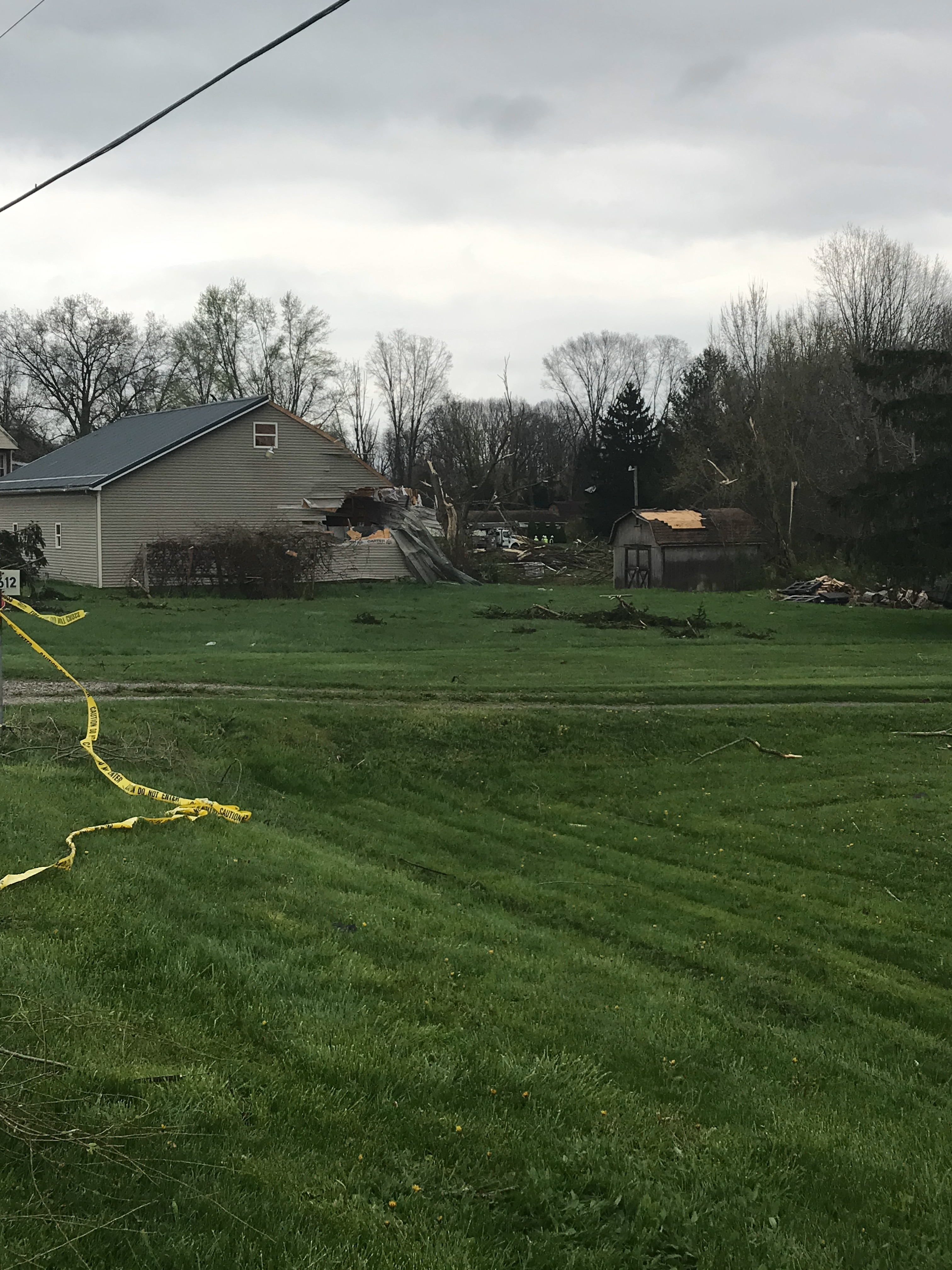
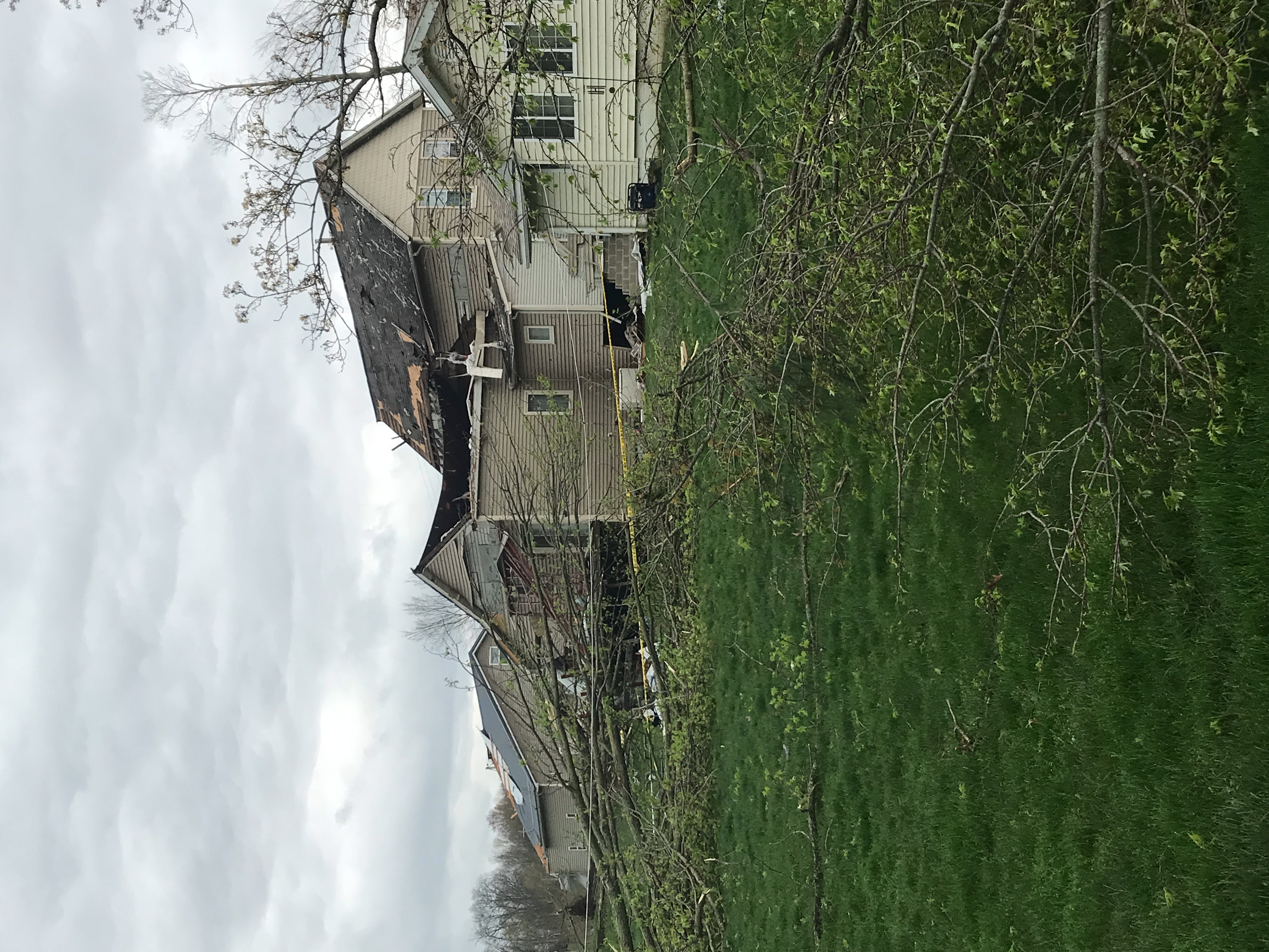
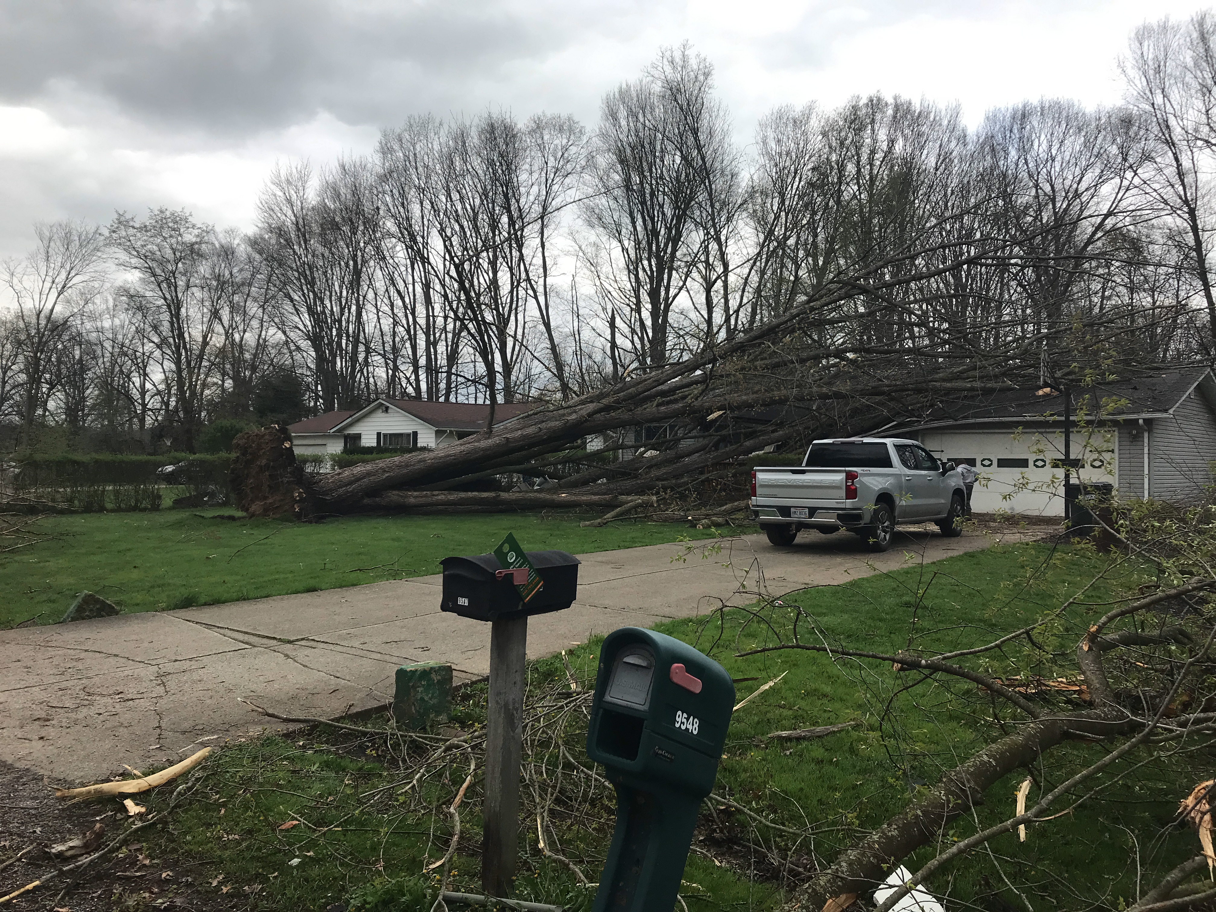
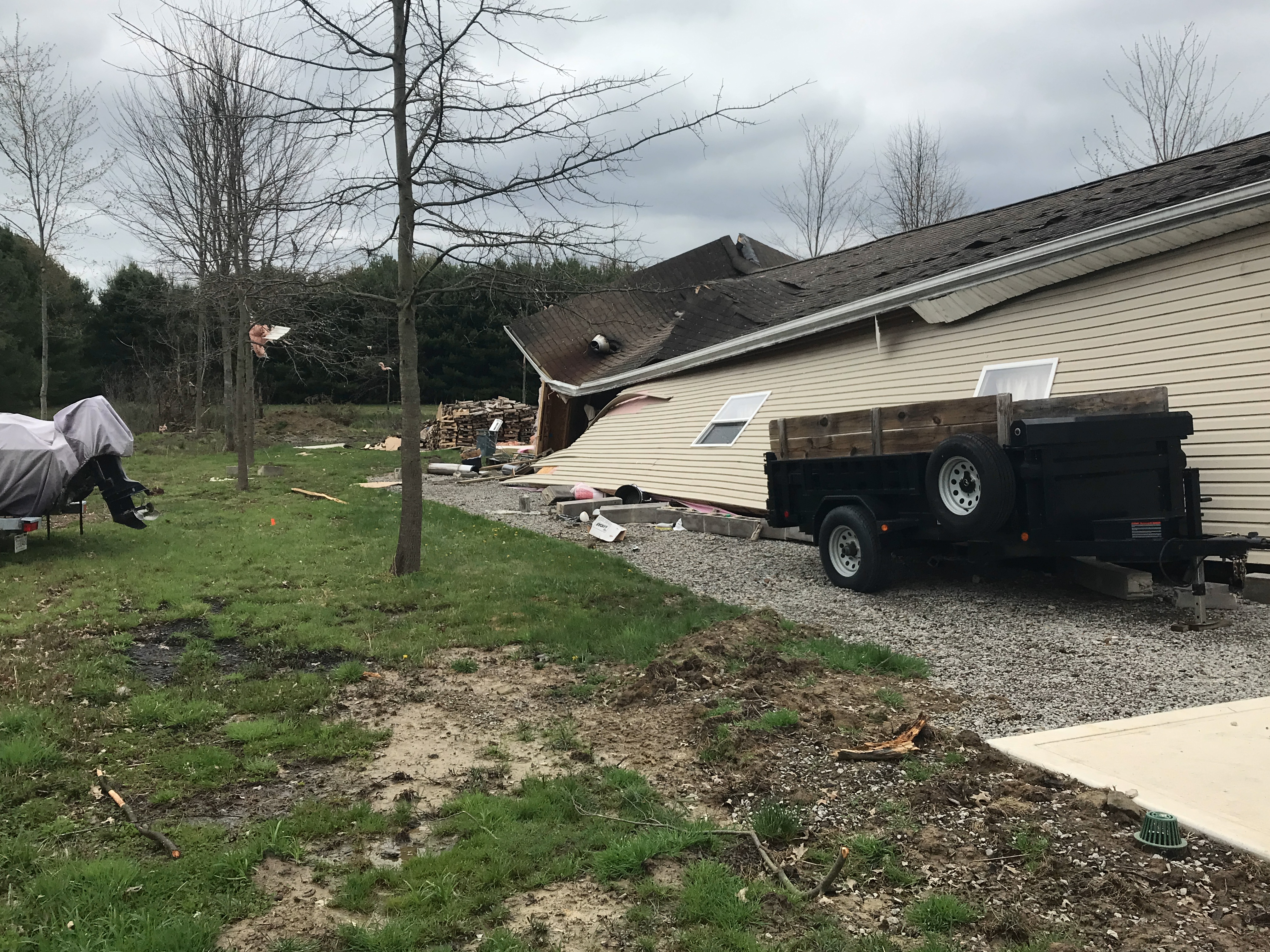
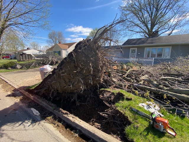
EF-1 Windham, OH Tornado Damage
 |
.jpg) |
 |
 |
| Collapsed wall of an outbuilding in Windham, OH (NWS Storm Survey) |
House heavily damaged and slightly shifted off of its foundation in Windham, OH (NWS Storm Survey) |
Many trees downed with damage to houses in Windham, OH (NWS Storm Survey) |
Large tree uprooted onto a house in Windham, OH (NWS Storm Survey) |
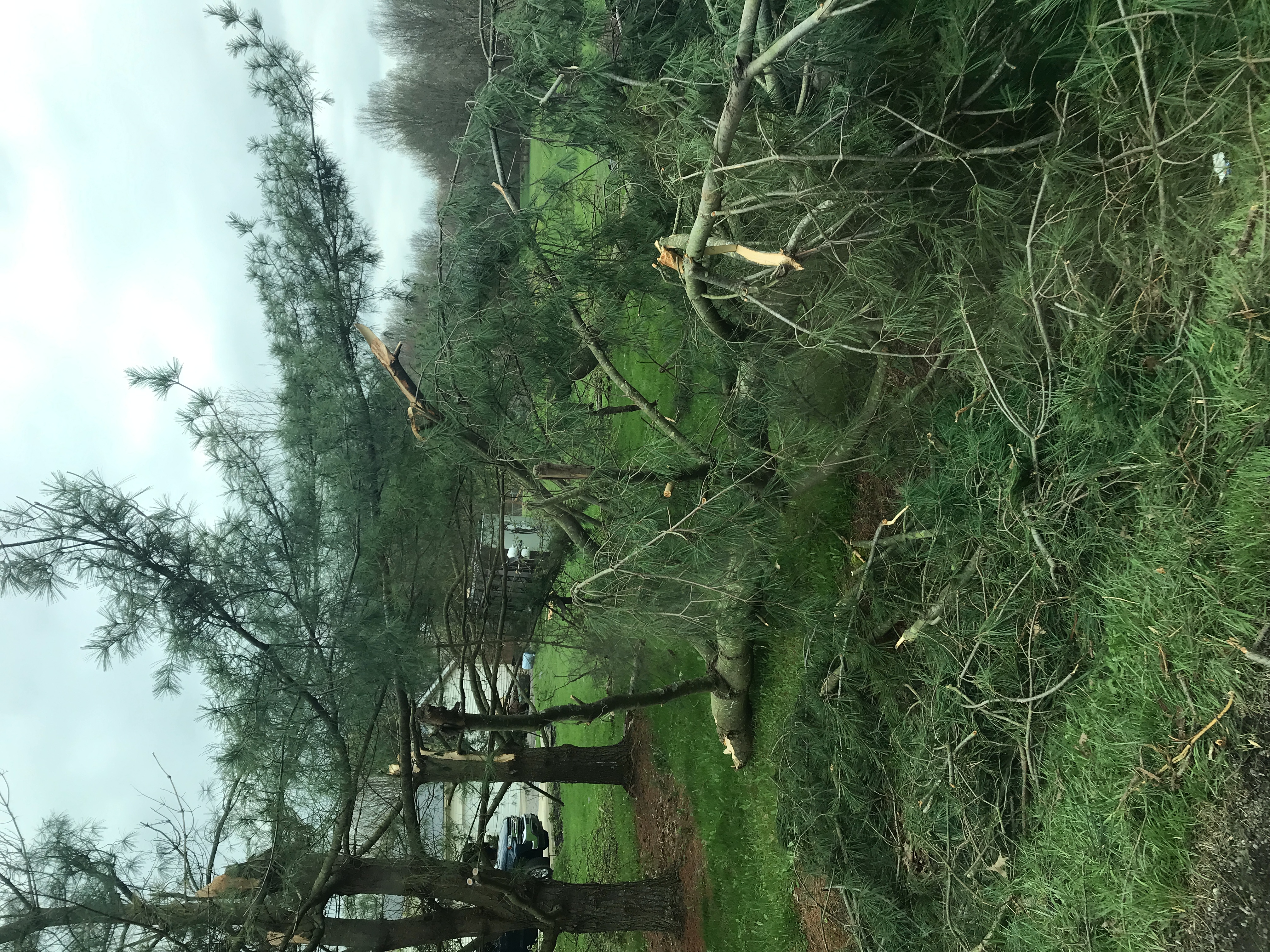
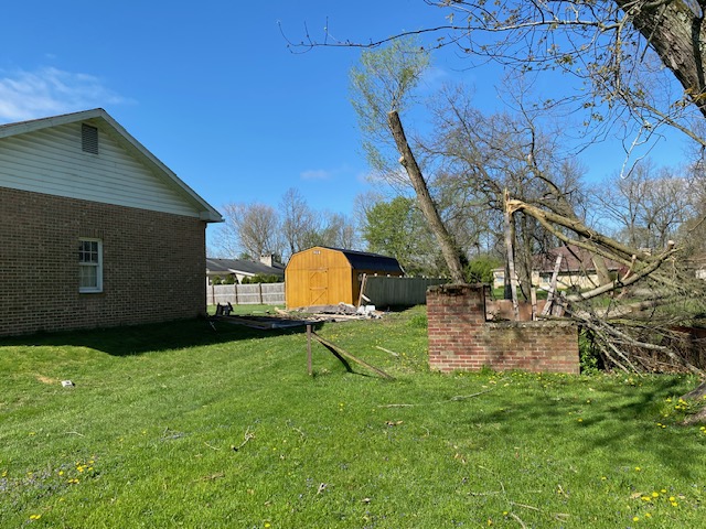
EF-0 Champion Township, OH Tornado Damage
 |
 |
 |
 |
| Large trees snapped in Champion Township, OH (NWS Storm Survey) |
Row of pine trees snapped in Southington Township, OH (NWS Storm Survey) |
Damage to the roof, siding, shutters, and gutters of a house in Champion Township, OH (NWS Storm Survey) |
Collapsed garage in Southington Township, OH (NWS Storm Survey) |
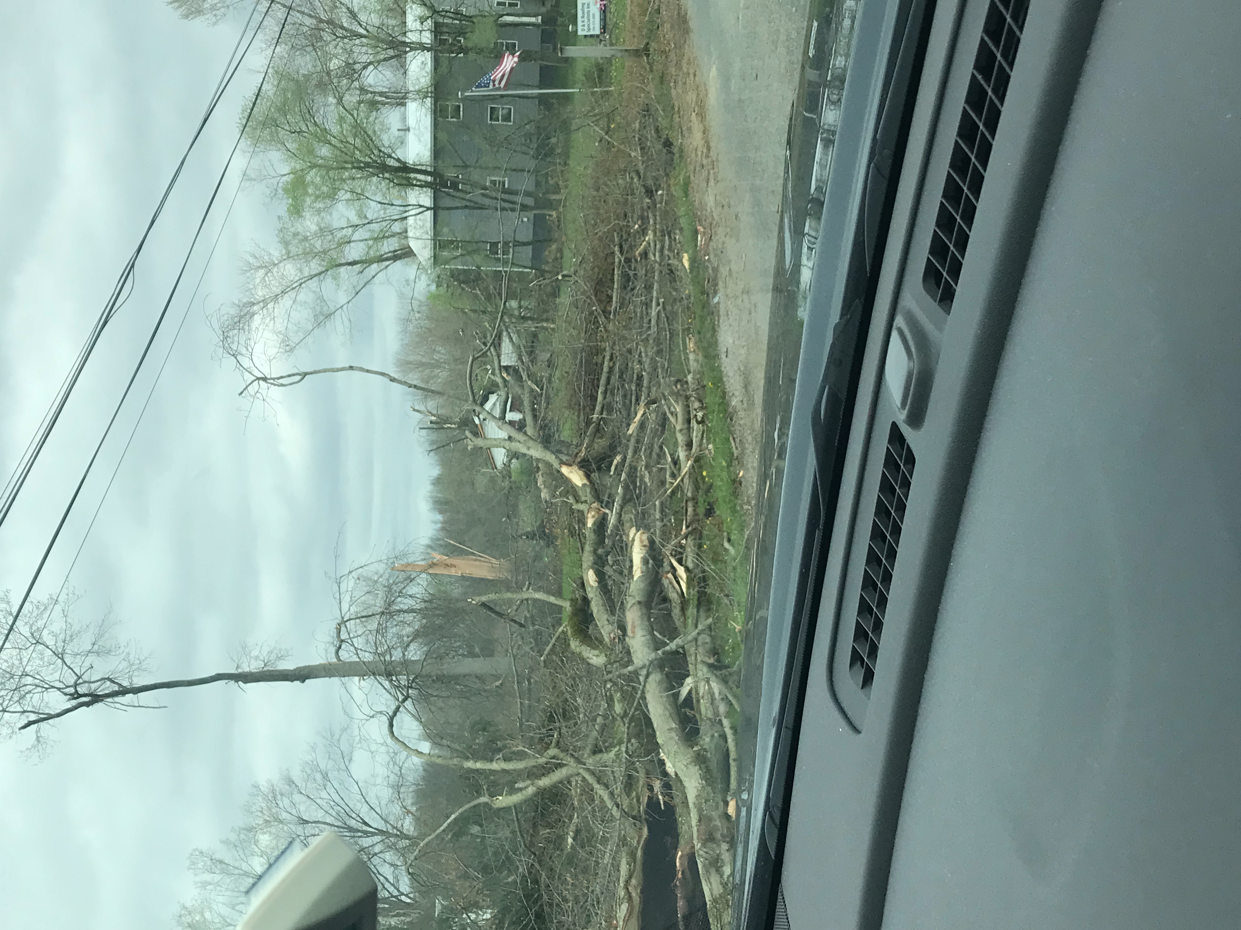
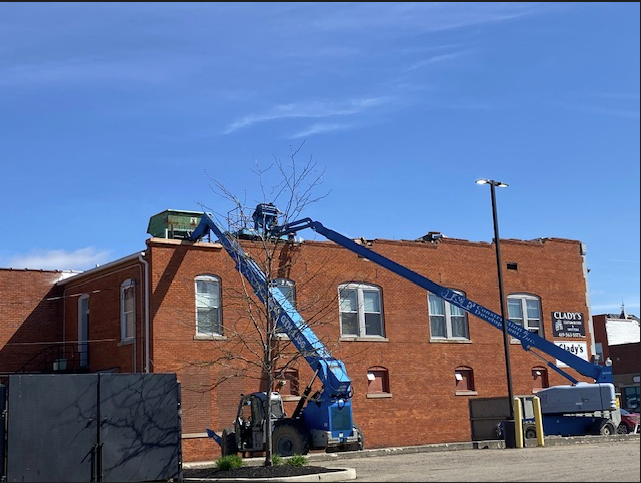
EF-1 Bucyrus, OH Tornado Damage
 |
 |
 |
 |
| House shifted off of its foundation in Bucyrus, OH (NWS Storm Survey) |
Large trees snapped in Bucyrus, OH (NWS Storm Survey) |
Roof damage to a building in downtown Bucyrus, OH (NWS Storm Survey) |
Large tree uprooted and damage to houses in Bucyrus, OH (NWS Storm Survey) |
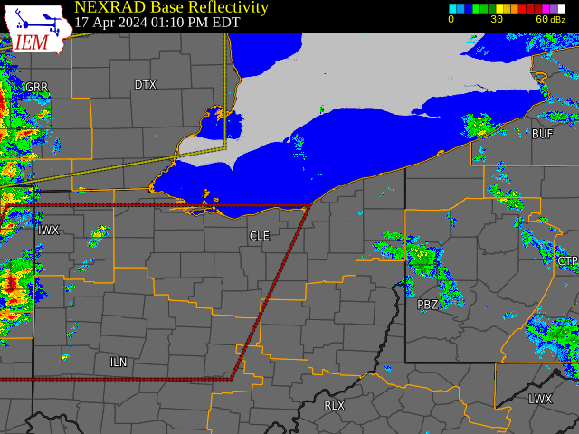
Radar
 |
 |
| Regional radar loop of the line of strong to severe thunderstorms that swept across the region ahead of the cold front during the afternoon and evening. Embedded supercells produced several tornadoes, as well as pockets of straight line wind damage. | Radar screen capture of the Windham tornado at 6:47 PM. Pictured are reflectivity (top left), velocity (top right), correlation coefficient with a TDS signature present (bottom left), and normalized rotation (bottom right). |
Storm Reports

Preliminary Local Storm Report...Summary
National Weather Service Cleveland OH
1256 PM EDT Fri Apr 19 2024

..TIME...   ...EVENT...      ...CITY LOCATION...     ...LAT.LON...
..DATE...   ....MAG....      ..COUNTY LOCATION..ST.. ...SOURCE....
            ..REMARKS..

0401 PM     Tstm Wnd Dmg     2 ENE Marion            40.59N 83.09W
04/17/2024                   Marion             OH   911 Call Center

            Power lines down near the intersection of
            University Drive and 309. Time estimated via
            radar.

0518 PM     Tstm Wnd Dmg     4 WSW Shreve            40.67N 82.09W
04/17/2024                   Holmes             OH   911 Call Center

            Tree downed in Big Prairie. Delayed report.
            Time estimated via radar.

0530 PM     Tstm Wnd Dmg     Killbuck                40.50N 81.98W
04/17/2024                   Holmes             OH   911 Call Center

            Delayed report of tree downed in Killbuck.
            Time estimated via radar.

0530 PM     Tstm Wnd Dmg     Millersburg             40.56N 81.92W
04/17/2024                   Holmes             OH   911 Call Center

            Delayed report of tree downed in
            Millersburg. Time estimated via radar.

0646 PM     Tstm Wnd Dmg     2 W Windham             41.23N 81.08W
04/17/2024                   Portage            OH   911 Call Center

            Tree down on State Route 303.

0406 PM     Tstm Wnd Gst     4 NE Marion             40.62N 83.07W
04/17/2024  M64 MPH          Marion             OH   ASOS

            ASOS station KMNN Marion.

0606 PM     Tstm Wnd Gst     3 N Cleveland           41.52N 81.68W
04/17/2024  M66 MPH          Cuyahoga           OH   ASOS

            ASOS station KBKL Cleveland.

0535 PM     Tstm Wnd Gst     2 SW Millersburg        40.53N 81.95W
04/17/2024  M61 MPH          Holmes             OH   AWOS

            AWOS station K10G 2 WSW Millersburg.

0451 PM     Tstm Wnd Dmg     2 ESE Bellville         40.61N 82.47W
04/17/2024                   Richland           OH   Amateur Radio

            Multiple trees down on Route 97 between
            Butler and Bellville. One and a half foot in
            diameter trees snapped about 3 feet above
            ground. Time estimated via radar.

0330 PM     Tstm Wnd Gst     9 ENE Oregon            41.70N 83.26W
04/17/2024  M52 MPH          LEZ142             OH   C-Man Station

            C-MAN Station TWCO1 8 ENE Oregon gust to 52
            mph/45 knots.

0645 PM     Tstm Wnd Dmg     2 WNW Windham           41.24N 81.07W
04/17/2024                   Portage            OH   Dept of Highways

            Report of at least one tractor trailer blown
            over on eastbound lanes of Ohio Turnpike
            (I-80) beyond State Route 44. Time estimated
            via radar.

0408 PM     Tstm Wnd Dmg     Bucyrus                 40.81N 82.98W
04/17/2024                   Crawford           OH   Emergency Mngr

            Emergency management, law enforcement, and
            trained spotters report several instances of
            structural damage to homes and businesses in
            Bucyrus. Numerous trees down as well. Time
            estimated via radar.

0704 PM     Tstm Wnd Dmg     3 NW Champion Heights   41.32N 80.88W
04/17/2024                   Trumbull           OH   Emergency Mngr

            Delayed report, damage to a roof along with
            several large trees down, one of which was
            on a garage. A camper was also blown over.

0519 PM     Tstm Wnd Dmg     2 N Glenmont            40.55N 82.10W
04/17/2024                   Holmes             OH   Law Enforcement

            Tree down across TR 222.

0522 PM     Tstm Wnd Dmg     5 E Nashville           40.59N 82.02W
04/17/2024                   Holmes             OH   Law Enforcement

            Tree down near the intersection of SR 754
            and CR 320. Time estimated via radar.

0528 PM     Tstm Wnd Dmg     1 NE Killbuck           40.51N 81.97W
04/17/2024                   Holmes             OH   Law Enforcement

            Tree down on TR 91.

0443 PM     Tstm Wnd Gst     2 NNE Sandusky          41.49N 82.70W
04/17/2024  M58 MPH          LEZ144             OH   Mesonet

            Marine mesonet station XSDB 2 NNE Sandusky
            gust to 50 knots.

0330 PM     Marine Tstm Wind 9 ENE Oregon            41.70N 83.26W
04/17/2024  M52 MPH          LEZ142             OH   Mesonet

            45 knot wind gust at Mesonet station TWCO1 8
            ENE Oregon.

0406 PM     Tornado          1 WSW Bucyrus           40.80N 83.00W
04/17/2024                   Crawford           OH   NWS Storm Survey

            NWS storm damage survey confirmed an EF-1
            tornado with estimated peak winds of 110 mph
            in Bucyrus, OH. The damage path length is
            3.48 miles and maximum width is 100 yards.
            This LSR denotes the start location of the
            tornado.

0651 PM     Tornado          2 W Windham             41.23N 81.08W
04/17/2024                   Portage            OH   NWS Storm Survey

            NWS storm damage survey confirmed an EF-1
            tornado with estimated peak winds of 110 mph
            in Windham, OH. The damage path length is
            3.99 miles and maximum width is 65 yards.
            This LSR denotes the start location of the
            tornado.

0701 PM     Tornado          3 WNW Champion Heights  41.31N 80.91W
04/17/2024                   Trumbull           OH   NWS Storm Survey

            NWS storm damage survey confirmed an EF-0
            tornado with estimated peak winds of 80 mph
            in Southington and Champion Townships in OH.
            The damage path length is 2.96 miles with
            maximum width of 20 yards. This LSR denotes
            the start location of the tornado.

0350 PM     Hail             Marseilles              40.70N 83.40W
04/17/2024  M1.00 Inch       Wyandot            OH   Public

            Delayed report.

0408 PM     Tstm Wnd Dmg     1 NNE Bucyrus           40.81N 82.97W
04/17/2024                   Crawford           OH   Public

            Trees snapped a couple of feet above ground
            in addition to several trees uprooted and
            structural failure of what appears to be a
            shed or outbuilding on E Mansfield St. Time
            estimated via radar.

0647 PM     Tstm Wnd Dmg     2 W Windham             41.24N 81.07W
04/17/2024                   Portage            OH   Public

            Drone footage photo shows extensive damage
            to a house that was shifted off of the
            foundation. There was also an overturned
            vehicle. Time estimate via radar.

0711 PM     Tstm Wnd Dmg     5 NNE Champion Heights  41.35N 80.81W
04/17/2024                   Trumbull           OH   Public

            Delayed report, multiple trees down along
            with large limbs on Bristol Champion
            Townline Rd NE west of N Park Ave.

0259 PM     Tstm Wnd Dmg     2 SSE Sylvania          41.69N 83.68W
04/17/2024                   Lucas              OH   Trained Spotter

            12-15 inch diameter tree snapped off. Time
            estimated from radar.

0301 PM     Tstm Wnd Dmg     3 E Sylvania            41.72N 83.64W
04/17/2024                   Lucas              OH   Trained Spotter

            Multiple large branches down. Time estimated
            via radar.

0401 PM     Tstm Wnd Dmg     3 SW Marion             40.56N 83.16W
04/17/2024                   Marion             OH   Trained Spotter

            Tree and utility poles down.

0405 PM     Tstm Wnd Gst     2 E Marion              40.59N 83.08W
04/17/2024  E65 MPH          Marion             OH   Trained Spotter

            Estimated 60-70 mph wind gust and pea size
            hail.

0415 PM     Hail             4 WSW Polk              40.92N 82.28W
04/17/2024  M1.00 Inch       Ashland            OH   Trained Spotter

            Lasted almost 5 minutes.

0629 PM     Tstm Wnd Dmg     Streetsboro             41.24N 81.35W
04/17/2024                   Portage            OH   Trained Spotter

            Tree down.

0648 PM     Tstm Wnd Dmg     1 NNW Windham           41.25N 81.05W
04/17/2024                   Portage            OH   Trained Spotter

            House damaged on County Road 229 south of
            State Route 82. Time estimated via radar.
Environment
 |
 |
 |
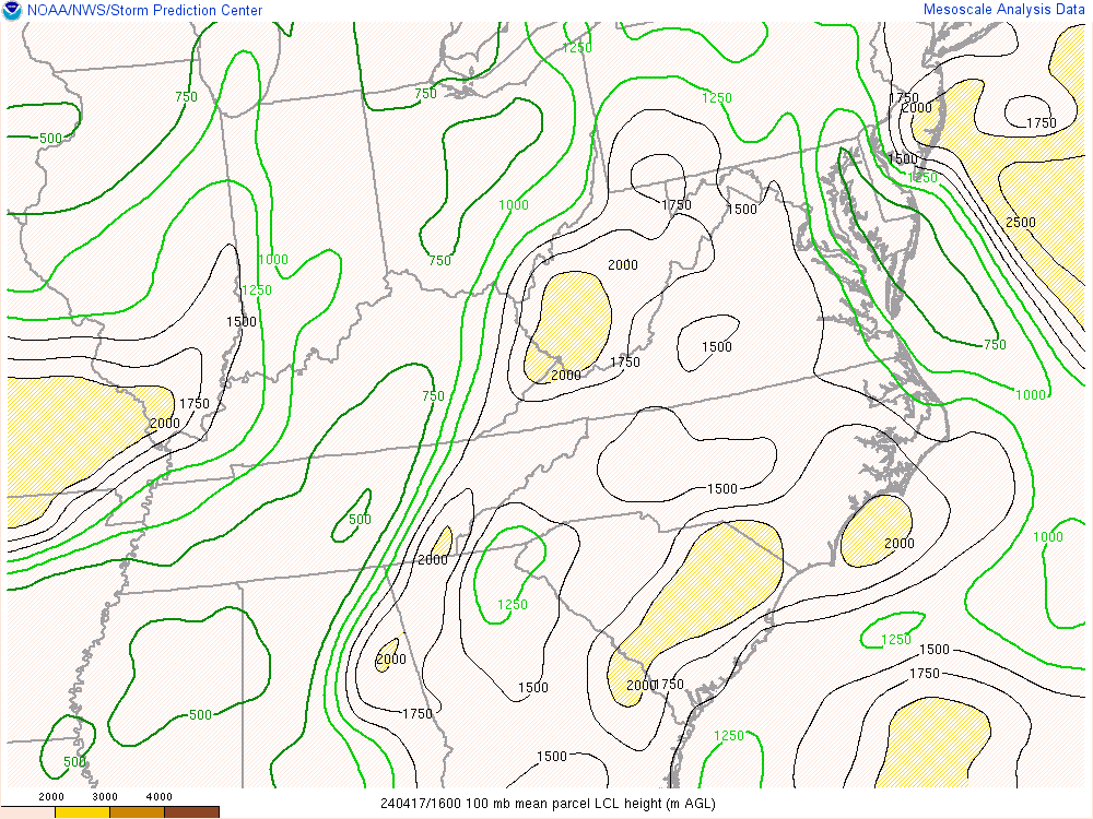 |
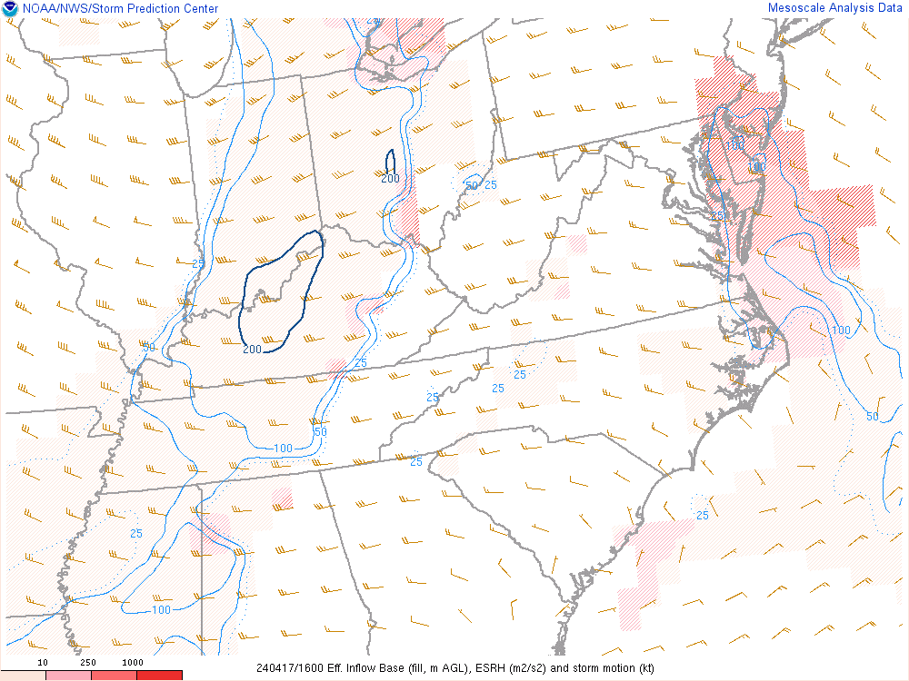
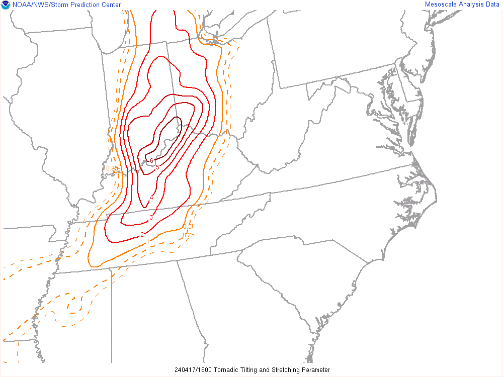
| Figure 1: MLCAPE & Effective Shear from 16Z to 00Z on April 17, 2024. Note the pocket of 1000 J/kg CAPE and 45 to 50 knots of shear across northern OH. | Figure 2: Effective SRH (ESRH) from 16Z to 00Z on April 17, 2024. Note ESRH values ranging between 100 to 200 m2/s2 across the area. | Figure 3: Tornadic Tilting and Stretching parameter from 16Z to 00Z on April 17, 2024. Note the small enhanced area (red contour) across Northeast Ohio towards the end of the loop. | Figure 4: LCLs from 16Z to 00Z on April 17, 2024. Note the initially unfavorable LCL heights > 1000 m. However, towards the end of the loop, more favorable LCL heights < 1000 m entered Northeast Ohio where an EF-1 tornado occurred. |
 |
Media use of NWS Web News Stories is encouraged! Please acknowledge the NWS as the source of any news information accessed from this site. |
|


 Follow us on YouTube